Cambridge IGCSE Geography 0460 — 2016 Oct/Nov Paper 2 · Variant 1
0460/21/O/N/16 · 60 marks · ≈68 min
The question paper and its mark scheme, free to read here and free to download. This is Cambridge’s own paper, exactly as it was sat.
Question paper20 pages

Mark scheme7 pages
Answers below. Sit the paper first if you are practising.
Paper as text
Question paper, page 1
This document consists of 16 printed pages, 4 blank pages and 1 Insert. DC (RW/SG) 115301/3 © UCLES 2016 [Turn over Cambridge International Examinations Cambridge International General Certificate of Secondary Education * 6 2 4 7 3 0 9 9 5 5 * GEOGRAPHY 0460/21 Paper 2 October/November 2016 1 hour 30 minutes Candidates answer on the Question Paper. Additional Materials: Ruler Protractor Plain paper Calculator 1:50 000 Survey Map Extract is enclosed with this Question Paper. READ THESE INSTRUCTIONS FIRST Write your Centre number, candidate number and name in the spaces provided. Write in dark blue or black pen. You may use an HB pencil for any diagrams or graphs. Do not use staples, paper clips, glue or correction fluid. DO NOT WRITE IN ANY BARCODES. Write your answer to each question in the space provided. If additional space is required, you should use the lined pages at the end of the booklet. The question number(s) must be clearly shown. Answer all questions. The Insert contains Photographs A and B for Question 3. The Survey Map Extract and the Insert are not required by the Examiner. Sketch maps and diagrams should be drawn whenever they serve to illustrate an answer. At the end of the examination, fasten all your work securely together. The number of marks is given in brackets [ ] at the end of each question or part question. The syllabus is approved for use in England, Wales and Northern Ireland as a Cambridge International Level 1/Level 2 Certificate.
Question paper, page 2
2 0460/21/O/N/16 © UCLES 2016 1 Study the map extract for Keswick, United Kingdom. The scale is 1:50 000. Fig. 1 shows some of the features in the south east of the map extract. 24 23 22 21 24 23 22 21 30 29 28 27 26 25 30 29 28 27 26 25 E D C A B lake Fig. 1 (a) Using the map extract, identify the following features shown on Fig. 1: (i) the land use in area A; …[1] (ii) the height above sea level at spot height B; … metres [1] (iii) the type of road at C; …[1] (iv) feature D; …[1] (v) the name of river E. …[1] (b) Estimate the area of the lake shown on Fig. 1. Circle one correct answer below. 3 km2 5 km2 7 km2 9 km2 [1]
Question paper, page 3
3 0460/21/O/N/16 © UCLES 2016 [Turn over (c) Fig. 2 shows the whole of the map extract and area X in the north east. Keswick 30 25 21 30 25 21 19 23 30 19 23 30 X Fig. 2 (i) Describe the relief of area X. … … … … … … … …[4] (ii) Describe the width of the rivers in area X. … …[1] (iii) Describe the drainage pattern of area X. … …[1]
Question paper, page 4
4 0460/21/O/N/16 © UCLES 2016 (d) Fig. 3 shows the whole of the map extract and the primary A66 road (shown in green on the map extract). Keswick 30 21 30 21 19 30 19 30 S Q P R Fig. 3 (i) Measure the distance along the road from the eastern edge of the map extract at P to the roundabout (circle) at Q. Give your answer in metres. … metres [1] (ii) What is the compass bearing from point P to point Q? Tick one correct answer below. Tick (✓) 090° 180° 225° 270° [1] (iii) What is the six-figure grid reference of the roundabout (circle) at Q? Tick one correct answer below. Tick (✓) 265243 263244 243263 254234 [1]
Question paper, page 5
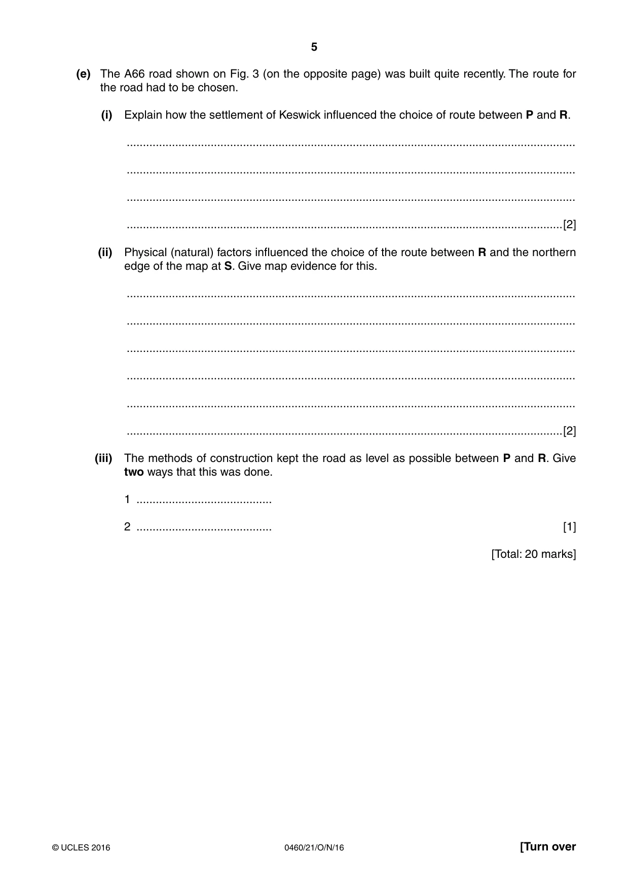
5 0460/21/O/N/16 © UCLES 2016 [Turn over (e) The A66 road shown on Fig. 3 (on the opposite page) was built quite recently. The route for the road had to be chosen. (i) Explain how the settlement of Keswick influenced the choice of route between P and R. … … … …[2] (ii) Physical (natural) factors influenced the choice of the route between R and the northern edge of the map at S. Give map evidence for this. … … … … … …[2] (iii) The methods of construction kept the road as level as possible between P and R. Give two ways that this was done. 1 … 2 … [1] [Total: 20 marks]
Question paper, page 6
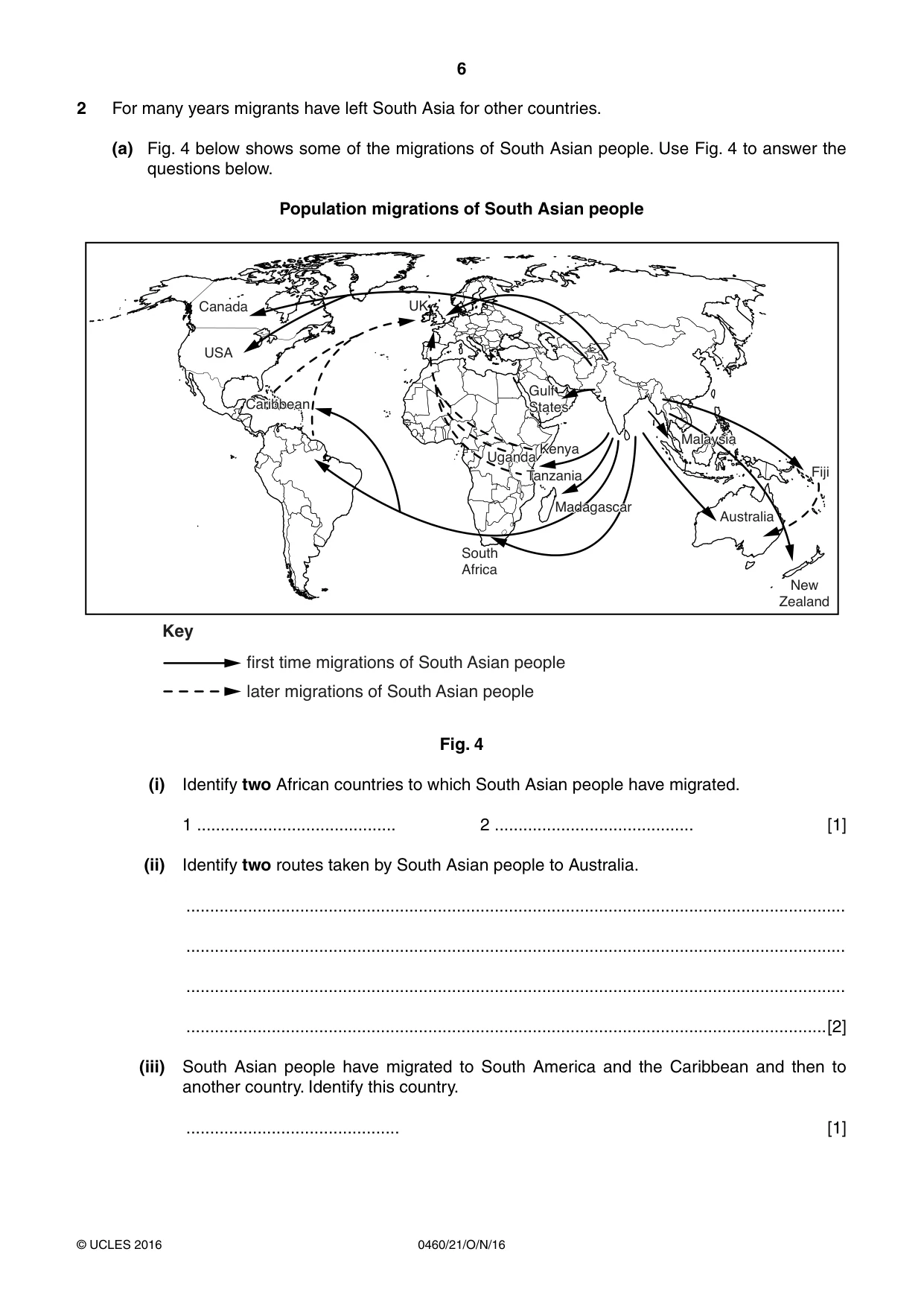
6 0460/21/O/N/16 © UCLES 2016 2 For many years migrants have left South Asia for other countries. (a) Fig. 4 below shows some of the migrations of South Asian people. Use Fig. 4 to answer the questions below. Population migrations of South Asian people Madagascar Madagascar South Africa Gulf States Gulf States Kenya Kenya Uganda Uganda Tanzania Tanzania UK Canada USA Caribbean Caribbean Australia Malaysia Malaysia New Zealand Fiji Key first time migrations of South Asian people later migrations of South Asian people Fig. 4 (i) Identify two African countries to which South Asian people have migrated. 1 … 2 … [1] (ii) Identify two routes taken by South Asian people to Australia. … … … …[2] (iii) South Asian people have migrated to South America and the Caribbean and then to another country. Identify this country. … [1]
Question paper, page 7
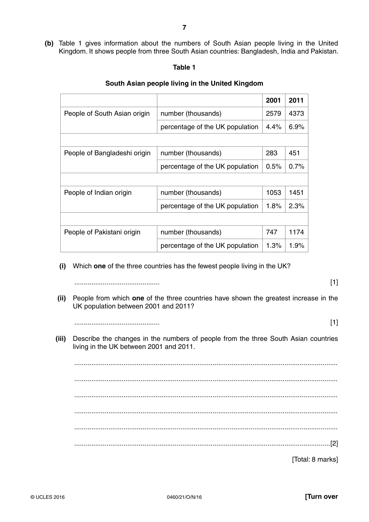
7 0460/21/O/N/16 © UCLES 2016 [Turn over (b) Table 1 gives information about the numbers of South Asian people living in the United Kingdom. It shows people from three South Asian countries: Bangladesh, India and Pakistan. Table 1 South Asian people living in the United Kingdom 2001 2011 People of South Asian origin number (thousands) 2579 4373 percentage of the UK population 4.4% 6.9% People of Bangladeshi origin number (thousands) 283 451 percentage of the UK population 0.5% 0.7% People of Indian origin number (thousands) 1053 1451 percentage of the UK population 1.8% 2.3% People of Pakistani origin number (thousands) 747 1174 percentage of the UK population 1.3% 1.9% (i) Which one of the three countries has the fewest people living in the UK? … [1] (ii) People from which one of the three countries have shown the greatest increase in the UK population between 2001 and 2011? … [1] (iii) Describe the changes in the numbers of people from the three South Asian countries living in the UK between 2001 and 2011. … … … … … …[2] [Total: 8 marks]
Question paper, page 8
8 0460/21/O/N/16 © UCLES 2016 BLANK PAGE
Question paper, page 9
9 0460/21/O/N/16 © UCLES 2016 [Turn over 3 Study Photographs A and B (Insert), which show coastal landforms. (a) Describe the coastal landforms shown on Photograph A. … … … … … … … … … … …[5] (b) Explain how the coastal landform at X on Photograph B has influenced the formation of the coastal landforms at Y. … … … … … … … … …[3] [Total: 8 marks]
Question paper, page 10
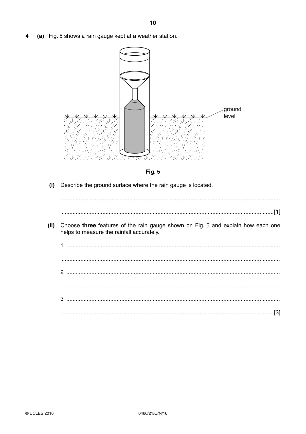
10 0460/21/O/N/16 © UCLES 2016 4 (a) Fig. 5 shows a rain gauge kept at a weather station. ground level Fig. 5 (i) Describe the ground surface where the rain gauge is located. … …[1] (ii) Choose three features of the rain gauge shown on Fig. 5 and explain how each one helps to measure the rainfall accurately. 1 … … 2 … … 3 … …[3]
Question paper, page 11
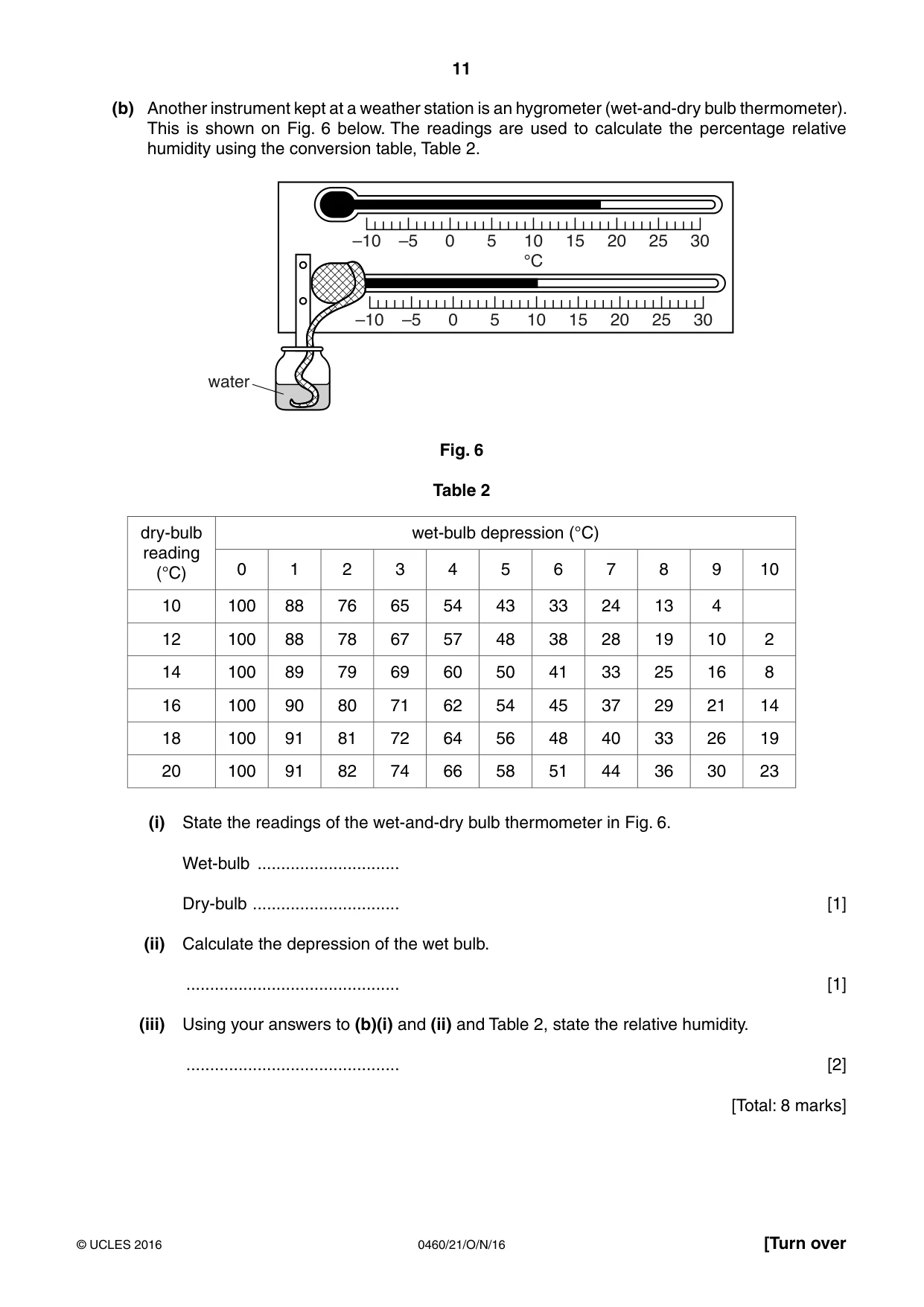
11 0460/21/O/N/16 © UCLES 2016 [Turn over (b) Another instrument kept at a weather station is an hygrometer (wet-and-dry bulb thermometer). This is shown on Fig. 6 below. The readings are used to calculate the percentage relative humidity using the conversion table, Table 2. –10 –5 0 5 10 15 20 25 30 –10 –5 0 5 10 15 20 25 30 °C water Fig. 6 Table 2 dry-bulb reading (°C) wet-bulb depression (°C) 0 1 2 3 4 5 6 7 8 9 10 10 100 88 76 65 54 43 33 24 13 4 12 100 88 78 67 57 48 38 28 19 10 2 14 100 89 79 69 60 50 41 33 25 16 8 16 100 90 80 71 62 54 45 37 29 21 14 18 100 91 81 72 64 56 48 40 33 26 19 20 100 91 82 74 66 58 51 44 36 30 23 (i) State the readings of the wet-and-dry bulb thermometer in Fig. 6. Wet-bulb … Dry-bulb … [1] (ii) Calculate the depression of the wet bulb. … [1] (iii) Using your answers to (b)(i) and (ii) and Table 2, state the relative humidity. … [2] [Total: 8 marks]
Question paper, page 12
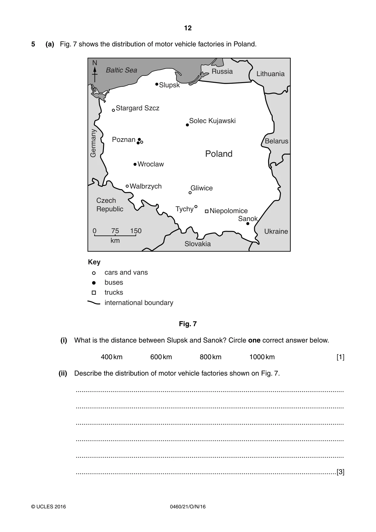
12 0460/21/O/N/16 © UCLES 2016 5 (a) Fig. 7 shows the distribution of motor vehicle factories in Poland. Slupsk Solec Kujawski Stargard Szcz Poznan Wroclaw Walbrzych Tychy Gliwice Niepolomice Sanok Poland Germany Czech Republic Slovakia Ukraine Belarus Lithuania Russia Baltic Sea N 0 75 km 150 Key cars and vans buses trucks international boundary Fig. 7 (i) What is the distance between Slupsk and Sanok? Circle one correct answer below. 400 km 600 km 800 km 1000 km [1] (ii) Describe the distribution of motor vehicle factories shown on Fig. 7. … … … … … …[3]
Question paper, page 13
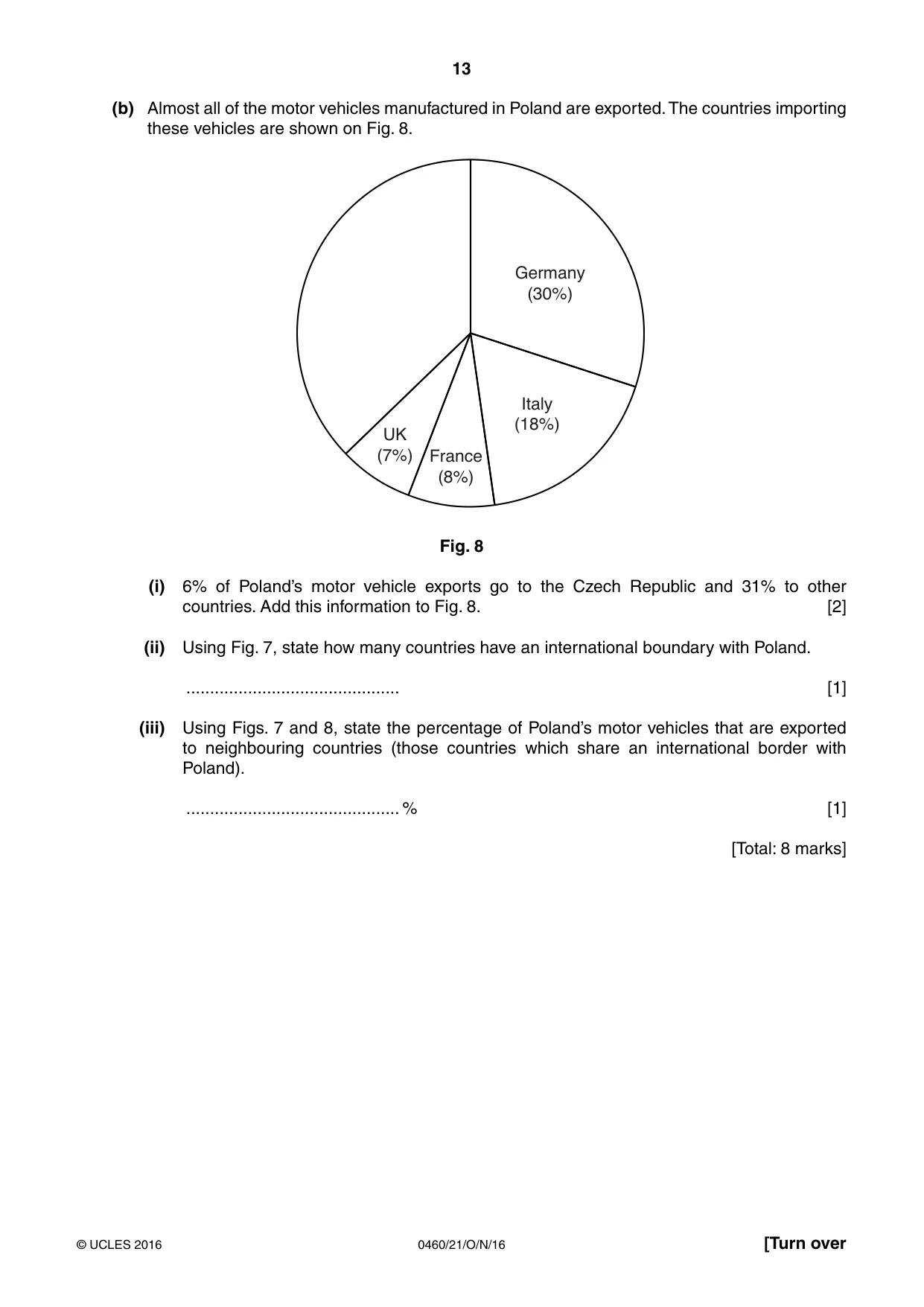
13 0460/21/O/N/16 © UCLES 2016 [Turn over (b) Almost all of the motor vehicles manufactured in Poland are exported. The countries importing these vehicles are shown on Fig. 8. Germany (30%) Italy (18%) France (8%) UK (7%) Fig. 8 (i) 6% of Poland’s motor vehicle exports go to the Czech Republic and 31% to other countries. Add this information to Fig. 8. [2] (ii) Using Fig. 7, state how many countries have an international boundary with Poland. … [1] (iii) Using Figs. 7 and 8, state the percentage of Poland’s motor vehicles that are exported to neighbouring countries (those countries which share an international border with Poland). … % [1] [Total: 8 marks]
Question paper, page 14
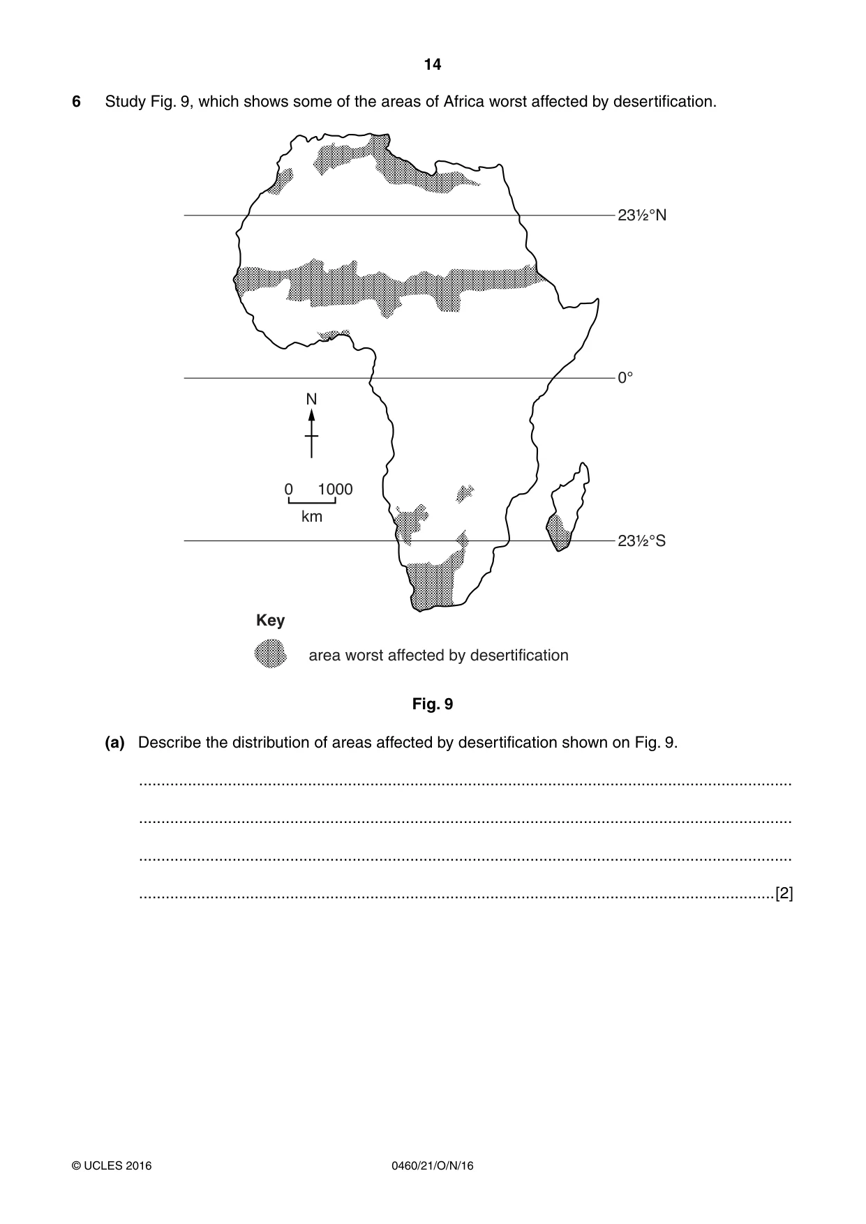
14 0460/21/O/N/16 © UCLES 2016 6 Study Fig. 9, which shows some of the areas of Africa worst affected by desertification. 23½°N 23½°S 0° 0 1000 km N Key area worst affected by desertification Fig. 9 (a) Describe the distribution of areas affected by desertification shown on Fig. 9. … … … …[2]
Question paper, page 15
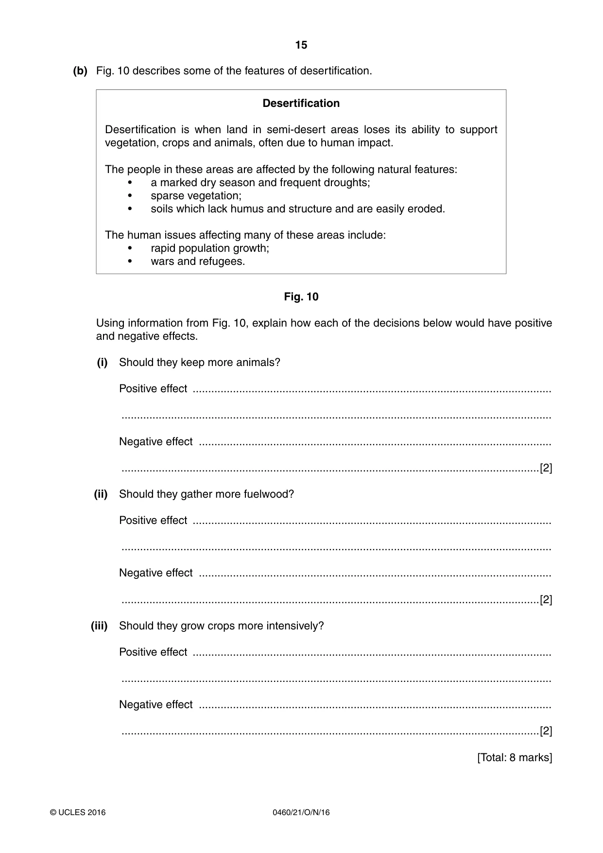
15 0460/21/O/N/16 © UCLES 2016 (b) Fig. 10 describes some of the features of desertification. Desertification Desertification is when land in semi-desert areas loses its ability to support vegetation, crops and animals, often due to human impact. The people in these areas are affected by the following natural features: • a marked dry season and frequent droughts; • sparse vegetation; • soils which lack humus and structure and are easily eroded. The human issues affecting many of these areas include: • rapid population growth; • wars and refugees. Fig. 10 Using information from Fig. 10, explain how each of the decisions below would have positive and negative effects. (i) Should they keep more animals? Positive effect … … Negative effect … …[2] (ii) Should they gather more fuelwood? Positive effect … … Negative effect … …[2] (iii) Should they grow crops more intensively? Positive effect … … Negative effect … …[2] [Total: 8 marks]
Question paper, page 16
16 0460/21/O/N/16 © UCLES 2016 Additional Pages If you use the following pages to complete the answer(s) to any question(s), the question number(s) must be clearly shown. … … … … … … … … … … … … … … … … … … … … … … … … … …
Question paper, page 17
17 0460/21/O/N/16 © UCLES 2016 … … … … … … … … … … … … … … … … … … … … … … … … … … … …
Question paper, page 18
18 0460/21/O/N/16 © UCLES 2016 BLANK PAGE
Question paper, page 19
19 0460/21/O/N/16 © UCLES 2016 BLANK PAGE
Question paper, page 20
20 0460/21/O/N/16 © UCLES 2016 Permission to reproduce items where third-party owned material protected by copyright is included has been sought and cleared where possible. Every reasonable effort has been made by the publisher (UCLES) to trace copyright holders, but if any items requiring clearance have unwittingly been included, the publisher will be pleased to make amends at the earliest possible opportunity. To avoid the issue of disclosure of answer-related information to candidates, all copyright acknowledgements are reproduced online in the Cambridge International Examinations Copyright Acknowledgements Booklet. This is produced for each series of examinations and is freely available to download at www.cie.org.uk after the live examination series. Cambridge International Examinations is part of the Cambridge Assessment Group. Cambridge Assessment is the brand name of University of Cambridge Local Examinations Syndicate (UCLES), which is itself a department of the University of Cambridge. BLANK PAGE
Mark scheme, page 1
® IGCSE is the registered trademark of Cambridge International Examinations. This syllabus is approved for use in England, Wales and Northern Ireland as a Cambridge International Level 1/Level 2 Certificate. This document consists of 7 printed pages. © UCLES 2016 [Turn over Cambridge International Examinations Cambridge International General Certificate of Secondary Education GEOGRAPHY 0460/21 Paper 2 October/November 2016 MARK SCHEME Maximum Mark: 60 Published This mark scheme is published as an aid to teachers and candidates, to indicate the requirements of the examination. It shows the basis on which Examiners were instructed to award marks. It does not indicate the details of the discussions that took place at an Examiners’ meeting before marking began, which would have considered the acceptability of alternative answers. Mark schemes should be read in conjunction with the question paper and the Principal Examiner Report for Teachers. Cambridge will not enter into discussions about these mark schemes. Cambridge is publishing the mark schemes for the October/November 2016 series for most Cambridge IGCSE®, Cambridge International A and AS Level components and some Cambridge O Level components.
Mark scheme, page 2
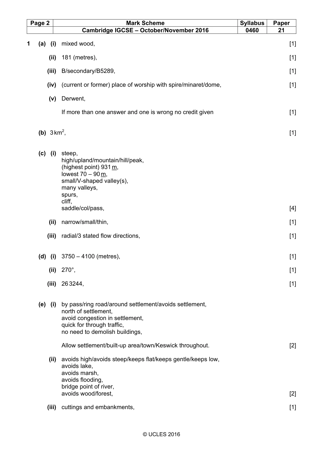
Page 2 Mark Scheme Syllabus Paper Cambridge IGCSE – October/November 2016 0460 21 © UCLES 2016 1 (a) (i) mixed wood, [1] (ii) 181 (metres), [1] (iii) B/secondary/B5289, [1] (iv) (current or former) place of worship with spire/minaret/dome, [1] (v) Derwent, If more than one answer and one is wrong no credit given [1] (b) 3 km2, [1] (c) (i) steep, high/upland/mountain/hill/peak, (highest point) 931 m, lowest 70 – 90 m, small/V-shaped valley(s), many valleys, spurs, cliff, saddle/col/pass, [4] (ii) narrow/small/thin, [1] (iii) radial/3 stated flow directions, [1] (d) (i) 3750 – 4100 (metres), [1] (ii) 270°, [1] (iii) 26 3244, [1] (e) (i) by pass/ring road/around settlement/avoids settlement, north of settlement, avoid congestion in settlement, quick for through traffic, no need to demolish buildings, Allow settlement/built-up area/town/Keswick throughout. [2] (ii) avoids high/avoids steep/keeps flat/keeps gentle/keeps low, avoids lake, avoids marsh, avoids flooding, bridge point of river, avoids wood/forest, [2] (iii) cuttings and embankments, [1]
Mark scheme, page 3
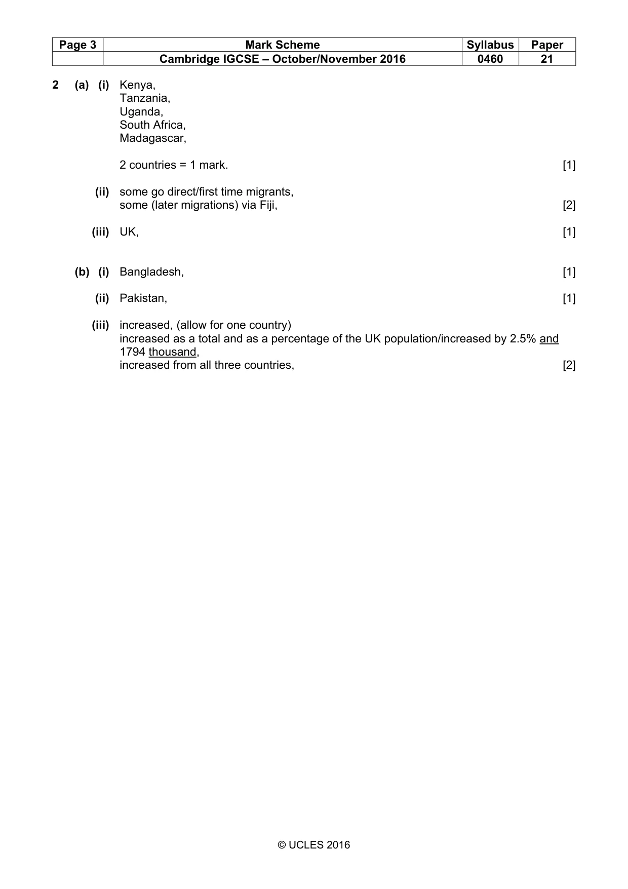
Page 3 Mark Scheme Syllabus Paper Cambridge IGCSE – October/November 2016 0460 21 © UCLES 2016 2 (a) (i) Kenya, Tanzania, Uganda, South Africa, Madagascar, 2 countries = 1 mark. [1] (ii) some go direct/first time migrants, some (later migrations) via Fiji, [2] (iii) UK, [1] (b) (i) Bangladesh, [1] (ii) Pakistan, [1] (iii) increased, (allow for one country) increased as a total and as a percentage of the UK population/increased by 2.5% and 1794 thousand, increased from all three countries, [2]
Mark scheme, page 4
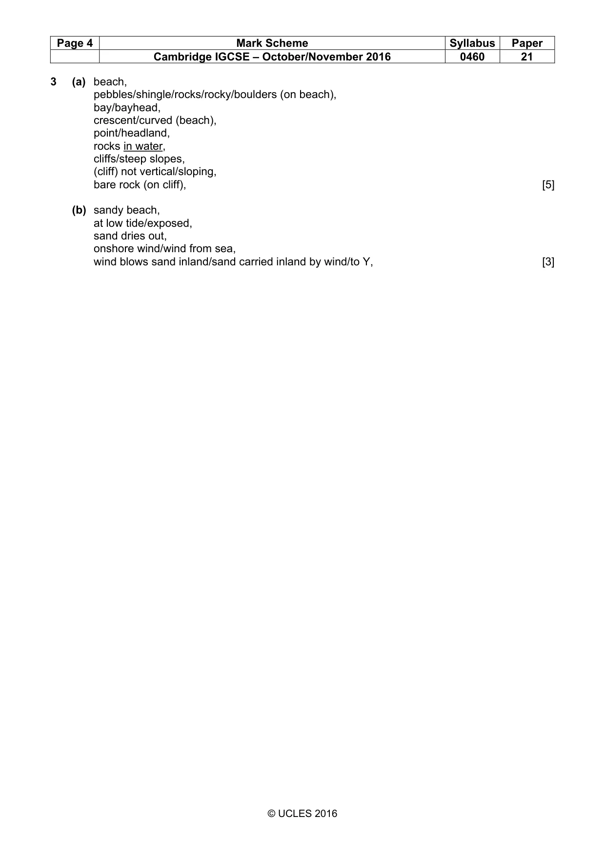
Page 4 Mark Scheme Syllabus Paper Cambridge IGCSE – October/November 2016 0460 21 © UCLES 2016 3 (a) beach, pebbles/shingle/rocks/rocky/boulders (on beach), bay/bayhead, crescent/curved (beach), point/headland, rocks in water, cliffs/steep slopes, (cliff) not vertical/sloping, bare rock (on cliff), [5] (b) sandy beach, at low tide/exposed, sand dries out, onshore wind/wind from sea, wind blows sand inland/sand carried inland by wind/to Y, [3]
Mark scheme, page 5
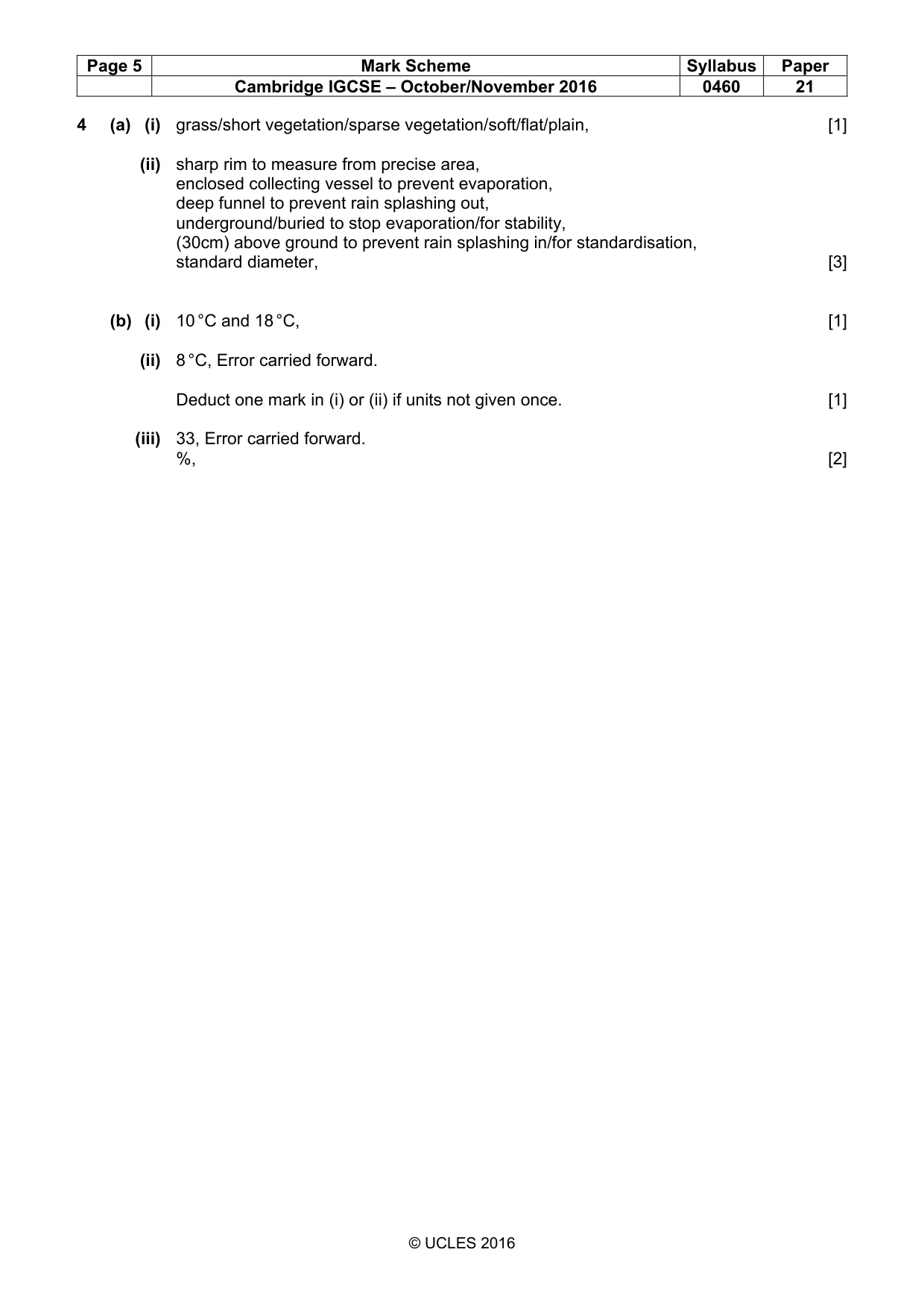
Page 5 Mark Scheme Syllabus Paper Cambridge IGCSE – October/November 2016 0460 21 © UCLES 2016 4 (a) (i) grass/short vegetation/sparse vegetation/soft/flat/plain, [1] (ii) sharp rim to measure from precise area, enclosed collecting vessel to prevent evaporation, deep funnel to prevent rain splashing out, underground/buried to stop evaporation/for stability, (30cm) above ground to prevent rain splashing in/for standardisation, standard diameter, [3] (b) (i) 10 °C and 18 °C, [1] (ii) 8 °C, Error carried forward. Deduct one mark in (i) or (ii) if units not given once. [1] (iii) 33, Error carried forward. %, [2]
Mark scheme, page 6
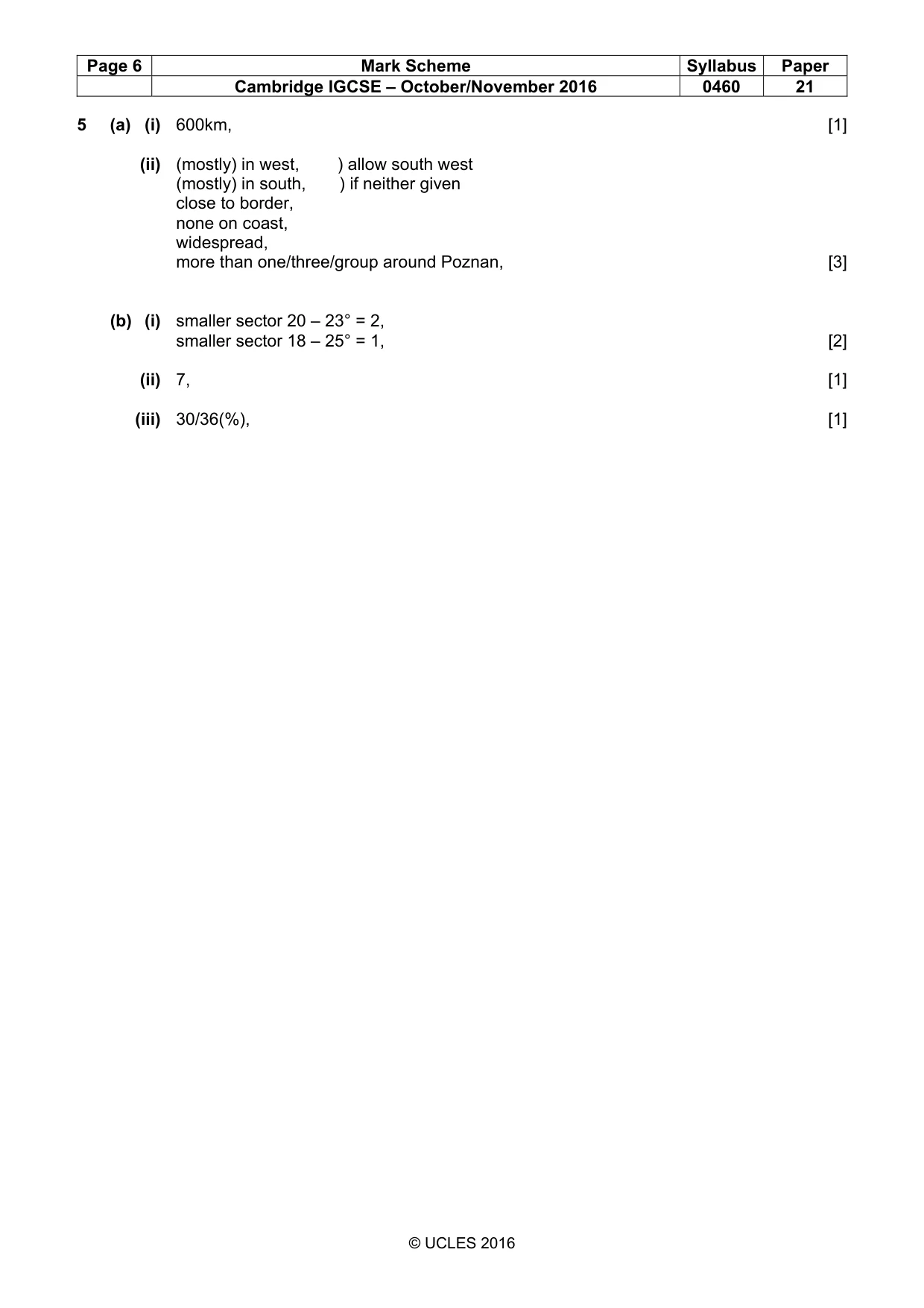
Page 6 Mark Scheme Syllabus Paper Cambridge IGCSE – October/November 2016 0460 21 © UCLES 2016 5 (a) (i) 600km, [1] (ii) (mostly) in west, ) allow south west (mostly) in south, ) if neither given close to border, none on coast, widespread, more than one/three/group around Poznan, [3] (b) (i) smaller sector 20 – 23° = 2, smaller sector 18 – 25° = 1, [2] (ii) 7, [1] (iii) 30/36(%), [1]
Mark scheme, page 7
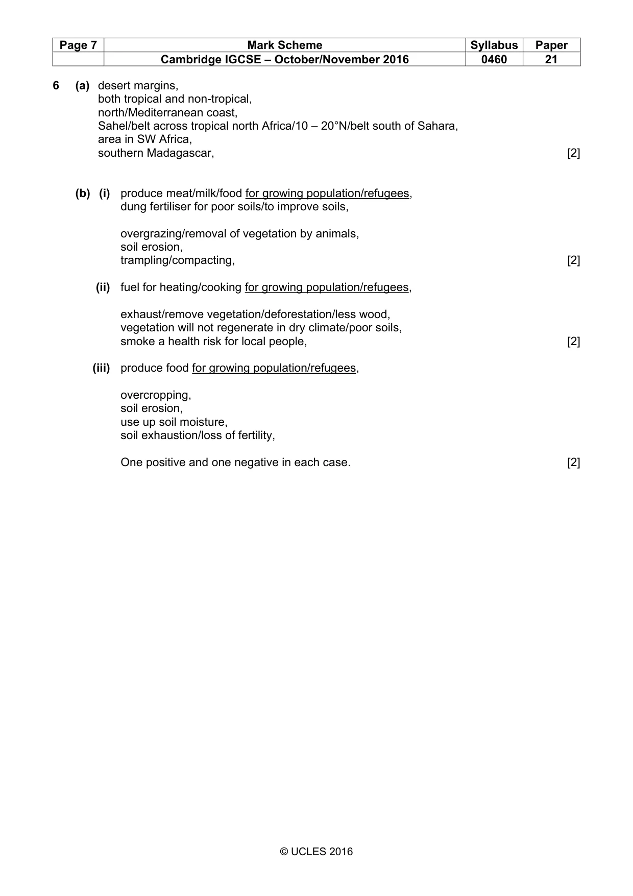
Page 7 Mark Scheme Syllabus Paper Cambridge IGCSE – October/November 2016 0460 21 © UCLES 2016 6 (a) desert margins, both tropical and non-tropical, north/Mediterranean coast, Sahel/belt across tropical north Africa/10 – 20°N/belt south of Sahara, area in SW Africa, southern Madagascar, [2] (b) (i) produce meat/milk/food for growing population/refugees, dung fertiliser for poor soils/to improve soils, overgrazing/removal of vegetation by animals, soil erosion, trampling/compacting, [2] (ii) fuel for heating/cooking for growing population/refugees, exhaust/remove vegetation/deforestation/less wood, vegetation will not regenerate in dry climate/poor soils, smoke a health risk for local people, [2] (iii) produce food for growing population/refugees, overcropping, soil erosion, use up soil moisture, soil exhaustion/loss of fertility, One positive and one negative in each case. [2]
What you needed in this session
Cambridge’s own grade thresholds for 2016 Oct/Nov, Paper 2 · Variant 1. A higher threshold means an easier paper — the bar moves with how the cohort did.