Cambridge A Level Geography 9696 — 2022 May/June Paper 3 · Variant 1
9696/31/M/J/22 · 60 marks · ≈68 min
The question paper and its mark scheme, free to read here and free to download. This is Cambridge’s own paper, exactly as it was sat.
Question paper4 pages

Mark scheme22 pages
Answers below. Sit the paper first if you are practising.

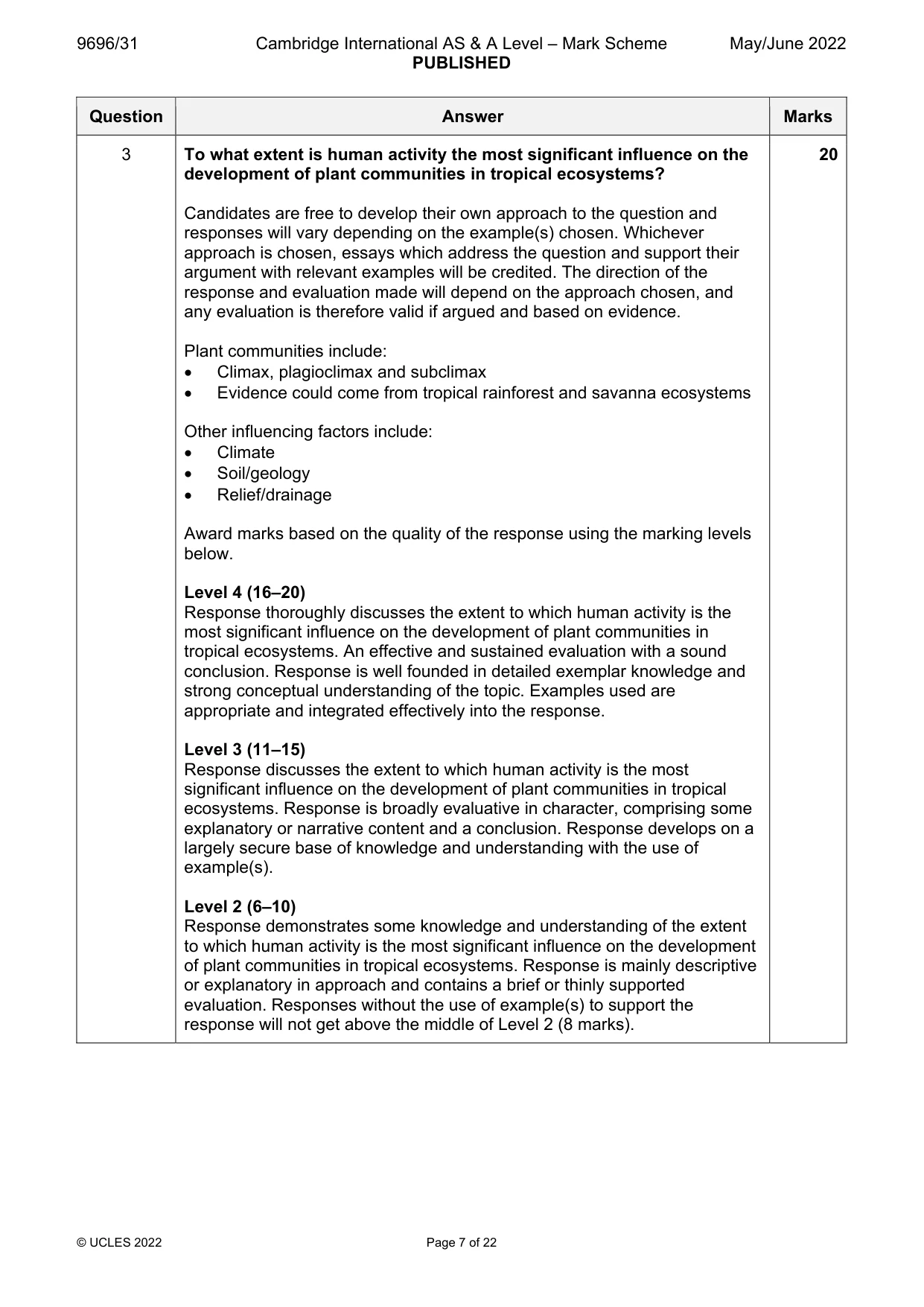

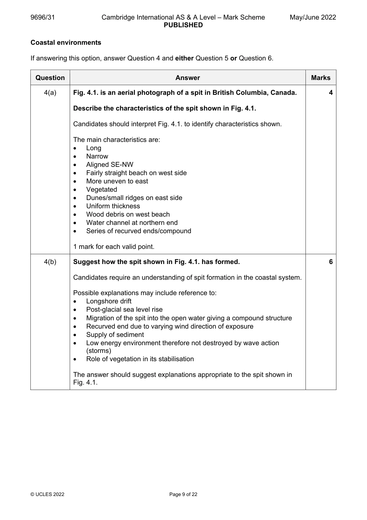
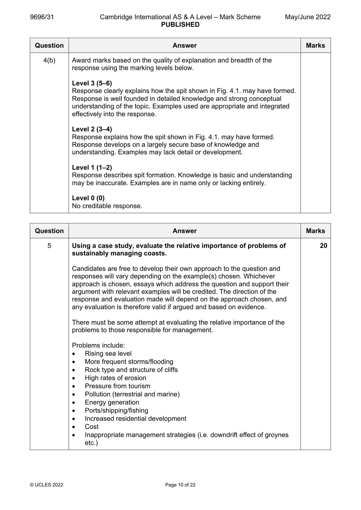
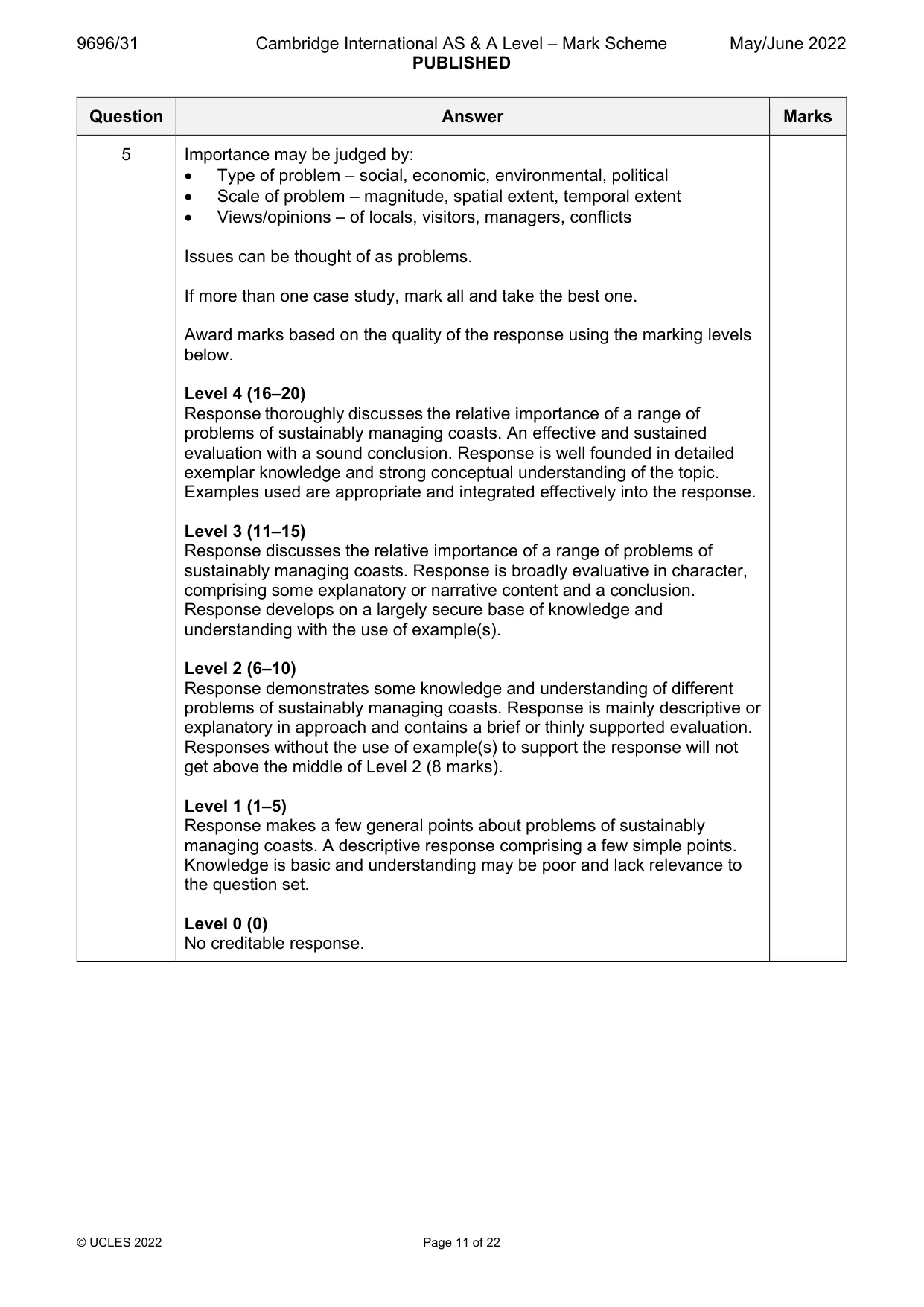
Paper as text
Question paper, page 1
Cambridge International AS & A Level 9696/31 May/June 2022 1 hour 30 minutes GEOGRAPHY Paper 3 Advanced Physical Geography Options You must answer on the enclosed answer booklet. You will need: Answer booklet (enclosed) Insert (enclosed) INSTRUCTIONS • Answer four questions in total: Answer questions from two options. For each option, follow the instructions inside on which questions to answer. • Follow the instructions on the front cover of the answer booklet. If you need additional answer paper, ask the invigilator for a continuation booklet. • Sketch maps and diagrams should be drawn whenever they serve to illustrate an answer. • You should make reference to appropriate examples studied in the field or the classroom, even where such examples are not specifically requested by the question. INFORMATION • The total mark for this paper is 60. • The number of marks for each question or part question is shown in brackets [ ]. • The insert contains all the resources referred to in the questions. This document has 4 pages. Any blank pages are indicated. [Turn over 06_9696_31_2022_1.4 © UCLES 2022 *4291400092*
Question paper, page 2
Answer questions from two different options. Tropical environments If answering this option, answer Question 1 and either Question 2 or Question 3. Fig. 1.1 shows a subtropical anticyclone over Australia, 2 September 2018. 1 Describe the atmospheric pressure pattern over Australia shown in Fig. 1.1. [4] (a) Explain the role of subtropical anticyclones in influencing the characteristics of tropical climates. [6] (b) Assess the influence of different rock types on the formation of characteristic landforms of tropical environments. [20] 2 To what extent is human activity the most significant influence on the development of plant communities in tropical ecosystems? [20] 3 Coastal environments If answering this option, answer Question 4 and either Question 5 or Question 6. Fig. 4.1 is an aerial photograph of a spit in British Columbia, Canada. 4 Describe the characteristics of the spit shown in Fig. 4.1. [4] (a) Suggest how the spit shown in Fig. 4.1 has formed. [6] (b) Using a case study, evaluate the relative importance of problems of sustainably managing coasts. [20] 5 ‘Sea level change has a very limited role in the formation of coastal landforms.’ How far do you agree? [20] 6 06_9696_31_2022_1.4 © UCLES 2022 2
Question paper, page 3
Hazardous environments If answering this option, answer Question 7 and either Question 8 or Question 9. Fig. 7.1 shows the extent of two historic mudflows from the Mount Rainier volcano, USA. 7 Compare the extent of the two mudflows shown in Fig. 7.1. [4] (a) Suggest how the mudflows shown in Fig. 7.1 were formed. [6] (b) Assess the relative importance of the factors influencing the formation of tornadoes. [20] 8 ‘Perception of risk varies depending on the type of hazard.’ To what extent do you agree with this view? [20] 9 Hot arid and semi-arid environments If answering this option, answer Question 10 and either Question 11 or Question 12. Fig. 10.1 shows the results of two laboratory experiments. 10 Compare the patterns of weight loss in the two experiments shown in Fig. 10.1. [4] (a) Explain how rocks are weathered by salt in semi-arid environments. [6] (b) Assess the relative significance of the causes of aridity. [20] 11 ‘Wind transportation in hot arid and semi-arid environments is more important in the formation of some characteristic landforms than others.’ How far do you agree with this view? [20] 12 06_9696_31_2022_1.4 © UCLES 2022 3
Question paper, page 4
BLANK PAGE The boundaries and names shown, the designations used and the presentation of material on any maps contained in this question paper/insert do not imply official endorsement or acceptance by Cambridge Assessment International Education concerning the legal status of any country, territory, or area or any of its authorities, or of the delimitation of its frontiers or boundaries. Permission to reproduce items where third-party owned material protected by copyright is included has been sought and cleared where possible. Every reasonable effort has been made by the publisher (UCLES) to trace copyright holders, but if any items requiring clearance have unwittingly been included, the publisher will be pleased to make amends at the earliest possible opportunity. To avoid the issue of disclosure of answer-related information to candidates, all copyright acknowledgements are reproduced online in the Cambridge Assessment International Education Copyright Acknowledgements Booklet. This is produced for each series of examinations and is freely available to download at www.cambridgeinternational.org after the live examination series. Cambridge Assessment International Education is part of Cambridge Assessment. Cambridge Assessment is the brand name of the University of Cambridge Local Examinations Syndicate (UCLES), which is a department of the University of Cambridge. 06_9696_31_2022_1.4 © UCLES 2022 4
Mark scheme, page 1
This document consists of 22 printed pages. © UCLES 2022 [Turn over Cambridge International AS & A Level GEOGRAPHY 9696/31 Paper 3 Advanced Physical Geography Options May/June 2022 MARK SCHEME Maximum Mark: 60 Published This mark scheme is published as an aid to teachers and candidates, to indicate the requirements of the examination. It shows the basis on which Examiners were instructed to award marks. It does not indicate the details of the discussions that took place at an Examiners’ meeting before marking began, which would have considered the acceptability of alternative answers. Mark schemes should be read in conjunction with the question paper and the Principal Examiner Report for Teachers. Cambridge International will not enter into discussions about these mark schemes. Cambridge International is publishing the mark schemes for the May/June 2022 series for most Cambridge IGCSE, Cambridge International A and AS Level and Cambridge Pre-U components, and some Cambridge O Level components.
Mark scheme, page 2
9696/31 Cambridge International AS & A Level – Mark Scheme PUBLISHED May/June 2022 © UCLES 2022 Page 2 of 22 Generic Marking Principles These general marking principles must be applied by all examiners when marking candidate answers. They should be applied alongside the specific content of the mark scheme or generic level descriptors for a question. Each question paper and mark scheme will also comply with these marking principles. GENERIC MARKING PRINCIPLE 1: Marks must be awarded in line with: the specific content of the mark scheme or the generic level descriptors for the question the specific skills defined in the mark scheme or in the generic level descriptors for the question the standard of response required by a candidate as exemplified by the standardisation scripts. GENERIC MARKING PRINCIPLE 2: Marks awarded are always whole marks (not half marks, or other fractions). GENERIC MARKING PRINCIPLE 3: Marks must be awarded positively: marks are awarded for correct/valid answers, as defined in the mark scheme. However, credit is given for valid answers which go beyond the scope of the syllabus and mark scheme, referring to your Team Leader as appropriate marks are awarded when candidates clearly demonstrate what they know and can do marks are not deducted for errors marks are not deducted for omissions answers should only be judged on the quality of spelling, punctuation and grammar when these features are specifically assessed by the question as indicated by the mark scheme. The meaning, however, should be unambiguous. GENERIC MARKING PRINCIPLE 4: Rules must be applied consistently, e.g. in situations where candidates have not followed instructions or in the application of generic level descriptors. GENERIC MARKING PRINCIPLE 5: Marks should be awarded using the full range of marks defined in the mark scheme for the question (however; the use of the full mark range may be limited according to the quality of the candidate responses seen). GENERIC MARKING PRINCIPLE 6: Marks awarded are based solely on the requirements as defined in the mark scheme. Marks should not be awarded with grade thresholds or grade descriptors in mind.
Mark scheme, page 3
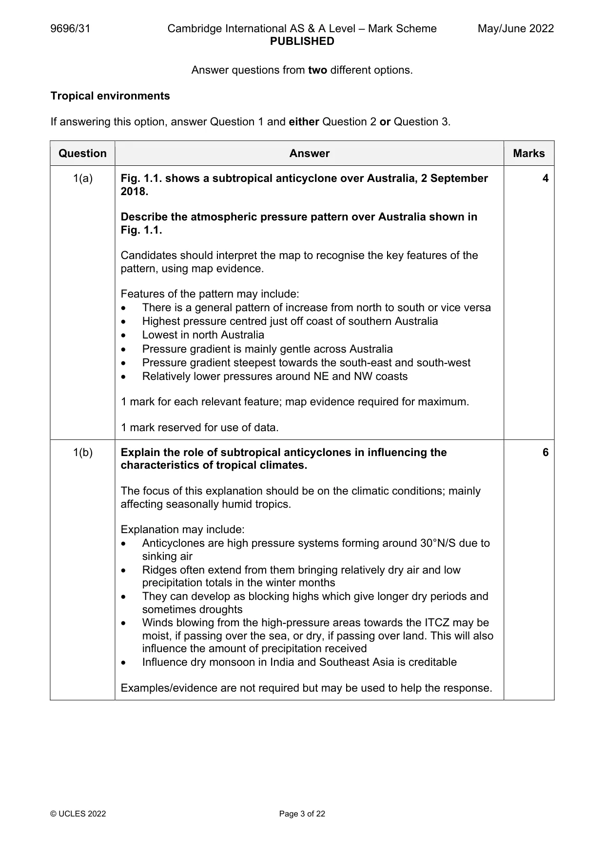
9696/31 Cambridge International AS & A Level – Mark Scheme PUBLISHED May/June 2022 © UCLES 2022 Page 3 of 22 Answer questions from two different options. Tropical environments If answering this option, answer Question 1 and either Question 2 or Question 3. Question Answer Marks 1(a) Fig. 1.1. shows a subtropical anticyclone over Australia, 2 September 2018. Describe the atmospheric pressure pattern over Australia shown in Fig. 1.1. Candidates should interpret the map to recognise the key features of the pattern, using map evidence. Features of the pattern may include: There is a general pattern of increase from north to south or vice versa Highest pressure centred just off coast of southern Australia Lowest in north Australia Pressure gradient is mainly gentle across Australia Pressure gradient steepest towards the south-east and south-west Relatively lower pressures around NE and NW coasts 1 mark for each relevant feature; map evidence required for maximum. 1 mark reserved for use of data. 4 1(b) Explain the role of subtropical anticyclones in influencing the characteristics of tropical climates. The focus of this explanation should be on the climatic conditions; mainly affecting seasonally humid tropics. Explanation may include: Anticyclones are high pressure systems forming around 30°N/S due to sinking air Ridges often extend from them bringing relatively dry air and low precipitation totals in the winter months They can develop as blocking highs which give longer dry periods and sometimes droughts Winds blowing from the high-pressure areas towards the ITCZ may be moist, if passing over the sea, or dry, if passing over land. This will also influence the amount of precipitation received Influence dry monsoon in India and Southeast Asia is creditable Examples/evidence are not required but may be used to help the response. 6
Mark scheme, page 4
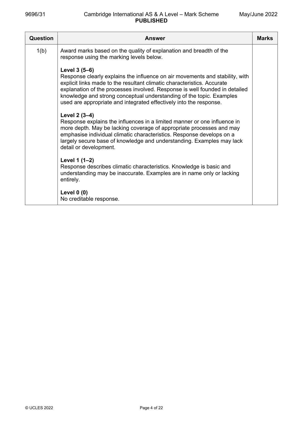
9696/31 Cambridge International AS & A Level – Mark Scheme PUBLISHED May/June 2022 © UCLES 2022 Page 4 of 22 Question Answer Marks 1(b) Award marks based on the quality of explanation and breadth of the response using the marking levels below. Level 3 (5–6) Response clearly explains the influence on air movements and stability, with explicit links made to the resultant climatic characteristics. Accurate explanation of the processes involved. Response is well founded in detailed knowledge and strong conceptual understanding of the topic. Examples used are appropriate and integrated effectively into the response. Level 2 (3–4) Response explains the influences in a limited manner or one influence in more depth. May be lacking coverage of appropriate processes and may emphasise individual climatic characteristics. Response develops on a largely secure base of knowledge and understanding. Examples may lack detail or development. Level 1 (1–2) Response describes climatic characteristics. Knowledge is basic and understanding may be inaccurate. Examples are in name only or lacking entirely. Level 0 (0) No creditable response.
Mark scheme, page 5
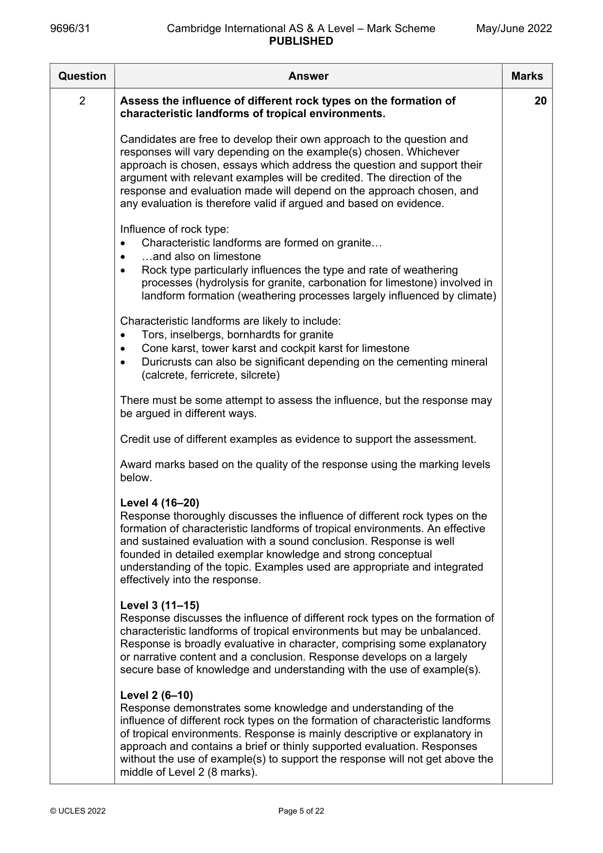
9696/31 Cambridge International AS & A Level – Mark Scheme PUBLISHED May/June 2022 © UCLES 2022 Page 5 of 22 Question Answer Marks 2 Assess the influence of different rock types on the formation of characteristic landforms of tropical environments. Candidates are free to develop their own approach to the question and responses will vary depending on the example(s) chosen. Whichever approach is chosen, essays which address the question and support their argument with relevant examples will be credited. The direction of the response and evaluation made will depend on the approach chosen, and any evaluation is therefore valid if argued and based on evidence. Influence of rock type: Characteristic landforms are formed on granite… …and also on limestone Rock type particularly influences the type and rate of weathering processes (hydrolysis for granite, carbonation for limestone) involved in landform formation (weathering processes largely influenced by climate) Characteristic landforms are likely to include: Tors, inselbergs, bornhardts for granite Cone karst, tower karst and cockpit karst for limestone Duricrusts can also be significant depending on the cementing mineral (calcrete, ferricrete, silcrete) There must be some attempt to assess the influence, but the response may be argued in different ways. Credit use of different examples as evidence to support the assessment. Award marks based on the quality of the response using the marking levels below. Level 4 (16–20) Response thoroughly discusses the influence of different rock types on the formation of characteristic landforms of tropical environments. An effective and sustained evaluation with a sound conclusion. Response is well founded in detailed exemplar knowledge and strong conceptual understanding of the topic. Examples used are appropriate and integrated effectively into the response. Level 3 (11–15) Response discusses the influence of different rock types on the formation of characteristic landforms of tropical environments but may be unbalanced. Response is broadly evaluative in character, comprising some explanatory or narrative content and a conclusion. Response develops on a largely secure base of knowledge and understanding with the use of example(s). Level 2 (6–10) Response demonstrates some knowledge and understanding of the influence of different rock types on the formation of characteristic landforms of tropical environments. Response is mainly descriptive or explanatory in approach and contains a brief or thinly supported evaluation. Responses without the use of example(s) to support the response will not get above the middle of Level 2 (8 marks). 20
Mark scheme, page 6
9696/31 Cambridge International AS & A Level – Mark Scheme PUBLISHED May/June 2022 © UCLES 2022 Page 6 of 22 Question Answer Marks 2 Level 1 (1–5) Response makes a few general points about rock type and/or landforms without the necessary focus on their links. A descriptive response comprising a few simple points. Knowledge is basic and understanding may be poor and lack relevance to the question set. Level 0 (0) No creditable response.
Mark scheme, page 7
9696/31 Cambridge International AS & A Level – Mark Scheme PUBLISHED May/June 2022 © UCLES 2022 Page 7 of 22 Question Answer Marks 3 To what extent is human activity the most significant influence on the development of plant communities in tropical ecosystems? Candidates are free to develop their own approach to the question and responses will vary depending on the example(s) chosen. Whichever approach is chosen, essays which address the question and support their argument with relevant examples will be credited. The direction of the response and evaluation made will depend on the approach chosen, and any evaluation is therefore valid if argued and based on evidence. Plant communities include: Climax, plagioclimax and subclimax Evidence could come from tropical rainforest and savanna ecosystems Other influencing factors include: Climate Soil/geology Relief/drainage Award marks based on the quality of the response using the marking levels below. Level 4 (16–20) Response thoroughly discusses the extent to which human activity is the most significant influence on the development of plant communities in tropical ecosystems. An effective and sustained evaluation with a sound conclusion. Response is well founded in detailed exemplar knowledge and strong conceptual understanding of the topic. Examples used are appropriate and integrated effectively into the response. Level 3 (11–15) Response discusses the extent to which human activity is the most significant influence on the development of plant communities in tropical ecosystems. Response is broadly evaluative in character, comprising some explanatory or narrative content and a conclusion. Response develops on a largely secure base of knowledge and understanding with the use of example(s). Level 2 (6–10) Response demonstrates some knowledge and understanding of the extent to which human activity is the most significant influence on the development of plant communities in tropical ecosystems. Response is mainly descriptive or explanatory in approach and contains a brief or thinly supported evaluation. Responses without the use of example(s) to support the response will not get above the middle of Level 2 (8 marks). 20
Mark scheme, page 8
9696/31 Cambridge International AS & A Level – Mark Scheme PUBLISHED May/June 2022 © UCLES 2022 Page 8 of 22 Question Answer Marks 3 Level 1 (1–5) Response makes a few general points about plant communities and/or human activity, but without the necessary focus on the influence of human activity or other factors. A descriptive response comprising a few simple points. Knowledge is basic and understanding may be poor and lack relevance to the question set. Level 0 (0) No creditable response.
Mark scheme, page 9
9696/31 Cambridge International AS & A Level – Mark Scheme PUBLISHED May/June 2022 © UCLES 2022 Page 9 of 22 Coastal environments If answering this option, answer Question 4 and either Question 5 or Question 6. Question Answer Marks 4(a) Fig. 4.1. is an aerial photograph of a spit in British Columbia, Canada. Describe the characteristics of the spit shown in Fig. 4.1. Candidates should interpret Fig. 4.1. to identify characteristics shown. The main characteristics are: Long Narrow Aligned SE-NW Fairly straight beach on west side More uneven to east Vegetated Dunes/small ridges on east side Uniform thickness Wood debris on west beach Water channel at northern end Series of recurved ends/compound 1 mark for each valid point. 4 4(b) Suggest how the spit shown in Fig. 4.1. has formed. Candidates require an understanding of spit formation in the coastal system. Possible explanations may include reference to: Longshore drift Post-glacial sea level rise Migration of the spit into the open water giving a compound structure Recurved end due to varying wind direction of exposure Supply of sediment Low energy environment therefore not destroyed by wave action (storms) Role of vegetation in its stabilisation The answer should suggest explanations appropriate to the spit shown in Fig. 4.1. 6
Mark scheme, page 10
9696/31 Cambridge International AS & A Level – Mark Scheme PUBLISHED May/June 2022 © UCLES 2022 Page 10 of 22 Question Answer Marks 4(b) Award marks based on the quality of explanation and breadth of the response using the marking levels below. Level 3 (5–6) Response clearly explains how the spit shown in Fig. 4.1. may have formed. Response is well founded in detailed knowledge and strong conceptual understanding of the topic. Examples used are appropriate and integrated effectively into the response. Level 2 (3–4) Response explains how the spit shown in Fig. 4.1. may have formed. Response develops on a largely secure base of knowledge and understanding. Examples may lack detail or development. Level 1 (1–2) Response describes spit formation. Knowledge is basic and understanding may be inaccurate. Examples are in name only or lacking entirely. Level 0 (0) No creditable response. Question Answer Marks 5 Using a case study, evaluate the relative importance of problems of sustainably managing coasts. Candidates are free to develop their own approach to the question and responses will vary depending on the example(s) chosen. Whichever approach is chosen, essays which address the question and support their argument with relevant examples will be credited. The direction of the response and evaluation made will depend on the approach chosen, and any evaluation is therefore valid if argued and based on evidence. There must be some attempt at evaluating the relative importance of the problems to those responsible for management. Problems include: Rising sea level More frequent storms/flooding Rock type and structure of cliffs High rates of erosion Pressure from tourism Pollution (terrestrial and marine) Energy generation Ports/shipping/fishing Increased residential development Cost Inappropriate management strategies (i.e. downdrift effect of groynes etc.) 20
Mark scheme, page 11
9696/31 Cambridge International AS & A Level – Mark Scheme PUBLISHED May/June 2022 © UCLES 2022 Page 11 of 22 Question Answer Marks 5 Importance may be judged by: Type of problem – social, economic, environmental, political Scale of problem – magnitude, spatial extent, temporal extent Views/opinions – of locals, visitors, managers, conflicts Issues can be thought of as problems. If more than one case study, mark all and take the best one. Award marks based on the quality of the response using the marking levels below. Level 4 (16–20) Response thoroughly discusses the relative importance of a range of problems of sustainably managing coasts. An effective and sustained evaluation with a sound conclusion. Response is well founded in detailed exemplar knowledge and strong conceptual understanding of the topic. Examples used are appropriate and integrated effectively into the response. Level 3 (11–15) Response discusses the relative importance of a range of problems of sustainably managing coasts. Response is broadly evaluative in character, comprising some explanatory or narrative content and a conclusion. Response develops on a largely secure base of knowledge and understanding with the use of example(s). Level 2 (6–10) Response demonstrates some knowledge and understanding of different problems of sustainably managing coasts. Response is mainly descriptive or explanatory in approach and contains a brief or thinly supported evaluation. Responses without the use of example(s) to support the response will not get above the middle of Level 2 (8 marks). Level 1 (1–5) Response makes a few general points about problems of sustainably managing coasts. A descriptive response comprising a few simple points. Knowledge is basic and understanding may be poor and lack relevance to the question set. Level 0 (0) No creditable response.
Mark scheme, page 12
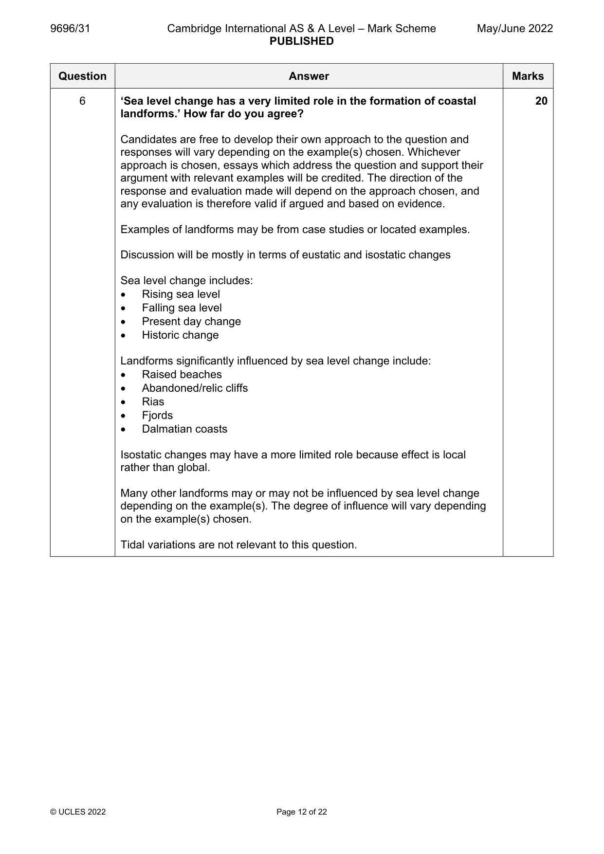
9696/31 Cambridge International AS & A Level – Mark Scheme PUBLISHED May/June 2022 © UCLES 2022 Page 12 of 22 Question Answer Marks 6 ‘Sea level change has a very limited role in the formation of coastal landforms.’ How far do you agree? Candidates are free to develop their own approach to the question and responses will vary depending on the example(s) chosen. Whichever approach is chosen, essays which address the question and support their argument with relevant examples will be credited. The direction of the response and evaluation made will depend on the approach chosen, and any evaluation is therefore valid if argued and based on evidence. Examples of landforms may be from case studies or located examples. Discussion will be mostly in terms of eustatic and isostatic changes Sea level change includes: Rising sea level Falling sea level Present day change Historic change Landforms significantly influenced by sea level change include: Raised beaches Abandoned/relic cliffs Rias Fjords Dalmatian coasts Isostatic changes may have a more limited role because effect is local rather than global. Many other landforms may or may not be influenced by sea level change depending on the example(s). The degree of influence will vary depending on the example(s) chosen. Tidal variations are not relevant to this question. 20
Mark scheme, page 13
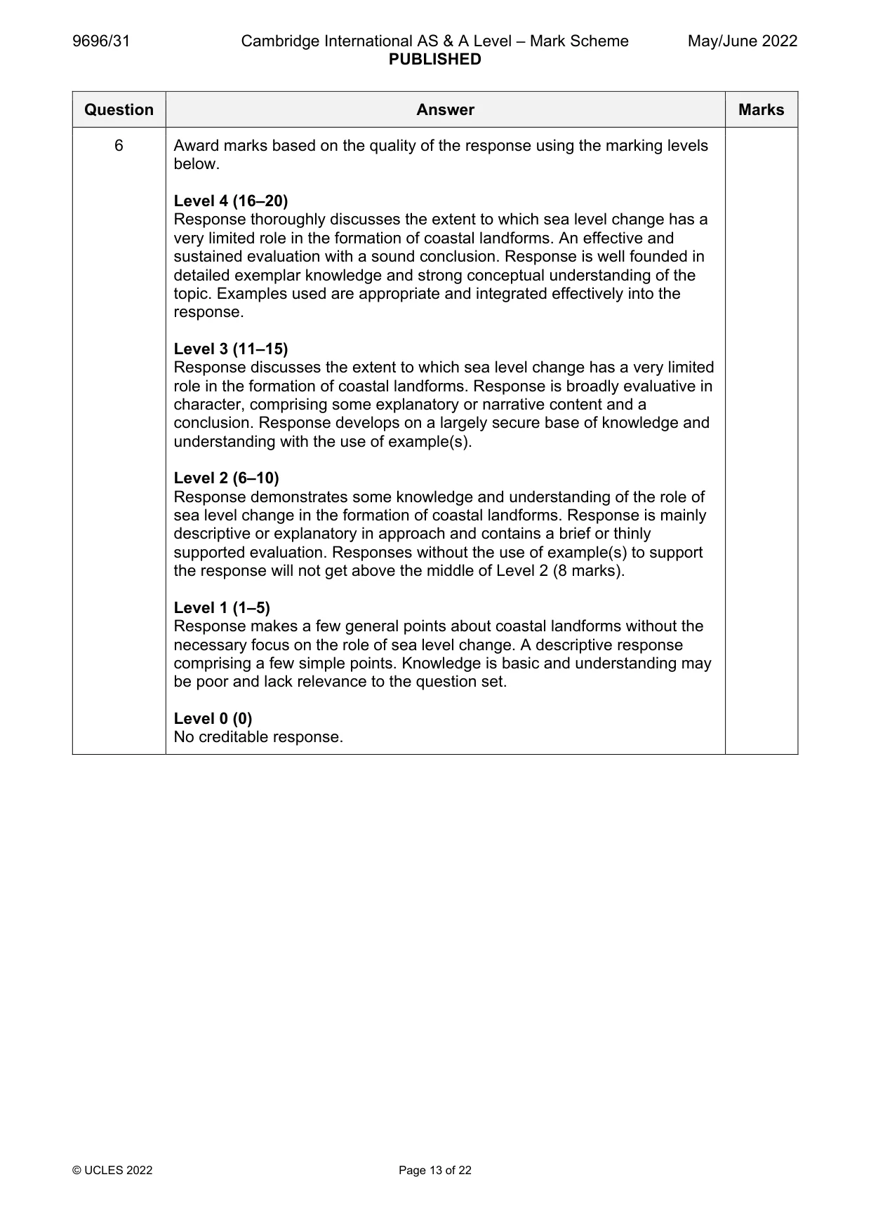
9696/31 Cambridge International AS & A Level – Mark Scheme PUBLISHED May/June 2022 © UCLES 2022 Page 13 of 22 Question Answer Marks 6 Award marks based on the quality of the response using the marking levels below. Level 4 (16–20) Response thoroughly discusses the extent to which sea level change has a very limited role in the formation of coastal landforms. An effective and sustained evaluation with a sound conclusion. Response is well founded in detailed exemplar knowledge and strong conceptual understanding of the topic. Examples used are appropriate and integrated effectively into the response. Level 3 (11–15) Response discusses the extent to which sea level change has a very limited role in the formation of coastal landforms. Response is broadly evaluative in character, comprising some explanatory or narrative content and a conclusion. Response develops on a largely secure base of knowledge and understanding with the use of example(s). Level 2 (6–10) Response demonstrates some knowledge and understanding of the role of sea level change in the formation of coastal landforms. Response is mainly descriptive or explanatory in approach and contains a brief or thinly supported evaluation. Responses without the use of example(s) to support the response will not get above the middle of Level 2 (8 marks). Level 1 (1–5) Response makes a few general points about coastal landforms without the necessary focus on the role of sea level change. A descriptive response comprising a few simple points. Knowledge is basic and understanding may be poor and lack relevance to the question set. Level 0 (0) No creditable response.
Mark scheme, page 14
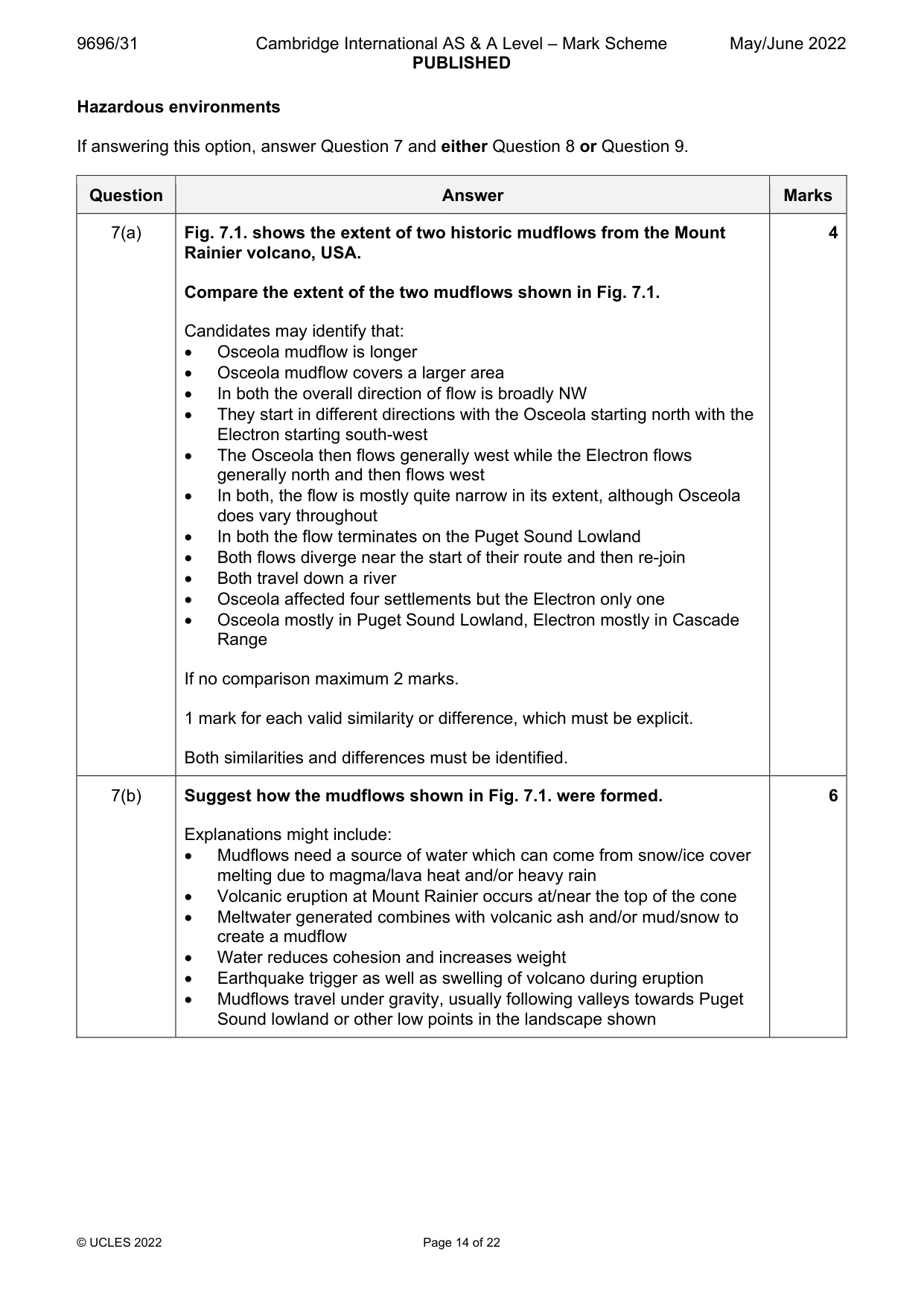
9696/31 Cambridge International AS & A Level – Mark Scheme PUBLISHED May/June 2022 © UCLES 2022 Page 14 of 22 Hazardous environments If answering this option, answer Question 7 and either Question 8 or Question 9. Question Answer Marks 7(a) Fig. 7.1. shows the extent of two historic mudflows from the Mount Rainier volcano, USA. Compare the extent of the two mudflows shown in Fig. 7.1. Candidates may identify that: Osceola mudflow is longer Osceola mudflow covers a larger area In both the overall direction of flow is broadly NW They start in different directions with the Osceola starting north with the Electron starting south-west The Osceola then flows generally west while the Electron flows generally north and then flows west In both, the flow is mostly quite narrow in its extent, although Osceola does vary throughout In both the flow terminates on the Puget Sound Lowland Both flows diverge near the start of their route and then re-join Both travel down a river Osceola affected four settlements but the Electron only one Osceola mostly in Puget Sound Lowland, Electron mostly in Cascade Range If no comparison maximum 2 marks. 1 mark for each valid similarity or difference, which must be explicit. Both similarities and differences must be identified. 4 7(b) Suggest how the mudflows shown in Fig. 7.1. were formed. Explanations might include: Mudflows need a source of water which can come from snow/ice cover melting due to magma/lava heat and/or heavy rain Volcanic eruption at Mount Rainier occurs at/near the top of the cone Meltwater generated combines with volcanic ash and/or mud/snow to create a mudflow Water reduces cohesion and increases weight Earthquake trigger as well as swelling of volcano during eruption Mudflows travel under gravity, usually following valleys towards Puget Sound lowland or other low points in the landscape shown 6
Mark scheme, page 15
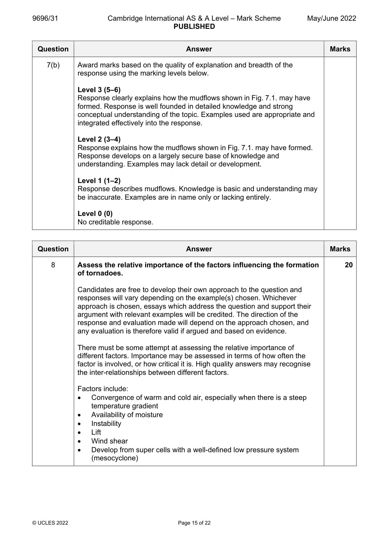
9696/31 Cambridge International AS & A Level – Mark Scheme PUBLISHED May/June 2022 © UCLES 2022 Page 15 of 22 Question Answer Marks 7(b) Award marks based on the quality of explanation and breadth of the response using the marking levels below. Level 3 (5–6) Response clearly explains how the mudflows shown in Fig. 7.1. may have formed. Response is well founded in detailed knowledge and strong conceptual understanding of the topic. Examples used are appropriate and integrated effectively into the response. Level 2 (3–4) Response explains how the mudflows shown in Fig. 7.1. may have formed. Response develops on a largely secure base of knowledge and understanding. Examples may lack detail or development. Level 1 (1–2) Response describes mudflows. Knowledge is basic and understanding may be inaccurate. Examples are in name only or lacking entirely. Level 0 (0) No creditable response. Question Answer Marks 8 Assess the relative importance of the factors influencing the formation of tornadoes. Candidates are free to develop their own approach to the question and responses will vary depending on the example(s) chosen. Whichever approach is chosen, essays which address the question and support their argument with relevant examples will be credited. The direction of the response and evaluation made will depend on the approach chosen, and any evaluation is therefore valid if argued and based on evidence. There must be some attempt at assessing the relative importance of different factors. Importance may be assessed in terms of how often the factor is involved, or how critical it is. High quality answers may recognise the inter-relationships between different factors. Factors include: Convergence of warm and cold air, especially when there is a steep temperature gradient Availability of moisture Instability Lift Wind shear Develop from super cells with a well-defined low pressure system (mesocyclone) 20
Mark scheme, page 16
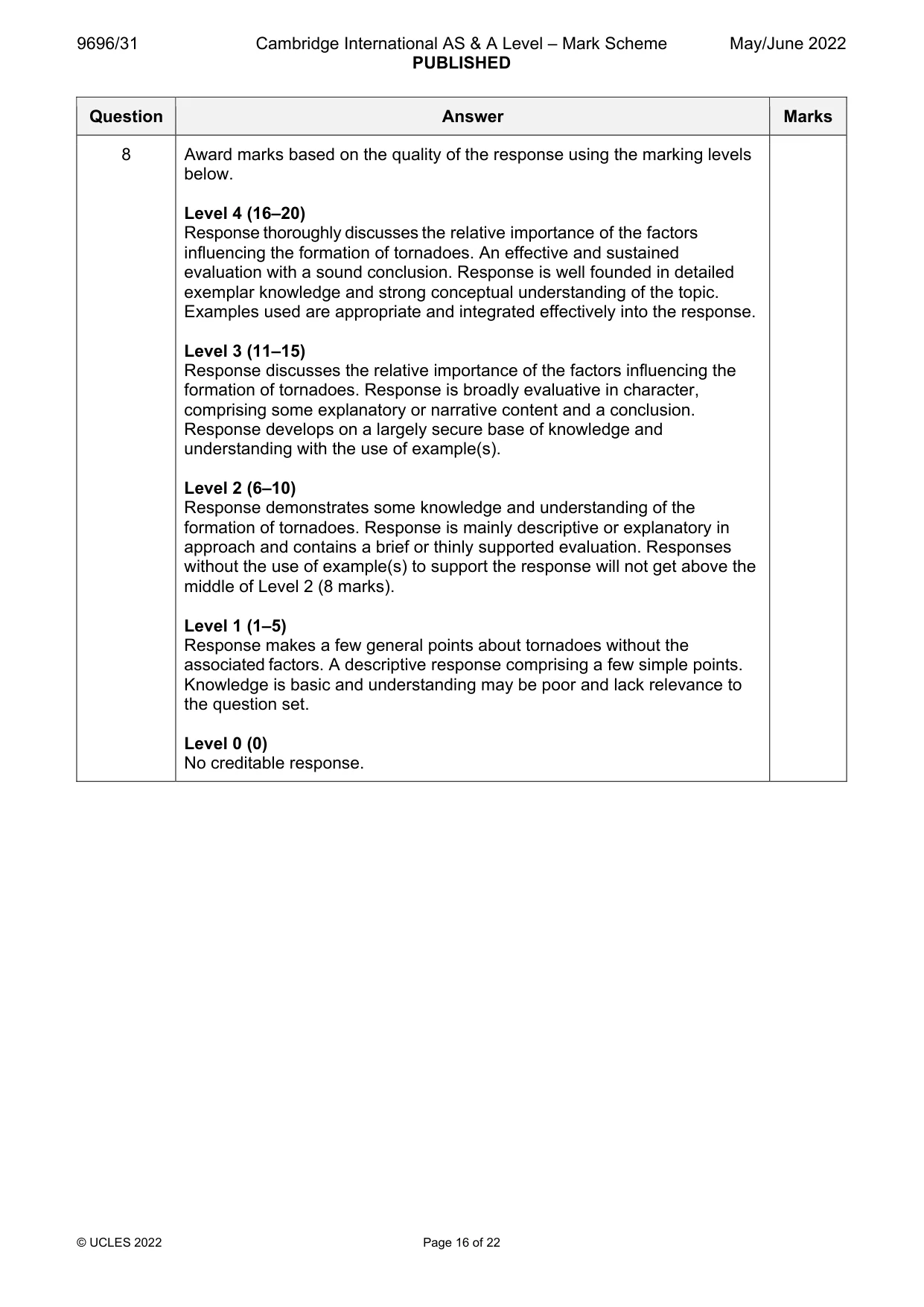
9696/31 Cambridge International AS & A Level – Mark Scheme PUBLISHED May/June 2022 © UCLES 2022 Page 16 of 22 Question Answer Marks 8 Award marks based on the quality of the response using the marking levels below. Level 4 (16–20) Response thoroughly discusses the relative importance of the factors influencing the formation of tornadoes. An effective and sustained evaluation with a sound conclusion. Response is well founded in detailed exemplar knowledge and strong conceptual understanding of the topic. Examples used are appropriate and integrated effectively into the response. Level 3 (11–15) Response discusses the relative importance of the factors influencing the formation of tornadoes. Response is broadly evaluative in character, comprising some explanatory or narrative content and a conclusion. Response develops on a largely secure base of knowledge and understanding with the use of example(s). Level 2 (6–10) Response demonstrates some knowledge and understanding of the formation of tornadoes. Response is mainly descriptive or explanatory in approach and contains a brief or thinly supported evaluation. Responses without the use of example(s) to support the response will not get above the middle of Level 2 (8 marks). Level 1 (1–5) Response makes a few general points about tornadoes without the associated factors. A descriptive response comprising a few simple points. Knowledge is basic and understanding may be poor and lack relevance to the question set. Level 0 (0) No creditable response.
Mark scheme, page 17
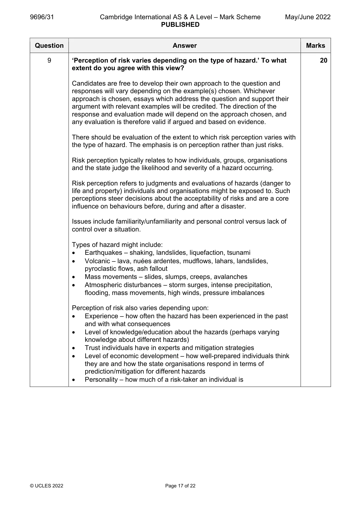
9696/31 Cambridge International AS & A Level – Mark Scheme PUBLISHED May/June 2022 © UCLES 2022 Page 17 of 22 Question Answer Marks 9 ‘Perception of risk varies depending on the type of hazard.’ To what extent do you agree with this view? Candidates are free to develop their own approach to the question and responses will vary depending on the example(s) chosen. Whichever approach is chosen, essays which address the question and support their argument with relevant examples will be credited. The direction of the response and evaluation made will depend on the approach chosen, and any evaluation is therefore valid if argued and based on evidence. There should be evaluation of the extent to which risk perception varies with the type of hazard. The emphasis is on perception rather than just risks. Risk perception typically relates to how individuals, groups, organisations and the state judge the likelihood and severity of a hazard occurring. Risk perception refers to judgments and evaluations of hazards (danger to life and property) individuals and organisations might be exposed to. Such perceptions steer decisions about the acceptability of risks and are a core influence on behaviours before, during and after a disaster. Issues include familiarity/unfamiliarity and personal control versus lack of control over a situation. Types of hazard might include: Earthquakes – shaking, landslides, liquefaction, tsunami Volcanic – lava, nuées ardentes, mudflows, lahars, landslides, pyroclastic flows, ash fallout Mass movements – slides, slumps, creeps, avalanches Atmospheric disturbances – storm surges, intense precipitation, flooding, mass movements, high winds, pressure imbalances Perception of risk also varies depending upon: Experience – how often the hazard has been experienced in the past and with what consequences Level of knowledge/education about the hazards (perhaps varying knowledge about different hazards) Trust individuals have in experts and mitigation strategies Level of economic development – how well-prepared individuals think they are and how the state organisations respond in terms of prediction/mitigation for different hazards Personality – how much of a risk-taker an individual is 20
Mark scheme, page 18
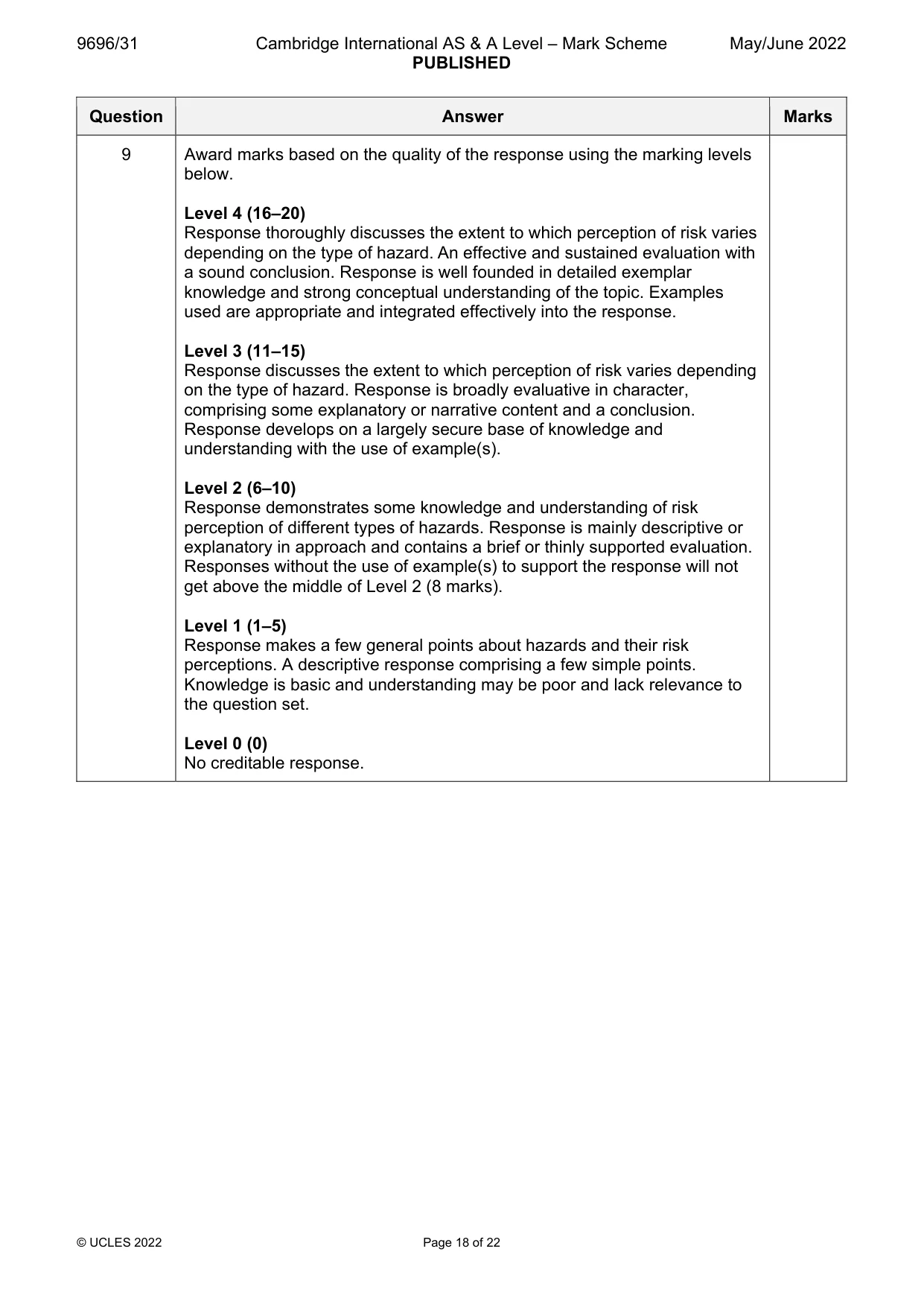
9696/31 Cambridge International AS & A Level – Mark Scheme PUBLISHED May/June 2022 © UCLES 2022 Page 18 of 22 Question Answer Marks 9 Award marks based on the quality of the response using the marking levels below. Level 4 (16–20) Response thoroughly discusses the extent to which perception of risk varies depending on the type of hazard. An effective and sustained evaluation with a sound conclusion. Response is well founded in detailed exemplar knowledge and strong conceptual understanding of the topic. Examples used are appropriate and integrated effectively into the response. Level 3 (11–15) Response discusses the extent to which perception of risk varies depending on the type of hazard. Response is broadly evaluative in character, comprising some explanatory or narrative content and a conclusion. Response develops on a largely secure base of knowledge and understanding with the use of example(s). Level 2 (6–10) Response demonstrates some knowledge and understanding of risk perception of different types of hazards. Response is mainly descriptive or explanatory in approach and contains a brief or thinly supported evaluation. Responses without the use of example(s) to support the response will not get above the middle of Level 2 (8 marks). Level 1 (1–5) Response makes a few general points about hazards and their risk perceptions. A descriptive response comprising a few simple points. Knowledge is basic and understanding may be poor and lack relevance to the question set. Level 0 (0) No creditable response.
Mark scheme, page 19
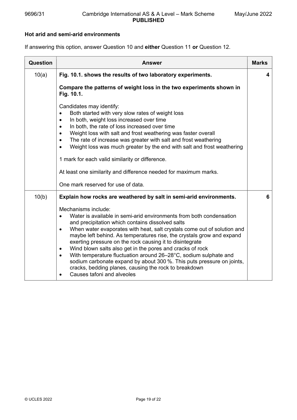
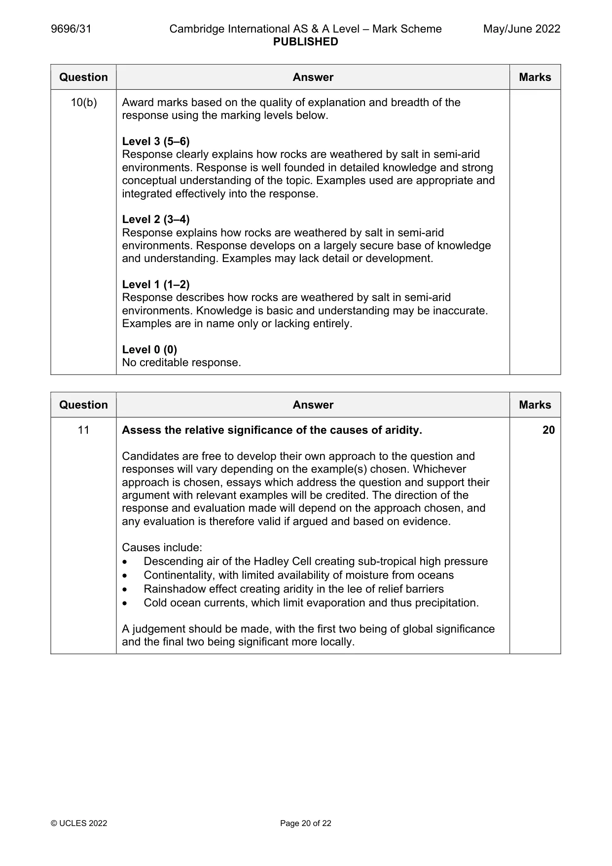
9696/31 Cambridge International AS & A Level – Mark Scheme PUBLISHED May/June 2022 © UCLES 2022 Page 19 of 22 Hot arid and semi-arid environments If answering this option, answer Question 10 and either Question 11 or Question 12. Question Answer Marks 10(a) Fig. 10.1. shows the results of two laboratory experiments. Compare the patterns of weight loss in the two experiments shown in Fig. 10.1. Candidates may identify: Both started with very slow rates of weight loss In both, weight loss increased over time In both, the rate of loss increased over time Weight loss with salt and frost weathering was faster overall The rate of increase was greater with salt and frost weathering Weight loss was much greater by the end with salt and frost weathering 1 mark for each valid similarity or difference. At least one similarity and difference needed for maximum marks. One mark reserved for use of data. 4 10(b) Explain how rocks are weathered by salt in semi-arid environments. Mechanisms include: Water is available in semi-arid environments from both condensation and precipitation which contains dissolved salts When water evaporates with heat, salt crystals come out of solution and maybe left behind. As temperatures rise, the crystals grow and expand exerting pressure on the rock causing it to disintegrate Wind blown salts also get in the pores and cracks of rock With temperature fluctuation around 26–28°C, sodium sulphate and sodium carbonate expand by about 300 %. This puts pressure on joints, cracks, bedding planes, causing the rock to breakdown Causes tafoni and alveoles 6
Mark scheme, page 20
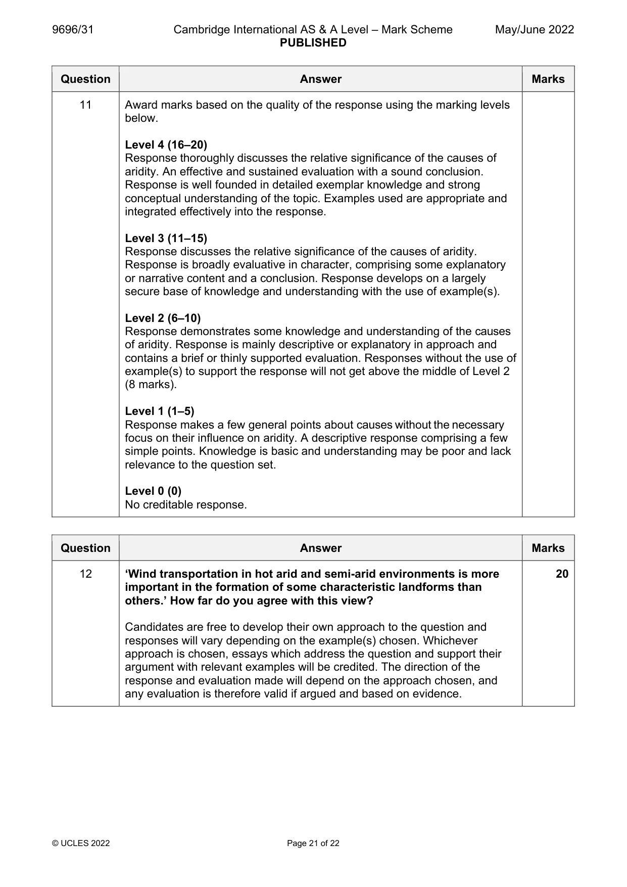
9696/31 Cambridge International AS & A Level – Mark Scheme PUBLISHED May/June 2022 © UCLES 2022 Page 20 of 22 Question Answer Marks 10(b) Award marks based on the quality of explanation and breadth of the response using the marking levels below. Level 3 (5–6) Response clearly explains how rocks are weathered by salt in semi-arid environments. Response is well founded in detailed knowledge and strong conceptual understanding of the topic. Examples used are appropriate and integrated effectively into the response. Level 2 (3–4) Response explains how rocks are weathered by salt in semi-arid environments. Response develops on a largely secure base of knowledge and understanding. Examples may lack detail or development. Level 1 (1–2) Response describes how rocks are weathered by salt in semi-arid environments. Knowledge is basic and understanding may be inaccurate. Examples are in name only or lacking entirely. Level 0 (0) No creditable response. Question Answer Marks 11 Assess the relative significance of the causes of aridity. Candidates are free to develop their own approach to the question and responses will vary depending on the example(s) chosen. Whichever approach is chosen, essays which address the question and support their argument with relevant examples will be credited. The direction of the response and evaluation made will depend on the approach chosen, and any evaluation is therefore valid if argued and based on evidence. Causes include: Descending air of the Hadley Cell creating sub-tropical high pressure Continentality, with limited availability of moisture from oceans Rainshadow effect creating aridity in the lee of relief barriers Cold ocean currents, which limit evaporation and thus precipitation. A judgement should be made, with the first two being of global significance and the final two being significant more locally. 20
Mark scheme, page 21
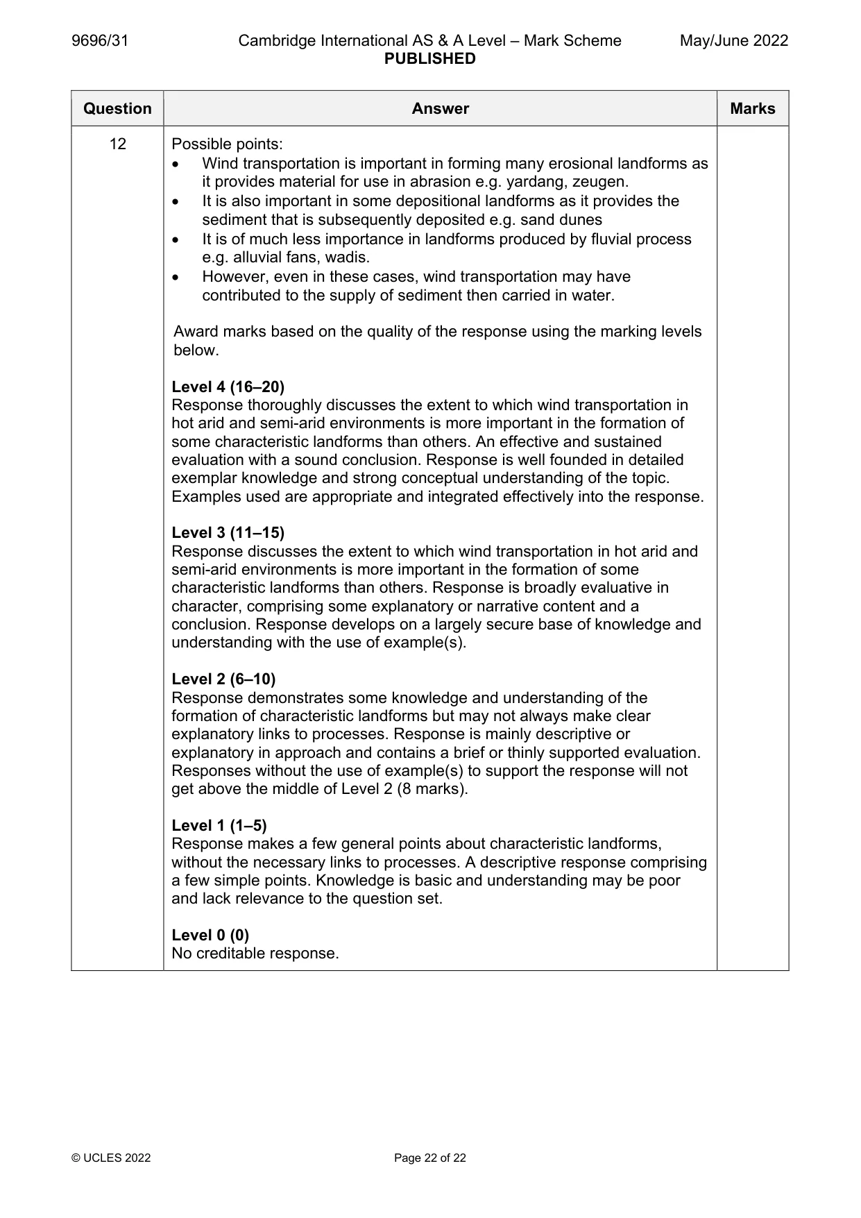
9696/31 Cambridge International AS & A Level – Mark Scheme PUBLISHED May/June 2022 © UCLES 2022 Page 21 of 22 Question Answer Marks 11 Award marks based on the quality of the response using the marking levels below. Level 4 (16–20) Response thoroughly discusses the relative significance of the causes of aridity. An effective and sustained evaluation with a sound conclusion. Response is well founded in detailed exemplar knowledge and strong conceptual understanding of the topic. Examples used are appropriate and integrated effectively into the response. Level 3 (11–15) Response discusses the relative significance of the causes of aridity. Response is broadly evaluative in character, comprising some explanatory or narrative content and a conclusion. Response develops on a largely secure base of knowledge and understanding with the use of example(s). Level 2 (6–10) Response demonstrates some knowledge and understanding of the causes of aridity. Response is mainly descriptive or explanatory in approach and contains a brief or thinly supported evaluation. Responses without the use of example(s) to support the response will not get above the middle of Level 2 (8 marks). Level 1 (1–5) Response makes a few general points about causes without the necessary focus on their influence on aridity. A descriptive response comprising a few simple points. Knowledge is basic and understanding may be poor and lack relevance to the question set. Level 0 (0) No creditable response. Question Answer Marks 12 ‘Wind transportation in hot arid and semi-arid environments is more important in the formation of some characteristic landforms than others.’ How far do you agree with this view? Candidates are free to develop their own approach to the question and responses will vary depending on the example(s) chosen. Whichever approach is chosen, essays which address the question and support their argument with relevant examples will be credited. The direction of the response and evaluation made will depend on the approach chosen, and any evaluation is therefore valid if argued and based on evidence. 20
Mark scheme, page 22
9696/31 Cambridge International AS & A Level – Mark Scheme PUBLISHED May/June 2022 © UCLES 2022 Page 22 of 22 Question Answer Marks 12 Possible points: Wind transportation is important in forming many erosional landforms as it provides material for use in abrasion e.g. yardang, zeugen. It is also important in some depositional landforms as it provides the sediment that is subsequently deposited e.g. sand dunes It is of much less importance in landforms produced by fluvial process e.g. alluvial fans, wadis. However, even in these cases, wind transportation may have contributed to the supply of sediment then carried in water. Award marks based on the quality of the response using the marking levels below. Level 4 (16–20) Response thoroughly discusses the extent to which wind transportation in hot arid and semi-arid environments is more important in the formation of some characteristic landforms than others. An effective and sustained evaluation with a sound conclusion. Response is well founded in detailed exemplar knowledge and strong conceptual understanding of the topic. Examples used are appropriate and integrated effectively into the response. Level 3 (11–15) Response discusses the extent to which wind transportation in hot arid and semi-arid environments is more important in the formation of some characteristic landforms than others. Response is broadly evaluative in character, comprising some explanatory or narrative content and a conclusion. Response develops on a largely secure base of knowledge and understanding with the use of example(s). Level 2 (6–10) Response demonstrates some knowledge and understanding of the formation of characteristic landforms but may not always make clear explanatory links to processes. Response is mainly descriptive or explanatory in approach and contains a brief or thinly supported evaluation. Responses without the use of example(s) to support the response will not get above the middle of Level 2 (8 marks). Level 1 (1–5) Response makes a few general points about characteristic landforms, without the necessary links to processes. A descriptive response comprising a few simple points. Knowledge is basic and understanding may be poor and lack relevance to the question set. Level 0 (0) No creditable response.
What you needed in this session
Cambridge’s own grade thresholds for 2022 May/June, Paper 3 · Variant 1. A higher threshold means an easier paper — the bar moves with how the cohort did.