Cambridge A Level Geography 9696 — 2018 May/June Paper 3 · Variant 1
9696/31/M/J/18 · 12 questions · 60 marks · ≈68 min
The question paper and its mark scheme, free to read here and free to download. This is Cambridge’s own paper, exactly as it was sat.
Question paper4 pages

Mark scheme26 pages
Answers below. Sit the paper first if you are practising.


Questions as text
Q1 · A photograph which shows a tropical granite landscape in Africa
1 Fig. 1.1 is a photograph which shows a tropical granite landscape in Africa. (a) With the aid of a labelled diagram, describe the landforms shown in Fig. 1.1. [4] (b) Explain the role of deep weathering in the development of the granite landforms you described in (a). [6]
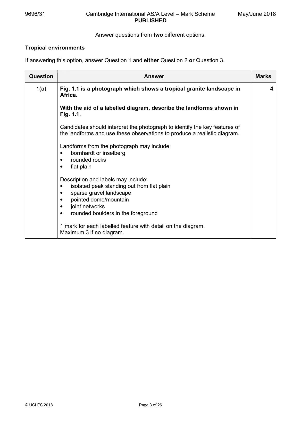
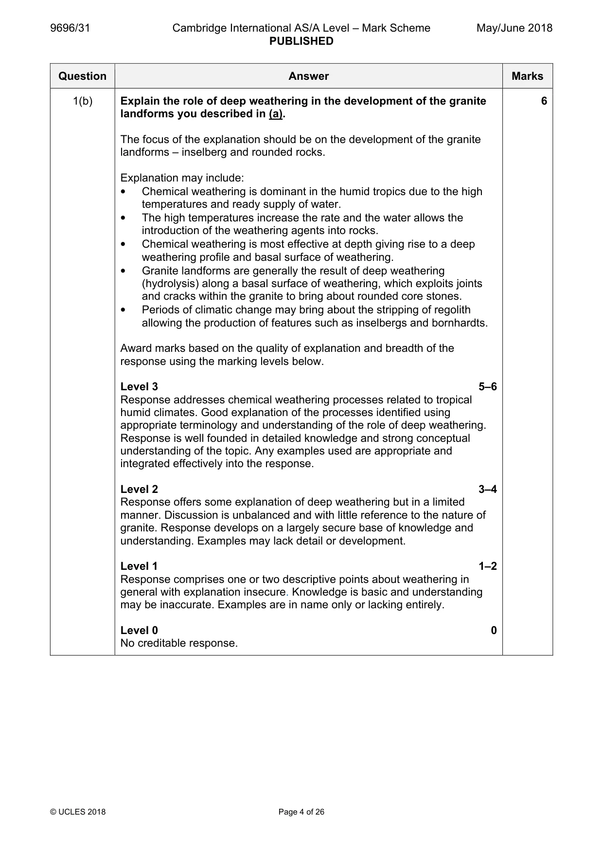
Mark scheme: Question Answer Marks 1(a) Fig. 1.1 is a photograph which shows a tropical granite landscape in 4 Africa. With the aid of a labelled diagram, describe the landforms shown in Fig. 1.1. Candidates should interpret the photograph to identify the key features of the landforms and use these observations to produce a realistic diagram. Landforms from the photograph may include: • bornhardt or inselberg • rounded rocks • flat plain Description and labels may include: • isolated peak standing out from flat plain • sparse gravel landscape • pointed dome/mountain • joint networks • rounded boulders in the foreground 1 mark for each labelled feature with detail on the diagram. Maximum 3 if no diagram. 1(b) Explain the role of deep weathering in the development of the granite 6 landforms you described in (a). The focus of the explanation should be on the development of the granite landforms – inselberg and rounded rocks. Explanation may include: • Chemical weathering is dominant in the humid tropics due to the high temperatures and ready supply of water. • The high temperatures increase the rate and the water allows the introduction of the weathering agents into rocks. • Chemical weathering is most effective at depth giving rise to a deep weathering profile and basal surface of weathering. • Granite landforms are generally the result of deep weathering (hydrolysis) along a basal surface of weathering, which exploits joints and cracks within the granite to bring about rounded core stones. • Periods of climatic change may bring about the stripping of regolith allowing the production of features such as inselbergs and bornhardts. Award marks based on the quality of explanation and breadth of the response using the marking levels below. Level 3 5–6 Response addresses chemical weathering processes related to tropical humid climates. Good explanation of the processes identified using appropriate terminology and understanding of the role of deep weathering. Response is well founded in detailed knowledge and strong conceptual understanding of the topic. Any examples used are appropriate and integrated effectively into the response. Level 2 3–4 Response offers some explanation of deep weathering but in a limited manner. Discussion is unbalanced and with little reference to the nature of granite. Response develops on a largely secure base of knowledge and understanding. Examples may lack detail or development. Level 1 1–2 Response comprises one or two descriptive points about weathering in general with explanation insecure. Knowledge is basic and understanding may be inaccurate. Examples are in name only or lacking entirely. Level 0 0 No creditable response.
Q2 · ‘The intertropical convergence zone (ITCZ) is the most important control of tropical…
2 ‘The intertropical convergence zone (ITCZ) is the most important control of tropical climates.’ With reference to the climatic characteristics of both humid tropical and seasonally humid tropical climates, how far do you agree with this statement? [20]
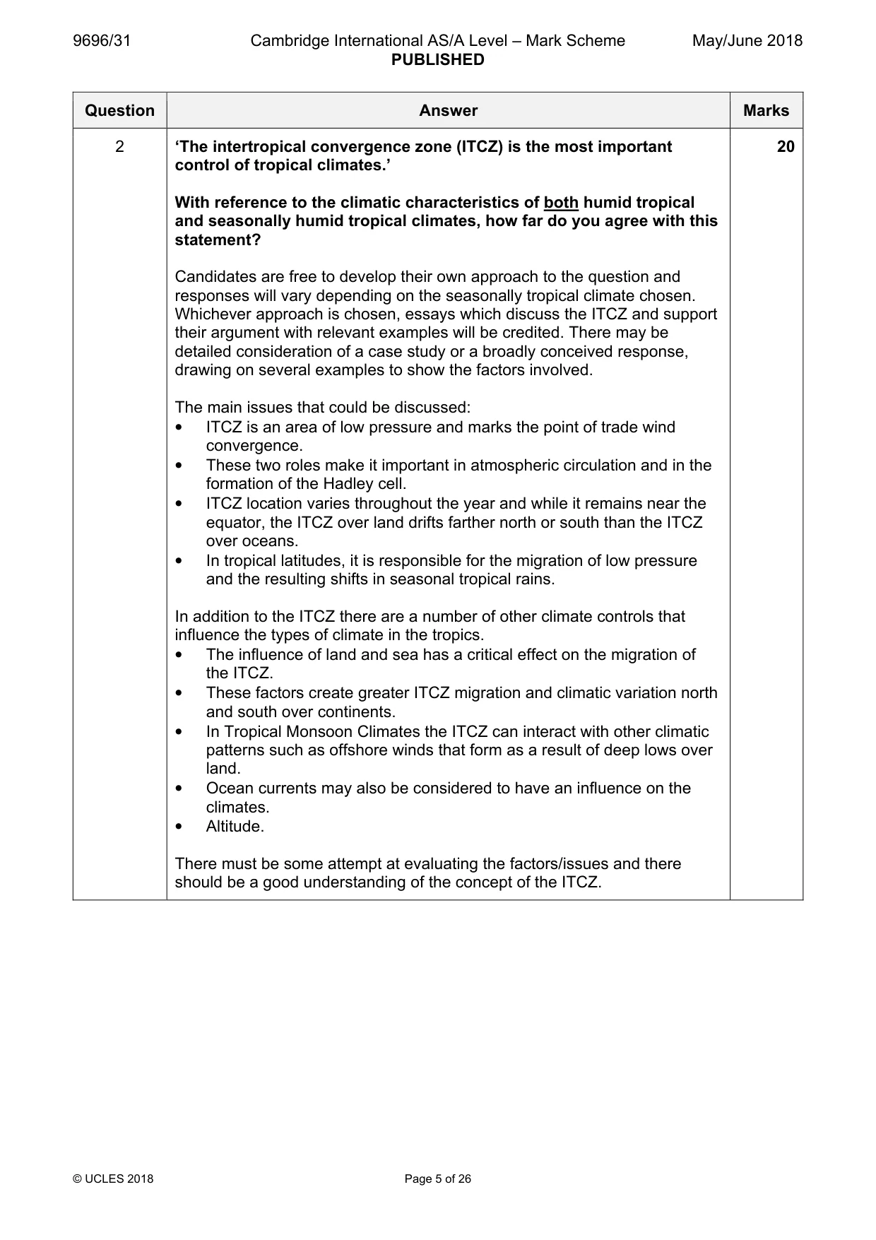
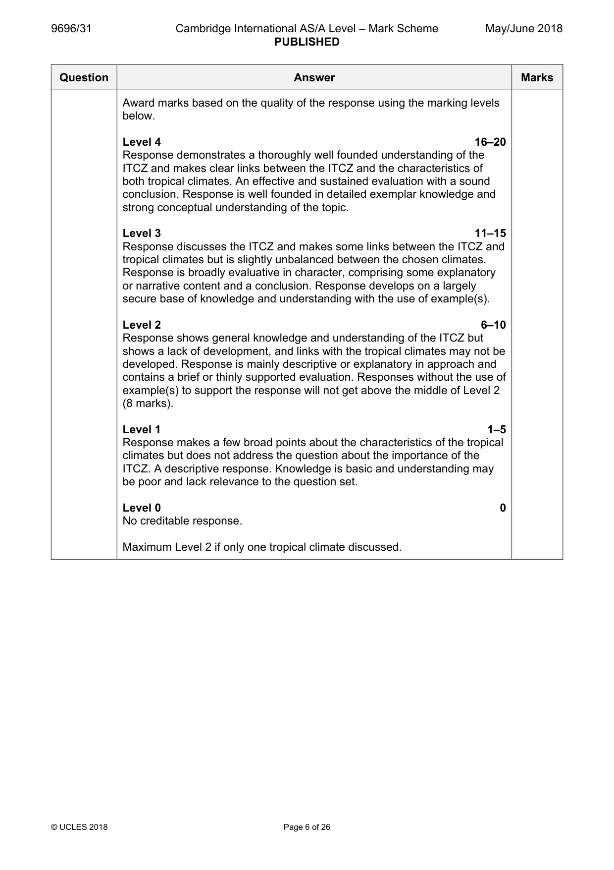
Mark scheme: 2 ‘The intertropical convergence zone (ITCZ) is the most important 20 control of tropical climates.’ With reference to the climatic characteristics of both humid tropical and seasonally humid tropical climates, how far do you agree with this statement? Candidates are free to develop their own approach to the question and responses will vary depending on the seasonally tropical climate chosen. Whichever approach is chosen, essays which discuss the ITCZ and support their argument with relevant examples will be credited. There may be detailed consideration of a case study or a broadly conceived response, drawing on several examples to show the factors involved. The main issues that could be discussed: • ITCZ is an area of low pressure and marks the point of trade wind convergence. • These two roles make it important in atmospheric circulation and in the formation of the Hadley cell. • ITCZ location varies throughout the year and while it remains near the equator, the ITCZ over land drifts farther north or south than the ITCZ over oceans. • In tropical latitudes, it is responsible for the migration of low pressure and the resulting shifts in seasonal tropical rains. In addition to the ITCZ there are a number of other climate controls that influence the types of climate in the tropics. • The influence of land and sea has a critical effect on the migration of the ITCZ. • These factors create greater ITCZ migration and climatic variation north and south over continents. • In Tropical Monsoon Climates the ITCZ can interact with other climatic patterns such as offshore winds that form as a result of deep lows over land. • Ocean currents may also be considered to have an influence on the climates. • Altitude. There must be some attempt at evaluating the factors/issues and there should be a good understanding of the concept of the ITCZ. Award marks based on the quality of the response using the marking levels below. Level 4 16–20 Response demonstrates a thoroughly well founded understanding of the ITCZ and makes clear links between the ITCZ and the characteristics of both tropical climates. An effective and sustained evaluation with a sound conclusion. Response is well founded in detailed exemplar knowledge and strong conceptual understanding of the topic. Level 3 11–15 Response discusses the ITCZ and makes some links between the ITCZ and tropical climates but is slightly unbalanced between the chosen climates. Response is broadly evaluative in character, comprising some explanatory or narrative content and a conclusion. Response develops on a largely secure base of knowledge and understanding with the use of example(s). Level 2 6–10 Response shows general knowledge and understanding of the ITCZ but shows a lack of development, and links with the tropical climates may not be developed. Response is mainly descriptive or explanatory in approach and contains a brief or thinly supported evaluation. Responses without the use of example(s) to support the response will not get above the middle of Level 2 (8 marks). Level 1 1–5 Response makes a few broad points about the characteristics of the tropical climates but does not address the question about the importance of the ITCZ. A descriptive response. Knowledge is basic and understanding may be poor and lack relevance to the question set. Level 0 0 No creditable response. Maximum Level 2 if only one tropical climate discussed.
Q3 · For one tropical ecosystem, describe the characteristics of the nutrient cycle and assess…
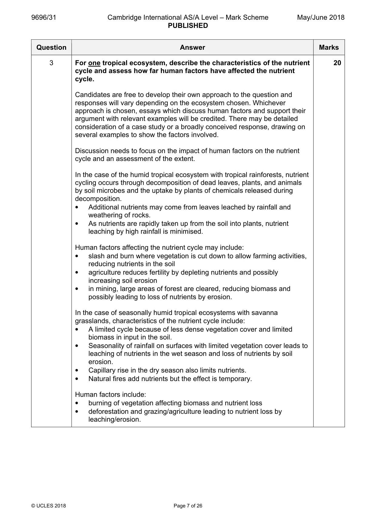
3 For one tropical ecosystem, describe the characteristics of the nutrient cycle and assess how far human factors have affected the nutrient cycle. [20] [Total: 30] Coastal environments If answering this option, answer Question 4 and either Question 5 or Question 6.
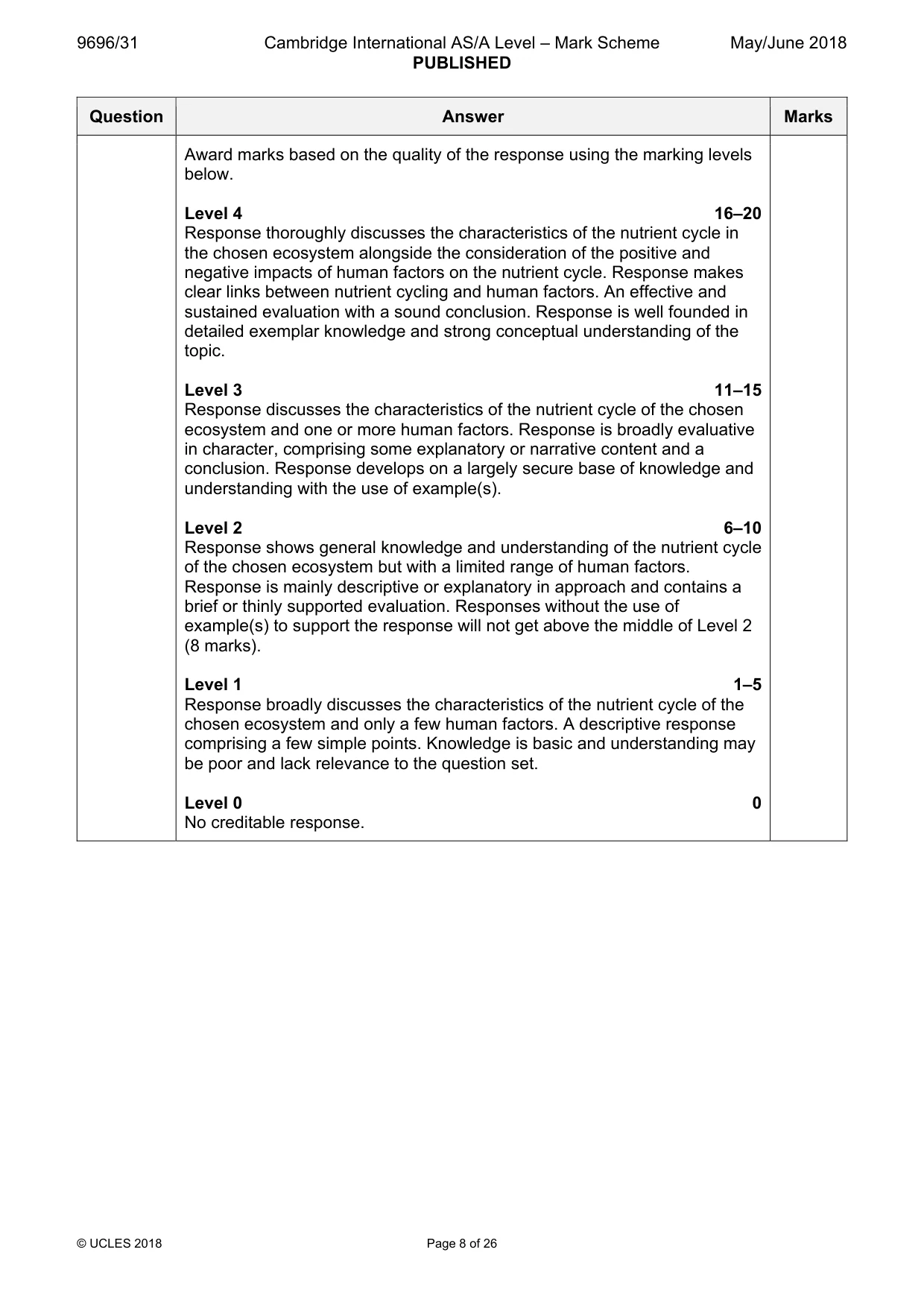
Mark scheme: 3 For one tropical ecosystem, describe the characteristics of the nutrient 20 cycle and assess how far human factors have affected the nutrient cycle. Candidates are free to develop their own approach to the question and responses will vary depending on the ecosystem chosen. Whichever approach is chosen, essays which discuss human factors and support their argument with relevant examples will be credited. There may be detailed consideration of a case study or a broadly conceived response, drawing on several examples to show the factors involved. Discussion needs to focus on the impact of human factors on the nutrient cycle and an assessment of the extent. In the case of the humid tropical ecosystem with tropical rainforests, nutrient cycling occurs through decomposition of dead leaves, plants, and animals by soil microbes and the uptake by plants of chemicals released during decomposition. • Additional nutrients may come from leaves leached by rainfall and weathering of rocks. • As nutrients are rapidly taken up from the soil into plants, nutrient leaching by high rainfall is minimised. Human factors affecting the nutrient cycle may include: • slash and burn where vegetation is cut down to allow farming activities, reducing nutrients in the soil • agriculture reduces fertility by depleting nutrients and possibly increasing soil erosion • in mining, large areas of forest are cleared, reducing biomass and possibly leading to loss of nutrients by erosion. In the case of seasonally humid tropical ecosystems with savanna grasslands, characteristics of the nutrient cycle include: • A limited cycle because of less dense vegetation cover and limited biomass in input in the soil. • Seasonality of rainfall on surfaces with limited vegetation cover leads to leaching of nutrients in the wet season and loss of nutrients by soil erosion. • Capillary rise in the dry season also limits nutrients. • Natural fires add nutrients but the effect is temporary. Human factors include: • burning of vegetation affecting biomass and nutrient loss • deforestation and grazing/agriculture leading to nutrient loss by leaching/erosion. Award marks based on the quality of the response using the marking levels below. Level 4 16–20 Response thoroughly discusses the characteristics of the nutrient cycle in the chosen ecosystem alongside the consideration of the positive and negative impacts of human factors on the nutrient cycle. Response makes clear links between nutrient cycling and human factors. An effective and sustained evaluation with a sound conclusion. Response is well founded in detailed exemplar knowledge and strong conceptual understanding of the topic. Level 3 11–15 Response discusses the characteristics of the nutrient cycle of the chosen ecosystem and one or more human factors. Response is broadly evaluative in character, comprising some explanatory or narrative content and a conclusion. Response develops on a largely secure base of knowledge and understanding with the use of example(s). Level 2 6–10 Response shows general knowledge and understanding of the nutrient cycle of the chosen ecosystem but with a limited range of human factors. Response is mainly descriptive or explanatory in approach and contains a brief or thinly supported evaluation. Responses without the use of example(s) to support the response will not get above the middle of Level 2 (8 marks). Level 1 1–5 Response broadly discusses the characteristics of the nutrient cycle of the chosen ecosystem and only a few human factors. A descriptive response comprising a few simple points. Knowledge is basic and understanding may be poor and lack relevance to the question set. Level 0 0 No creditable response. Coastal environments If answering this option, answer Question 4 and either Question 5 or Question 6.
Q4 · The development of a cliff and a wave-cut platform
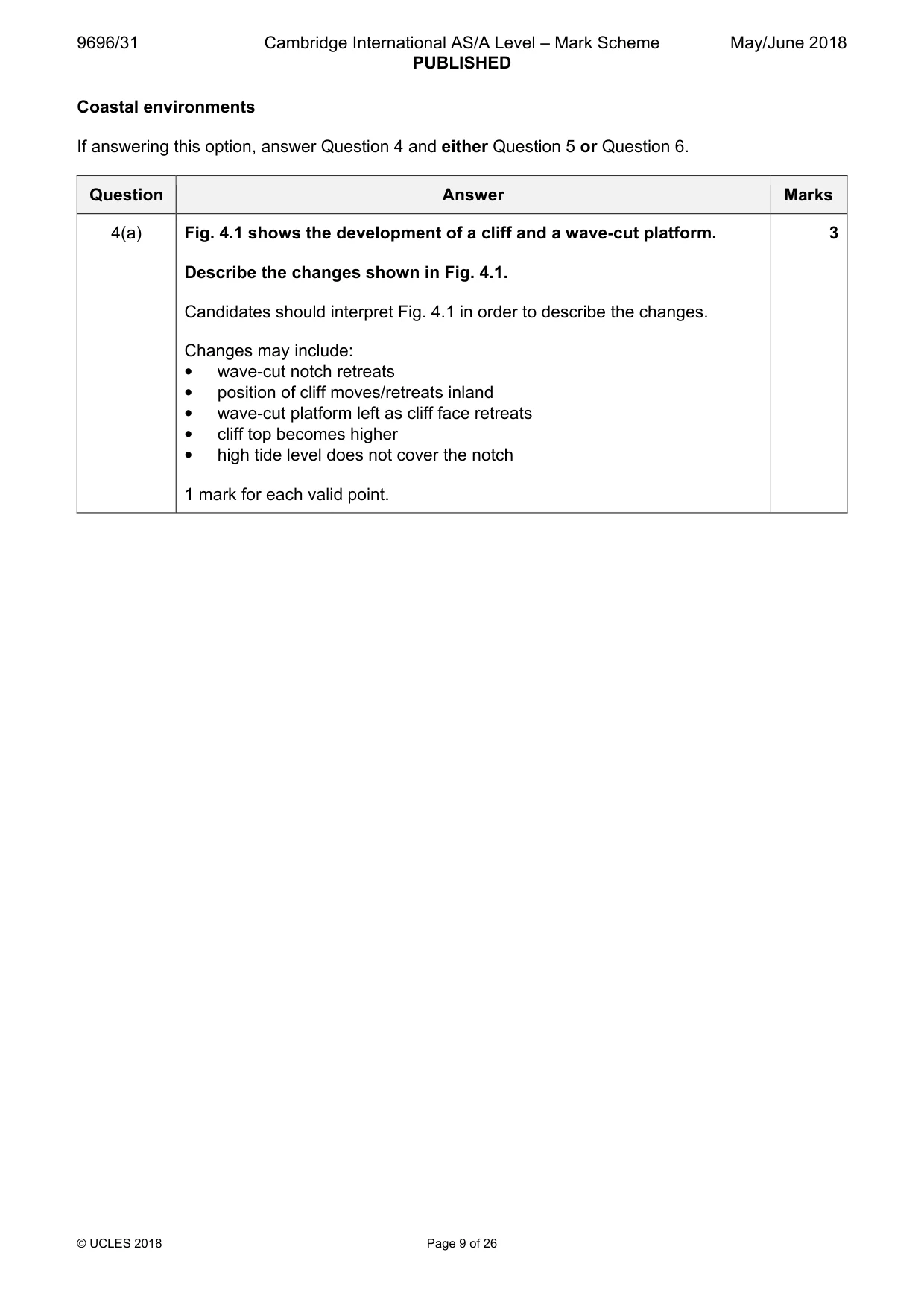
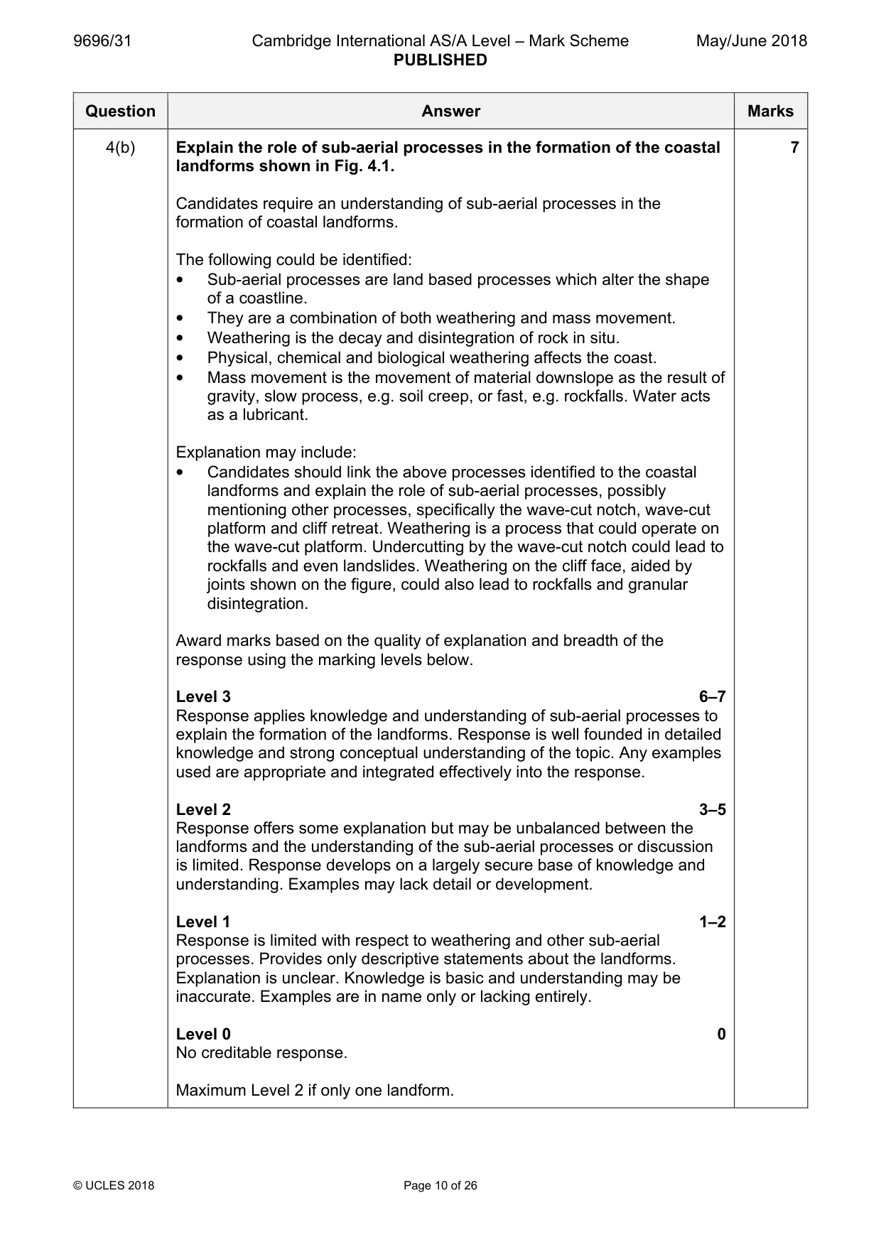
4 Fig. 4.1 shows the development of a cliff and a wave-cut platform. (a) Describe the changes shown in Fig. 4.1. [3] (b) Explain the role of sub-aerial processes in the formation of the coastal landforms shown in Fig. 4.1. [7]
Mark scheme: 4(a) Fig. 4.1 shows the development of a cliff and a wave-cut platform. 3 Describe the changes shown in Fig. 4.1. Candidates should interpret Fig. 4.1 in order to describe the changes. Changes may include: • wave-cut notch retreats • position of cliff moves/retreats inland • wave-cut platform left as cliff face retreats • cliff top becomes higher • high tide level does not cover the notch 1 mark for each valid point. 4(b) Explain the role of sub-aerial processes in the formation of the coastal 7 landforms shown in Fig. 4.1. Candidates require an understanding of sub-aerial processes in the formation of coastal landforms. The following could be identified: • Sub-aerial processes are land based processes which alter the shape of a coastline. • They are a combination of both weathering and mass movement. • Weathering is the decay and disintegration of rock in situ. • Physical, chemical and biological weathering affects the coast. • Mass movement is the movement of material downslope as the result of gravity, slow process, e.g. soil creep, or fast, e.g. rockfalls. Water acts as a lubricant. Explanation may include: • Candidates should link the above processes identified to the coastal landforms and explain the role of sub-aerial processes, possibly mentioning other processes, specifically the wave-cut notch, wave-cut platform and cliff retreat. Weathering is a process that could operate on the wave-cut platform. Undercutting by the wave-cut notch could lead to rockfalls and even landslides. Weathering on the cliff face, aided by joints shown on the figure, could also lead to rockfalls and granular disintegration. Award marks based on the quality of explanation and breadth of the response using the marking levels below. Level 3 6–7 Response applies knowledge and understanding of sub-aerial processes to explain the formation of the landforms. Response is well founded in detailed knowledge and strong conceptual understanding of the topic. Any examples used are appropriate and integrated effectively into the response. Level 2 3–5 Response offers some explanation but may be unbalanced between the landforms and the understanding of the sub-aerial processes or discussion is limited. Response develops on a largely secure base of knowledge and understanding. Examples may lack detail or development. Level 1 1–2 Response is limited with respect to weathering and other sub-aerial processes. Provides only descriptive statements about the landforms. Explanation is unclear. Knowledge is basic and understanding may be inaccurate. Examples are in name only or lacking entirely. Level 0 0 No creditable response. Maximum Level 2 if only one landform.
Q5 · Evaluate the roles of marine transportation and deposition in the shaping of coastal…
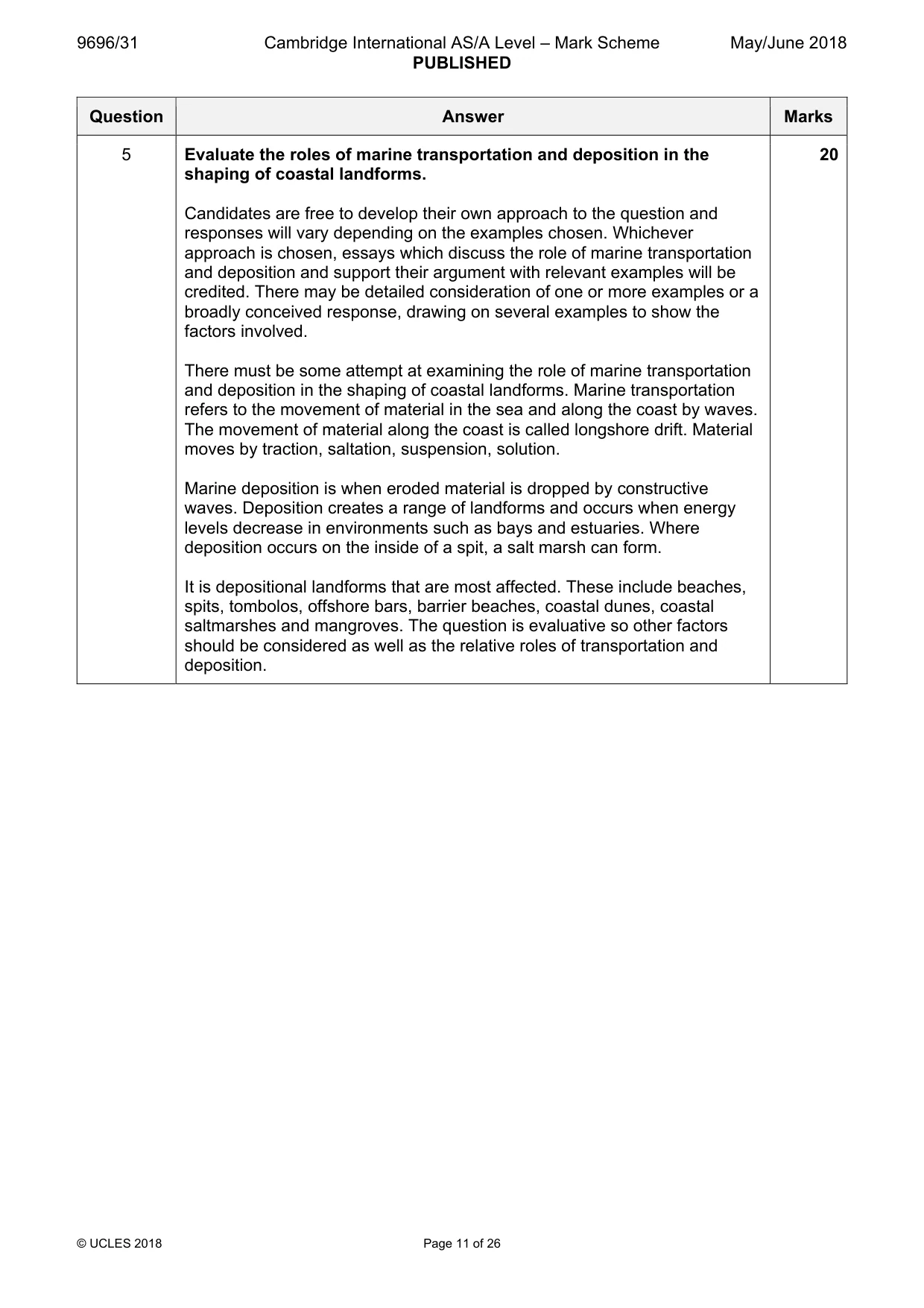
5 Evaluate the roles of marine transportation and deposition in the shaping of coastal landforms. [20]
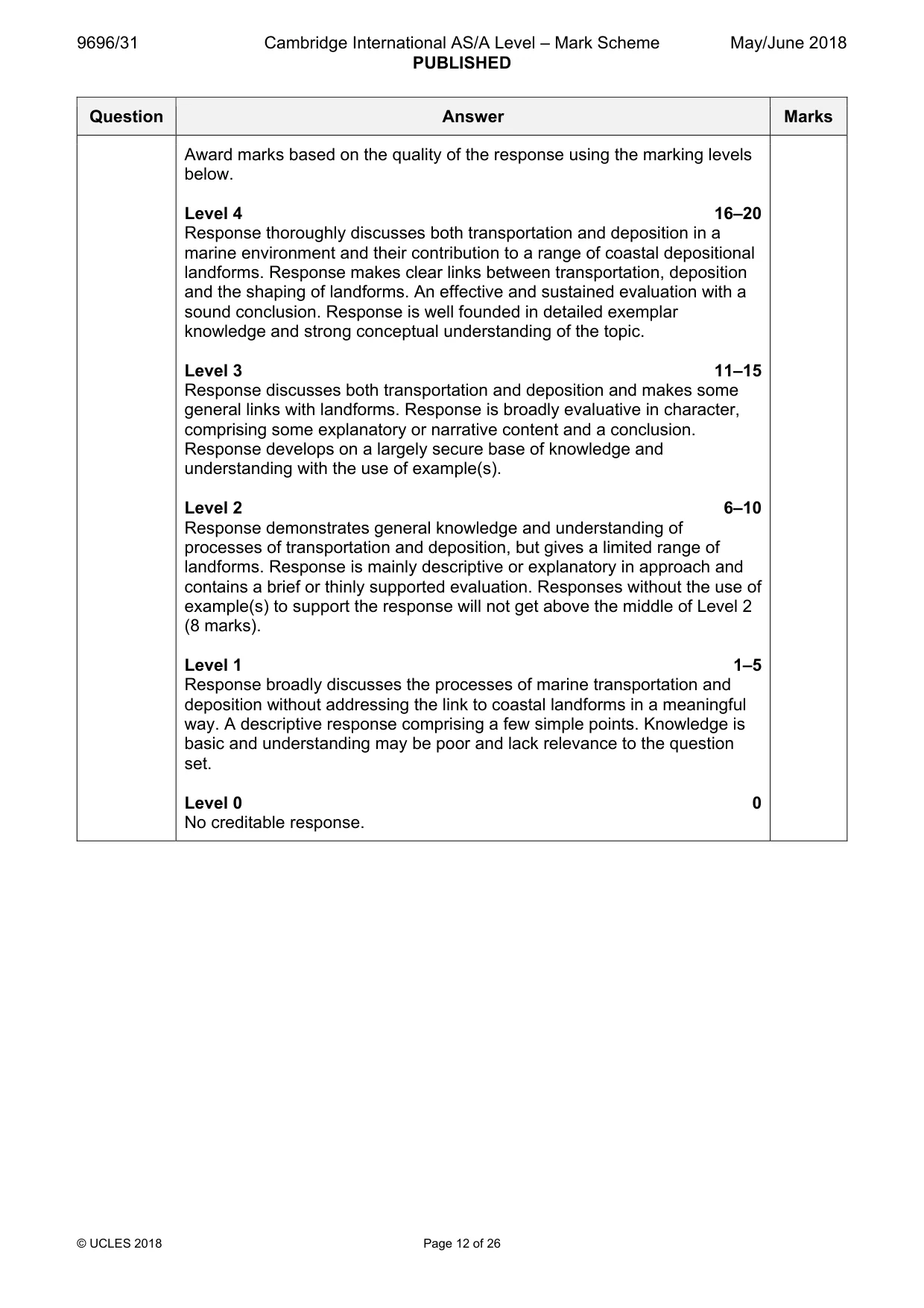
Mark scheme: 5 Evaluate the roles of marine transportation and deposition in the 20 shaping of coastal landforms. Candidates are free to develop their own approach to the question and responses will vary depending on the examples chosen. Whichever approach is chosen, essays which discuss the role of marine transportation and deposition and support their argument with relevant examples will be credited. There may be detailed consideration of one or more examples or a broadly conceived response, drawing on several examples to show the factors involved. There must be some attempt at examining the role of marine transportation and deposition in the shaping of coastal landforms. Marine transportation refers to the movement of material in the sea and along the coast by waves. The movement of material along the coast is called longshore drift. Material moves by traction, saltation, suspension, solution. Marine deposition is when eroded material is dropped by constructive waves. Deposition creates a range of landforms and occurs when energy levels decrease in environments such as bays and estuaries. Where deposition occurs on the inside of a spit, a salt marsh can form. It is depositional landforms that are most affected. These include beaches, spits, tombolos, offshore bars, barrier beaches, coastal dunes, coastal saltmarshes and mangroves. The question is evaluative so other factors should be considered as well as the relative roles of transportation and deposition. Award marks based on the quality of the response using the marking levels below. Level 4 16–20 Response thoroughly discusses both transportation and deposition in a marine environment and their contribution to a range of coastal depositional landforms. Response makes clear links between transportation, deposition and the shaping of landforms. An effective and sustained evaluation with a sound conclusion. Response is well founded in detailed exemplar knowledge and strong conceptual understanding of the topic. Level 3 11–15 Response discusses both transportation and deposition and makes some general links with landforms. Response is broadly evaluative in character, comprising some explanatory or narrative content and a conclusion. Response develops on a largely secure base of knowledge and understanding with the use of example(s). Level 2 6–10 Response demonstrates general knowledge and understanding of processes of transportation and deposition, but gives a limited range of landforms. Response is mainly descriptive or explanatory in approach and contains a brief or thinly supported evaluation. Responses without the use of example(s) to support the response will not get above the middle of Level 2 (8 marks). Level 1 1–5 Response broadly discusses the processes of marine transportation and deposition without addressing the link to coastal landforms in a meaningful way. A descriptive response comprising a few simple points. Knowledge is basic and understanding may be poor and lack relevance to the question set. Level 0 0 No creditable response.
Q6 · Assess the relative importance of climate change as a threat to coral reefs
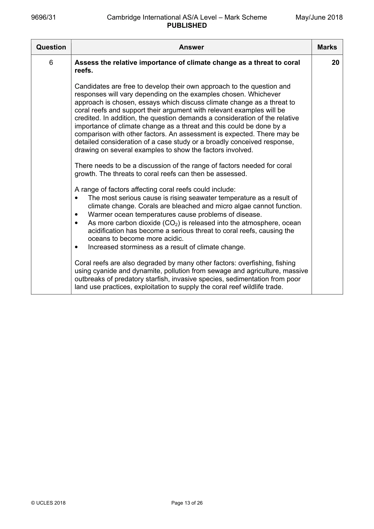
6 Assess the relative importance of climate change as a threat to coral reefs. [20] [Total: 30] Hazardous environments If answering this option, answer Question 7 and either Question 8 or Question 9.
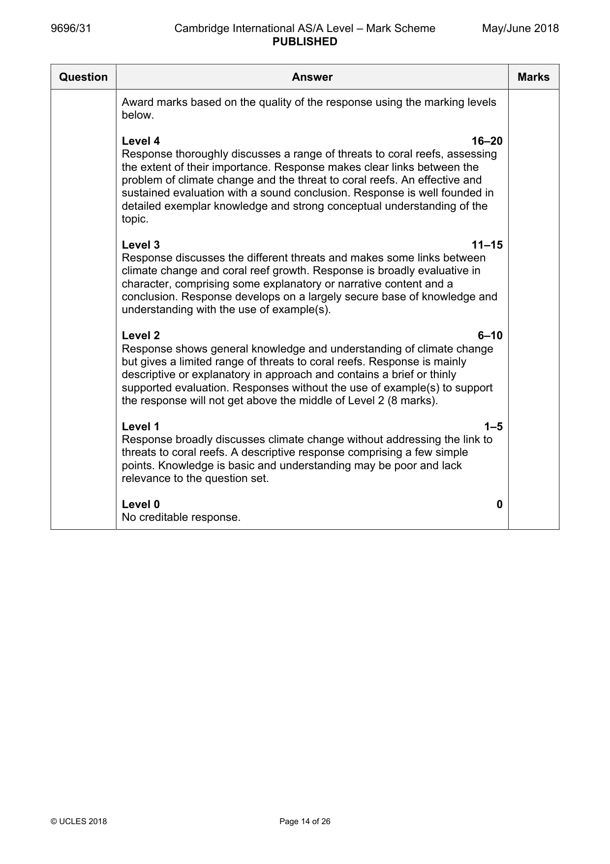
Mark scheme: 6 Assess the relative importance of climate change as a threat to coral 20 reefs. Candidates are free to develop their own approach to the question and responses will vary depending on the examples chosen. Whichever approach is chosen, essays which discuss climate change as a threat to coral reefs and support their argument with relevant examples will be credited. In addition, the question demands a consideration of the relative importance of climate change as a threat and this could be done by a comparison with other factors. An assessment is expected. There may be detailed consideration of a case study or a broadly conceived response, drawing on several examples to show the factors involved. There needs to be a discussion of the range of factors needed for coral growth. The threats to coral reefs can then be assessed. A range of factors affecting coral reefs could include: • The most serious cause is rising seawater temperature as a result of climate change. Corals are bleached and micro algae cannot function. • Warmer ocean temperatures cause problems of disease. • As more carbon dioxide (CO2) is released into the atmosphere, ocean acidification has become a serious threat to coral reefs, causing the oceans to become more acidic. • Increased storminess as a result of climate change. Coral reefs are also degraded by many other factors: overfishing, fishing using cyanide and dynamite, pollution from sewage and agriculture, massive outbreaks of predatory starfish, invasive species, sedimentation from poor land use practices, exploitation to supply the coral reef wildlife trade. Award marks based on the quality of the response using the marking levels below. Level 4 16–20 Response thoroughly discusses a range of threats to coral reefs, assessing the extent of their importance. Response makes clear links between the problem of climate change and the threat to coral reefs. An effective and sustained evaluation with a sound conclusion. Response is well founded in detailed exemplar knowledge and strong conceptual understanding of the topic. Level 3 11–15 Response discusses the different threats and makes some links between climate change and coral reef growth. Response is broadly evaluative in character, comprising some explanatory or narrative content and a conclusion. Response develops on a largely secure base of knowledge and understanding with the use of example(s). Level 2 6–10 Response shows general knowledge and understanding of climate change but gives a limited range of threats to coral reefs. Response is mainly descriptive or explanatory in approach and contains a brief or thinly supported evaluation. Responses without the use of example(s) to support the response will not get above the middle of Level 2 (8 marks). Level 1 1–5 Response broadly discusses climate change without addressing the link to threats to coral reefs. A descriptive response comprising a few simple points. Knowledge is basic and understanding may be poor and lack relevance to the question set. Level 0 0 No creditable response. Hazardous environments If answering this option, answer Question 7 and either Question 8 or Question 9.
Q7 · Two types of mass movement
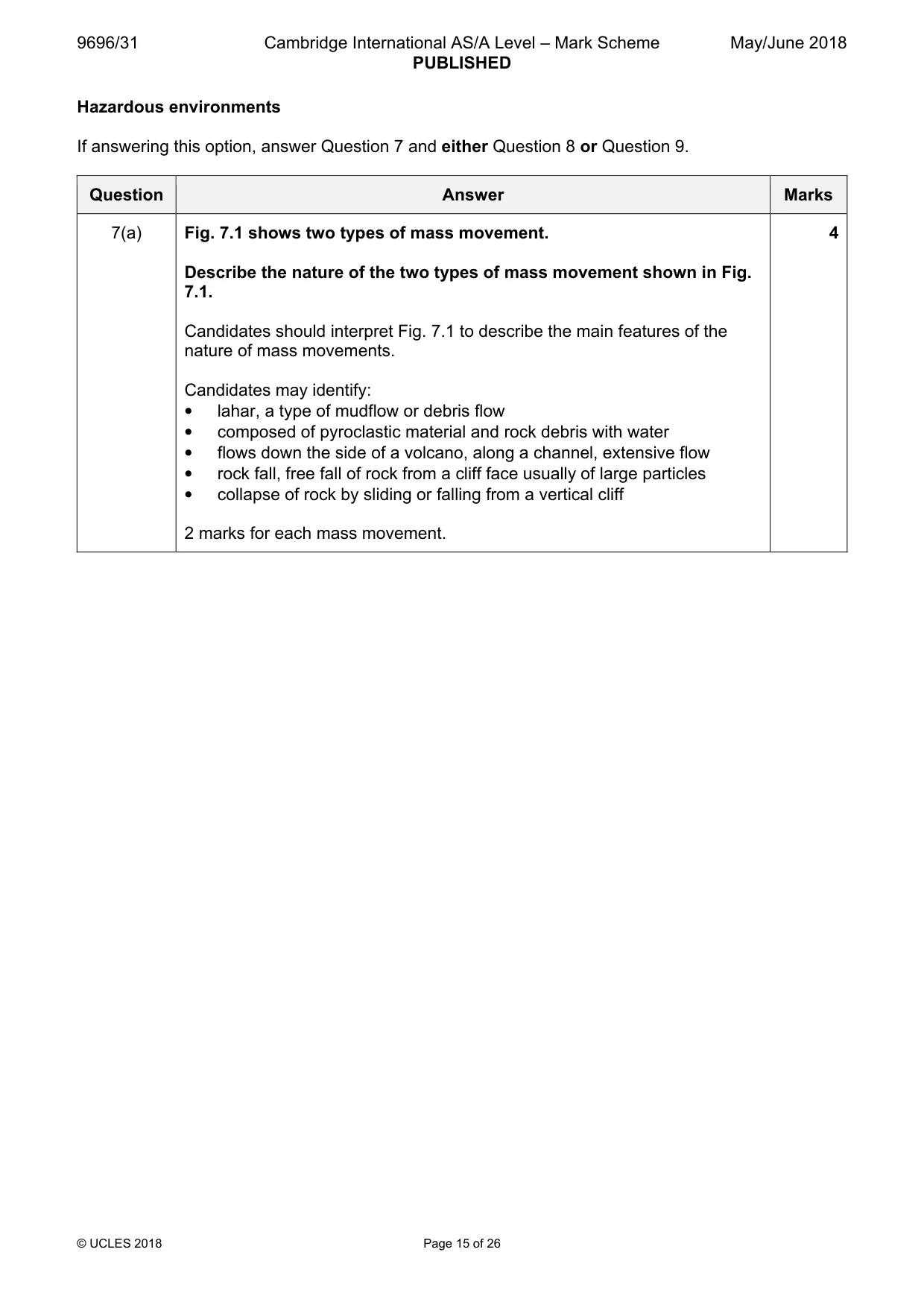
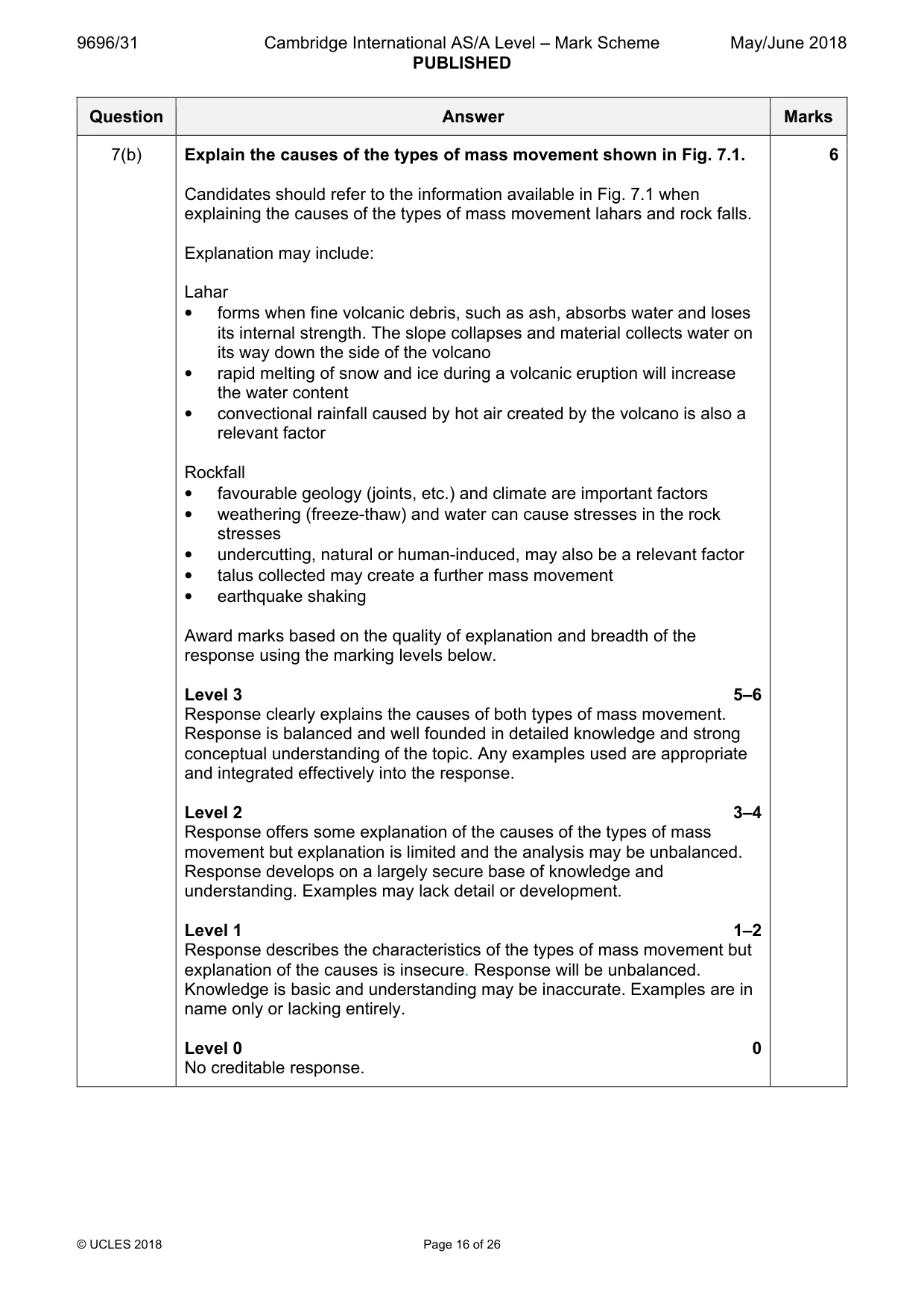
7 Fig. 7.1 shows two types of mass movement. (a) Describe the nature of the two types of mass movement shown in Fig. 7.1. [4] (b) Explain the causes of the types of mass movement shown in Fig. 7.1. [6]
Mark scheme: 7(a) Fig. 7.1 shows two types of mass movement. 4 Describe the nature of the two types of mass movement shown in Fig. 7.1. Candidates should interpret Fig. 7.1 to describe the main features of the nature of mass movements. Candidates may identify: • lahar, a type of mudflow or debris flow • composed of pyroclastic material and rock debris with water • flows down the side of a volcano, along a channel, extensive flow • rock fall, free fall of rock from a cliff face usually of large particles • collapse of rock by sliding or falling from a vertical cliff 2 marks for each mass movement. 7(b) Explain the causes of the types of mass movement shown in Fig. 7.1. 6 Candidates should refer to the information available in Fig. 7.1 when explaining the causes of the types of mass movement lahars and rock falls. Explanation may include: Lahar • forms when fine volcanic debris, such as ash, absorbs water and loses its internal strength. The slope collapses and material collects water on its way down the side of the volcano • rapid melting of snow and ice during a volcanic eruption will increase the water content • convectional rainfall caused by hot air created by the volcano is also a relevant factor Rockfall • favourable geology (joints, etc.) and climate are important factors • weathering (freeze-thaw) and water can cause stresses in the rock stresses • undercutting, natural or human-induced, may also be a relevant factor • talus collected may create a further mass movement • earthquake shaking Award marks based on the quality of explanation and breadth of the response using the marking levels below. Level 3 5–6 Response clearly explains the causes of both types of mass movement. Response is balanced and well founded in detailed knowledge and strong conceptual understanding of the topic. Any examples used are appropriate and integrated effectively into the response. Level 2 3–4 Response offers some explanation of the causes of the types of mass movement but explanation is limited and the analysis may be unbalanced. Response develops on a largely secure base of knowledge and understanding. Examples may lack detail or development. Level 1 1–2 Response describes the characteristics of the types of mass movement but explanation of the causes is insecure. Response will be unbalanced. Knowledge is basic and understanding may be inaccurate. Examples are in name only or lacking entirely. Level 0 0 No creditable response.
Q8 · ‘The hazardous impact of earthquakes depends on the levels of preparedness and…
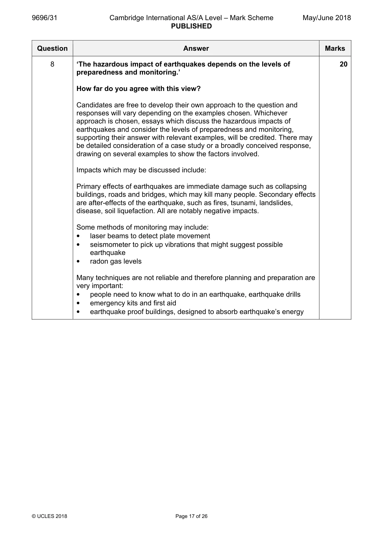
8 ‘The hazardous impact of earthquakes depends on the levels of preparedness and monitoring.’ How far do you agree with this view? [20]
Mark scheme: 8 ‘The hazardous impact of earthquakes depends on the levels of 20 preparedness and monitoring.’ How far do you agree with this view? Candidates are free to develop their own approach to the question and responses will vary depending on the examples chosen. Whichever approach is chosen, essays which discuss the hazardous impacts of earthquakes and consider the levels of preparedness and monitoring, supporting their answer with relevant examples, will be credited. There may be detailed consideration of a case study or a broadly conceived response, drawing on several examples to show the factors involved. Impacts which may be discussed include: Primary effects of earthquakes are immediate damage such as collapsing buildings, roads and bridges, which may kill many people. Secondary effects are after-effects of the earthquake, such as fires, tsunami, landslides, disease, soil liquefaction. All are notably negative impacts. Some methods of monitoring may include: • laser beams to detect plate movement • seismometer to pick up vibrations that might suggest possible earthquake • radon gas levels Many techniques are not reliable and therefore planning and preparation are very important: • people need to know what to do in an earthquake, earthquake drills • emergency kits and first aid • earthquake proof buildings, designed to absorb earthquake’s energy Award marks based on the quality of the response using the marking levels below. Level 4 16–20 Response thoroughly discusses a range of impacts of earthquakes. Response makes clear links between the impacts and assesses whether impacts of earthquakes vary depending on preparedness and monitoring. An effective and sustained evaluation with a sound conclusion. Response is well founded in detailed exemplar knowledge and strong conceptual understanding of the topic. Level 3 11–15 Response discusses one or more impacts of earthquakes and makes some links, but may be mostly about impacts with less discussion about the importance of preparedness and monitoring. Response is broadly evaluative in character, comprising some explanatory or narrative content and a conclusion. Response develops on a largely secure base of knowledge and understanding with the use of example(s). Level 2 6–10 Response shows general knowledge and understanding of a limited range of impacts of earthquakes. Response is mainly descriptive or explanatory in approach and contains a brief or thinly supported evaluation of the levels of preparedness and monitoring. Responses without the use of example(s) to support the response will not get above the middle of Level 2 (8 marks). Level 1 1–5 Response broadly discusses earthquakes, but without a focus on the question or a convincing conclusion. A descriptive response comprising a few simple points. Knowledge is basic and understanding may be poor and lack relevance to the question set. Level 0 0 No creditable response.
Q9 · Evaluate the view that primary impacts from large scale atmospheric disturbances are…
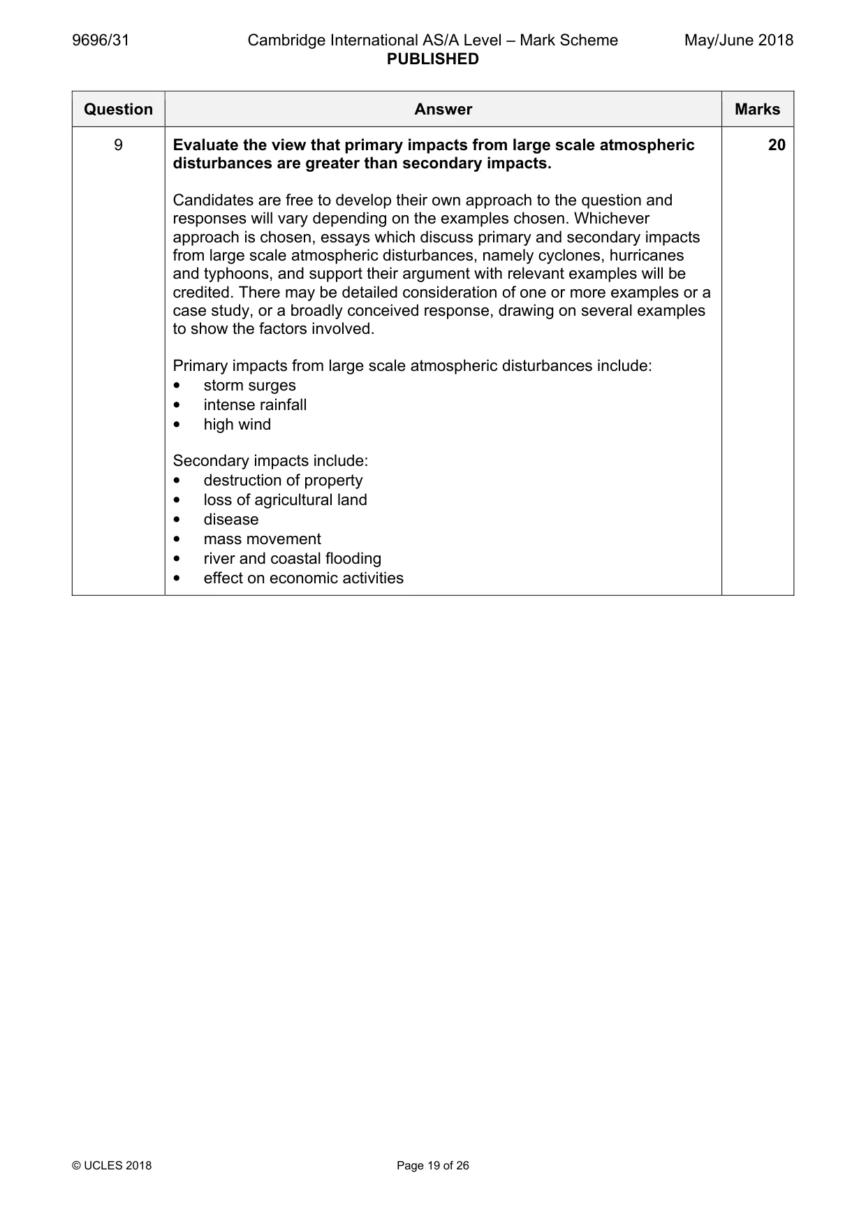
9 Evaluate the view that primary impacts from large scale atmospheric disturbances are greater than secondary impacts. [20] [Total: 30] Hot arid and semi-arid environments If answering this option, answer Question 10 and either Question 11 or Question 12.
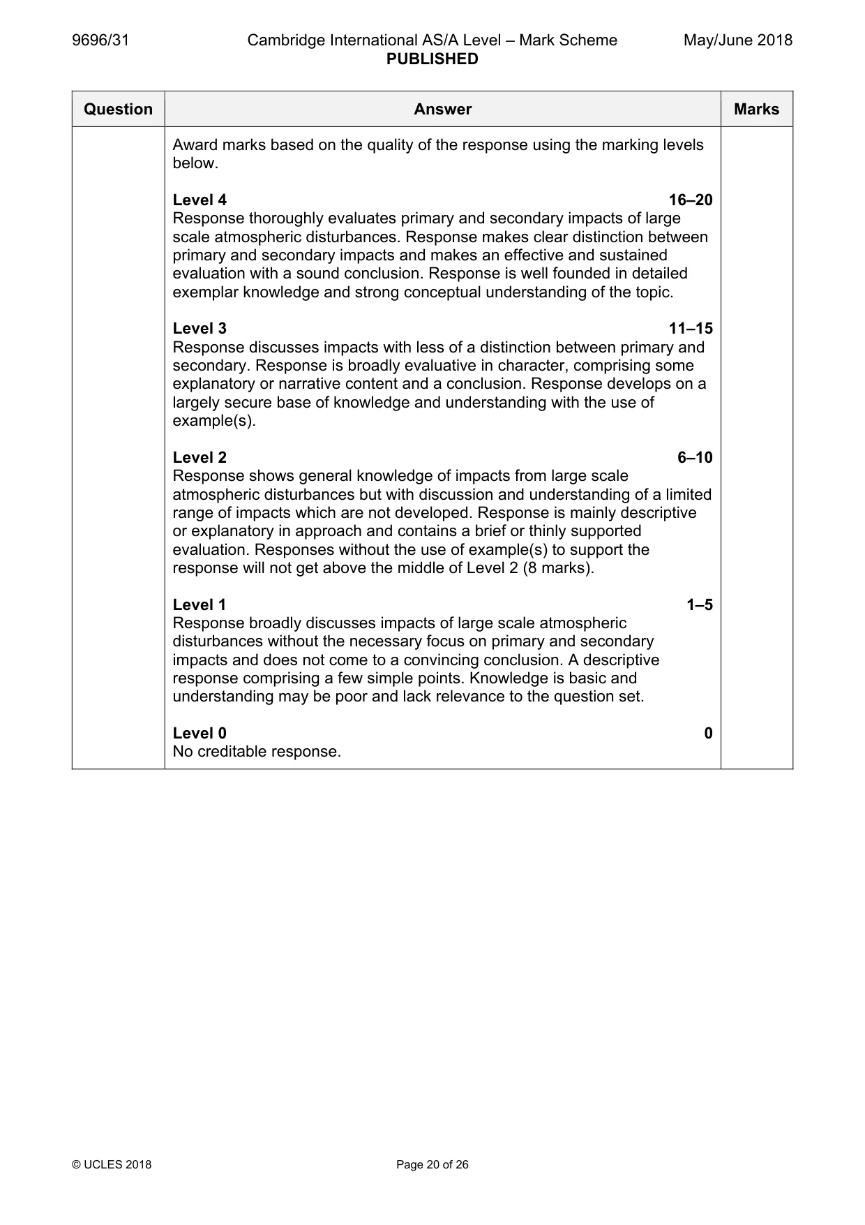
Mark scheme: 9 Evaluate the view that primary impacts from large scale atmospheric 20 disturbances are greater than secondary impacts. Candidates are free to develop their own approach to the question and responses will vary depending on the examples chosen. Whichever approach is chosen, essays which discuss primary and secondary impacts from large scale atmospheric disturbances, namely cyclones, hurricanes and typhoons, and support their argument with relevant examples will be credited. There may be detailed consideration of one or more examples or a case study, or a broadly conceived response, drawing on several examples to show the factors involved. Primary impacts from large scale atmospheric disturbances include: • storm surges • intense rainfall • high wind Secondary impacts include: • destruction of property • loss of agricultural land • disease • mass movement • river and coastal flooding • effect on economic activities Award marks based on the quality of the response using the marking levels below. Level 4 16–20 Response thoroughly evaluates primary and secondary impacts of large scale atmospheric disturbances. Response makes clear distinction between primary and secondary impacts and makes an effective and sustained evaluation with a sound conclusion. Response is well founded in detailed exemplar knowledge and strong conceptual understanding of the topic. Level 3 11–15 Response discusses impacts with less of a distinction between primary and secondary. Response is broadly evaluative in character, comprising some explanatory or narrative content and a conclusion. Response develops on a largely secure base of knowledge and understanding with the use of example(s). Level 2 6–10 Response shows general knowledge of impacts from large scale atmospheric disturbances but with discussion and understanding of a limited range of impacts which are not developed. Response is mainly descriptive or explanatory in approach and contains a brief or thinly supported evaluation. Responses without the use of example(s) to support the response will not get above the middle of Level 2 (8 marks). Level 1 1–5 Response broadly discusses impacts of large scale atmospheric disturbances without the necessary focus on primary and secondary impacts and does not come to a convincing conclusion. A descriptive response comprising a few simple points. Knowledge is basic and understanding may be poor and lack relevance to the question set. Level 0 0 No creditable response. Hot arid and semi-arid environments If answering this option, answer Question 10 and either Question 11 or Question 12.
Q10 · Desert landforms created by water
10 Fig. 10.1 shows desert landforms created by water. (a) Describe the fluvial processes which created the landforms shown in Fig. 10.1. [4] (b) Explain the role of Pleistocene pluvials in the development of any two landforms shown in Fig. 10.1. [6]
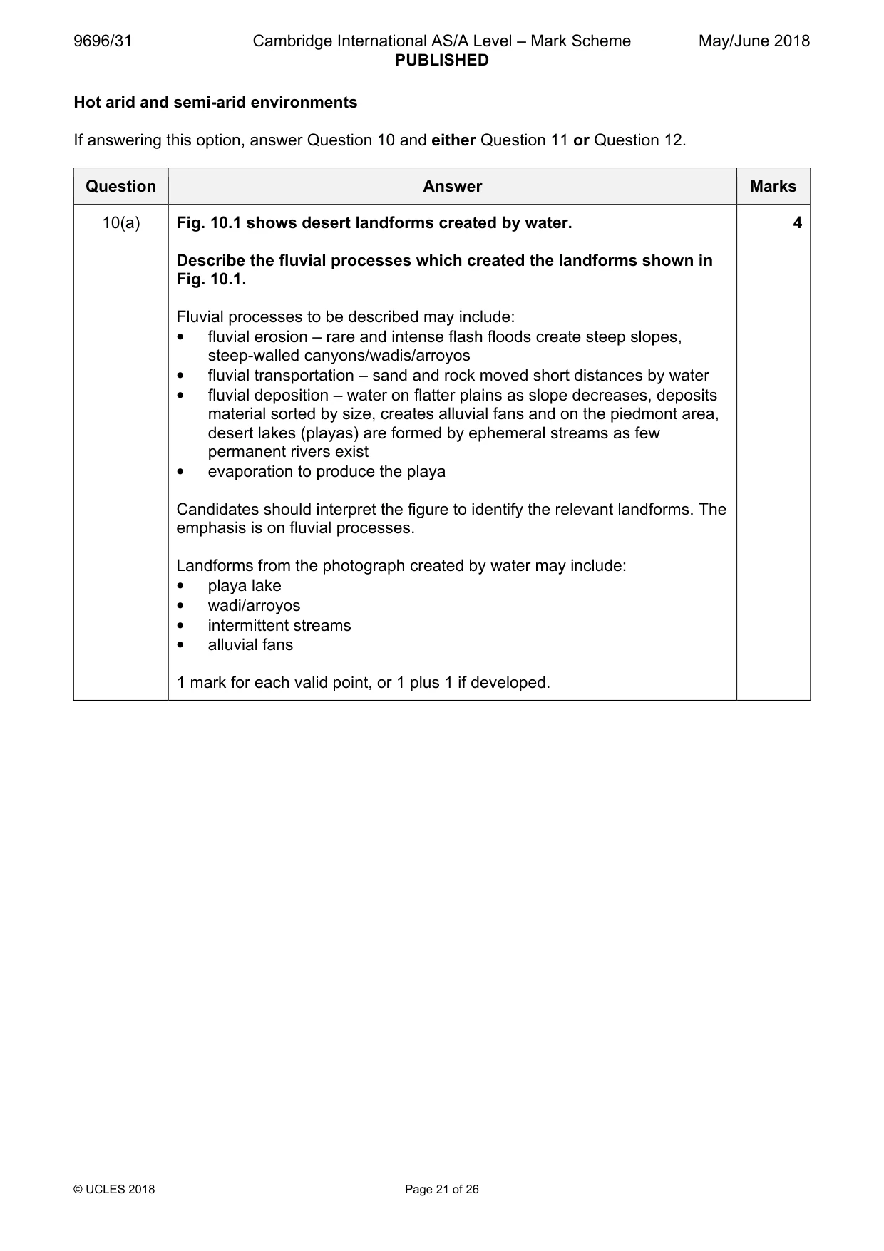
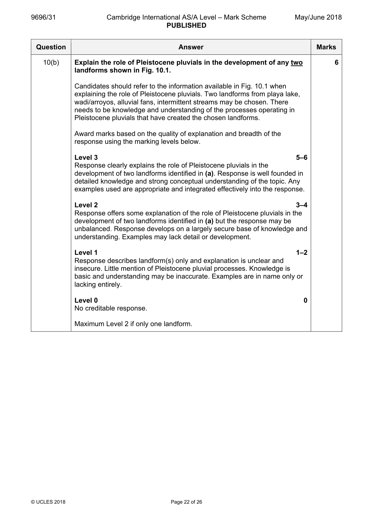
Mark scheme: 10(a) Fig. 10.1 shows desert landforms created by water. 4 Describe the fluvial processes which created the landforms shown in Fig. 10.1. Fluvial processes to be described may include: • fluvial erosion – rare and intense flash floods create steep slopes, steep-walled canyons/wadis/arroyos • fluvial transportation – sand and rock moved short distances by water • fluvial deposition – water on flatter plains as slope decreases, deposits material sorted by size, creates alluvial fans and on the piedmont area, desert lakes (playas) are formed by ephemeral streams as few permanent rivers exist • evaporation to produce the playa Candidates should interpret the figure to identify the relevant landforms. The emphasis is on fluvial processes. Landforms from the photograph created by water may include: • playa lake • wadi/arroyos • intermittent streams • alluvial fans 1 mark for each valid point, or 1 plus 1 if developed. 10(b) Explain the role of Pleistocene pluvials in the development of any two 6 landforms shown in Fig. 10.1. Candidates should refer to the information available in Fig. 10.1 when explaining the role of Pleistocene pluvials. Two landforms from playa lake, wadi/arroyos, alluvial fans, intermittent streams may be chosen. There needs to be knowledge and understanding of the processes operating in Pleistocene pluvials that have created the chosen landforms. Award marks based on the quality of explanation and breadth of the response using the marking levels below. Level 3 5–6 Response clearly explains the role of Pleistocene pluvials in the development of two landforms identified in (a). Response is well founded in detailed knowledge and strong conceptual understanding of the topic. Any examples used are appropriate and integrated effectively into the response. Level 2 3–4 Response offers some explanation of the role of Pleistocene pluvials in the development of two landforms identified in (a) but the response may be unbalanced. Response develops on a largely secure base of knowledge and understanding. Examples may lack detail or development. Level 1 1–2 Response describes landform(s) only and explanation is unclear and insecure. Little mention of Pleistocene pluvial processes. Knowledge is basic and understanding may be inaccurate. Examples are in name only or lacking entirely. Level 0 0 No creditable response. Maximum Level 2 if only one landform.
Q11 · To what extent is the lack of precipitation the only climatic feature of arid…
11 To what extent is the lack of precipitation the only climatic feature of arid environments? [20]
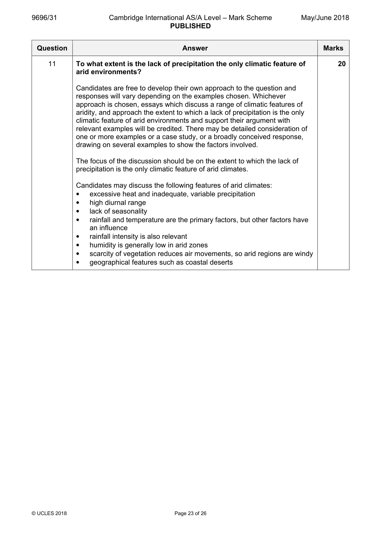
Mark scheme: 11 To what extent is the lack of precipitation the only climatic feature of 20 arid environments? Candidates are free to develop their own approach to the question and responses will vary depending on the examples chosen. Whichever approach is chosen, essays which discuss a range of climatic features of aridity, and approach the extent to which a lack of precipitation is the only climatic feature of arid environments and support their argument with relevant examples will be credited. There may be detailed consideration of one or more examples or a case study, or a broadly conceived response, drawing on several examples to show the factors involved. The focus of the discussion should be on the extent to which the lack of precipitation is the only climatic feature of arid climates. Candidates may discuss the following features of arid climates: • excessive heat and inadequate, variable precipitation • high diurnal range • lack of seasonality • rainfall and temperature are the primary factors, but other factors have an influence • rainfall intensity is also relevant • humidity is generally low in arid zones • scarcity of vegetation reduces air movements, so arid regions are windy • geographical features such as coastal deserts Award marks based on the quality of the response using the marking levels below. Level 4 16–20 Response thoroughly discusses the climatic features of arid environments and provides a thorough assessment of the relative importance of the lack of precipitation as the main climatic feature. An effective and sustained evaluation with a sound conclusion. Response is well founded in detailed exemplar knowledge and strong conceptual understanding of the topic. Level 3 11–15 Response discusses the climatic features of arid environments and makes a sound assessment of the relative importance of the lack of precipitation as the main climatic feature. Response is broadly evaluative in character, comprising some explanatory or narrative content and a conclusion. Response develops on a largely secure base of knowledge and understanding with the use of example(s). Level 2 6–10 Response shows general knowledge and understanding of the climatic features of arid environments. Response is mainly descriptive or explanatory in approach and contains a brief or thinly supported evaluation. Responses without the use of example(s) to support the response will not get above the middle of Level 2 (8 marks). Level 1 1–5 Response broadly discusses the climatic features of arid environments without a clear focus on the question. A descriptive response comprising a few simple points. Knowledge is basic and understanding may be poor and lack relevance to the question set. Level 0 0 No creditable response.
Q12 · Assess the extent to which either a hot arid or a semi-arid environment can be…
12 Assess the extent to which either a hot arid or a semi-arid environment can be sustainably managed. [20] [Total: 30]
Mark scheme: 12 Assess the extent to which either a hot arid or a semi-arid environment 20 can be sustainably managed. Candidates are free to develop their own approach to the question and responses will vary depending on the environment chosen. Whichever environment is chosen, essays which discuss sustainable management and support their argument with relevant examples will be credited. There may be detailed consideration of one or more examples or a case study, or a broadly conceived response, drawing on several examples to show the factors involved. The detail will depend on which environment is chosen and statements on the fragility of hot arid/semi-arid environments could be a good starting point. Sustainable management opportunities might include: • resource exploitation, agriculture, recreation and tourism, film industry • areas where there is a presence of water at oases or exogenic rivers The potential availability of these opportunities depends on the environment and examples chosen. Assessment of the management should consider socio-economic and environmental needs, thus careful management is required to ensure sustainability. Award marks based on the quality of the response using the marking levels below. Level 4 16–20 Response thoroughly discusses the concept of sustainability and the management strategies that can be used within the chosen environment. Evaluation of the different opportunities is thorough and relevant. Response makes clear links between management and sustainability. An effective and sustained evaluation with a sound conclusion. Response is well founded in detailed exemplar knowledge and strong conceptual understanding of the topic. Level 3 11–15 Response discusses one or more examples of management but may be less detailed in the evaluation of sustainability. Response is broadly evaluative in character, comprising some explanatory or narrative content and a conclusion. Response develops on a largely secure base of knowledge and understanding with the use of example(s). Level 2 6–10 Response shows general knowledge and understanding of management ideas but evaluation of sustainability is limited and answer is unbalanced. Response is mainly descriptive or explanatory in approach and contains a brief or thinly supported evaluation. Responses without the use of example(s) to support the response will not get above the middle of Level 2 (8 marks). Level 1 1–5 Response broadly discusses management ideas but without the necessary focus on the question or a convincing conclusion about sustainability. A descriptive response comprising a few simple points. Knowledge is basic and understanding may be poor and lack relevance to the question set. Level 0 0 No creditable response.
What was in this paper
The subtopics covered by these 12 questions, and how many questions each got. Open one in a new tab to see every Cambridge question on it.
1Coastal processes1Coral reefs1Hazards resulting from atmospheric disturbances1Hot arid and semi-arid climates1Humid tropical (rainforest) ecosystems and seasonally humid tropical (savanna) ecosystems1Landforms of hot arid and semi-arid environments1Landforms of tropical environments1Slope processes1Sustainable management in hazardous environments1Sustainable management of hot arid and semi-arid environments1Tropical climates1What you needed in this session
Cambridge’s own grade thresholds for 2018 May/June, Paper 3 · Variant 1. A higher threshold means an easier paper — the bar moves with how the cohort did.