Cambridge IGCSE Geography 0460 — 2004 Oct/Nov Paper 2 · Variant 1
0460/21/O/N/04
The question paper and its mark scheme, free to read here and free to download. This is Cambridge’s own paper, exactly as it was sat.
Question paper8 pages

Mark scheme7 pages
Answers below. Sit the paper first if you are practising.
Paper as text
Question paper, page 1
This document consists of 6 printed pages, 2 blank page and 2 inserts. SP (DR) S60439/4 © UCLES 2004 [Turn over UNIVERSITY OF CAMBRIDGE INTERNATIONAL EXAMINATIONS International General Certificate of Secondary Education GEOGRAPHY 0460/02 Paper 2 October/November 2004 1 hour 30 minutes Additional Materials: Answer Booklet/Paper, Ruler (cm:mm) Protractor Set square 1:25000 Survey Map Extract is enclosed with this question paper. READ THESE INSTRUCTIONS FIRST If you have been given an Answer Booklet, follow the instructions on the front cover of the Booklet. Write your Centre number, candidate number and name on all the work you hand in. Write in dark blue or black pen on both sides of the paper. You may use a soft pencil for any diagrams, graphs or rough working. Do not use staples, paper clips, highlighters, glue or correction fluid. Answer all questions. At the end of the examination, fasten all your work securely together. The number of marks is given in brackets [ ] at the end of each question or part question. Insert 1 contains Fig. 1 for Question 1, Fig. 2 for Question 2, Fig. 5 for Question 6 and Fig. 6 for Question 7. Insert 2 contains Photograph A for Question 3. Sketch maps and diagrams should be drawn whenever they serve to illustrate an answer. www.XtremePapers.com
Question paper, page 2
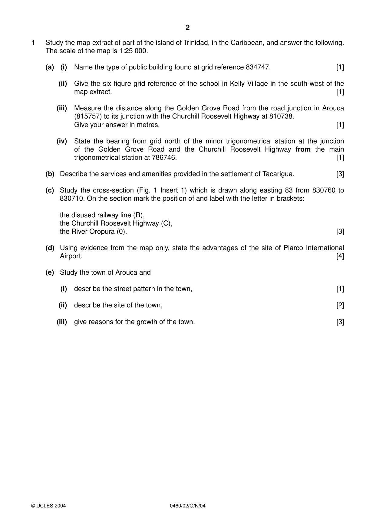
2 0460/02/O/N/04 1 Study the map extract of part of the island of Trinidad, in the Caribbean, and answer the following. The scale of the map is 1:25 000. (a) (i) Name the type of public building found at grid reference 834747. [1] (ii) Give the six figure grid reference of the school in Kelly Village in the south-west of the map extract. [1] (iii) Measure the distance along the Golden Grove Road from the road junction in Arouca (815757) to its junction with the Churchill Roosevelt Highway at 810738. Give your answer in metres. [1] (iv) State the bearing from grid north of the minor trigonometrical station at the junction of the Golden Grove Road and the Churchill Roosevelt Highway from the main trigonometrical station at 786746. [1] (b) Describe the services and amenities provided in the settlement of Tacarigua. [3] (c) Study the cross-section (Fig. 1 Insert 1) which is drawn along easting 83 from 830760 to 830710. On the section mark the position of and label with the letter in brackets: the disused railway line (R), the Churchill Roosevelt Highway (C), the River Oropura (0). [3] (d) Using evidence from the map only, state the advantages of the site of Piarco International Airport. [4] (e) Study the town of Arouca and (i) describe the street pattern in the town, [1] (ii) describe the site of the town, [2] (iii) give reasons for the growth of the town. [3] © UCLES 2004
Question paper, page 3
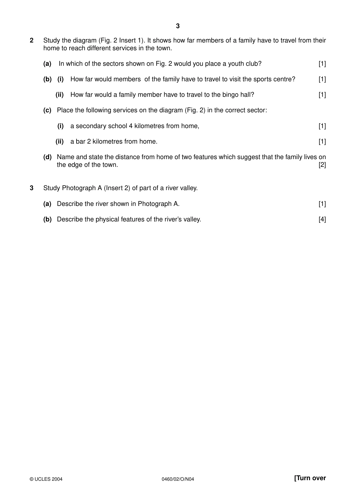
3 0460/02/O/N04 [Turn over 2 Study the diagram (Fig. 2 Insert 1). It shows how far members of a family have to travel from their home to reach different services in the town. (a) In which of the sectors shown on Fig. 2 would you place a youth club? [1] (b) (i) How far would members of the family have to travel to visit the sports centre? [1] (ii) How far would a family member have to travel to the bingo hall? [1] (c) Place the following services on the diagram (Fig. 2) in the correct sector: (i) a secondary school 4 kilometres from home, [1] (ii) a bar 2 kilometres from home. [1] (d) Name and state the distance from home of two features which suggest that the family lives on the edge of the town. [2] 3 Study Photograph A (Insert 2) of part of a river valley. (a) Describe the river shown in Photograph A. [1] (b) Describe the physical features of the river’s valley. [4] © UCLES 2004
Question paper, page 4
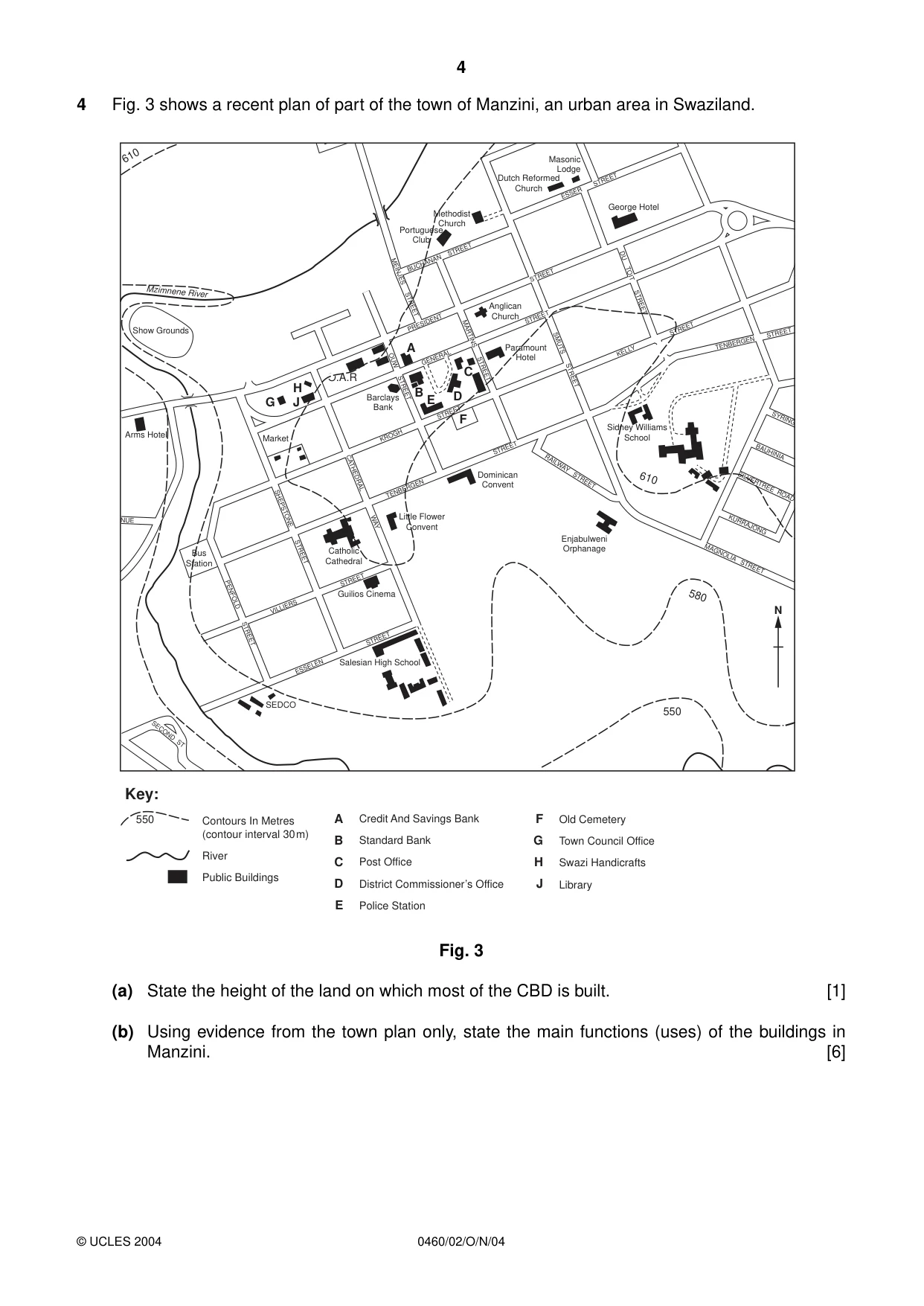
4 0460/02/O/N/04 4 Fig. 3 shows a recent plan of part of the town of Manzini, an urban area in Swaziland. Fig. 3 (a) State the height of the land on which most of the CBD is built. [1] (b) Using evidence from the town plan only, state the main functions (uses) of the buildings in Manzini. [6] BUCHANAN STREET PRESIDENT STREET TENBERGEN STREET VILLIERS STREET ESSELEN STREET KROGH STREET KELLY STREET TENBERGEN STREET GENERAL STREET ESSER STREET MEINJES STREET OUW STREET CATHEDRAL WAY SHEPSTONE STREET PENFOLD STREET NUE SECOND ST MARTINS STREET SMUTS STREET DU TOIT STREET SYRING BAUHINIA SILVERTREE ROAD KURRAJONG MAGNOLIA STREET RAILWAY STREET Show Grounds Arms Hotel Salesian High School SEDCO Little Flower Convent Bus Station Catholic Cathedral Barclays Bank Dominican Convent Enjabulweni Orphanage Sidney Williams School Guilios Cinema Market Paramount Hotel Anglican Church Methodist Church Dutch Reformed Church Masonic Lodge Portuguese Club George Hotel Mzimnene River G H J F B E D C A 610 580 550 610 N O.A.R A B C D E F G H J 550 Contours In Metres (contour interval 30m) River Public Buildings Credit And Savings Bank Standard Bank Post Office District Commissioner’s Office Police Station Old Cemetery Town Council Office Swazi Handicrafts Library Key: © UCLES 2004
Question paper, page 5
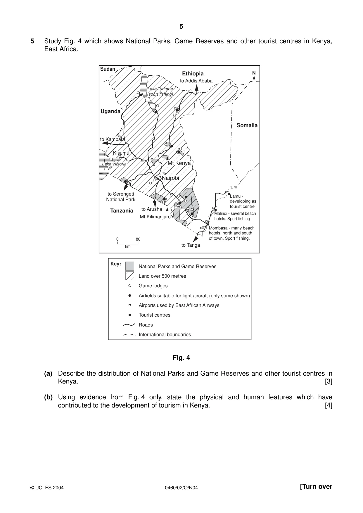
5 0460/02/O/N04 [Turn over 5 Study Fig. 4 which shows National Parks, Game Reserves and other tourist centres in Kenya, East Africa. Fig. 4 (a) Describe the distribution of National Parks and Game Reserves and other tourist centres in Kenya. [3] (b) Using evidence from Fig. 4 only, state the physical and human features which have contributed to the development of tourism in Kenya. [4] Nairobi Nairobi Mt Kenya Mt Kenya Kisumu Kisumu to Kampala to Kampala Lake Turkana Lake Turkana (sport fishing) (sport fishing) Lake Victoria Lake Victoria Sudan Ethiopia Uganda Somalia Tanzania to Addis Ababa Nairobi Mt Kenya to Serengeti National Park to Arusha Mt Kilimanjaro Kisumu to Kampala Lake Turkana (sport fishing) Lake Victoria to Tanga Lamu - developing as tourist centre Malindi - several beach hotels. Sport fishing Mombasa - many beach hotels, north and south of town. Sport fishing. N 0 80 km Key: National Parks and Game Reserves Land over 500 metres Game lodges Airfields suitable for light aircraft (only some shown) Airports used by East African Airways Tourist centres Roads International boundaries © UCLES 2004
Question paper, page 6
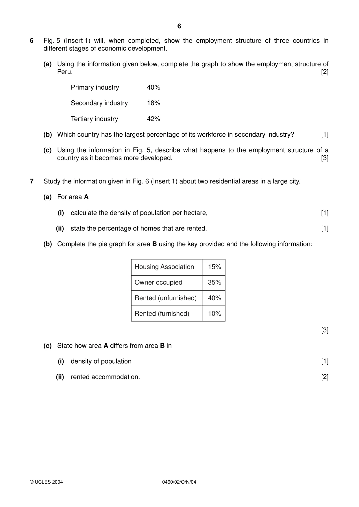
6 0460/02/O/N/04 6 Fig. 5 (Insert 1) will, when completed, show the employment structure of three countries in different stages of economic development. (a) Using the information given below, complete the graph to show the employment structure of Peru. [2] Primary industry 40% Secondary industry 18% Tertiary industry 42% (b) Which country has the largest percentage of its workforce in secondary industry? [1] (c) Using the information in Fig. 5, describe what happens to the employment structure of a country as it becomes more developed. [3] 7 Study the information given in Fig. 6 (Insert 1) about two residential areas in a large city. (a) For area A (i) calculate the density of population per hectare, [1] (ii) state the percentage of homes that are rented. [1] (b) Complete the pie graph for area B using the key provided and the following information: [3] (c) State how area A differs from area B in (i) density of population [1] (ii) rented accommodation. [2] Housing Association 15% Owner occupied 35% Rented (unfurnished) 40% Rented (furnished) 10% © UCLES 2004
Question paper, page 8
8 0460/02/O/N/04 BLANK PAGE Copyright Acknowledgements: Question 3. Photograph, R. Howarth. Question 4. A. D. BOWEN. Certificate Geography of Swaziland. © Reproduced by permission of Pearson Education Ltd. The University of Cambridge Local Examinations Syndicate has made every effort to trace copyright holders, but if we have inadvertently overlooked any we will be pleased to make the necessary arrangements at the first opportunity. University of Cambridge International Examinations is part of the University of Cambridge Local Examinations Syndicate (UCLES), which is itself a department of the University of Cambridge.
Mark scheme, page 1
UNIVERSITY OF CAMBRIDGE INTERNATIONAL EXAMINATIONS International General Certificate of Secondary Education MARK SCHEME for the November 2004 question papers 0460 GEOGRAPHY 0460/02 Paper 2, maximum mark 60 This mark scheme is published as an aid to teachers and students, to indicate the requirements of the examination. It shows the basis on which Examiners were initially instructed to award marks. It does not indicate the details of the discussions that took place at an Examiners’ meeting before marking began. Any substantial changes to the mark scheme that arose from these discussions will be recorded in the published Report on the Examination. All Examiners are instructed that alternative correct answers and unexpected approaches in candidates’ scripts must be given marks that fairly reflect the relevant knowledge and skills demonstrated. Mark schemes must be read in conjunction with the question papers and the Report on the Examination. CIE will not enter into discussion or correspondence in connection with these mark schemes. CIE is publishing the mark schemes for the November 2004 question papers for most IGCSE and GCE Advanced Level syllabuses. www.XtremePapers.com
Mark scheme, page 2
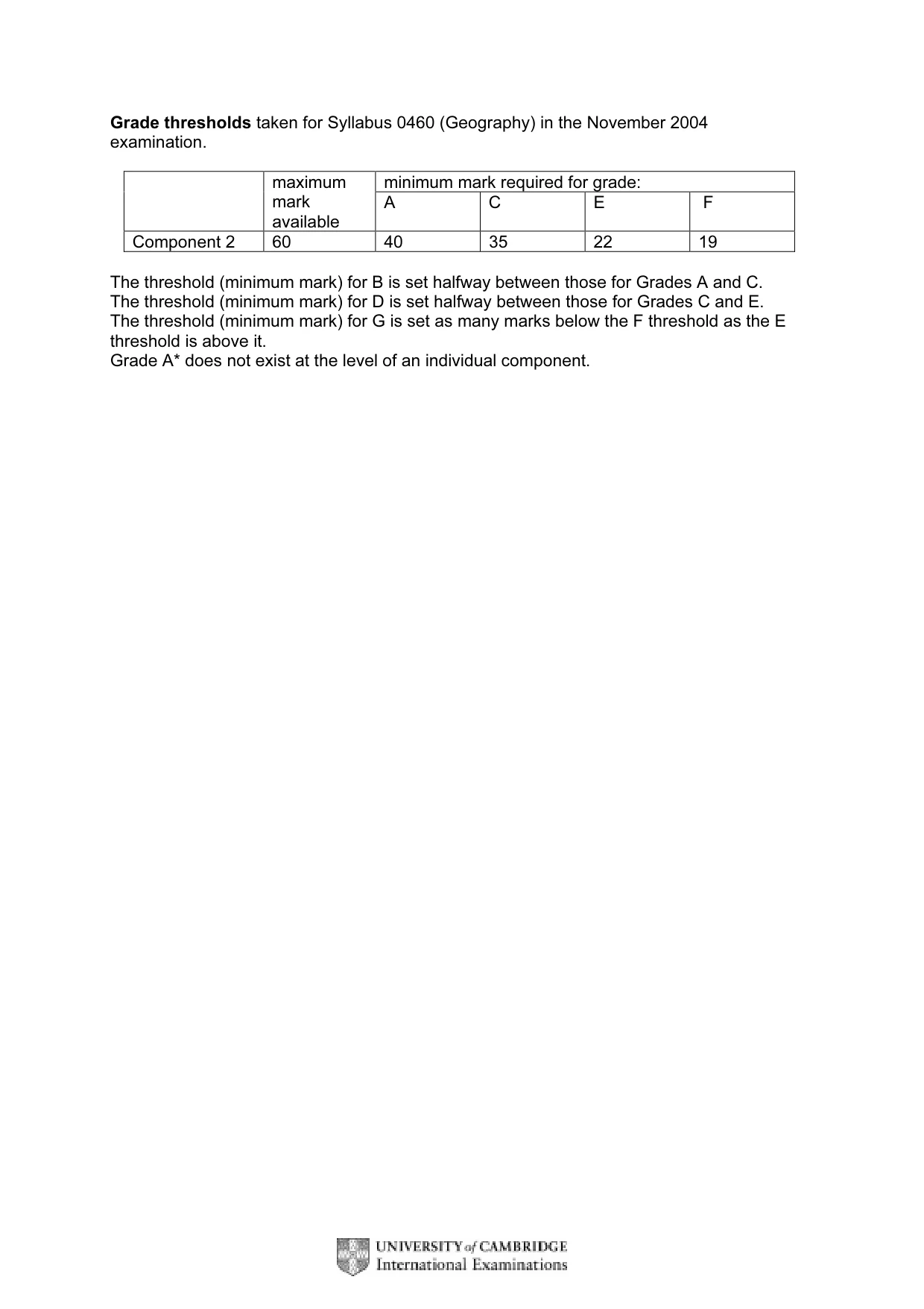
Grade thresholds taken for Syllabus 0460 (Geography) in the November 2004 examination. minimum mark required for grade: maximum mark available A C E F Component 2 60 40 35 22 19 The threshold (minimum mark) for B is set halfway between those for Grades A and C. The threshold (minimum mark) for D is set halfway between those for Grades C and E. The threshold (minimum mark) for G is set as many marks below the F threshold as the E threshold is above it. Grade A* does not exist at the level of an individual component.
Mark scheme, page 3
November 2004 INTERNATIONAL GCSE MARK SCHEME MAXIMUM MARK: 60 SYLLABUS/COMPONENT: 0460/02 GEOGRAPHY Extended
Mark scheme, page 4
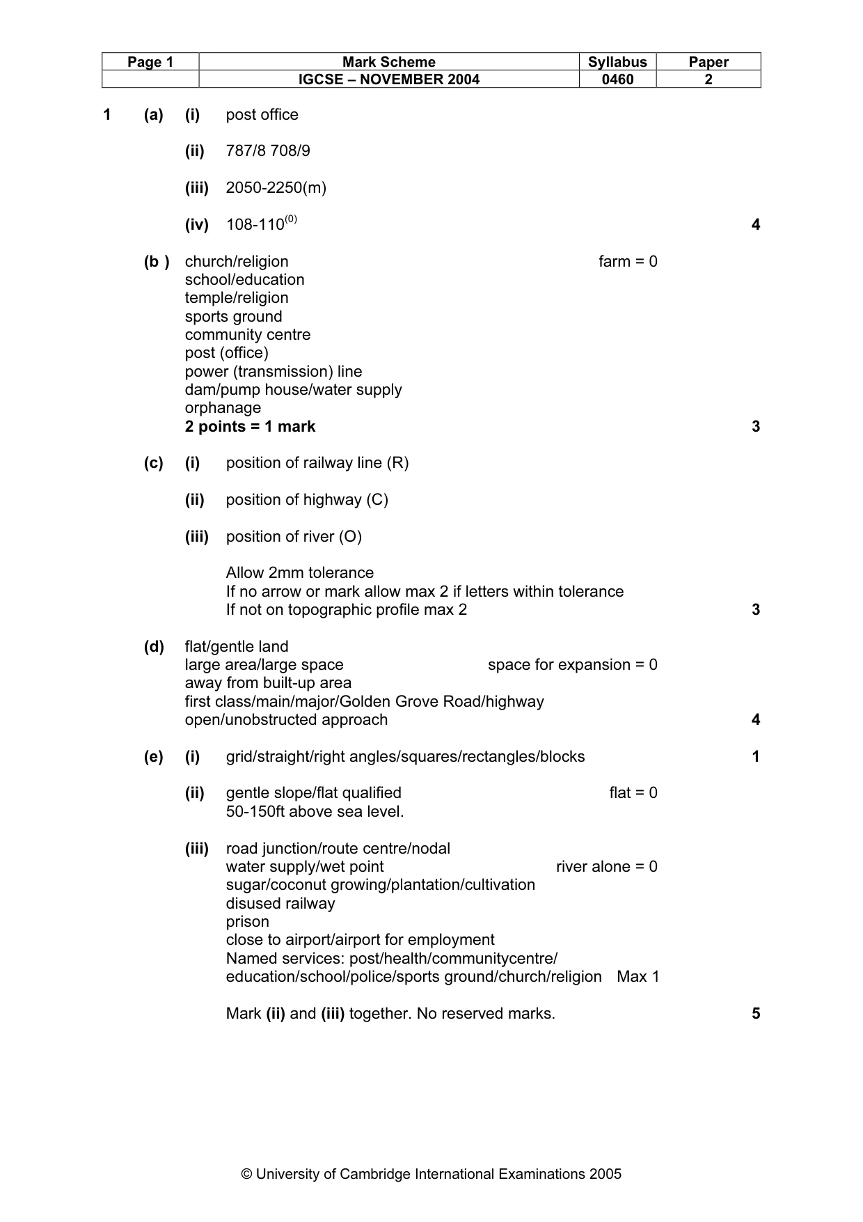
Page 1 Mark Scheme Syllabus Paper IGCSE – NOVEMBER 2004 0460 2 © University of Cambridge International Examinations 2005 1 (a) (i) post office (ii) 787/8 708/9 (iii) 2050-2250(m) (iv) 108-110(0) 4 (b ) church/religion farm = 0 school/education temple/religion sports ground community centre post (office) power (transmission) line dam/pump house/water supply orphanage 2 points = 1 mark 3 (c) (i) position of railway line (R) (ii) position of highway (C) (iii) position of river (O) Allow 2mm tolerance If no arrow or mark allow max 2 if letters within tolerance If not on topographic profile max 2 3 (d) flat/gentle land large area/large space space for expansion = 0 away from built-up area first class/main/major/Golden Grove Road/highway open/unobstructed approach 4 (e) (i) grid/straight/right angles/squares/rectangles/blocks 1 (ii) gentle slope/flat qualified flat = 0 50-150ft above sea level. (iii) road junction/route centre/nodal water supply/wet point river alone = 0 sugar/coconut growing/plantation/cultivation disused railway prison close to airport/airport for employment Named services: post/health/communitycentre/ education/school/police/sports ground/church/religion Max 1 Mark (ii) and (iii) together. No reserved marks. 5
Mark scheme, page 5
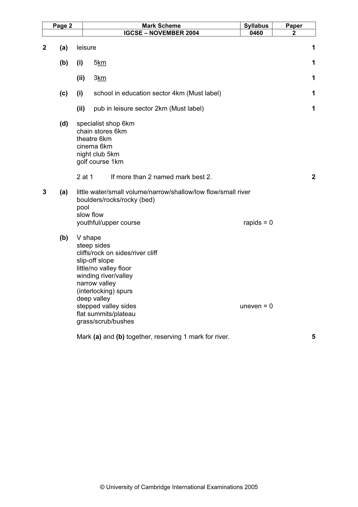
Page 2 Mark Scheme Syllabus Paper IGCSE – NOVEMBER 2004 0460 2 © University of Cambridge International Examinations 2005 2 (a) leisure 1 (b) (i) 5km 1 (ii) 3km 1 (c) (i) school in education sector 4km (Must label) 1 (ii) pub in leisure sector 2km (Must label) 1 (d) specialist shop 6km chain stores 6km theatre 6km cinema 6km night club 5km golf course 1km 2 at 1 If more than 2 named mark best 2. 2 3 (a) little water/small volume/narrow/shallow/low flow/small river boulders/rocks/rocky (bed) pool slow flow youthful/upper course rapids = 0 (b) V shape steep sides cliffs/rock on sides/river cliff slip-off slope little/no valley floor winding river/valley narrow valley (interlocking) spurs deep valley stepped valley sides uneven = 0 flat summits/plateau grass/scrub/bushes Mark (a) and (b) together, reserving 1 mark for river. 5
Mark scheme, page 6
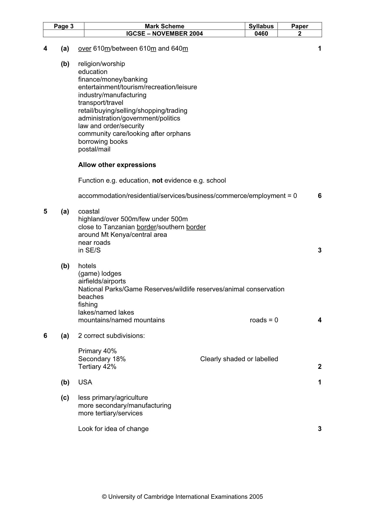
Page 3 Mark Scheme Syllabus Paper IGCSE – NOVEMBER 2004 0460 2 © University of Cambridge International Examinations 2005 4 (a) over 610m/between 610m and 640m 1 (b) religion/worship education finance/money/banking entertainment/tourism/recreation/leisure industry/manufacturing transport/travel retail/buying/selling/shopping/trading administration/government/politics law and order/security community care/looking after orphans borrowing books postal/mail Allow other expressions Function e.g. education, not evidence e.g. school accommodation/residential/services/business/commerce/employment = 0 6 5 (a) coastal highland/over 500m/few under 500m close to Tanzanian border/southern border around Mt Kenya/central area near roads in SE/S 3 (b) hotels (game) lodges airfields/airports National Parks/Game Reserves/wildlife reserves/animal conservation beaches fishing lakes/named lakes mountains/named mountains roads = 0 4 6 (a) 2 correct subdivisions: Primary 40% Secondary 18% Clearly shaded or labelled Tertiary 42% 2 (b) USA 1 (c) less primary/agriculture more secondary/manufacturing more tertiary/services Look for idea of change 3
Mark scheme, page 7
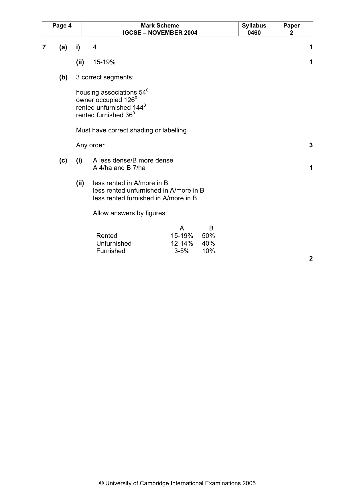
Page 4 Mark Scheme Syllabus Paper IGCSE – NOVEMBER 2004 0460 2 © University of Cambridge International Examinations 2005 7 (a) i) 4 1 (ii) 15-19% 1 (b) 3 correct segments: housing associations 540 owner occupied 1260 rented unfurnished 1440 rented furnished 360 Must have correct shading or labelling Any order 3 (c) (i) A less dense/B more dense A 4/ha and B 7/ha 1 (ii) less rented in A/more in B less rented unfurnished in A/more in B less rented furnished in A/more in B Allow answers by figures: A B Rented 15-19% 50% Unfurnished 12-14% 40% Furnished 3-5% 10% 2