Cambridge IGCSE Environmental Management 0680 — 2018 Oct/Nov Paper 2 · Variant 1
0680/21/O/N/18 · 2 questions · 80 marks · ≈90 min
The question paper and its mark scheme, free to read here and free to download. This is Cambridge’s own paper, exactly as it was sat.
Question paper20 pages




Mark scheme14 pages
Answers below. Sit the paper first if you are practising.
Questions as text
Q1 · The map shows Banff National Park in the Rocky Mountains of Canada
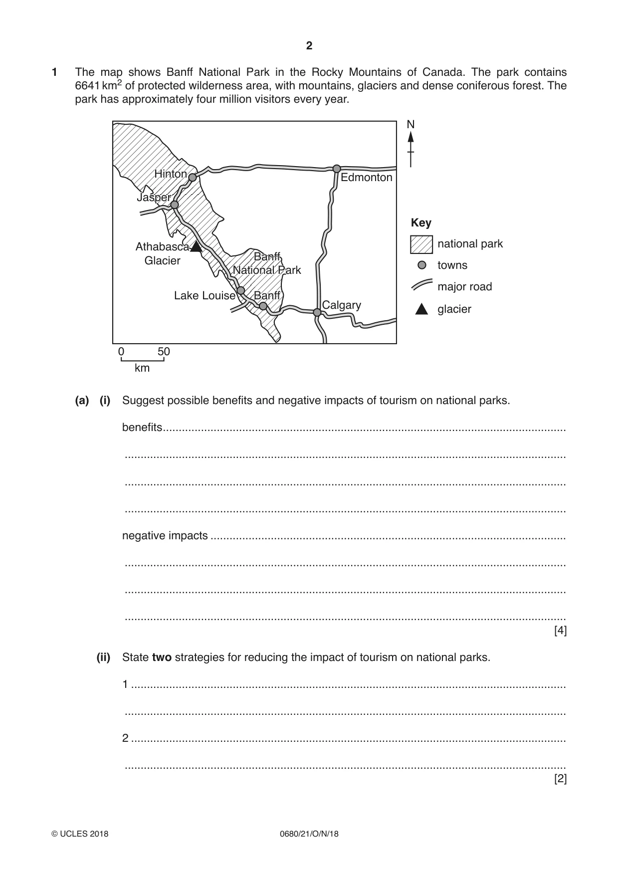
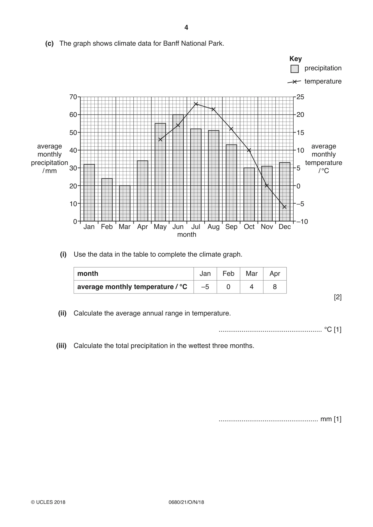
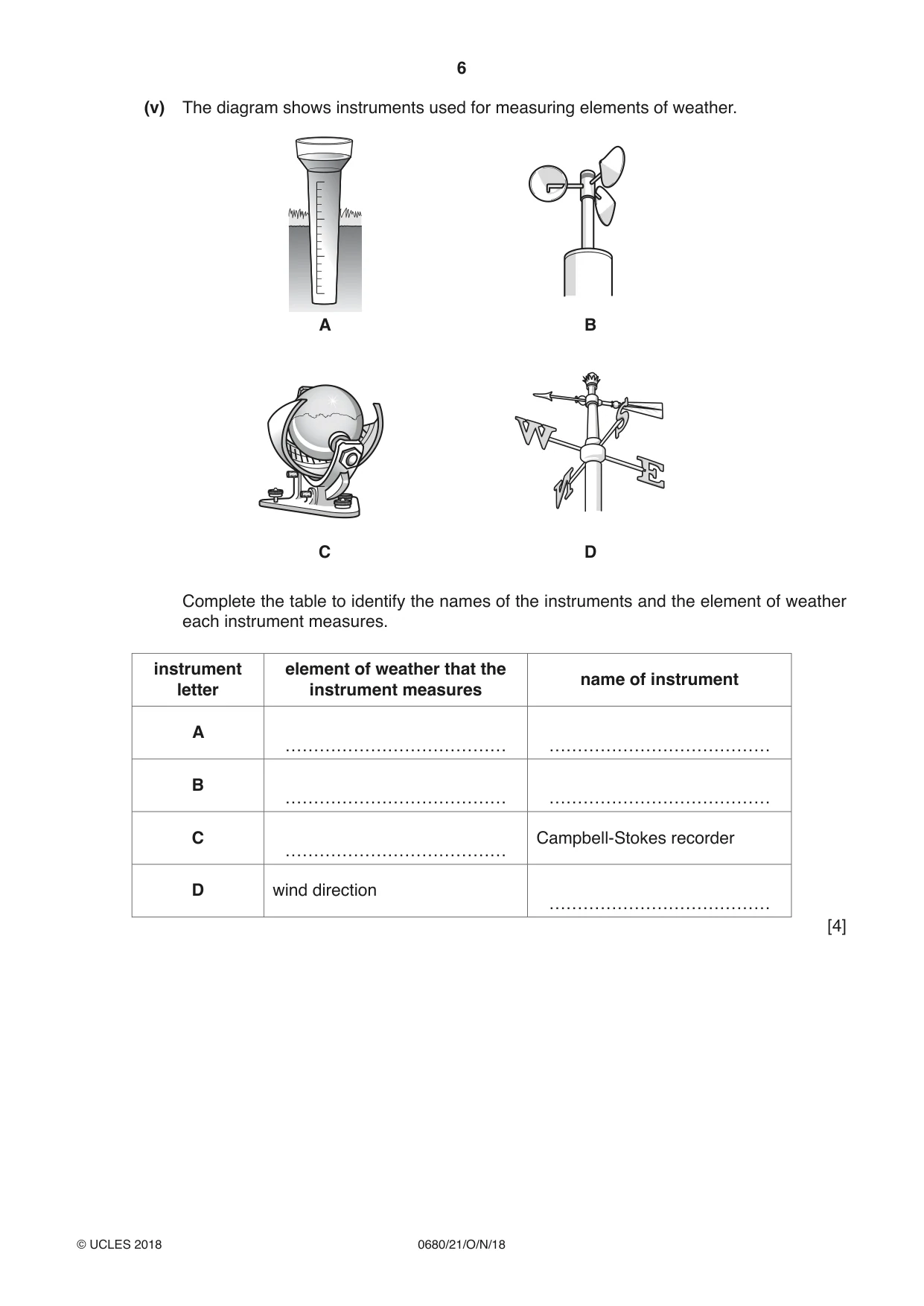
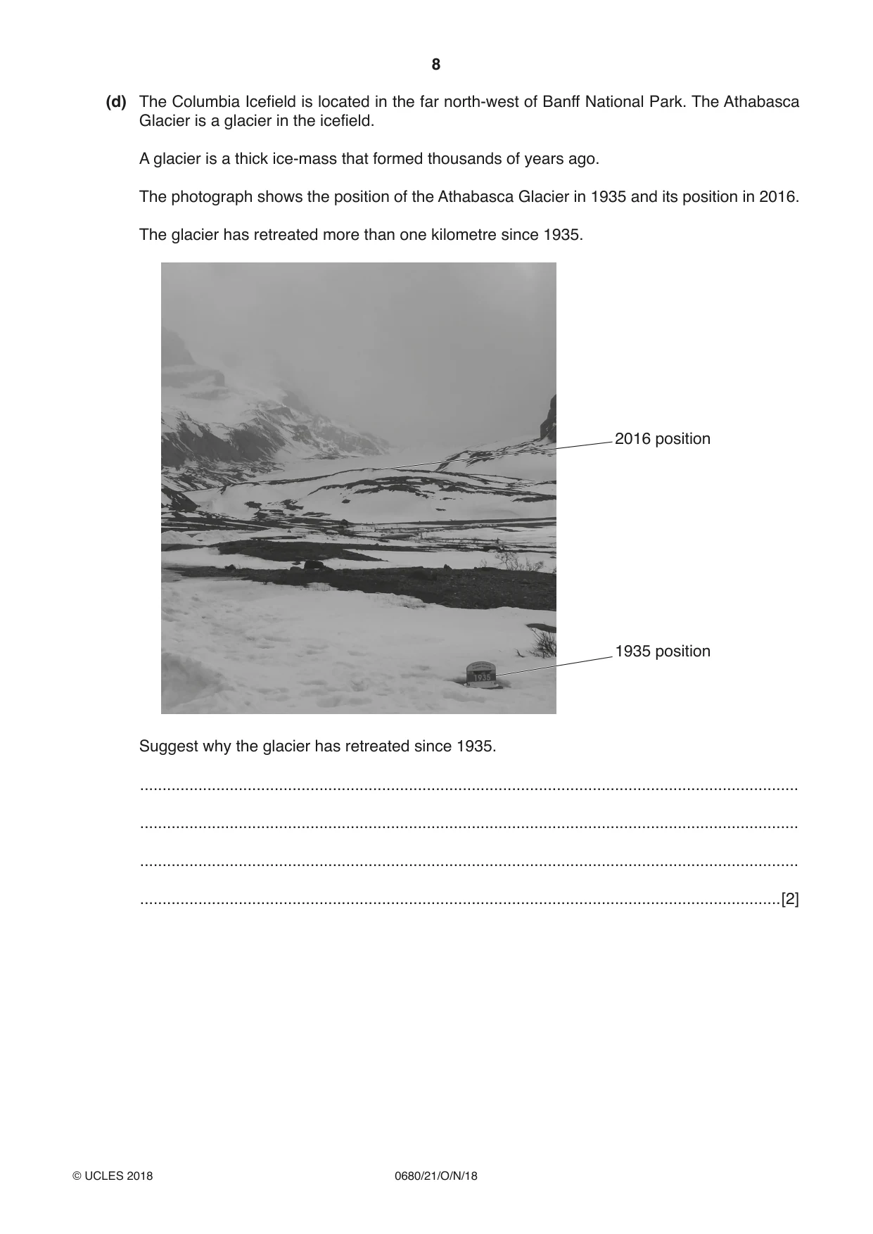
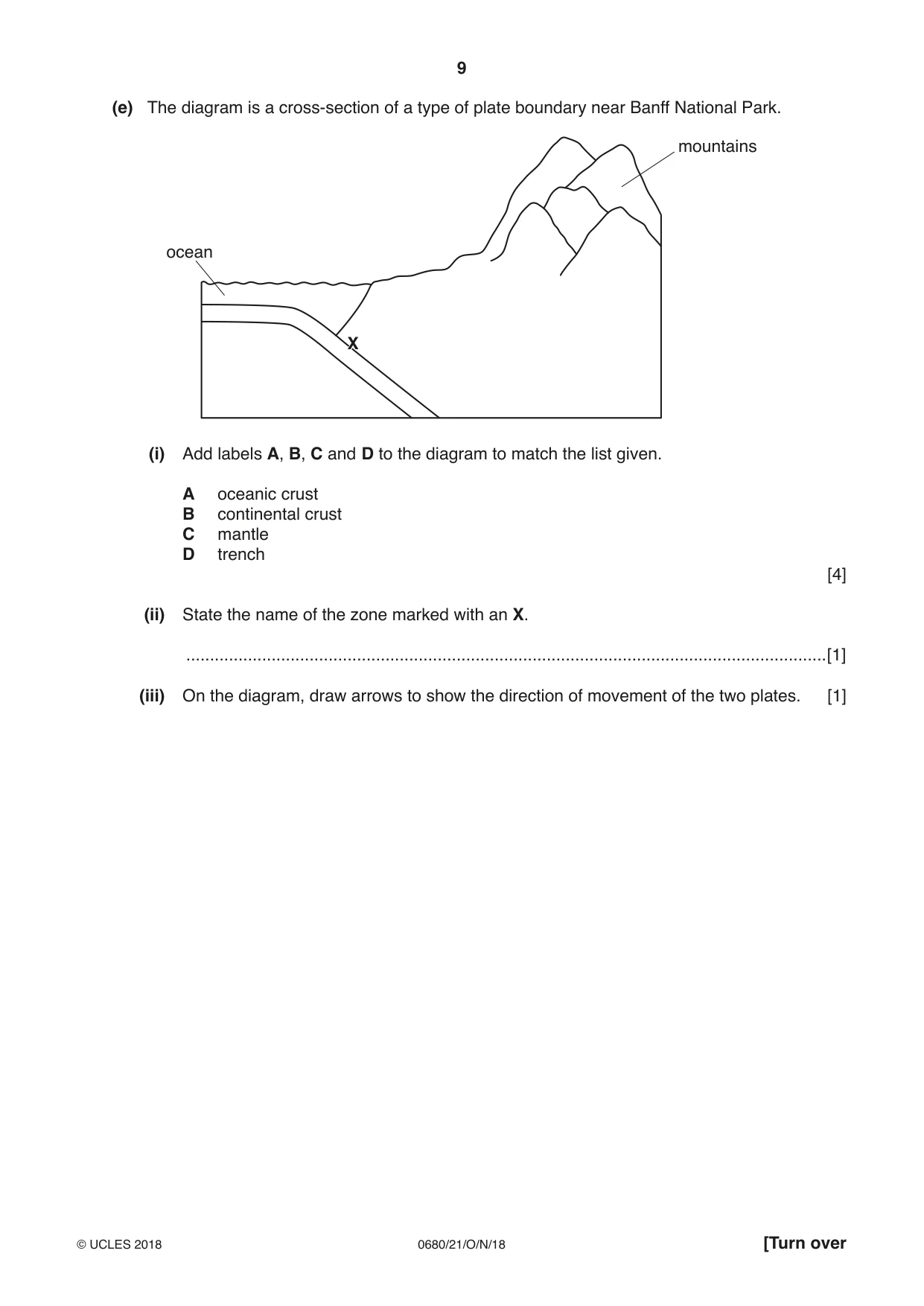
1 The map shows Banff National Park in the Rocky Mountains of Canada. The park contains 6641 km2 of protected wilderness area, with mountains, glaciers and dense coniferous forest. The park has approximately four million visitors every year. N HintonHinton EdmontonEdmonton JasperJasper Key AthabascaAthabasca national park BanffBanff GlacierGlacier towns NationalNational ParkPark major road LakeLake LouiseLouise BanffBanff CalgaryCalgary glacier 0 50 km (a) (i) Suggest possible benefits and negative impacts of tourism on national parks. benefits ............................................................................................................................... ........................................................................................................................................... ........................................................................................................................................... ........................................................................................................................................... negative impacts ................................................................................................................ ........................................................................................................................................... ........................................................................................................................................... ........................................................................................................................................... [4] (ii) State two strategies for reducing the impact of tourism on national parks. 1 ......................................................................................................................................... ........................................................................................................................................... 2 ......................................................................................................................................... ........................................................................................................................................... [2] (b) In October 2014, a small earthquake occurred near Banff National Park. Suggest why people live in earthquake zones even though there is a risk to their safety. ................................................................................................................................................... ................................................................................................................................................... ................................................................................................................................................... ................................................................................................................................................... ................................................................................................................................................... ................................................................................................................................................... ................................................................................................................................................... ...............................................................................................................................................[4] (c) The graph shows climate data for Banff National Park. Key precipitation temperature 70 25 60 20 50 15 average average 40 10 monthly monthly precipitation temperature 30 5 / mm / °C 20 0 10 –5 0 –10 Jan Feb Mar Apr May Jun Jul Aug Sep Oct Nov Dec month (i) Use the data in the table to complete the climate graph. month Jan Feb Mar Apr average monthly temperature / °C –5 0 4 8 [2] (ii) Calculate the average annual range in temperature. ...................................................... °C [1] (iii) Calculate the total precipitation in the wettest three months. .................................................... mm [1] (iv) Use the graph to describe the pattern of temperature and precipitation in Banff National Park. ........................................................................................................................................... ........................................................................................................................................... ........................................................................................................................................... ........................................................................................................................................... ........................................................................................................................................... ........................................................................................................................................... ........................................................................................................................................... ...................................................................................................................................... [4] (v) The diagram shows instruments used for measuring elements of weather. A B C D Complete the table to identify the names of the instruments and the element of weather each instrument measures. instrument element of weather that the name of instrument letter instrument measures A B C Campbell-Stokes recorder D wind direction [4] (vi) In June 2013, 200 mm of rain fell in less than two days in Banff National Park. The rainfall caused major flooding of many rivers. Describe the problems for people when rivers flood. ........................................................................................................................................... ........................................................................................................................................... ........................................................................................................................................... ........................................................................................................................................... ........................................................................................................................................... ........................................................................................................................................... ........................................................................................................................................... .......................................................................................................................................[4] (d) The Columbia Icefield is located in the far north-west of Banff National Park. The Athabasca Glacier is a glacier in the icefield. A glacier is a thick ice-mass that formed thousands of years ago. The photograph shows the position of the Athabasca Glacier in 1935 and its position in 2016. The glacier has retreated more than one kilometre since 1935. 2016 position 1935 position Suggest why the glacier has retreated since 1935. ................................................................................................................................................... ................................................................................................................................................... ................................................................................................................................................... ...............................................................................................................................................[2] (e) The diagram is a cross-section of a type of plate boundary near Banff National Park. mountains ocean X (i) Add labels A, B, C and D to the diagram to match the list given. A oceanic crust B continental crust C mantle D trench [4] (ii) State the name of the zone marked with an X. .......................................................................................................................................[1] (iii) On the diagram, draw arrows to show the direction of movement of the two plates. [1] (f) Some areas of Banff National Park have geothermally heated groundwater. ‘Geothermal energy could be used as a global alternative to fossil fuels.’ To what extent do you agree with this statement? Explain your answer. ................................................................................................................................................... ................................................................................................................................................... ................................................................................................................................................... ................................................................................................................................................... ................................................................................................................................................... ................................................................................................................................................... ................................................................................................................................................... ................................................................................................................................................... ................................................................................................................................................... ................................................................................................................................................... ................................................................................................................................................... ...............................................................................................................................................[6]
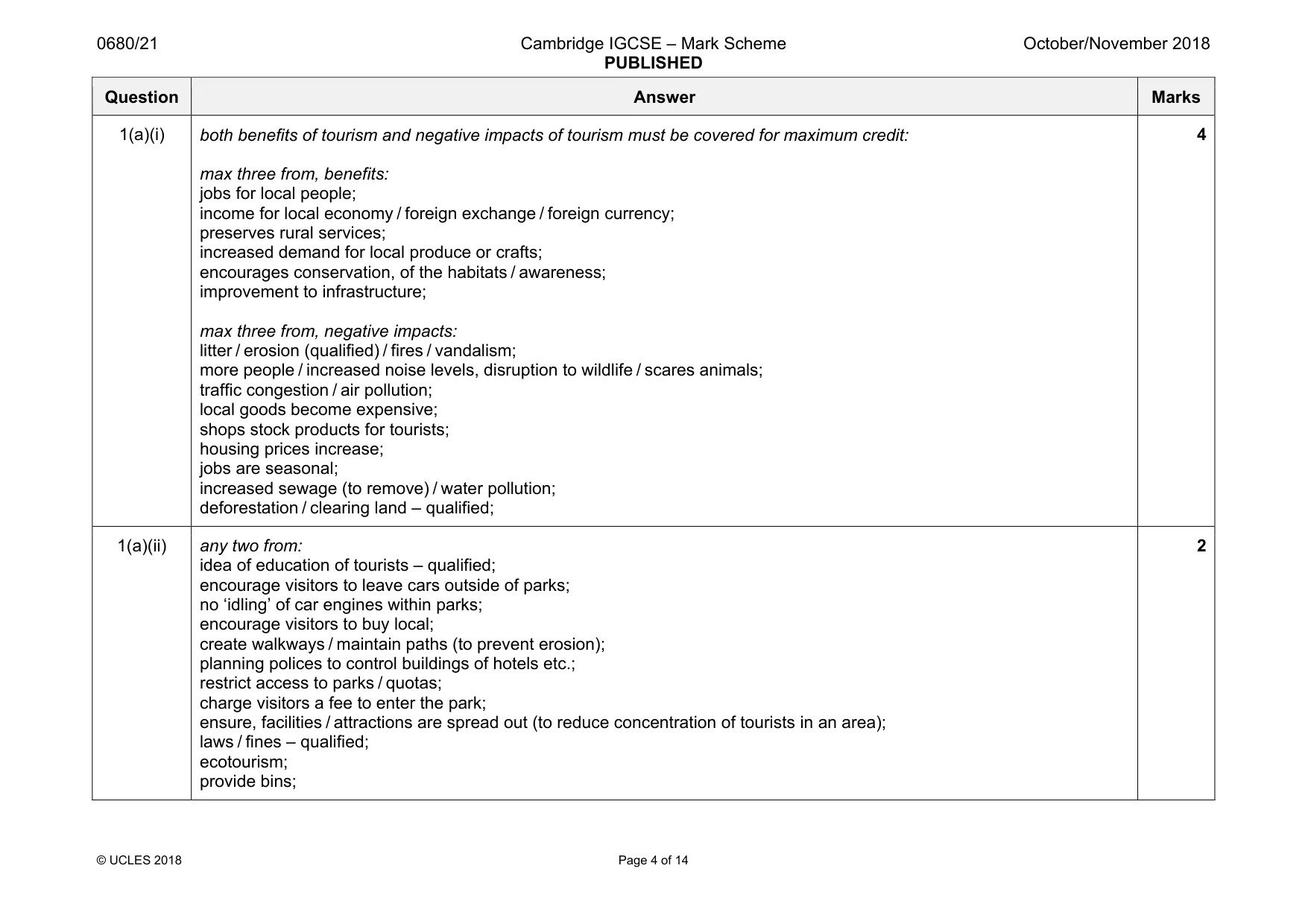
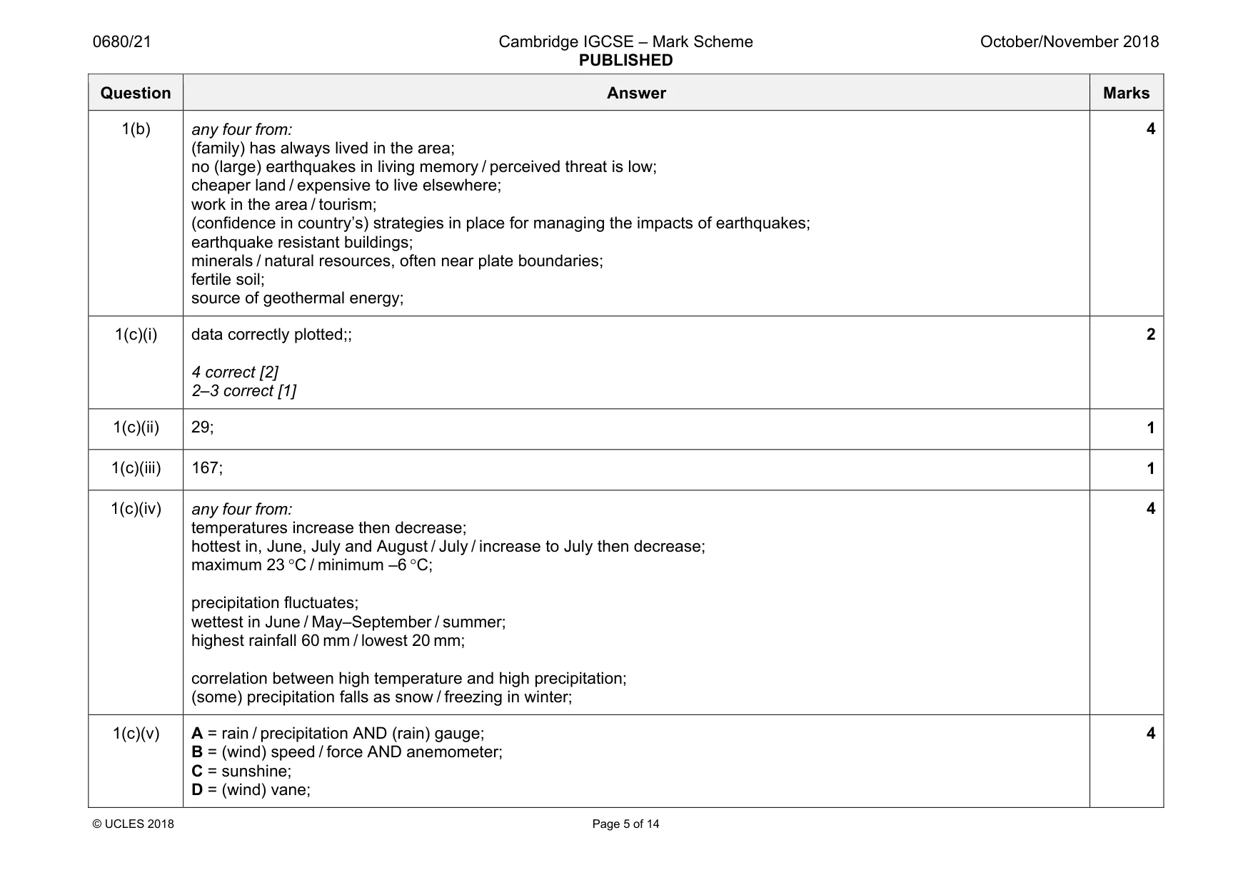
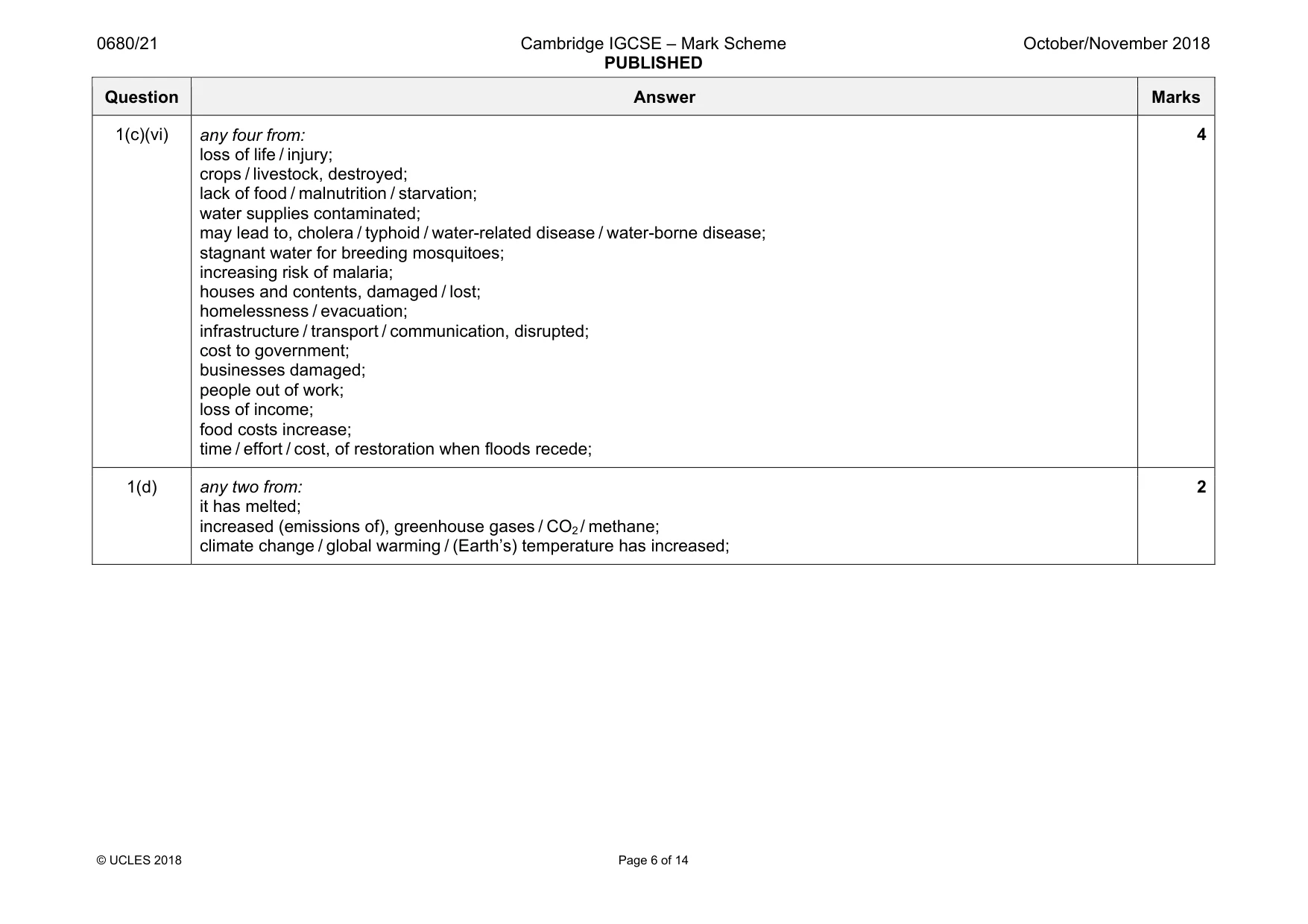
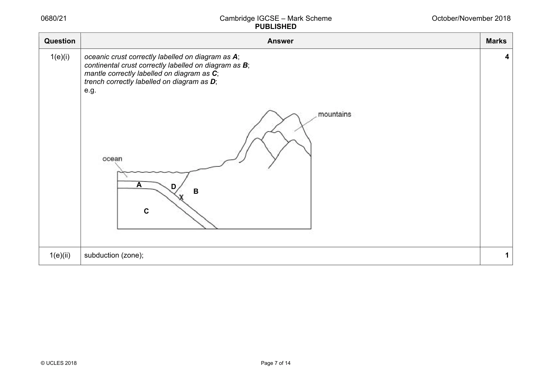
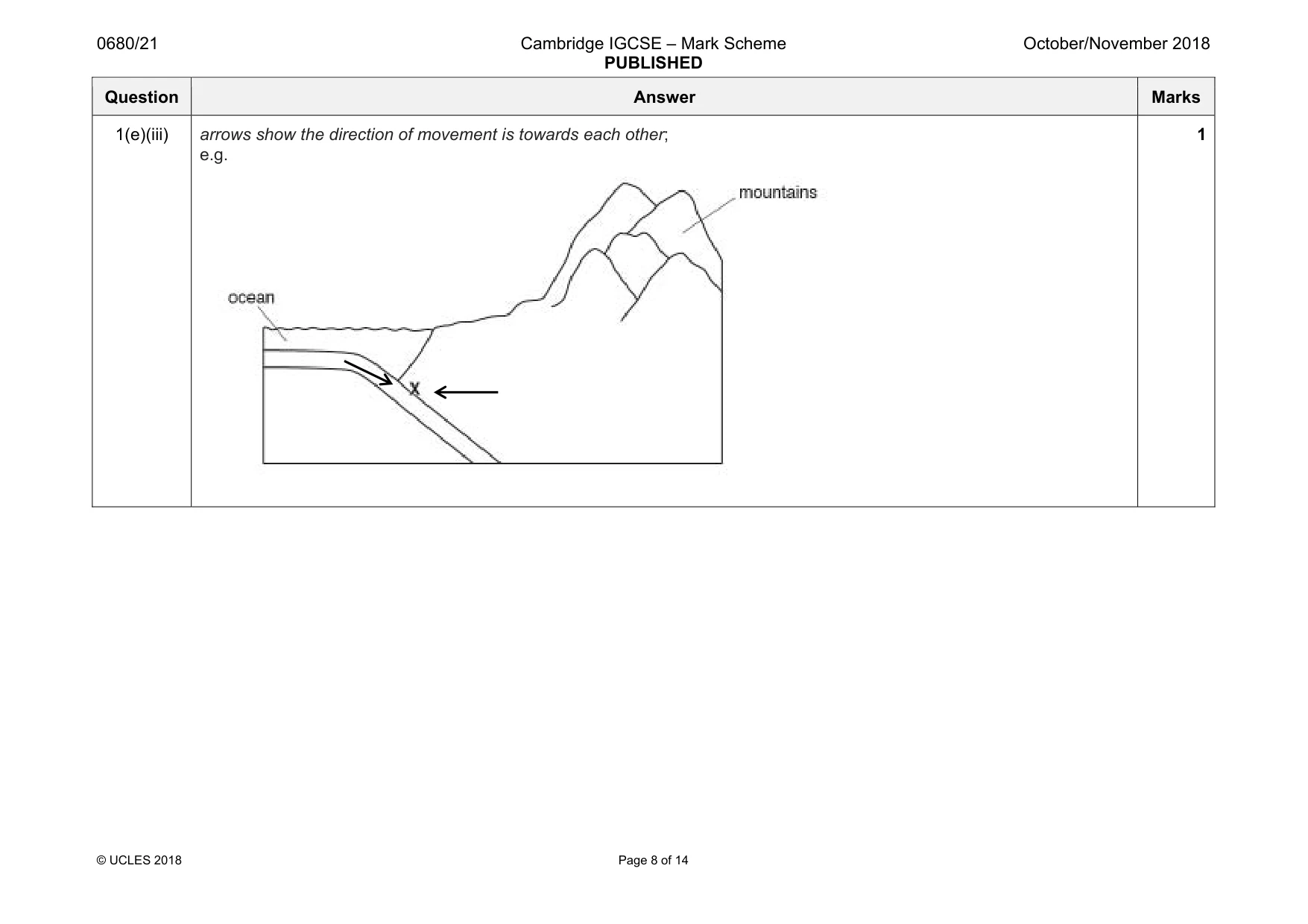
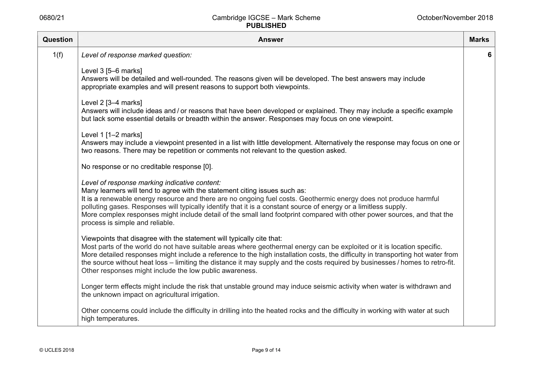
Mark scheme: 1(a)(i) both benefits of tourism and negative impacts of tourism must be covered for maximum credit: max three from, benefits: jobs for local people; income for local economy / foreign exchange / foreign currency; preserves rural services; increased demand for local produce or crafts; encourages conservation, of the habitats / awareness; improvement to infrastructure; max three from, negative impacts: litter / erosion (qualified) / fires / vandalism; more people / increased noise levels, disruption to wildlife / scares animals; traffic congestion / air pollution; local goods become expensive; shops stock products for tourists; housing prices increase; jobs are seasonal; increased sewage (to remove) / water pollution; deforestation / clearing land – qualified; 4 1(a)(ii) any two from: idea of education of tourists – qualified; encourage visitors to leave cars outside of parks; no ‘idling’ of car engines within parks; encourage visitors to buy local; create walkways / maintain paths (to prevent erosion); planning polices to control buildings of hotels etc.; restrict access to parks / quotas; charge visitors a fee to enter the park; ensure, facilities / attractions are spread out (to reduce concentration of tourists in an area); laws / fines – qualified; ecotourism; provide bins; 2 Question Answer Marks 1(b) any four from: (family) has always lived in the area; no (large) earthquakes in living memory / perceived threat is low; cheaper land / expensive to live elsewhere; work in the area / tourism; (confidence in country’s) strategies in place for managing the impacts of earthquakes; earthquake resistant buildings; minerals / natural resources, often near plate boundaries; fertile soil; source of geothermal energy; 4 1(c)(i) data correctly plotted;; 4 correct [2] 2–3 correct [1] 2 1(c)(ii) 29; 1 1(c)(iii) 167; 1 1(c)(iv) any four from: temperatures increase then decrease; hottest in, June, July and August / July / increase to July then decrease; maximum 23 °C / minimum –6 °C; precipitation fluctuates; wettest in June / May–September / summer; highest rainfall 60 mm / lowest 20 mm; correlation between high temperature and high precipitation; (some) precipitation falls as snow / freezing in winter; 4 1(c)(v) A = rain / precipitation AND (rain) gauge; B = (wind) speed / force AND anemometer; C = sunshine; D = (wind) vane; 4 Question Answer Marks 1(c)(vi) any four from: loss of life / injury; crops / livestock, destroyed; lack of food / malnutrition / starvation; water supplies contaminated; may lead to, cholera / typhoid / water-related disease / water-borne disease; stagnant water for breeding mosquitoes; increasing risk of malaria; houses and contents, damaged / lost; homelessness / evacuation; infrastructure / transport / communication, disrupted; cost to government; businesses damaged; people out of work; loss of income; food costs increase; time / effort / cost, of restoration when floods recede; 4 1(d) any two from: it has melted; increased (emissions of), greenhouse gases / CO2 / methane; climate change / global warming / (Earth’s) temperature has increased; 2 Question Answer Marks 1(e)(i) oceanic crust correctly labelled on diagram as A; continental crust correctly labelled on diagram as B; mantle correctly labelled on diagram as C; trench correctly labelled on diagram as D; e.g. 4 1(e)(ii) subduction (zone); 1 A D B C Question Answer Marks 1(e)(iii) arrows show the direction of movement is towards each other; e.g. 1 Question Answer Marks 1(f) Level of response marked question: Level 3 [5–6 marks] Answers will be detailed and well-rounded. The reasons given will be developed. The best answers may include appropriate examples and will present reasons to support both viewpoints. Level 2 [3–4 marks] Answers will include ideas and / or reasons that have been developed or explained. They may include a specific example but lack some essential details or breadth within the answer. Responses may focus on one viewpoint. Level 1 [1–2 marks] Answers may include a viewpoint presented in a list with little development. Alternatively the response may focus on one or two reasons. There may be repetition or comments not relevant to the question asked. No response or no creditable response [0]. Level of response marking indicative content: Many learners will tend to agree with the statement citing issues such as: It is a renewable energy resource and there are no ongoing fuel costs. Geothermic energy does not produce harmful polluting gases. Responses will typically identify that it is a constant source of energy or a limitless supply. More complex responses might include detail of the small land footprint compared with other power sources, and that the process is simple and reliable. Viewpoints that disagree with the statement will typically cite that: Most parts of the world do not have suitable areas where geothermal energy can be exploited or it is location specific. More detailed responses might include a reference to the high installation costs, the difficulty in transporting hot water from the source without heat loss – limiting the distance it may supply and the costs required by businesses / homes to retro-fit. Other responses might include the low public awareness. Longer term effects might include the risk that unstable ground may induce seismic activity when water is withdrawn and the unknown impact on agricultural irrigation. Other concerns could include the difficulty in drilling into the heated rocks and the difficulty in working with water at such high temperatures. 6
Q2 · The fact sheet contains information about oil sand
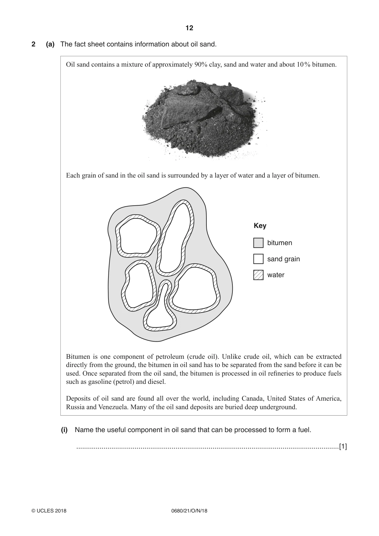
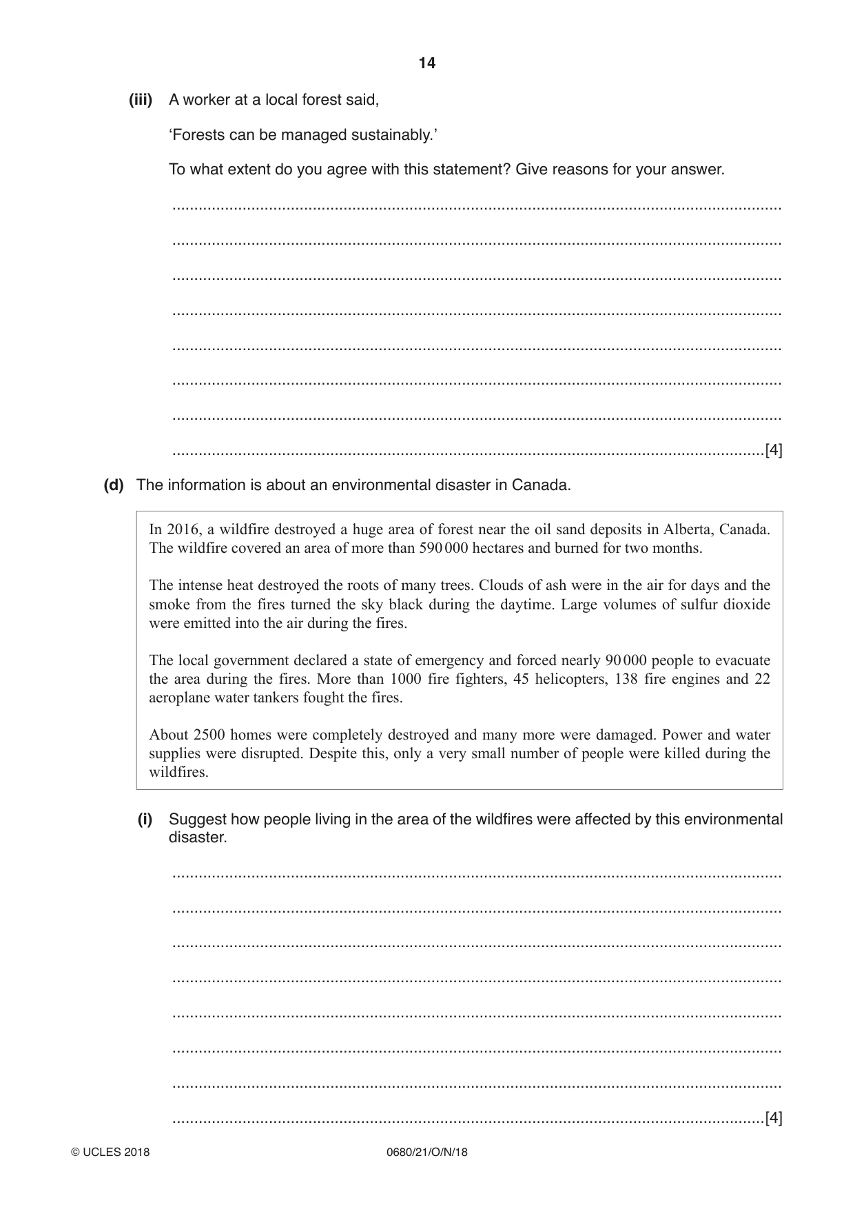
2 (a) The fact sheet contains information about oil sand. Oil sand contains a mixture of approximately 90% clay, sand and water and about 10 % bitumen. Each grain of sand in the oil sand is surrounded by a layer of water and a layer of bitumen. Key bitumen sand grain water Bitumen is one component of petroleum (crude oil). Unlike crude oil, which can be extracted directly from the ground, the bitumen in oil sand has to be separated from the sand before it can be used. Once separated from the oil sand, the bitumen is processed in oil refineries to produce fuels such as gasoline (petrol) and diesel. Deposits of oil sand are found all over the world, including Canada, United States of America, Russia and Venezuela. Many of the oil sand deposits are buried deep underground. (i) Name the useful component in oil sand that can be processed to form a fuel. .......................................................................................................................................[1] (ii) Suggest why extracting the useful component from oil sand is not economically viable. ........................................................................................................................................... ........................................................................................................................................... ........................................................................................................................................... .......................................................................................................................................[2] (b) Crude oil is a fossil fuel. Describe the formation of crude oil. ................................................................................................................................................... ................................................................................................................................................... ................................................................................................................................................... ................................................................................................................................................... ................................................................................................................................................... ...............................................................................................................................................[3] (c) The oil sand deposits in Canada are covered by forest. The forest must be cleared before the oil sand can be mined. (i) Describe the negative impacts of deforestation on an area of land. ........................................................................................................................................... ........................................................................................................................................... ........................................................................................................................................... ........................................................................................................................................... ........................................................................................................................................... .......................................................................................................................................[3] (ii) The wood from forests is used for timber. State one way timber can be used more efficiently so that forests do not need to be cut down to provide the timber. .......................................................................................................................................[1] (iii) A worker at a local forest said, ‘Forests can be managed sustainably.’ To what extent do you agree with this statement? Give reasons for your answer. ........................................................................................................................................... ........................................................................................................................................... ........................................................................................................................................... ........................................................................................................................................... ........................................................................................................................................... ........................................................................................................................................... ........................................................................................................................................... .......................................................................................................................................[4] (d) The information is about an environmental disaster in Canada. In 2016, a wildfire destroyed a huge area of forest near the oil sand deposits in Alberta, Canada. The wildfire covered an area of more than 590 000 hectares and burned for two months. The intense heat destroyed the roots of many trees. Clouds of ash were in the air for days and the smoke from the fires turned the sky black during the daytime. Large volumes of sulfur dioxide were emitted into the air during the fires. The local government declared a state of emergency and forced nearly 90 000 people to evacuate the area during the fires. More than 1000 fire fighters, 45 helicopters, 138 fire engines and 22 aeroplane water tankers fought the fires. About 2500 homes were completely destroyed and many more were damaged. Power and water supplies were disrupted. Despite this, only a very small number of people were killed during the wildfires. (i) Suggest how people living in the area of the wildfires were affected by this environmental disaster. ........................................................................................................................................... ........................................................................................................................................... ........................................................................................................................................... ........................................................................................................................................... ........................................................................................................................................... ........................................................................................................................................... ........................................................................................................................................... .......................................................................................................................................[4]
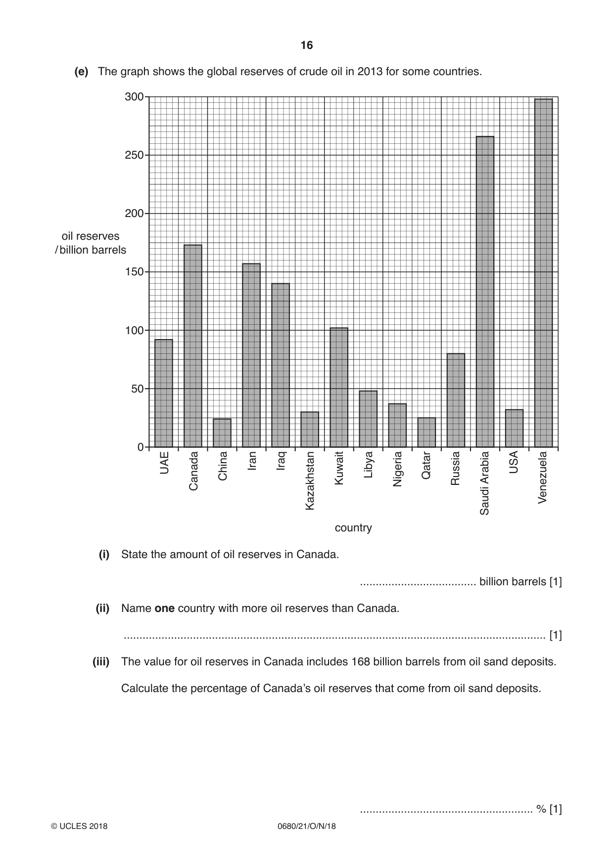
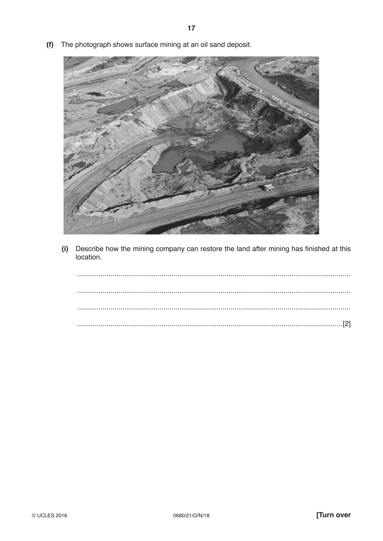
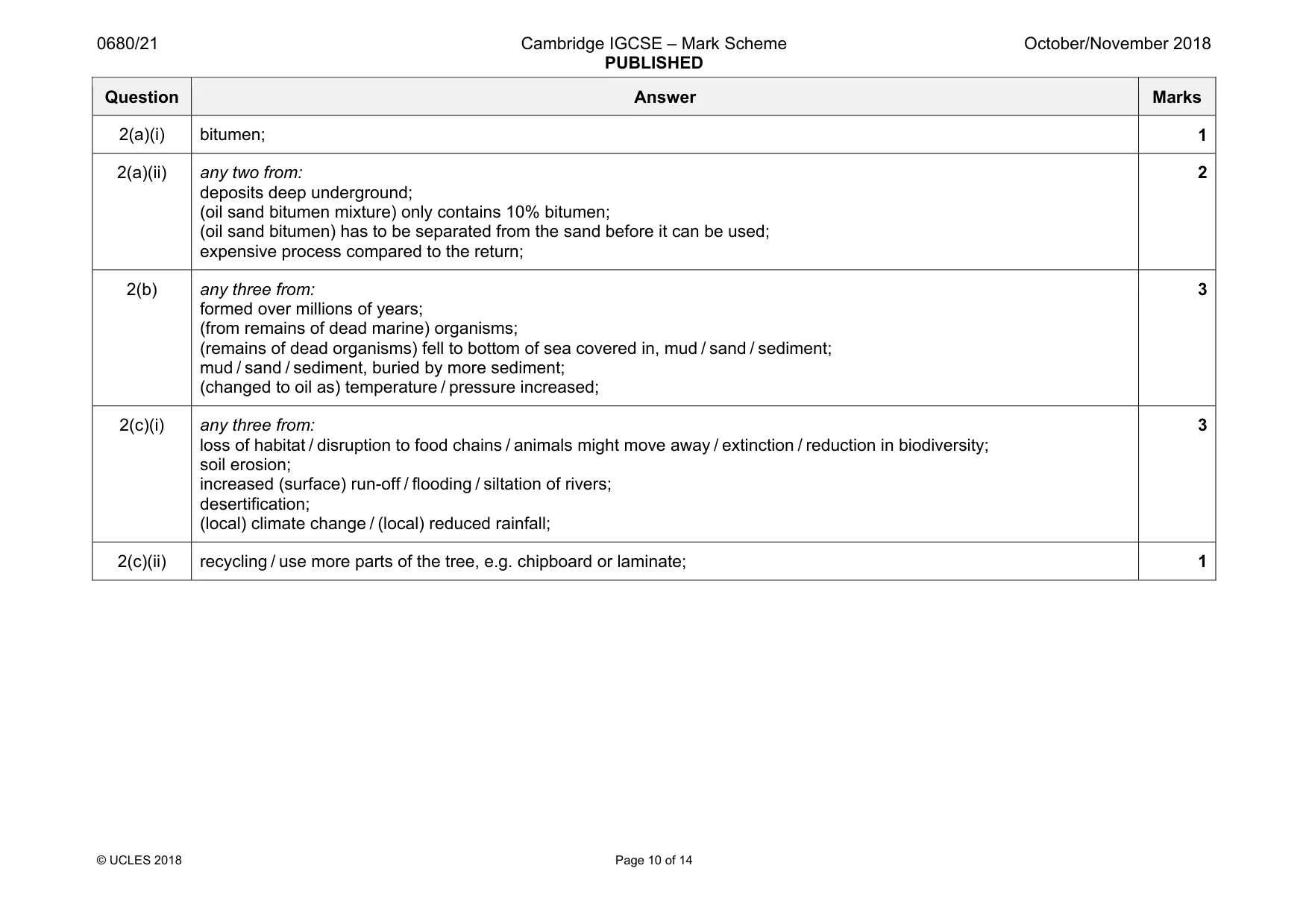
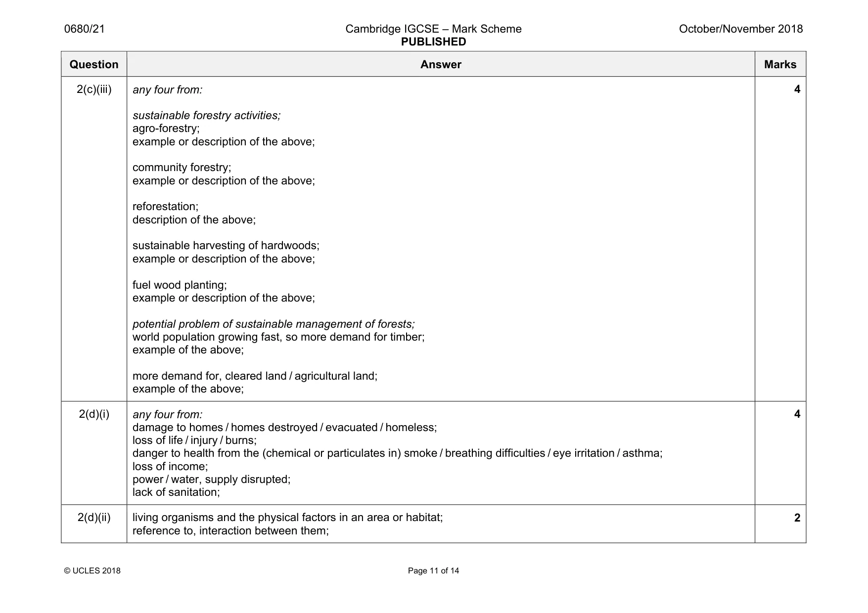
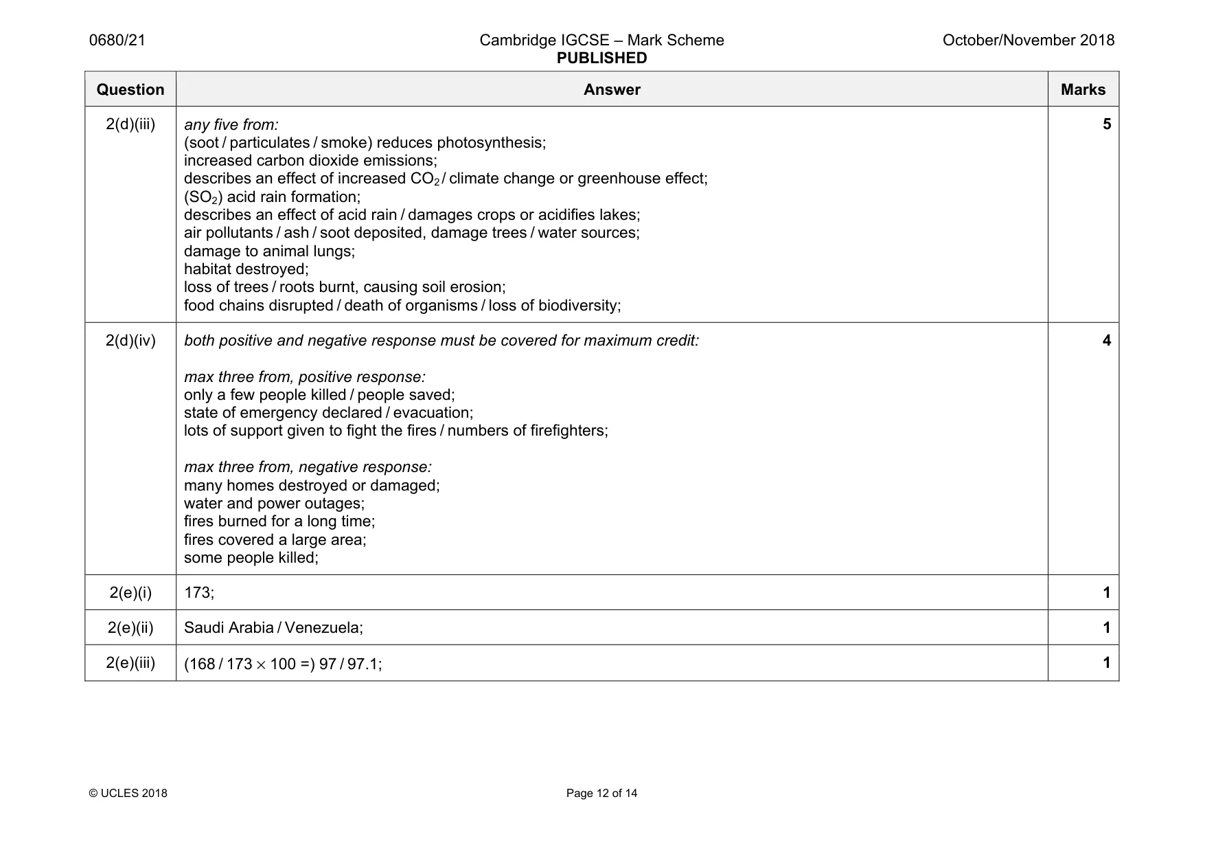
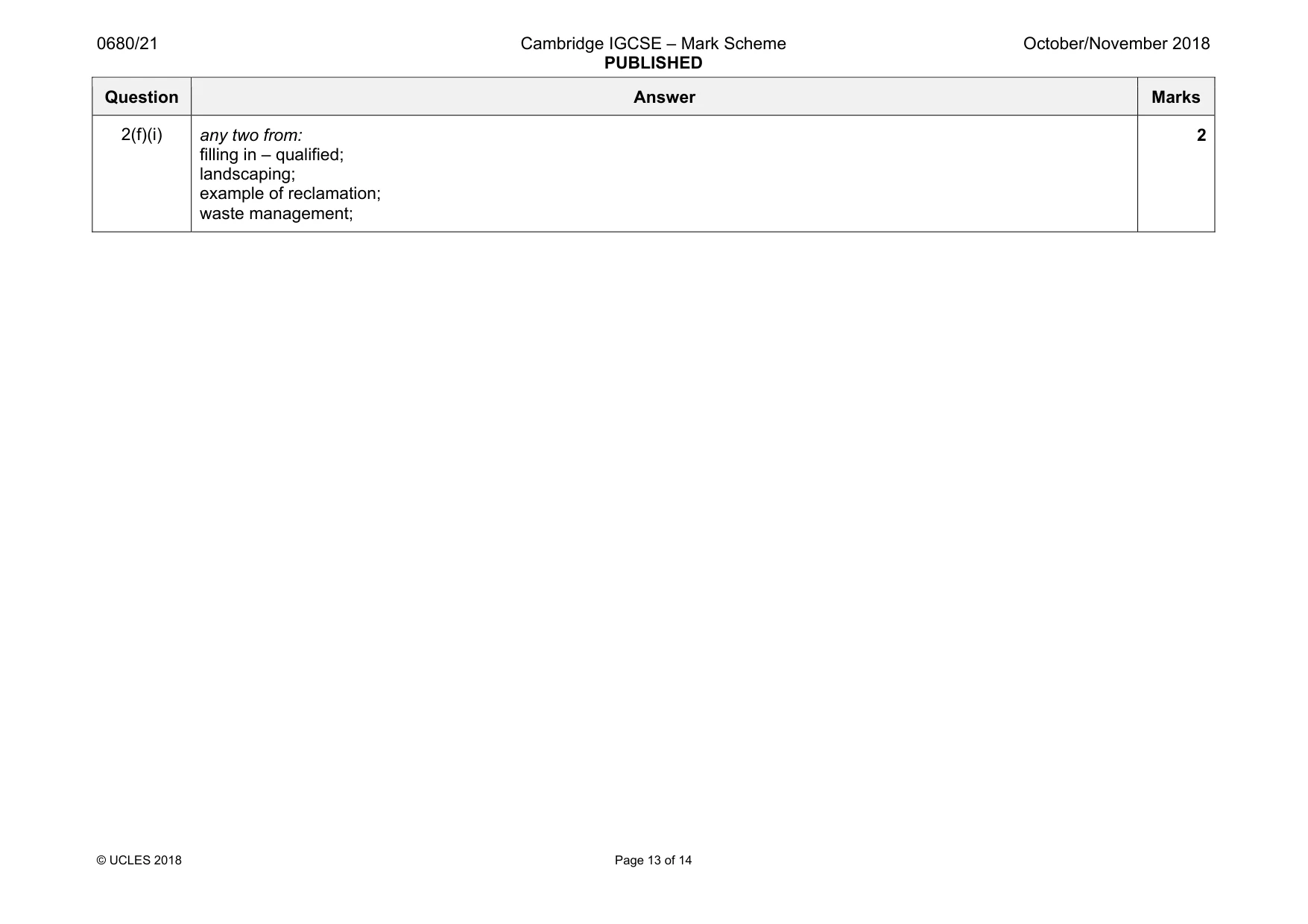
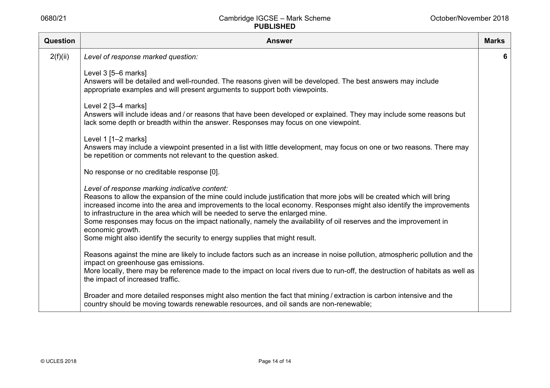
Mark scheme: 2(a)(i) bitumen; 1 2(a)(ii) any two from: deposits deep underground; (oil sand bitumen mixture) only contains 10% bitumen; (oil sand bitumen) has to be separated from the sand before it can be used; expensive process compared to the return; 2 2(b) any three from: formed over millions of years; (from remains of dead marine) organisms; (remains of dead organisms) fell to bottom of sea covered in, mud / sand / sediment; mud / sand / sediment, buried by more sediment; (changed to oil as) temperature / pressure increased; 3 2(c)(i) any three from: loss of habitat / disruption to food chains / animals might move away / extinction / reduction in biodiversity; soil erosion; increased (surface) run-off / flooding / siltation of rivers; desertification; (local) climate change / (local) reduced rainfall; 3 2(c)(ii) recycling / use more parts of the tree, e.g. chipboard or laminate; 1 Question Answer Marks 2(c)(iii) any four from: sustainable forestry activities; agro-forestry; example or description of the above; community forestry; example or description of the above; reforestation; description of the above; sustainable harvesting of hardwoods; example or description of the above; fuel wood planting; example or description of the above; potential problem of sustainable management of forests; world population growing fast, so more demand for timber; example of the above; more demand for, cleared land / agricultural land; example of the above; 4 2(d)(i) any four from: damage to homes / homes destroyed / evacuated / homeless; loss of life / injury / burns; danger to health from the (chemical or particulates in) smoke / breathing difficulties / eye irritation / asthma; loss of income; power / water, supply disrupted; lack of sanitation; 4 2(d)(ii) living organisms and the physical factors in an area or habitat; reference to, interaction between them; 2 Question Answer Marks 2(d)(iii) any five from: (soot / particulates / smoke) reduces photosynthesis; increased carbon dioxide emissions; describes an effect of increased CO2 / climate change or greenhouse effect; (SO2) acid rain formation; describes an effect of acid rain / damages crops or acidifies lakes; air pollutants / ash / soot deposited, damage trees / water sources; damage to animal lungs; habitat destroyed; loss of trees / roots burnt, causing soil erosion; food chains disrupted / death of organisms / loss of biodiversity; 5 2(d)(iv) both positive and negative response must be covered for maximum credit: max three from, positive response: only a few people killed / people saved; state of emergency declared / evacuation; lots of support given to fight the fires / numbers of firefighters; max three from, negative response: many homes destroyed or damaged; water and power outages; fires burned for a long time; fires covered a large area; some people killed; 4 2(e)(i) 173; 1 2(e)(ii) Saudi Arabia / Venezuela; 1 2(e)(iii) (168 / 173 × 100 =) 97 / 97.1; 1 Question Answer Marks 2(f)(i) any two from: filling in – qualified; landscaping; example of reclamation; waste management; 2 Question Answer Marks 2(f)(ii) Level of response marked question: Level 3 [5–6 marks] Answers will be detailed and well-rounded. The reasons given will be developed. The best answers may include appropriate examples and will present arguments to support both viewpoints. Level 2 [3–4 marks] Answers will include ideas and / or reasons that have been developed or explained. They may include some reasons but lack some depth or breadth within the answer. Responses may focus on one viewpoint. Level 1 [1–2 marks] Answers may include a viewpoint presented in a list with little development, may focus on one or two reasons. There may be repetition or comments not relevant to the question asked. No response or no creditable response [0]. Level of response marking indicative content: Reasons to allow the expansion of the mine could include justification that more jobs will be created which will bring increased income into the area and improvements to the local economy. Responses might also identify the improvements to infrastructure in the area which will be needed to serve the enlarged mine. Some responses may focus on the impact nationally, namely the availability of oil reserves and the improvement in economic growth. Some might also identify the security to energy supplies that might result. Reasons against the mine are likely to include factors such as an increase in noise pollution, atmospheric pollution and the impact on greenhouse gas emissions. More locally, there may be reference made to the impact on local rivers due to run-off, the destruction of habitats as well as the impact of increased traffic. Broader and more detailed responses might also mention the fact that mining / extraction is carbon intensive and the country should be moving towards renewable resources, and oil sands are non-renewable; 6
What was in this paper
The subtopics covered by these 2 questions, and how many questions each got. Open one in a new tab to see every Cambridge question on it.
What you needed in this session
Cambridge’s own grade thresholds for 2018 Oct/Nov, Paper 2 · Variant 1. A higher threshold means an easier paper — the bar moves with how the cohort did.