Cambridge IGCSE Environmental Management 0680 — 2010 Oct/Nov Paper 2 · Variant 3
0680/23/O/N/10 · 80 marks · ≈90 min
The question paper and its mark scheme, free to read here and free to download. This is Cambridge’s own paper, exactly as it was sat.
Question paper20 pages


Mark scheme7 pages
Answers below. Sit the paper first if you are practising.
Paper as text
Question paper, page 1
This document consists of 17 printed pages and 3 blank pages. DC (AC/SW) 33482/1 © UCLES 2010 [Turn over UNIVERSITY OF CAMBRIDGE INTERNATIONAL EXAMINATIONS International General Certificate of Secondary Education * 8 0 1 8 2 4 3 5 1 8 * ENVIRONMENTAL MANAGEMENT 0680/23 Paper 2 October/November 2010 1 hour 45 minutes Candidates answer on the Question Paper. Additional Materials: Ruler READ THESE INSTRUCTIONS FIRST Write your Centre number, candidate number and name on all the work you hand in. Write in dark blue or black pen. You may use a soft pencil for any diagrams, graphs or rough working. Do not use staples, paper clips, highlighters, glue or correction fluid. DO NOT WRITE IN ANY BARCODES. Answer both questions. At the end of the examination, fasten all your work securely together. The number of marks is given in brackets [ ] at the end of each question or part question. For Examiner’s Use 1 2 Total www.XtremePapers.com
Question paper, page 2
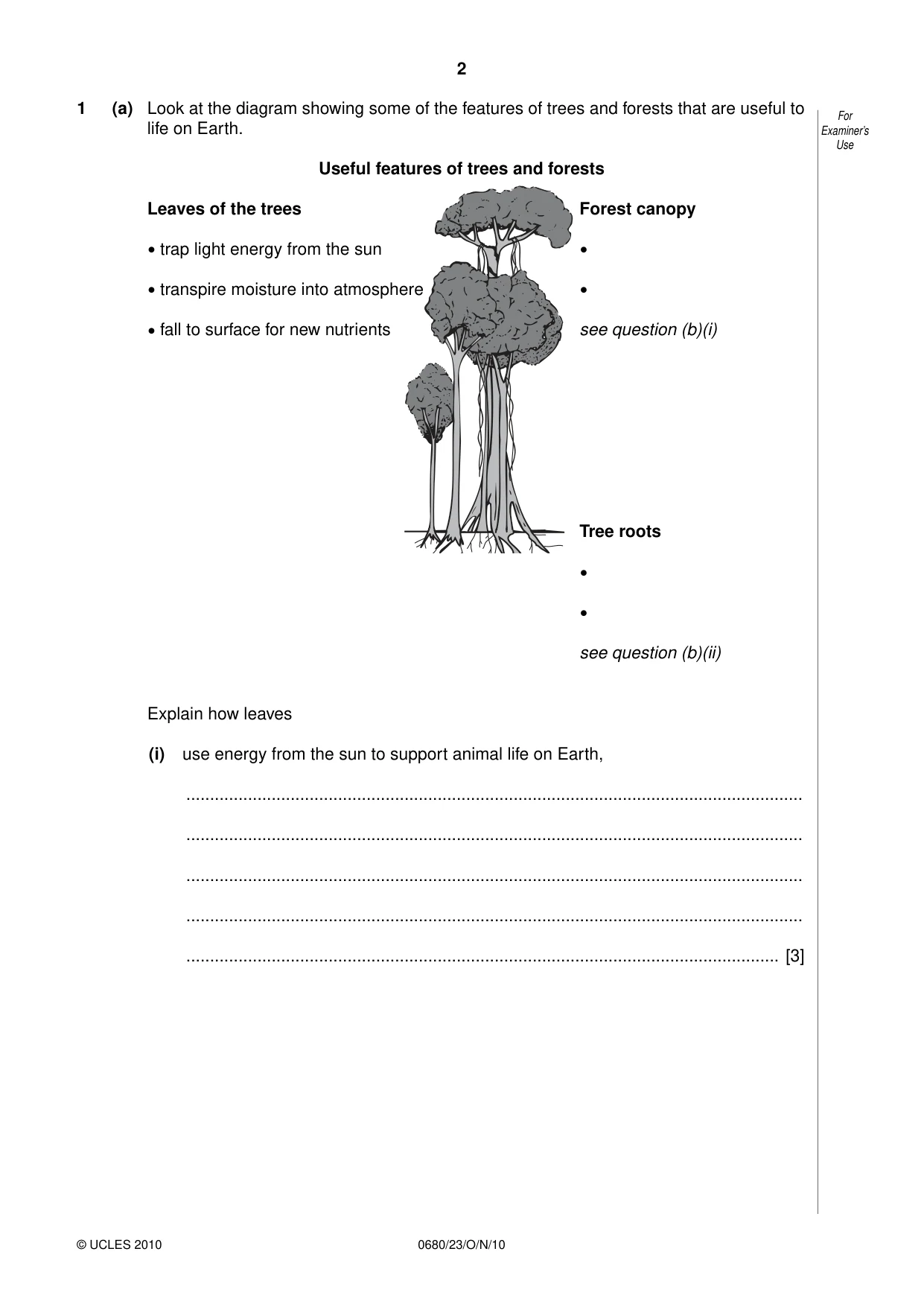
2 © UCLES 2010 0680/23/O/N/10 For Examiner’s Use 1 (a) Look at the diagram showing some of the features of trees and forests that are useful to life on Earth. Useful features of trees and forests Leaves of the trees Forest canopy • trap light energy from the sun • • transpire moisture into atmosphere • • fall to surface for new nutrients see question (b)(i) Tree roots • • see question (b)(ii) Explain how leaves (i) use energy from the sun to support animal life on Earth, … … … … … [3]
Question paper, page 3
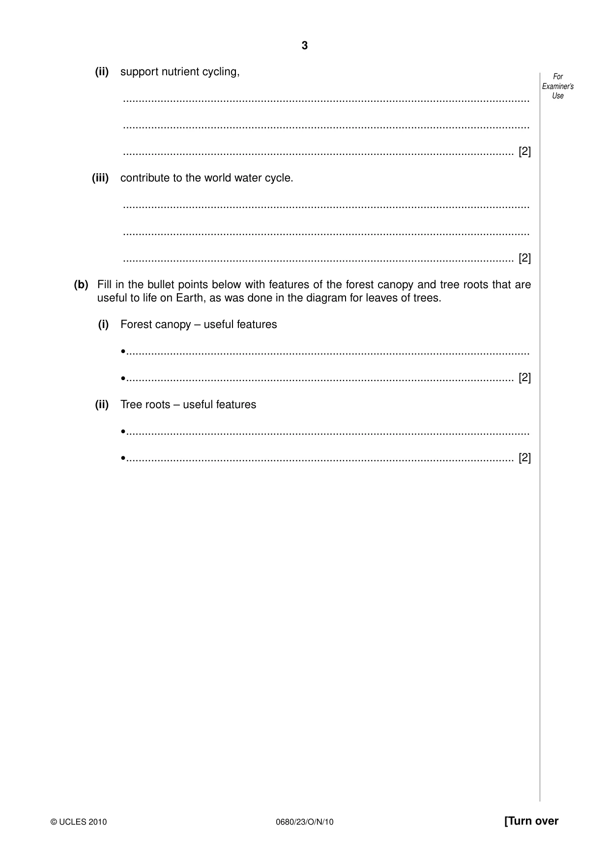
3 © UCLES 2010 [Turn over 0680/23/O/N/10 For Examiner’s Use (ii) support nutrient cycling, … … … [2] (iii) contribute to the world water cycle. … … … [2] (b) Fill in the bullet points below with features of the forest canopy and tree roots that are useful to life on Earth, as was done in the diagram for leaves of trees. (i) Forest canopy – useful features • … • … [2] (ii) Tree roots – useful features • … • … [2]
Question paper, page 4
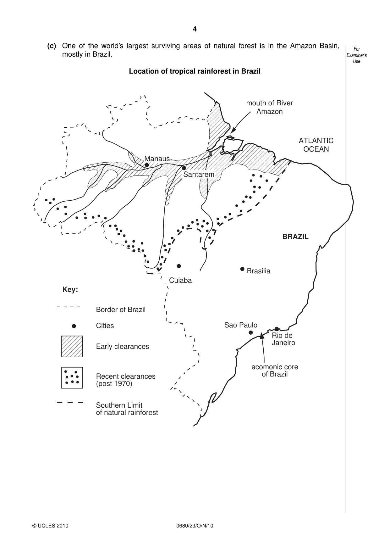
4 © UCLES 2010 0680/23/O/N/10 For Examiner’s Use (c) One of the world’s largest surviving areas of natural forest is in the Amazon Basin, mostly in Brazil. Location of tropical rainforest in Brazil Manaus Santarem mouth of River Amazon ecomonic core of Brazil ATLANTIC OCEAN BRAZIL Brasilia Rio de Janeiro Early clearances Cities Border of Brazil Southern Limit of natural rainforest Key: Recent clearances (post 1970) Sao Paulo Cuiaba
Question paper, page 5
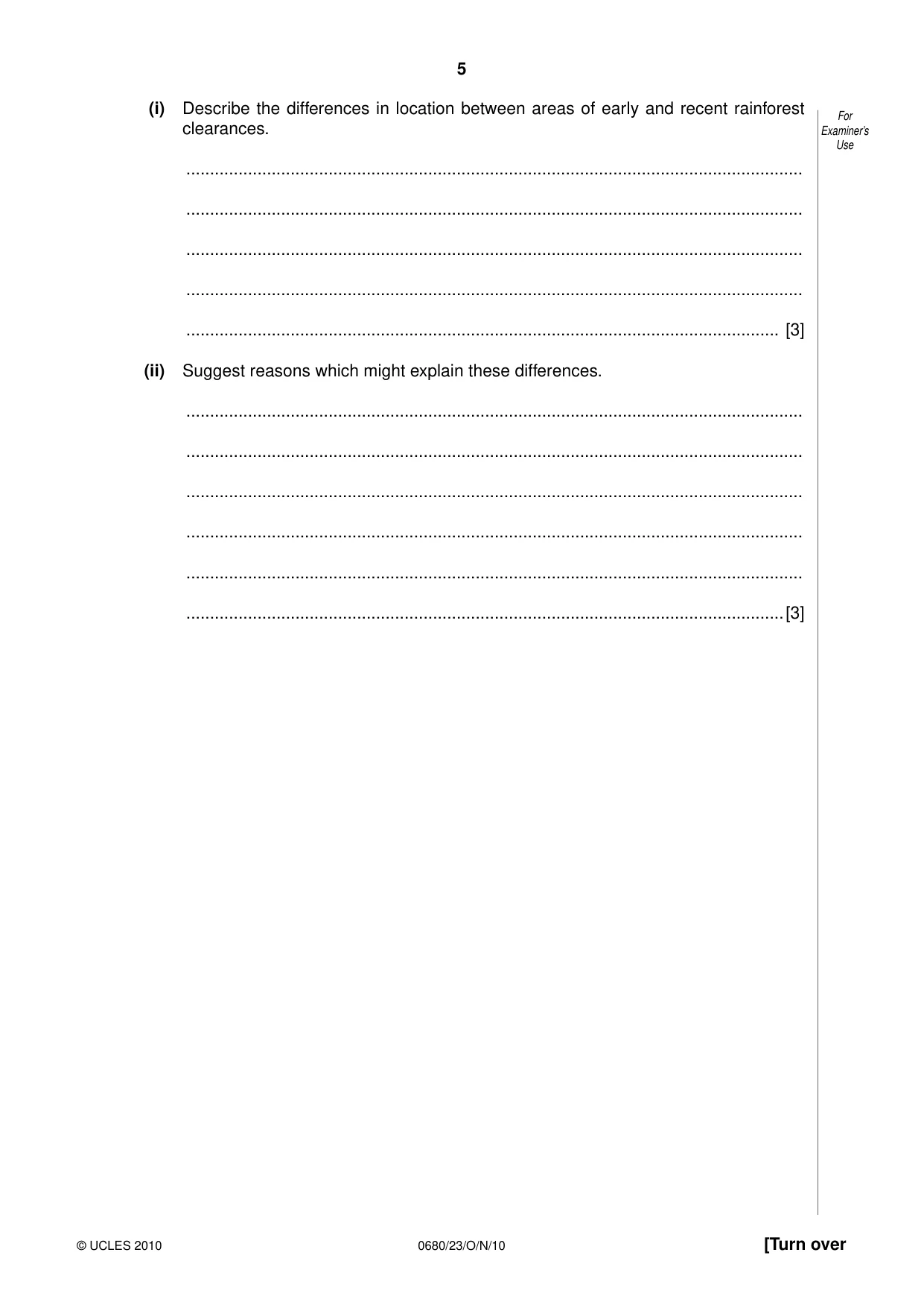
5 © UCLES 2010 [Turn over 0680/23/O/N/10 For Examiner’s Use (i) Describe the differences in location between areas of early and recent rainforest clearances. … … … … … [3] (ii) Suggest reasons which might explain these differences. … … … … … …[3]
Question paper, page 6
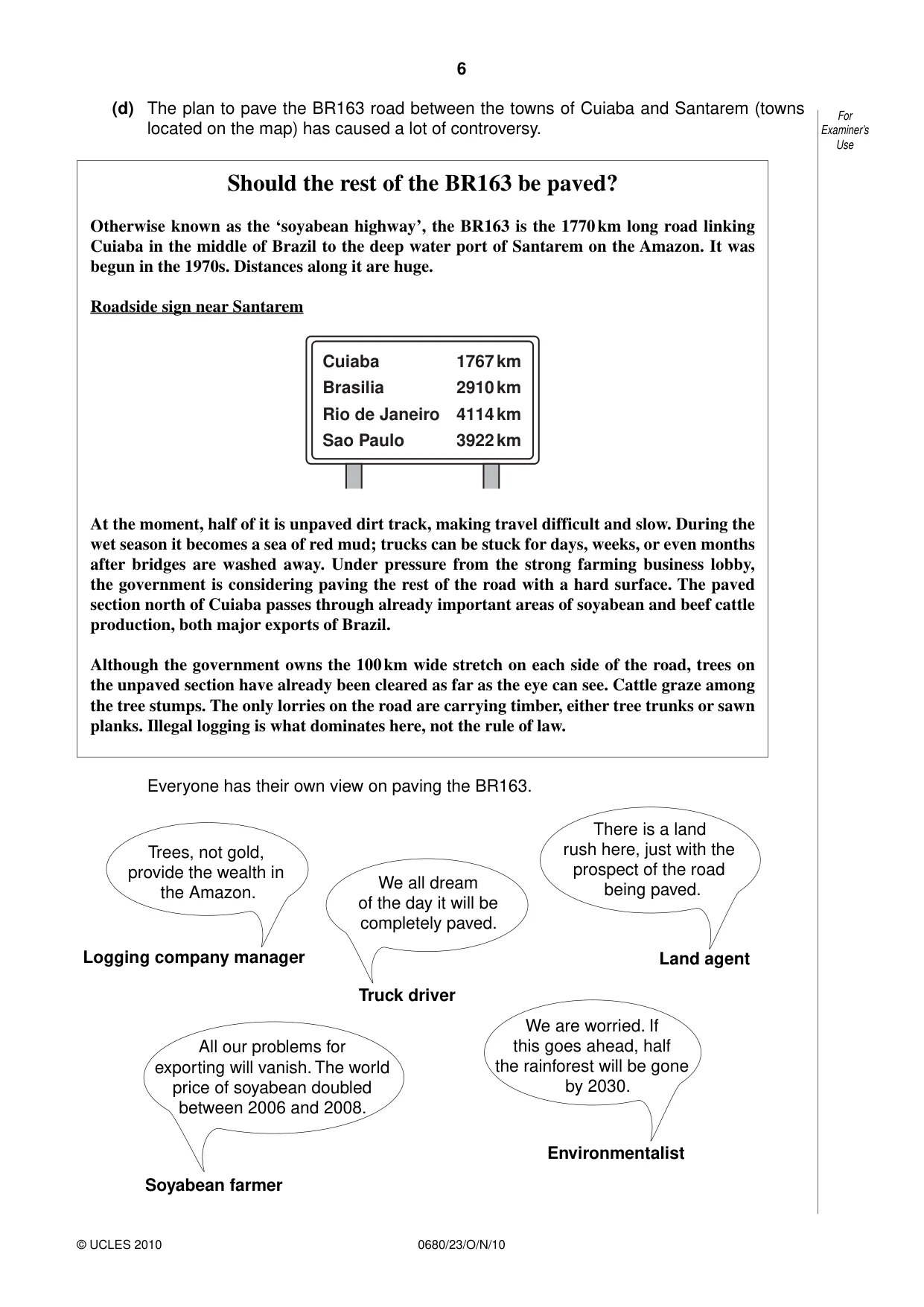
6 © UCLES 2010 0680/23/O/N/10 For Examiner’s Use (d) The plan to pave the BR163 road between the towns of Cuiaba and Santarem (towns located on the map) has caused a lot of controversy. Should the rest of the BR163 be paved? Otherwise known as the ‘soyabean highway’, the BR163 is the 1770 km long road linking Cuiaba in the middle of Brazil to the deep water port of Santarem on the Amazon. It was begun in the 1970s. Distances along it are huge. Roadside sign near Santarem Cuiaba Brasilia Rio de Janeiro Sao Paulo 1767 km 2910 km 4114 km 3922 km At the moment, half of it is unpaved dirt track, making travel difficult and slow. During the wet season it becomes a sea of red mud; trucks can be stuck for days, weeks, or even months after bridges are washed away. Under pressure from the strong farming business lobby, the government is considering paving the rest of the road with a hard surface. The paved section north of Cuiaba passes through already important areas of soyabean and beef cattle production, both major exports of Brazil. Although the government owns the 100 km wide stretch on each side of the road, trees on the unpaved section have already been cleared as far as the eye can see. Cattle graze among the tree stumps. The only lorries on the road are carrying timber, either tree trunks or sawn planks. Illegal logging is what dominates here, not the rule of law. Everyone has their own view on paving the BR163. Trees, not gold, provide the wealth in the Amazon. There is a land rush here, just with the prospect of the road being paved. We are worried. If this goes ahead, half the rainforest will be gone by 2030. All our problems for exporting will vanish. The world price of soyabean doubled between 2006 and 2008. We all dream of the day it will be completely paved. Logging company manager Truck driver Land agent Environmentalist Soyabean farmer
Question paper, page 7
7 © UCLES 2010 [Turn over 0680/23/O/N/10 For Examiner’s Use (i) State the economic advantages of paving the remainder of the BR163 road. … … … … … … [3] (ii) How strong are the economic reasons for paving the road? Explain what you think. … … … … [2] (iii) How far do you agree with the environmentalist that half the Amazon rainforest will be gone by 2030? Answer as fully as you can with the help of the information given. … … … … … … … … [4]
Question paper, page 8
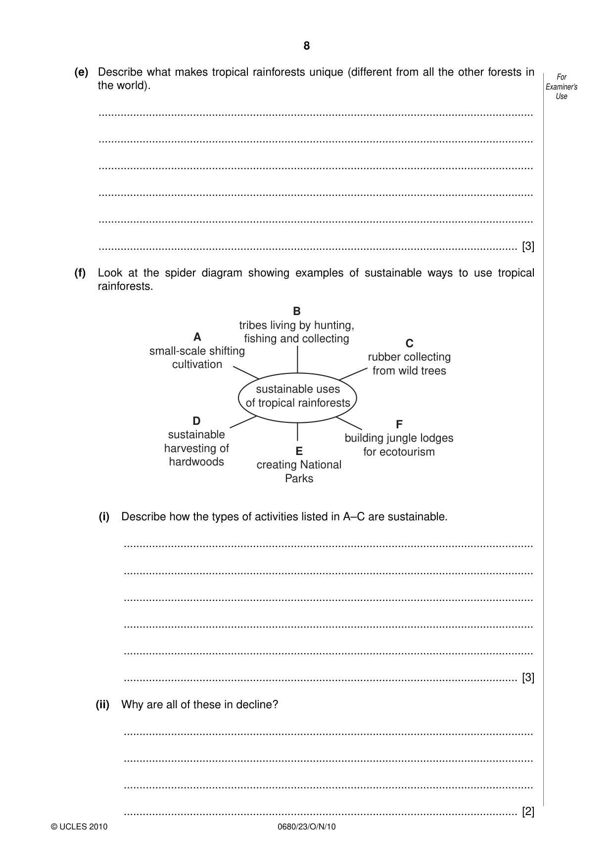
8 © UCLES 2010 0680/23/O/N/10 For Examiner’s Use (e) Describe what makes tropical rainforests unique (different from all the other forests in the world). … … … … … … [3] (f) Look at the spider diagram showing examples of sustainable ways to use tropical rainforests. D sustainable harvesting of hardwoods A small-scale shifting cultivation F building jungle lodges for ecotourism C rubber collecting from wild trees E creating National Parks B tribes living by hunting, fishing and collecting sustainable uses of tropical rainforests (i) Describe how the types of activities listed in A–C are sustainable. … … … … … … [3] (ii) Why are all of these in decline? … … … … [2]
Question paper, page 9
9 © UCLES 2010 [Turn over 0680/23/O/N/10 For Examiner’s Use (iii) State two ways in which sustainable logging of hardwoods is different from the logging taking place along the sides of the BR163 in Brazil. … … … … [2] (iv) What is ecotourism, and can it save the rainforest and its peoples? … … … … … … … … [4] [Total: 40 marks]
Question paper, page 10
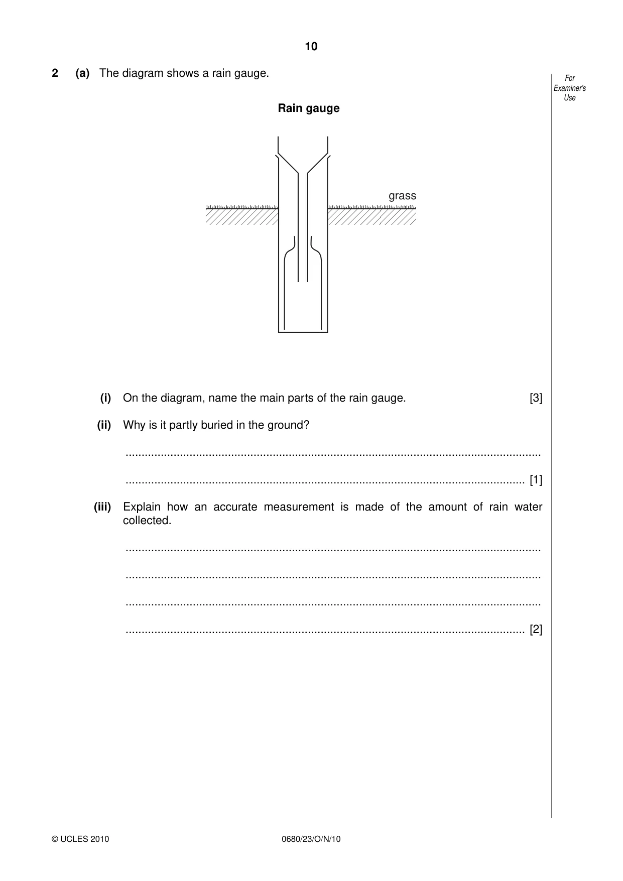
10 © UCLES 2010 0680/23/O/N/10 For Examiner’s Use 2 (a) The diagram shows a rain gauge. Rain gauge grass (i) On the diagram, name the main parts of the rain gauge. [3] (ii) Why is it partly buried in the ground? … … [1] (iii) Explain how an accurate measurement is made of the amount of rain water collected. … … … … [2]
Question paper, page 11
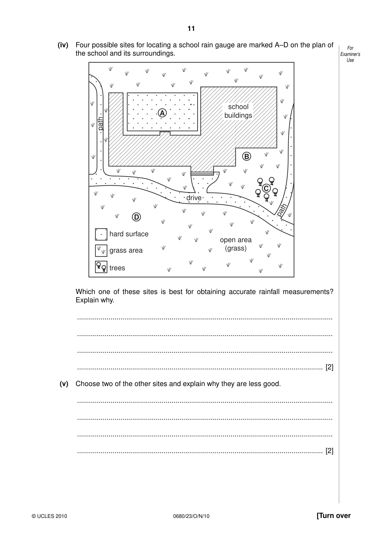
11 © UCLES 2010 [Turn over 0680/23/O/N/10 For Examiner’s Use (iv) Four possible sites for locating a school rain gauge are marked A–D on the plan of the school and its surroundings. school buildings open area (grass) drive path hard surface grass area trees A B C D path Which one of these sites is best for obtaining accurate rainfall measurements? Explain why. … … … … [2] (v) Choose two of the other sites and explain why they are less good. … … … … [2] .
Question paper, page 12
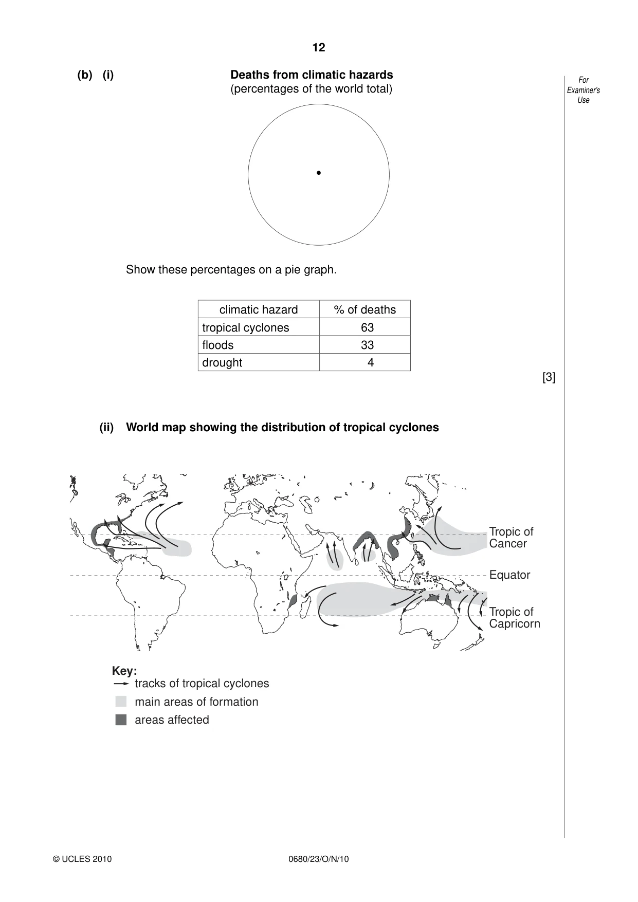
12 © UCLES 2010 0680/23/O/N/10 For Examiner’s Use (b) (i) Deaths from climatic hazards (percentages of the world total) Show these percentages on a pie graph. climatic hazard % of deaths tropical cyclones 63 floods 33 drought 4 [3] (ii) World map showing the distribution of tropical cyclones tracks of tropical cyclones main areas of formation areas affected Tropic of Cancer Equator Tropic of Capricorn Key: •
Question paper, page 13
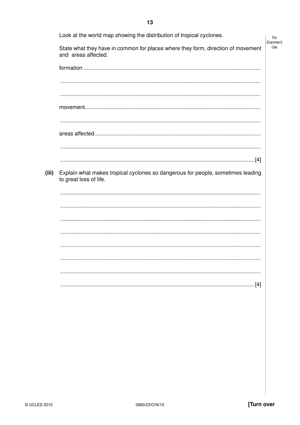
13 © UCLES 2010 [Turn over 0680/23/O/N/10 For Examiner’s Use Look at the world map showing the distribution of tropical cyclones. State what they have in common for places where they form, direction of movement and areas affected. formation … … … movement … … areas affected … … …[4] (iii) Explain what makes tropical cyclones so dangerous for people, sometimes leading to great loss of life. … … … … … … … …[4]
Question paper, page 14
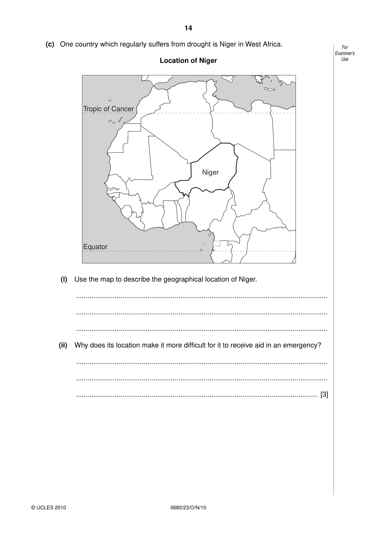
14 © UCLES 2010 0680/23/O/N/10 For Examiner’s Use (c) One country which regularly suffers from drought is Niger in West Africa. Location of Niger Niger Tropic of Cancer Equator (i) Use the map to describe the geographical location of Niger. … … … (ii) Why does its location make it more difficult for it to receive aid in an emergency? … … … [3]
Question paper, page 15
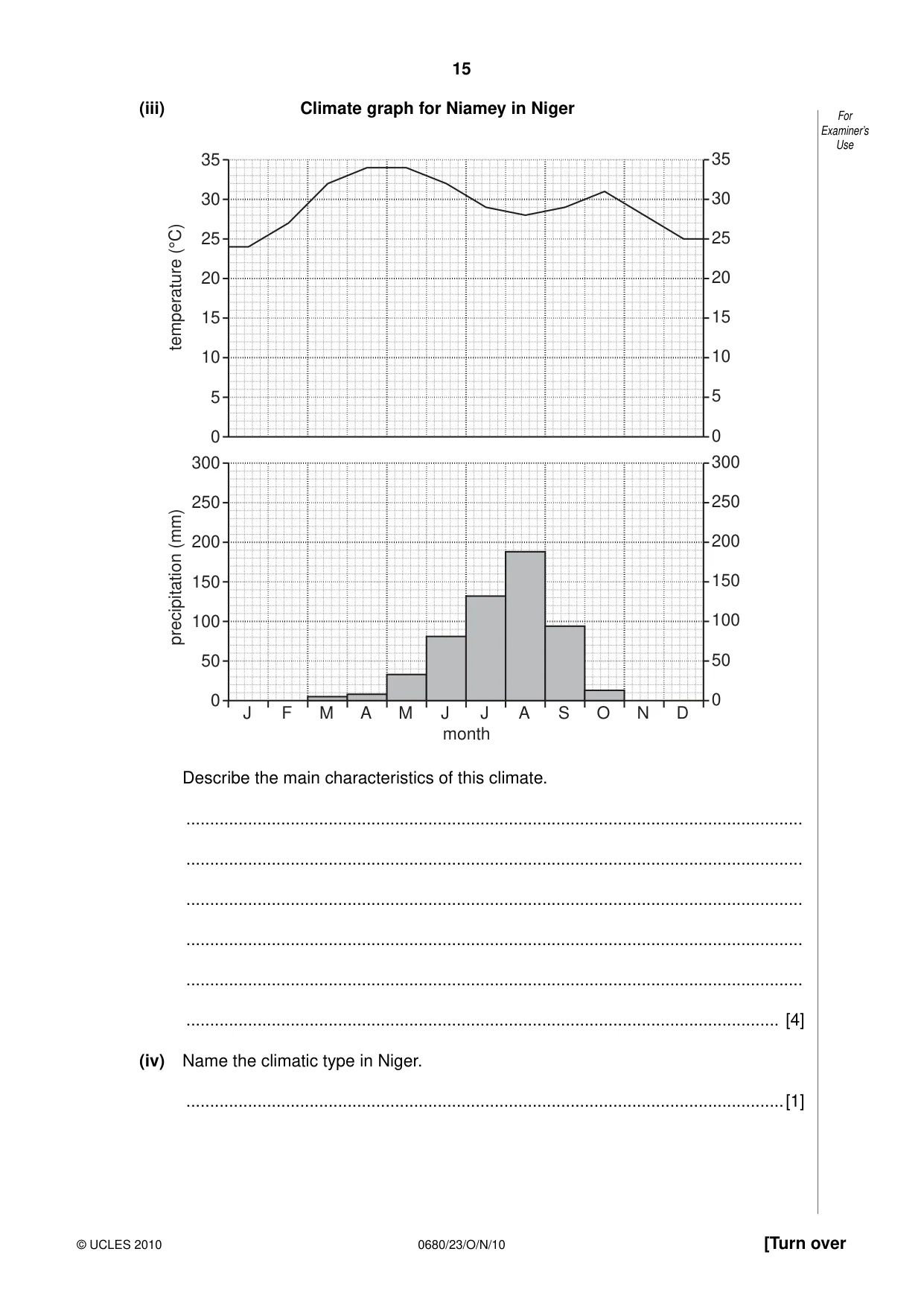
15 © UCLES 2010 [Turn over 0680/23/O/N/10 For Examiner’s Use (iii) Climate graph for Niamey in Niger 0 5 10 15 20 25 30 35 0 5 10 15 20 25 30 35 0 J F M A M J month J A S O N D 50 100 150 precipitation (mm) temperature (°C) 200 250 300 0 50 100 150 200 250 300 Describe the main characteristics of this climate. … … … … … … [4] (iv) Name the climatic type in Niger. …[1]
Question paper, page 16
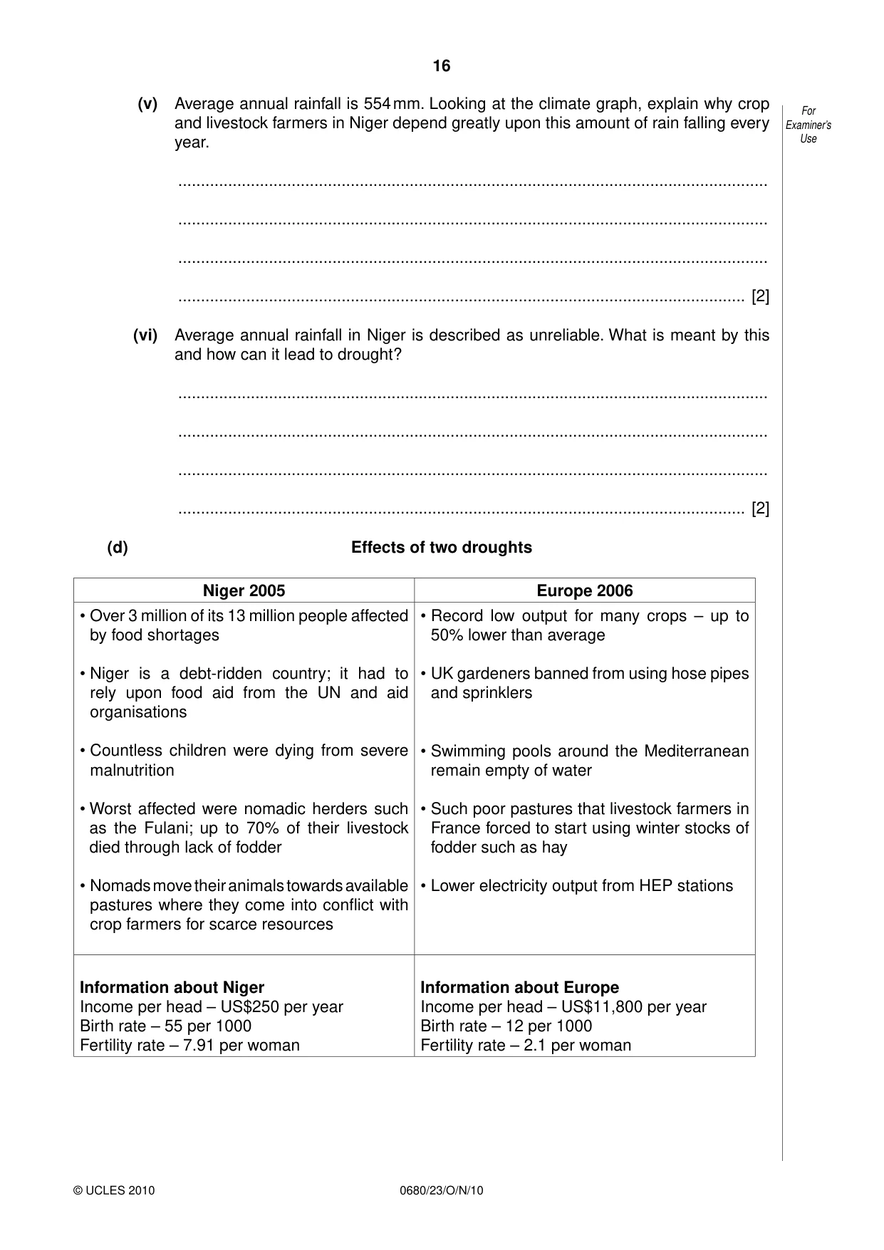
16 © UCLES 2010 0680/23/O/N/10 For Examiner’s Use (v) Average annual rainfall is 554 mm. Looking at the climate graph, explain why crop and livestock farmers in Niger depend greatly upon this amount of rain falling every year. … … … … [2] (vi) Average annual rainfall in Niger is described as unreliable. What is meant by this and how can it lead to drought? … … … … [2] (d) Effects of two droughts Niger 2005 Europe 2006 • Over 3 million of its 13 million people affected by food shortages • Niger is a debt-ridden country; it had to rely upon food aid from the UN and aid organisations • Countless children were dying from severe malnutrition • Worst affected were nomadic herders such as the Fulani; up to 70% of their livestock died through lack of fodder • Nomads move their animals towards available pastures where they come into conflict with crop farmers for scarce resources • Record low output for many crops – up to 50% lower than average • UK gardeners banned from using hose pipes and sprinklers • Swimming pools around the Mediterranean remain empty of water • Such poor pastures that livestock farmers in France forced to start using winter stocks of fodder such as hay • Lower electricity output from HEP stations Information about Niger Income per head – US$250 per year Birth rate – 55 per 1000 Fertility rate – 7.91 per woman Information about Europe Income per head – US$11,800 per year Birth rate – 12 per 1000 Fertility rate – 2.1 per woman
Question paper, page 17
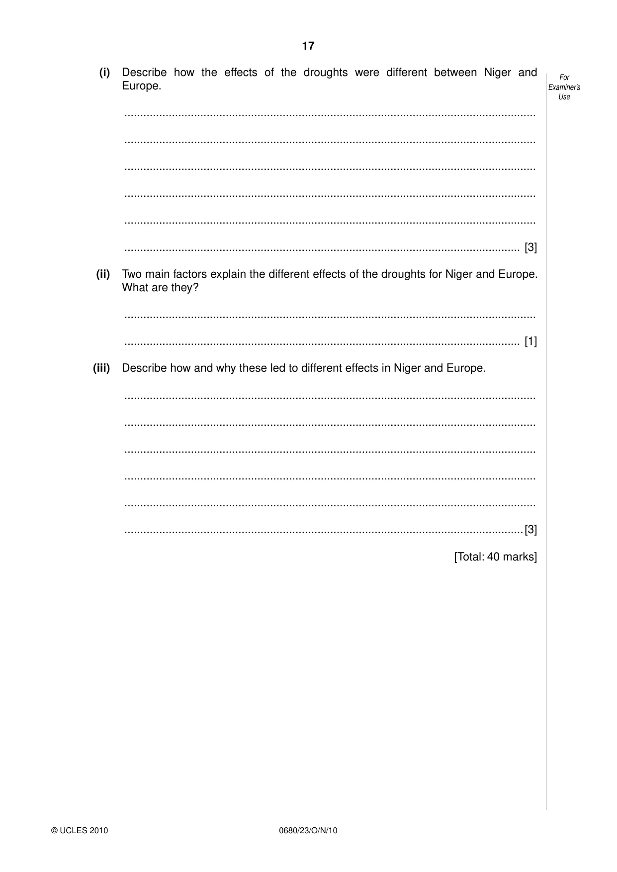
17 © UCLES 2010 For Examiner’s Use 0680/23/O/N/10 (i) Describe how the effects of the droughts were different between Niger and Europe. … … … … … … [3] (ii) Two main factors explain the different effects of the droughts for Niger and Europe. What are they? … … [1] (iii) Describe how and why these led to different effects in Niger and Europe. … … … … … …[3] [Total: 40 marks]
Question paper, page 18
18 © UCLES 2010 0680/23/O/N/10 BLANK PAGE
Question paper, page 19
19 © UCLES 2010 BLANK PAGE 0680/23/O/N/10
Question paper, page 20
20 0680/23/O/N/10 BLANK PAGE © UCLES 2010 Permission to reproduce items where third-party owned material protected by copyright is included has been sought and cleared where possible. Every reasonable effort has been made by the publisher (UCLES) to trace copyright holders, but if any items requiring clearance have unwittingly been included, the publisher will be pleased to make amends at the earliest possible opportunity. University of Cambridge International Examinations is part of the Cambridge Assessment Group. Cambridge Assessment is the brand name of University of Cambridge Local Examinations Syndicate (UCLES), which is itself a department of the University of Cambridge.
Mark scheme, page 1
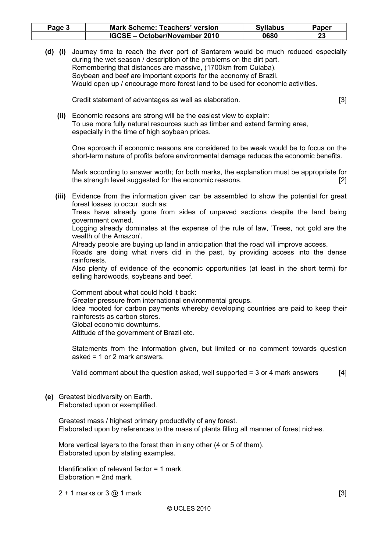
UNIVERSITY OF CAMBRIDGE INTERNATIONAL EXAMINATIONS International General Certificate of Secondary Education MARK SCHEME for the October/November 2010 question paper for the guidance of teachers 0680 ENVIRONMENTAL MANAGEMENT 0680/23 Paper 2, maximum raw mark 80 This mark scheme is published as an aid to teachers and candidates, to indicate the requirements of the examination. It shows the basis on which Examiners were instructed to award marks. It does not indicate the details of the discussions that took place at an Examiners’ meeting before marking began, which would have considered the acceptability of alternative answers. Mark schemes must be read in conjunction with the question papers and the report on the examination. • CIE will not enter into discussions or correspondence in connection with these mark schemes. CIE is publishing the mark schemes for the October/November 2010 question papers for most IGCSE, GCE Advanced Level and Advanced Subsidiary Level syllabuses and some Ordinary Level syllabuses. www.XtremePapers.com
Mark scheme, page 2
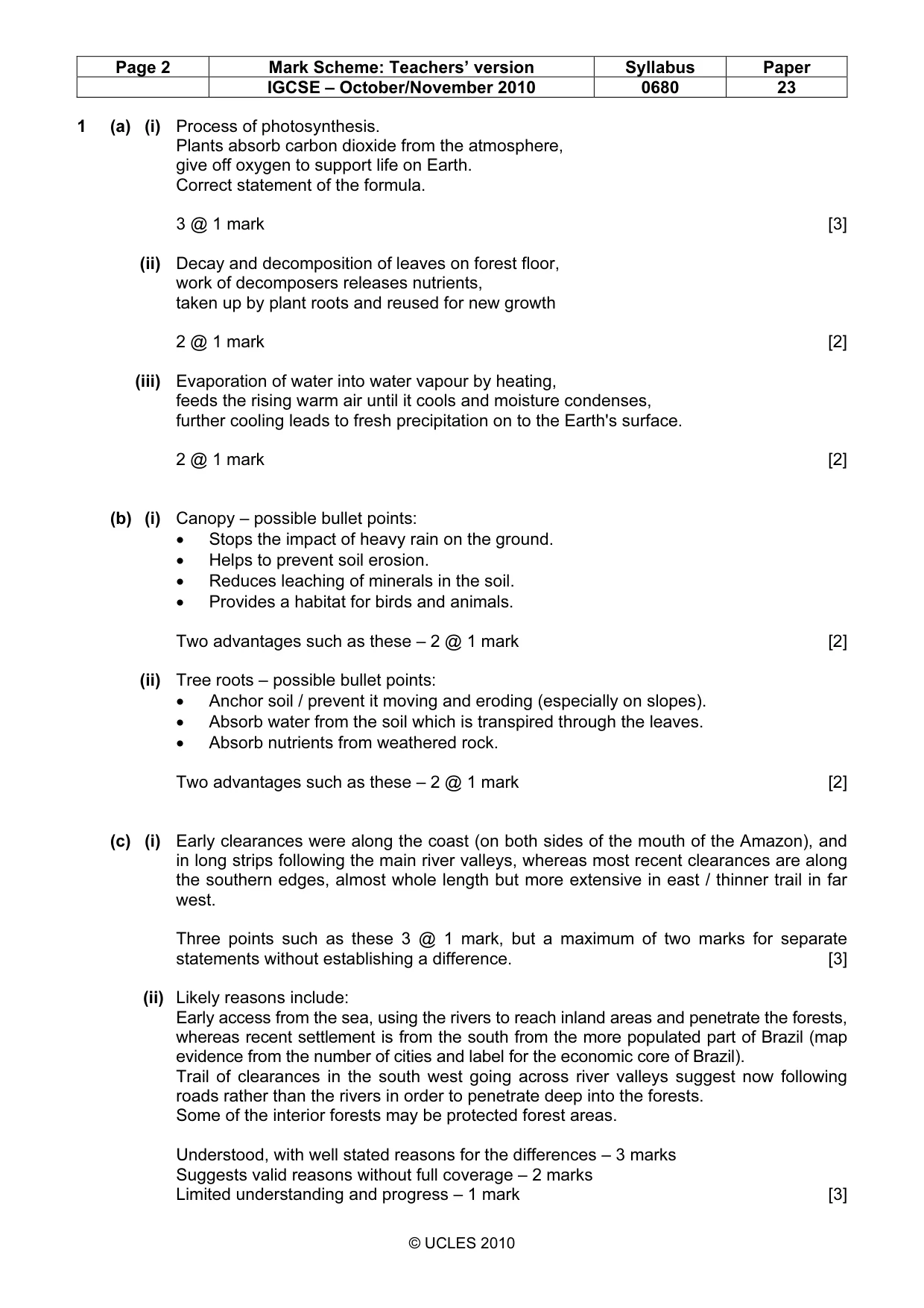
Page 2 Mark Scheme: Teachers’ version Syllabus Paper IGCSE – October/November 2010 0680 23 © UCLES 2010 1 (a) (i) Process of photosynthesis. Plants absorb carbon dioxide from the atmosphere, give off oxygen to support life on Earth. Correct statement of the formula. 3 @ 1 mark [3] (ii) Decay and decomposition of leaves on forest floor, work of decomposers releases nutrients, taken up by plant roots and reused for new growth 2 @ 1 mark [2] (iii) Evaporation of water into water vapour by heating, feeds the rising warm air until it cools and moisture condenses, further cooling leads to fresh precipitation on to the Earth's surface. 2 @ 1 mark [2] (b) (i) Canopy – possible bullet points: • Stops the impact of heavy rain on the ground. • Helps to prevent soil erosion. • Reduces leaching of minerals in the soil. • Provides a habitat for birds and animals. Two advantages such as these – 2 @ 1 mark [2] (ii) Tree roots – possible bullet points: • Anchor soil / prevent it moving and eroding (especially on slopes). • Absorb water from the soil which is transpired through the leaves. • Absorb nutrients from weathered rock. Two advantages such as these – 2 @ 1 mark [2] (c) (i) Early clearances were along the coast (on both sides of the mouth of the Amazon), and in long strips following the main river valleys, whereas most recent clearances are along the southern edges, almost whole length but more extensive in east / thinner trail in far west. Three points such as these 3 @ 1 mark, but a maximum of two marks for separate statements without establishing a difference. [3] (ii) Likely reasons include: Early access from the sea, using the rivers to reach inland areas and penetrate the forests, whereas recent settlement is from the south from the more populated part of Brazil (map evidence from the number of cities and label for the economic core of Brazil). Trail of clearances in the south west going across river valleys suggest now following roads rather than the rivers in order to penetrate deep into the forests. Some of the interior forests may be protected forest areas. Understood, with well stated reasons for the differences – 3 marks Suggests valid reasons without full coverage – 2 marks Limited understanding and progress – 1 mark [3]
Mark scheme, page 3
Page 3 Mark Scheme: Teachers’ version Syllabus Paper IGCSE – October/November 2010 0680 23 © UCLES 2010 (d) (i) Journey time to reach the river port of Santarem would be much reduced especially during the wet season / description of the problems on the dirt part. Remembering that distances are massive, (1700km from Cuiaba). Soybean and beef are important exports for the economy of Brazil. Would open up / encourage more forest land to be used for economic activities. Credit statement of advantages as well as elaboration. [3] (ii) Economic reasons are strong will be the easiest view to explain: To use more fully natural resources such as timber and extend farming area, especially in the time of high soybean prices. One approach if economic reasons are considered to be weak would be to focus on the short-term nature of profits before environmental damage reduces the economic benefits. Mark according to answer worth; for both marks, the explanation must be appropriate for the strength level suggested for the economic reasons. [2] (iii) Evidence from the information given can be assembled to show the potential for great forest losses to occur, such as: Trees have already gone from sides of unpaved sections despite the land being government owned. Logging already dominates at the expense of the rule of law, 'Trees, not gold are the wealth of the Amazon'. Already people are buying up land in anticipation that the road will improve access. Roads are doing what rivers did in the past, by providing access into the dense rainforests. Also plenty of evidence of the economic opportunities (at least in the short term) for selling hardwoods, soybeans and beef. Comment about what could hold it back: Greater pressure from international environmental groups. Idea mooted for carbon payments whereby developing countries are paid to keep their rainforests as carbon stores. Global economic downturns. Attitude of the government of Brazil etc. Statements from the information given, but limited or no comment towards question asked = 1 or 2 mark answers. Valid comment about the question asked, well supported = 3 or 4 mark answers [4] (e) Greatest biodiversity on Earth. Elaborated upon or exemplified. Greatest mass / highest primary productivity of any forest. Elaborated upon by references to the mass of plants filling all manner of forest niches. More vertical layers to the forest than in any other (4 or 5 of them). Elaborated upon by stating examples. Identification of relevant factor = 1 mark. Elaboration = 2nd mark. 2 + 1 marks or 3 @ 1 mark [3]
Mark scheme, page 4
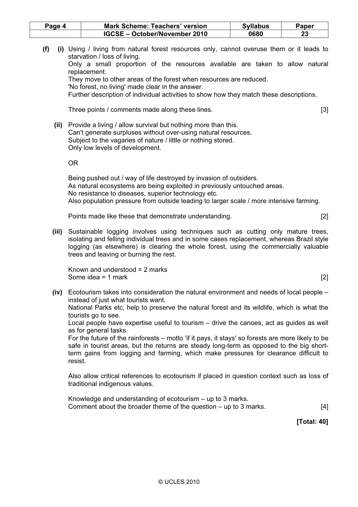
Page 4 Mark Scheme: Teachers’ version Syllabus Paper IGCSE – October/November 2010 0680 23 © UCLES 2010 (f) (i) Using / living from natural forest resources only, cannot overuse them or it leads to starvation / loss of living. Only a small proportion of the resources available are taken to allow natural replacement. They move to other areas of the forest when resources are reduced. 'No forest, no living' made clear in the answer. Further description of individual activities to show how they match these descriptions. Three points / comments made along these lines. [3] (ii) Provide a living / allow survival but nothing more than this. Can't generate surpluses without over-using natural resources. Subject to the vagaries of nature / little or nothing stored. Only low levels of development. OR Being pushed out / way of life destroyed by invasion of outsiders. As natural ecosystems are being exploited in previously untouched areas. No resistance to diseases, superior technology etc. Also population pressure from outside leading to larger scale / more intensive farming. Points made like these that demonstrate understanding. [2] (iii) Sustainable logging involves using techniques such as cutting only mature trees, isolating and felling individual trees and in some cases replacement, whereas Brazil style logging (as elsewhere) is clearing the whole forest, using the commercially valuable trees and leaving or burning the rest. Known and understood = 2 marks Some idea = 1 mark [2] (iv) Ecotourism takes into consideration the natural environment and needs of local people – instead of just what tourists want. National Parks etc, help to preserve the natural forest and its wildlife, which is what the tourists go to see. Local people have expertise useful to tourism – drive the canoes, act as guides as well as for general tasks. For the future of the rainforests – motto 'if it pays, it stays' so forests are more likely to be safe in tourist areas, but the returns are steady long-term as opposed to the big short- term gains from logging and farming, which make pressures for clearance difficult to resist. Also allow critical references to ecotourism if placed in question context such as loss of traditional indigenous values. Knowledge and understanding of ecotourism – up to 3 marks. Comment about the broader theme of the question – up to 3 marks. [4] [Total: 40]
Mark scheme, page 5
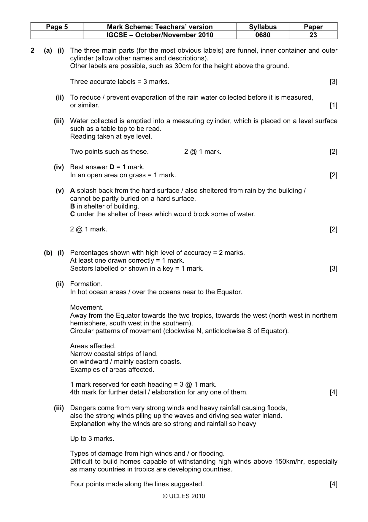
Page 5 Mark Scheme: Teachers’ version Syllabus Paper IGCSE – October/November 2010 0680 23 © UCLES 2010 2 (a) (i) The three main parts (for the most obvious labels) are funnel, inner container and outer cylinder (allow other names and descriptions). Other labels are possible, such as 30cm for the height above the ground. Three accurate labels = 3 marks. [3] (ii) To reduce / prevent evaporation of the rain water collected before it is measured, or similar. [1] (iii) Water collected is emptied into a measuring cylinder, which is placed on a level surface such as a table top to be read. Reading taken at eye level. Two points such as these. 2 @ 1 mark. [2] (iv) Best answer D = 1 mark. In an open area on grass = 1 mark. [2] (v) A splash back from the hard surface / also sheltered from rain by the building / cannot be partly buried on a hard surface. B in shelter of building. C under the shelter of trees which would block some of water. 2 @ 1 mark. [2] (b) (i) Percentages shown with high level of accuracy = 2 marks. At least one drawn correctly = 1 mark. Sectors labelled or shown in a key = 1 mark. [3] (ii) Formation. In hot ocean areas / over the oceans near to the Equator. Movement. Away from the Equator towards the two tropics, towards the west (north west in northern hemisphere, south west in the southern), Circular patterns of movement (clockwise N, anticlockwise S of Equator). Areas affected. Narrow coastal strips of land, on windward / mainly eastern coasts. Examples of areas affected. 1 mark reserved for each heading = 3 @ 1 mark. 4th mark for further detail / elaboration for any one of them. [4] (iii) Dangers come from very strong winds and heavy rainfall causing floods, also the strong winds piling up the waves and driving sea water inland. Explanation why the winds are so strong and rainfall so heavy Up to 3 marks. Types of damage from high winds and / or flooding. Difficult to build homes capable of withstanding high winds above 150km/hr, especially as many countries in tropics are developing countries. Four points made along the lines suggested. [4]
Mark scheme, page 6
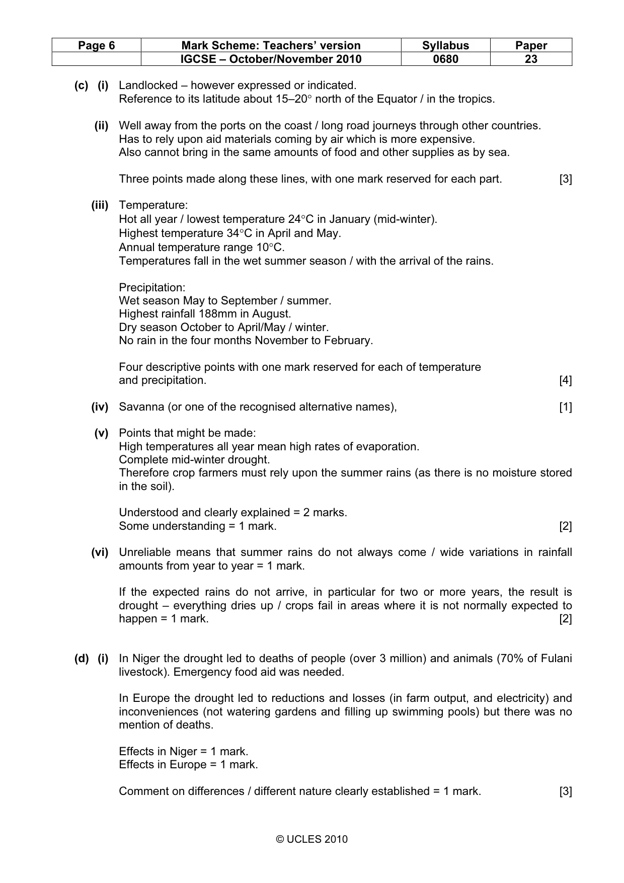
Page 6 Mark Scheme: Teachers’ version Syllabus Paper IGCSE – October/November 2010 0680 23 © UCLES 2010 (c) (i) Landlocked – however expressed or indicated. Reference to its latitude about 15–20° north of the Equator / in the tropics. (ii) Well away from the ports on the coast / long road journeys through other countries. Has to rely upon aid materials coming by air which is more expensive. Also cannot bring in the same amounts of food and other supplies as by sea. Three points made along these lines, with one mark reserved for each part. [3] (iii) Temperature: Hot all year / lowest temperature 24°C in January (mid-winter). Highest temperature 34°C in April and May. Annual temperature range 10°C. Temperatures fall in the wet summer season / with the arrival of the rains. Precipitation: Wet season May to September / summer. Highest rainfall 188mm in August. Dry season October to April/May / winter. No rain in the four months November to February. Four descriptive points with one mark reserved for each of temperature and precipitation. [4] (iv) Savanna (or one of the recognised alternative names), [1] (v) Points that might be made: High temperatures all year mean high rates of evaporation. Complete mid-winter drought. Therefore crop farmers must rely upon the summer rains (as there is no moisture stored in the soil). Understood and clearly explained = 2 marks. Some understanding = 1 mark. [2] (vi) Unreliable means that summer rains do not always come / wide variations in rainfall amounts from year to year = 1 mark. If the expected rains do not arrive, in particular for two or more years, the result is drought – everything dries up / crops fail in areas where it is not normally expected to happen = 1 mark. [2] (d) (i) In Niger the drought led to deaths of people (over 3 million) and animals (70% of Fulani livestock). Emergency food aid was needed. In Europe the drought led to reductions and losses (in farm output, and electricity) and inconveniences (not watering gardens and filling up swimming pools) but there was no mention of deaths. Effects in Niger = 1 mark. Effects in Europe = 1 mark. Comment on differences / different nature clearly established = 1 mark. [3]
Mark scheme, page 7
Page 7 Mark Scheme: Teachers’ version Syllabus Paper IGCSE – October/November 2010 0680 23 © UCLES 2010 (ii) Recognition that the two factors are poverty and population increase, however stated. Both needed for the mark. [1] (iii) Poverty in Niger meant that there was nothing in reserve for dealing with the drought, which is why people and animals died. Aid was needed to alleviate its effects. Made worse by the high birth rate – population growth and more and more mouths to feed so that surpluses could be not be built up to prepare for years with bad harvests. Contrast this with livestock farmers in France able to use stored winter fodder. No mention of deaths and aid because shortfalls in farm output could be offset by buying food elsewhere. Understood and clearly stated = 3 marks. Some progress = 1 or 2 mark answers. [3] [Total: 40]
What you needed in this session
Cambridge’s own grade thresholds for 2010 Oct/Nov, Paper 2 · Variant 3. A higher threshold means an easier paper — the bar moves with how the cohort did.