Cambridge A Level Geography 9696 — 2023 May/June Paper 3 · Variant 2
9696/32/M/J/23 · 11 questions · 60 marks · ≈68 min
The question paper and its mark scheme, free to read here and free to download. This is Cambridge’s own paper, exactly as it was sat.
Question paper4 pages
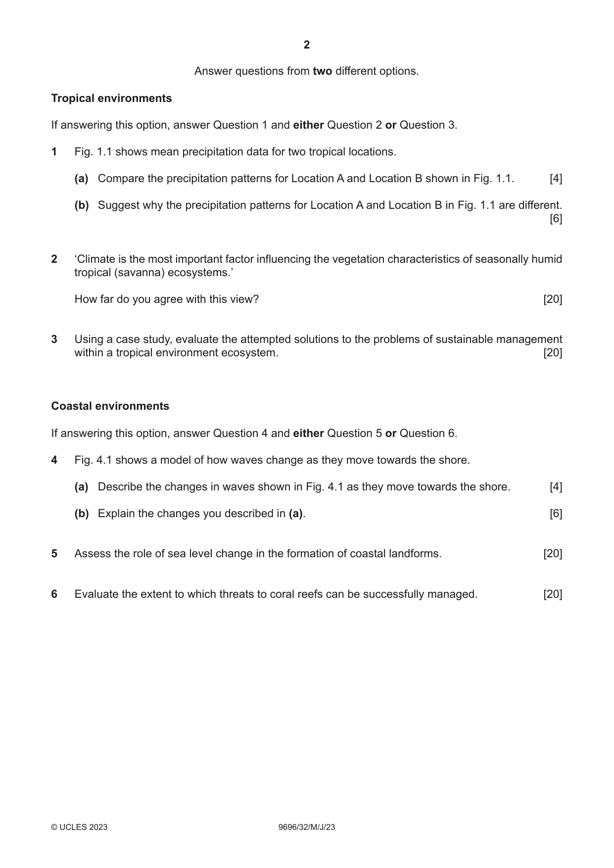
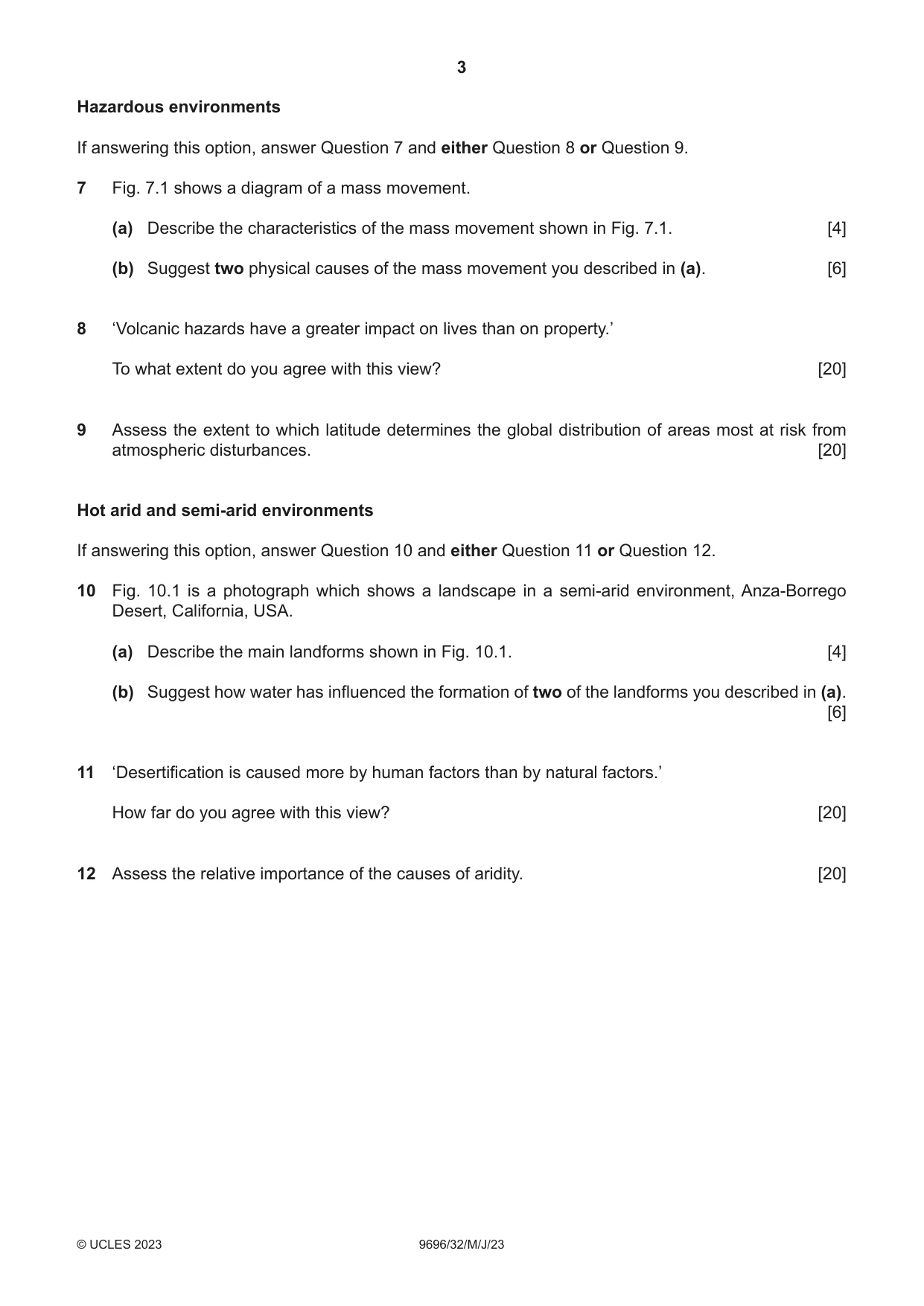
Mark scheme26 pages
Answers below. Sit the paper first if you are practising.






Questions as text
Q1 · Mean precipitation data for two tropical locations
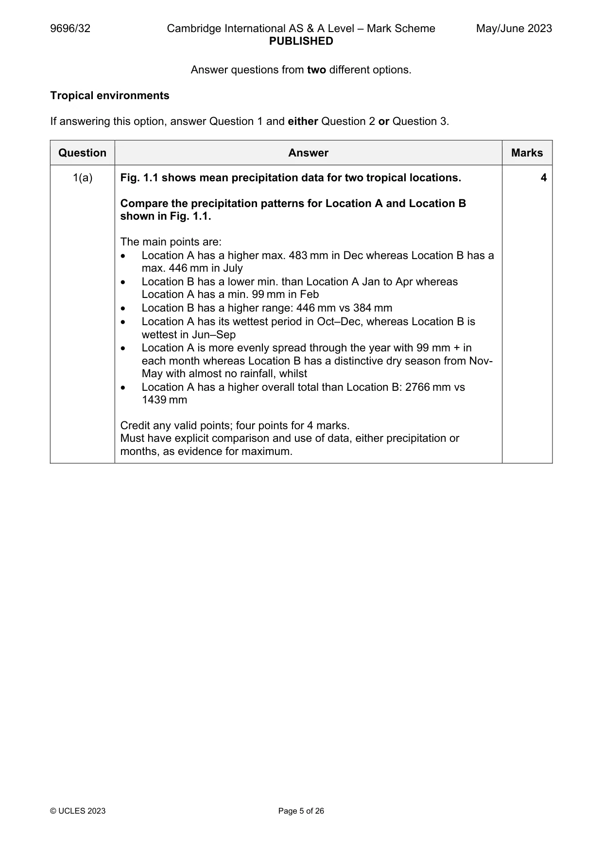
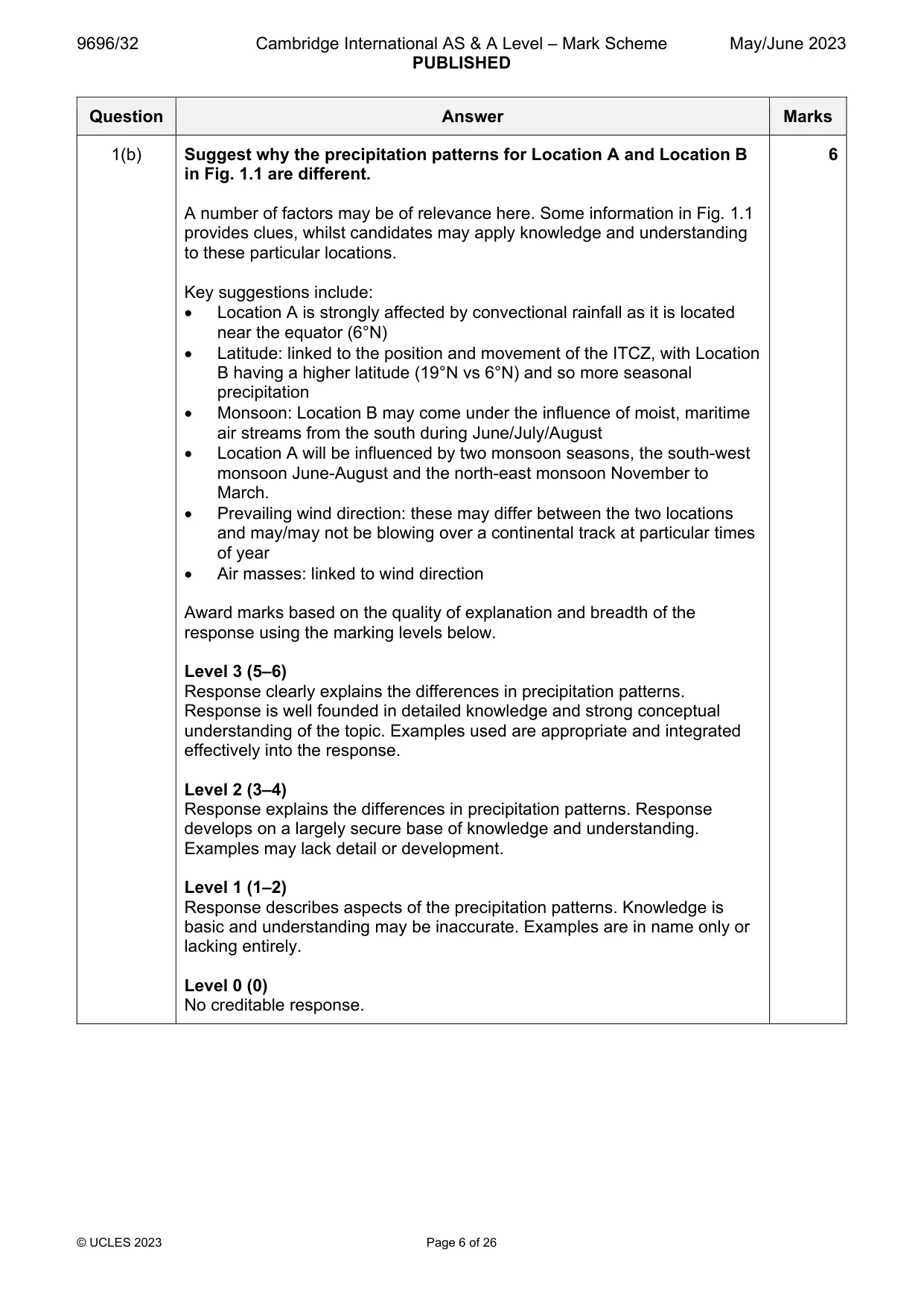
1 Fig. 1.1 shows mean precipitation data for two tropical locations. (a) Compare the precipitation patterns for Location A and Location B shown in Fig. 1.1. [4] (b) Suggest why the precipitation patterns for Location A and Location B in Fig. 1.1 are different. [6]
Mark scheme: Question Answer Marks 1(a) Fig. 1.1 shows mean precipitation data for two tropical locations. 4 Compare the precipitation patterns for Location A and Location B shown in Fig. 1.1. The main points are: Location A has a higher max. 483 mm in Dec whereas Location B has a max. 446 mm in July Location B has a lower min. than Location A Jan to Apr whereas Location A has a min. 99 mm in Feb Location B has a higher range: 446 mm vs 384 mm Location A has its wettest period in Oct–Dec, whereas Location B is wettest in Jun–Sep Location A is more evenly spread through the year with 99 mm + in each month whereas Location B has a distinctive dry season from Nov- May with almost no rainfall, whilst Location A has a higher overall total than Location B: 2766 mm vs 1439 mm Credit any valid points; four points for 4 marks. Must have explicit comparison and use of data, either precipitation or months, as evidence for maximum. 1(b) Suggest why the precipitation patterns for Location A and Location B 6 in Fig. 1.1 are different. A number of factors may be of relevance here. Some information in Fig. 1.1 provides clues, whilst candidates may apply knowledge and understanding to these particular locations. Key suggestions include: Location A is strongly affected by convectional rainfall as it is located near the equator (6°N) Latitude: linked to the position and movement of the ITCZ, with Location B having a higher latitude (19°N vs 6°N) and so more seasonal precipitation Monsoon: Location B may come under the influence of moist, maritime air streams from the south during June/July/August Location A will be influenced by two monsoon seasons, the south-west monsoon June-August and the north-east monsoon November to March. Prevailing wind direction: these may differ between the two locations and may/may not be blowing over a continental track at particular times of year Air masses: linked to wind direction Award marks based on the quality of explanation and breadth of the response using the marking levels below. Level 3 (5–6) Response clearly explains the differences in precipitation patterns. Response is well founded in detailed knowledge and strong conceptual understanding of the topic. Examples used are appropriate and integrated effectively into the response. Level 2 (3–4) Response explains the differences in precipitation patterns. Response develops on a largely secure base of knowledge and understanding. Examples may lack detail or development. Level 1 (1–2) Response describes aspects of the precipitation patterns. Knowledge is basic and understanding may be inaccurate. Examples are in name only or lacking entirely. Level 0 (0) No creditable response.
Q2 · ‘Climate is the most important factor influencing the vegetation characteristics of…
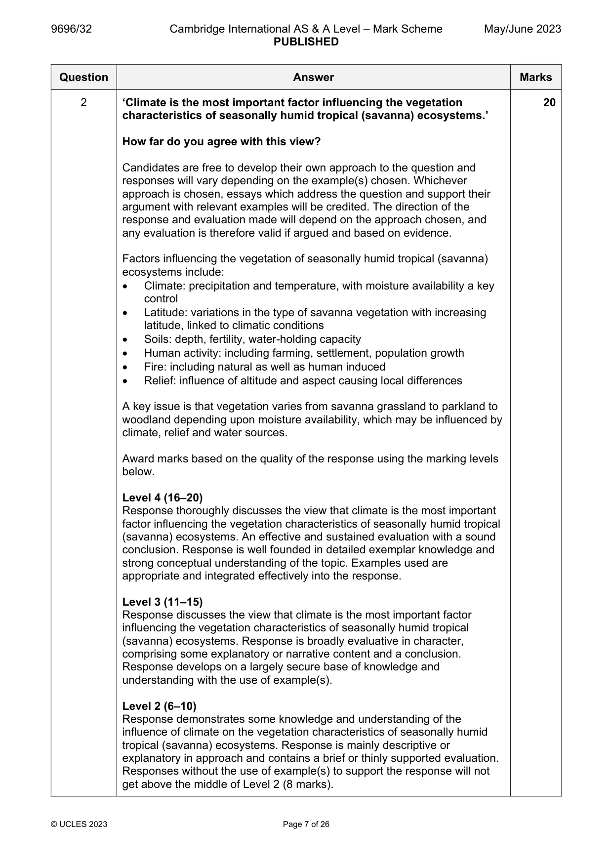
2 ‘Climate is the most important factor influencing the vegetation characteristics of seasonally humid tropical (savanna) ecosystems.’ How far do you agree with this view? [20]
Mark scheme: 2 ‘Climate is the most important factor influencing the vegetation 20 characteristics of seasonally humid tropical (savanna) ecosystems.’ How far do you agree with this view? Candidates are free to develop their own approach to the question and responses will vary depending on the example(s) chosen. Whichever approach is chosen, essays which address the question and support their argument with relevant examples will be credited. The direction of the response and evaluation made will depend on the approach chosen, and any evaluation is therefore valid if argued and based on evidence. Factors influencing the vegetation of seasonally humid tropical (savanna) ecosystems include: Climate: precipitation and temperature, with moisture availability a key control Latitude: variations in the type of savanna vegetation with increasing latitude, linked to climatic conditions Soils: depth, fertility, water-holding capacity Human activity: including farming, settlement, population growth Fire: including natural as well as human induced Relief: influence of altitude and aspect causing local differences A key issue is that vegetation varies from savanna grassland to parkland to woodland depending upon moisture availability, which may be influenced by climate, relief and water sources. Award marks based on the quality of the response using the marking levels below. Level 4 (16–20) Response thoroughly discusses the view that climate is the most important factor influencing the vegetation characteristics of seasonally humid tropical (savanna) ecosystems. An effective and sustained evaluation with a sound conclusion. Response is well founded in detailed exemplar knowledge and strong conceptual understanding of the topic. Examples used are appropriate and integrated effectively into the response. Level 3 (11–15) Response discusses the view that climate is the most important factor influencing the vegetation characteristics of seasonally humid tropical (savanna) ecosystems. Response is broadly evaluative in character, comprising some explanatory or narrative content and a conclusion. Response develops on a largely secure base of knowledge and understanding with the use of example(s). Level 2 (6–10) Response demonstrates some knowledge and understanding of the influence of climate on the vegetation characteristics of seasonally humid tropical (savanna) ecosystems. Response is mainly descriptive or explanatory in approach and contains a brief or thinly supported evaluation. Responses without the use of example(s) to support the response will not get above the middle of Level 2 (8 marks). 2 Level 1 (1–5) Response makes a few general points about climate/and or vegetation of seasonally humid tropical (savanna) ecosystems. A descriptive response comprising a few simple points. Knowledge is basic and understanding may be poor and lack relevance to the question set. Level 0 (0) No creditable response.
Q3 · Using a case study, evaluate the attempted solutions to the problems of sustainable…
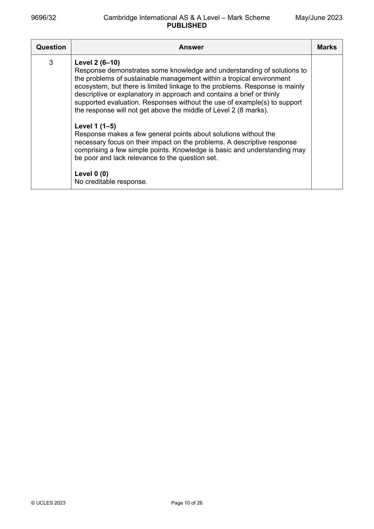
3 Using a case study, evaluate the attempted solutions to the problems of sustainable management within a tropical environment ecosystem. [20] Coastal environments If answering this option, answer Question 4 and either Question 5 or Question 6.
Mark scheme: 3 Using a case study, evaluate the attempted solutions to the problems 20 of sustainable management within a tropical environment ecosystem. Candidates are free to develop their own approach to the question and responses will vary depending on the example(s) chosen. Whichever approach is chosen, essays which address the question and support their argument with relevant examples will be credited. The direction of the response and evaluation made will depend on the approach chosen, and any evaluation is therefore valid if argued and based on evidence. Problems include: Illegal logging Commercial agriculture, including monoculture, ranching, plantations Population pressures Climate change Fire Capital requirements Solutions include: National Parks/nature reserves Socially responsible logging Sustainable tourism/ecotourism Quotas Afforestation/reforestation schemes Education Criteria for evaluating success should be established. These might include economic, social, and environmental aspects of sustainability. Award marks based on the quality of the response using the marking levels below. Level 4 (16–20) Response thoroughly discusses a wide range of solutions to the problems of sustainable management within a tropical environment ecosystem and explicitly links them to the problems. An effective and sustained evaluation with a sound conclusion. Response is well founded in detailed exemplar knowledge and strong conceptual understanding of the topic. Examples used are appropriate and integrated effectively into the response. Level 3 (11–15) Response discusses a range of solutions and makes links to the problems of sustainable management within a tropical environment ecosystem, albeit implicitly. Response is broadly evaluative in character, comprising some explanatory or narrative content and a conclusion. Response develops on a largely secure base of knowledge and understanding with the use of example(s). 3 Level 2 (6–10) Response demonstrates some knowledge and understanding of solutions to the problems of sustainable management within a tropical environment ecosystem, but there is limited linkage to the problems. Response is mainly descriptive or explanatory in approach and contains a brief or thinly supported evaluation. Responses without the use of example(s) to support the response will not get above the middle of Level 2 (8 marks). Level 1 (1–5) Response makes a few general points about solutions without the necessary focus on their impact on the problems. A descriptive response comprising a few simple points. Knowledge is basic and understanding may be poor and lack relevance to the question set. Level 0 (0) No creditable response. Coastal environments If answering this option, answer Question 4 and either Question 5 or Question 6.
Q4 · A model of how waves change as they move towards the shore
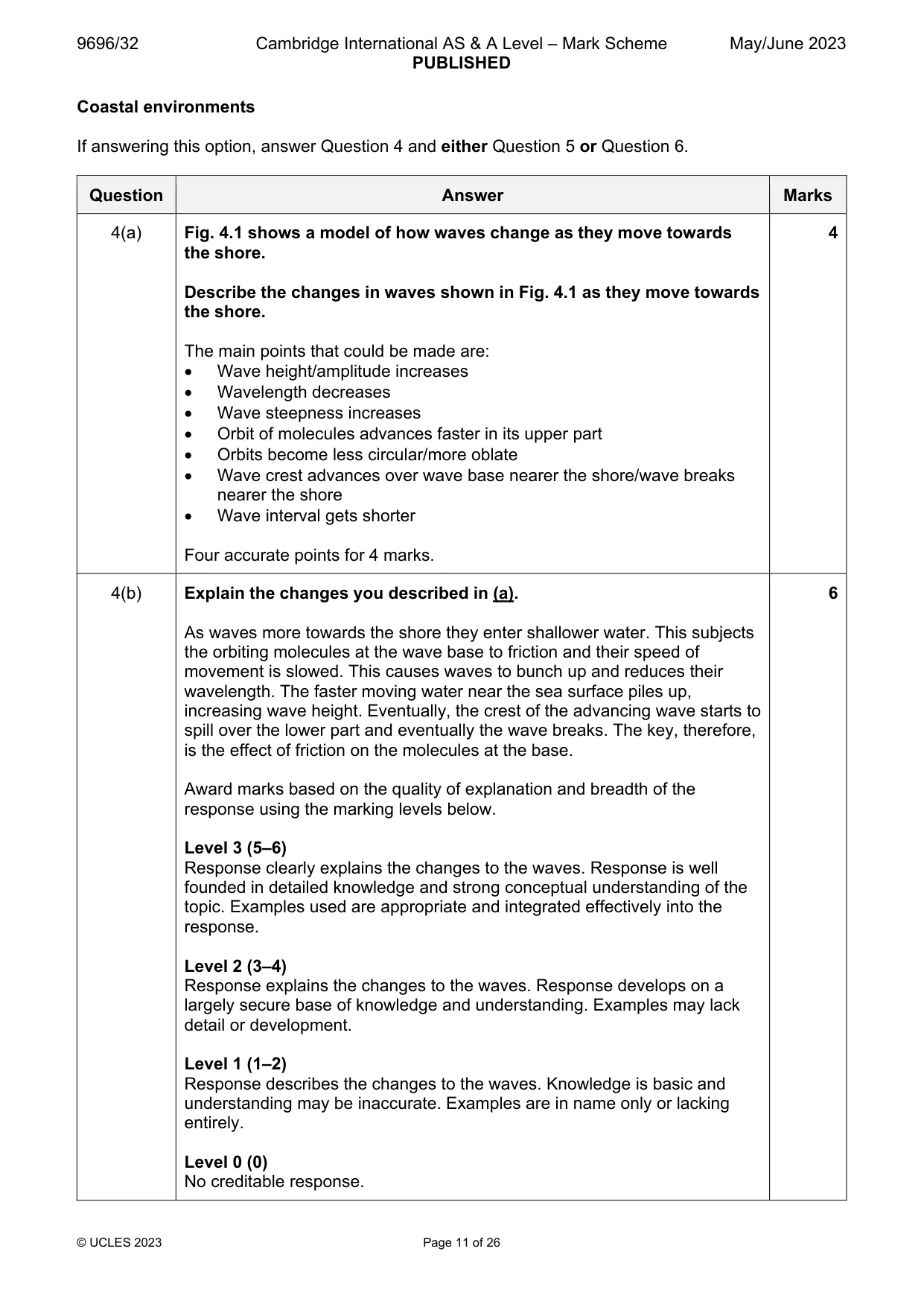
4 Fig. 4.1 shows a model of how waves change as they move towards the shore. (a) Describe the changes in waves shown in Fig. 4.1 as they move towards the shore. [4] (b) Explain the changes you described in (a). [6]
Mark scheme: 4(a) Fig. 4.1 shows a model of how waves change as they move towards 4 the shore. Describe the changes in waves shown in Fig. 4.1 as they move towards the shore. The main points that could be made are: Wave height/amplitude increases Wavelength decreases Wave steepness increases Orbit of molecules advances faster in its upper part Orbits become less circular/more oblate Wave crest advances over wave base nearer the shore/wave breaks nearer the shore Wave interval gets shorter Four accurate points for 4 marks. 4(b) Explain the changes you described in (a). 6 As waves more towards the shore they enter shallower water. This subjects the orbiting molecules at the wave base to friction and their speed of movement is slowed. This causes waves to bunch up and reduces their wavelength. The faster moving water near the sea surface piles up, increasing wave height. Eventually, the crest of the advancing wave starts to spill over the lower part and eventually the wave breaks. The key, therefore, is the effect of friction on the molecules at the base. Award marks based on the quality of explanation and breadth of the response using the marking levels below. Level 3 (5–6) Response clearly explains the changes to the waves. Response is well founded in detailed knowledge and strong conceptual understanding of the topic. Examples used are appropriate and integrated effectively into the response. Level 2 (3–4) Response explains the changes to the waves. Response develops on a largely secure base of knowledge and understanding. Examples may lack detail or development. Level 1 (1–2) Response describes the changes to the waves. Knowledge is basic and understanding may be inaccurate. Examples are in name only or lacking entirely. Level 0 (0) No creditable response.
Q5 · Assess the role of sea level change in the formation of coastal landforms
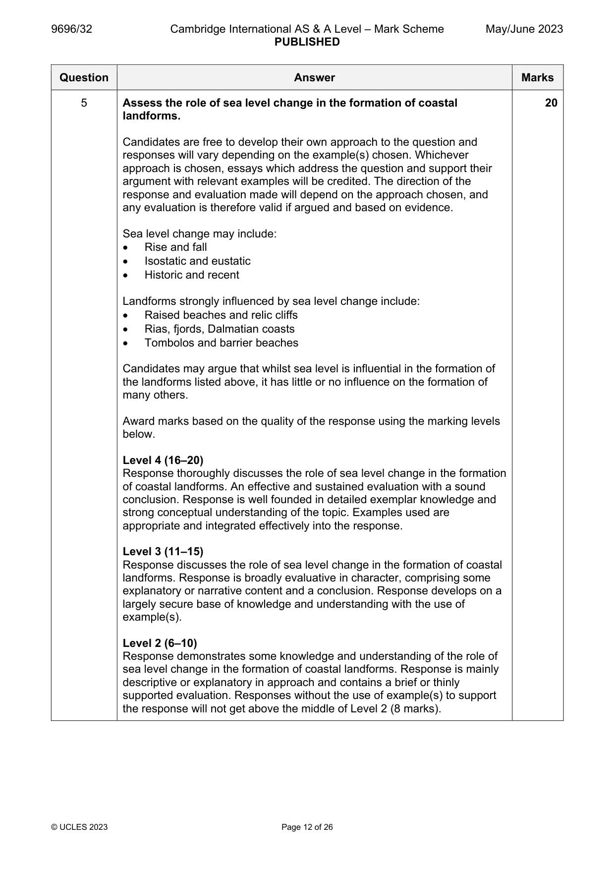
5 Assess the role of sea level change in the formation of coastal landforms. [20]
Mark scheme: 5 Assess the role of sea level change in the formation of coastal 20 landforms. Candidates are free to develop their own approach to the question and responses will vary depending on the example(s) chosen. Whichever approach is chosen, essays which address the question and support their argument with relevant examples will be credited. The direction of the response and evaluation made will depend on the approach chosen, and any evaluation is therefore valid if argued and based on evidence. Sea level change may include: Rise and fall Isostatic and eustatic Historic and recent Landforms strongly influenced by sea level change include: Raised beaches and relic cliffs Rias, fjords, Dalmatian coasts Tombolos and barrier beaches Candidates may argue that whilst sea level is influential in the formation of the landforms listed above, it has little or no influence on the formation of many others. Award marks based on the quality of the response using the marking levels below. Level 4 (16–20) Response thoroughly discusses the role of sea level change in the formation of coastal landforms. An effective and sustained evaluation with a sound conclusion. Response is well founded in detailed exemplar knowledge and strong conceptual understanding of the topic. Examples used are appropriate and integrated effectively into the response. Level 3 (11–15) Response discusses the role of sea level change in the formation of coastal landforms. Response is broadly evaluative in character, comprising some explanatory or narrative content and a conclusion. Response develops on a largely secure base of knowledge and understanding with the use of example(s). Level 2 (6–10) Response demonstrates some knowledge and understanding of the role of sea level change in the formation of coastal landforms. Response is mainly descriptive or explanatory in approach and contains a brief or thinly supported evaluation. Responses without the use of example(s) to support the response will not get above the middle of Level 2 (8 marks). 5 Level 1 (1–5) Response makes a few general points about the role of sea level change in the formation of coastal landforms. A descriptive response comprising a few simple points. Knowledge is basic and understanding may be poor and lack relevance to the question set. Level 0 (0) No creditable response.
Q6 · Hazardous environments If answering this option, answer Question 7 and either Question 8…
Hazardous environments If answering this option, answer Question 7 and either Question 8 or Question 9.
Mark scheme: 6 Evaluate the extent to which threats to coral reefs can be successfully 20 managed. Candidates are free to develop their own approach to the question and responses will vary depending on the example(s) chosen. Whichever approach is chosen, essays which address the question and support their argument with relevant examples will be credited. The direction of the response and evaluation made will depend on the approach chosen, and any evaluation is therefore valid if argued and based on evidence. Threats to coral reefs include: Global warming Sea level rise Acidification Crown of Thorns Starfish Pollution Physical damage Management strategies include: Global reduction in greenhouse gas emissions Limiting human activities such as fishing and blasting Protection e.g. MPAs More sustainable tourism International co-operation and funding of initiatives Education Monitoring and enforcement Award marks based on the quality of the response using the marking levels below. Level 4 (16–20) Response thoroughly discusses the extent to which threats to coral reefs can be successfully managed. An effective and sustained evaluation with a sound conclusion. Response is well founded in detailed exemplar knowledge and strong conceptual understanding of the topic. Examples used are appropriate and integrated effectively into the response. Level 3 (11–15) Response discusses the extent to which threats to coral reefs can be successfully managed. Response is broadly evaluative in character, comprising some explanatory or narrative content and a conclusion. Response develops on a largely secure base of knowledge and understanding with the use of example(s). Level 2 (6–10) Response demonstrates some knowledge and understanding of the threats to coral reefs and how they can be successfully managed. Response is mainly descriptive or explanatory in approach and contains a brief or thinly supported evaluation. Responses without the use of example(s) to support the response will not get above the middle of Level 2 (8 marks). 6 Level 1 (1–5) Response makes a few general points about the threats to coral reefs and how they can be managed. A descriptive response comprising a few simple points. Knowledge is basic and understanding may be poor and lack relevance to the question set. Level 0 (0) No creditable response. Hazardous environments If answering this option, answer Question 7 and either Question 8 or Question 9.
Q7 · A diagram of a mass movement
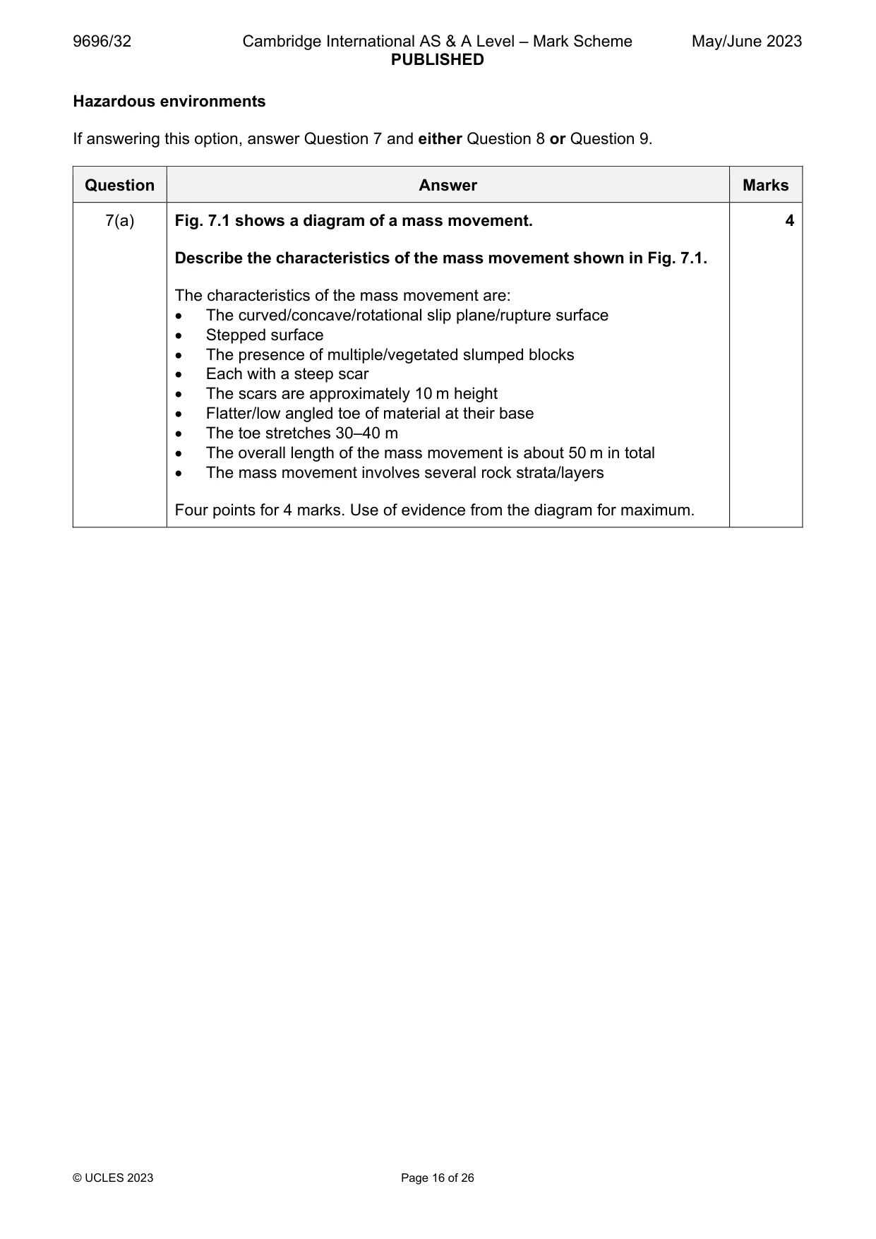
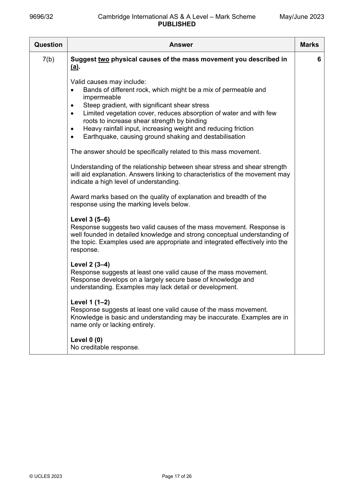
7 Fig. 7.1 shows a diagram of a mass movement. (a) Describe the characteristics of the mass movement shown in Fig. 7.1. [4] (b) Suggest two physical causes of the mass movement you described in (a). [6]
Mark scheme: 7(a) Fig. 7.1 shows a diagram of a mass movement. 4 Describe the characteristics of the mass movement shown in Fig. 7.1. The characteristics of the mass movement are: The curved/concave/rotational slip plane/rupture surface Stepped surface The presence of multiple/vegetated slumped blocks Each with a steep scar The scars are approximately 10 m height Flatter/low angled toe of material at their base The toe stretches 30–40 m The overall length of the mass movement is about 50 m in total The mass movement involves several rock strata/layers Four points for 4 marks. Use of evidence from the diagram for maximum. 7(b) Suggest two physical causes of the mass movement you described in 6 (a). Valid causes may include: Bands of different rock, which might be a mix of permeable and impermeable Steep gradient, with significant shear stress Limited vegetation cover, reduces absorption of water and with few roots to increase shear strength by binding Heavy rainfall input, increasing weight and reducing friction Earthquake, causing ground shaking and destabilisation The answer should be specifically related to this mass movement. Understanding of the relationship between shear stress and shear strength will aid explanation. Answers linking to characteristics of the movement may indicate a high level of understanding. Award marks based on the quality of explanation and breadth of the response using the marking levels below. Level 3 (5–6) Response suggests two valid causes of the mass movement. Response is well founded in detailed knowledge and strong conceptual understanding of the topic. Examples used are appropriate and integrated effectively into the response. Level 2 (3–4) Response suggests at least one valid cause of the mass movement. Response develops on a largely secure base of knowledge and understanding. Examples may lack detail or development. Level 1 (1–2) Response suggests at least one valid cause of the mass movement. Knowledge is basic and understanding may be inaccurate. Examples are in name only or lacking entirely. Level 0 (0) No creditable response.
Q8 · ‘Volcanic hazards have a greater impact on lives than on property.’ To what extent do you…
8 ‘Volcanic hazards have a greater impact on lives than on property.’ To what extent do you agree with this view? [20]
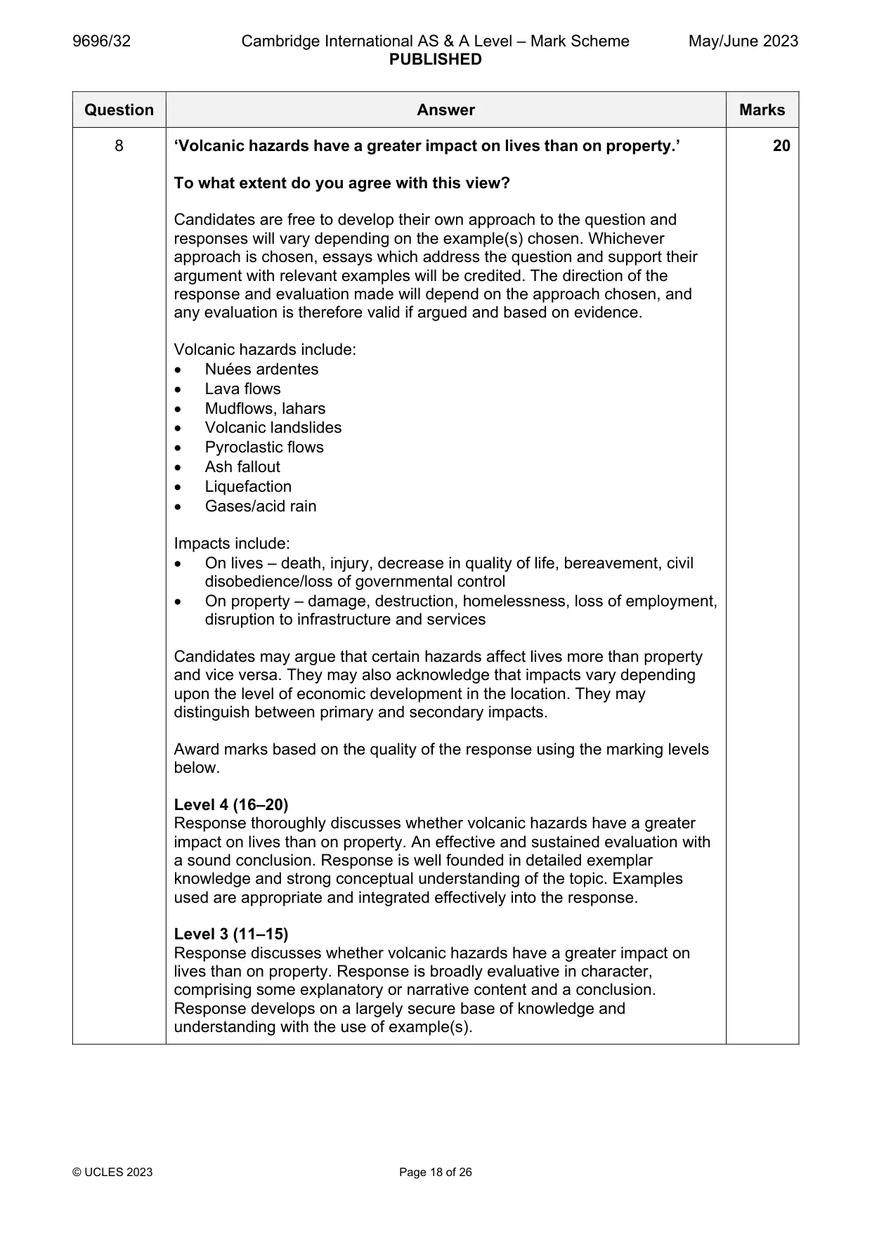
Mark scheme: 8 ‘Volcanic hazards have a greater impact on lives than on property.’ 20 To what extent do you agree with this view? Candidates are free to develop their own approach to the question and responses will vary depending on the example(s) chosen. Whichever approach is chosen, essays which address the question and support their argument with relevant examples will be credited. The direction of the response and evaluation made will depend on the approach chosen, and any evaluation is therefore valid if argued and based on evidence. Volcanic hazards include: Nuées ardentes Lava flows Mudflows, lahars Volcanic landslides Pyroclastic flows Ash fallout Liquefaction Gases/acid rain Impacts include: On lives – death, injury, decrease in quality of life, bereavement, civil disobedience/loss of governmental control On property – damage, destruction, homelessness, loss of employment, disruption to infrastructure and services Candidates may argue that certain hazards affect lives more than property and vice versa. They may also acknowledge that impacts vary depending upon the level of economic development in the location. They may distinguish between primary and secondary impacts. Award marks based on the quality of the response using the marking levels below. Level 4 (16–20) Response thoroughly discusses whether volcanic hazards have a greater impact on lives than on property. An effective and sustained evaluation with a sound conclusion. Response is well founded in detailed exemplar knowledge and strong conceptual understanding of the topic. Examples used are appropriate and integrated effectively into the response. Level 3 (11–15) Response discusses whether volcanic hazards have a greater impact on lives than on property. Response is broadly evaluative in character, comprising some explanatory or narrative content and a conclusion. Response develops on a largely secure base of knowledge and understanding with the use of example(s). 8 Level 2 (6–10) Response demonstrates some knowledge and understanding of the impact of volcanic hazards on lives and property. Response is mainly descriptive or explanatory in approach and contains a brief or thinly supported evaluation. Responses without the use of example(s) to support the response will not get above the middle of Level 2 (8 marks). Level 1 (1–5) Response makes a few general points about the impact of volcanic hazards on lives and/or property. A descriptive response comprising a few simple points. Knowledge is basic and understanding may be poor and lack relevance to the question set. Level 0 (0) No creditable response.
Q9 · Assess the extent to which latitude determines the global distribution of areas most at…
9 Assess the extent to which latitude determines the global distribution of areas most at risk from atmospheric disturbances. [20] Hot arid and semi-arid environments If answering this option, answer Question 10 and either Question 11 or Question 12.
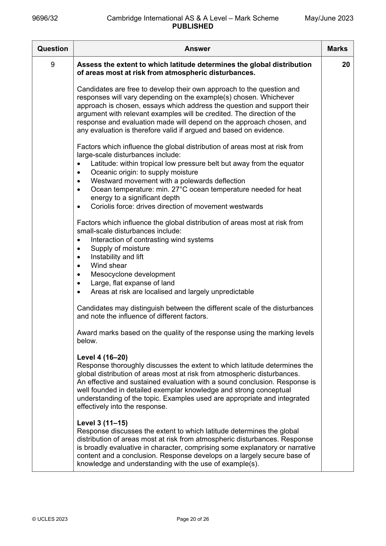
Mark scheme: 9 Assess the extent to which latitude determines the global distribution 20 of areas most at risk from atmospheric disturbances. Candidates are free to develop their own approach to the question and responses will vary depending on the example(s) chosen. Whichever approach is chosen, essays which address the question and support their argument with relevant examples will be credited. The direction of the response and evaluation made will depend on the approach chosen, and any evaluation is therefore valid if argued and based on evidence. Factors which influence the global distribution of areas most at risk from large-scale disturbances include: Latitude: within tropical low pressure belt but away from the equator Oceanic origin: to supply moisture Westward movement with a polewards deflection Ocean temperature: min. 27°C ocean temperature needed for heat energy to a significant depth Coriolis force: drives direction of movement westwards Factors which influence the global distribution of areas most at risk from small-scale disturbances include: Interaction of contrasting wind systems Supply of moisture Instability and lift Wind shear Mesocyclone development Large, flat expanse of land Areas at risk are localised and largely unpredictable Candidates may distinguish between the different scale of the disturbances and note the influence of different factors. Award marks based on the quality of the response using the marking levels below. Level 4 (16–20) Response thoroughly discusses the extent to which latitude determines the global distribution of areas most at risk from atmospheric disturbances. An effective and sustained evaluation with a sound conclusion. Response is well founded in detailed exemplar knowledge and strong conceptual understanding of the topic. Examples used are appropriate and integrated effectively into the response. Level 3 (11–15) Response discusses the extent to which latitude determines the global distribution of areas most at risk from atmospheric disturbances. Response is broadly evaluative in character, comprising some explanatory or narrative content and a conclusion. Response develops on a largely secure base of knowledge and understanding with the use of example(s). 9 Level 2 (6–10) Response demonstrates some knowledge and understanding of the global distribution of areas most at risk from atmospheric disturbances and the influencing factors. Response is mainly descriptive or explanatory in approach and contains a brief or thinly supported evaluation. Responses without the use of example(s) to support the response will not get above the middle of Level 2 (8 marks). Level 1 (1–5) Response makes a few general points about the global distribution of areas most at risk from atmospheric disturbances. A descriptive response comprising a few simple points. Knowledge is basic and understanding may be poor and lack relevance to the question set. Level 0 (0) No creditable response. Hot arid and semi-arid environments If answering this option, answer Question 10 and either Question 11 or Question 12.
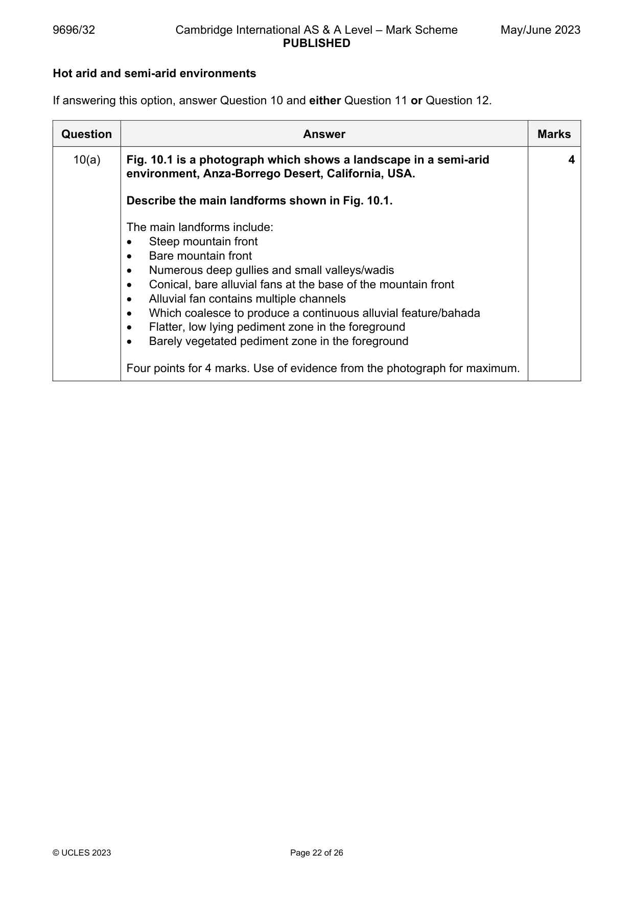
Q10 · A photograph which shows a landscape in a semi-arid environment, Anza-Borrego Desert…
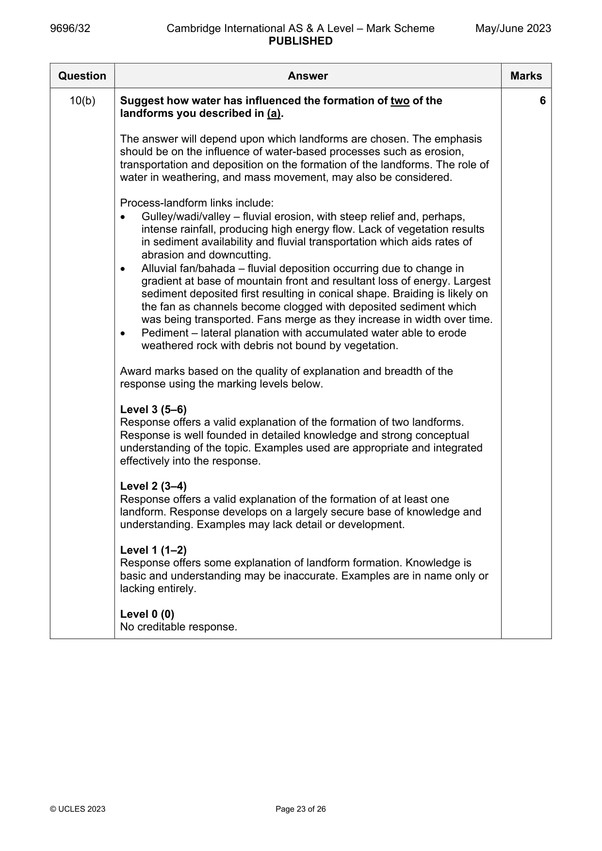
10 Fig. 10.1 is a photograph which shows a landscape in a semi-arid environment, Anza-Borrego Desert, California, USA. (a) Describe the main landforms shown in Fig. 10.1. [4] (b) Suggest how water has influenced the formation of two of the landforms you described in (a). [6]
Mark scheme: 10(a) Fig. 10.1 is a photograph which shows a landscape in a semi-arid 4 environment, Anza-Borrego Desert, California, USA. Describe the main landforms shown in Fig. 10.1. The main landforms include: Steep mountain front Bare mountain front Numerous deep gullies and small valleys/wadis Conical, bare alluvial fans at the base of the mountain front Alluvial fan contains multiple channels Which coalesce to produce a continuous alluvial feature/bahada Flatter, low lying pediment zone in the foreground Barely vegetated pediment zone in the foreground Four points for 4 marks. Use of evidence from the photograph for maximum. 10(b) Suggest how water has influenced the formation of two of the 6 landforms you described in (a). The answer will depend upon which landforms are chosen. The emphasis should be on the influence of water-based processes such as erosion, transportation and deposition on the formation of the landforms. The role of water in weathering, and mass movement, may also be considered. Process-landform links include: Gulley/wadi/valley – fluvial erosion, with steep relief and, perhaps, intense rainfall, producing high energy flow. Lack of vegetation results in sediment availability and fluvial transportation which aids rates of abrasion and downcutting. Alluvial fan/bahada – fluvial deposition occurring due to change in gradient at base of mountain front and resultant loss of energy. Largest sediment deposited first resulting in conical shape. Braiding is likely on the fan as channels become clogged with deposited sediment which was being transported. Fans merge as they increase in width over time. Pediment – lateral planation with accumulated water able to erode weathered rock with debris not bound by vegetation. Award marks based on the quality of explanation and breadth of the response using the marking levels below. Level 3 (5–6) Response offers a valid explanation of the formation of two landforms. Response is well founded in detailed knowledge and strong conceptual understanding of the topic. Examples used are appropriate and integrated effectively into the response. Level 2 (3–4) Response offers a valid explanation of the formation of at least one landform. Response develops on a largely secure base of knowledge and understanding. Examples may lack detail or development. Level 1 (1–2) Response offers some explanation of landform formation. Knowledge is basic and understanding may be inaccurate. Examples are in name only or lacking entirely. Level 0 (0) No creditable response.
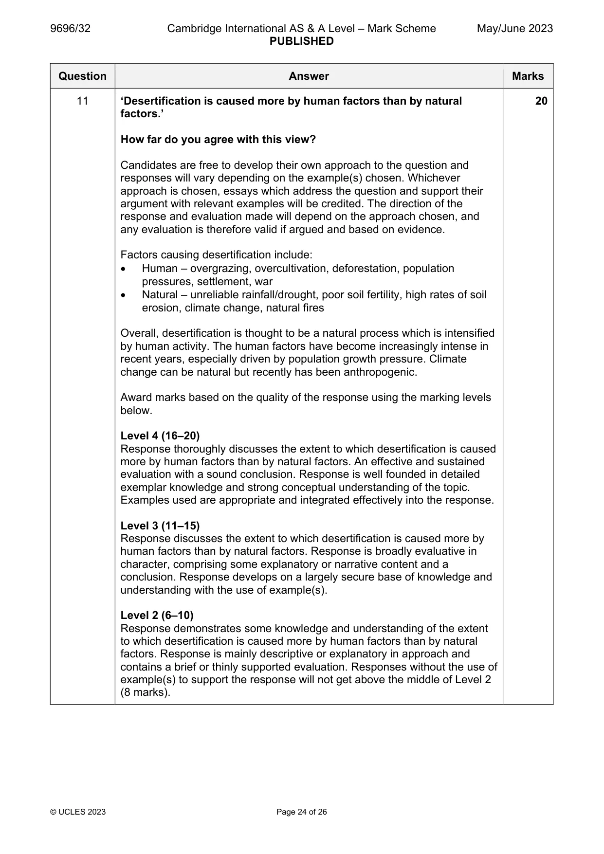
Q11 · ‘Desertification is caused more by human factors than by natural factors.’ How far do you…
11 ‘Desertification is caused more by human factors than by natural factors.’ How far do you agree with this view? [20]
Mark scheme: 11 ‘Desertification is caused more by human factors than by natural 20 factors.’ How far do you agree with this view? Candidates are free to develop their own approach to the question and responses will vary depending on the example(s) chosen. Whichever approach is chosen, essays which address the question and support their argument with relevant examples will be credited. The direction of the response and evaluation made will depend on the approach chosen, and any evaluation is therefore valid if argued and based on evidence. Factors causing desertification include: Human – overgrazing, overcultivation, deforestation, population pressures, settlement, war Natural – unreliable rainfall/drought, poor soil fertility, high rates of soil erosion, climate change, natural fires Overall, desertification is thought to be a natural process which is intensified by human activity. The human factors have become increasingly intense in recent years, especially driven by population growth pressure. Climate change can be natural but recently has been anthropogenic. Award marks based on the quality of the response using the marking levels below. Level 4 (16–20) Response thoroughly discusses the extent to which desertification is caused more by human factors than by natural factors. An effective and sustained evaluation with a sound conclusion. Response is well founded in detailed exemplar knowledge and strong conceptual understanding of the topic. Examples used are appropriate and integrated effectively into the response. Level 3 (11–15) Response discusses the extent to which desertification is caused more by human factors than by natural factors. Response is broadly evaluative in character, comprising some explanatory or narrative content and a conclusion. Response develops on a largely secure base of knowledge and understanding with the use of example(s). Level 2 (6–10) Response demonstrates some knowledge and understanding of the extent to which desertification is caused more by human factors than by natural factors. Response is mainly descriptive or explanatory in approach and contains a brief or thinly supported evaluation. Responses without the use of example(s) to support the response will not get above the middle of Level 2 (8 marks). 11 Level 1 (1–5) Response makes a few general points about the causes of desertification. A descriptive response comprising a few simple points. Knowledge is basic and understanding may be poor and lack relevance to the question set. Level 0 (0) No creditable response.
What was in this paper
The subtopics covered by these 11 questions, and how many questions each got. Open one in a new tab to see every Cambridge question on it.
1Coastal processes1Hazards resulting from atmospheric disturbances1Hazards resulting from mass movements1Hazards resulting from tectonic processes1Humid tropical (rainforest) ecosystems and seasonally humid tropical (savanna) ecosystems1Landforms of hot arid and semi-arid environments1Sustainable management in hazardous environments1Sustainable management of hot arid and semi-arid environments1Sustainable management of tropical environments1Tropical climates1What you needed in this session
Cambridge’s own grade thresholds for 2023 May/June, Paper 3 · Variant 2. A higher threshold means an easier paper — the bar moves with how the cohort did.