Cambridge A Level Geography 9696 — 2015 Oct/Nov Paper 2 · Variant 3
9696/23/O/N/15 · 50 marks · ≈56 min
The question paper and its mark scheme, free to read here and free to download. This is Cambridge’s own paper, exactly as it was sat.
Question paper4 pages

Mark scheme11 pages
Answers below. Sit the paper first if you are practising.

Paper as text
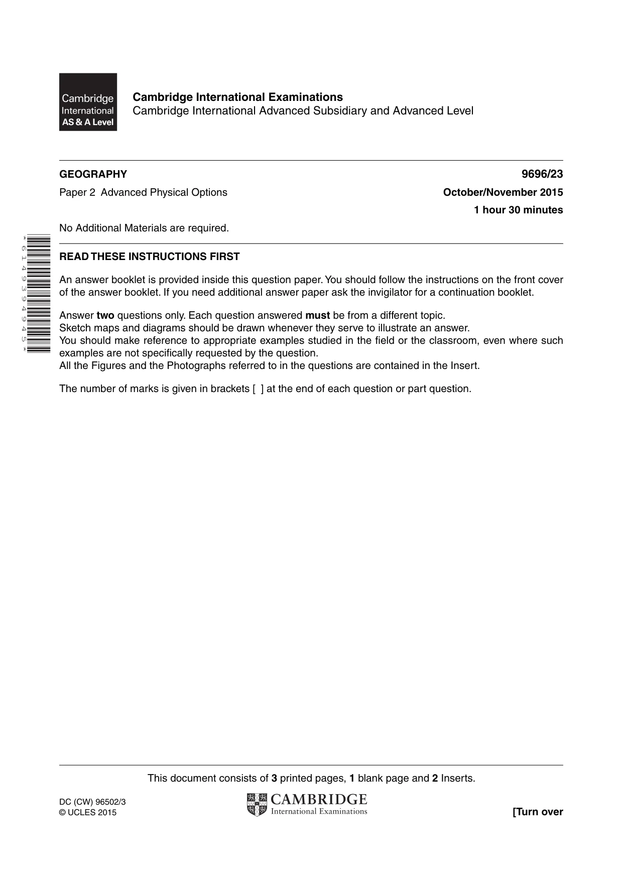
Question paper, page 1
This document consists of 3 printed pages, 1 blank page and 2 Inserts. DC (CW) 96502/3 © UCLES 2015 [Turn over Cambridge International Examinations Cambridge International Advanced Subsidiary and Advanced Level * 6 1 4 9 3 9 4 9 4 5 * GEOGRAPHY 9696/23 Paper 2 Advanced Physical Options October/November 2015 1 hour 30 minutes No Additional Materials are required. READ THESE INSTRUCTIONS FIRST An answer booklet is provided inside this question paper. You should follow the instructions on the front cover of the answer booklet. If you need additional answer paper ask the invigilator for a continuation booklet. Answer two questions only. Each question answered must be from a different topic. Sketch maps and diagrams should be drawn whenever they serve to illustrate an answer. You should make reference to appropriate examples studied in the field or the classroom, even where such examples are not specifically requested by the question. All the Figures and the Photographs referred to in the questions are contained in the Insert. The number of marks is given in brackets [ ] at the end of each question or part question.
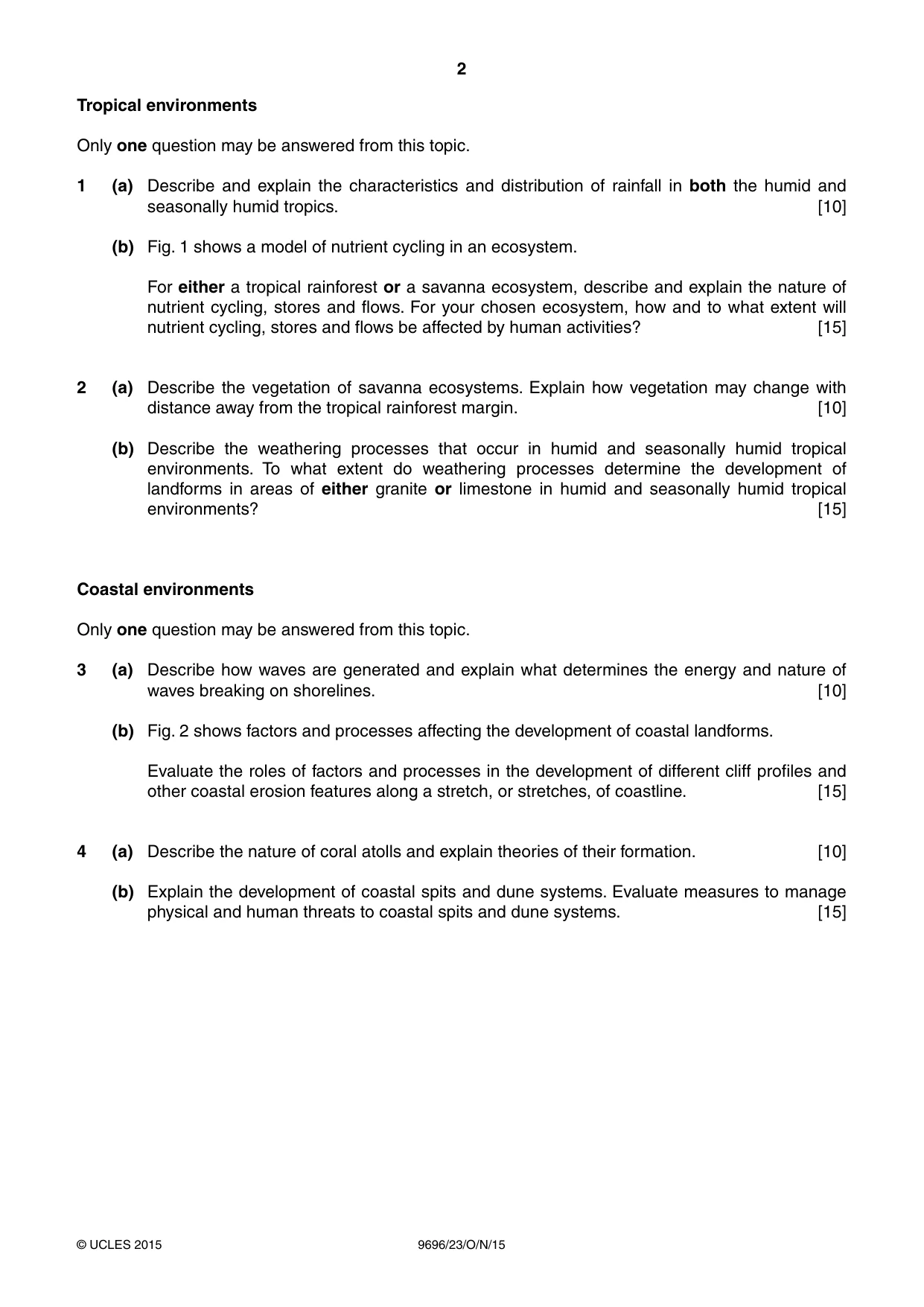
Question paper, page 2
2 9696/23/O/N/15 © UCLES 2015 Tropical environments Only one question may be answered from this topic. 1 (a) Describe and explain the characteristics and distribution of rainfall in both the humid and seasonally humid tropics. [10] (b) Fig. 1 shows a model of nutrient cycling in an ecosystem. For either a tropical rainforest or a savanna ecosystem, describe and explain the nature of nutrient cycling, stores and flows. For your chosen ecosystem, how and to what extent will nutrient cycling, stores and flows be affected by human activities? [15] 2 (a) Describe the vegetation of savanna ecosystems. Explain how vegetation may change with distance away from the tropical rainforest margin. [10] (b) Describe the weathering processes that occur in humid and seasonally humid tropical environments. To what extent do weathering processes determine the development of landforms in areas of either granite or limestone in humid and seasonally humid tropical environments? [15] Coastal environments Only one question may be answered from this topic. 3 (a) Describe how waves are generated and explain what determines the energy and nature of waves breaking on shorelines. [10] (b) Fig. 2 shows factors and processes affecting the development of coastal landforms. Evaluate the roles of factors and processes in the development of different cliff profiles and other coastal erosion features along a stretch, or stretches, of coastline. [15] 4 (a) Describe the nature of coral atolls and explain theories of their formation. [10] (b) Explain the development of coastal spits and dune systems. Evaluate measures to manage physical and human threats to coastal spits and dune systems. [15]
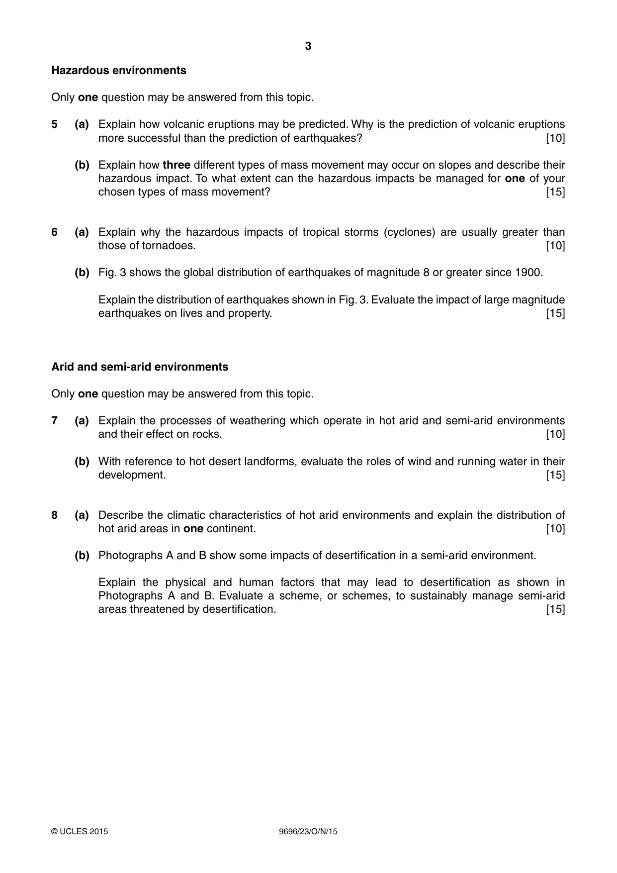
Question paper, page 3
3 9696/23/O/N/15 © UCLES 2015 Hazardous environments Only one question may be answered from this topic. 5 (a) Explain how volcanic eruptions may be predicted. Why is the prediction of volcanic eruptions more successful than the prediction of earthquakes? [10] (b) Explain how three different types of mass movement may occur on slopes and describe their hazardous impact. To what extent can the hazardous impacts be managed for one of your chosen types of mass movement? [15] 6 (a) Explain why the hazardous impacts of tropical storms (cyclones) are usually greater than those of tornadoes. [10] (b) Fig. 3 shows the global distribution of earthquakes of magnitude 8 or greater since 1900. Explain the distribution of earthquakes shown in Fig. 3. Evaluate the impact of large magnitude earthquakes on lives and property. [15] Arid and semi-arid environments Only one question may be answered from this topic. 7 (a) Explain the processes of weathering which operate in hot arid and semi-arid environments and their effect on rocks. [10] (b) With reference to hot desert landforms, evaluate the roles of wind and running water in their development. [15] 8 (a) Describe the climatic characteristics of hot arid environments and explain the distribution of hot arid areas in one continent. [10] (b) Photographs A and B show some impacts of desertification in a semi-arid environment. Explain the physical and human factors that may lead to desertification as shown in Photographs A and B. Evaluate a scheme, or schemes, to sustainably manage semi-arid areas threatened by desertification. [15]
Question paper, page 4
4 9696/23/O/N/15 © UCLES 2015 BLANK PAGE Permission to reproduce items where third-party owned material protected by copyright is included has been sought and cleared where possible. Every reasonable effort has been made by the publisher (UCLES) to trace copyright holders, but if any items requiring clearance have unwittingly been included, the publisher will be pleased to make amends at the earliest possible opportunity. To avoid the issue of disclosure of answer-related information to candidates, all copyright acknowledgements are reproduced online in the Cambridge International Examinations Copyright Acknowledgements Booklet. This is produced for each series of examinations and is freely available to download at www.cie.org.uk after the live examination series. Cambridge International Examinations is part of the Cambridge Assessment Group. Cambridge Assessment is the brand name of University of Cambridge Local Examinations Syndicate (UCLES), which is itself a department of the University of Cambridge.
Mark scheme, page 1
® IGCSE is the registered trademark of Cambridge International Examinations. CAMBRIDGE INTERNATIONAL EXAMINATIONS Cambridge International Advanced Subsidiary and Advanced Level MARK SCHEME for the October/November 2015 series 9696 GEOGRAPHY 9696/23 Paper 2 (Advanced Physical Options), maximum raw mark 50 This mark scheme is published as an aid to teachers and candidates, to indicate the requirements of the examination. It shows the basis on which Examiners were instructed to award marks. It does not indicate the details of the discussions that took place at an Examiners’ meeting before marking began, which would have considered the acceptability of alternative answers. Mark schemes should be read in conjunction with the question paper and the Principal Examiner Report for Teachers. Cambridge will not enter into discussions about these mark schemes. Cambridge is publishing the mark schemes for the October/November 2015 series for most Cambridge IGCSE®, Cambridge International A and AS Level components and some Cambridge O Level components.
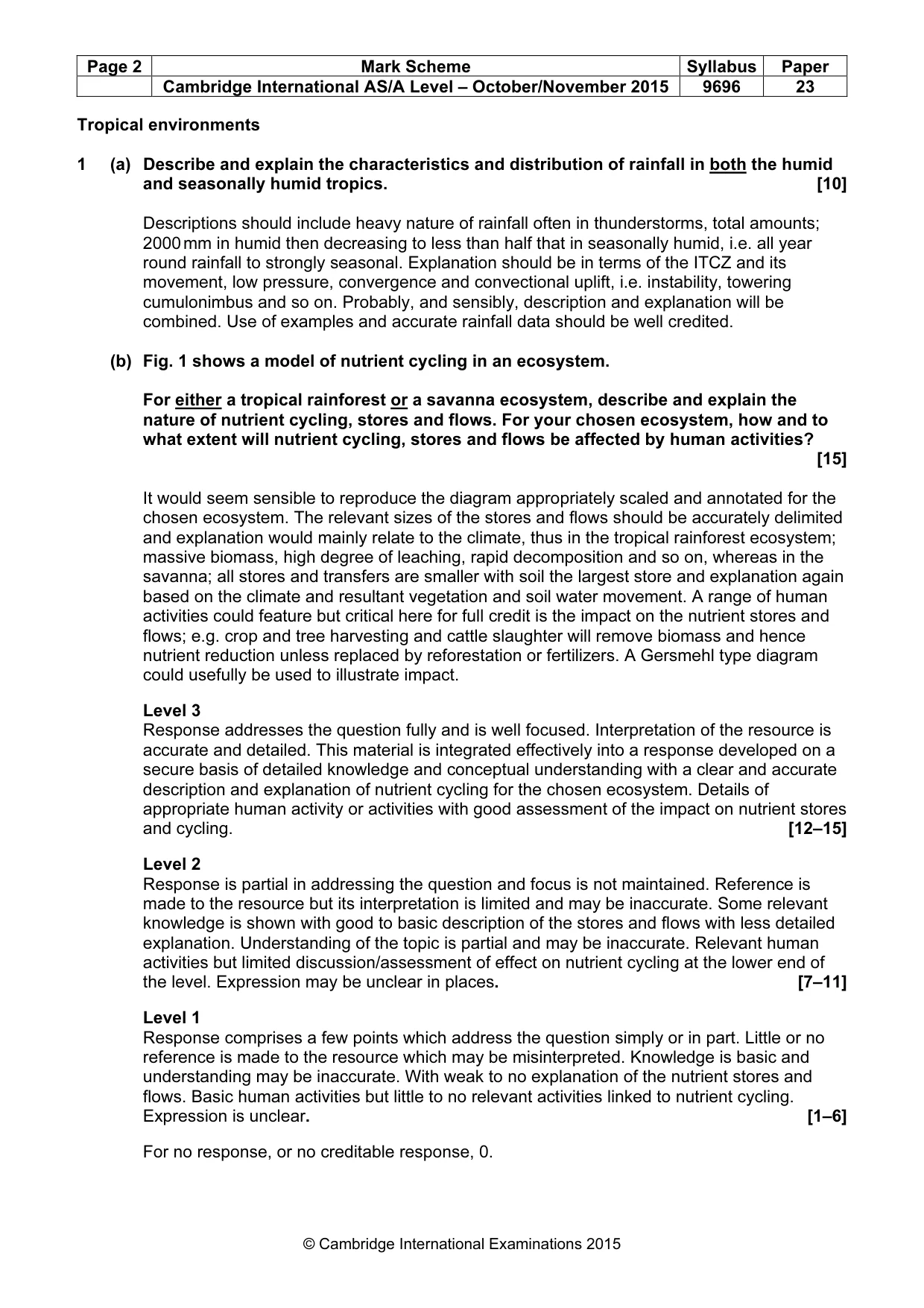
Mark scheme, page 2
Page 2 Mark Scheme Syllabus Paper Cambridge International AS/A Level – October/November 2015 9696 23 © Cambridge International Examinations 2015 Tropical environments 1 (a) Describe and explain the characteristics and distribution of rainfall in both the humid and seasonally humid tropics. [10] Descriptions should include heavy nature of rainfall often in thunderstorms, total amounts; 2000 mm in humid then decreasing to less than half that in seasonally humid, i.e. all year round rainfall to strongly seasonal. Explanation should be in terms of the ITCZ and its movement, low pressure, convergence and convectional uplift, i.e. instability, towering cumulonimbus and so on. Probably, and sensibly, description and explanation will be combined. Use of examples and accurate rainfall data should be well credited. (b) Fig. 1 shows a model of nutrient cycling in an ecosystem. For either a tropical rainforest or a savanna ecosystem, describe and explain the nature of nutrient cycling, stores and flows. For your chosen ecosystem, how and to what extent will nutrient cycling, stores and flows be affected by human activities? [15] It would seem sensible to reproduce the diagram appropriately scaled and annotated for the chosen ecosystem. The relevant sizes of the stores and flows should be accurately delimited and explanation would mainly relate to the climate, thus in the tropical rainforest ecosystem; massive biomass, high degree of leaching, rapid decomposition and so on, whereas in the savanna; all stores and transfers are smaller with soil the largest store and explanation again based on the climate and resultant vegetation and soil water movement. A range of human activities could feature but critical here for full credit is the impact on the nutrient stores and flows; e.g. crop and tree harvesting and cattle slaughter will remove biomass and hence nutrient reduction unless replaced by reforestation or fertilizers. A Gersmehl type diagram could usefully be used to illustrate impact. Level 3 Response addresses the question fully and is well focused. Interpretation of the resource is accurate and detailed. This material is integrated effectively into a response developed on a secure basis of detailed knowledge and conceptual understanding with a clear and accurate description and explanation of nutrient cycling for the chosen ecosystem. Details of appropriate human activity or activities with good assessment of the impact on nutrient stores and cycling. [12–15] Level 2 Response is partial in addressing the question and focus is not maintained. Reference is made to the resource but its interpretation is limited and may be inaccurate. Some relevant knowledge is shown with good to basic description of the stores and flows with less detailed explanation. Understanding of the topic is partial and may be inaccurate. Relevant human activities but limited discussion/assessment of effect on nutrient cycling at the lower end of the level. Expression may be unclear in places. [7–11] Level 1 Response comprises a few points which address the question simply or in part. Little or no reference is made to the resource which may be misinterpreted. Knowledge is basic and understanding may be inaccurate. With weak to no explanation of the nutrient stores and flows. Basic human activities but little to no relevant activities linked to nutrient cycling. Expression is unclear. [1–6] For no response, or no creditable response, 0.
Mark scheme, page 3
Page 3 Mark Scheme Syllabus Paper Cambridge International AS/A Level – October/November 2015 9696 23 © Cambridge International Examinations 2015 2 (a) Describe the vegetation of savanna ecosystems. Explain how vegetation may change with distance away from the tropical rainforest margin. [10] Ecosystems, plural, could help signal that, unlike the TRF, the savanna varies with latitude away from the TRF; essentially the savanna vegetation structure is one of open woodland within a cover of grassland but with areas of closer tree cover and others with scattered trees degenerating into scrub savanna. Trees are xerophytic with adaptations to resist seasonal drought; deciduous with small waxy leaves, deep rooted, thick barks, spreading branches, pyrophytic. E.g. baobab, acacias, eucalyptus. Grasses up to 3 or 5 metres, grow in tufts and rapidly after summer rains. The decreasing summer rainfall away from the TRF margin explains the change from parkland (closed savanna) through ‘true savanna’ to ‘scrub or open savanna’. The best answers will bring in the change in soil conditions related to the climate and possibly nutrient cycling. (b) Describe the weathering processes that occur in humid and seasonally humid tropical environments. To what extent do weathering processes determine the development of landforms in areas of either granite or limestone in humid and seasonally humid tropical environments? [15] The command in the first part is ‘describe’ but many answers may well embrace explanation which can be argued as adding descriptive detail but not necessary for full credit. In humid tropical, chemical weathering dominates with hydrolysis, carbonation and chelation operating rapidly but with physical weathering being limited. Effectiveness is linked to high temperatures accelerating the rate of chemical processes with abundant water and dissolved humic acids together with CO2. In seasonally humid tropical, physical weathering can become dominant, described by thinner vegetation cover and large diurnal range of temperature. However, weathering will be slow and chemical weathering still important. Many will bring in freeze thaw for no credit unless justified by altitude. We go through all climatic zones climbing Kilimanjaro. To a large extent, weathering processes do determine the development of the landforms, especially under humid tropical conditions. However the structure, particularly jointing, and the mineral composition of granite and limestone determine their morphology to a major extent. Finally, erosion is necessary to remove regolith to maintain the processes. The ‘How’ should include detail of the weathering processes and reactions as well as the erosional ones. Level 3 Response addresses the question fully and is well focused. This material is integrated effectively into a response developed on a secure basis of detailed knowledge and conceptual understanding with a high level of knowledge and understanding shown in description of weathering effectiveness. Well balanced appraisal of the roles of processes and factors with clear and accurate exemplification. [12–15] Level 2 Response is partial in addressing the question and focus is not maintained. Some relevant knowledge is shown but understanding of the topic is partial and may be inaccurate with respect to weathering processes operating in the two environments. Understanding of the role and processes of weathering in development of landforms may be partial but the assessment of other factors may be limited. Expression may be unclear in places. [7–11] Level 1 Response comprises a few points which address the question simply or in part. Knowledge of appropriate types of weathering is basic and understanding of the relevant specific processes related to the rock types may be inaccurate. Limited or lack of assessment of the role of lithology or structure or the role of erosional processes. Expression is unclear. [1–6] For no response, or no creditable response, 0.
Mark scheme, page 4
Page 4 Mark Scheme Syllabus Paper Cambridge International AS/A Level – October/November 2015 9696 23 © Cambridge International Examinations 2015 Coastal environments 3 (a) Describe how waves are generated and explain what determines the energy and nature of waves breaking on shorelines. [10] Waves are generated essentially by sea water particles being set in motion by the frictional drag of wind blowing over open water bodies. Expect diagrams showing circular motion of the water particles. Some may introduce tsunami but not needed for full credit. The energy and nature of waves are determined by fetch, wind strength and duration and then the morphology of the shoreline: gently or steeply shelving, straight or crenulated. Hence different types of breaking waves; at least two for full credit. (b) Fig. 2 shows factors and processes affecting the development of coastal landforms. Evaluate the roles of factors and processes in the development of different cliff profiles and other coastal erosion features along a stretch, or stretches, of coastline. [15] There will be caves, arches, stacks and stumps in abundance and deserve much credit if due consideration is given to both factors and processes and there is evidence of clear knowledge and understanding. A full answer should include a range of cliff profiles and the development of shore platforms perhaps. Others might develop concordant and discordant features. The best answers will be selective in choice of examples and address the question of ‘evaluating the role’ and not merely provide a catalogue of features. Level 3 Response addresses the question fully and is well focused. Interpretation of the resource is accurate and detailed. This material is integrated effectively into a response developed on a secure basis of detailed knowledge and conceptual understanding with a clear and accurate description and explanation of a selection of features fully detailed to evaluate the role of marine and sub-aerial processes. [12–15] Level 2 Response is partial in addressing the question and focus is not maintained. Reference is made to the resource but its interpretation is limited and may be inaccurate. Some relevant knowledge is shown. Understanding of the topic is partial and may be inaccurate with respect to the range of features and the relevant processes and factors but lacking accurate detail at the lower end of the level. Evaluation limited to some extent. Expression may be unclear in places. [7–11] Level 1 Response comprises a few points which address the question simply or in part. Little or no reference is made to the resource which may be misinterpreted. Knowledge is basic and understanding may be inaccurate with little beyond the cave to stump sequence and lacking in precision regarding the role of rock types and structures. Marine erosion processes described rather than applied to addressing the question. Expression is unclear. [1–6] For no response, or no creditable response, 0.
Mark scheme, page 5
Page 5 Mark Scheme Syllabus Paper Cambridge International AS/A Level – October/November 2015 9696 23 © Cambridge International Examinations 2015 4 (a) Describe the nature of coral atolls and explain theories of their formation. [10] This is a straightforward demand so credit is earned from accuracy of description and a clear and realistic understanding of two theories. There should be some description of the nature of coral. Explanation will most probably be Darwin (subsidence) and Daly (glacial eustatism), but Murray and others are possible. Quality rather that quantity needed and much credit should be given to fully and accurately labelled diagrams. (b) Explain the development of coastal spits and dune systems. Evaluate measures to manage physical and human threats to coastal spits and dune systems. [15] As in (a), the first demand should be straightforward and therefore again some realistic and accurate explanations are necessary for decent credit. Use of well understood examples should aid this and we do need to go beyond simple longshore drift diagrams ending at a river estuary. Some consideration of the nature of waves and material supply as well as the effect of prevailing winds and secondary winds in the case of spits. For dune development, again supply is important as is a tidal range that exposes a wide area of sand. There is often confusion about marram grass as opposed to eel grass or sea couch grass. Threats could be from episodic storm events, starvation of material supply, human activities. Examples will hopefully be used in evaluating measures to manage such threats. Level 3 Response addresses the question fully and is well focused. This material is integrated effectively into a response developed on a secure basis of detailed knowledge and conceptual understanding with a high level of knowledge and understanding shown with detailed and accurate explanation of both landforms. Well understood threats, both physical and human. Genuine evaluation of the management of threats with reference to actual cases. [12–15] Level 2 Response is partial in addressing the question and focus is not maintained. Some relevant knowledge is shown but understanding of the topic is partial and may be inaccurate with respect to both landforms. Some understanding of threats is shown but the analysis is not well developed at the lower end of the level. Management suggested is not detailed and with limited evaluation. Expression may be unclear in places. [7–11] Level 1 Response comprises a few points which address the question simply or in part. Knowledge is basic and understanding may be limited with respect to explanations with very basic/simplistic diagrams. Threats will be mainly human with management perhaps limited prohibition and education with limited evaluation. Expression is unclear. [1–6] For no response, or no creditable response, 0.
Mark scheme, page 6
Page 6 Mark Scheme Syllabus Paper Cambridge International AS/A Level – October/November 2015 9696 23 © Cambridge International Examinations 2015 Hazardous environments 5 (a) Explain how volcanic eruptions may be predicted. Why is the prediction of volcanic eruptions more successful than the prediction of earthquakes? [10] Much greater knowledge and understanding of this topic has become apparent and it should be expected that accurate detail is provided and that relevant examples will be used; Mt. St. Helens, Pinatubo etc. Satellites can now provide Infra-red imaging for temperature rises and GPS to detect ground swelling. On the ground, swarms of small earthquakes, ground swelling, gas discharges can be measured and there may be vegetation and wildlife dying and spring water polluted detectable without instrumentation. Therefore, volcanologists have an advantage over seismologists as no volcano erupts without warning signs and their location is fixed. This should be compared with the difficulty of predicting earthquakes. No doubt cases will be made for their successful prediction and credit awarded for this. Animals have been claimed as indicators and should be credited if a sensible assessment is made.
Mark scheme, page 7
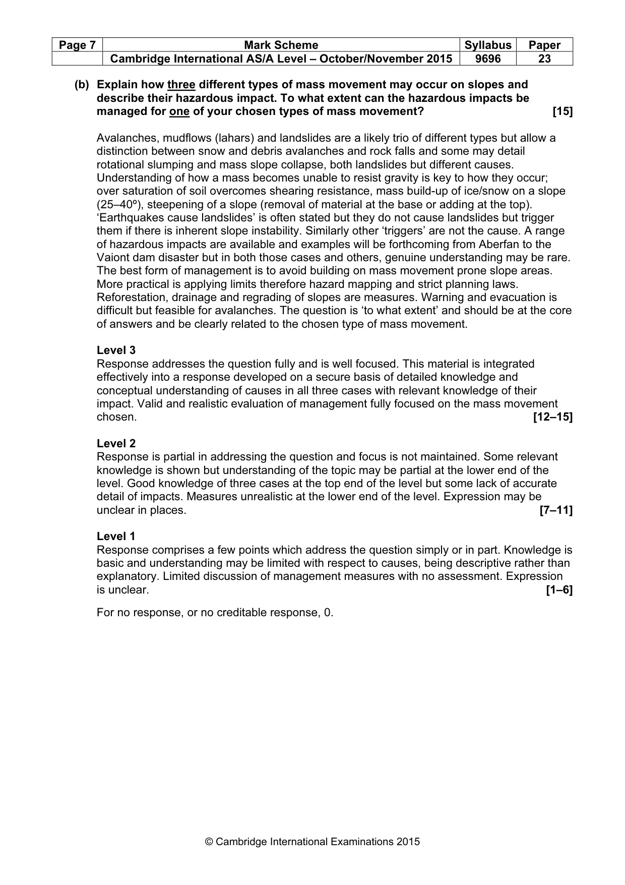
Page 7 Mark Scheme Syllabus Paper Cambridge International AS/A Level – October/November 2015 9696 23 © Cambridge International Examinations 2015 (b) Explain how three different types of mass movement may occur on slopes and describe their hazardous impact. To what extent can the hazardous impacts be managed for one of your chosen types of mass movement? [15] Avalanches, mudflows (lahars) and landslides are a likely trio of different types but allow a distinction between snow and debris avalanches and rock falls and some may detail rotational slumping and mass slope collapse, both landslides but different causes. Understanding of how a mass becomes unable to resist gravity is key to how they occur; over saturation of soil overcomes shearing resistance, mass build-up of ice/snow on a slope (25–40º), steepening of a slope (removal of material at the base or adding at the top). ‘Earthquakes cause landslides’ is often stated but they do not cause landslides but trigger them if there is inherent slope instability. Similarly other ‘triggers’ are not the cause. A range of hazardous impacts are available and examples will be forthcoming from Aberfan to the Vaiont dam disaster but in both those cases and others, genuine understanding may be rare. The best form of management is to avoid building on mass movement prone slope areas. More practical is applying limits therefore hazard mapping and strict planning laws. Reforestation, drainage and regrading of slopes are measures. Warning and evacuation is difficult but feasible for avalanches. The question is ‘to what extent’ and should be at the core of answers and be clearly related to the chosen type of mass movement. Level 3 Response addresses the question fully and is well focused. This material is integrated effectively into a response developed on a secure basis of detailed knowledge and conceptual understanding of causes in all three cases with relevant knowledge of their impact. Valid and realistic evaluation of management fully focused on the mass movement chosen. [12–15] Level 2 Response is partial in addressing the question and focus is not maintained. Some relevant knowledge is shown but understanding of the topic may be partial at the lower end of the level. Good knowledge of three cases at the top end of the level but some lack of accurate detail of impacts. Measures unrealistic at the lower end of the level. Expression may be unclear in places. [7–11] Level 1 Response comprises a few points which address the question simply or in part. Knowledge is basic and understanding may be limited with respect to causes, being descriptive rather than explanatory. Limited discussion of management measures with no assessment. Expression is unclear. [1–6] For no response, or no creditable response, 0.
Mark scheme, page 8
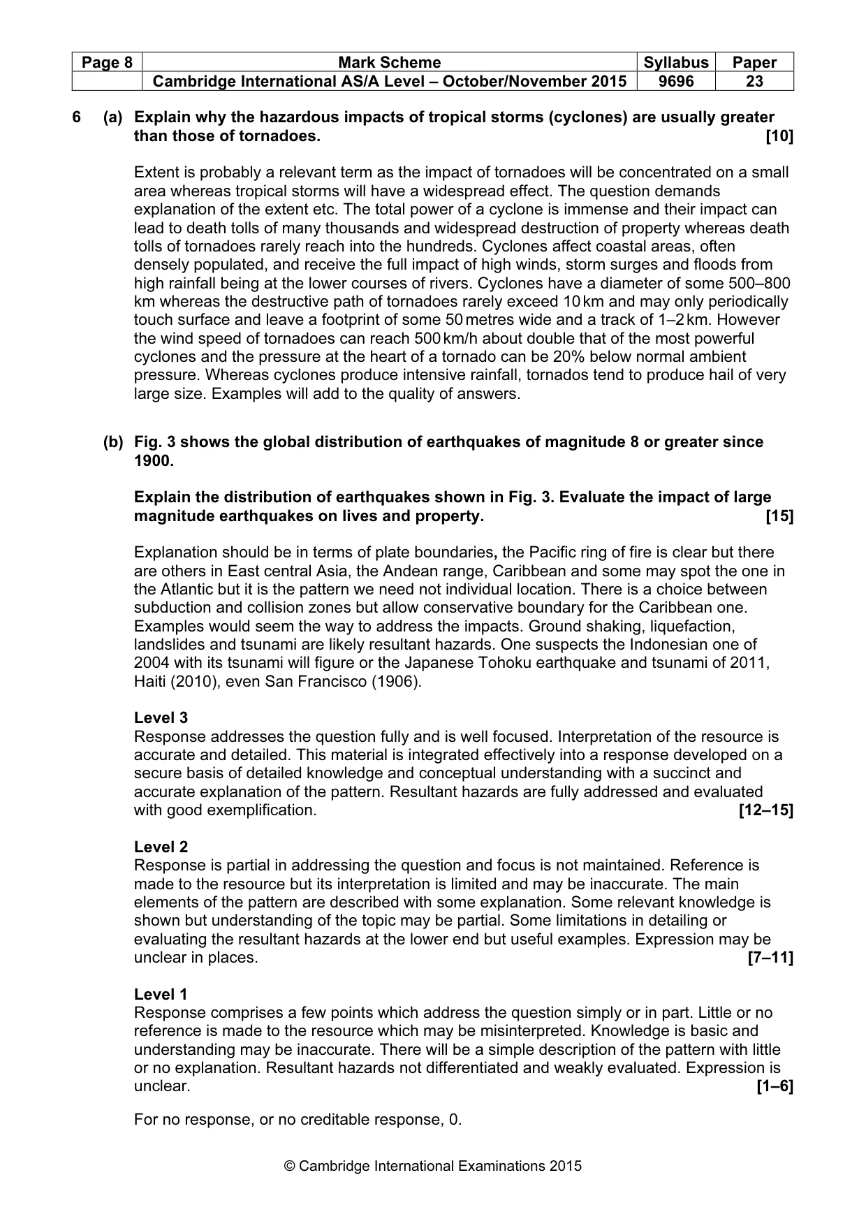
Page 8 Mark Scheme Syllabus Paper Cambridge International AS/A Level – October/November 2015 9696 23 © Cambridge International Examinations 2015 6 (a) Explain why the hazardous impacts of tropical storms (cyclones) are usually greater than those of tornadoes. [10] Extent is probably a relevant term as the impact of tornadoes will be concentrated on a small area whereas tropical storms will have a widespread effect. The question demands explanation of the extent etc. The total power of a cyclone is immense and their impact can lead to death tolls of many thousands and widespread destruction of property whereas death tolls of tornadoes rarely reach into the hundreds. Cyclones affect coastal areas, often densely populated, and receive the full impact of high winds, storm surges and floods from high rainfall being at the lower courses of rivers. Cyclones have a diameter of some 500–800 km whereas the destructive path of tornadoes rarely exceed 10 km and may only periodically touch surface and leave a footprint of some 50 metres wide and a track of 1–2 km. However the wind speed of tornadoes can reach 500 km/h about double that of the most powerful cyclones and the pressure at the heart of a tornado can be 20% below normal ambient pressure. Whereas cyclones produce intensive rainfall, tornados tend to produce hail of very large size. Examples will add to the quality of answers. (b) Fig. 3 shows the global distribution of earthquakes of magnitude 8 or greater since 1900. Explain the distribution of earthquakes shown in Fig. 3. Evaluate the impact of large magnitude earthquakes on lives and property. [15] Explanation should be in terms of plate boundaries, the Pacific ring of fire is clear but there are others in East central Asia, the Andean range, Caribbean and some may spot the one in the Atlantic but it is the pattern we need not individual location. There is a choice between subduction and collision zones but allow conservative boundary for the Caribbean one. Examples would seem the way to address the impacts. Ground shaking, liquefaction, landslides and tsunami are likely resultant hazards. One suspects the Indonesian one of 2004 with its tsunami will figure or the Japanese Tohoku earthquake and tsunami of 2011, Haiti (2010), even San Francisco (1906). Level 3 Response addresses the question fully and is well focused. Interpretation of the resource is accurate and detailed. This material is integrated effectively into a response developed on a secure basis of detailed knowledge and conceptual understanding with a succinct and accurate explanation of the pattern. Resultant hazards are fully addressed and evaluated with good exemplification. [12–15] Level 2 Response is partial in addressing the question and focus is not maintained. Reference is made to the resource but its interpretation is limited and may be inaccurate. The main elements of the pattern are described with some explanation. Some relevant knowledge is shown but understanding of the topic may be partial. Some limitations in detailing or evaluating the resultant hazards at the lower end but useful examples. Expression may be unclear in places. [7–11] Level 1 Response comprises a few points which address the question simply or in part. Little or no reference is made to the resource which may be misinterpreted. Knowledge is basic and understanding may be inaccurate. There will be a simple description of the pattern with little or no explanation. Resultant hazards not differentiated and weakly evaluated. Expression is unclear. [1–6] For no response, or no creditable response, 0.
Mark scheme, page 9
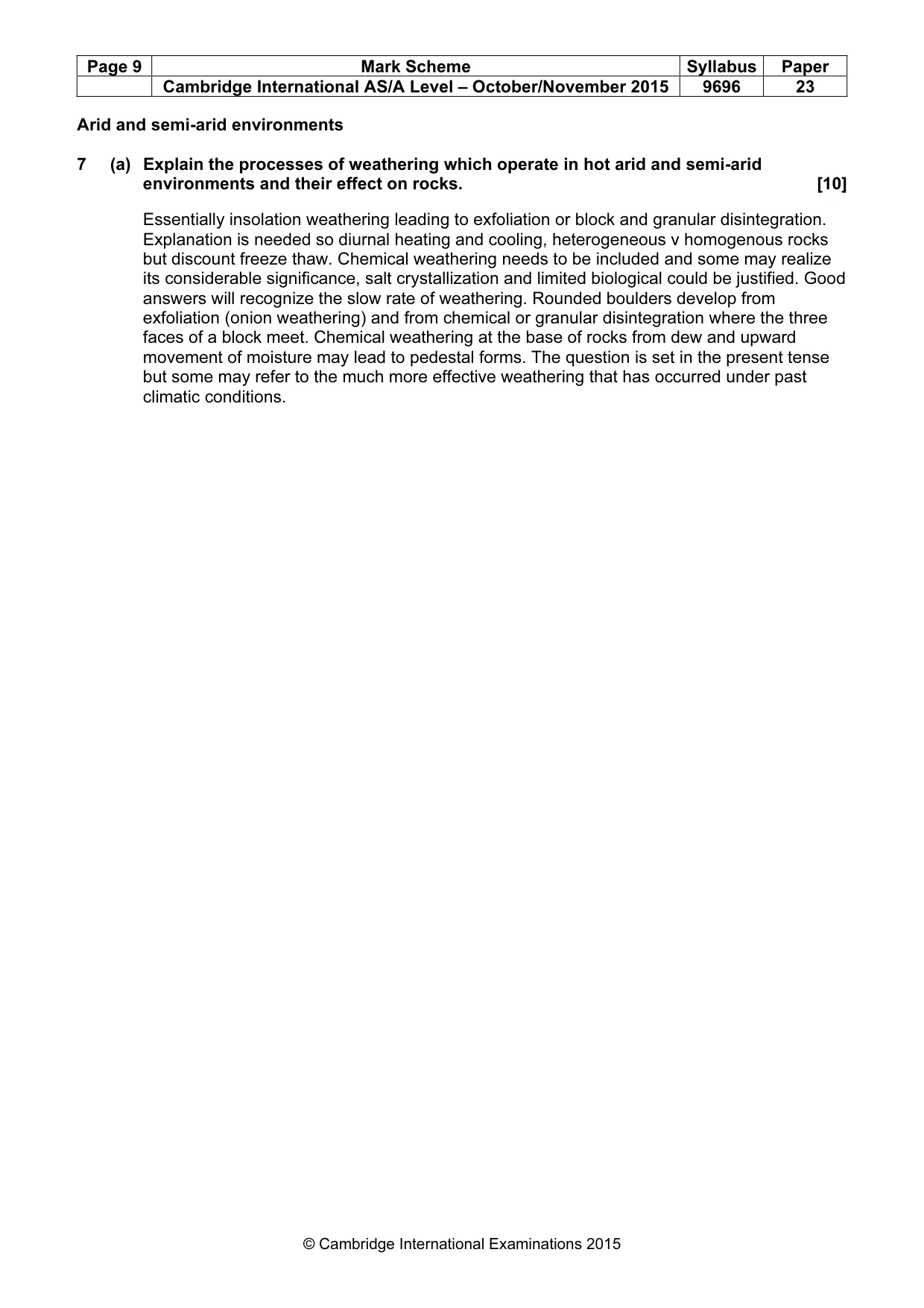
Page 9 Mark Scheme Syllabus Paper Cambridge International AS/A Level – October/November 2015 9696 23 © Cambridge International Examinations 2015 Arid and semi-arid environments 7 (a) Explain the processes of weathering which operate in hot arid and semi-arid environments and their effect on rocks. [10] Essentially insolation weathering leading to exfoliation or block and granular disintegration. Explanation is needed so diurnal heating and cooling, heterogeneous v homogenous rocks but discount freeze thaw. Chemical weathering needs to be included and some may realize its considerable significance, salt crystallization and limited biological could be justified. Good answers will recognize the slow rate of weathering. Rounded boulders develop from exfoliation (onion weathering) and from chemical or granular disintegration where the three faces of a block meet. Chemical weathering at the base of rocks from dew and upward movement of moisture may lead to pedestal forms. The question is set in the present tense but some may refer to the much more effective weathering that has occurred under past climatic conditions.
Mark scheme, page 10
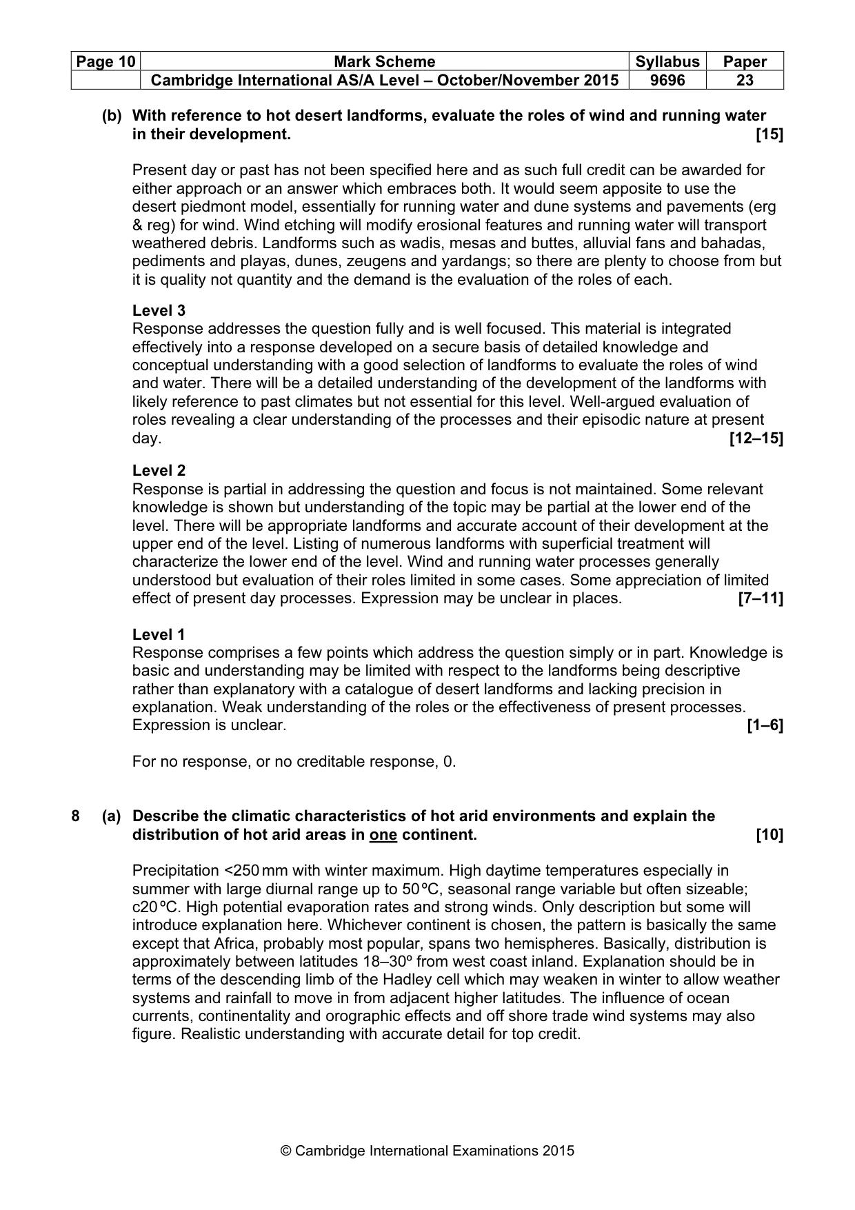
Page 10 Mark Scheme Syllabus Paper Cambridge International AS/A Level – October/November 2015 9696 23 © Cambridge International Examinations 2015 (b) With reference to hot desert landforms, evaluate the roles of wind and running water in their development. [15] Present day or past has not been specified here and as such full credit can be awarded for either approach or an answer which embraces both. It would seem apposite to use the desert piedmont model, essentially for running water and dune systems and pavements (erg & reg) for wind. Wind etching will modify erosional features and running water will transport weathered debris. Landforms such as wadis, mesas and buttes, alluvial fans and bahadas, pediments and playas, dunes, zeugens and yardangs; so there are plenty to choose from but it is quality not quantity and the demand is the evaluation of the roles of each. Level 3 Response addresses the question fully and is well focused. This material is integrated effectively into a response developed on a secure basis of detailed knowledge and conceptual understanding with a good selection of landforms to evaluate the roles of wind and water. There will be a detailed understanding of the development of the landforms with likely reference to past climates but not essential for this level. Well-argued evaluation of roles revealing a clear understanding of the processes and their episodic nature at present day. [12–15] Level 2 Response is partial in addressing the question and focus is not maintained. Some relevant knowledge is shown but understanding of the topic may be partial at the lower end of the level. There will be appropriate landforms and accurate account of their development at the upper end of the level. Listing of numerous landforms with superficial treatment will characterize the lower end of the level. Wind and running water processes generally understood but evaluation of their roles limited in some cases. Some appreciation of limited effect of present day processes. Expression may be unclear in places. [7–11] Level 1 Response comprises a few points which address the question simply or in part. Knowledge is basic and understanding may be limited with respect to the landforms being descriptive rather than explanatory with a catalogue of desert landforms and lacking precision in explanation. Weak understanding of the roles or the effectiveness of present processes. Expression is unclear. [1–6] For no response, or no creditable response, 0. 8 (a) Describe the climatic characteristics of hot arid environments and explain the distribution of hot arid areas in one continent. [10] Precipitation <250 mm with winter maximum. High daytime temperatures especially in summer with large diurnal range up to 50 ºC, seasonal range variable but often sizeable; c20 ºC. High potential evaporation rates and strong winds. Only description but some will introduce explanation here. Whichever continent is chosen, the pattern is basically the same except that Africa, probably most popular, spans two hemispheres. Basically, distribution is approximately between latitudes 18–30º from west coast inland. Explanation should be in terms of the descending limb of the Hadley cell which may weaken in winter to allow weather systems and rainfall to move in from adjacent higher latitudes. The influence of ocean currents, continentality and orographic effects and off shore trade wind systems may also figure. Realistic understanding with accurate detail for top credit.
Mark scheme, page 11
Page 11 Mark Scheme Syllabus Paper Cambridge International AS/A Level – October/November 2015 9696 23 © Cambridge International Examinations 2015 (b) Photographs A and B show some impacts of desertification in a semi-arid environment. Explain the physical and human factors that may lead to desertification as shown in Photographs A and B. Evaluate a scheme, or schemes, to sustainably manage semi- arid areas threatened by desertification. [15] Both physical and human factors should be addressed; too often the physical is ignored or treated too superficially. The semi-arid climate is in a marginal region depending on the reliability of the movement of the ITCZ bringing summer rainfall and are regions sensitive to any global climatic changes. Extreme high temperatures leading to fire, strong winds and soils lacking structure and with limited plant root system all contribute to soil erosion and sand storms. Human factors have been a major contributor; over grazing, depletion of any forest for building and fuel, inappropriate cultivation and irrigation and all exacerbated by increasing population pressure. Such over cultivation and grazing further reduces the soil structure leading to massive soil erosion, dust storms and extension of desert margins. Case studies, or examples, with realistic and appropriate detail are required in evaluating measures to combat desertification and develop sustainable management. Addressing the problem should be recognised as a monumental task with no simple solutions. Expect wind breaks or structures to reduce the advance of sands, e.g. Africa’s ‘Green Wall’. Use of drought resistant crops, such as sorghums, in place of exhausting cash crops. Controlled drip irrigation systems in place of field ditches and the control of grazing. Input of fertilizers and mulching. But realisation of the poverty of most such areas and that all ‘solutions’ require knowledge and capital. Understanding of the work of NGOs as well as government agencies. Level 3 Response addresses the question fully and is well focused. This material is integrated effectively into a response developed on a secure basis of detailed knowledge and conceptual understanding of causes. Good knowledge of the physical environment with a realistic understanding of the difficulties of applying any effective solutions. Appropriate detail and ability to weigh up their likely and long term success. Exemplification in all parts of the answer. [12–15] Level 2 Response is partial in addressing the question and focus is not maintained. Some relevant knowledge is shown but understanding of the topic may be partial. Both parts of the question are addressed but somewhat lacking in accurate detail and limited in examples. Some appropriate solutions with limited evaluation but not well developed or detailed. At the lower end of the level the solutions are unrealistic and an awareness of the true nature of the environment lacking. Expression may be unclear in places. [7–11] Level 1 Response comprises a few points which address the question simply or in part. Knowledge is basic and understanding may be inaccurate with weak in coverage of the nature of the environment. A confused mixture of solutions with little or no evaluation. Expression is unclear. [1–6] For no response, or no creditable response, 0.
What you needed in this session
Cambridge’s own grade thresholds for 2015 Oct/Nov, Paper 2 · Variant 3. A higher threshold means an easier paper — the bar moves with how the cohort did.