Cambridge IGCSE Pakistan Studies 0448 — 2014 May/June Paper 2 · Variant 1
0448/21/M/J/14 · 5 questions · 119 marks · ≈134 min
The question paper and its mark scheme, free to read here and free to download. This is Cambridge’s own paper, exactly as it was sat.
Question paper20 pages


Mark scheme11 pages
Answers below. Sit the paper first if you are practising.
Questions as text
Question 1
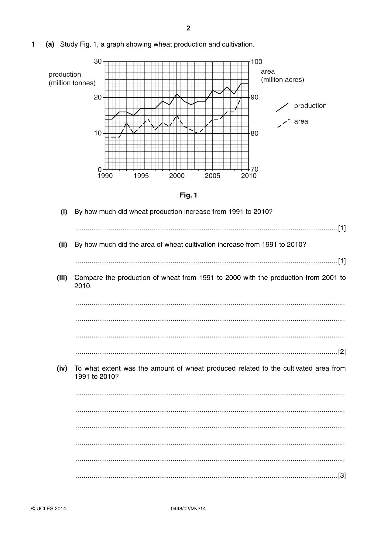
1 (a) Study Fig. 1, a graph showing wheat production and cultivation. 30 100 area production (million acres) (million tonnes) 20 90 production area 10 80 0 70 1990 1995 2000 2005 2010 Fig. 1 (i) By how much did wheat production increase from 1991 to 2010? .......................................................................................................................................[1] (ii) By how much did the area of wheat cultivation increase from 1991 to 2010? .......................................................................................................................................[1] (iii) Compare the production of wheat from 1991 to 2000 with the production from 2001 to 2010. ........................................................................................................................................... ........................................................................................................................................... ........................................................................................................................................... .......................................................................................................................................[2] (iv) To what extent was the amount of wheat produced related to the cultivated area from 1991 to 2010? ........................................................................................................................................... ........................................................................................................................................... ........................................................................................................................................... ........................................................................................................................................... ........................................................................................................................................... .......................................................................................................................................[3] (b) (i) Circle the months in which most wheat is grown in Pakistan. OCTOBER – MAY JUNE – SEPTEMBER [1] (ii) Explain why the climate at this time is most suitable for wheat farming. ........................................................................................................................................... ........................................................................................................................................... ........................................................................................................................................... ........................................................................................................................................... ........................................................................................................................................... .......................................................................................................................................[3] (c) Why are waterlogging and salinity called ‘the twin menaces for farmers’? ................................................................................................................................................... ................................................................................................................................................... ................................................................................................................................................... ...............................................................................................................................................[2] (d) Describe the ways in which damage by waterlogging and salinity can be prevented. ................................................................................................................................................... ................................................................................................................................................... ................................................................................................................................................... ................................................................................................................................................... ................................................................................................................................................... ................................................................................................................................................... ................................................................................................................................................... ................................................................................................................................................... ................................................................................................................................................... ................................................................................................................................................... ................................................................................................................................................... ...............................................................................................................................................[6] (e) To what extent can better education and training increase farm production? ................................................................................................................................................... ................................................................................................................................................... ................................................................................................................................................... ................................................................................................................................................... ................................................................................................................................................... ................................................................................................................................................... ................................................................................................................................................... ................................................................................................................................................... ................................................................................................................................................... ................................................................................................................................................... ................................................................................................................................................... ...............................................................................................................................................[6] [Total: 25]
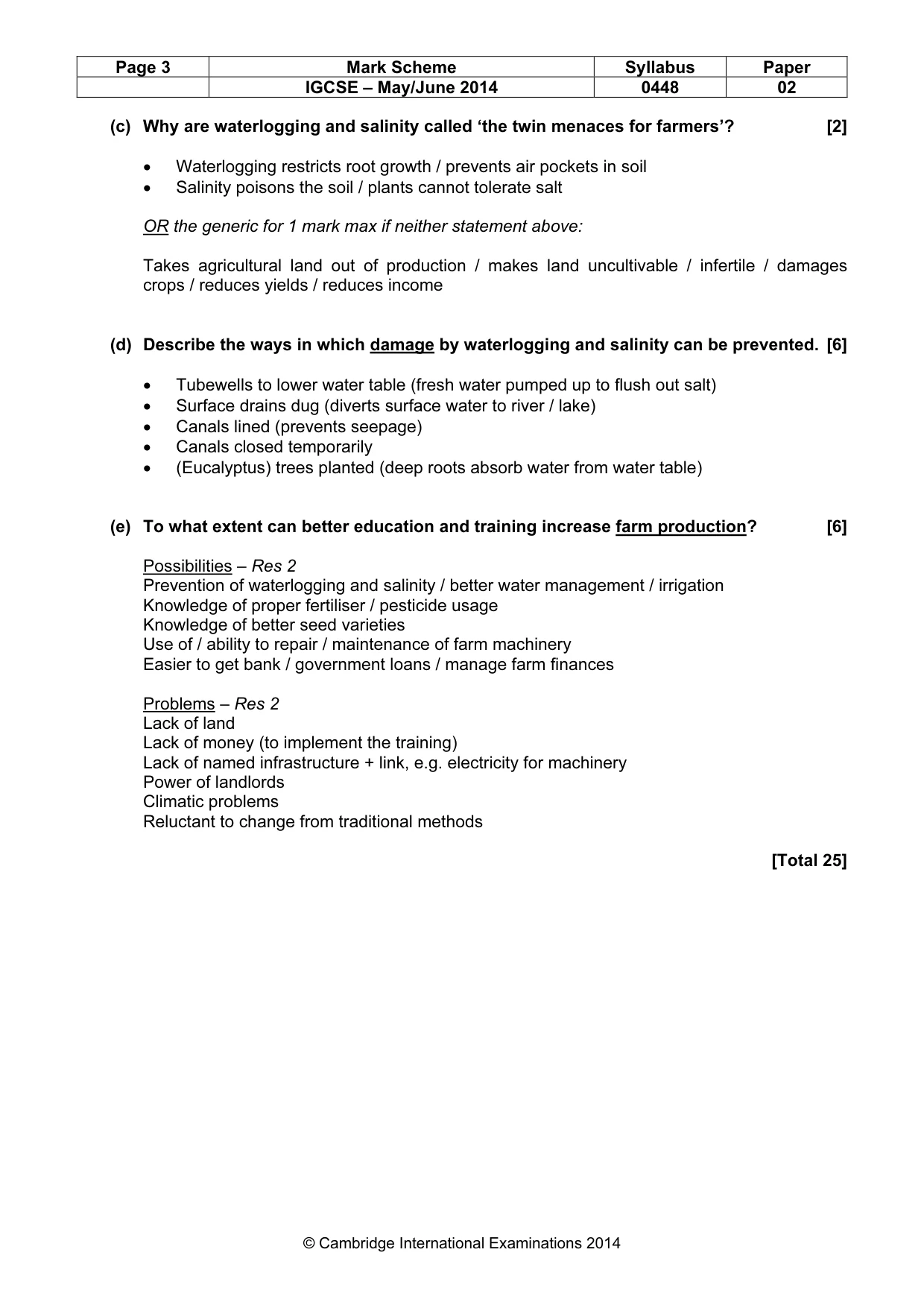
Mark scheme: 1 (a) Study Fig 1, a graph showing wheat production and cultivation (i) By how much did wheat production increase from 1991 to 2010? [1] 10 million tonnes (ii) By how much did the area of wheat cultivation increase from 1991 to 2010? [1] 11 million acres (iii) Compare the production of wheat from 1991 to 2000 with the production from 2001 to 2010. [2] Both increased Both fluctuated (year to year) For 1991–2000 Accept converse for 2001–10 Lower (average) production Increased at a higher rate From 14–21 mn / by 7 mn whereas 2001–10 from 19–24 mn / by 5 mn Rises to / maximum 21 mn whereas 2001–10 24 mn References to figures need million (iv) To what extent was wheat production related to the cultivated area from 1991 to 2010? [3] • Direct relationship / positive correlation / relationship described e.g. when production is high, area is high • Inverse / no relationship = 0 Res 1 • Both lowest in 1991 • Both highest in 2010 • Year both constant – 2009 • Years both increase – 1994 / 1997 / 1999 / 2004 / 2006 / 2008 • Years both decrease – 1993 / 1998 / 2000 / 2001 • Exception (max 1) e.g.: production increases when area decreases – 2002 • production increases when area constant – 1991 • production decreases when area constant 2005 / 2007 • area increases when production constant – 1992 / 1995 / 2003 • area decreases when production constant – 1996 (b) (i) Circle the months in which most wheat is grown in Pakistan. [1] October–May: Both periods circled = 0 (ii) Explain why the climate at this time is most suitable for wheat farming [3] • Mild temperatures / 10–20 °C for growth • Warmer / 25–30 °C (in spring) for ripening / harvesting • Moderate rainfall / 150–500 mm (in spring) for growth / to swell the grain / before harvest • Dry period / no rain (in spring) for harvest IGCSE – May/June 2014 0448 02 (c) Why are waterlogging and salinity called ‘the twin menaces for farmers’? [2] • Waterlogging restricts root growth / prevents air pockets in soil • Salinity poisons the soil / plants cannot tolerate salt OR the generic for 1 mark max if neither statement above: Takes agricultural land out of production / makes land uncultivable / infertile / damages crops / reduces yields / reduces income (d) Describe the ways in which damage by waterlogging and salinity can be prevented. [6] • Tubewells to lower water table (fresh water pumped up to flush out salt) • Surface drains dug (diverts surface water to river / lake) • Canals lined (prevents seepage) • Canals closed temporarily • (Eucalyptus) trees planted (deep roots absorb water from water table) (e) To what extent can better education and training increase farm production? [6] Possibilities – Res 2 Prevention of waterlogging and salinity / better water management / irrigation Knowledge of proper fertiliser / pesticide usage Knowledge of better seed varieties Use of / ability to repair / maintenance of farm machinery Easier to get bank / government loans / manage farm finances Problems – Res 2 Lack of land Lack of money (to implement the training) Lack of named infrastructure + link, e.g. electricity for machinery Power of landlords Climatic problems Reluctant to change from traditional methods [Total 25] IGCSE – May/June 2014 0448 02
Question 2
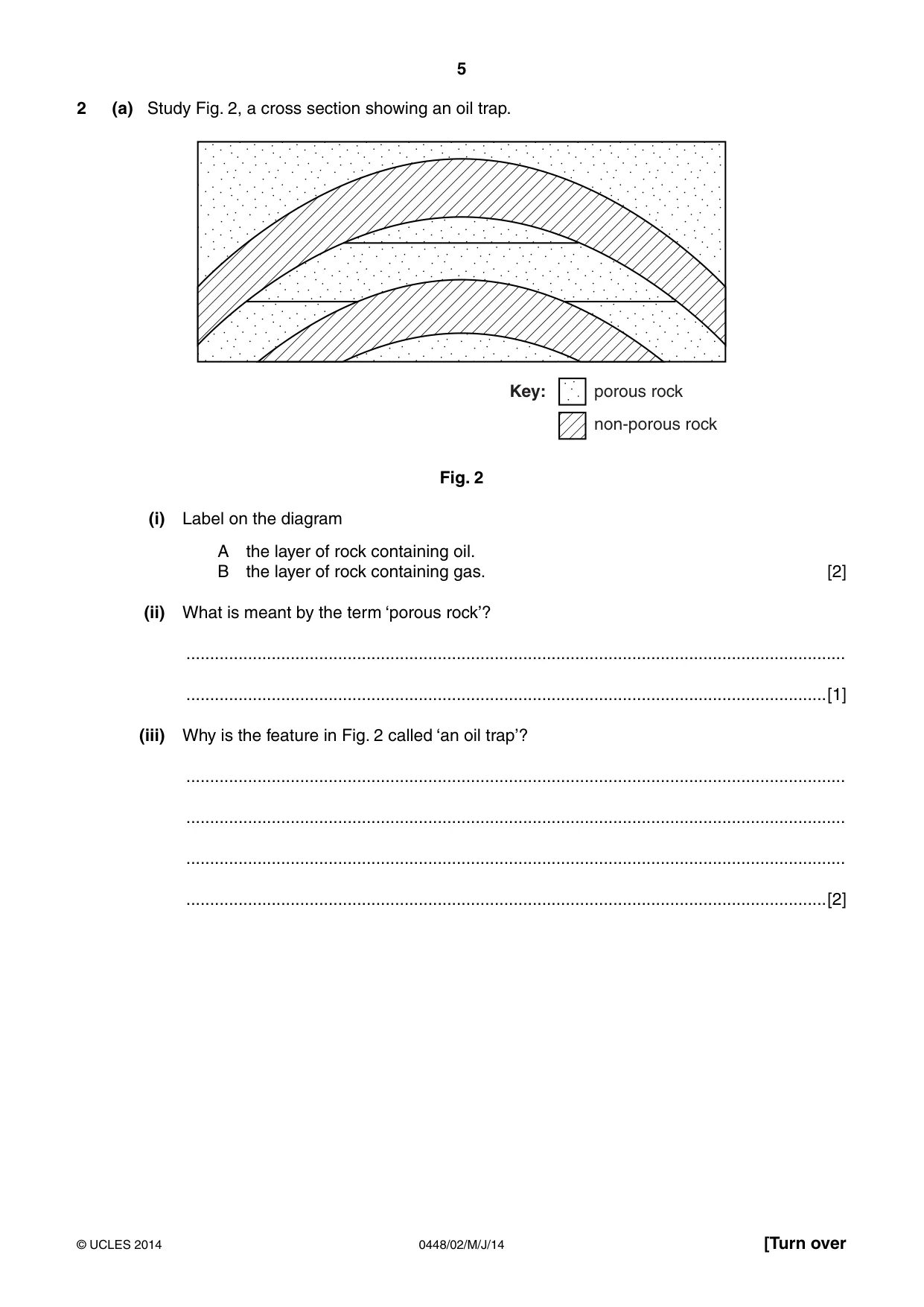
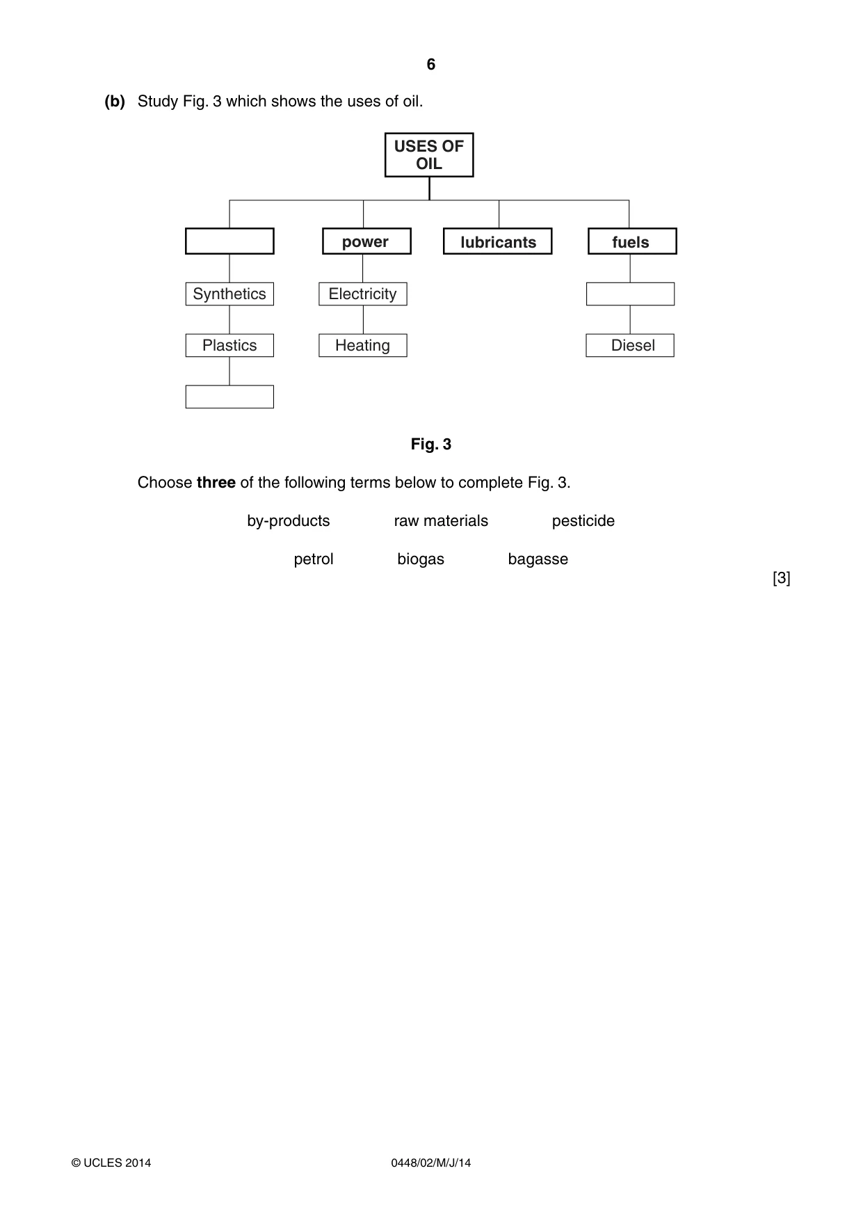
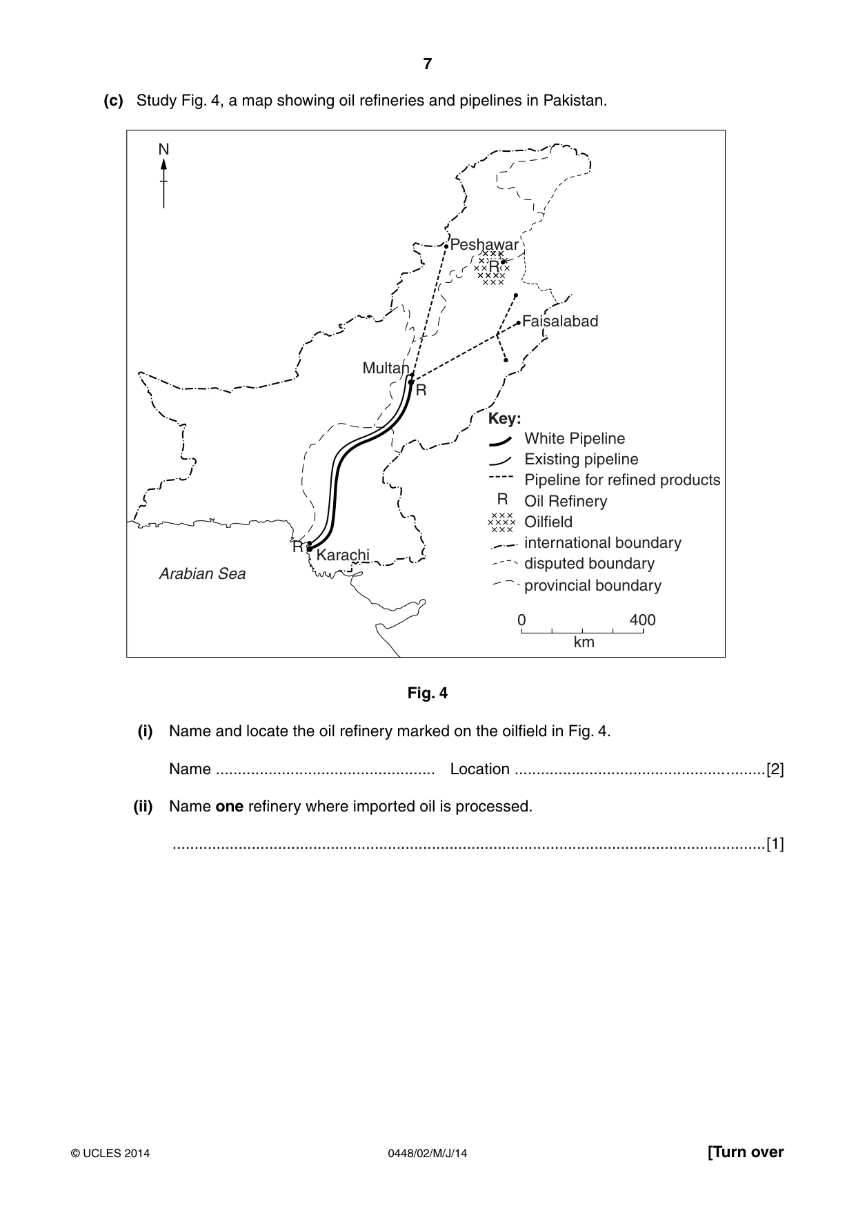
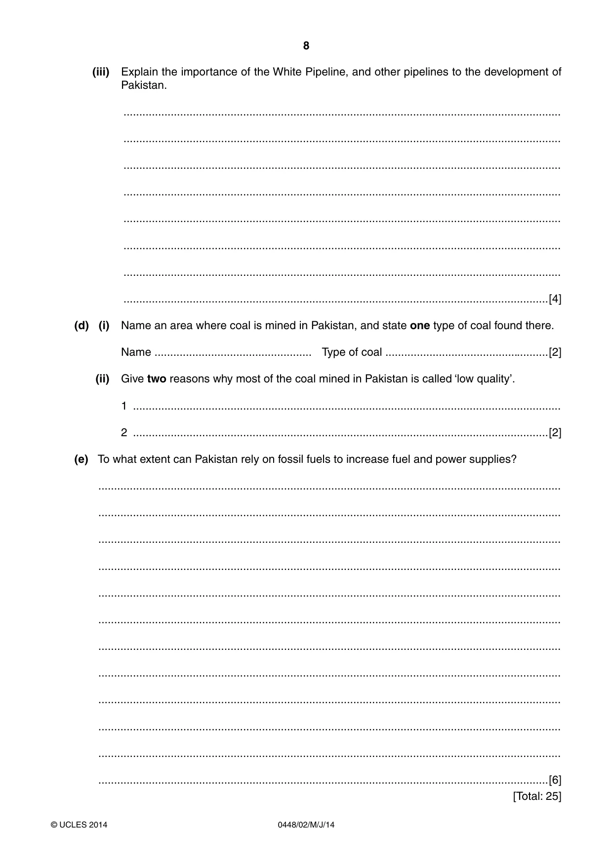
2 (a) Study Fig. 2, a cross section showing an oil trap. Key: porous rock non-porous rock Fig. 2 (i) Label on the diagram A the layer of rock containing oil. B the layer of rock containing gas. [2] (ii) What is meant by the term ‘porous rock’? ........................................................................................................................................... .......................................................................................................................................[1] (iii) Why is the feature in Fig. 2 called ‘an oil trap’? ........................................................................................................................................... ........................................................................................................................................... ........................................................................................................................................... .......................................................................................................................................[2] (b) Study Fig. 3 which shows the uses of oil. 86(6 2) 2,/ power lubricants fuels Synthetics Electricity Plastics Heating Diesel Fig. 3 Choose three of the following terms below to complete Fig. 3. by-products raw materials pesticide petrol biogas bagasse [3] (c) Study Fig. 4, a map showing oil refineries and pipelines in Pakistan. N Peshawar R Faisalabad Multan R Key: White Pipeline Existing pipeline Pipeline for refined products R Oil Refinery Oilfield R international boundary Karachi disputed boundary Arabian Sea provincial boundary 0 400 km Fig. 4 (i) Name and locate the oil refinery marked on the oilfield in Fig. 4. Name .................................................. Location ................................................ .........[2] (ii) Name one refinery where imported oil is processed. .......................................................................................................................................[1] (iii) Explain the importance of the White Pipeline, and other pipelines to the development of Pakistan. ........................................................................................................................................... ........................................................................................................................................... ........................................................................................................................................... ........................................................................................................................................... ........................................................................................................................................... ........................................................................................................................................... ........................................................................................................................................... .......................................................................................................................................[4] (d) (i) Name an area where coal is mined in Pakistan, and state one type of coal found there. Name .................................................. Type of coal ....................................................[2] (ii) Give two reasons why most of the coal mined in Pakistan is called ‘low quality’. 1 ........................................................................................................................................ 2 ....................................................................................................................................[2] (e) To what extent can Pakistan rely on fossil fuels to increase fuel and power supplies? ................................................................................................................................................... ................................................................................................................................................... ................................................................................................................................................... ................................................................................................................................................... ................................................................................................................................................... ................................................................................................................................................... ................................................................................................................................................... ................................................................................................................................................... ................................................................................................................................................... ................................................................................................................................................... ................................................................................................................................................... ...............................................................................................................................................[6] [Total: 25]
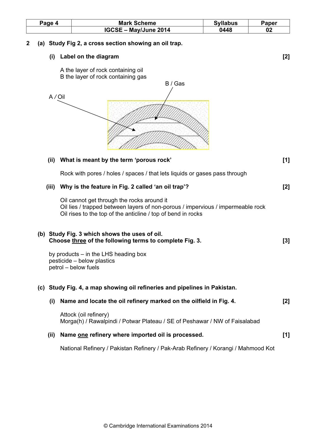
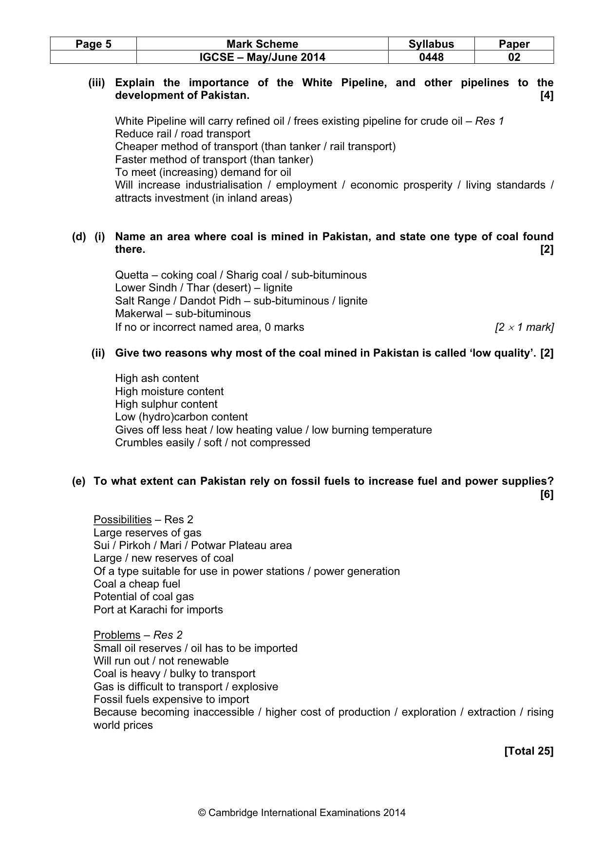
Mark scheme: 2 (a) Study Fig 2, a cross section showing an oil trap. (i) Label on the diagram [2] A the layer of rock containing oil B the layer of rock containing gas B / Gas A / Oil (ii) What is meant by the term ‘porous rock’ [1] Rock with pores / holes / spaces / that lets liquids or gases pass through (iii) Why is the feature in Fig. 2 called ‘an oil trap’? [2] Oil cannot get through the rocks around it Oil lies / trapped between layers of non-porous / impervious / impermeable rock Oil rises to the top of the anticline / top of bend in rocks (b) Study Fig. 3 which shows the uses of oil. Choose three of the following terms to complete Fig. 3. [3] by products – in the LHS heading box pesticide – below plastics petrol – below fuels (c) Study Fig. 4, a map showing oil refineries and pipelines in Pakistan. (i) Name and locate the oil refinery marked on the oilfield in Fig. 4. [2] Attock (oil refinery) Morga(h) / Rawalpindi / Potwar Plateau / SE of Peshawar / NW of Faisalabad (ii) Name one refinery where imported oil is processed. [1] National Refinery / Pakistan Refinery / Pak-Arab Refinery / Korangi / Mahmood Kot IGCSE – May/June 2014 0448 02 (iii) Explain the importance of the White Pipeline, and other pipelines to the development of Pakistan. [4] White Pipeline will carry refined oil / frees existing pipeline for crude oil – Res 1 Reduce rail / road transport Cheaper method of transport (than tanker / rail transport) Faster method of transport (than tanker) To meet (increasing) demand for oil Will increase industrialisation / employment / economic prosperity / living standards / attracts investment (in inland areas) (d) (i) Name an area where coal is mined in Pakistan, and state one type of coal found there. [2] Quetta – coking coal / Sharig coal / sub-bituminous Lower Sindh / Thar (desert) – lignite Salt Range / Dandot Pidh – sub-bituminous / lignite Makerwal – sub-bituminous If no or incorrect named area, 0 marks [2 × 1 mark] (ii) Give two reasons why most of the coal mined in Pakistan is called ‘low quality’. [2] High ash content High moisture content High sulphur content Low (hydro)carbon content Gives off less heat / low heating value / low burning temperature Crumbles easily / soft / not compressed (e) To what extent can Pakistan rely on fossil fuels to increase fuel and power supplies? [6] Possibilities – Res 2 Large reserves of gas Sui / Pirkoh / Mari / Potwar Plateau area Large / new reserves of coal Of a type suitable for use in power stations / power generation Coal a cheap fuel Potential of coal gas Port at Karachi for imports Problems – Res 2 Small oil reserves / oil has to be imported Will run out / not renewable Coal is heavy / bulky to transport Gas is difficult to transport / explosive Fossil fuels expensive to import Because becoming inaccessible / higher cost of production / exploration / extraction / rising world prices [Total 25] IGCSE – May/June 2014 0448 02
Q3 · Study the map Fig
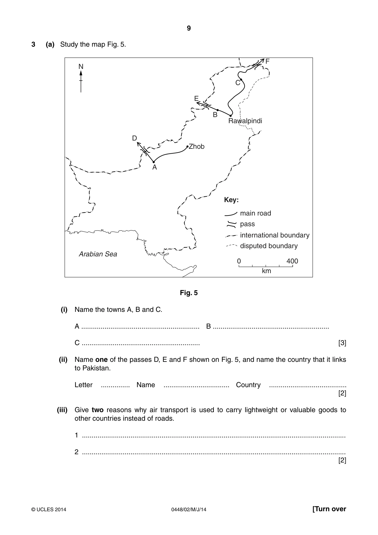
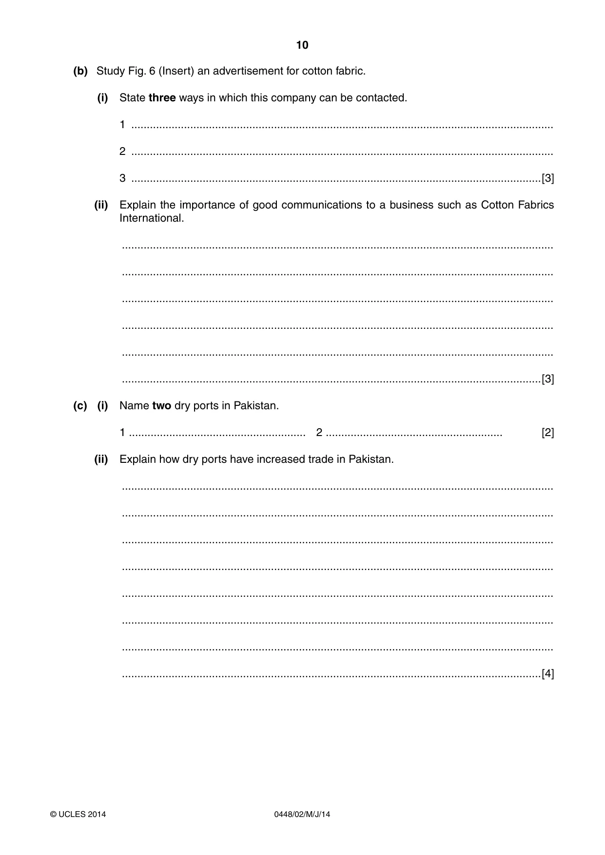
3 (a) Study the map Fig. 5. F N C E B Rawalpindi D Zhob A Key: main road pass international boundary disputed boundary Arabian Sea 0 400 km Fig. 5 (i) Name the towns A, B and C. A ............................................................. B ............................................................ C ............................................................. [3] (ii) Name one of the passes D, E and F shown on Fig. 5, and name the country that it links to Pakistan. Letter ............... Name .................................. Country ........................................ [2] (iii) Give two reasons why air transport is used to carry lightweight or valuable goods to other countries instead of roads. 1 ........................................................................................................................................ 2 ........................................................................................................................................ [2] (b) Study Fig. 6 (Insert) an advertisement for cotton fabric. (i) State three ways in which this company can be contacted. 1 ........................................................................................................................................ 2 ........................................................................................................................................ 3 ....................................................................................................................................[3] (ii) Explain the importance of good communications to a business such as Cotton Fabrics International. ........................................................................................................................................... ........................................................................................................................................... ........................................................................................................................................... ........................................................................................................................................... ........................................................................................................................................... .......................................................................................................................................[3] (c) (i) Name two dry ports in Pakistan. 1 ......................................................... 2 ......................................................... [2] (ii) Explain how dry ports have increased trade in Pakistan. ........................................................................................................................................... ........................................................................................................................................... ........................................................................................................................................... ........................................................................................................................................... ........................................................................................................................................... ........................................................................................................................................... ........................................................................................................................................... .......................................................................................................................................[4] (d) To what extent could a better road network increase the development of small scale and craft industries of Pakistan? ................................................................................................................................................... ................................................................................................................................................... ................................................................................................................................................... ................................................................................................................................................... ................................................................................................................................................... ................................................................................................................................................... ................................................................................................................................................... ................................................................................................................................................... ................................................................................................................................................... ................................................................................................................................................... ................................................................................................................................................... ...............................................................................................................................................[6] [Total: 25]
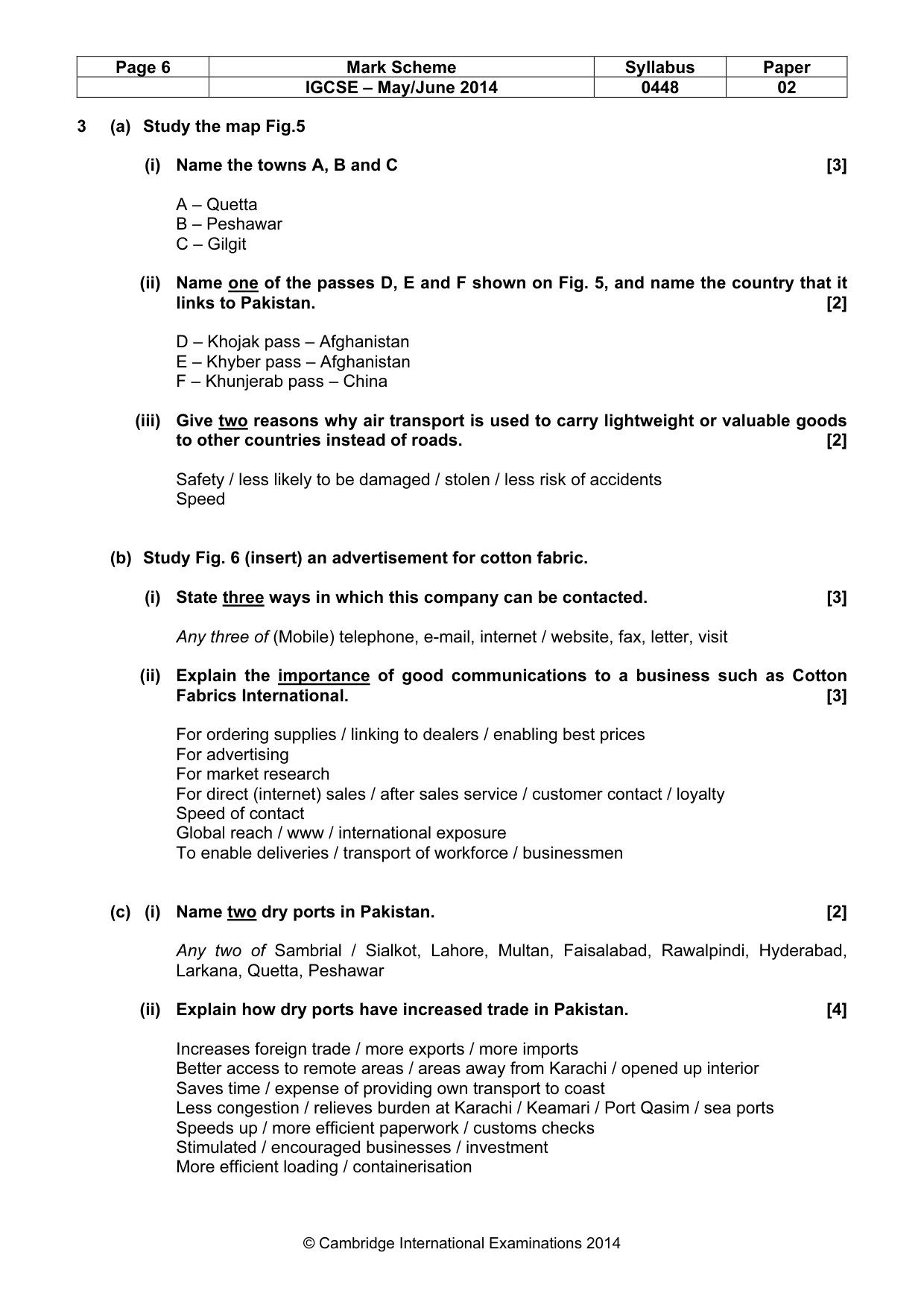
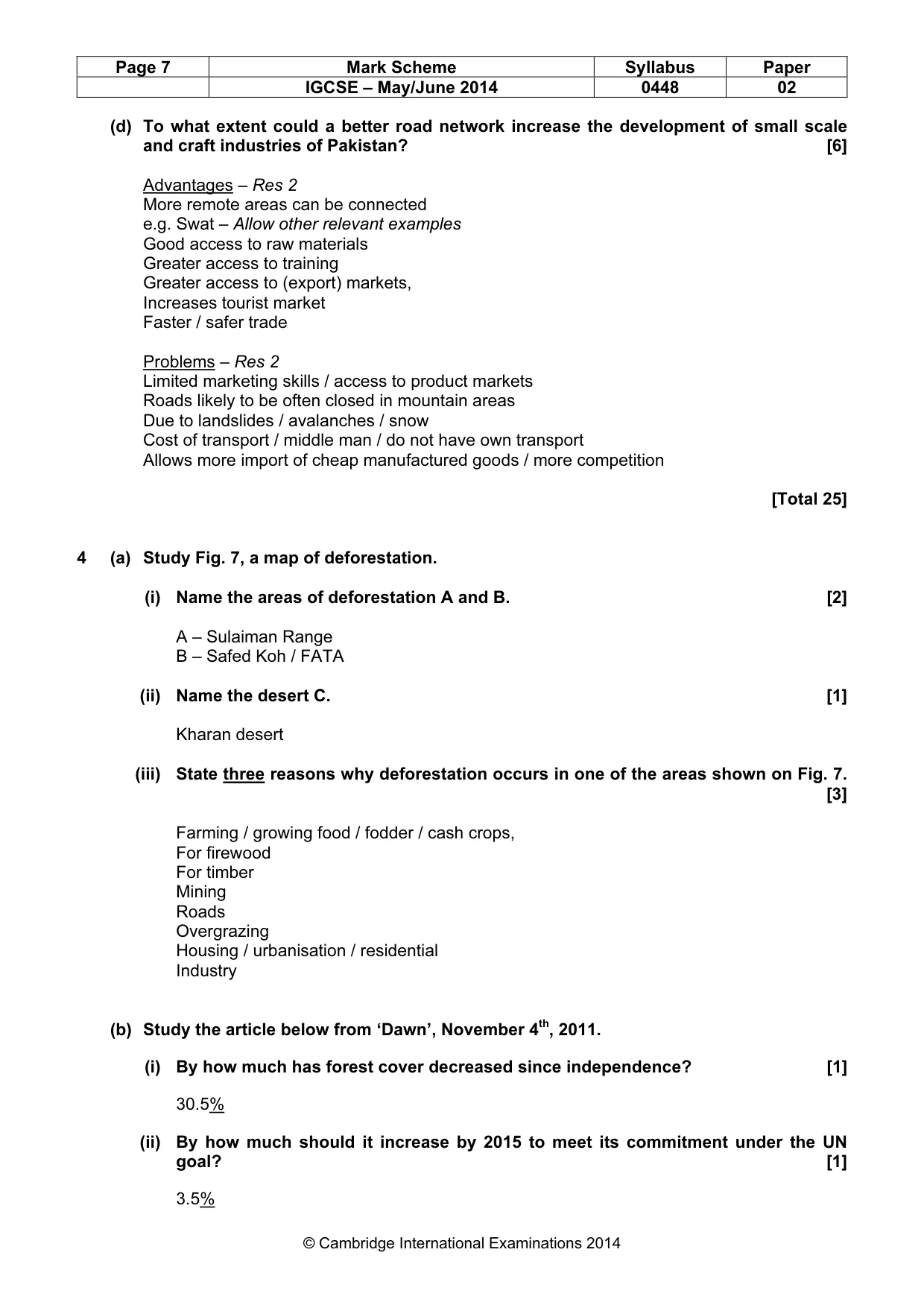
Mark scheme: 3 (a) Study the map Fig.5 (i) Name the towns A, B and C [3] A – Quetta B – Peshawar C – Gilgit (ii) Name one of the passes D, E and F shown on Fig. 5, and name the country that it links to Pakistan. [2] D – Khojak pass – Afghanistan E – Khyber pass – Afghanistan F – Khunjerab pass – China (iii) Give two reasons why air transport is used to carry lightweight or valuable goods to other countries instead of roads. [2] Safety / less likely to be damaged / stolen / less risk of accidents Speed (b) Study Fig. 6 (insert) an advertisement for cotton fabric. (i) State three ways in which this company can be contacted. [3] Any three of (Mobile) telephone, e-mail, internet / website, fax, letter, visit (ii) Explain the importance of good communications to a business such as Cotton Fabrics International. [3] For ordering supplies / linking to dealers / enabling best prices For advertising For market research For direct (internet) sales / after sales service / customer contact / loyalty Speed of contact Global reach / www / international exposure To enable deliveries / transport of workforce / businessmen (c) (i) Name two dry ports in Pakistan. [2] Any two of Sambrial / Sialkot, Lahore, Multan, Faisalabad, Rawalpindi, Hyderabad, Larkana, Quetta, Peshawar (ii) Explain how dry ports have increased trade in Pakistan. [4] Increases foreign trade / more exports / more imports Better access to remote areas / areas away from Karachi / opened up interior Saves time / expense of providing own transport to coast Less congestion / relieves burden at Karachi / Keamari / Port Qasim / sea ports Speeds up / more efficient paperwork / customs checks Stimulated / encouraged businesses / investment More efficient loading / containerisation IGCSE – May/June 2014 0448 02 (d) To what extent could a better road network increase the development of small scale and craft industries of Pakistan? [6] Advantages – Res 2 More remote areas can be connected e.g. Swat – Allow other relevant examples Good access to raw materials Greater access to training Greater access to (export) markets, Increases tourist market Faster / safer trade Problems – Res 2 Limited marketing skills / access to product markets Roads likely to be often closed in mountain areas Due to landslides / avalanches / snow Cost of transport / middle man / do not have own transport Allows more import of cheap manufactured goods / more competition [Total 25]
Question 4
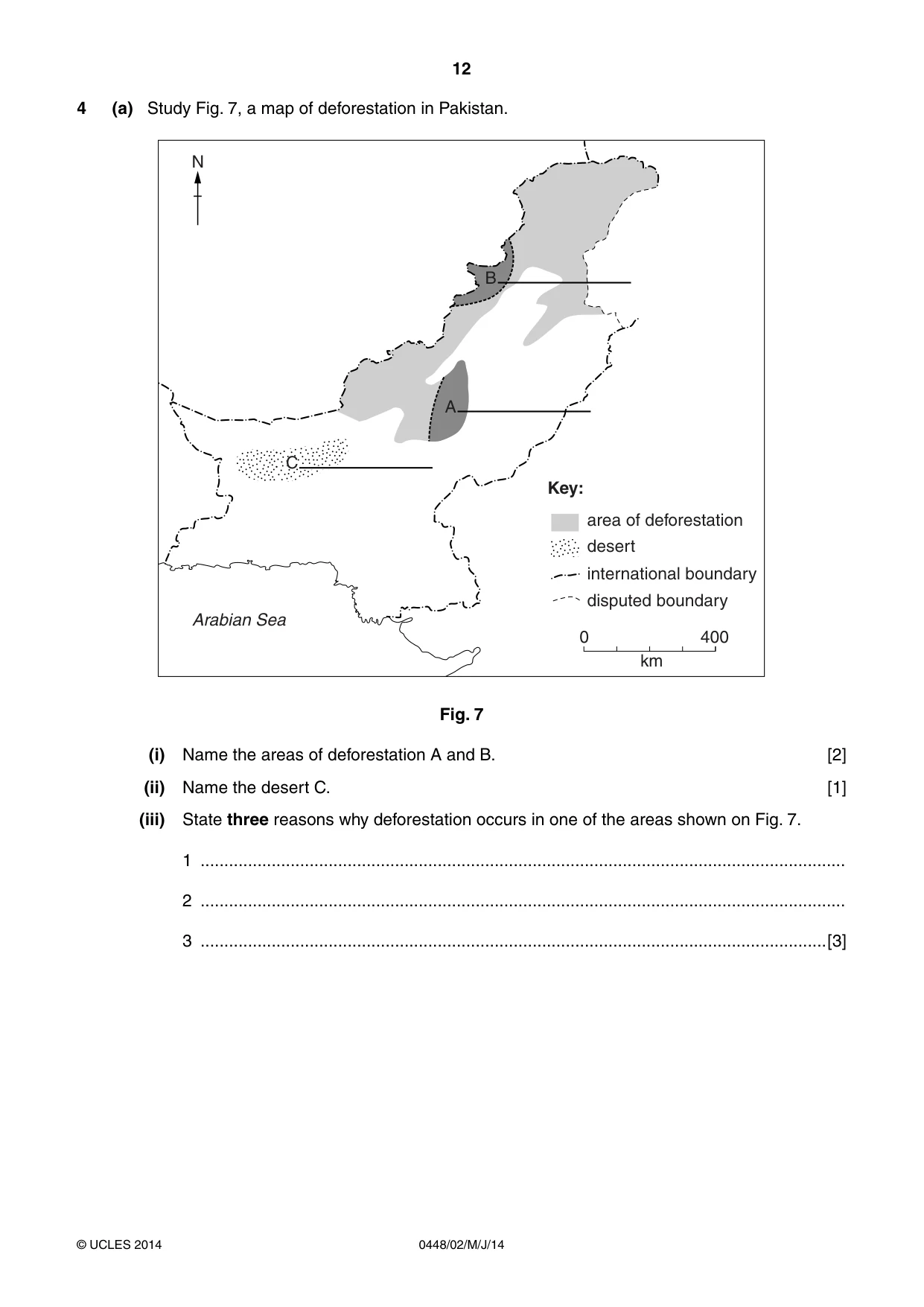
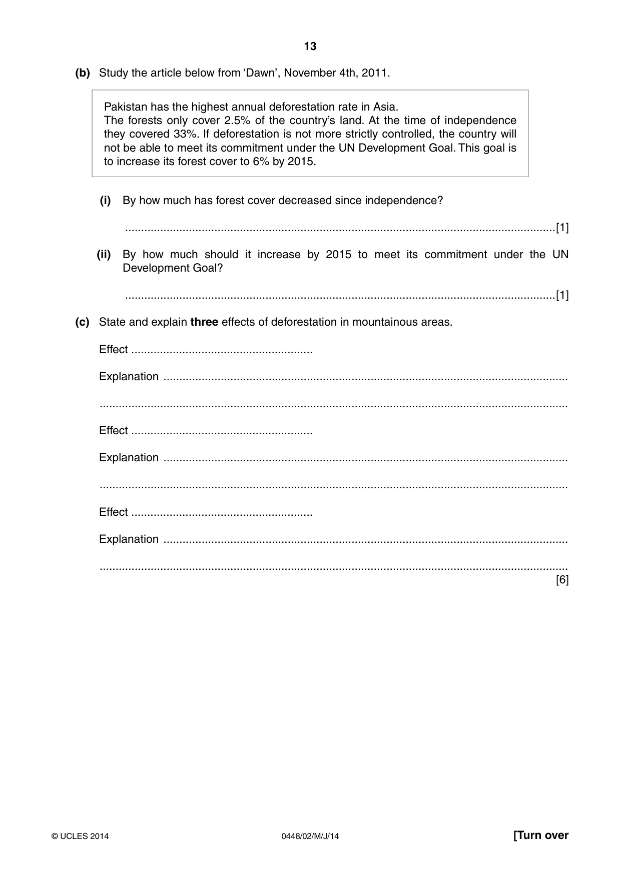
4 (a) Study Fig. 7, a map of deforestation in Pakistan. N B A C Key: area of deforestation desert international boundary disputed boundary Arabian Sea 0 400 km Fig. 7 (i) Name the areas of deforestation A and B. [2] (ii) Name the desert C. [1] (iii) State three reasons why deforestation occurs in one of the areas shown on Fig. 7. 1 ........................................................................................................................................ 2 ........................................................................................................................................ 3 ....................................................................................................................................[3] (b) Study the article below from ‘Dawn’, November 4th, 2011. Pakistan has the highest annual deforestation rate in Asia. The forests only cover 2.5% of the country’s land. At the time of independence they covered 33%. If deforestation is not more strictly controlled, the country will not be able to meet its commitment under the UN Development Goal. This goal is to increase its forest cover to 6% by 2015. (i) By how much has forest cover decreased since independence? .......................................................................................................................................[1] (ii) By how much should it increase by 2015 to meet its commitment under the UN Development Goal? .......................................................................................................................................[1] (c) State and explain three effects of deforestation in mountainous areas. Effect ......................................................... Explanation ............................................................................................................................... ................................................................................................................................................... Effect ......................................................... Explanation ............................................................................................................................... ................................................................................................................................................... Effect ......................................................... Explanation ............................................................................................................................... ................................................................................................................................................... [6] (d) Explain how forests can become a source of income for the people of rural areas. ................................................................................................................................................... ................................................................................................................................................... ................................................................................................................................................... ................................................................................................................................................... ................................................................................................................................................... ................................................................................................................................................... ................................................................................................................................................... ...............................................................................................................................................[4] (e) (i) What is meant by the term ‘sustainable agriculture’? ........................................................................................................................................... .......................................................................................................................................[1] (ii) To what extent can agriculture be sustainable in Pakistan? ........................................................................................................................................... ........................................................................................................................................... ........................................................................................................................................... ........................................................................................................................................... ........................................................................................................................................... ........................................................................................................................................... ........................................................................................................................................... ........................................................................................................................................... ........................................................................................................................................... ........................................................................................................................................... ........................................................................................................................................... .......................................................................................................................................[6] [Total: 25]
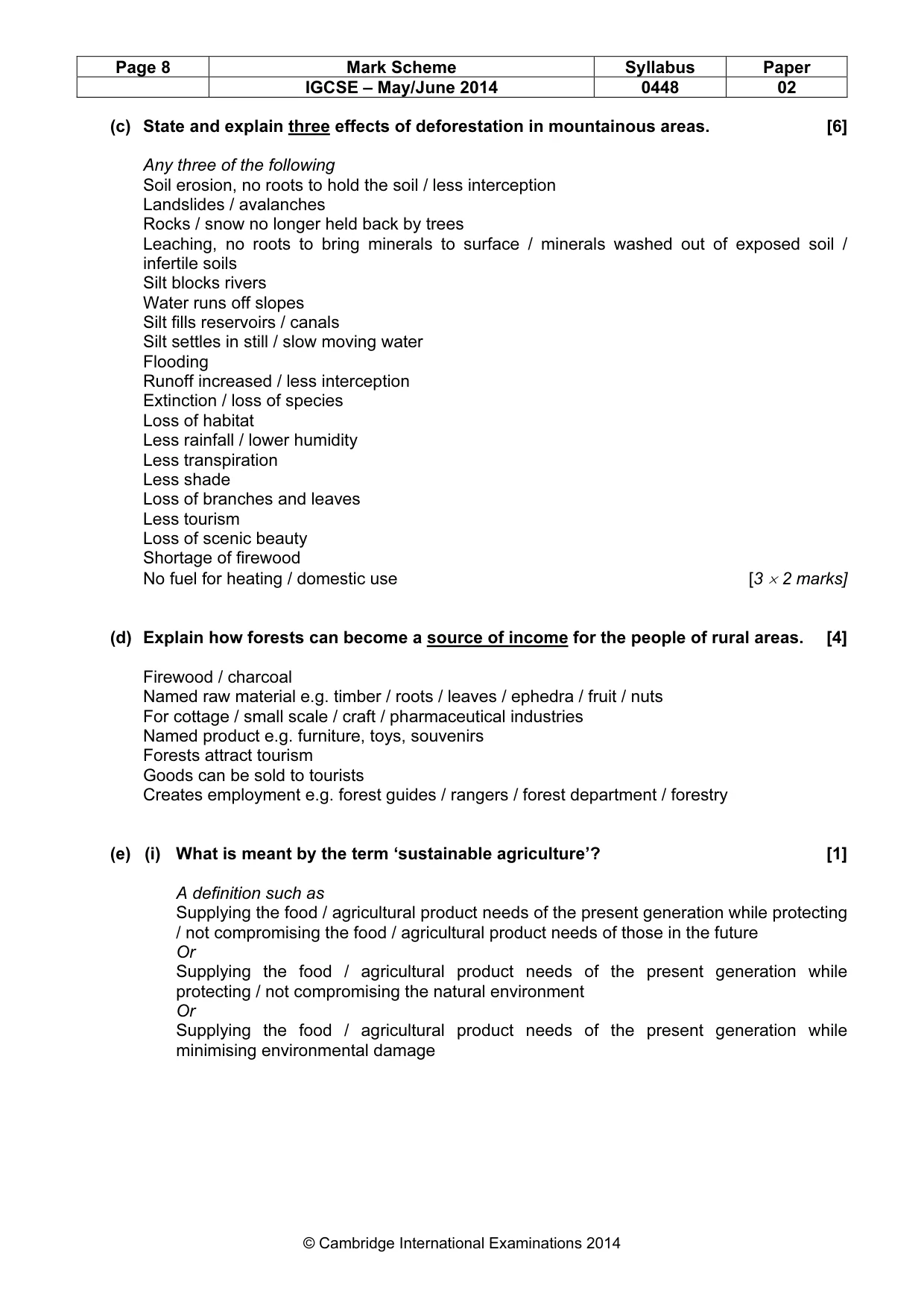
Mark scheme: 4 (a) Study Fig. 7, a map of deforestation. (i) Name the areas of deforestation A and B. [2] A – Sulaiman Range B – Safed Koh / FATA (ii) Name the desert C. [1] Kharan desert (iii) State three reasons why deforestation occurs in one of the areas shown on Fig. 7. [3] Farming / growing food / fodder / cash crops, For firewood For timber Mining Roads Overgrazing Housing / urbanisation / residential Industry (b) Study the article below from ‘Dawn’, November 4th, 2011. (i) By how much has forest cover decreased since independence? [1] 30.5% (ii) By how much should it increase by 2015 to meet its commitment under the UN goal? [1] 3.5% IGCSE – May/June 2014 0448 02 (c) State and explain three effects of deforestation in mountainous areas. [6] Any three of the following Soil erosion, no roots to hold the soil / less interception Landslides / avalanches Rocks / snow no longer held back by trees Leaching, no roots to bring minerals to surface / minerals washed out of exposed soil / infertile soils Silt blocks rivers Water runs off slopes Silt fills reservoirs / canals Silt settles in still / slow moving water Flooding Runoff increased / less interception Extinction / loss of species Loss of habitat Less rainfall / lower humidity Less transpiration Less shade Loss of branches and leaves Less tourism Loss of scenic beauty Shortage of firewood No fuel for heating / domestic use [3 × 2 marks] (d) Explain how forests can become a source of income for the people of rural areas. [4] Firewood / charcoal Named raw material e.g. timber / roots / leaves / ephedra / fruit / nuts For cottage / small scale / craft / pharmaceutical industries Named product e.g. furniture, toys, souvenirs Forests attract tourism Goods can be sold to tourists Creates employment e.g. forest guides / rangers / forest department / forestry (e) (i) What is meant by the term ‘sustainable agriculture’? [1] A definition such as Supplying the food / agricultural product needs of the present generation while protecting / not compromising the food / agricultural product needs of those in the future Or Supplying the food / agricultural product needs of the present generation while protecting / not compromising the natural environment Or Supplying the food / agricultural product needs of the present generation while minimising environmental damage IGCSE – May/June 2014 0448 02 (ii) To what extent can agriculture be sustainable in Pakistan? [6] Possibilities – Res 2 Less overcropping / multicropping Methods of preserving soil e.g. terraces / contour ploughing Restrict use of heavy machinery Keeping vegetation cover Better water management / avoiding over watering / conserving water / lining canals Organic farming / using manure Use of appropriate knowledge / training Problems – Res 2 High demand for more food Pressures on land e.g. for timber Lack of education / awareness of sustainable methods Unco-operative landlords Land reform needed Lack of government will / support / investment Resistance to changing traditional / modern methods [Total 25]
Question 5
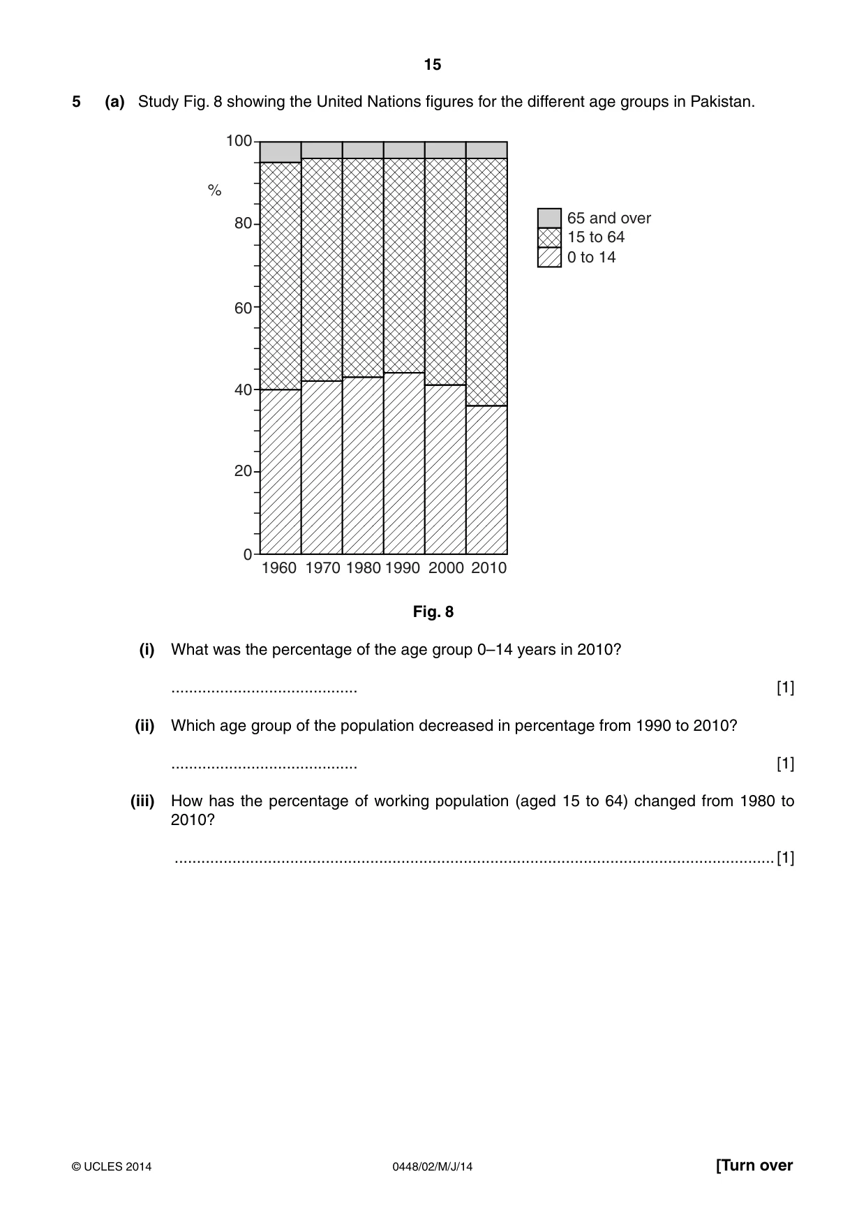
5 (a) Study Fig. 8 showing the United Nations figures for the different age groups in Pakistan. 100 % 65 and over 80 15 to 64 0 to 14 60 40 20 0 1960 1970 1980 1990 2000 2010 Fig. 8 (i) What was the percentage of the age group 0–14 years in 2010? .......................................... [1] (ii) Which age group of the population decreased in percentage from 1990 to 2010? .......................................... [1] (iii) How has the percentage of working population (aged 15 to 64) changed from 1980 to 2010? .......................................................................................................................................[1] (b) (i) What is meant by ‘seasonal migration’? ........................................................................................................................................... ........................................................................................................................................... ........................................................................................................................................... .......................................................................................................................................[2] (ii) Name and describe an example of seasonal migration. Example ................................................................ Description ........................................................................................................................ ........................................................................................................................................... ........................................................................................................................................... ........................................................................................................................................... ........................................................................................................................................... ........................................................................................................................................... ........................................................................................................................................... .......................................................................................................................................[4] (c) Study Photographs A and B (Insert). (i) Give four features of the housing shown in the photographs. 1 ........................................................................................................................................ 2 ........................................................................................................................................ 3 ........................................................................................................................................ 4 ....................................................................................................................................[4] (ii) Explain why people live in areas such as those shown in Photographs A and B. ........................................................................................................................................... ........................................................................................................................................... ........................................................................................................................................... ........................................................................................................................................... ........................................................................................................................................... ........................................................................................................................................... ........................................................................................................................................... ........................................................................................................................................... ........................................................................................................................................... ........................................................................................................................................... ........................................................................................................................................... .......................................................................................................................................[6]
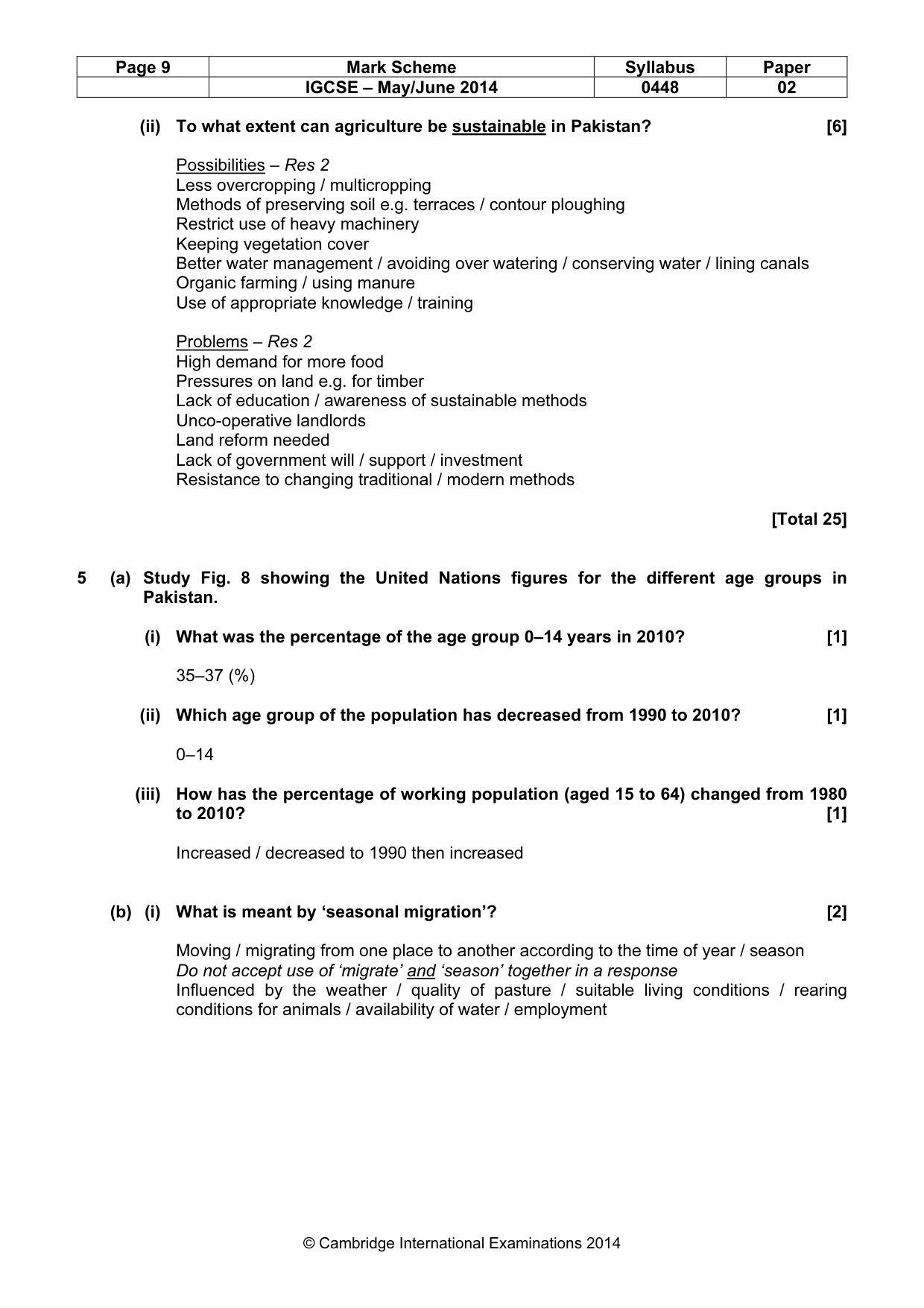
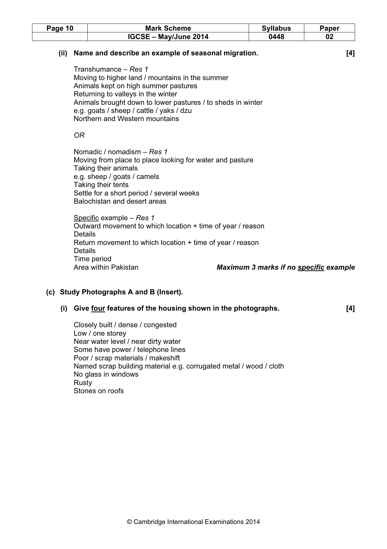
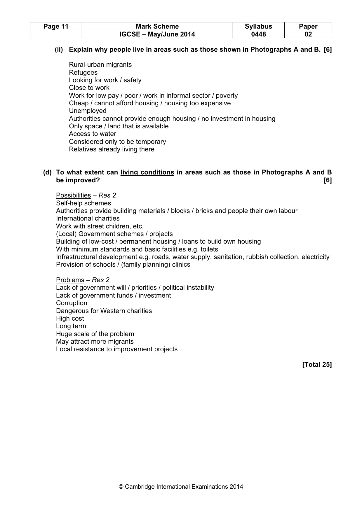
Mark scheme: 5 (a) Study Fig. 8 showing the United Nations figures for the different age groups in Pakistan. (i) What was the percentage of the age group 0–14 years in 2010? [1] 35–37 (%) (ii) Which age group of the population has decreased from 1990 to 2010? [1] 0–14 (iii) How has the percentage of working population (aged 15 to 64) changed from 1980 to 2010? [1] Increased / decreased to 1990 then increased (b) (i) What is meant by ‘seasonal migration’? [2] Moving / migrating from one place to another according to the time of year / season Do not accept use of ‘migrate’ and ‘season’ together in a response Influenced by the weather / quality of pasture / suitable living conditions / rearing conditions for animals / availability of water / employment IGCSE – May/June 2014 0448 02 (ii) Name and describe an example of seasonal migration. [4] Transhumance – Res 1 Moving to higher land / mountains in the summer Animals kept on high summer pastures Returning to valleys in the winter Animals brought down to lower pastures / to sheds in winter e.g. goats / sheep / cattle / yaks / dzu Northern and Western mountains OR Nomadic / nomadism – Res 1 Moving from place to place looking for water and pasture Taking their animals e.g. sheep / goats / camels Taking their tents Settle for a short period / several weeks Balochistan and desert areas Specific example – Res 1 Outward movement to which location + time of year / reason Details Return movement to which location + time of year / reason Details Time period Area within Pakistan Maximum 3 marks if no specific example (c) Study Photographs A and B (Insert). (i) Give four features of the housing shown in the photographs. [4] Closely built / dense / congested Low / one storey Near water level / near dirty water Some have power / telephone lines Poor / scrap materials / makeshift Named scrap building material e.g. corrugated metal / wood / cloth No glass in windows Rusty Stones on roofs IGCSE – May/June 2014 0448 02 (ii) Explain why people live in areas such as those shown in Photographs A and B. [6] Rural-urban migrants Refugees Looking for work / safety Close to work Work for low pay / poor / work in informal sector / poverty Cheap / cannot afford housing / housing too expensive Unemployed Authorities cannot provide enough housing / no investment in housing Only space / land that is available Access to water Considered only to be temporary Relatives already living there (d) To what extent can living conditions in areas such as those in Photographs A and B be improved? [6] Possibilities – Res 2 Self-help schemes Authorities provide building materials / blocks / bricks and people their own labour International charities Work with street children, etc. (Local) Government schemes / projects Building of low-cost / permanent housing / loans to build own housing With minimum standards and basic facilities e.g. toilets Infrastructural development e.g. roads, water supply, sanitation, rubbish collection, electricity Provision of schools / (family planning) clinics Problems – Res 2 Lack of government will / priorities / political instability Lack of government funds / investment Corruption Dangerous for Western charities High cost Long term Huge scale of the problem May attract more migrants Local resistance to improvement projects [Total 25]