Cambridge IGCSE Geography 0460 — 2022 Feb/March Paper 2 · Variant 2
0460/22/F/M/22 · 6 questions · 60 marks · ≈68 min
The question paper and its mark scheme, free to read here and free to download. This is Cambridge’s own paper, exactly as it was sat.
Question paper20 pages





Mark scheme7 pages
Answers below. Sit the paper first if you are practising.
Questions as text
Q1 · Study the map extract for Troon, Scotland
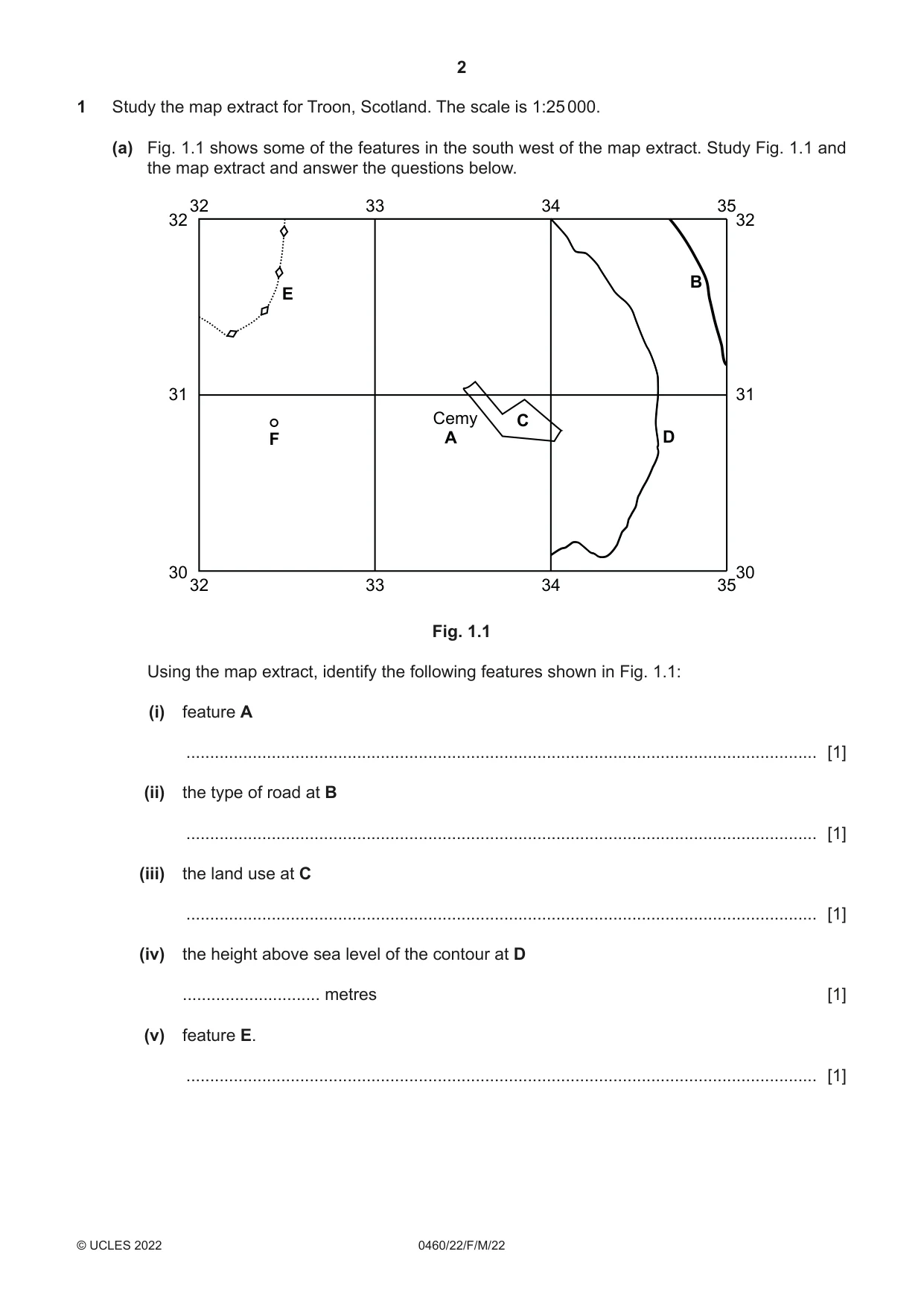
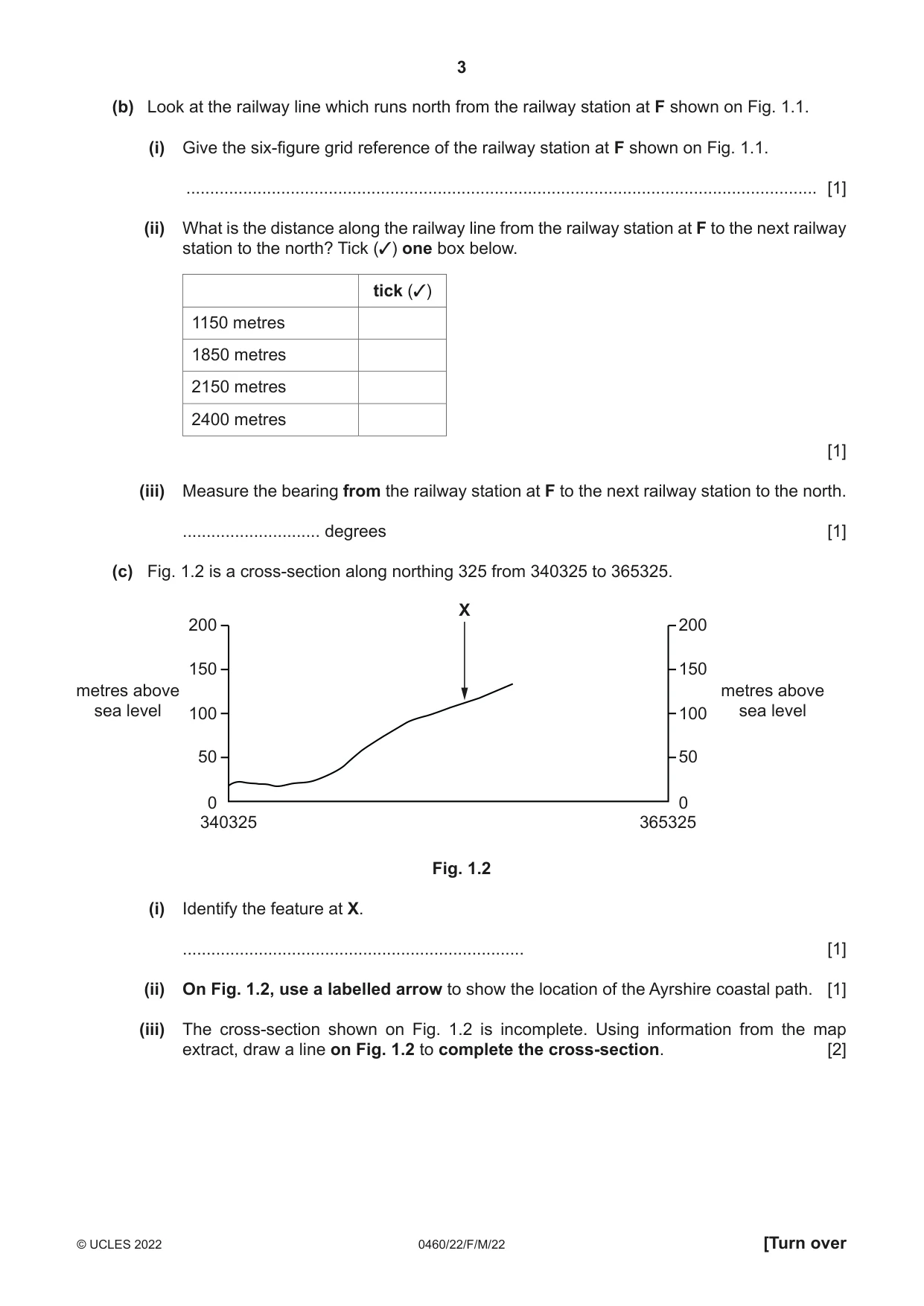
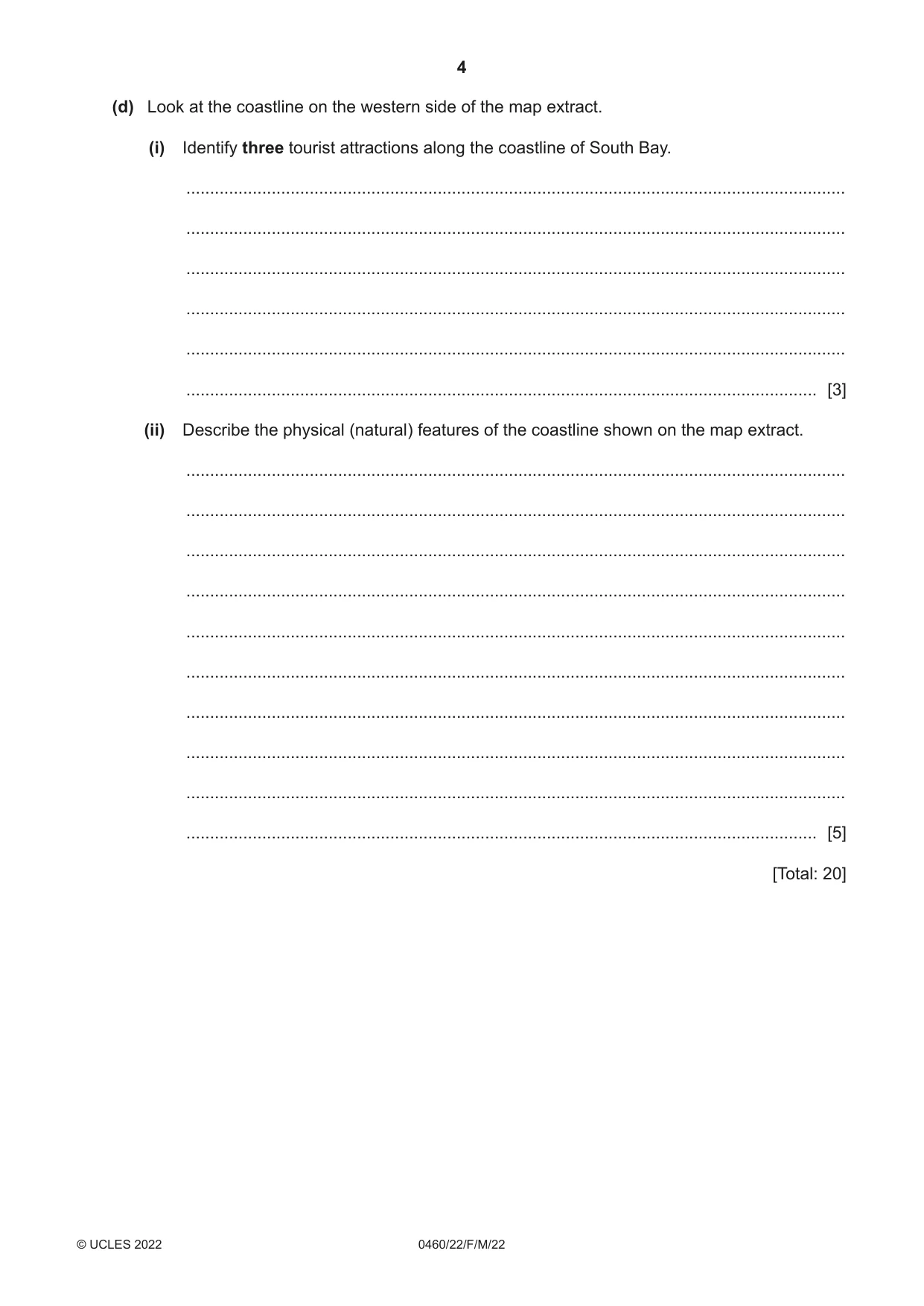
1 Study the map extract for Troon, Scotland. The scale is 1:25 000. (a) Fig. 1.1 shows some of the features in the south west of the map extract. Study Fig. 1.1 and the map extract and answer the questions below. 32 33 34 35 32 32 B E 31 31 Cemy C F A D 30 30 32 33 34 35 Fig. 1.1 Using the map extract, identify the following features shown in Fig. 1.1: (i) feature A ..................................................................................................................................... [1] (ii) the type of road at B ..................................................................................................................................... [1] (iii) the land use at C ..................................................................................................................................... [1] (iv) the height above sea level of the contour at D ............................. metres [1] (v) feature E. ..................................................................................................................................... [1] (b) Look at the railway line which runs north from the railway station at F shown on Fig. 1.1. (i) Give the six‑figure grid reference of the railway station at F shown on Fig. 1.1. ..................................................................................................................................... [1] (ii) What is the distance along the railway line from the railway station at F to the next railway station to the north? Tick (✓) one box below. tick (✓) 1150 metres 1850 metres 2150 metres 2400 metres [1] (iii) Measure the bearing from the railway station at F to the next railway station to the north. ............................. degrees [1] (c) Fig. 1.2 is a cross‑section along northing 325 from 340325 to 365325. X 200 200 150 150 metres above metres above sea level 100 100 sea level 50 50 0 0 340325 365325 Fig. 1.2 (i) Identify the feature at X. ........................................................................ [1] (ii) On Fig. 1.2, use a labelled arrow to show the location of the Ayrshire coastal path. [1] (iii) The cross‑section shown on Fig. 1.2 is incomplete. Using information from the map extract, draw a line on Fig. 1.2 to complete the cross-section. [2] (d) Look at the coastline on the western side of the map extract. (i) Identify three tourist attractions along the coastline of South Bay. ........................................................................................................................................... ........................................................................................................................................... ........................................................................................................................................... ........................................................................................................................................... ........................................................................................................................................... ..................................................................................................................................... [3] (ii) Describe the physical (natural) features of the coastline shown on the map extract. ........................................................................................................................................... ........................................................................................................................................... ........................................................................................................................................... ........................................................................................................................................... ........................................................................................................................................... ........................................................................................................................................... ........................................................................................................................................... ........................................................................................................................................... ........................................................................................................................................... ..................................................................................................................................... [5] [Total: 20] TURN PAGE FOR QUESTION 2
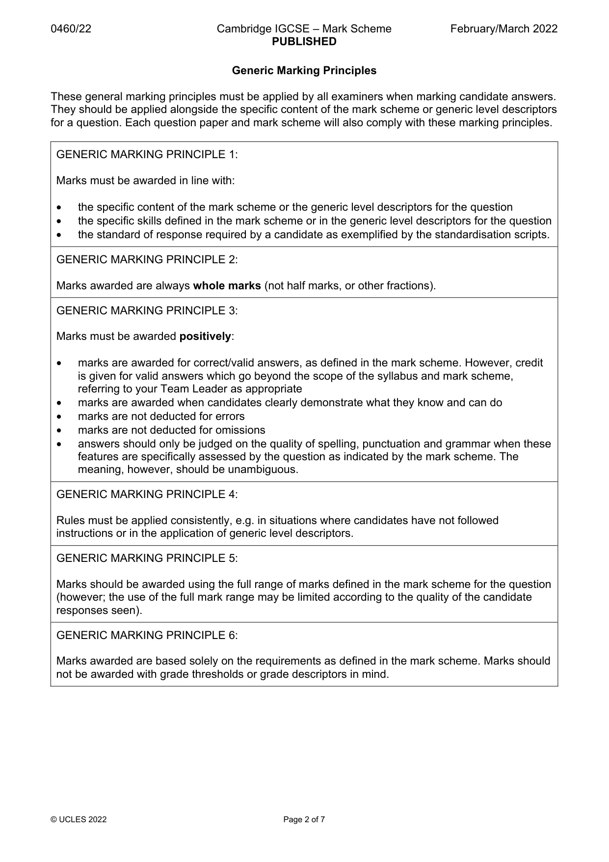
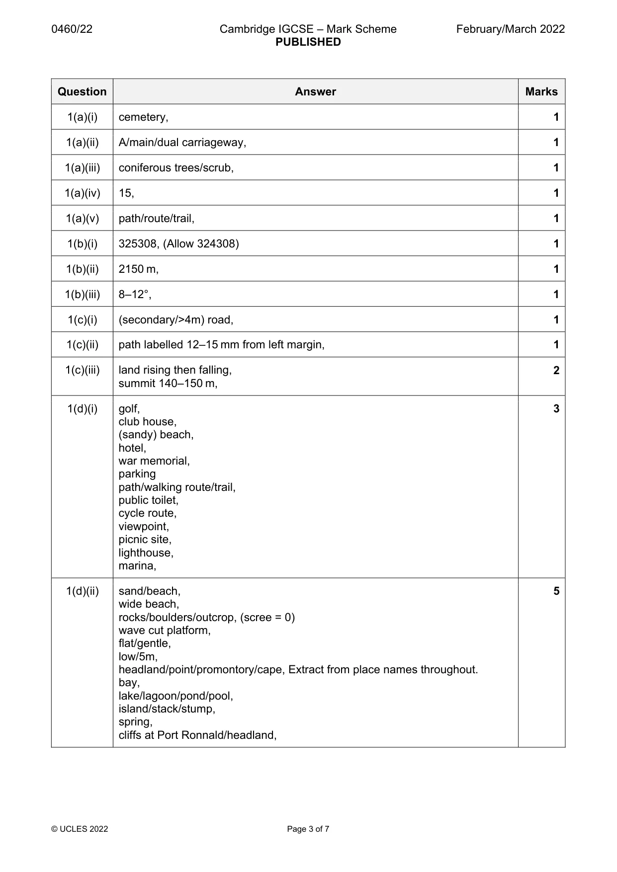
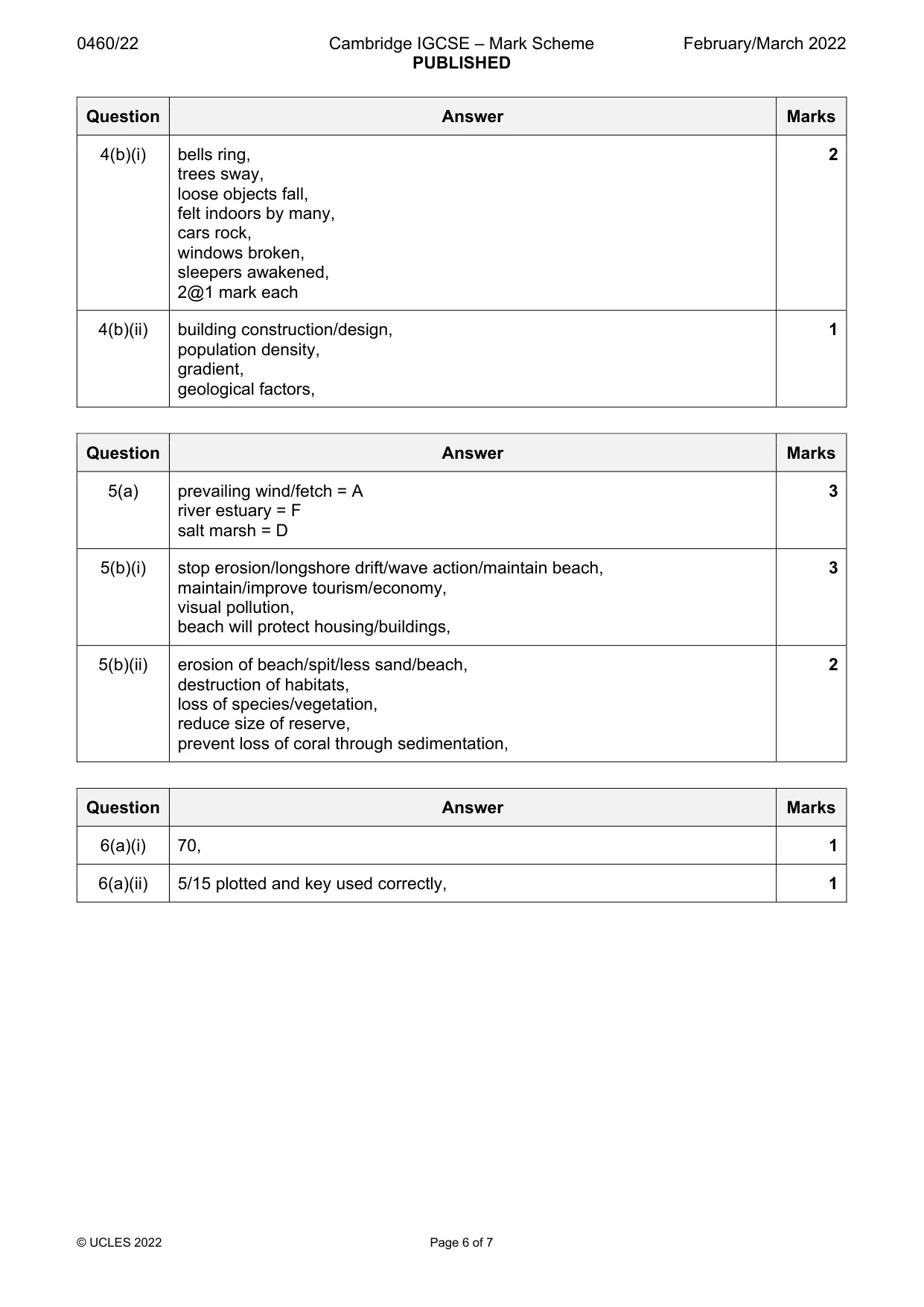
Mark scheme: Question Answer Marks 1(a)(i) cemetery, 1 1(a)(ii) A/main/dual carriageway, 1 1(a)(iii) coniferous trees/scrub, 1 1(a)(iv) 15, 1 1(a)(v) path/route/trail, 1 1(b)(i) 325308, (Allow 324308) 1 1(b)(ii) 2150 m, 1 1(b)(iii) 8–12°, 1 1(c)(i) (secondary/>4m) road, 1 1(c)(ii) path labelled 12–15 mm from left margin, 1 1(c)(iii) land rising then falling, 2 summit 140–150 m, 1(d)(i) golf, 3 club house, (sandy) beach, hotel, war memorial, parking path/walking route/trail, public toilet, cycle route, viewpoint, picnic site, lighthouse, marina, 1(d)(ii) sand/beach, 5 wide beach, rocks/boulders/outcrop, (scree = 0) wave cut platform, flat/gentle, low/5m, headland/point/promontory/cape, Extract from place names throughout. bay, lake/lagoon/pond/pool, island/stack/stump, spring, cliffs at Port Ronnald/headland,
Q2 · The countries in the world which had an average life expectancy of more than 74 years in…
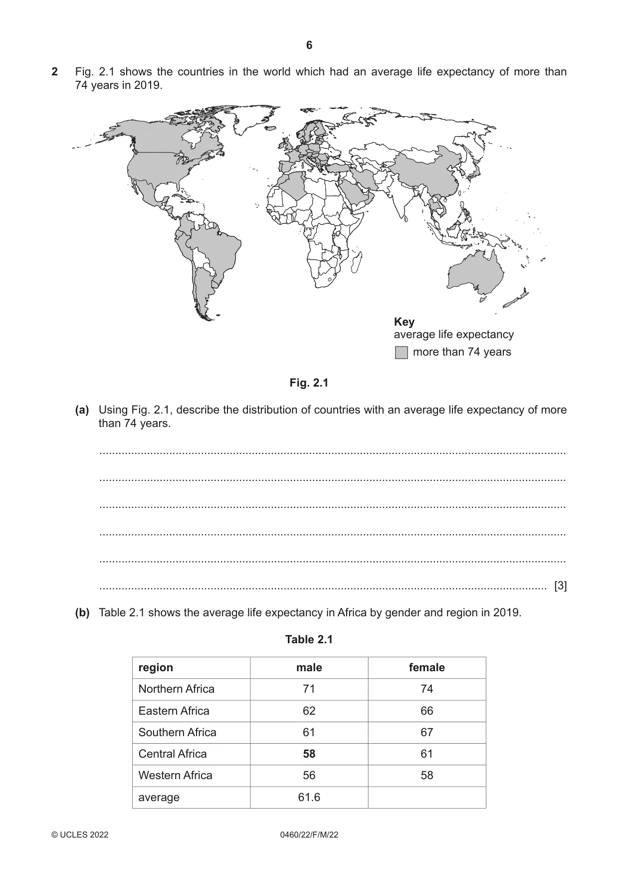
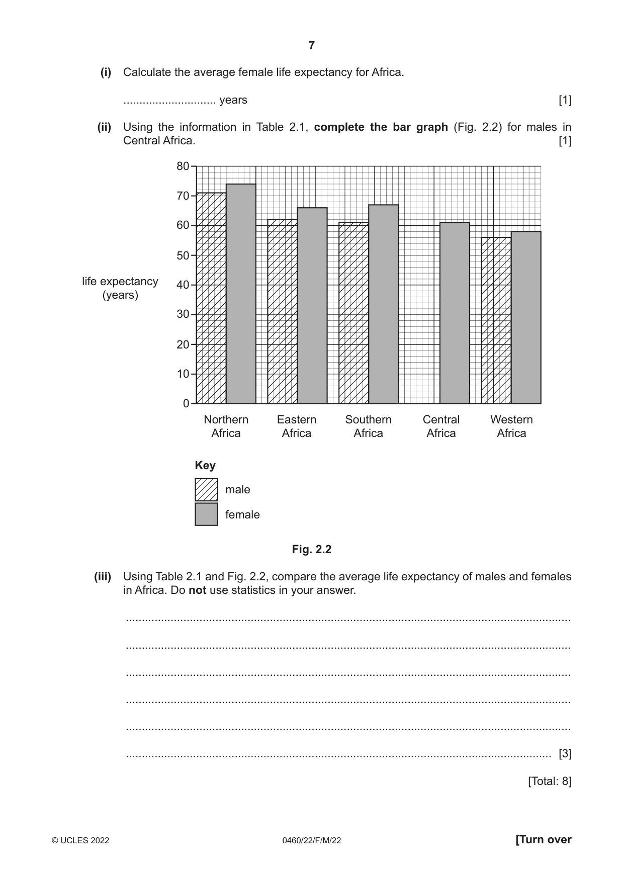
2 Fig. 2.1 shows the countries in the world which had an average life expectancy of more than 74 years in 2019. Key average life expectancy more than 74 years Fig. 2.1 (a) Using Fig. 2.1, describe the distribution of countries with an average life expectancy of more than 74 years. ................................................................................................................................................... ................................................................................................................................................... ................................................................................................................................................... ................................................................................................................................................... ................................................................................................................................................... ............................................................................................................................................. [3] (b) Table 2.1 shows the average life expectancy in Africa by gender and region in 2019. Table 2.1 region male female Northern Africa 71 74 Eastern Africa 62 66 Southern Africa 61 67 Central Africa 58 61 Western Africa 56 58 average 61.6 (i) Calculate the average female life expectancy for Africa. ............................. years [1] (ii) Using the information in Table 2.1, complete the bar graph (Fig. 2.2) for males in Central Africa. [1] 80 70 60 50 life expectancy 40 (years) 30 20 10 0 Northern Eastern Southern Central Western Africa Africa Africa Africa Africa Key male female Fig. 2.2 (iii) Using Table 2.1 and Fig. 2.2, compare the average life expectancy of males and females in Africa. Do not use statistics in your answer. ........................................................................................................................................... ........................................................................................................................................... ........................................................................................................................................... ........................................................................................................................................... ........................................................................................................................................... ..................................................................................................................................... [3] [Total: 8]
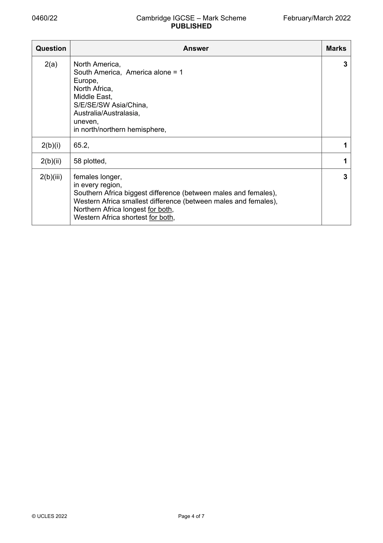
Mark scheme: 2(a) North America, 3 South America, America alone = 1 Europe, North Africa, Middle East, S/E/SE/SW Asia/China, Australia/Australasia, uneven, in north/northern hemisphere, 2(b)(i) 65.2, 1 2(b)(ii) 58 plotted, 1 2(b)(iii) females longer, 3 in every region, Southern Africa biggest difference (between males and females), Western Africa smallest difference (between males and females), Northern Africa longest for both, Western Africa shortest for both,
Question 3
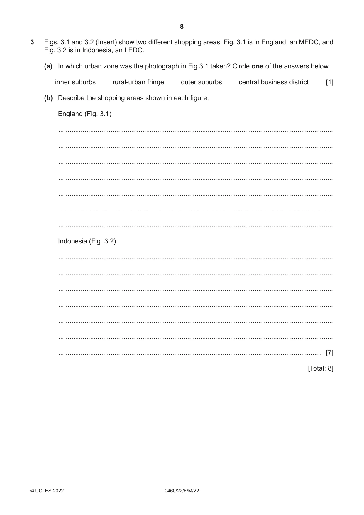
3 Figs. 3.1 and 3.2 (Insert) show two different shopping areas. Fig. 3.1 is in England, an MEDC, and Fig. 3.2 is in Indonesia, an LEDC. (a) In which urban zone was the photograph in Fig 3.1 taken? Circle one of the answers below. inner suburbs rural‑urban fringe outer suburbs central business district [1] (b) Describe the shopping areas shown in each figure. England (Fig. 3.1) ................................................................................................................................................... ................................................................................................................................................... ................................................................................................................................................... ................................................................................................................................................... ................................................................................................................................................... ................................................................................................................................................... ................................................................................................................................................... Indonesia (Fig. 3.2) ................................................................................................................................................... ................................................................................................................................................... ................................................................................................................................................... ................................................................................................................................................... ................................................................................................................................................... ................................................................................................................................................... ............................................................................................................................................. [7] [Total: 8] TURN PAGE FOR QUESTION 4
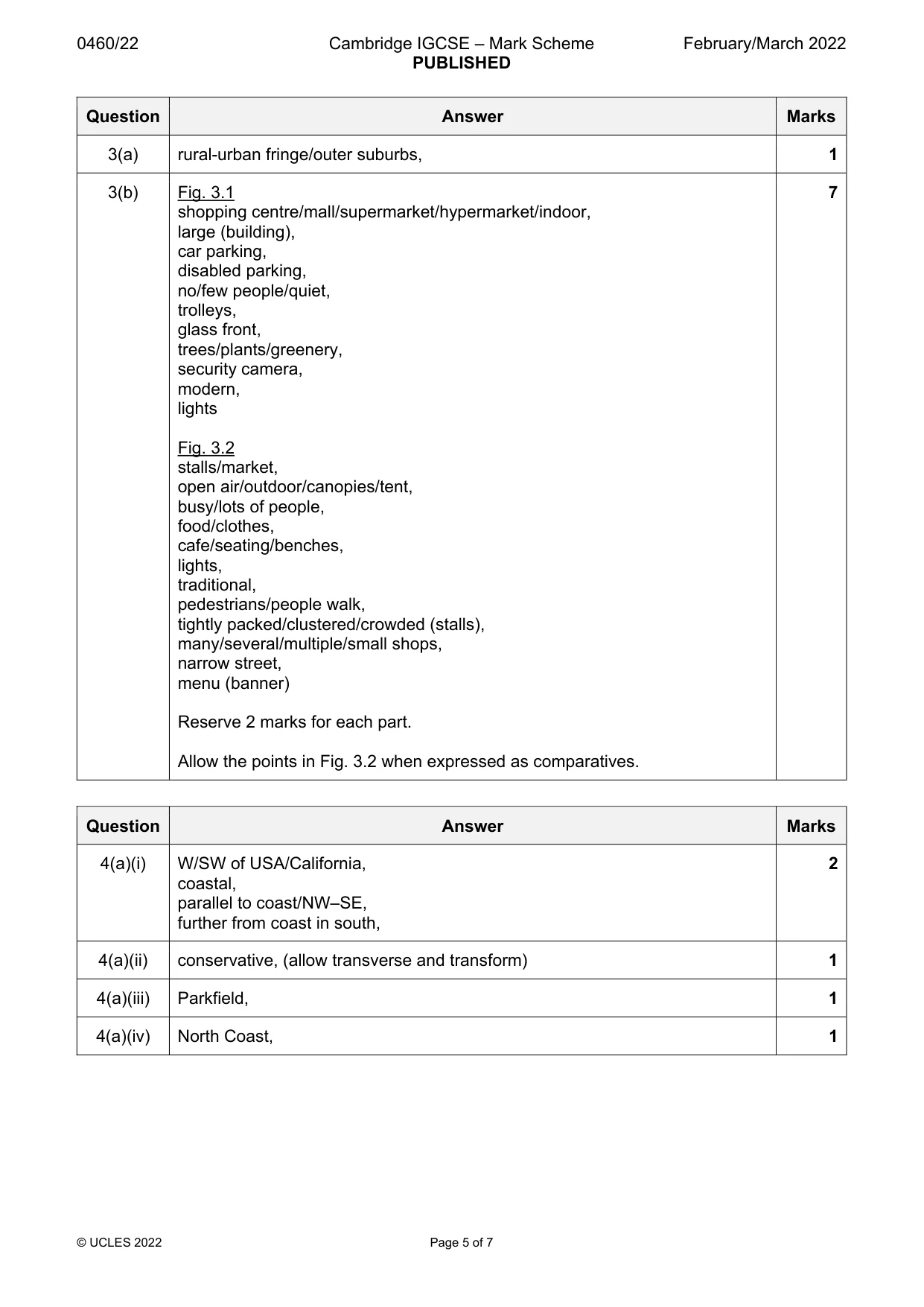
Mark scheme: 3(a) rural-urban fringe/outer suburbs, 1 3(b) Fig. 3.1 7 shopping centre/mall/supermarket/hypermarket/indoor, large (building), car parking, disabled parking, no/few people/quiet, trolleys, glass front, trees/plants/greenery, security camera, modern, lights Fig. 3.2 stalls/market, open air/outdoor/canopies/tent, busy/lots of people, food/clothes, cafe/seating/benches, lights, traditional, pedestrians/people walk, tightly packed/clustered/crowded (stalls), many/several/multiple/small shops, narrow street, menu (banner) Reserve 2 marks for each part. Allow the points in Fig. 3.2 when expressed as comparatives.
Q4 · The predicted impact of future earthquakes along the San Andreas fault in the USA
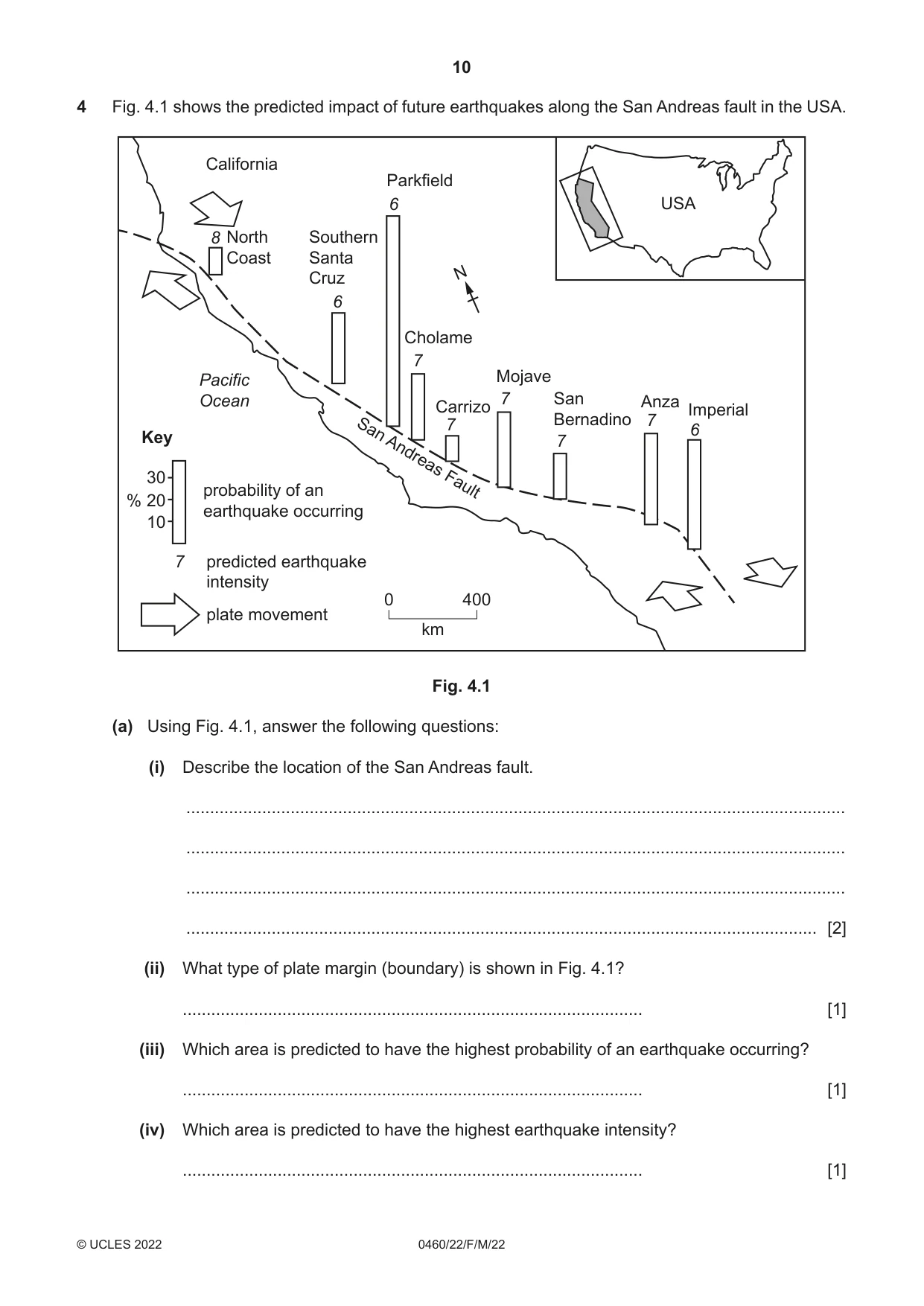
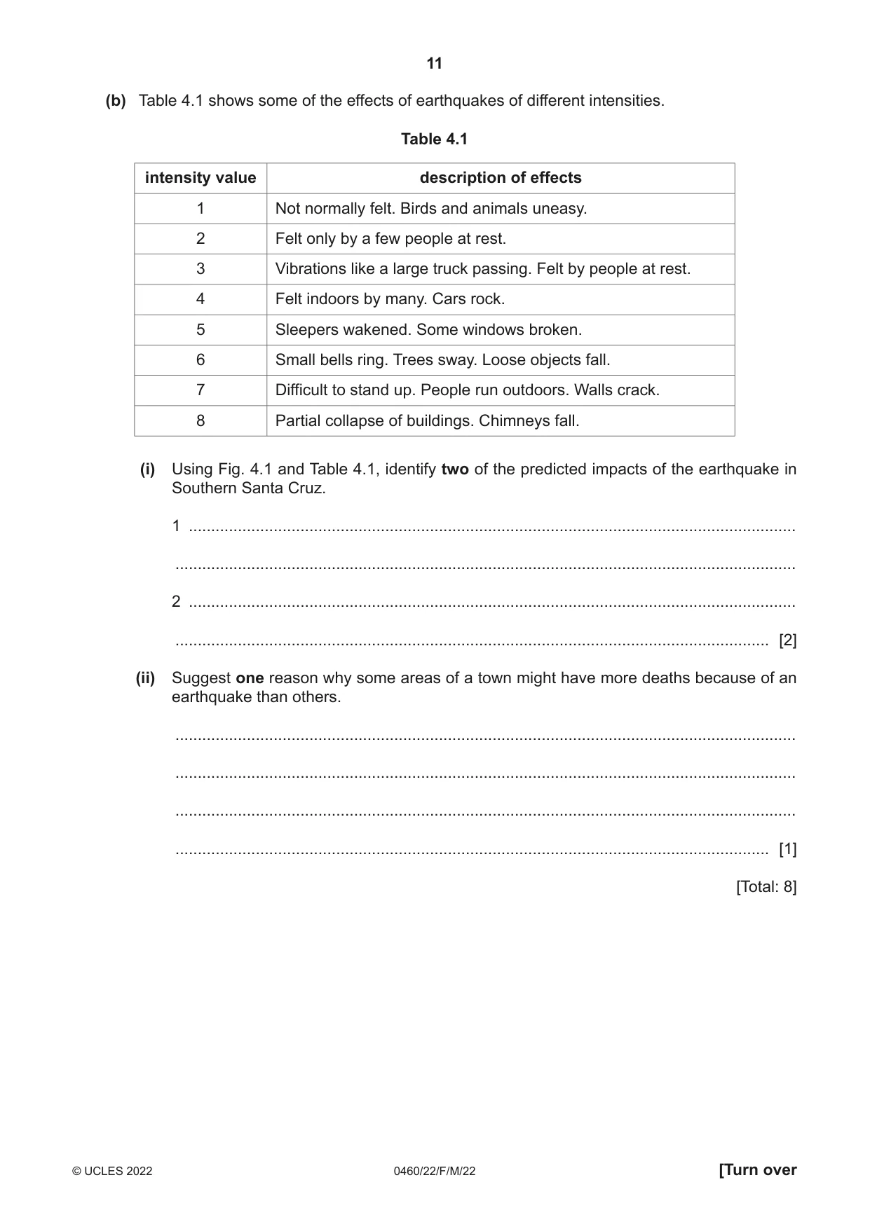
4 Fig. 4.1 shows the predicted impact of future earthquakes along the San Andreas fault in the USA. California Parkfield 6 USA 8 North Southern Coast Santa Cruz N 6 Cholame 7 Pacific Mojave Ocean 7 San Anza Carrizo Imperial Bernadino 7 7 6 Key San 7 Andreas 30 probability of an Fault % 20 earthquake occurring 10 7 predicted earthquake intensity 0 400 plate movement km Fig. 4.1 (a) Using Fig. 4.1, answer the following questions: (i) Describe the location of the San Andreas fault. ........................................................................................................................................... ........................................................................................................................................... ........................................................................................................................................... ..................................................................................................................................... [2] (ii) What type of plate margin (boundary) is shown in Fig. 4.1? ................................................................................................. [1] (iii) Which area is predicted to have the highest probability of an earthquake occurring? ................................................................................................. [1] (iv) Which area is predicted to have the highest earthquake intensity? ................................................................................................. [1] (b) Table 4.1 shows some of the effects of earthquakes of different intensities. Table 4.1 intensity value description of effects 1 Not normally felt. Birds and animals uneasy. 2 Felt only by a few people at rest. 3 Vibrations like a large truck passing. Felt by people at rest. 4 Felt indoors by many. Cars rock. 5 Sleepers wakened. Some windows broken. 6 Small bells ring. Trees sway. Loose objects fall. 7 Difficult to stand up. People run outdoors. Walls crack. 8 Partial collapse of buildings. Chimneys fall. (i) Using Fig. 4.1 and Table 4.1, identify two of the predicted impacts of the earthquake in Southern Santa Cruz. 1 ........................................................................................................................................ ........................................................................................................................................... 2 ........................................................................................................................................ ..................................................................................................................................... [2] (ii) Suggest one reason why some areas of a town might have more deaths because of an earthquake than others. ........................................................................................................................................... ........................................................................................................................................... ........................................................................................................................................... ..................................................................................................................................... [1] [Total: 8]
Mark scheme: 4(a)(i) W/SW of USA/California, 2 coastal, parallel to coast/NW–SE, further from coast in south, 4(a)(ii) conservative, (allow transverse and transform) 1 4(a)(iii) Parkfield, 1 4(a)(iv) North Coast, 1 4(b)(i) bells ring, 2 trees sway, loose objects fall, felt indoors by many, cars rock, windows broken, sleepers awakened, 2@1 mark each 4(b)(ii) building construction/design, 1 population density, gradient, geological factors,
Q5 · An area of coastline where a spit has developed
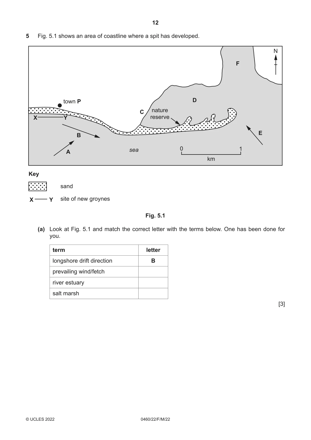
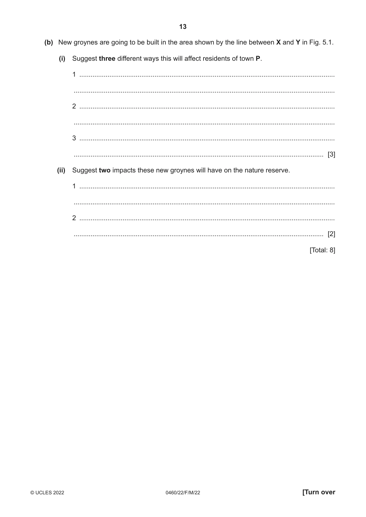
5 Fig. 5.1 shows an area of coastline where a spit has developed. N F town P D nature C X Y reserve E B sea 0 1 A km Key sand X Y site of new groynes Fig. 5.1 (a) Look at Fig. 5.1 and match the correct letter with the terms below. One has been done for you. term letter longshore drift direction B prevailing wind/fetch river estuary salt marsh [3] (b) New groynes are going to be built in the area shown by the line between X and Y in Fig. 5.1. (i) Suggest three different ways this will affect residents of town P. 1 ........................................................................................................................................ ........................................................................................................................................... 2 ........................................................................................................................................ ........................................................................................................................................... 3 ........................................................................................................................................ ..................................................................................................................................... [3] (ii) Suggest two impacts these new groynes will have on the nature reserve. 1 ........................................................................................................................................ ........................................................................................................................................... 2 ........................................................................................................................................ ..................................................................................................................................... [2] [Total: 8]
Mark scheme: 5(a) prevailing wind/fetch = A 3 river estuary = F salt marsh = D 5(b)(i) stop erosion/longshore drift/wave action/maintain beach, 3 maintain/improve tourism/economy, visual pollution, beach will protect housing/buildings, 5(b)(ii) erosion of beach/spit/less sand/beach, 2 destruction of habitats, loss of species/vegetation, reduce size of reserve, prevent loss of coral through sedimentation,
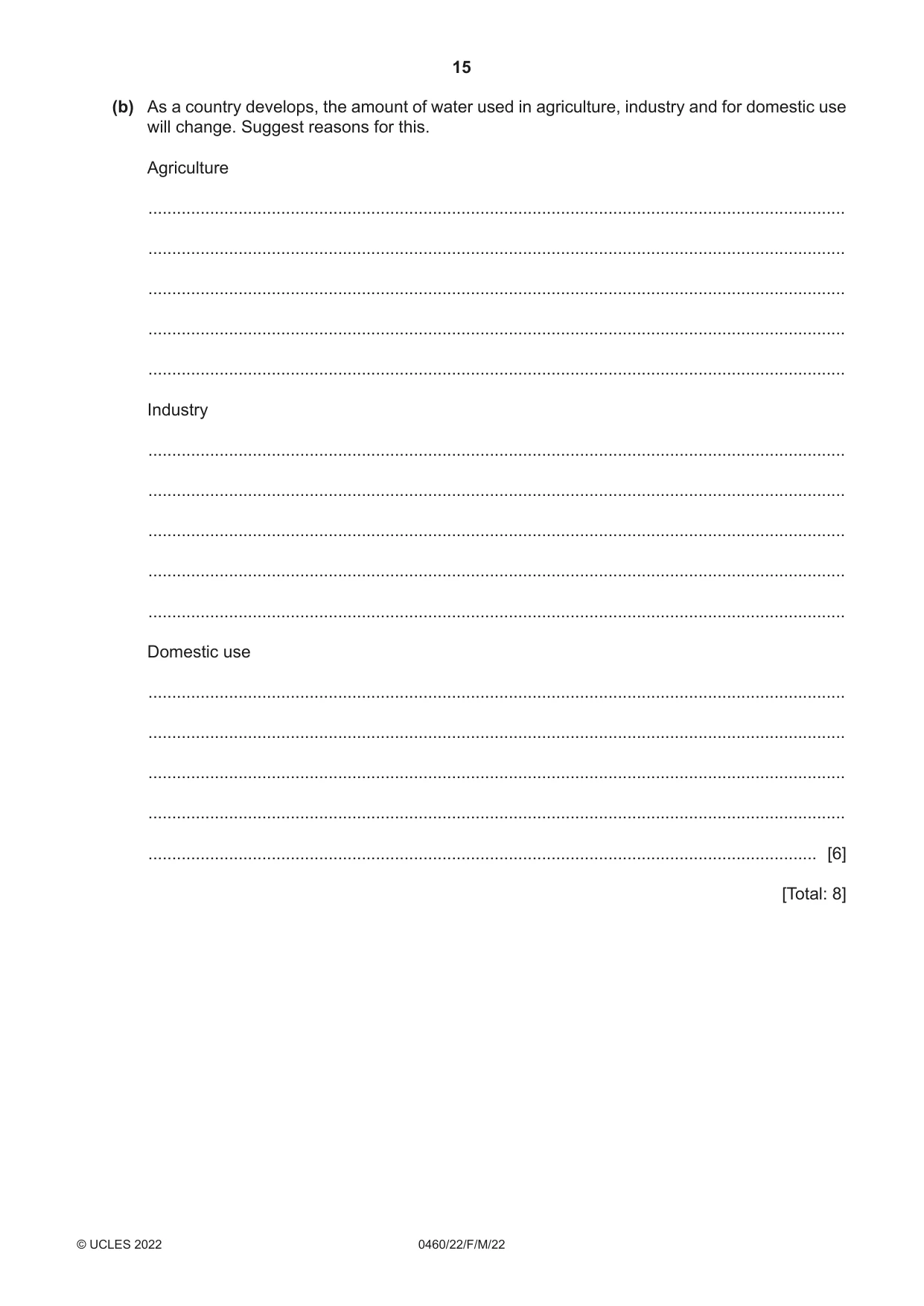
Q6 · How water is used globally and Fig
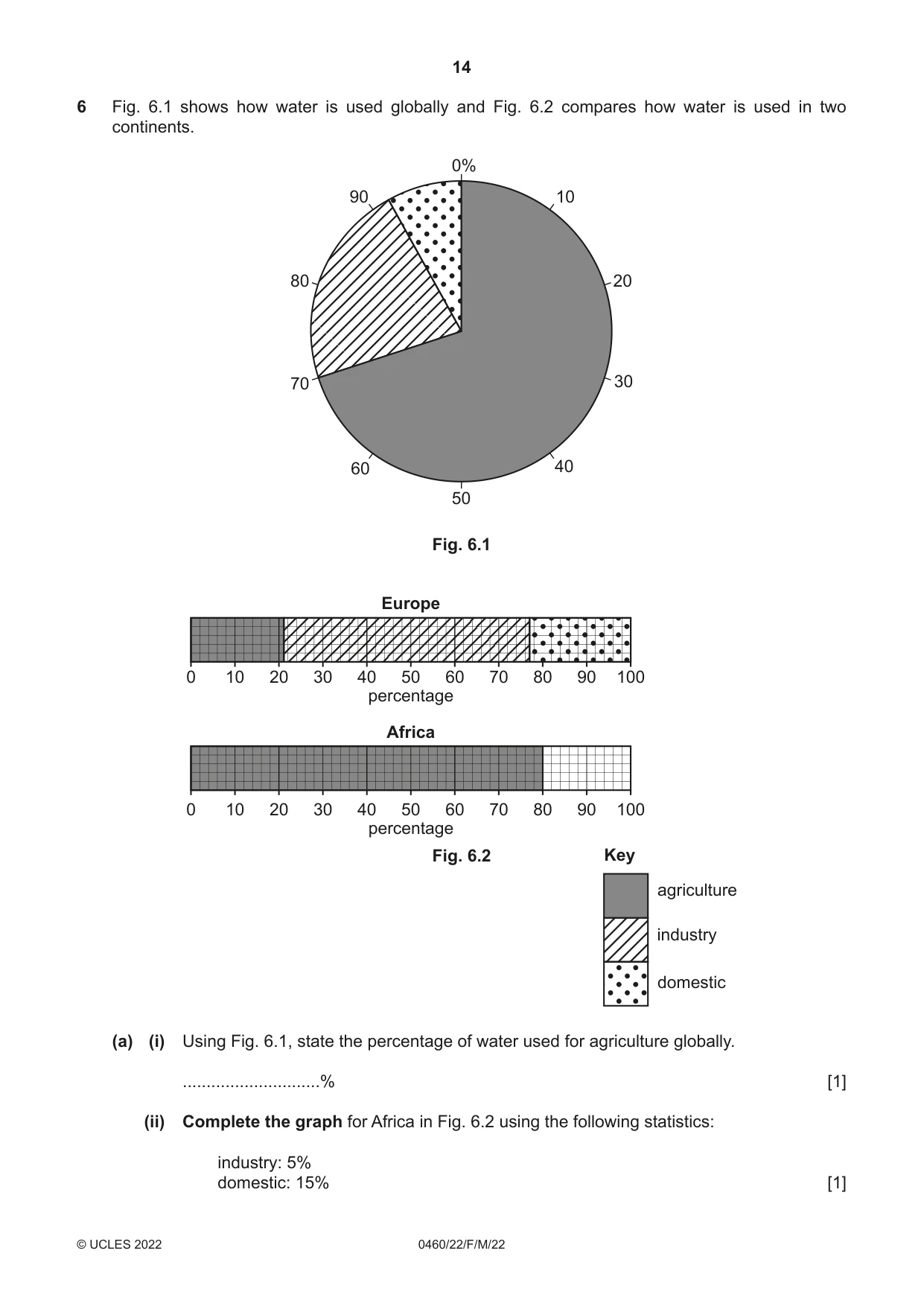
6 Fig. 6.1 shows how water is used globally and Fig. 6.2 compares how water is used in two continents. 0% 90 10 80 20 70 30 60 40 50 Fig. 6.1 Europe 0 10 20 30 40 50 60 70 80 90 100 percentage Africa 0 10 20 30 40 50 60 70 80 90 100 percentage Fig. 6.2 Key agriculture industry domestic (a) (i) Using Fig. 6.1, state the percentage of water used for agriculture globally. .............................% [1] (ii) Complete the graph for Africa in Fig. 6.2 using the following statistics: industry: 5% domestic: 15% [1] (b) As a country develops, the amount of water used in agriculture, industry and for domestic use will change. Suggest reasons for this. Agriculture ................................................................................................................................................... ................................................................................................................................................... ................................................................................................................................................... ................................................................................................................................................... ................................................................................................................................................... Industry ................................................................................................................................................... ................................................................................................................................................... ................................................................................................................................................... ................................................................................................................................................... ................................................................................................................................................... Domestic use ................................................................................................................................................... ................................................................................................................................................... ................................................................................................................................................... ................................................................................................................................................... ............................................................................................................................................. [6] [Total: 8] Additional pages If you use the following pages to complete the answer to any question, the question number must be clearly shown. .................................................................................................................................................................. .................................................................................................................................................................. .................................................................................................................................................................. .................................................................................................................................................................. .................................................................................................................................................................. .................................................................................................................................................................. .................................................................................................................................................................. .................................................................................................................................................................. .................................................................................................................................................................. .................................................................................................................................................................. .................................................................................................................................................................. .................................................................................................................................................................. .................................................................................................................................................................. .................................................................................................................................................................. .................................................................................................................................................................. .................................................................................................................................................................. .................................................................................................................................................................. .................................................................................................................................................................. .................................................................................................................................................................. .................................................................................................................................................................. .................................................................................................................................................................. .................................................................................................................................................................. .................................................................................................................................................................. .................................................................................................................................................................. ..................................................................................................................................................................
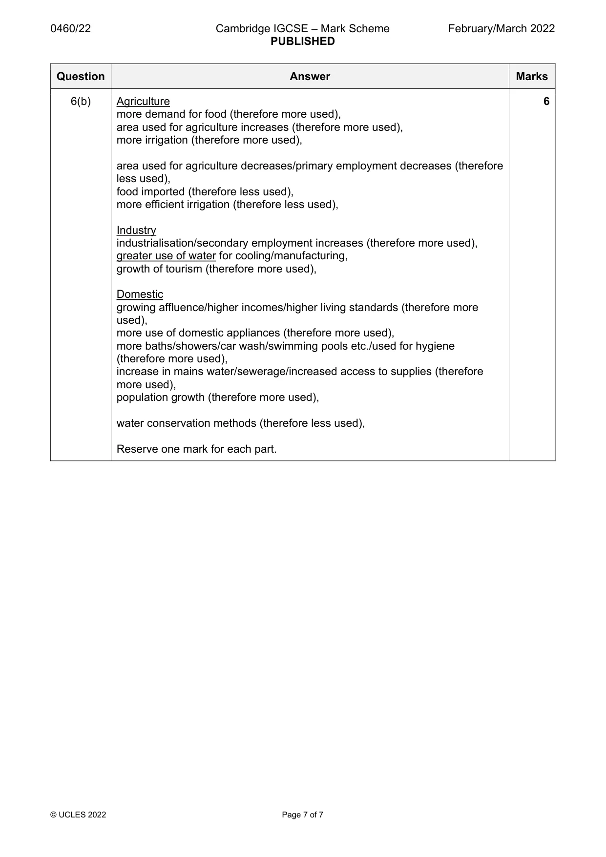
Mark scheme: 6(a)(i) 70, 1 6(a)(ii) 5/15 plotted and key used correctly, 1 6(b) Agriculture 6 more demand for food (therefore more used), area used for agriculture increases (therefore more used), more irrigation (therefore more used), area used for agriculture decreases/primary employment decreases (therefore less used), food imported (therefore less used), more efficient irrigation (therefore less used), Industry industrialisation/secondary employment increases (therefore more used), greater use of water for cooling/manufacturing, growth of tourism (therefore more used), Domestic growing affluence/higher incomes/higher living standards (therefore more used), more use of domestic appliances (therefore more used), more baths/showers/car wash/swimming pools etc./used for hygiene (therefore more used), increase in mains water/sewerage/increased access to supplies (therefore more used), population growth (therefore more used), water conservation methods (therefore less used), Reserve one mark for each part.
What was in this paper
The subtopics covered by these 6 questions, and how many questions each got. Open one in a new tab to see every Cambridge question on it.
What you needed in this session
Cambridge’s own grade thresholds for 2022 Feb/March, Paper 2 · Variant 2. A higher threshold means an easier paper — the bar moves with how the cohort did.