Cambridge IGCSE Geography 0460 — 2020 Oct/Nov Paper 1 · Variant 1
0460/11/O/N/20 · 75 marks · ≈84 min
The question paper and its mark scheme, free to read here and free to download. This is Cambridge’s own paper, exactly as it was sat.
Question paper32 pages




Mark scheme18 pages
Answers below. Sit the paper first if you are practising.
Paper as text
Question paper, page 1
Cambridge IGCSE™ This document has 32 pages. Blank pages are indicated. DC (ST/CT) 180594/6 © UCLES 2020 [Turn over * 4 0 4 4 8 4 2 9 9 1 * GEOGRAPHY 0460/11 Paper 1 Geographical Themes October/November 2020 1 hour 45 minutes You must answer on the question paper. You will need: Insert (enclosed) Calculator Ruler INSTRUCTIONS ● Answer three questions in total, one from each section. ● Use a black or dark blue pen. You may use an HB pencil for any diagrams or graphs. ● Write your name, centre number and candidate number in the boxes at the top of the page. ● Write your answer to each question in the space provided. ● Do not use an erasable pen or correction fluid. ● Do not write on any bar codes. ● If additional space is needed, you should use the lined pages at the end of this booklet; the question number or numbers must be clearly shown. INFORMATION ● The total mark for this paper is 75. ● The number of marks for each question or part question is shown in brackets [ ]. ● The insert contains additional resources referred to in the questions. Definitions MEDCs – More Economically Developed Countries LEDCs – Less Economically Developed Countries
Question paper, page 2
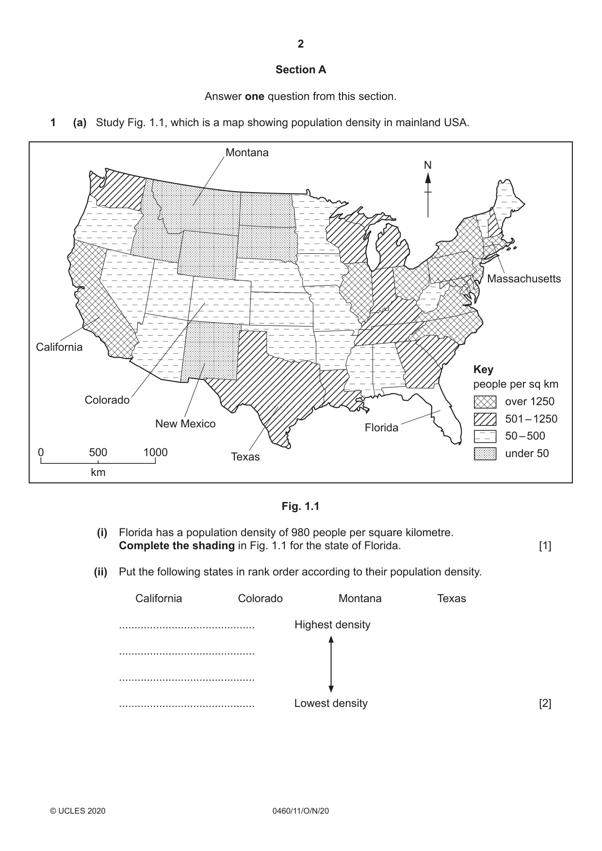
2 0460/11/O/N/20 © UCLES 2020 Section A Answer one question from this section. 1 (a) Study Fig. 1.1, which is a map showing population density in mainland USA. N Key people per sq km over 1250 50 – 500 0 500 km 1000 501 – 1250 under 50 Montana Florida Texas New Mexico Colorado California Massachusetts Fig. 1.1 (i) Florida has a population density of 980 people per square kilometre. Complete the shading in Fig. 1.1 for the state of Florida. [1] (ii) Put the following states in rank order according to their population density. California Colorado Montana Texas … Highest density … … … Lowest density [2]
Question paper, page 3
3 0460/11/O/N/20 © UCLES 2020 [Turn over (iii) Describe the distribution of states with a population density of over 1250 people per square kilometre. … … … … … … [3] (iv) Explain how economic factors can influence population density. … … … … … … … … [4]
Question paper, page 4
4 0460/11/O/N/20 © UCLES 2020 (b) Look again at Fig. 1.1 along with Figs. 1.2 and 1.3, which show information about relief and climate in the USA. Relief of the USA N Key height above sea level over 2000 m under 500 m 0 500 km 1000 500 – 2000 m Fig. 1.2 Climate of the USA N 0 500 km 1000 Key annual precipitation over 1500 mm under 750 mm international boundary state boundary 750 – 1500 mm 0 0 40 10 – 10 – 20 – 30 20 30 New Mexico (total 184 mm) J FMAMJ JASOND temperature (°C) precipitation (mm) 0 0 100 10 – 10 – 20 – 30 20 30 Massachusetts (total 1206 mm) J FMAMJJ ASOND temperature (°C) precipitation (mm) Fig. 1.3
Question paper, page 5
5 0460/11/O/N/20 © UCLES 2020 [Turn over (i) Using Figs. 1.1 and 1.2 only, state how relief influences population density in the USA. … … … … … … [3] (ii) Using Figs. 1.1 and 1.3 only, suggest reasons for the difference in population density between New Mexico and Massachusetts. Use statistics in your answer. … … … … … … … … … … [5]
Question paper, page 6
6 0460/11/O/N/20 © UCLES 2020 (c) For a country you have studied with a high young or old dependent population, describe the problems caused by this population structure. Circle your choice of young or old dependent population. Name of country … Young dependent Old dependent … … … … … … … … … … … … … … … … … … … … … … … [7] [Total: 25]
Question paper, page 7
7 0460/11/O/N/20 © UCLES 2020 [Turn over PLEASE TURN PAGE FOR QUESTION 2
Question paper, page 8
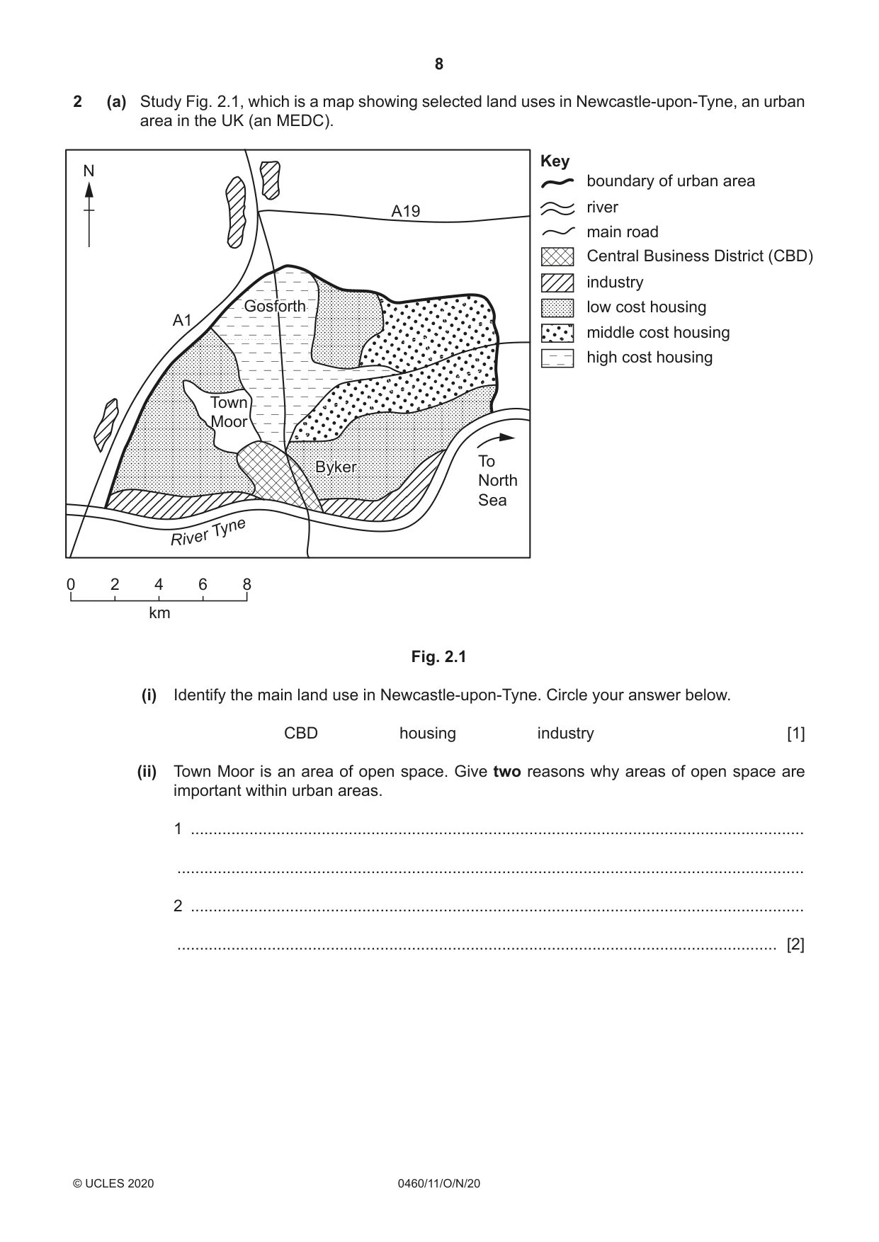
8 0460/11/O/N/20 © UCLES 2020 2 (a) Study Fig. 2.1, which is a map showing selected land uses in Newcastle-upon-Tyne, an urban area in the UK (an MEDC). N 0 2 4 6 8 km R i v er Tyn e Byker Gosforth Byker Gosforth Town Moor To North Sea A1 A19 Key industry Central Business District (CBD) middle cost housing low cost housing river boundary of urban area main road high cost housing Fig. 2.1 (i) Identify the main land use in Newcastle-upon-Tyne. Circle your answer below. CBD housing industry [1] (ii) Town Moor is an area of open space. Give two reasons why areas of open space are important within urban areas. 1 … … 2 … … [2]
Question paper, page 9
9 0460/11/O/N/20 © UCLES 2020 [Turn over (iii) Suggest the likely differences between the housing at Byker and Gosforth. … … … … … … [3] (iv) Suggest reasons for the distribution of industry shown in Fig. 2.1. … … … … … … … … [4]
Question paper, page 10
10 0460/11/O/N/20 © UCLES 2020 (b) Study Figs. 2.2 and 2.3 (Insert), which are photographs taken in an area which is being developed in the rural-urban fringe of a small town. (i) Suggest three reasons why the rural-urban fringe shown in Figs. 2.2 and 2.3 is being developed. 1 … … 2 … … 3 … … [3] (ii) Suggest why some people may agree with the development of the area shown in Figs. 2.2 and 2.3 but other people may oppose it. … … … … … … … … … … [5]
Question paper, page 11
11 0460/11/O/N/20 © UCLES 2020 [Turn over (c) For a named urban area you have studied, describe and explain the characteristics of the Central Business District (CBD). Name of urban area … … … … … … … … … … … … … … … … … … … … … … … … … … [7] [Total: 25]
Question paper, page 12
12 0460/11/O/N/20 © UCLES 2020 Section B Answer one question from this section. 3 (a) Study Fig. 3.1 (Insert), which is a photograph of a coastal area in Spain. (i) What coastal landform is marked by an X in Fig. 3.1? … [1] (ii) Describe two characteristics of coastal landform X. 1 … … 2 … … [2] (iii) Explain how the natural arch, marked Y in Fig. 3.1, was formed by coastal erosion. … … … … … … [3] (iv) Suggest reasons why the coastline shown in Fig. 3.1 is not straight. … … … … … … … … [4]
Question paper, page 13
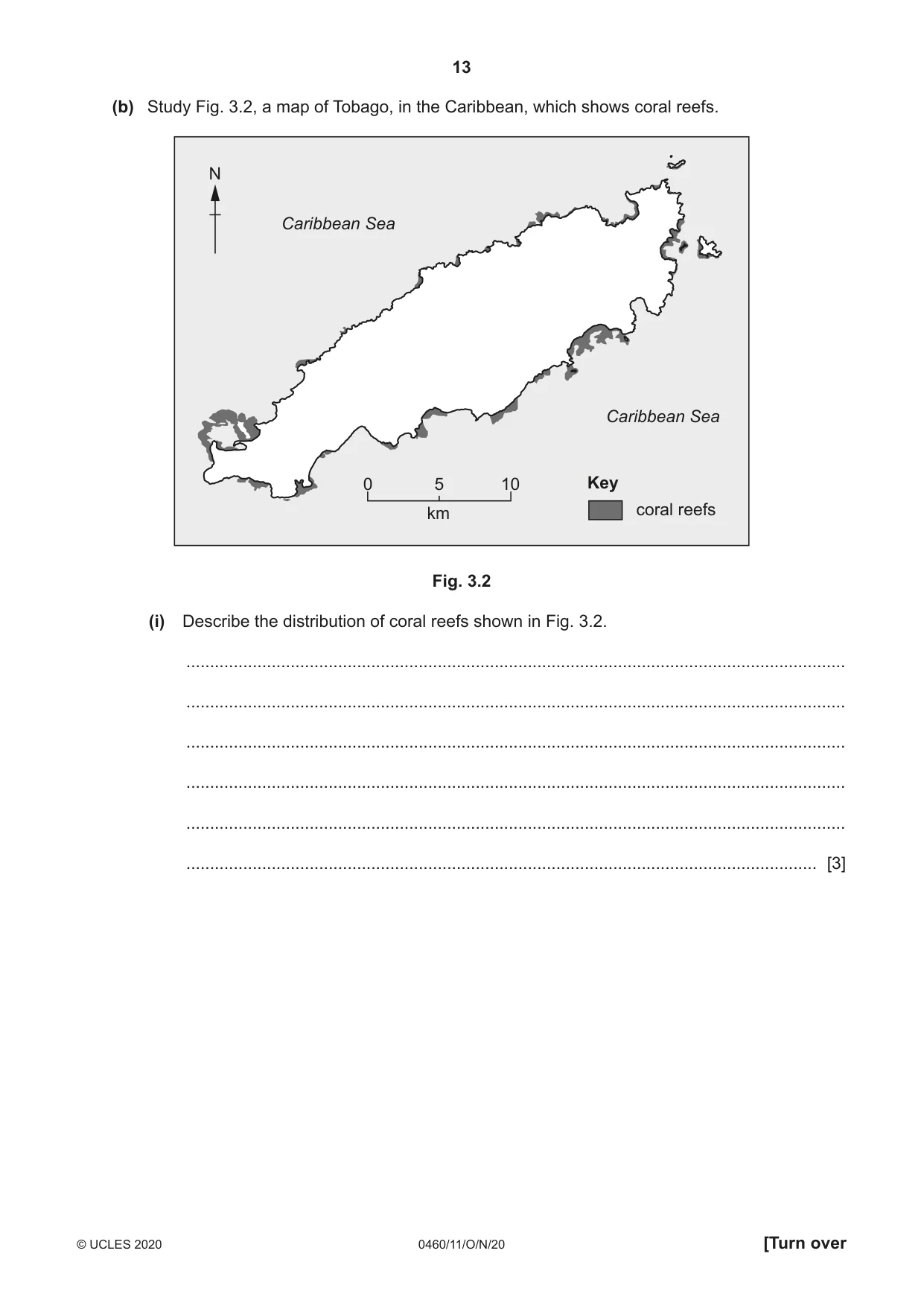
13 0460/11/O/N/20 © UCLES 2020 [Turn over (b) Study Fig. 3.2, a map of Tobago, in the Caribbean, which shows coral reefs. 0 10 5 km N Key coral reefs Caribbean Sea Caribbean Sea Fig. 3.2 (i) Describe the distribution of coral reefs shown in Fig. 3.2. … … … … … … [3]
Question paper, page 14
14 0460/11/O/N/20 © UCLES 2020 (ii) Describe the conditions required for the development of coral reefs. … … … … … … … … … … [5]
Question paper, page 15
15 0460/11/O/N/20 © UCLES 2020 [Turn over (c) For a named coastal area you have studied, describe attempts to manage erosion. Name of coastal area … … … … … … … … … … … … … … … … … … … … … … … … … … [7] [Total: 25]
Question paper, page 16
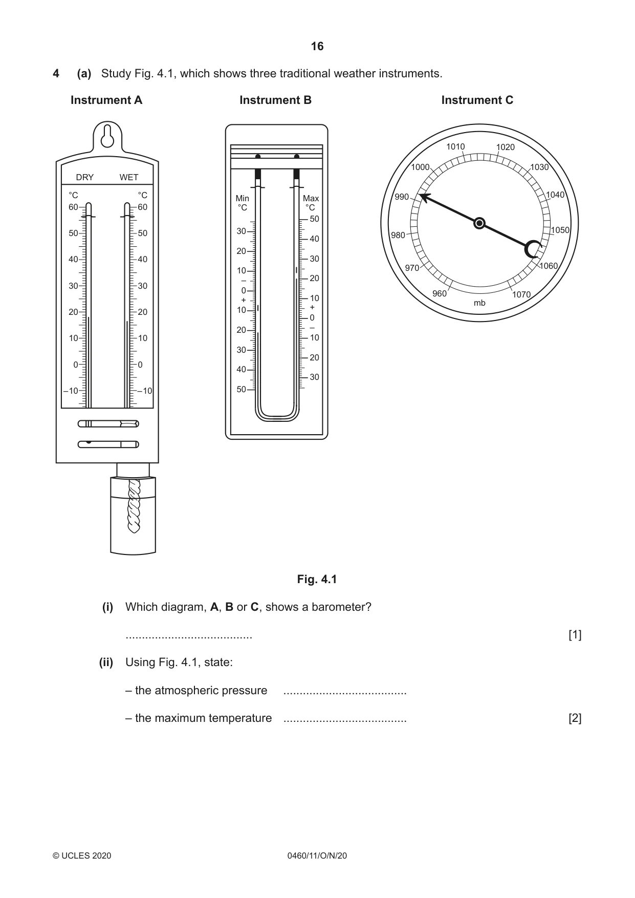
16 0460/11/O/N/20 © UCLES 2020 4 (a) Study Fig. 4.1, which shows three traditional weather instruments. 60 DRY WET 50 40 30 20 10 0 – 10 60 °C °C 50 40 30 20 10 0 – 10 30 °C °C 20 10 – + 0 10 20 30 40 50 50 40 30 – + 20 10 0 10 20 30 Min Max mb 1010 1000 990 980 970 960 1070 1060 1050 1040 1030 1020 Instrument A Instrument B Instrument C Fig. 4.1 (i) Which diagram, A, B or C, shows a barometer? … [1] (ii) Using Fig. 4.1, state: – the atmospheric pressure … – the maximum temperature … [2]
Question paper, page 17
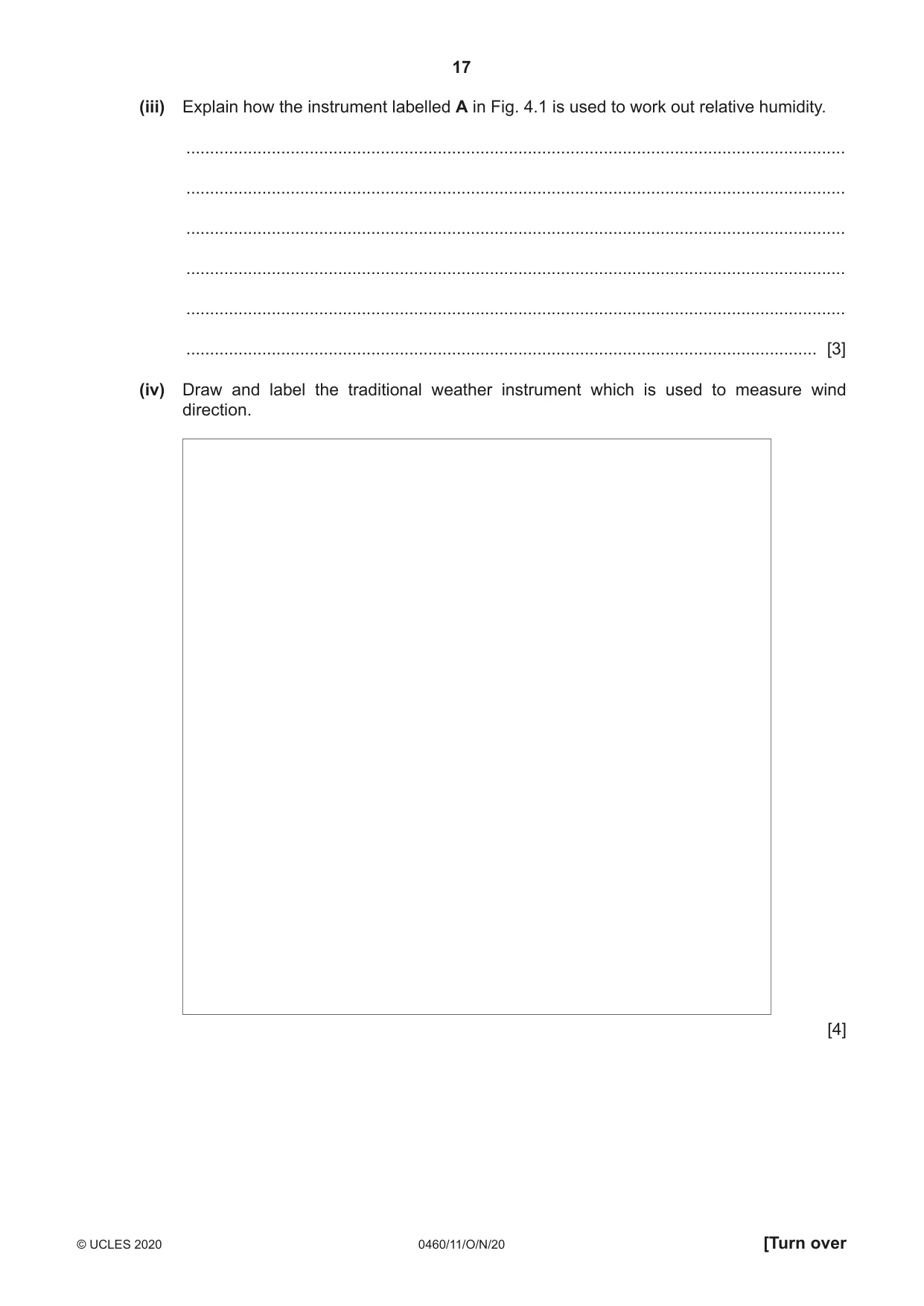
17 0460/11/O/N/20 © UCLES 2020 [Turn over (iii) Explain how the instrument labelled A in Fig. 4.1 is used to work out relative humidity. … … … … … … [3] (iv) Draw and label the traditional weather instrument which is used to measure wind direction. [4]
Question paper, page 18
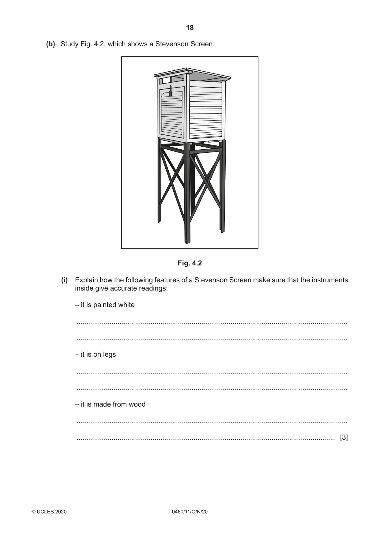
18 0460/11/O/N/20 © UCLES 2020 (b) Study Fig. 4.2, which shows a Stevenson Screen. Fig. 4.2 (i) Explain how the following features of a Stevenson Screen make sure that the instruments inside give accurate readings: – it is painted white … … – it is on legs … … – it is made from wood … … [3]
Question paper, page 19
19 0460/11/O/N/20 © UCLES 2020 [Turn over (ii) Describe and explain the ideal location of a Stevenson Screen. … … … … … … … … … … [5]
Question paper, page 20
20 0460/11/O/N/20 © UCLES 2020 (c) For a named river you have studied, explain why flooding has occurred. Name of river … … … … … … … … … … … … … … … … … … … … … … … … … … [7] [Total: 25]
Question paper, page 21
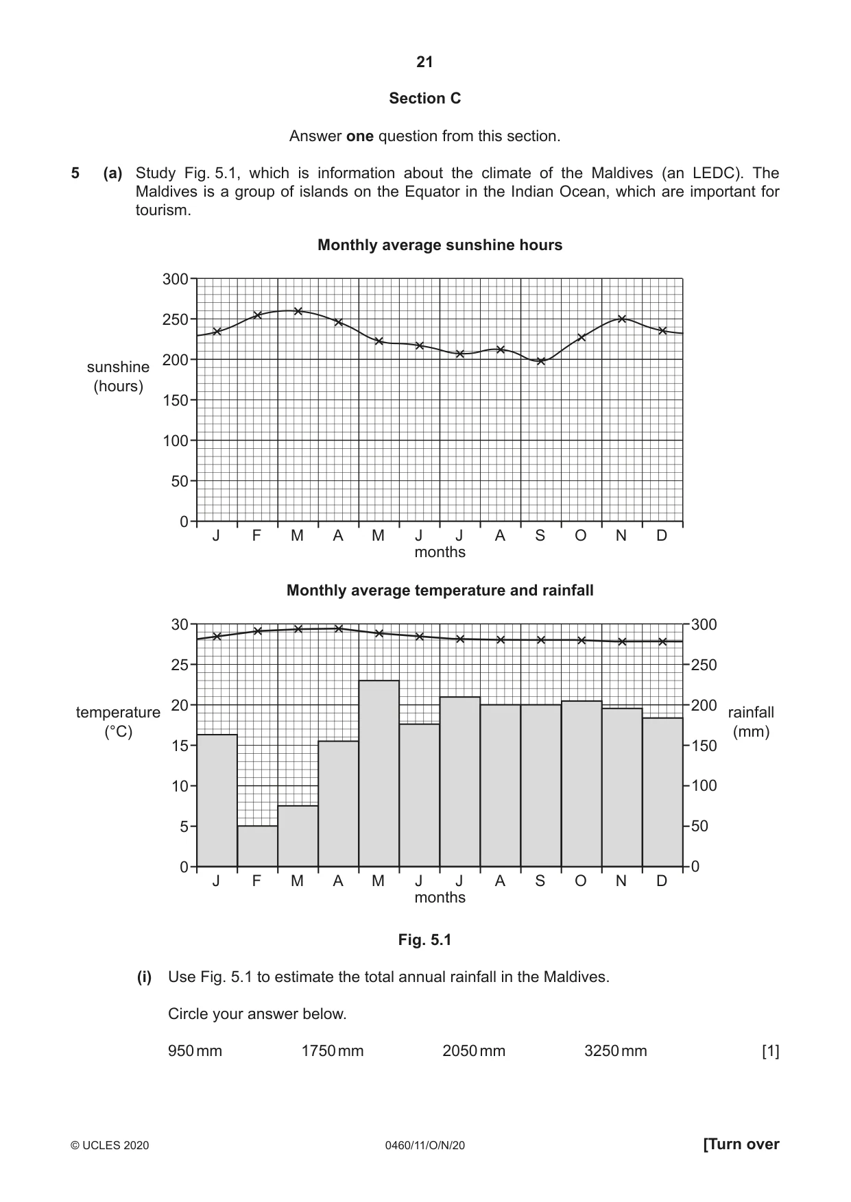
21 0460/11/O/N/20 © UCLES 2020 [Turn over Section C Answer one question from this section. 5 (a) Study Fig. 5.1, which is information about the climate of the Maldives (an LEDC). The Maldives is a group of islands on the Equator in the Indian Ocean, which are important for tourism. 0 J F M A M J J months Monthly average temperature and rainfall A S O N D 5 10 15 20 25 30 300 250 200 150 100 50 0 temperature (°C) rainfall (mm) 0 J F M A M J J months Monthly average sunshine hours A S O N D 50 100 150 200 250 300 sunshine (hours) Fig. 5.1 (i) Use Fig. 5.1 to estimate the total annual rainfall in the Maldives. Circle your answer below. 950 mm 1750 mm 2050 mm 3250 mm [1]
Question paper, page 22
22 0460/11/O/N/20 © UCLES 2020 (ii) Describe the attractions of the climate of the Maldives for tourists. … … … … [2] (iii) Describe the characteristics of the physical landscape of small tropical islands, such as the Maldives, which have encouraged the growth of the tourist industry. … … … … … … [3] (iv) Suggest ways in which the tourist industry is likely to benefit local communities in the Maldives. … … … … … … … … [4]
Question paper, page 23
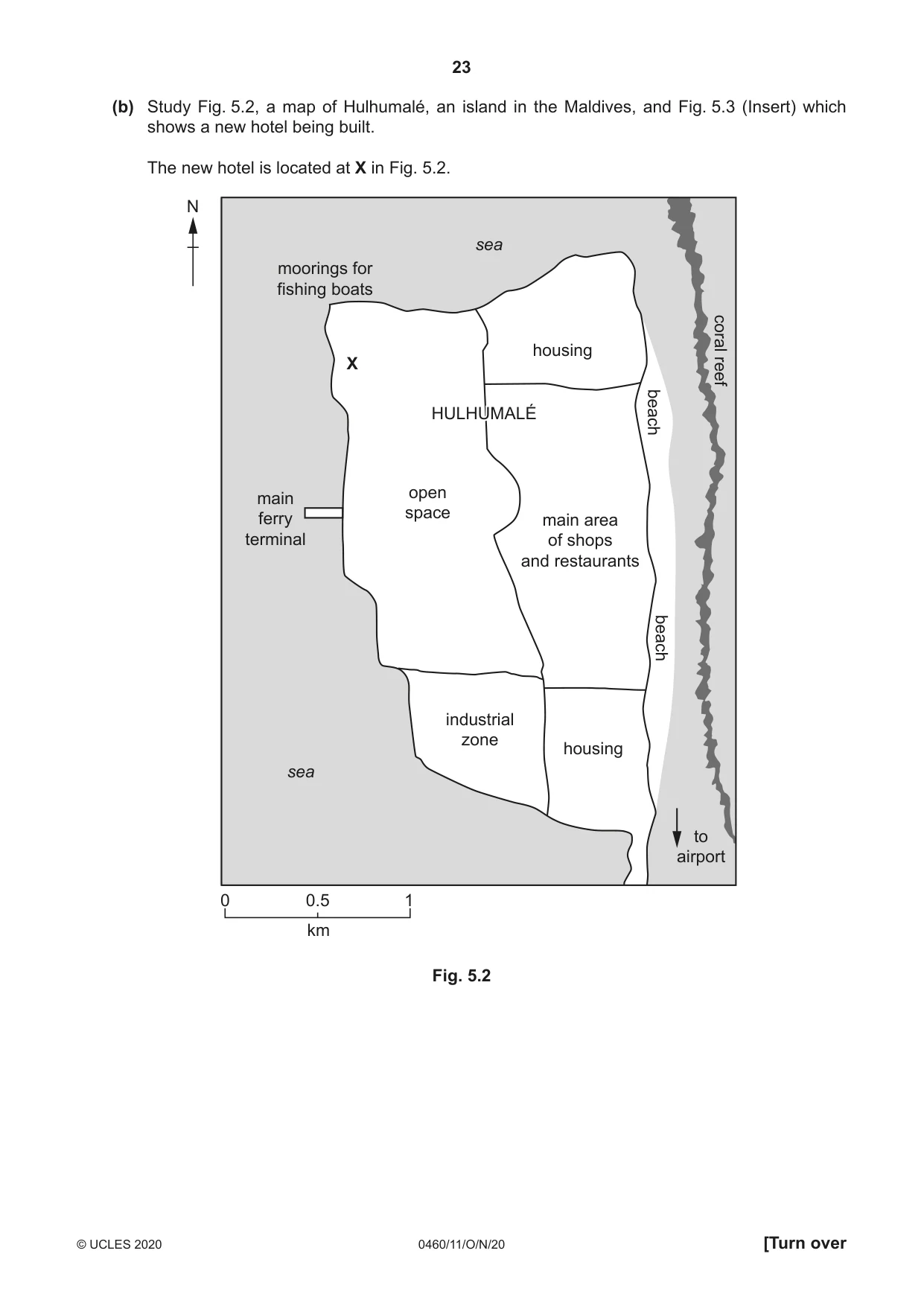
23 0460/11/O/N/20 © UCLES 2020 [Turn over (b) Study Fig. 5.2, a map of Hulhumalé, an island in the Maldives, and Fig. 5.3 (Insert) which shows a new hotel being built. The new hotel is located at X in Fig. 5.2. N 0 0.5 1 km HULHUMALÉ HULHUMALÉ open space industrial zone to airport housing housing main area of shops and restaurants beach beach main ferry terminal moorings for fishing boats coral reef X sea sea Fig. 5.2
Question paper, page 24
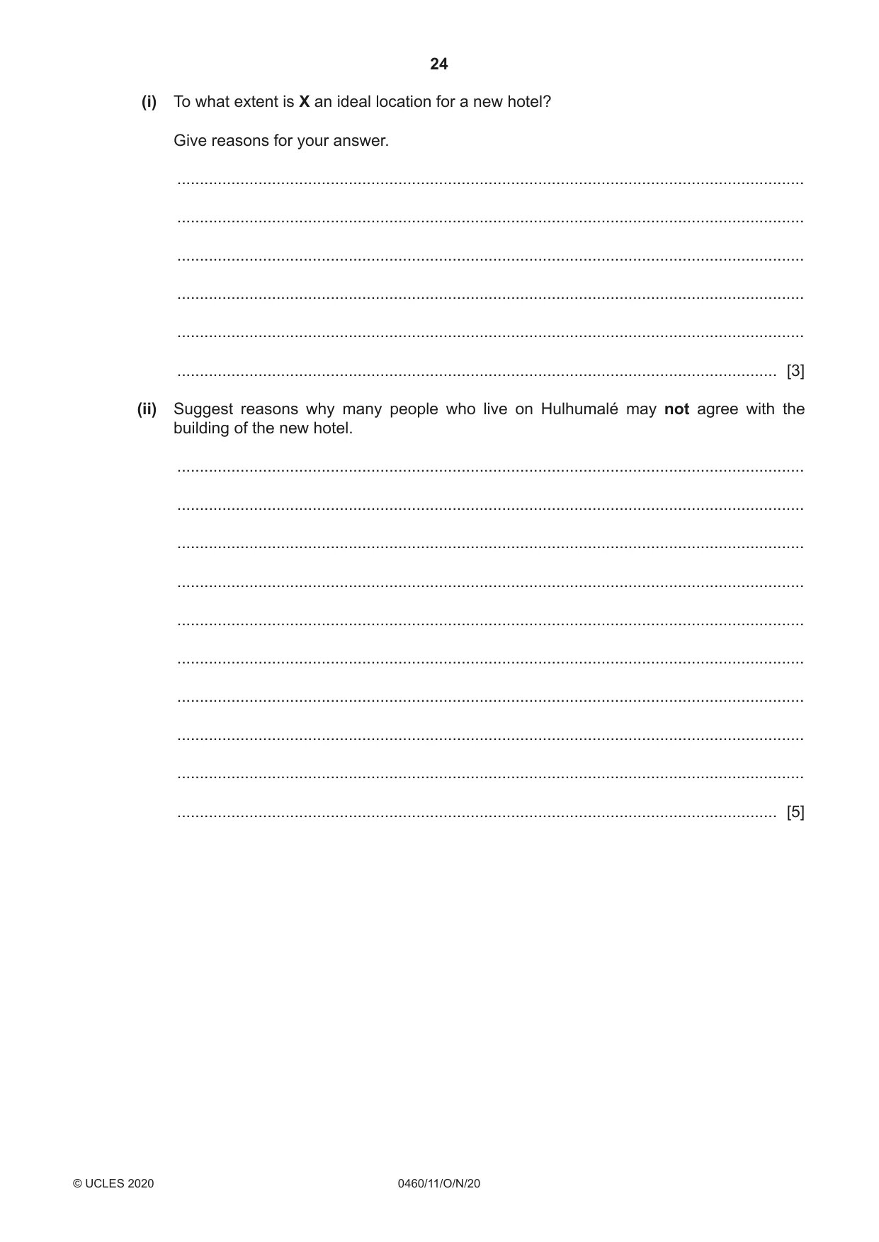
24 0460/11/O/N/20 © UCLES 2020 (i) To what extent is X an ideal location for a new hotel? Give reasons for your answer. … … … … … … [3] (ii) Suggest reasons why many people who live on Hulhumalé may not agree with the building of the new hotel. … … … … … … … … … … [5]
Question paper, page 25
25 0460/11/O/N/20 © UCLES 2020 [Turn over (c) For a named country or area you have studied, describe the different methods which are used to manage tourism. Name of country or area … … … … … … … … … … … … … … … … … … … … … … … … … … [7] [Total: 25]
Question paper, page 26
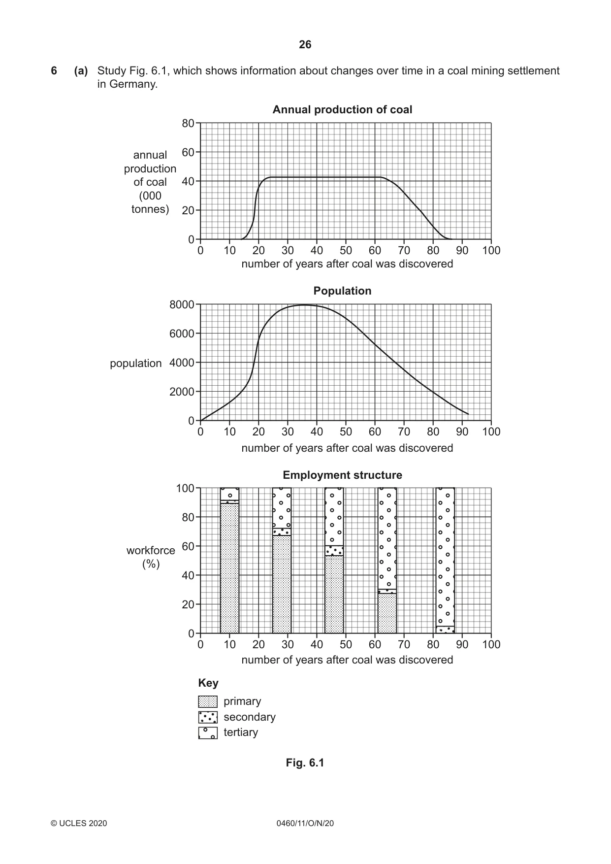
26 0460/11/O/N/20 © UCLES 2020 6 (a) Study Fig. 6.1, which shows information about changes over time in a coal mining settlement in Germany. 0 0 10 20 30 40 50 60 number of years after coal was discovered number of years after coal was discovered number of years after coal was discovered Key primary secondary tertiary Employment structure 70 80 90 100 20 40 60 80 100 workforce (%) 0 0 10 20 30 40 50 60 Population 70 80 90 100 2000 4000 6000 8000 population 0 0 10 20 30 40 50 60 Annual production of coal 70 80 90 100 20 40 60 80 annual production of coal (000 tonnes) Fig. 6.1
Question paper, page 27
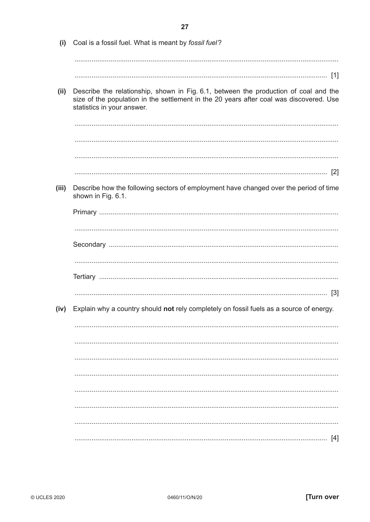
27 0460/11/O/N/20 © UCLES 2020 [Turn over (i) Coal is a fossil fuel. What is meant by fossil fuel ? … … [1] (ii) Describe the relationship, shown in Fig. 6.1, between the production of coal and the size of the population in the settlement in the 20 years after coal was discovered. Use statistics in your answer. … … … … [2] (iii) Describe how the following sectors of employment have changed over the period of time shown in Fig. 6.1. Primary … … Secondary … … Tertiary … … [3] (iv) Explain why a country should not rely completely on fossil fuels as a source of energy. … … … … … … … … [4]
Question paper, page 28
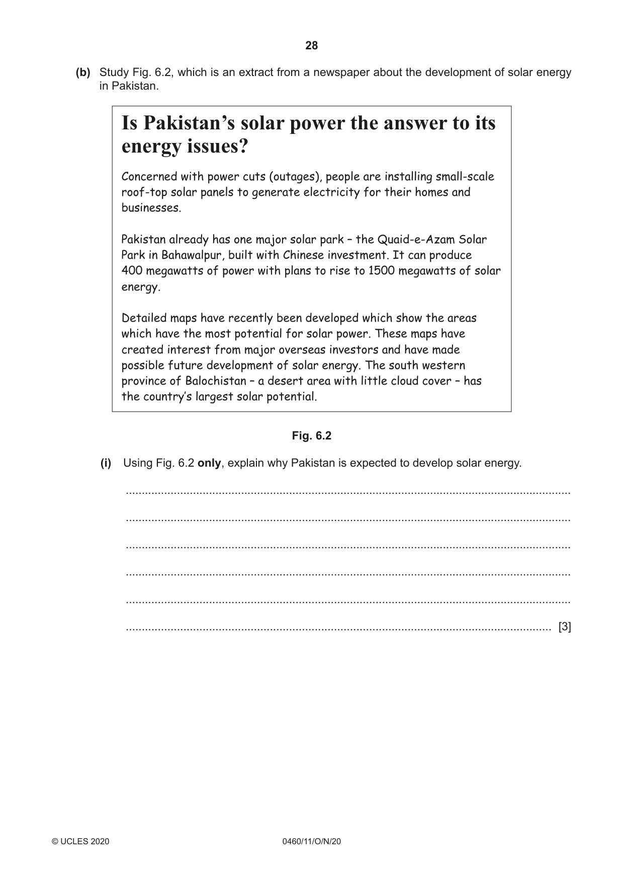
28 0460/11/O/N/20 © UCLES 2020 (b) Study Fig. 6.2, which is an extract from a newspaper about the development of solar energy in Pakistan. Is Pakistan’s solar power the answer to its energy issues? Concerned with power cuts (outages), people are installing small-scale roof-top solar panels to generate electricity for their homes and businesses. Pakistan already has one major solar park – the Quaid-e-Azam Solar Park in Bahawalpur, built with Chinese investment. It can produce 400 megawatts of power with plans to rise to 1500 megawatts of solar energy. Detailed maps have recently been developed which show the areas which have the most potential for solar power. These maps have created interest from major overseas investors and have made possible future development of solar energy. The south western province of Balochistan – a desert area with little cloud cover – has the country’s largest solar potential. Fig. 6.2 (i) Using Fig. 6.2 only, explain why Pakistan is expected to develop solar energy. … … … … … … [3]
Question paper, page 29
29 0460/11/O/N/20 © UCLES 2020 [Turn over (ii) Explain why renewable sources do not provide large amounts of energy in many countries. … … … … … … … … … … [5]
Question paper, page 30
30 0460/11/O/N/20 © UCLES 2020 (c) For a named country or area you have studied, describe different methods used to supply clean drinking water to the population. Name of country … … … … … … … … … … … … … … … … … … … … … … … … … … [7] [Total: 25]
Question paper, page 31
31 0460/11/O/N/20 © UCLES 2020 Additional Pages If you use the following lined pages to complete the answer(s) to any question(s), the question number(s) must be clearly shown. … … … … … … … … … … … … … … … … … … … … … … … … … …
Question paper, page 32
32 0460/11/O/N/20 © UCLES 2020 … … … … … … … … … … … … … … … … … … … … … … … … Permission to reproduce items where third-party owned material protected by copyright is included has been sought and cleared where possible. Every reasonable effort has been made by the publisher (UCLES) to trace copyright holders, but if any items requiring clearance have unwittingly been included, the publisher will be pleased to make amends at the earliest possible opportunity. To avoid the issue of disclosure of answer-related information to candidates, all copyright acknowledgements are reproduced online in the Cambridge Assessment International Education Copyright Acknowledgements Booklet. This is produced for each series of examinations and is freely available to download at www.cambridgeinternational.org after the live examination series. Cambridge Assessment International Education is part of the Cambridge Assessment Group. Cambridge Assessment is the brand name of the University of Cambridge Local Examinations Syndicate (UCLES), which itself is a department of the University of Cambridge.
Mark scheme, page 1
This document consists of 18 printed pages. © UCLES 2020 [Turn over Cambridge IGCSE™ GEOGRAPHY 0460/11 Paper 1 October/November 2020 MARK SCHEME Maximum Mark: 75 Published This mark scheme is published as an aid to teachers and candidates, to indicate the requirements of the examination. It shows the basis on which Examiners were instructed to award marks. It does not indicate the details of the discussions that took place at an Examiners’ meeting before marking began, which would have considered the acceptability of alternative answers. Mark schemes should be read in conjunction with the question paper and the Principal Examiner Report for Teachers. Cambridge International will not enter into discussions about these mark schemes. Cambridge International is publishing the mark schemes for the October/November 2020 series for most Cambridge IGCSE™, Cambridge International A and AS Level and Cambridge Pre-U components, and some Cambridge O Level components.
Mark scheme, page 2
0460/11 Cambridge IGCSE – Mark Scheme PUBLISHED October/November 2020 © UCLES 2020 Page 2 of 18 Generic Marking Principles These general marking principles must be applied by all examiners when marking candidate answers. They should be applied alongside the specific content of the mark scheme or generic level descriptors for a question. Each question paper and mark scheme will also comply with these marking principles. GENERIC MARKING PRINCIPLE 1: Marks must be awarded in line with: • the specific content of the mark scheme or the generic level descriptors for the question • the specific skills defined in the mark scheme or in the generic level descriptors for the question • the standard of response required by a candidate as exemplified by the standardisation scripts. GENERIC MARKING PRINCIPLE 2: Marks awarded are always whole marks (not half marks, or other fractions). GENERIC MARKING PRINCIPLE 3: Marks must be awarded positively: • marks are awarded for correct/valid answers, as defined in the mark scheme. However, credit is given for valid answers which go beyond the scope of the syllabus and mark scheme, referring to your Team Leader as appropriate • marks are awarded when candidates clearly demonstrate what they know and can do • marks are not deducted for errors • marks are not deducted for omissions • answers should only be judged on the quality of spelling, punctuation and grammar when these features are specifically assessed by the question as indicated by the mark scheme. The meaning, however, should be unambiguous. GENERIC MARKING PRINCIPLE 4: Rules must be applied consistently, e.g. in situations where candidates have not followed instructions or in the application of generic level descriptors. GENERIC MARKING PRINCIPLE 5: Marks should be awarded using the full range of marks defined in the mark scheme for the question (however; the use of the full mark range may be limited according to the quality of the candidate responses seen). GENERIC MARKING PRINCIPLE 6: Marks awarded are based solely on the requirements as defined in the mark scheme. Marks should not be awarded with grade thresholds or grade descriptors in mind.
Mark scheme, page 3
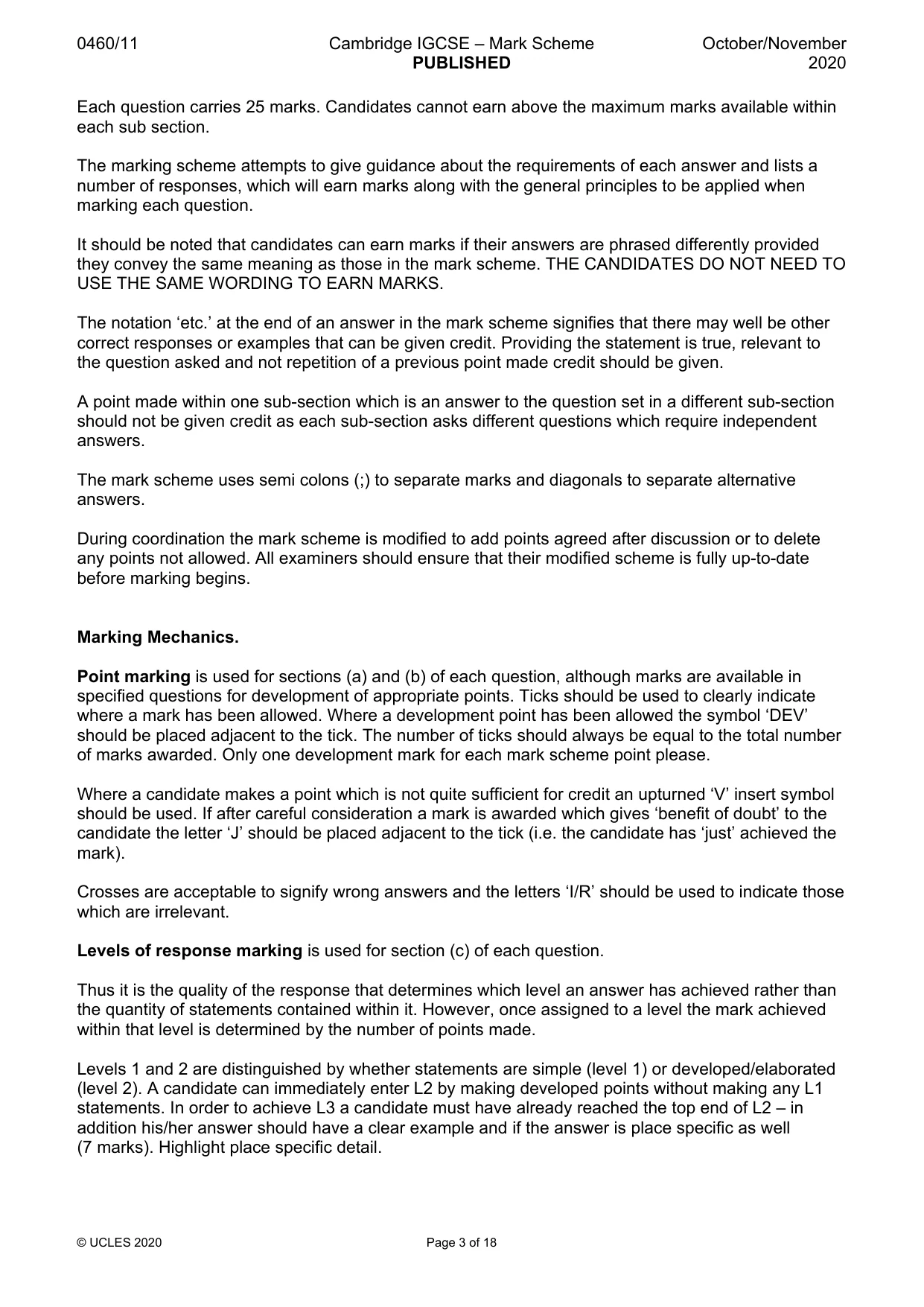
0460/11 Cambridge IGCSE – Mark Scheme PUBLISHED October/November 2020 © UCLES 2020 Page 3 of 18 Each question carries 25 marks. Candidates cannot earn above the maximum marks available within each sub section. The marking scheme attempts to give guidance about the requirements of each answer and lists a number of responses, which will earn marks along with the general principles to be applied when marking each question. It should be noted that candidates can earn marks if their answers are phrased differently provided they convey the same meaning as those in the mark scheme. THE CANDIDATES DO NOT NEED TO USE THE SAME WORDING TO EARN MARKS. The notation ‘etc.’ at the end of an answer in the mark scheme signifies that there may well be other correct responses or examples that can be given credit. Providing the statement is true, relevant to the question asked and not repetition of a previous point made credit should be given. A point made within one sub-section which is an answer to the question set in a different sub-section should not be given credit as each sub-section asks different questions which require independent answers. The mark scheme uses semi colons (;) to separate marks and diagonals to separate alternative answers. During coordination the mark scheme is modified to add points agreed after discussion or to delete any points not allowed. All examiners should ensure that their modified scheme is fully up-to-date before marking begins. Marking Mechanics. Point marking is used for sections (a) and (b) of each question, although marks are available in specified questions for development of appropriate points. Ticks should be used to clearly indicate where a mark has been allowed. Where a development point has been allowed the symbol ‘DEV’ should be placed adjacent to the tick. The number of ticks should always be equal to the total number of marks awarded. Only one development mark for each mark scheme point please. Where a candidate makes a point which is not quite sufficient for credit an upturned ‘V’ insert symbol should be used. If after careful consideration a mark is awarded which gives ‘benefit of doubt’ to the candidate the letter ‘J’ should be placed adjacent to the tick (i.e. the candidate has ‘just’ achieved the mark). Crosses are acceptable to signify wrong answers and the letters ‘I/R’ should be used to indicate those which are irrelevant. Levels of response marking is used for section (c) of each question. Thus it is the quality of the response that determines which level an answer has achieved rather than the quantity of statements contained within it. However, once assigned to a level the mark achieved within that level is determined by the number of points made. Levels 1 and 2 are distinguished by whether statements are simple (level 1) or developed/elaborated (level 2). A candidate can immediately enter L2 by making developed points without making any L1 statements. In order to achieve L3 a candidate must have already reached the top end of L2 – in addition his/her answer should have a clear example and if the answer is place specific as well (7 marks). Highlight place specific detail.
Mark scheme, page 4
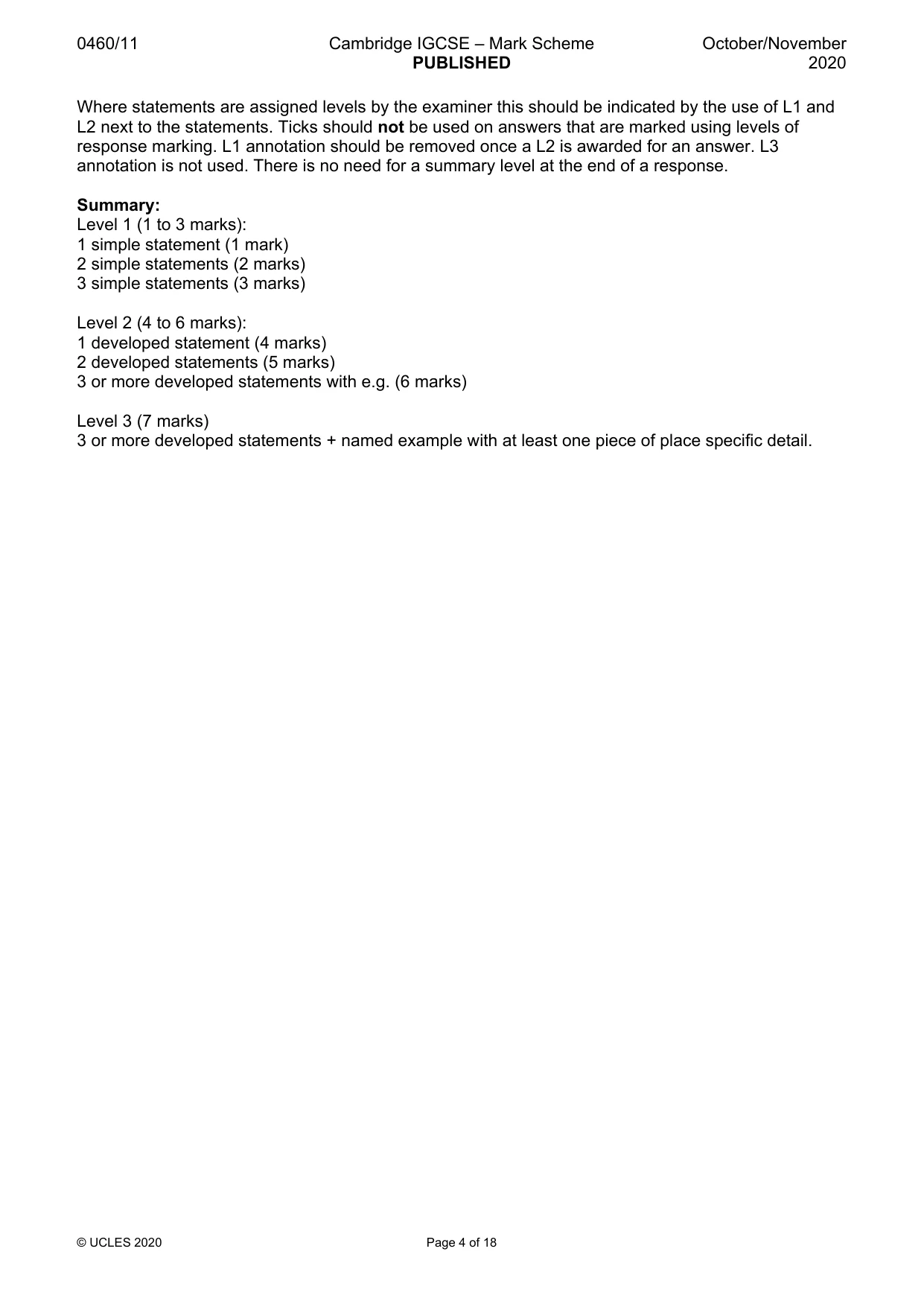
0460/11 Cambridge IGCSE – Mark Scheme PUBLISHED October/November 2020 © UCLES 2020 Page 4 of 18 Where statements are assigned levels by the examiner this should be indicated by the use of L1 and L2 next to the statements. Ticks should not be used on answers that are marked using levels of response marking. L1 annotation should be removed once a L2 is awarded for an answer. L3 annotation is not used. There is no need for a summary level at the end of a response. Summary: Level 1 (1 to 3 marks): 1 simple statement (1 mark) 2 simple statements (2 marks) 3 simple statements (3 marks) Level 2 (4 to 6 marks): 1 developed statement (4 marks) 2 developed statements (5 marks) 3 or more developed statements with e.g. (6 marks) Level 3 (7 marks) 3 or more developed statements + named example with at least one piece of place specific detail.
Mark scheme, page 5
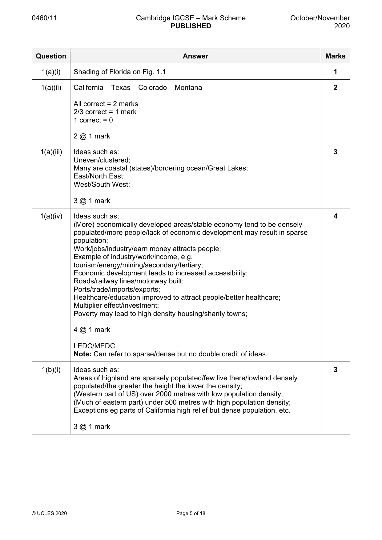
0460/11 Cambridge IGCSE – Mark Scheme PUBLISHED October/November 2020 © UCLES 2020 Page 5 of 18 Question Answer Marks 1(a)(i) Shading of Florida on Fig. 1.1 1 1(a)(ii) California Texas Colorado Montana All correct = 2 marks 2/3 correct = 1 mark 1 correct = 0 2 @ 1 mark 2 1(a)(iii) Ideas such as: Uneven/clustered; Many are coastal (states)/bordering ocean/Great Lakes; East/North East; West/South West; 3 @ 1 mark 3 1(a)(iv) Ideas such as; (More) economically developed areas/stable economy tend to be densely populated/more people/lack of economic development may result in sparse population; Work/jobs/industry/earn money attracts people; Example of industry/work/income, e.g. tourism/energy/mining/secondary/tertiary; Economic development leads to increased accessibility; Roads/railway lines/motorway built; Ports/trade/imports/exports; Healthcare/education improved to attract people/better healthcare; Multiplier effect/investment; Poverty may lead to high density housing/shanty towns; 4 @ 1 mark LEDC/MEDC Note: Can refer to sparse/dense but no double credit of ideas. 4 1(b)(i) Ideas such as: Areas of highland are sparsely populated/few live there/lowland densely populated/the greater the height the lower the density; (Western part of US) over 2000 metres with low population density; (Much of eastern part) under 500 metres with high population density; Exceptions eg parts of California high relief but dense population, etc. 3 @ 1 mark 3
Mark scheme, page 6
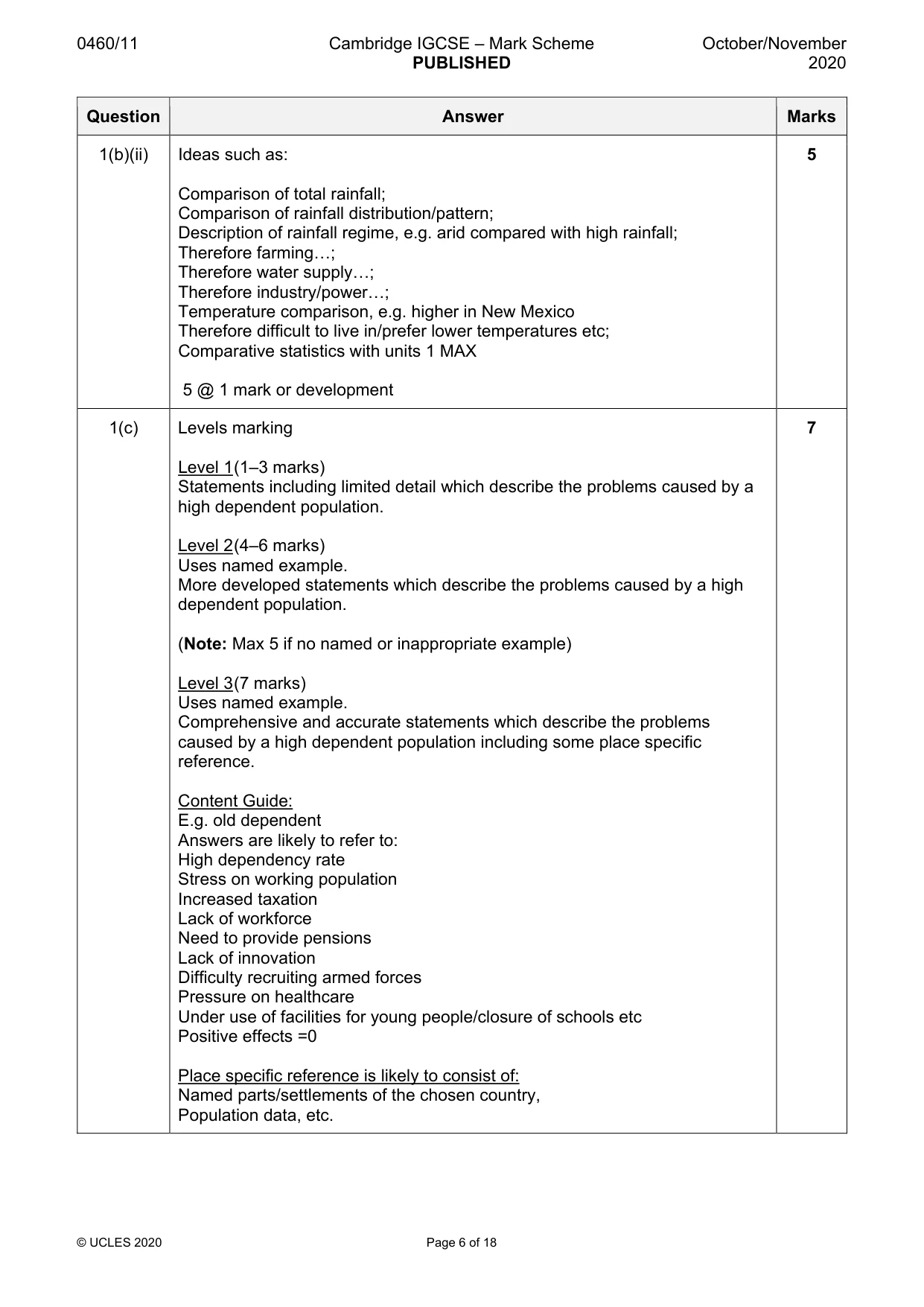
0460/11 Cambridge IGCSE – Mark Scheme PUBLISHED October/November 2020 © UCLES 2020 Page 6 of 18 Question Answer Marks 1(b)(ii) Ideas such as: Comparison of total rainfall; Comparison of rainfall distribution/pattern; Description of rainfall regime, e.g. arid compared with high rainfall; Therefore farming…; Therefore water supply…; Therefore industry/power…; Temperature comparison, e.g. higher in New Mexico Therefore difficult to live in/prefer lower temperatures etc; Comparative statistics with units 1 MAX 5 @ 1 mark or development 5 1(c) Levels marking Level 1 (1–3 marks) Statements including limited detail which describe the problems caused by a high dependent population. Level 2 (4–6 marks) Uses named example. More developed statements which describe the problems caused by a high dependent population. (Note: Max 5 if no named or inappropriate example) Level 3 (7 marks) Uses named example. Comprehensive and accurate statements which describe the problems caused by a high dependent population including some place specific reference. Content Guide: E.g. old dependent Answers are likely to refer to: High dependency rate Stress on working population Increased taxation Lack of workforce Need to provide pensions Lack of innovation Difficulty recruiting armed forces Pressure on healthcare Under use of facilities for young people/closure of schools etc Positive effects =0 Place specific reference is likely to consist of: Named parts/settlements of the chosen country, Population data, etc. 7
Mark scheme, page 7
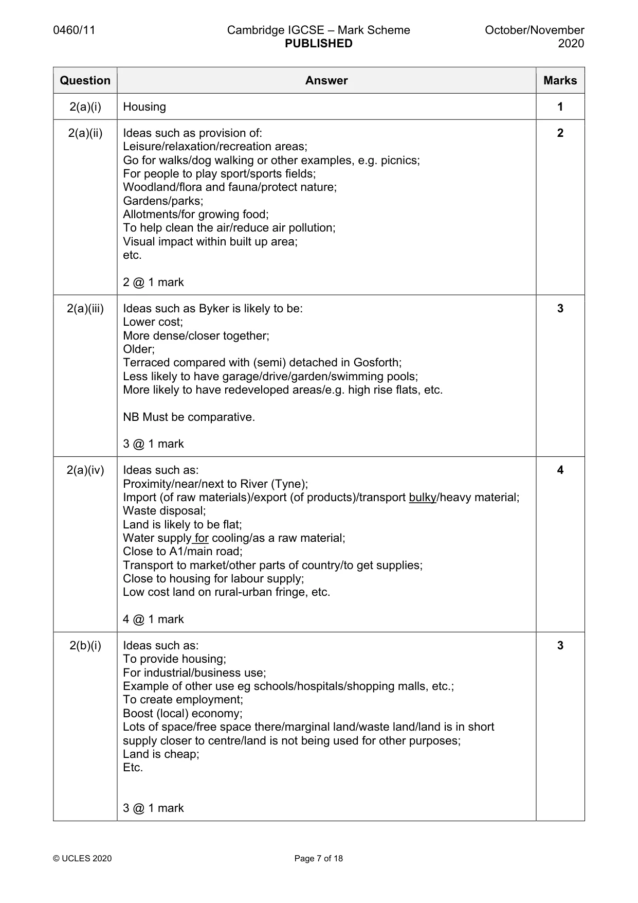
0460/11 Cambridge IGCSE – Mark Scheme PUBLISHED October/November 2020 © UCLES 2020 Page 7 of 18 Question Answer Marks 2(a)(i) Housing 1 2(a)(ii) Ideas such as provision of: Leisure/relaxation/recreation areas; Go for walks/dog walking or other examples, e.g. picnics; For people to play sport/sports fields; Woodland/flora and fauna/protect nature; Gardens/parks; Allotments/for growing food; To help clean the air/reduce air pollution; Visual impact within built up area; etc. 2 @ 1 mark 2 2(a)(iii) Ideas such as Byker is likely to be: Lower cost; More dense/closer together; Older; Terraced compared with (semi) detached in Gosforth; Less likely to have garage/drive/garden/swimming pools; More likely to have redeveloped areas/e.g. high rise flats, etc. NB Must be comparative. 3 @ 1 mark 3 2(a)(iv) Ideas such as: Proximity/near/next to River (Tyne); Import (of raw materials)/export (of products)/transport bulky/heavy material; Waste disposal; Land is likely to be flat; Water supply for cooling/as a raw material; Close to A1/main road; Transport to market/other parts of country/to get supplies; Close to housing for labour supply; Low cost land on rural-urban fringe, etc. 4 @ 1 mark 4 2(b)(i) Ideas such as: To provide housing; For industrial/business use; Example of other use eg schools/hospitals/shopping malls, etc.; To create employment; Boost (local) economy; Lots of space/free space there/marginal land/waste land/land is in short supply closer to centre/land is not being used for other purposes; Land is cheap; Etc. 3 @ 1 mark 3
Mark scheme, page 8
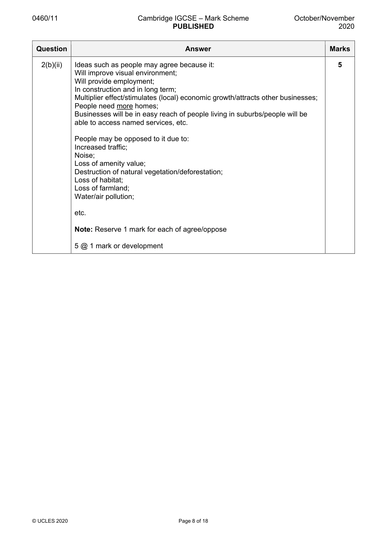
0460/11 Cambridge IGCSE – Mark Scheme PUBLISHED October/November 2020 © UCLES 2020 Page 8 of 18 Question Answer Marks 2(b)(ii) Ideas such as people may agree because it: Will improve visual environment; Will provide employment; In construction and in long term; Multiplier effect/stimulates (local) economic growth/attracts other businesses; People need more homes; Businesses will be in easy reach of people living in suburbs/people will be able to access named services, etc. People may be opposed to it due to: Increased traffic; Noise; Loss of amenity value; Destruction of natural vegetation/deforestation; Loss of habitat; Loss of farmland; Water/air pollution; etc. Note: Reserve 1 mark for each of agree/oppose 5 @ 1 mark or development 5
Mark scheme, page 9
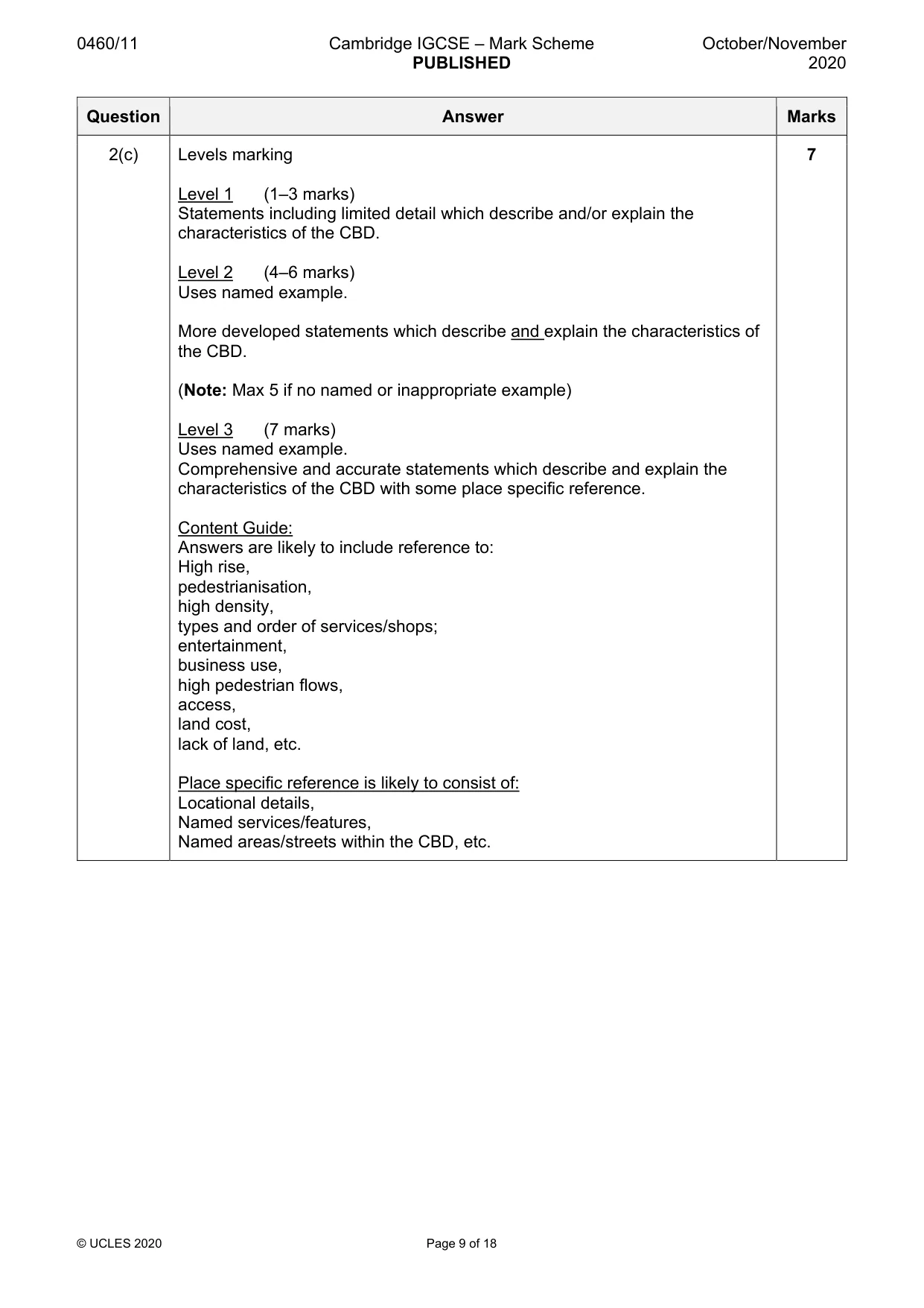
0460/11 Cambridge IGCSE – Mark Scheme PUBLISHED October/November 2020 © UCLES 2020 Page 9 of 18 Question Answer Marks 2(c) Levels marking Level 1 (1–3 marks) Statements including limited detail which describe and/or explain the characteristics of the CBD. Level 2 (4–6 marks) Uses named example. More developed statements which describe and explain the characteristics of the CBD. (Note: Max 5 if no named or inappropriate example) Level 3 (7 marks) Uses named example. Comprehensive and accurate statements which describe and explain the characteristics of the CBD with some place specific reference. Content Guide: Answers are likely to include reference to: High rise, pedestrianisation, high density, types and order of services/shops; entertainment, business use, high pedestrian flows, access, land cost, lack of land, etc. Place specific reference is likely to consist of: Locational details, Named services/features, Named areas/streets within the CBD, etc. 7
Mark scheme, page 10
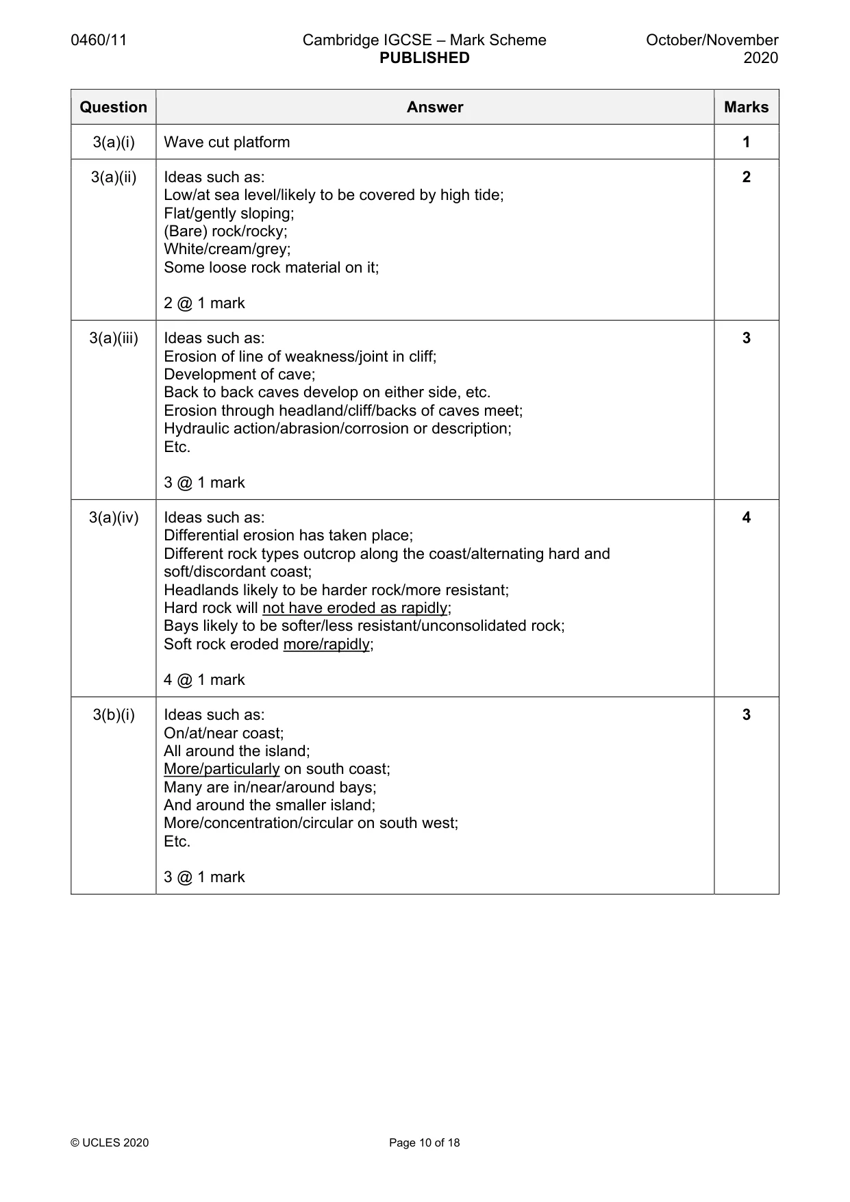
0460/11 Cambridge IGCSE – Mark Scheme PUBLISHED October/November 2020 © UCLES 2020 Page 10 of 18 Question Answer Marks 3(a)(i) Wave cut platform 1 3(a)(ii) Ideas such as: Low/at sea level/likely to be covered by high tide; Flat/gently sloping; (Bare) rock/rocky; White/cream/grey; Some loose rock material on it; 2 @ 1 mark 2 3(a)(iii) Ideas such as: Erosion of line of weakness/joint in cliff; Development of cave; Back to back caves develop on either side, etc. Erosion through headland/cliff/backs of caves meet; Hydraulic action/abrasion/corrosion or description; Etc. 3 @ 1 mark 3 3(a)(iv) Ideas such as: Differential erosion has taken place; Different rock types outcrop along the coast/alternating hard and soft/discordant coast; Headlands likely to be harder rock/more resistant; Hard rock will not have eroded as rapidly; Bays likely to be softer/less resistant/unconsolidated rock; Soft rock eroded more/rapidly; 4 @ 1 mark 4 3(b)(i) Ideas such as: On/at/near coast; All around the island; More/particularly on south coast; Many are in/near/around bays; And around the smaller island; More/concentration/circular on south west; Etc. 3 @ 1 mark 3
Mark scheme, page 11
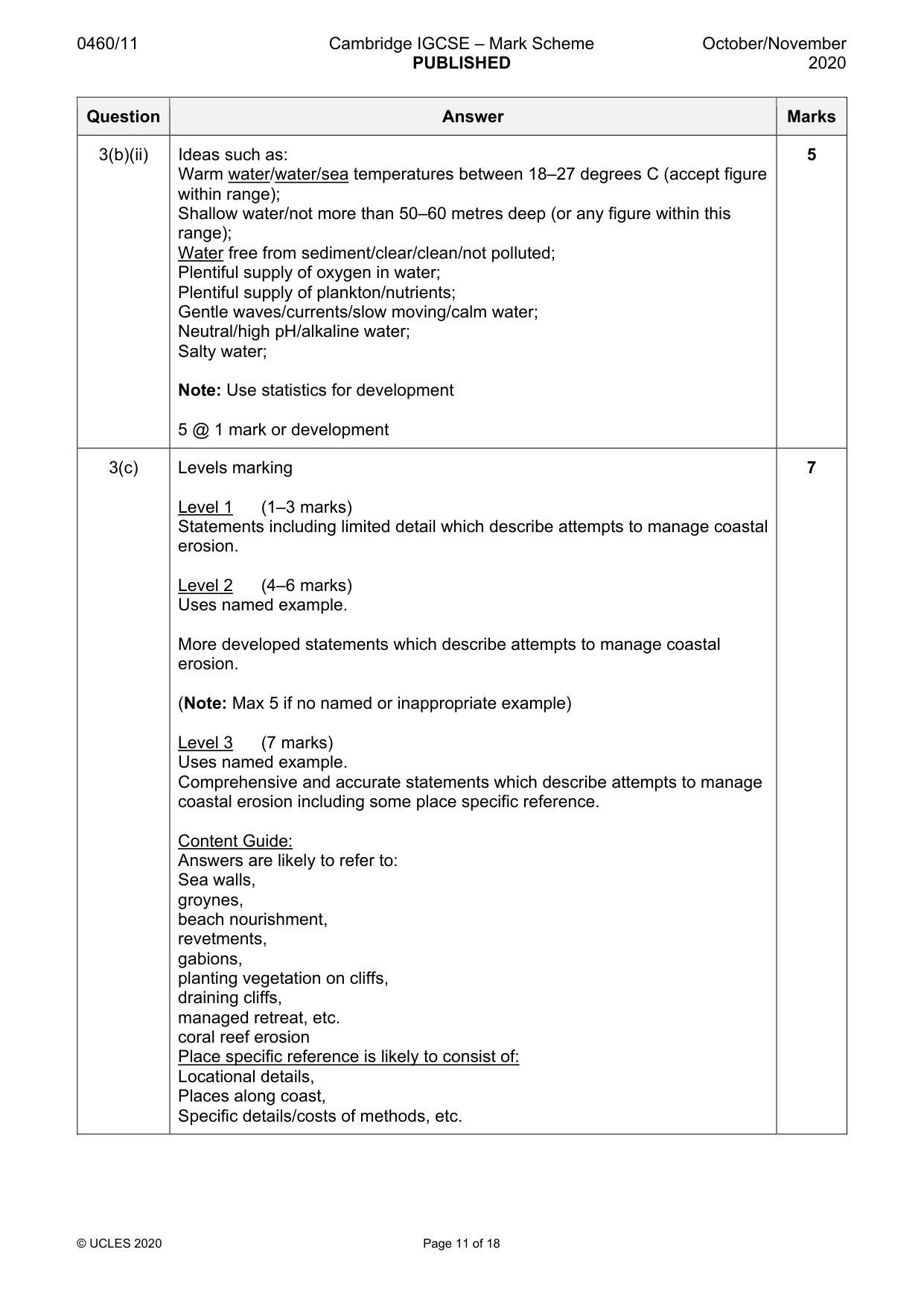
0460/11 Cambridge IGCSE – Mark Scheme PUBLISHED October/November 2020 © UCLES 2020 Page 11 of 18 Question Answer Marks 3(b)(ii) Ideas such as: Warm water/water/sea temperatures between 18–27 degrees C (accept figure within range); Shallow water/not more than 50–60 metres deep (or any figure within this range); Water free from sediment/clear/clean/not polluted; Plentiful supply of oxygen in water; Plentiful supply of plankton/nutrients; Gentle waves/currents/slow moving/calm water; Neutral/high pH/alkaline water; Salty water; Note: Use statistics for development 5 @ 1 mark or development 5 3(c) Levels marking Level 1 (1–3 marks) Statements including limited detail which describe attempts to manage coastal erosion. Level 2 (4–6 marks) Uses named example. More developed statements which describe attempts to manage coastal erosion. (Note: Max 5 if no named or inappropriate example) Level 3 (7 marks) Uses named example. Comprehensive and accurate statements which describe attempts to manage coastal erosion including some place specific reference. Content Guide: Answers are likely to refer to: Sea walls, groynes, beach nourishment, revetments, gabions, planting vegetation on cliffs, draining cliffs, managed retreat, etc. coral reef erosion Place specific reference is likely to consist of: Locational details, Places along coast, Specific details/costs of methods, etc. 7
Mark scheme, page 12
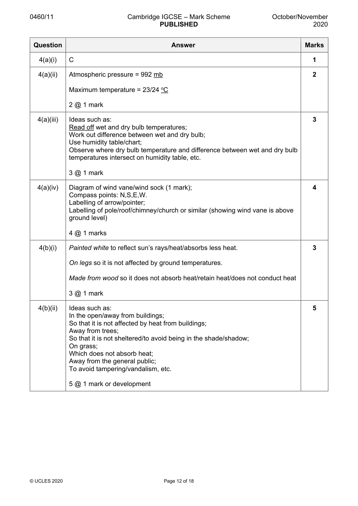
0460/11 Cambridge IGCSE – Mark Scheme PUBLISHED October/November 2020 © UCLES 2020 Page 12 of 18 Question Answer Marks 4(a)(i) C 1 4(a)(ii) Atmospheric pressure = 992 mb Maximum temperature = 23/24 oC 2 @ 1 mark 2 4(a)(iii) Ideas such as: Read off wet and dry bulb temperatures; Work out difference between wet and dry bulb; Use humidity table/chart; Observe where dry bulb temperature and difference between wet and dry bulb temperatures intersect on humidity table, etc. 3 @ 1 mark 3 4(a)(iv) Diagram of wind vane/wind sock (1 mark); Compass points: N,S,E,W. Labelling of arrow/pointer; Labelling of pole/roof/chimney/church or similar (showing wind vane is above ground level) 4 @ 1 marks 4 4(b)(i) Painted white to reflect sun’s rays/heat/absorbs less heat. On legs so it is not affected by ground temperatures. Made from wood so it does not absorb heat/retain heat/does not conduct heat 3 @ 1 mark 3 4(b)(ii) Ideas such as: In the open/away from buildings; So that it is not affected by heat from buildings; Away from trees; So that it is not sheltered/to avoid being in the shade/shadow; On grass; Which does not absorb heat; Away from the general public; To avoid tampering/vandalism, etc. 5 @ 1 mark or development 5
Mark scheme, page 13
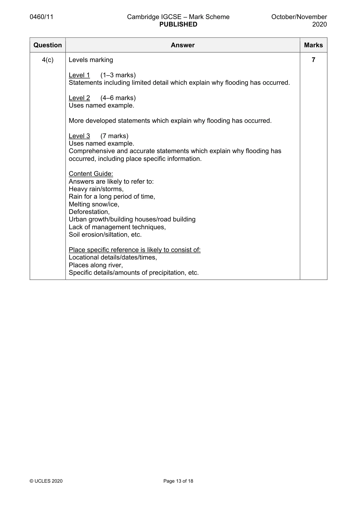
0460/11 Cambridge IGCSE – Mark Scheme PUBLISHED October/November 2020 © UCLES 2020 Page 13 of 18 Question Answer Marks 4(c) Levels marking Level 1 (1–3 marks) Statements including limited detail which explain why flooding has occurred. Level 2 (4–6 marks) Uses named example. More developed statements which explain why flooding has occurred. Level 3 (7 marks) Uses named example. Comprehensive and accurate statements which explain why flooding has occurred, including place specific information. Content Guide: Answers are likely to refer to: Heavy rain/storms, Rain for a long period of time, Melting snow/ice, Deforestation, Urban growth/building houses/road building Lack of management techniques, Soil erosion/siltation, etc. Place specific reference is likely to consist of: Locational details/dates/times, Places along river, Specific details/amounts of precipitation, etc. 7
Mark scheme, page 14
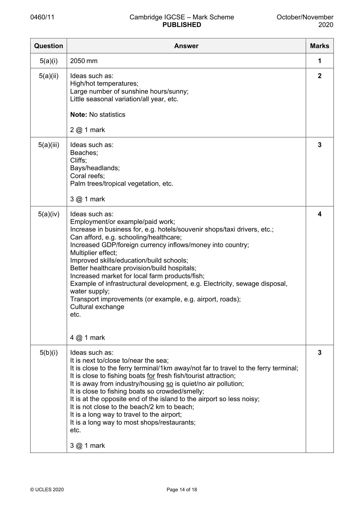
0460/11 Cambridge IGCSE – Mark Scheme PUBLISHED October/November 2020 © UCLES 2020 Page 14 of 18 Question Answer Marks 5(a)(i) 2050 mm 1 5(a)(ii) Ideas such as: High/hot temperatures; Large number of sunshine hours/sunny; Little seasonal variation/all year, etc. Note: No statistics 2 @ 1 mark 2 5(a)(iii) Ideas such as: Beaches; Cliffs; Bays/headlands; Coral reefs; Palm trees/tropical vegetation, etc. 3 @ 1 mark 3 5(a)(iv) Ideas such as: Employment/or example/paid work; Increase in business for, e.g. hotels/souvenir shops/taxi drivers, etc.; Can afford, e.g. schooling/healthcare; Increased GDP/foreign currency inflows/money into country; Multiplier effect; Improved skills/education/build schools; Better healthcare provision/build hospitals; Increased market for local farm products/fish; Example of infrastructural development, e.g. Electricity, sewage disposal, water supply; Transport improvements (or example, e.g. airport, roads); Cultural exchange etc. 4 @ 1 mark 4 5(b)(i) Ideas such as: It is next to/close to/near the sea; It is close to the ferry terminal/1km away/not far to travel to the ferry terminal; It is close to fishing boats for fresh fish/tourist attraction; It is away from industry/housing so is quiet/no air pollution; It is close to fishing boats so crowded/smelly; It is at the opposite end of the island to the airport so less noisy; It is not close to the beach/2 km to beach; It is a long way to travel to the airport; It is a long way to most shops/restaurants; etc. 3 @ 1 mark 3
Mark scheme, page 15
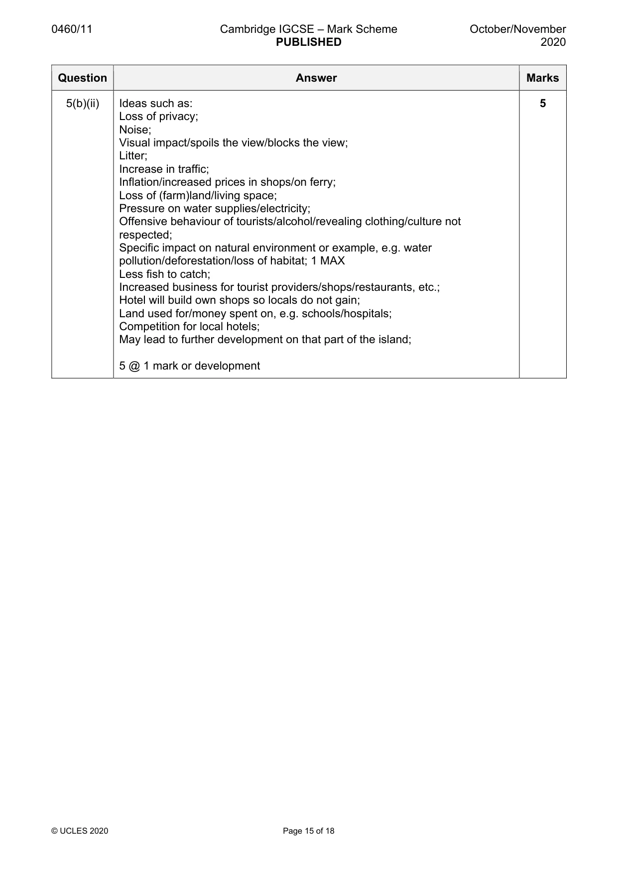
0460/11 Cambridge IGCSE – Mark Scheme PUBLISHED October/November 2020 © UCLES 2020 Page 15 of 18 Question Answer Marks 5(b)(ii) Ideas such as: Loss of privacy; Noise; Visual impact/spoils the view/blocks the view; Litter; Increase in traffic; Inflation/increased prices in shops/on ferry; Loss of (farm)land/living space; Pressure on water supplies/electricity; Offensive behaviour of tourists/alcohol/revealing clothing/culture not respected; Specific impact on natural environment or example, e.g. water pollution/deforestation/loss of habitat; 1 MAX Less fish to catch; Increased business for tourist providers/shops/restaurants, etc.; Hotel will build own shops so locals do not gain; Land used for/money spent on, e.g. schools/hospitals; Competition for local hotels; May lead to further development on that part of the island; 5 @ 1 mark or development 5
Mark scheme, page 16
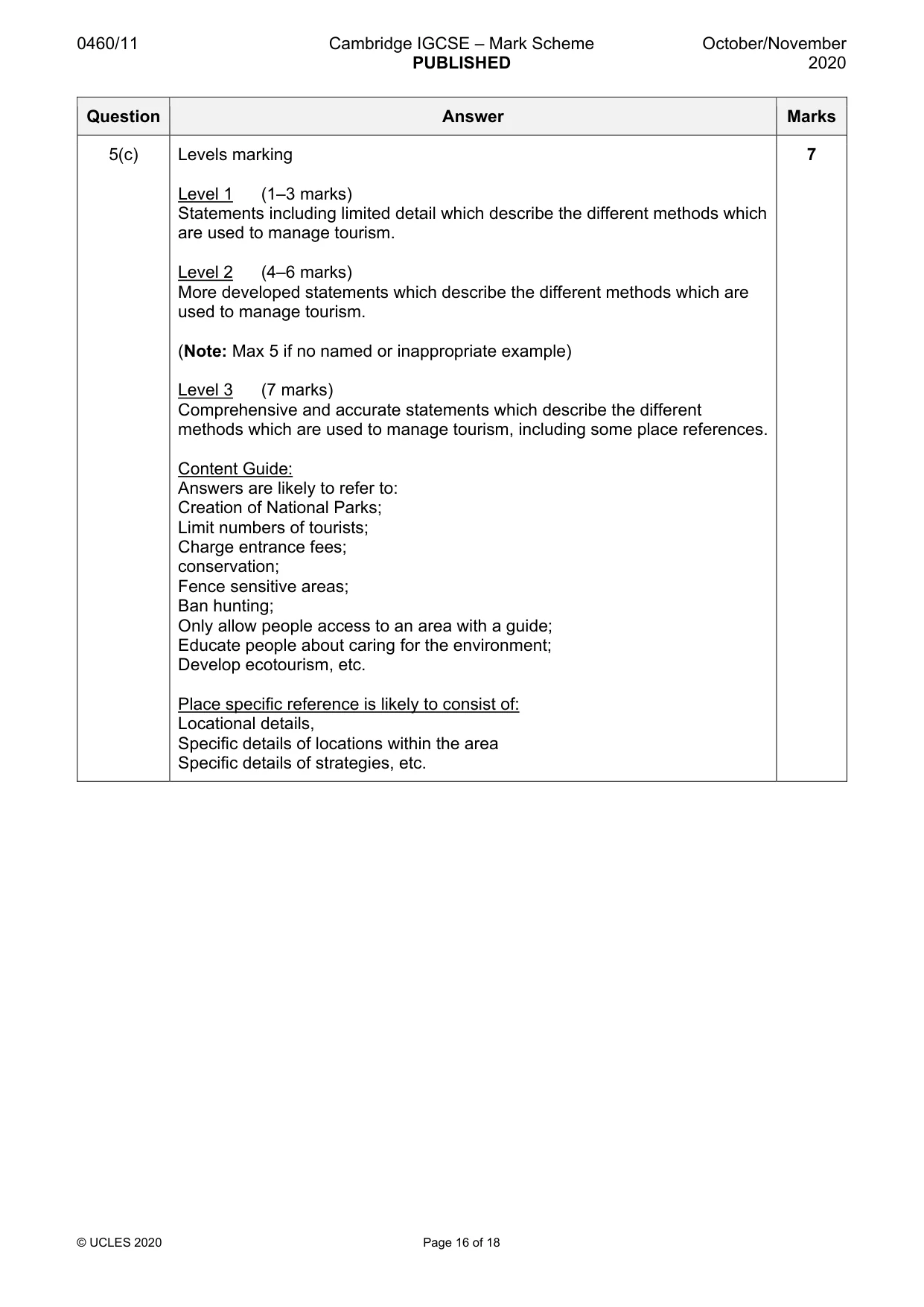
0460/11 Cambridge IGCSE – Mark Scheme PUBLISHED October/November 2020 © UCLES 2020 Page 16 of 18 Question Answer Marks 5(c) Levels marking Level 1 (1–3 marks) Statements including limited detail which describe the different methods which are used to manage tourism. Level 2 (4–6 marks) More developed statements which describe the different methods which are used to manage tourism. (Note: Max 5 if no named or inappropriate example) Level 3 (7 marks) Comprehensive and accurate statements which describe the different methods which are used to manage tourism, including some place references. Content Guide: Answers are likely to refer to: Creation of National Parks; Limit numbers of tourists; Charge entrance fees; conservation; Fence sensitive areas; Ban hunting; Only allow people access to an area with a guide; Educate people about caring for the environment; Develop ecotourism, etc. Place specific reference is likely to consist of: Locational details, Specific details of locations within the area Specific details of strategies, etc. 7
Mark scheme, page 17
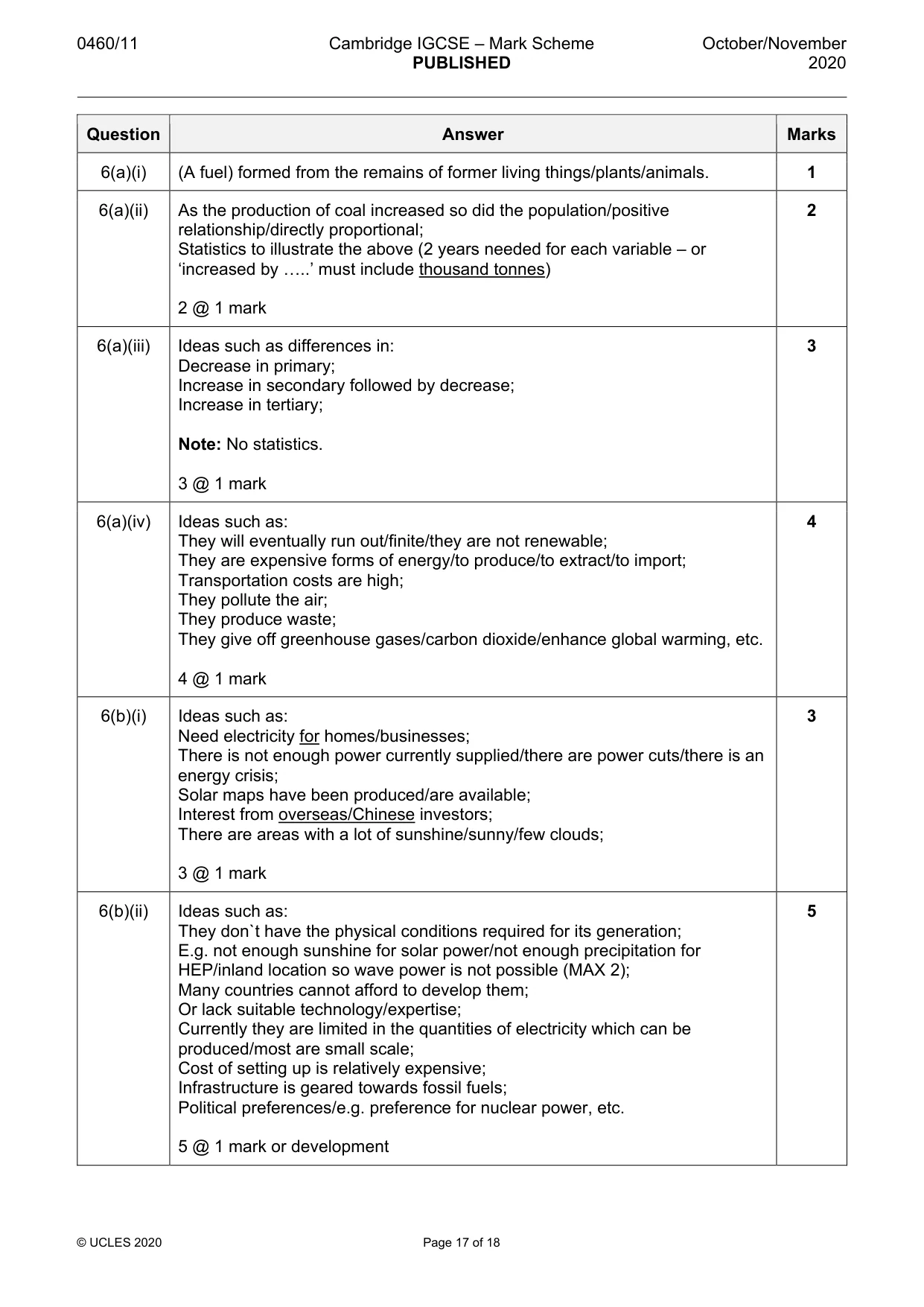
0460/11 Cambridge IGCSE – Mark Scheme PUBLISHED October/November 2020 © UCLES 2020 Page 17 of 18 Question Answer Marks 6(a)(i) (A fuel) formed from the remains of former living things/plants/animals. 1 6(a)(ii) As the production of coal increased so did the population/positive relationship/directly proportional; Statistics to illustrate the above (2 years needed for each variable – or ‘increased by …..’ must include thousand tonnes) 2 @ 1 mark 2 6(a)(iii) Ideas such as differences in: Decrease in primary; Increase in secondary followed by decrease; Increase in tertiary; Note: No statistics. 3 @ 1 mark 3 6(a)(iv) Ideas such as: They will eventually run out/finite/they are not renewable; They are expensive forms of energy/to produce/to extract/to import; Transportation costs are high; They pollute the air; They produce waste; They give off greenhouse gases/carbon dioxide/enhance global warming, etc. 4 @ 1 mark 4 6(b)(i) Ideas such as: Need electricity for homes/businesses; There is not enough power currently supplied/there are power cuts/there is an energy crisis; Solar maps have been produced/are available; Interest from overseas/Chinese investors; There are areas with a lot of sunshine/sunny/few clouds; 3 @ 1 mark 3 6(b)(ii) Ideas such as: They don`t have the physical conditions required for its generation; E.g. not enough sunshine for solar power/not enough precipitation for HEP/inland location so wave power is not possible (MAX 2); Many countries cannot afford to develop them; Or lack suitable technology/expertise; Currently they are limited in the quantities of electricity which can be produced/most are small scale; Cost of setting up is relatively expensive; Infrastructure is geared towards fossil fuels; Political preferences/e.g. preference for nuclear power, etc. 5 @ 1 mark or development 5
Mark scheme, page 18
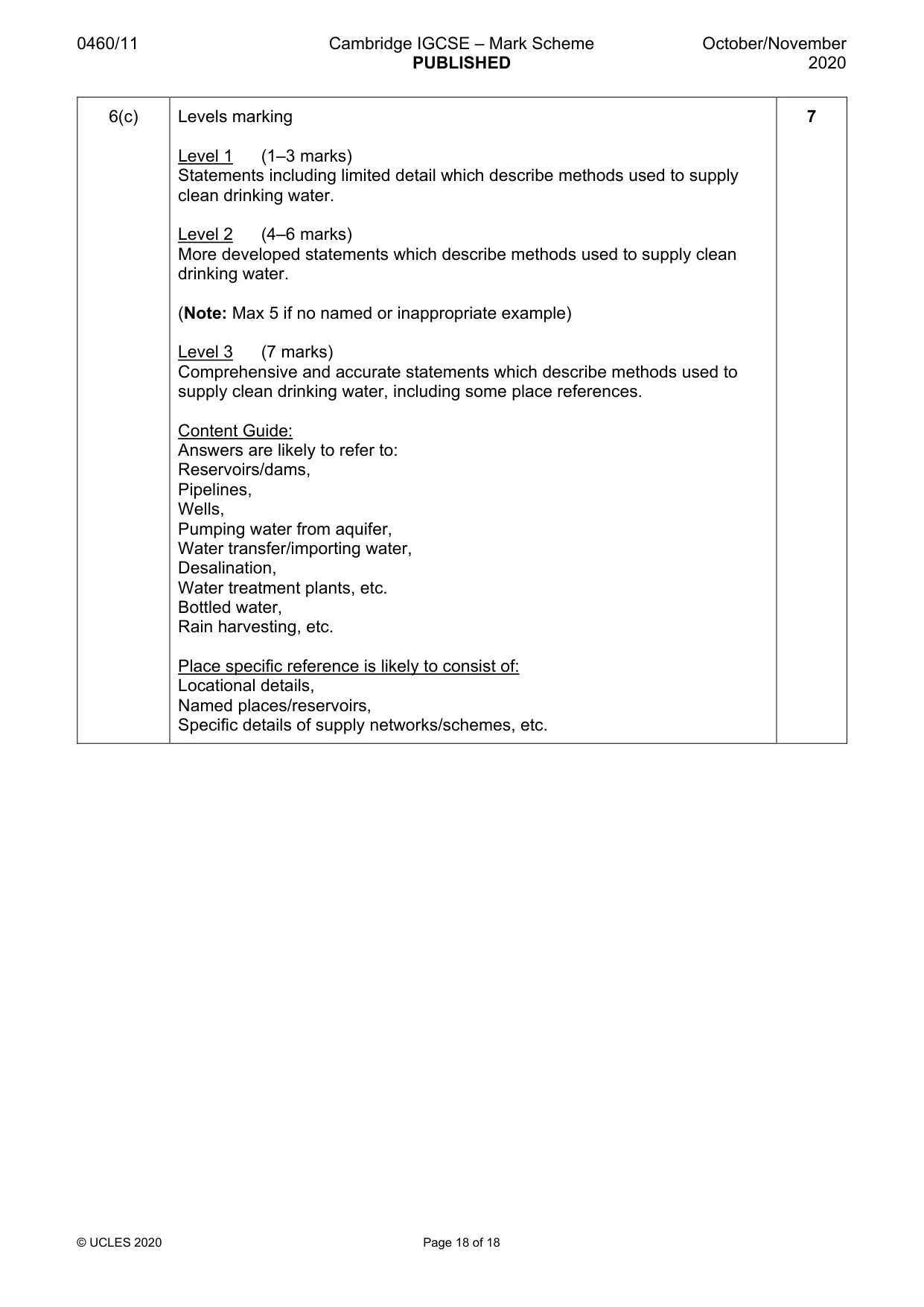
0460/11 Cambridge IGCSE – Mark Scheme PUBLISHED October/November 2020 © UCLES 2020 Page 18 of 18 6(c) Levels marking Level 1 (1–3 marks) Statements including limited detail which describe methods used to supply clean drinking water. Level 2 (4–6 marks) More developed statements which describe methods used to supply clean drinking water. (Note: Max 5 if no named or inappropriate example) Level 3 (7 marks) Comprehensive and accurate statements which describe methods used to supply clean drinking water, including some place references. Content Guide: Answers are likely to refer to: Reservoirs/dams, Pipelines, Wells, Pumping water from aquifer, Water transfer/importing water, Desalination, Water treatment plants, etc. Bottled water, Rain harvesting, etc. Place specific reference is likely to consist of: Locational details, Named places/reservoirs, Specific details of supply networks/schemes, etc. 7
What you needed in this session
Cambridge’s own grade thresholds for 2020 Oct/Nov, Paper 1 · Variant 1. A higher threshold means an easier paper — the bar moves with how the cohort did.