Cambridge IGCSE Geography 0460 — 2020 Oct/Nov Paper 1 · Variant 3
0460/13/O/N/20 · 75 marks · ≈84 min
The question paper and its mark scheme, free to read here and free to download. This is Cambridge’s own paper, exactly as it was sat.
Question paper32 pages


Mark scheme17 pages
Answers below. Sit the paper first if you are practising.
Paper as text
Question paper, page 1
Cambridge IGCSE™ * 7 3 5 8 8 1 0 0 3 5 * DC (PQ/FC) 180596/7 © UCLES 2020 [Turn over This document has 32 pages. Blank pages are indicated. GEOGRAPHY 0460/13 Paper 1 Geographical Themes October/November 2020 1 hour 45 minutes You must answer on the question paper. You will need: Insert (enclosed) Calculator Ruler INSTRUCTIONS ● Answer three questions in total, one from each section. ● Use a black or dark blue pen. You may use an HB pencil for any diagrams or graphs. ● Write your name, centre number and candidate number in the boxes at the top of the page. ● Write your answer to each question in the space provided. ● Do not use an erasable pen or correction fluid. ● Do not write on any bar codes. ● If additional space is needed, you should use the lined pages at the end of this booklet; the question number or numbers must be clearly shown. INFORMATION ● The total mark for this paper is 75. ● The number of marks for each question or part question is shown in brackets [ ]. ● The insert contains additional resources referred to in the questions. Definitions MEDCs – More Economically Developed Countries LEDCs – Less Economically Developed Countries
Question paper, page 2
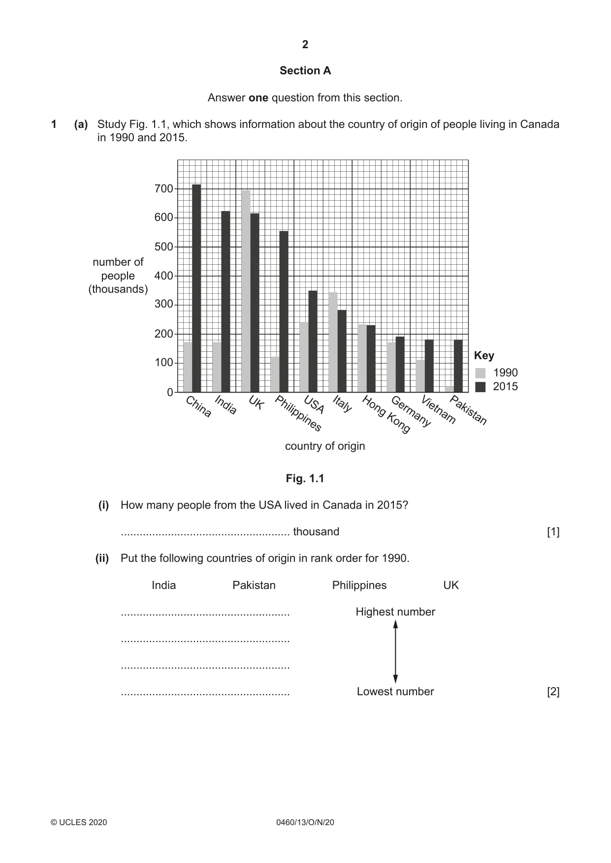
2 0460/13/O/N/20 © UCLES 2020 Section A Answer one question from this section. 1 (a) Study Fig. 1.1, which shows information about the country of origin of people living in Canada in 1990 and 2015. 0 country of origin Key 1990 China India UK Philippines USA Italy Hong Kong Germany Vietnam Pakistan 100 200 300 number of people (thousands) 400 500 600 700 2015 Fig. 1.1 (i) How many people from the USA lived in Canada in 2015? … thousand [1] (ii) Put the following countries of origin in rank order for 1990. India Pakistan Philippines UK … Highest number … … … Lowest number [2]
Question paper, page 3
3 0460/13/O/N/20 © UCLES 2020 [Turn over (iii) Using information from Fig. 1.1, describe how the number of people from China and Italy living in Canada changed between 1990 and 2015. You should use statistics in your answer. … … … … … … [3] (iv) Describe the problems which many migrants from China and Italy may face after moving to Canada. … … … … … … … … [4]
Question paper, page 4
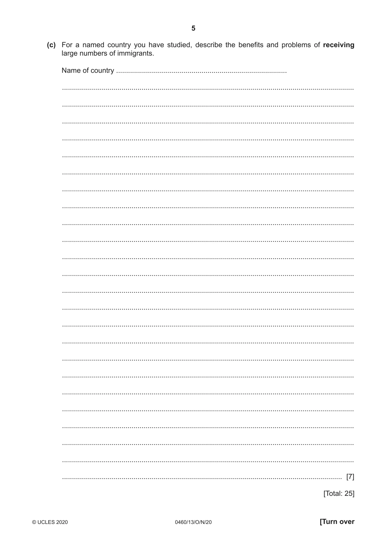
4 0460/13/O/N/20 © UCLES 2020 (b) Study Fig. 1.2 (Insert), which is a map showing information about global net migration. (i) Describe the distribution of areas with negative net migration. … … … … … … [3] (ii) Explain why many areas experience negative net migration. … … … … … … … … … … [5]
Question paper, page 5
5 0460/13/O/N/20 © UCLES 2020 [Turn over (c) For a named country you have studied, describe the benefits and problems of receiving large numbers of immigrants. Name of country … … … … … … … … … … … … … … … … … … … … … … … … … [7] [Total: 25]
Question paper, page 6
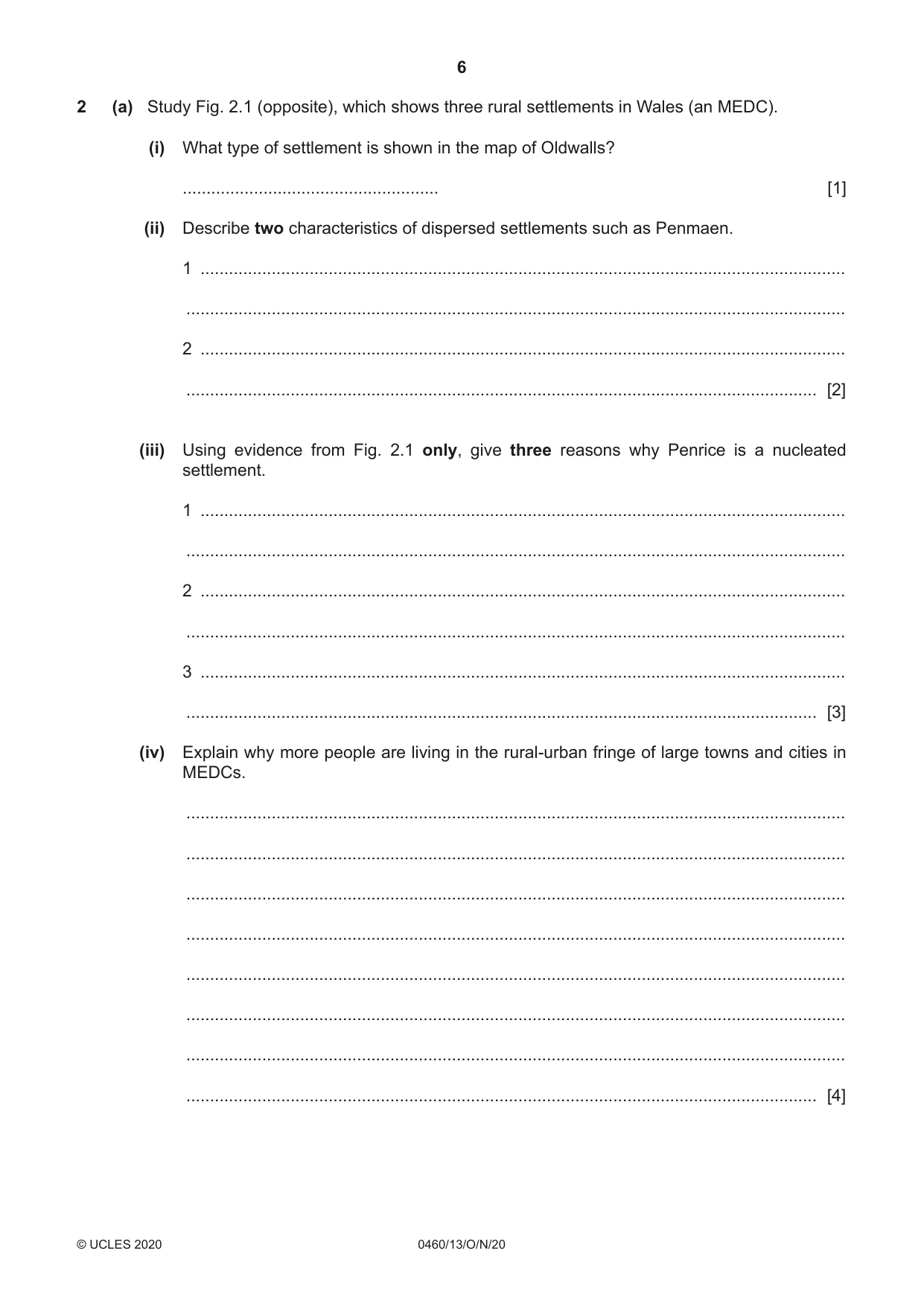
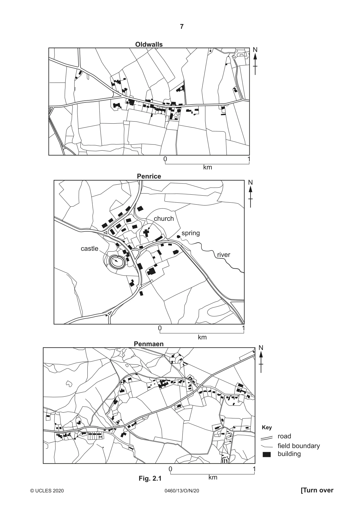
6 0460/13/O/N/20 © UCLES 2020 2 (a) Study Fig. 2.1 (opposite), which shows three rural settlements in Wales (an MEDC). (i) What type of settlement is shown in the map of Oldwalls? … [1] (ii) Describe two characteristics of dispersed settlements such as Penmaen. 1 … … 2 … … [2] (iii) Using evidence from Fig. 2.1 only, give three reasons why Penrice is a nucleated settlement. 1 … … 2 … … 3 … … [3] (iv) Explain why more people are living in the rural-urban fringe of large towns and cities in MEDCs. … … … … … … … … [4]
Question paper, page 7
7 0460/13/O/N/20 © UCLES 2020 [Turn over 0 km 1 0 km Key 1 0 km 1 road N N N Penrice Oldwalls Penmaen field boundary building castle church spring river Fig. 2.1
Question paper, page 8
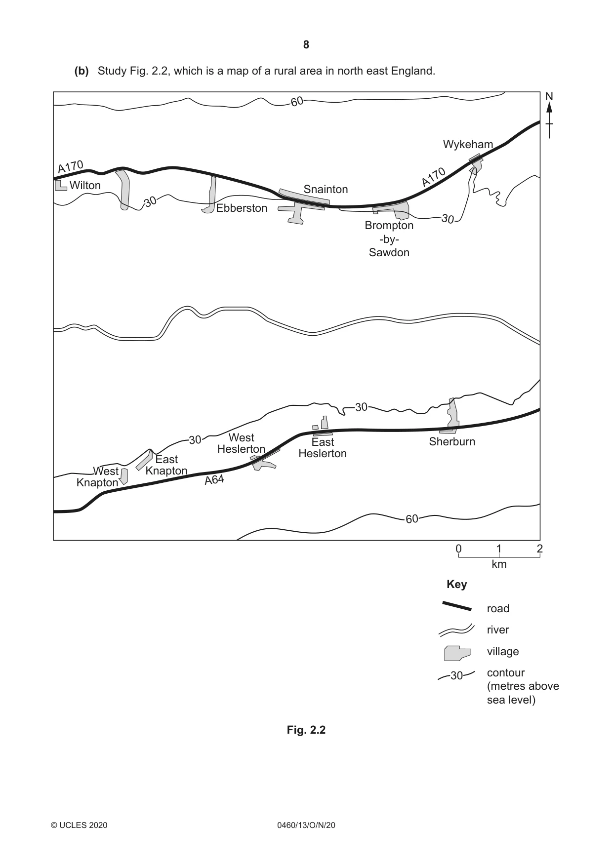
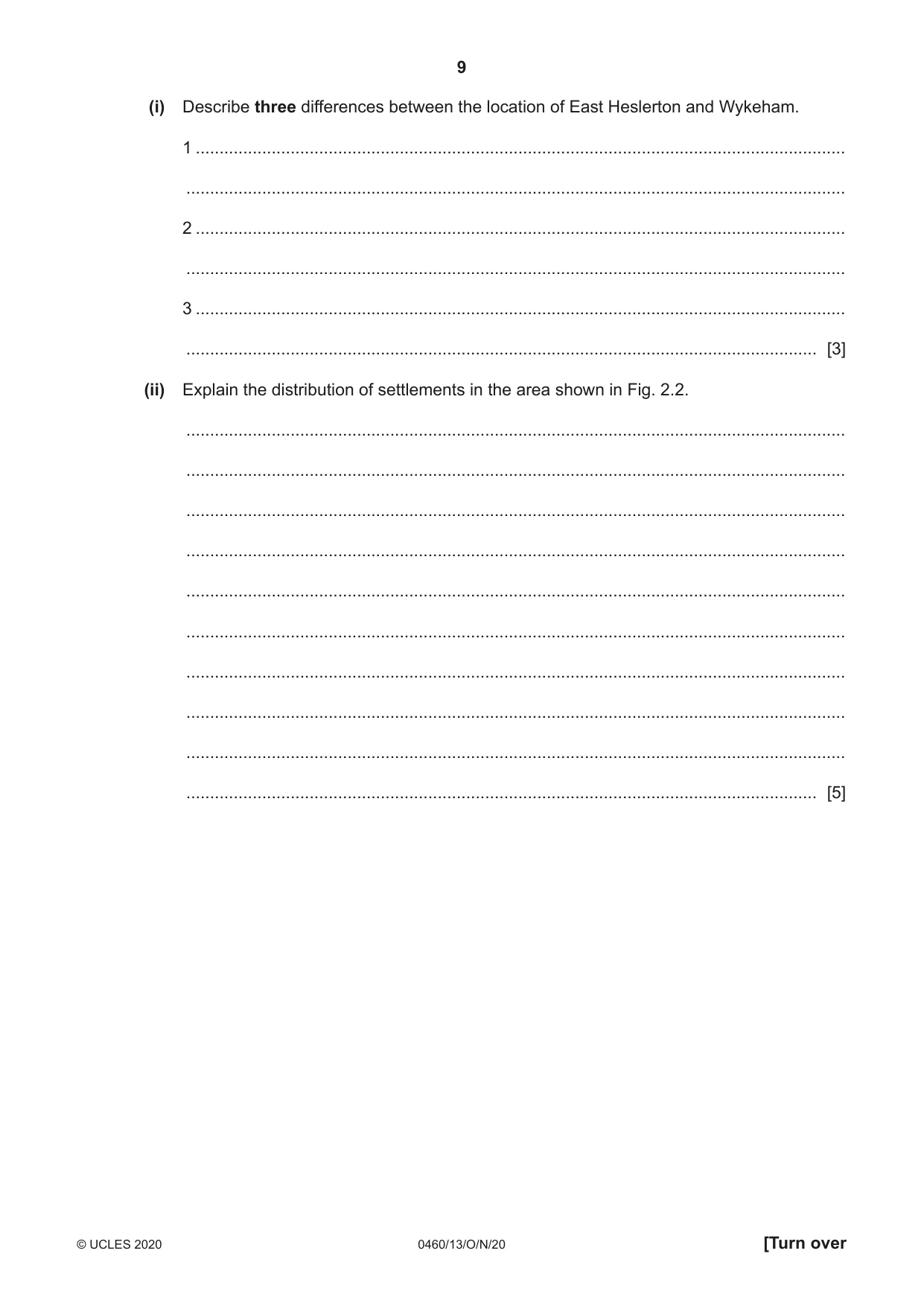
8 0460/13/O/N/20 © UCLES 2020 (b) Study Fig. 2.2, which is a map of a rural area in north east England. A170 A170 A64 Wilton Ebberston Snainton Wykeham Sherburn East Heslerton West Heslerton East Knapton West Knapton West Knapton Brompton -by- Sawdon 30 30 30 60 30 60 Key 0 km 2 1 road N river village contour (metres above sea level) 30 Fig. 2.2
Question paper, page 9
9 0460/13/O/N/20 © UCLES 2020 [Turn over (i) Describe three differences between the location of East Heslerton and Wykeham. 1 … … 2 … … 3 … … [3] (ii) Explain the distribution of settlements in the area shown in Fig. 2.2. … … … … … … … … … … [5]
Question paper, page 10
10 0460/13/O/N/20 © UCLES 2020 (c) Describe and explain the service provision in a named settlement you have studied. Name of settlement … … … … … … … … … … … … … … … … … … … … … … … … … … [7] [Total: 25]
Question paper, page 11
11 0460/13/O/N/20 © UCLES 2020 [Turn over TURN PAGE FOR QUESTION 3
Question paper, page 12
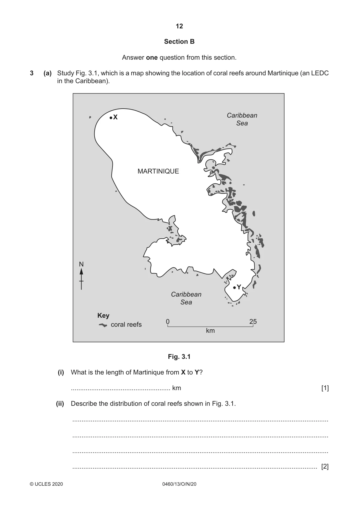
12 0460/13/O/N/20 © UCLES 2020 Section B Answer one question from this section. 3 (a) Study Fig. 3.1, which is a map showing the location of coral reefs around Martinique (an LEDC in the Caribbean). Key 0 km 25 coral reefs MARTINIQUE Caribbean Sea Caribbean Sea N X Y Fig. 3.1 (i) What is the length of Martinique from X to Y? … km [1] (ii) Describe the distribution of coral reefs shown in Fig. 3.1. … … … … [2]
Question paper, page 13
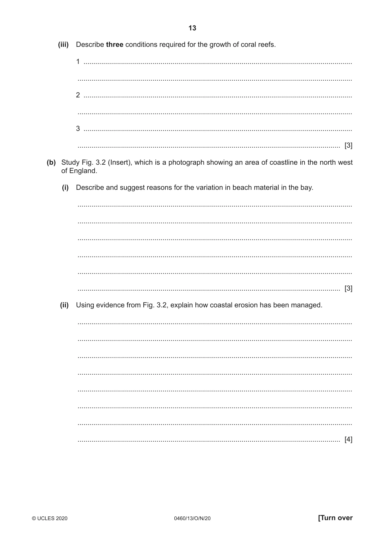
13 0460/13/O/N/20 © UCLES 2020 [Turn over (iii) Describe three conditions required for the growth of coral reefs. 1 … … 2 … … 3 … … [3] (b) Study Fig. 3.2 (Insert), which is a photograph showing an area of coastline in the north west of England. (i) Describe and suggest reasons for the variation in beach material in the bay. … … … … … … [3] (ii) Using evidence from Fig. 3.2, explain how coastal erosion has been managed. … … … … … … … … [4]
Question paper, page 14
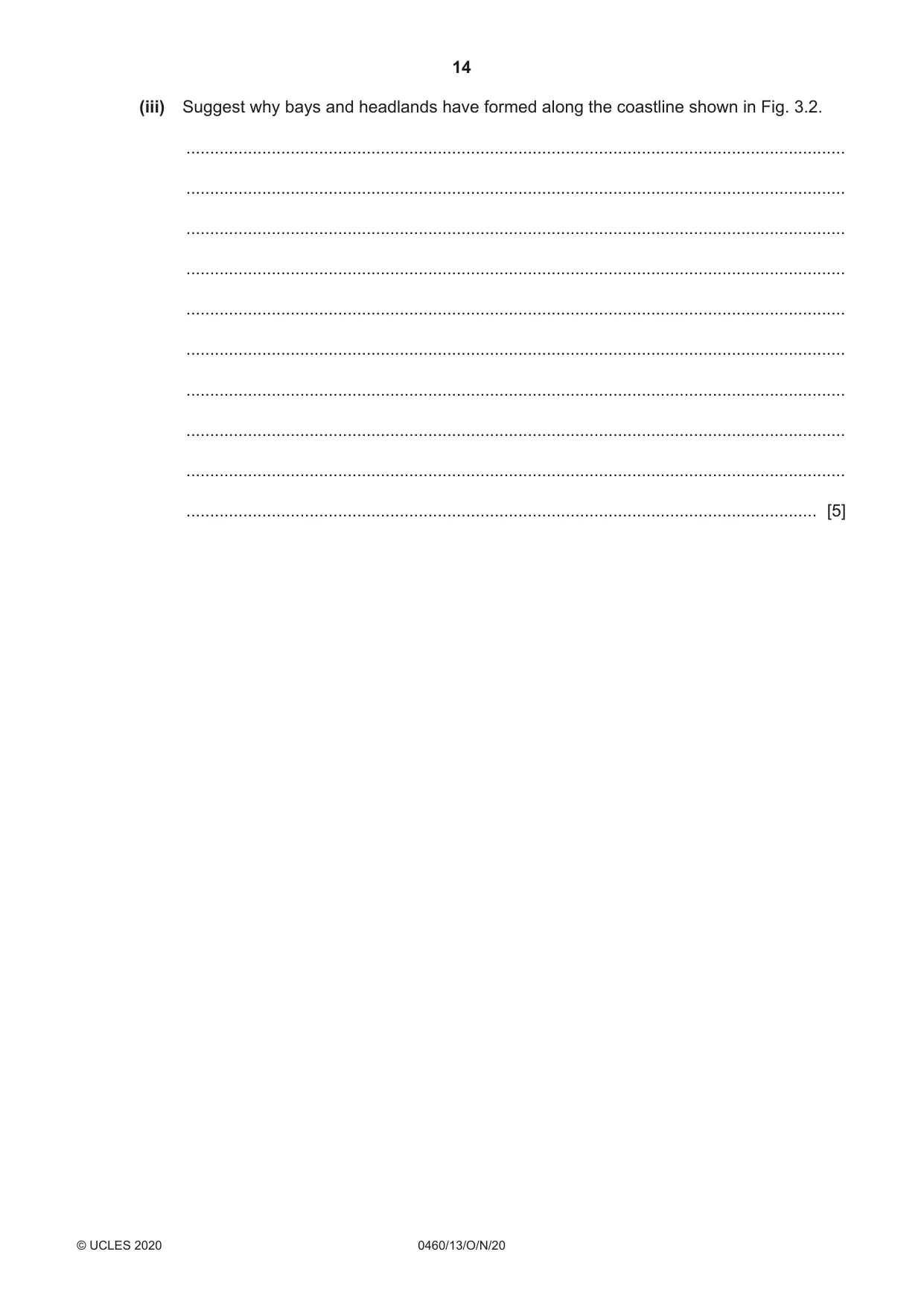
14 0460/13/O/N/20 © UCLES 2020 (iii) Suggest why bays and headlands have formed along the coastline shown in Fig. 3.2. … … … … … … … … … … [5]
Question paper, page 15
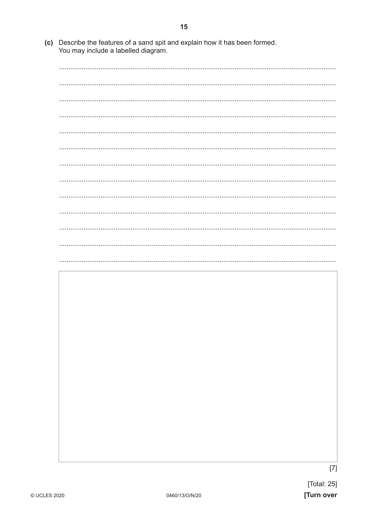
15 0460/13/O/N/20 © UCLES 2020 [Turn over (c) Describe the features of a sand spit and explain how it has been formed. You may include a labelled diagram. … … … … … … … … … … … … … [7] [Total: 25]
Question paper, page 16
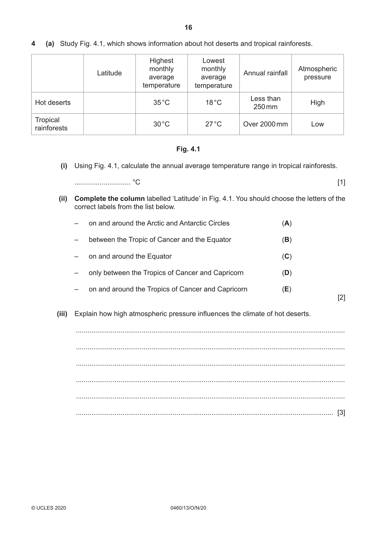
16 0460/13/O/N/20 © UCLES 2020 4 (a) Study Fig. 4.1, which shows information about hot deserts and tropical rainforests. Latitude Highest monthly average temperature Lowest monthly average temperature Annual rainfall Atmospheric pressure Hot deserts 35 °C 18 °C Less than 250 mm High Tropical rainforests 30 °C 27 °C Over 2000 mm Low Fig. 4.1 (i) Using Fig. 4.1, calculate the annual average temperature range in tropical rainforests. … °C [1] (ii) Complete the column labelled ‘Latitude’ in Fig. 4.1. You should choose the letters of the correct labels from the list below. – on and around the Arctic and Antarctic Circles (A) – between the Tropic of Cancer and the Equator (B) – on and around the Equator (C) – only between the Tropics of Cancer and Capricorn (D) – on and around the Tropics of Cancer and Capricorn (E) [2] (iii) Explain how high atmospheric pressure influences the climate of hot deserts. … … … … … … [3]
Question paper, page 17
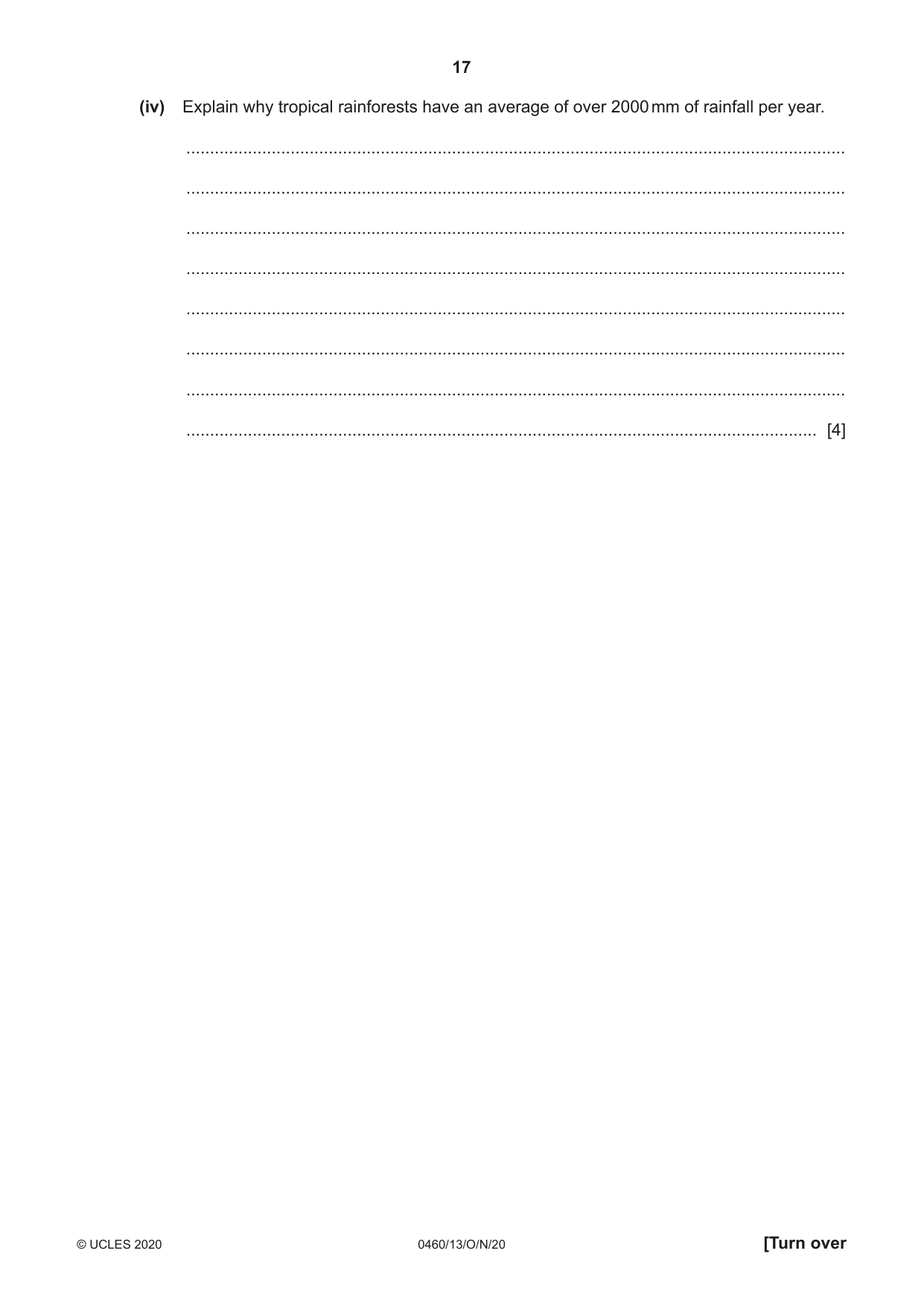
17 0460/13/O/N/20 © UCLES 2020 [Turn over (iv) Explain why tropical rainforests have an average of over 2000 mm of rainfall per year. … … … … … … … … [4]
Question paper, page 18
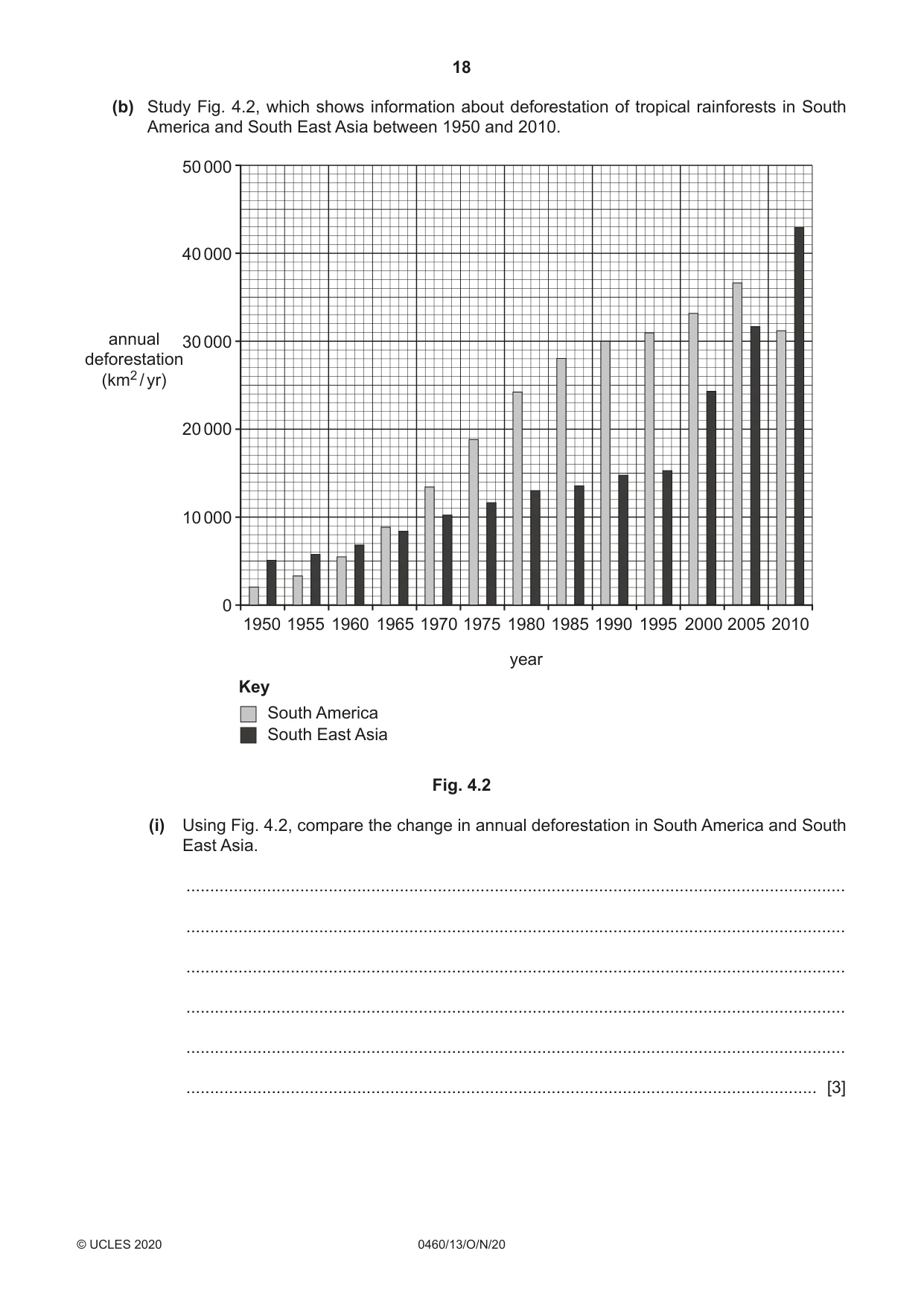
18 0460/13/O/N/20 © UCLES 2020 (b) Study Fig. 4.2, which shows information about deforestation of tropical rainforests in South America and South East Asia between 1950 and 2010. 1950 0 10 000 20 000 annual deforestation (km2 / yr) 30 000 40 000 50 000 1955 1960 1965 1970 1975 1980 year 1985 1990 1995 2000 2005 2010 Key South America South East Asia Fig. 4.2 (i) Using Fig. 4.2, compare the change in annual deforestation in South America and South East Asia. … … … … … … [3]
Question paper, page 19
19 0460/13/O/N/20 © UCLES 2020 [Turn over (ii) Explain why large amounts of deforestation have occurred in tropical rainforests. … … … … … … … … … … [5]
Question paper, page 20
20 0460/13/O/N/20 © UCLES 2020 (c) With reference to named examples, describe the impacts of deforestation. … … … … … … … … … … … … … … … … … … … … … … … … … … [7] [Total: 25]
Question paper, page 21
21 0460/13/O/N/20 © UCLES 2020 [Turn over TURN PAGE FOR QUESTION 5
Question paper, page 22
22 0460/13/O/N/20 © UCLES 2020 Section C Answer one question from this section. 5 (a) Study Fig. 5.1 (Insert), a map showing tourist attractions in Mauritius, an LEDC in the Indian Ocean. (i) Name the river gorge in the south west of Mauritius. … [1] (ii) Describe the location of the tourist resort of Grand Baie. … … … … [2] (iii) Identify three attractions of the human landscape for tourists in Mauritius. 1 … … 2 … … 3 … … [3] (iv) Explain how the tourist industry may benefit the people who live on the island of Mauritius. … … … … … … … … [4]
Question paper, page 23
23 0460/13/O/N/20 © UCLES 2020 [Turn over (b) Study Figs. 5.2 and 5.3 (Insert), which are photographs that were taken in Grand Baie, Mauritius. (i) Using evidence from Figs. 5.2 and 5.3 only, describe the natural attractions of Grand Baie for tourists. … … … … … … [3] (ii) Suggest how tourism in Grand Baie may have negative impacts on local people and the natural environment. … … … … … … … … … … [5]
Question paper, page 24
24 0460/13/O/N/20 © UCLES 2020 (c) For a named area you have studied, explain how the tourist industry is being developed without destroying the natural environment. Name of area … … … … … … … … … … … … … … … … … … … … … … … … … [7] [Total: 25]
Question paper, page 25
25 0460/13/O/N/20 © UCLES 2020 [Turn over TURN PAGE FOR QUESTION 6
Question paper, page 26
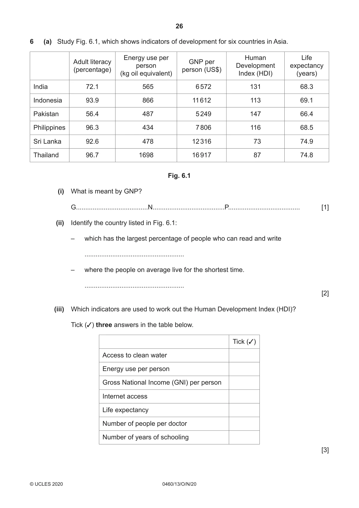
26 0460/13/O/N/20 © UCLES 2020 6 (a) Study Fig. 6.1, which shows indicators of development for six countries in Asia. Adult literacy (percentage) Energy use per person (kg oil equivalent) GNP per person (US$) Human Development Index (HDI) Life expectancy (years) India 72.1 565 6 572 131 68.3 Indonesia 93.9 866 11 612 113 69.1 Pakistan 56.4 487 5 249 147 66.4 Philippines 96.3 434 7 806 116 68.5 Sri Lanka 92.6 478 12 316 73 74.9 Thailand 96.7 1698 16 917 87 74.8 Fig. 6.1 (i) What is meant by GNP? G…N…P… [1] (ii) Identify the country listed in Fig. 6.1: – which has the largest percentage of people who can read and write … – where the people on average live for the shortest time. … [2] (iii) Which indicators are used to work out the Human Development Index (HDI)? Tick (✓) three answers in the table below. Tick (✓) Access to clean water Energy use per person Gross National Income (GNI) per person Internet access Life expectancy Number of people per doctor Number of years of schooling [3]
Question paper, page 27
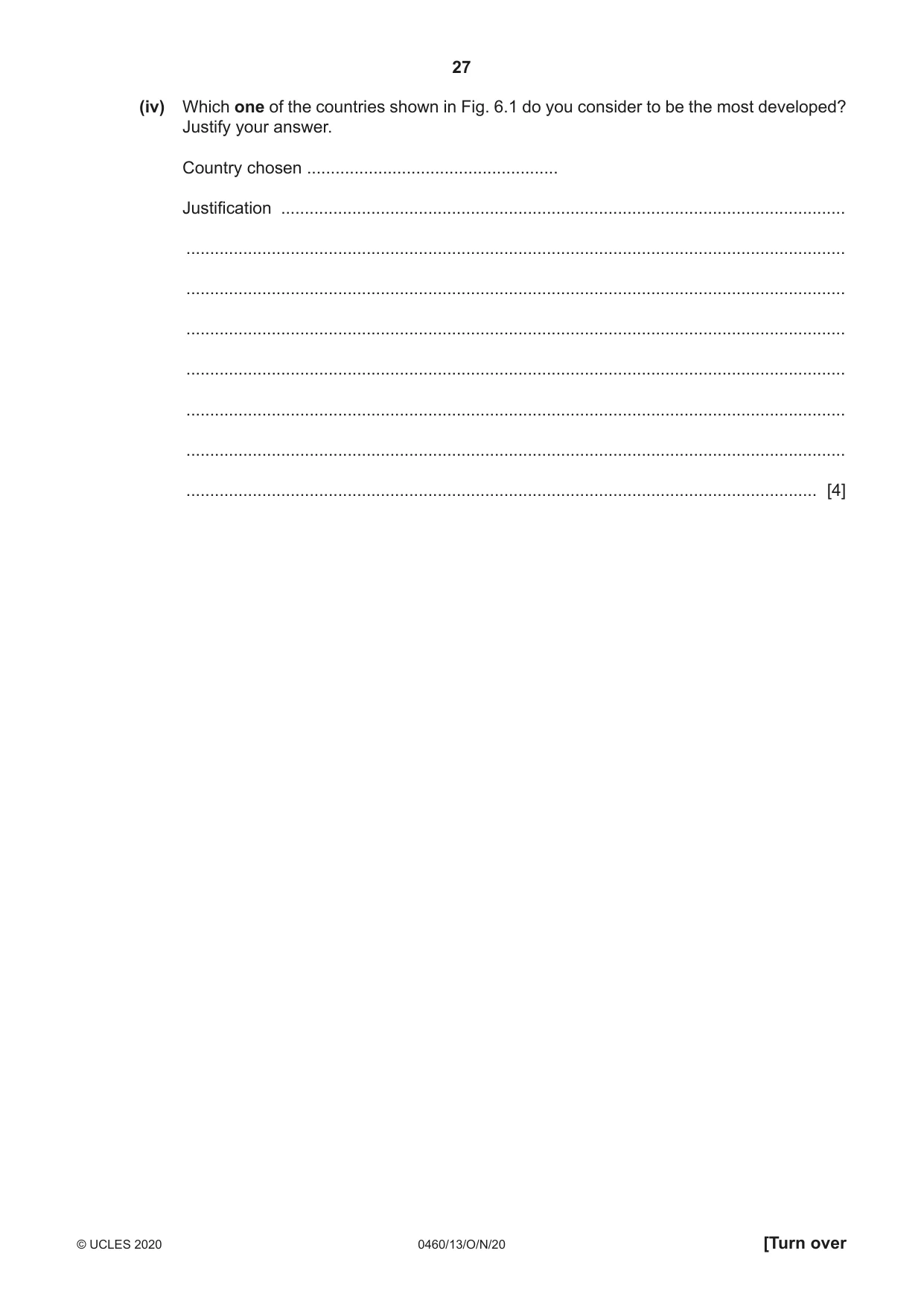
27 0460/13/O/N/20 © UCLES 2020 [Turn over (iv) Which one of the countries shown in Fig. 6.1 do you consider to be the most developed? Justify your answer. Country chosen … Justification … … … … … … … … [4]
Question paper, page 28
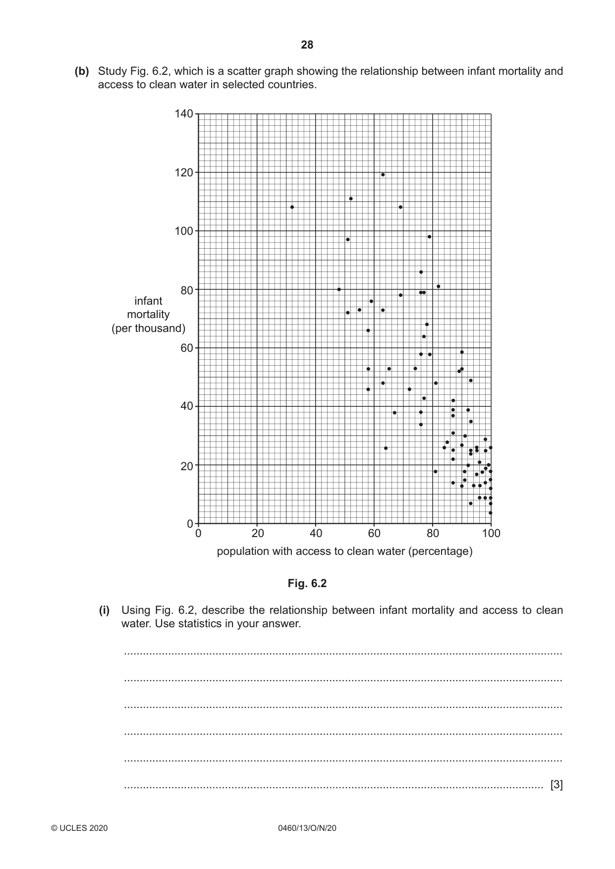
28 0460/13/O/N/20 © UCLES 2020 (b) Study Fig. 6.2, which is a scatter graph showing the relationship between infant mortality and access to clean water in selected countries. 0 20 40 population with access to clean water (percentage) infant mortality (per thousand) 60 80 100 0 20 40 60 80 100 120 140 Fig. 6.2 (i) Using Fig. 6.2, describe the relationship between infant mortality and access to clean water. Use statistics in your answer. … … … … … … [3]
Question paper, page 29
29 0460/13/O/N/20 © UCLES 2020 [Turn over (ii) Explain why plentiful supplies of water, especially clean water, are important for the people and economy of a country. … … … … … … … … … … [5]
Question paper, page 30
30 0460/13/O/N/20 © UCLES 2020 (c) For a named country or region you have studied, explain how clean water is supplied. Name of country or region … … … … … … … … … … … … … … … … … … … … … … … … … … [7] [Total: 25]
Question paper, page 31
31 0460/13/O/N/20 © UCLES 2020 Additional Pages If you use the following lined pages to complete the answer(s) to any question(s), the question number(s) must be clearly shown. … … … … … … … … … … … … … … … … … … … … … … … … … …
Question paper, page 32
32 0460/13/O/N/20 © UCLES 2020 … … … … … … … … … … … … … … … … … … … … … … … … Permission to reproduce items where third-party owned material protected by copyright is included has been sought and cleared where possible. Every reasonable effort has been made by the publisher (UCLES) to trace copyright holders, but if any items requiring clearance have unwittingly been included, the publisher will be pleased to make amends at the earliest possible opportunity. To avoid the issue of disclosure of answer-related information to candidates, all copyright acknowledgements are reproduced online in the Cambridge Assessment International Education Copyright Acknowledgements Booklet. This is produced for each series of examinations and is freely available to download at www.cambridgeinternational.org after the live examination series. Cambridge Assessment International Education is part of the Cambridge Assessment Group. Cambridge Assessment is the brand name of the University of Cambridge Local Examinations Syndicate (UCLES), which itself is a department of the University of Cambridge.
Mark scheme, page 1
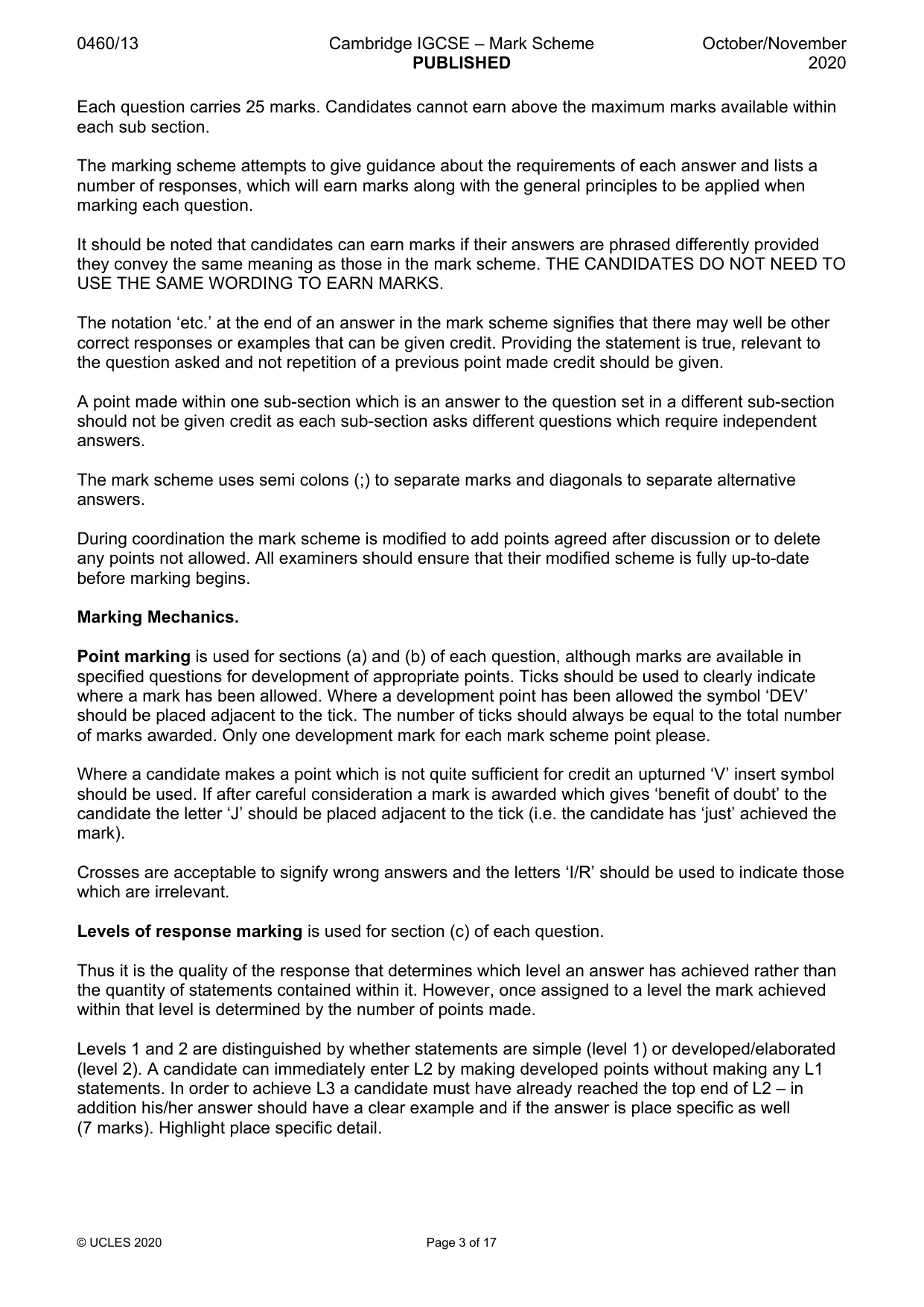
This document consists of 17 printed pages. © UCLES 2020 [Turn over Cambridge IGCSE™ GEOGRAPHY 0460/13 Paper 1 October/November 2020 MARK SCHEME Maximum Mark: 75 Published This mark scheme is published as an aid to teachers and candidates, to indicate the requirements of the examination. It shows the basis on which Examiners were instructed to award marks. It does not indicate the details of the discussions that took place at an Examiners’ meeting before marking began, which would have considered the acceptability of alternative answers. Mark schemes should be read in conjunction with the question paper and the Principal Examiner Report for Teachers. Cambridge International will not enter into discussions about these mark schemes. Cambridge International is publishing the mark schemes for the October/November 2020 series for most Cambridge IGCSE™, Cambridge International A and AS Level and Cambridge Pre-U components, and some Cambridge O Level components.
Mark scheme, page 2
0460/13 Cambridge IGCSE – Mark Scheme PUBLISHED October/November 2020 © UCLES 2020 Page 2 of 17 Generic Marking Principles These general marking principles must be applied by all examiners when marking candidate answers. They should be applied alongside the specific content of the mark scheme or generic level descriptors for a question. Each question paper and mark scheme will also comply with these marking principles. GENERIC MARKING PRINCIPLE 1: Marks must be awarded in line with: • the specific content of the mark scheme or the generic level descriptors for the question • the specific skills defined in the mark scheme or in the generic level descriptors for the question • the standard of response required by a candidate as exemplified by the standardisation scripts. GENERIC MARKING PRINCIPLE 2: Marks awarded are always whole marks (not half marks, or other fractions). GENERIC MARKING PRINCIPLE 3: Marks must be awarded positively: • marks are awarded for correct/valid answers, as defined in the mark scheme. However, credit is given for valid answers which go beyond the scope of the syllabus and mark scheme, referring to your Team Leader as appropriate • marks are awarded when candidates clearly demonstrate what they know and can do • marks are not deducted for errors • marks are not deducted for omissions • answers should only be judged on the quality of spelling, punctuation and grammar when these features are specifically assessed by the question as indicated by the mark scheme. The meaning, however, should be unambiguous. GENERIC MARKING PRINCIPLE 4: Rules must be applied consistently, e.g. in situations where candidates have not followed instructions or in the application of generic level descriptors. GENERIC MARKING PRINCIPLE 5: Marks should be awarded using the full range of marks defined in the mark scheme for the question (however; the use of the full mark range may be limited according to the quality of the candidate responses seen). GENERIC MARKING PRINCIPLE 6: Marks awarded are based solely on the requirements as defined in the mark scheme. Marks should not be awarded with grade thresholds or grade descriptors in mind.
Mark scheme, page 3
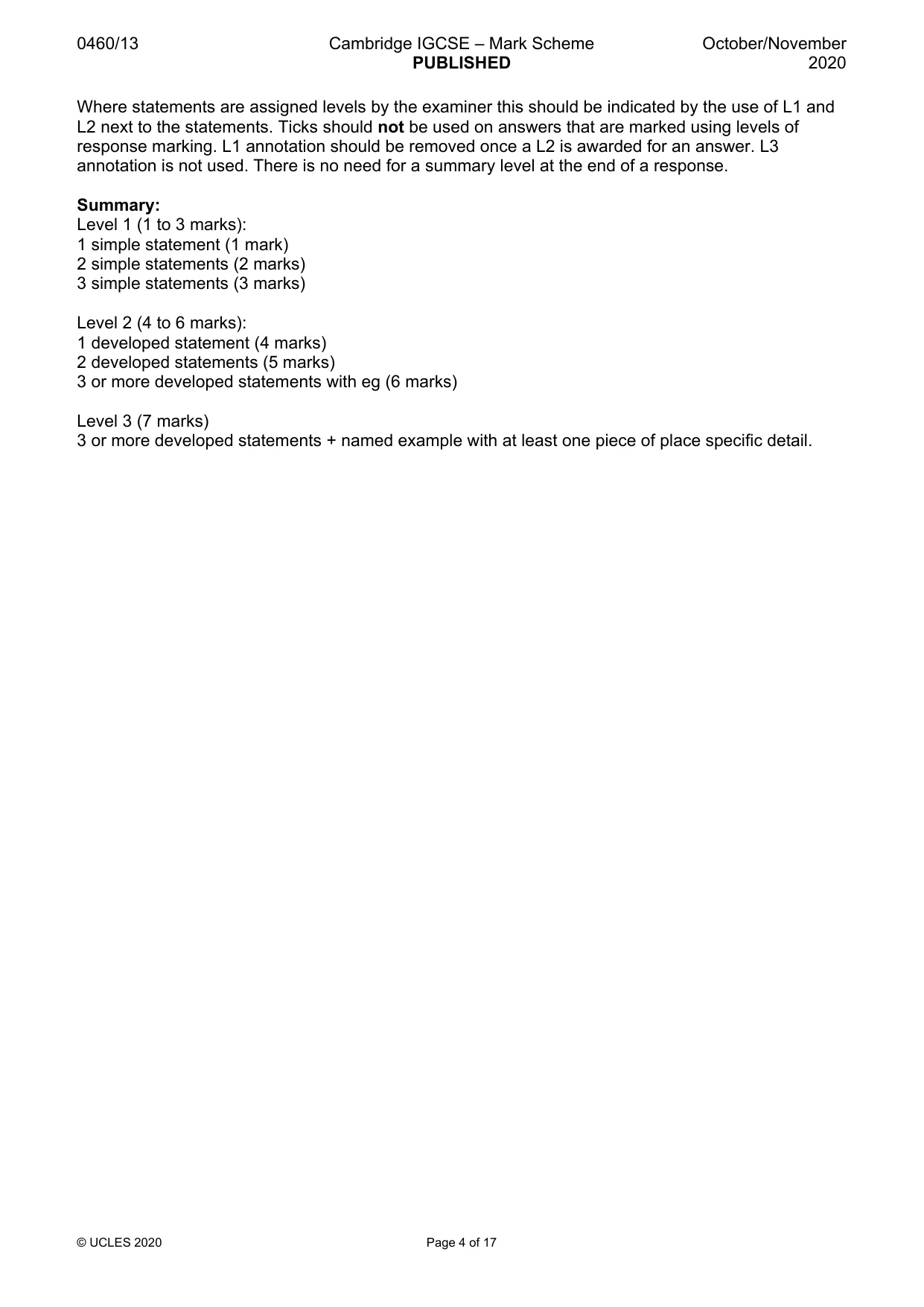
0460/13 Cambridge IGCSE – Mark Scheme PUBLISHED October/November 2020 © UCLES 2020 Page 3 of 17 Each question carries 25 marks. Candidates cannot earn above the maximum marks available within each sub section. The marking scheme attempts to give guidance about the requirements of each answer and lists a number of responses, which will earn marks along with the general principles to be applied when marking each question. It should be noted that candidates can earn marks if their answers are phrased differently provided they convey the same meaning as those in the mark scheme. THE CANDIDATES DO NOT NEED TO USE THE SAME WORDING TO EARN MARKS. The notation ‘etc.’ at the end of an answer in the mark scheme signifies that there may well be other correct responses or examples that can be given credit. Providing the statement is true, relevant to the question asked and not repetition of a previous point made credit should be given. A point made within one sub-section which is an answer to the question set in a different sub-section should not be given credit as each sub-section asks different questions which require independent answers. The mark scheme uses semi colons (;) to separate marks and diagonals to separate alternative answers. During coordination the mark scheme is modified to add points agreed after discussion or to delete any points not allowed. All examiners should ensure that their modified scheme is fully up-to-date before marking begins. Marking Mechanics. Point marking is used for sections (a) and (b) of each question, although marks are available in specified questions for development of appropriate points. Ticks should be used to clearly indicate where a mark has been allowed. Where a development point has been allowed the symbol ‘DEV’ should be placed adjacent to the tick. The number of ticks should always be equal to the total number of marks awarded. Only one development mark for each mark scheme point please. Where a candidate makes a point which is not quite sufficient for credit an upturned ‘V’ insert symbol should be used. If after careful consideration a mark is awarded which gives ‘benefit of doubt’ to the candidate the letter ‘J’ should be placed adjacent to the tick (i.e. the candidate has ‘just’ achieved the mark). Crosses are acceptable to signify wrong answers and the letters ‘I/R’ should be used to indicate those which are irrelevant. Levels of response marking is used for section (c) of each question. Thus it is the quality of the response that determines which level an answer has achieved rather than the quantity of statements contained within it. However, once assigned to a level the mark achieved within that level is determined by the number of points made. Levels 1 and 2 are distinguished by whether statements are simple (level 1) or developed/elaborated (level 2). A candidate can immediately enter L2 by making developed points without making any L1 statements. In order to achieve L3 a candidate must have already reached the top end of L2 – in addition his/her answer should have a clear example and if the answer is place specific as well (7 marks). Highlight place specific detail.
Mark scheme, page 4
0460/13 Cambridge IGCSE – Mark Scheme PUBLISHED October/November 2020 © UCLES 2020 Page 4 of 17 Where statements are assigned levels by the examiner this should be indicated by the use of L1 and L2 next to the statements. Ticks should not be used on answers that are marked using levels of response marking. L1 annotation should be removed once a L2 is awarded for an answer. L3 annotation is not used. There is no need for a summary level at the end of a response. Summary: Level 1 (1 to 3 marks): 1 simple statement (1 mark) 2 simple statements (2 marks) 3 simple statements (3 marks) Level 2 (4 to 6 marks): 1 developed statement (4 marks) 2 developed statements (5 marks) 3 or more developed statements with eg (6 marks) Level 3 (7 marks) 3 or more developed statements + named example with at least one piece of place specific detail.
Mark scheme, page 5
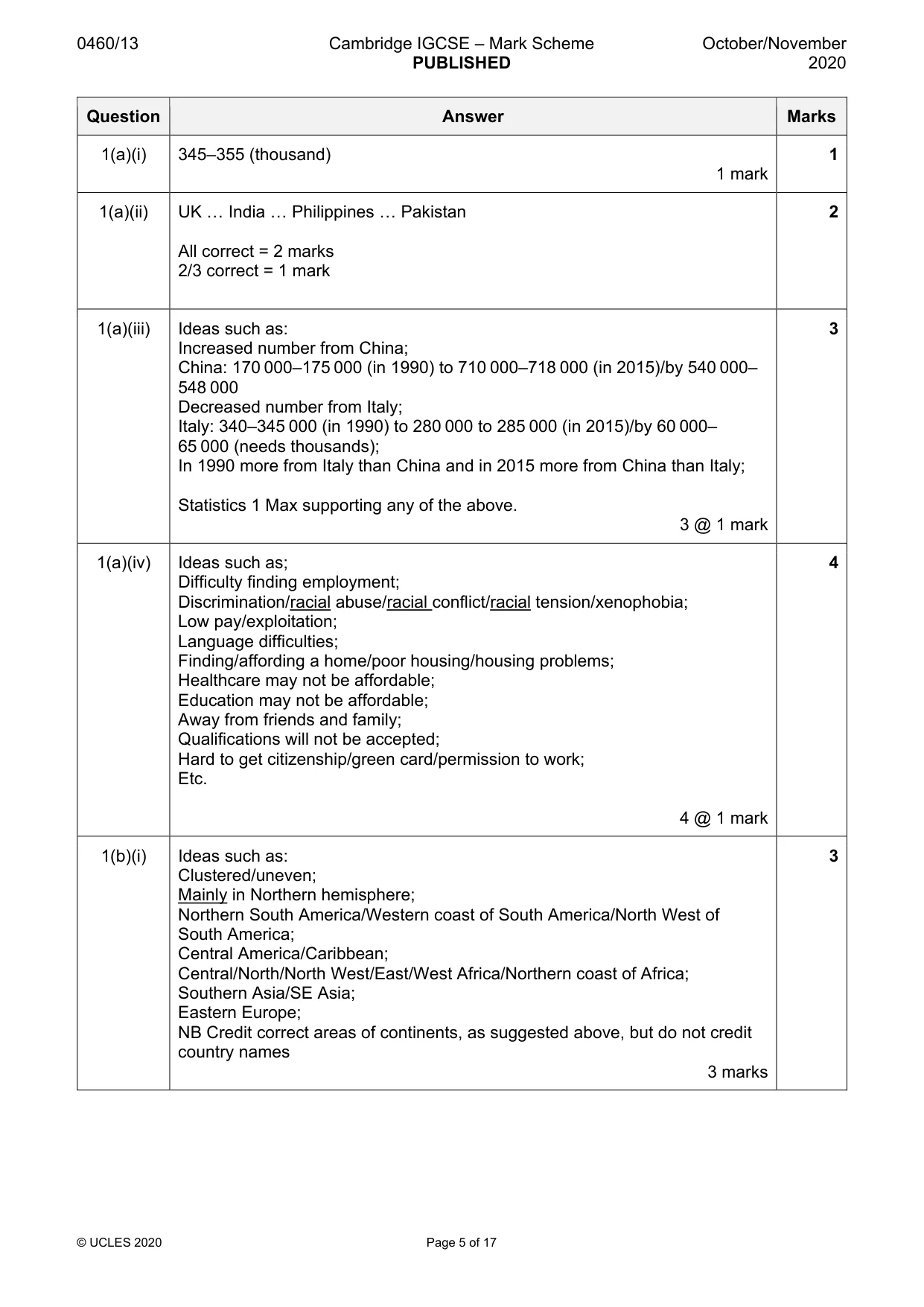
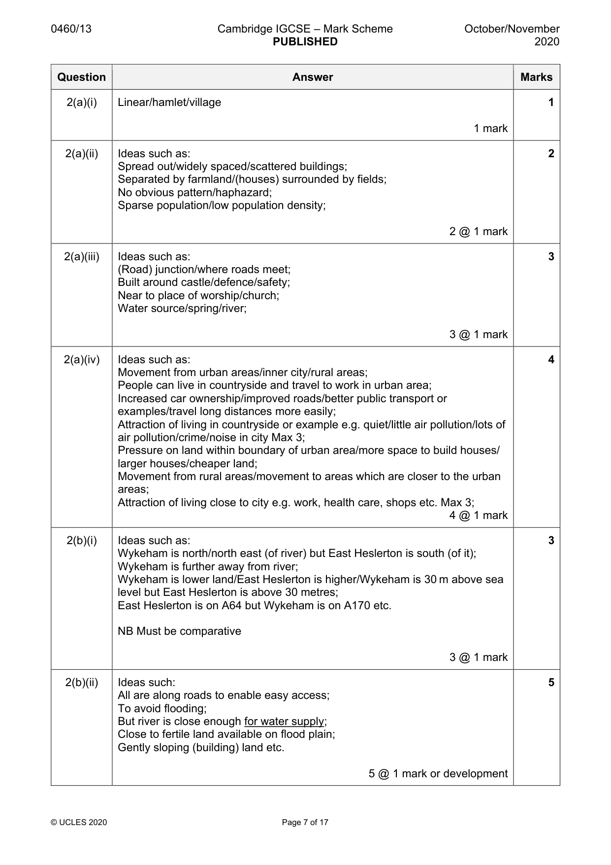
0460/13 Cambridge IGCSE – Mark Scheme PUBLISHED October/November 2020 © UCLES 2020 Page 5 of 17 Question Answer Marks 1(a)(i) 345–355 (thousand) 1 mark 1 1(a)(ii) UK … India … Philippines … Pakistan All correct = 2 marks 2/3 correct = 1 mark 2 1(a)(iii) Ideas such as: Increased number from China; China: 170 000–175 000 (in 1990) to 710 000–718 000 (in 2015)/by 540 000– 548 000 Decreased number from Italy; Italy: 340–345 000 (in 1990) to 280 000 to 285 000 (in 2015)/by 60 000– 65 000 (needs thousands); In 1990 more from Italy than China and in 2015 more from China than Italy; Statistics 1 Max supporting any of the above. 3 @ 1 mark 3 1(a)(iv) Ideas such as; Difficulty finding employment; Discrimination/racial abuse/racial conflict/racial tension/xenophobia; Low pay/exploitation; Language difficulties; Finding/affording a home/poor housing/housing problems; Healthcare may not be affordable; Education may not be affordable; Away from friends and family; Qualifications will not be accepted; Hard to get citizenship/green card/permission to work; Etc. 4 @ 1 mark 4 1(b)(i) Ideas such as: Clustered/uneven; Mainly in Northern hemisphere; Northern South America/Western coast of South America/North West of South America; Central America/Caribbean; Central/North/North West/East/West Africa/Northern coast of Africa; Southern Asia/SE Asia; Eastern Europe; NB Credit correct areas of continents, as suggested above, but do not credit country names 3 marks 3
Mark scheme, page 6
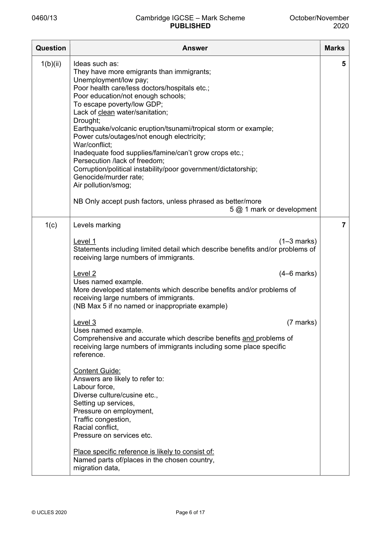
0460/13 Cambridge IGCSE – Mark Scheme PUBLISHED October/November 2020 © UCLES 2020 Page 6 of 17 Question Answer Marks 1(b)(ii) Ideas such as: They have more emigrants than immigrants; Unemployment/low pay; Poor health care/less doctors/hospitals etc.; Poor education/not enough schools; To escape poverty/low GDP; Lack of clean water/sanitation; Drought; Earthquake/volcanic eruption/tsunami/tropical storm or example; Power cuts/outages/not enough electricity; War/conflict; Inadequate food supplies/famine/can’t grow crops etc.; Persecution /lack of freedom; Corruption/political instability/poor government/dictatorship; Genocide/murder rate; Air pollution/smog; NB Only accept push factors, unless phrased as better/more 5 @ 1 mark or development 5 1(c) Levels marking Level 1 (1–3 marks) Statements including limited detail which describe benefits and/or problems of receiving large numbers of immigrants. Level 2 (4–6 marks) Uses named example. More developed statements which describe benefits and/or problems of receiving large numbers of immigrants. (NB Max 5 if no named or inappropriate example) Level 3 (7 marks) Uses named example. Comprehensive and accurate which describe benefits and problems of receiving large numbers of immigrants including some place specific reference. Content Guide: Answers are likely to refer to: Labour force, Diverse culture/cusine etc., Setting up services, Pressure on employment, Traffic congestion, Racial conflict, Pressure on services etc. Place specific reference is likely to consist of: Named parts of/places in the chosen country, migration data, 7
Mark scheme, page 7
0460/13 Cambridge IGCSE – Mark Scheme PUBLISHED October/November 2020 © UCLES 2020 Page 7 of 17 Question Answer Marks 2(a)(i) Linear/hamlet/village 1 mark 1 2(a)(ii) Ideas such as: Spread out/widely spaced/scattered buildings; Separated by farmland/(houses) surrounded by fields; No obvious pattern/haphazard; Sparse population/low population density; 2 @ 1 mark 2 2(a)(iii) Ideas such as: (Road) junction/where roads meet; Built around castle/defence/safety; Near to place of worship/church; Water source/spring/river; 3 @ 1 mark 3 2(a)(iv) Ideas such as: Movement from urban areas/inner city/rural areas; People can live in countryside and travel to work in urban area; Increased car ownership/improved roads/better public transport or examples/travel long distances more easily; Attraction of living in countryside or example e.g. quiet/little air pollution/lots of air pollution/crime/noise in city Max 3; Pressure on land within boundary of urban area/more space to build houses/ larger houses/cheaper land; Movement from rural areas/movement to areas which are closer to the urban areas; Attraction of living close to city e.g. work, health care, shops etc. Max 3; 4 @ 1 mark 4 2(b)(i) Ideas such as: Wykeham is north/north east (of river) but East Heslerton is south (of it); Wykeham is further away from river; Wykeham is lower land/East Heslerton is higher/Wykeham is 30 m above sea level but East Heslerton is above 30 metres; East Heslerton is on A64 but Wykeham is on A170 etc. NB Must be comparative 3 @ 1 mark 3 2(b)(ii) Ideas such: All are along roads to enable easy access; To avoid flooding; But river is close enough for water supply; Close to fertile land available on flood plain; Gently sloping (building) land etc. 5 @ 1 mark or development 5
Mark scheme, page 8
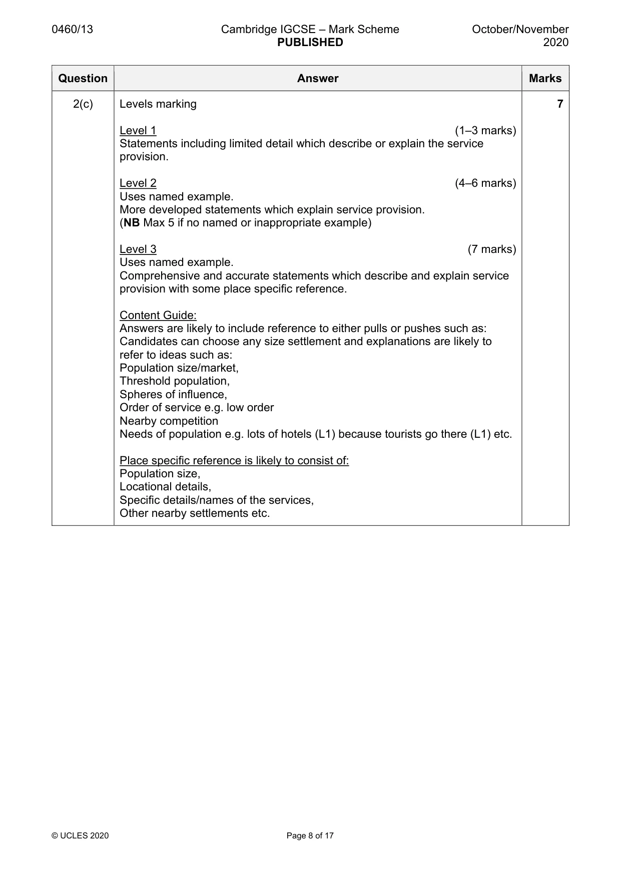
0460/13 Cambridge IGCSE – Mark Scheme PUBLISHED October/November 2020 © UCLES 2020 Page 8 of 17 Question Answer Marks 2(c) Levels marking Level 1 (1–3 marks) Statements including limited detail which describe or explain the service provision. Level 2 (4–6 marks) Uses named example. More developed statements which explain service provision. (NB Max 5 if no named or inappropriate example) Level 3 (7 marks) Uses named example. Comprehensive and accurate statements which describe and explain service provision with some place specific reference. Content Guide: Answers are likely to include reference to either pulls or pushes such as: Candidates can choose any size settlement and explanations are likely to refer to ideas such as: Population size/market, Threshold population, Spheres of influence, Order of service e.g. low order Nearby competition Needs of population e.g. lots of hotels (L1) because tourists go there (L1) etc. Place specific reference is likely to consist of: Population size, Locational details, Specific details/names of the services, Other nearby settlements etc. 7
Mark scheme, page 9
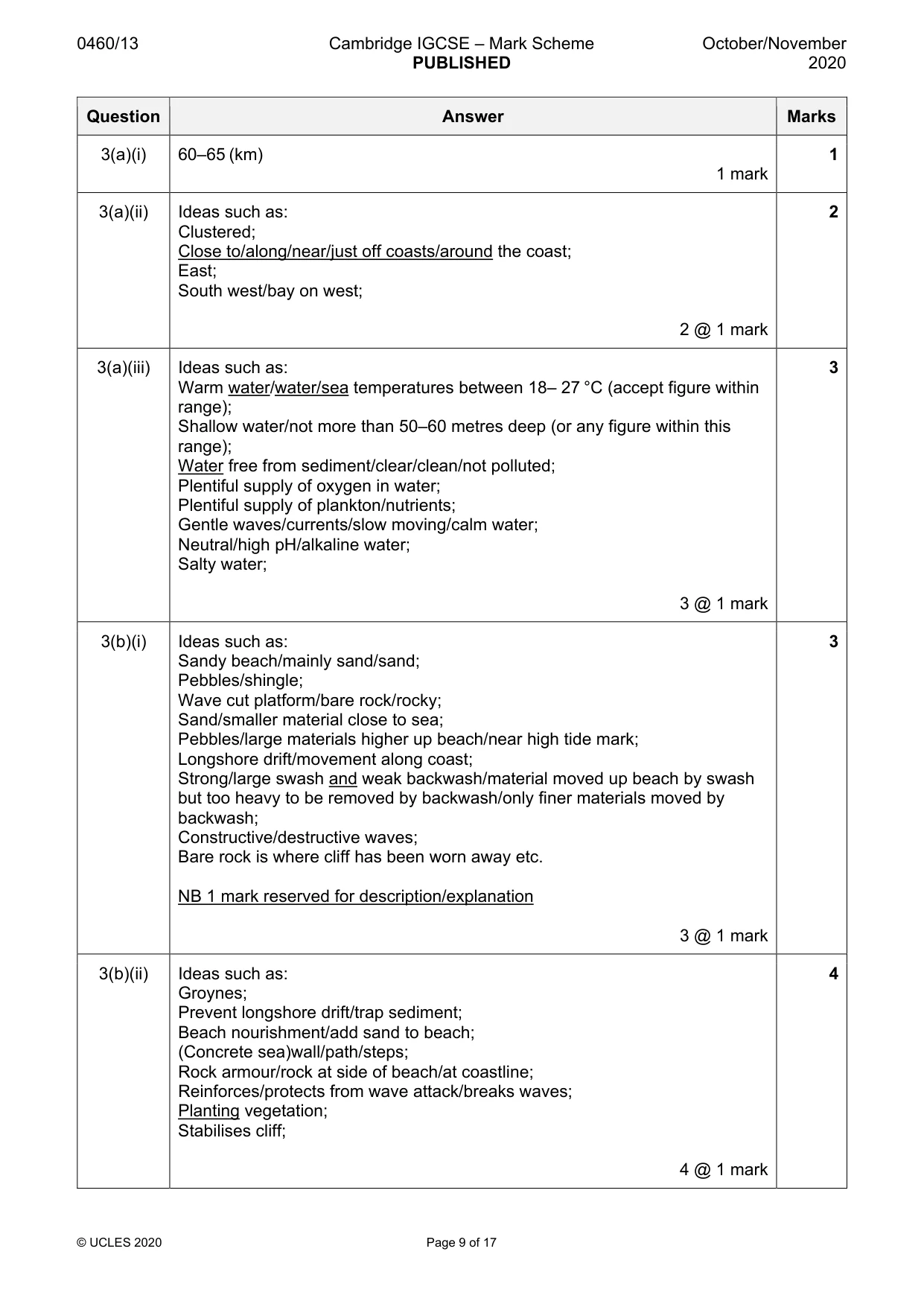
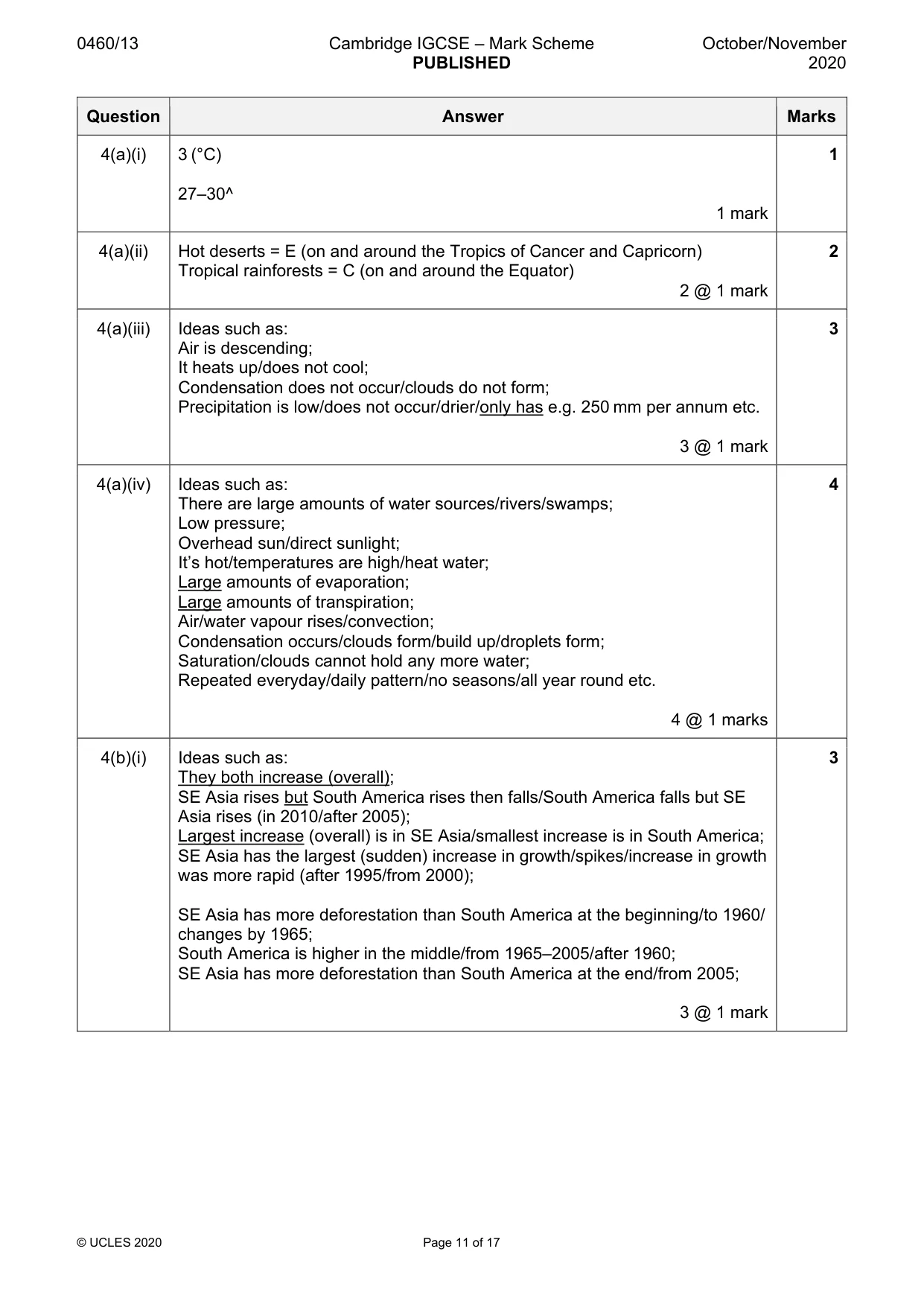
0460/13 Cambridge IGCSE – Mark Scheme PUBLISHED October/November 2020 © UCLES 2020 Page 9 of 17 Question Answer Marks 3(a)(i) 60–65 (km) 1 mark 1 3(a)(ii) Ideas such as: Clustered; Close to/along/near/just off coasts/around the coast; East; South west/bay on west; 2 @ 1 mark 2 3(a)(iii) Ideas such as: Warm water/water/sea temperatures between 18– 27 °C (accept figure within range); Shallow water/not more than 50–60 metres deep (or any figure within this range); Water free from sediment/clear/clean/not polluted; Plentiful supply of oxygen in water; Plentiful supply of plankton/nutrients; Gentle waves/currents/slow moving/calm water; Neutral/high pH/alkaline water; Salty water; 3 @ 1 mark 3 3(b)(i) Ideas such as: Sandy beach/mainly sand/sand; Pebbles/shingle; Wave cut platform/bare rock/rocky; Sand/smaller material close to sea; Pebbles/large materials higher up beach/near high tide mark; Longshore drift/movement along coast; Strong/large swash and weak backwash/material moved up beach by swash but too heavy to be removed by backwash/only finer materials moved by backwash; Constructive/destructive waves; Bare rock is where cliff has been worn away etc. NB 1 mark reserved for description/explanation 3 @ 1 mark 3 3(b)(ii) Ideas such as: Groynes; Prevent longshore drift/trap sediment; Beach nourishment/add sand to beach; (Concrete sea)wall/path/steps; Rock armour/rock at side of beach/at coastline; Reinforces/protects from wave attack/breaks waves; Planting vegetation; Stabilises cliff; 4 @ 1 mark 4
Mark scheme, page 10
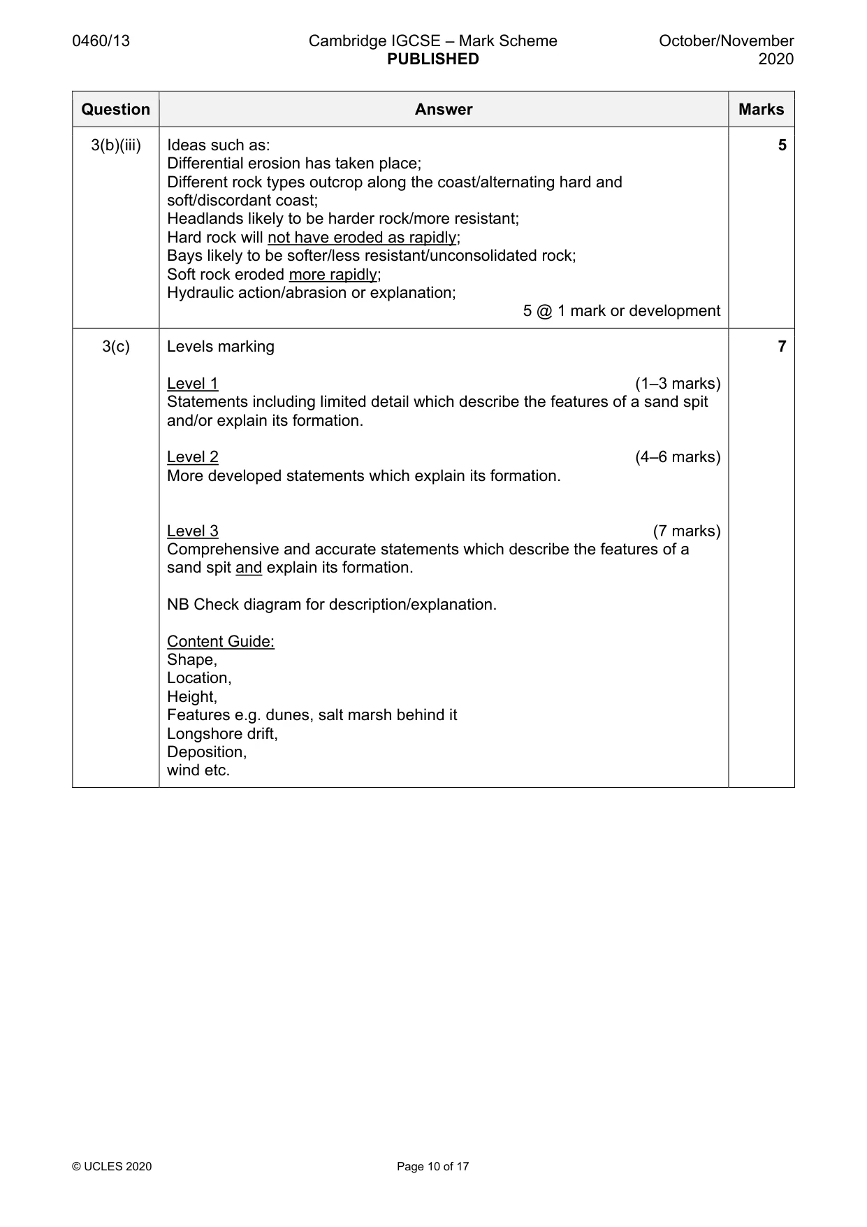
0460/13 Cambridge IGCSE – Mark Scheme PUBLISHED October/November 2020 © UCLES 2020 Page 10 of 17 Question Answer Marks 3(b)(iii) Ideas such as: Differential erosion has taken place; Different rock types outcrop along the coast/alternating hard and soft/discordant coast; Headlands likely to be harder rock/more resistant; Hard rock will not have eroded as rapidly; Bays likely to be softer/less resistant/unconsolidated rock; Soft rock eroded more rapidly; Hydraulic action/abrasion or explanation; 5 @ 1 mark or development 5 3(c) Levels marking Level 1 (1–3 marks) Statements including limited detail which describe the features of a sand spit and/or explain its formation. Level 2 (4–6 marks) More developed statements which explain its formation. Level 3 (7 marks) Comprehensive and accurate statements which describe the features of a sand spit and explain its formation. NB Check diagram for description/explanation. Content Guide: Shape, Location, Height, Features e.g. dunes, salt marsh behind it Longshore drift, Deposition, wind etc. 7
Mark scheme, page 11
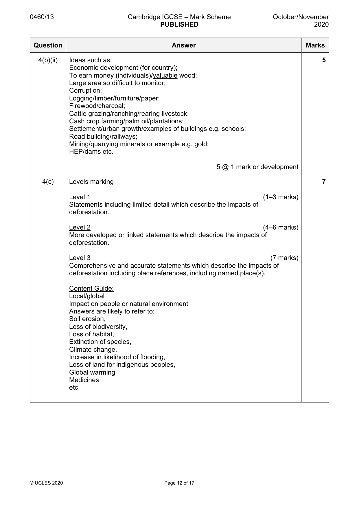
0460/13 Cambridge IGCSE – Mark Scheme PUBLISHED October/November 2020 © UCLES 2020 Page 11 of 17 Question Answer Marks 4(a)(i) 3 (°C) 27–30^ 1 mark 1 4(a)(ii) Hot deserts = E (on and around the Tropics of Cancer and Capricorn) Tropical rainforests = C (on and around the Equator) 2 @ 1 mark 2 4(a)(iii) Ideas such as: Air is descending; It heats up/does not cool; Condensation does not occur/clouds do not form; Precipitation is low/does not occur/drier/only has e.g. 250 mm per annum etc. 3 @ 1 mark 3 4(a)(iv) Ideas such as: There are large amounts of water sources/rivers/swamps; Low pressure; Overhead sun/direct sunlight; It’s hot/temperatures are high/heat water; Large amounts of evaporation; Large amounts of transpiration; Air/water vapour rises/convection; Condensation occurs/clouds form/build up/droplets form; Saturation/clouds cannot hold any more water; Repeated everyday/daily pattern/no seasons/all year round etc. 4 @ 1 marks 4 4(b)(i) Ideas such as: They both increase (overall); SE Asia rises but South America rises then falls/South America falls but SE Asia rises (in 2010/after 2005); Largest increase (overall) is in SE Asia/smallest increase is in South America; SE Asia has the largest (sudden) increase in growth/spikes/increase in growth was more rapid (after 1995/from 2000); SE Asia has more deforestation than South America at the beginning/to 1960/ changes by 1965; South America is higher in the middle/from 1965–2005/after 1960; SE Asia has more deforestation than South America at the end/from 2005; 3 @ 1 mark 3
Mark scheme, page 12
0460/13 Cambridge IGCSE – Mark Scheme PUBLISHED October/November 2020 © UCLES 2020 Page 12 of 17 Question Answer Marks 4(b)(ii) Ideas such as: Economic development (for country); To earn money (individuals)/valuable wood; Large area so difficult to monitor; Corruption; Logging/timber/furniture/paper; Firewood/charcoal; Cattle grazing/ranching/rearing livestock; Cash crop farming/palm oil/plantations; Settlement/urban growth/examples of buildings e.g. schools; Road building/railways; Mining/quarrying minerals or example e.g. gold; HEP/dams etc. 5 @ 1 mark or development 5 4(c) Levels marking Level 1 (1–3 marks) Statements including limited detail which describe the impacts of deforestation. Level 2 (4–6 marks) More developed or linked statements which describe the impacts of deforestation. Level 3 (7 marks) Comprehensive and accurate statements which describe the impacts of deforestation including place references, including named place(s). Content Guide: Local/global Impact on people or natural environment Answers are likely to refer to: Soil erosion, Loss of biodiversity, Loss of habitat, Extinction of species, Climate change, Increase in likelihood of flooding, Loss of land for indigenous peoples, Global warming Medicines etc. 7
Mark scheme, page 13
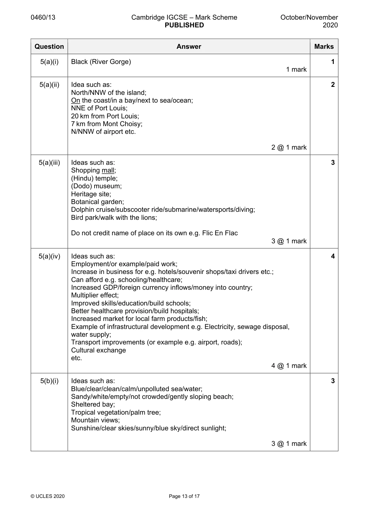
0460/13 Cambridge IGCSE – Mark Scheme PUBLISHED October/November 2020 © UCLES 2020 Page 13 of 17 Question Answer Marks 5(a)(i) Black (River Gorge) 1 mark 1 5(a)(ii) Idea such as: North/NNW of the island; On the coast/in a bay/next to sea/ocean; NNE of Port Louis; 20 km from Port Louis; 7 km from Mont Choisy; N/NNW of airport etc. 2 @ 1 mark 2 5(a)(iii) Ideas such as: Shopping mall; (Hindu) temple; (Dodo) museum; Heritage site; Botanical garden; Dolphin cruise/subscooter ride/submarine/watersports/diving; Bird park/walk with the lions; Do not credit name of place on its own e.g. Flic En Flac 3 @ 1 mark 3 5(a)(iv) Ideas such as: Employment/or example/paid work; Increase in business for e.g. hotels/souvenir shops/taxi drivers etc.; Can afford e.g. schooling/healthcare; Increased GDP/foreign currency inflows/money into country; Multiplier effect; Improved skills/education/build schools; Better healthcare provision/build hospitals; Increased market for local farm products/fish; Example of infrastructural development e.g. Electricity, sewage disposal, water supply; Transport improvements (or example e.g. airport, roads); Cultural exchange etc. 4 @ 1 mark 4 5(b)(i) Ideas such as: Blue/clear/clean/calm/unpolluted sea/water; Sandy/white/empty/not crowded/gently sloping beach; Sheltered bay; Tropical vegetation/palm tree; Mountain views; Sunshine/clear skies/sunny/blue sky/direct sunlight; 3 @ 1 mark 3
Mark scheme, page 14
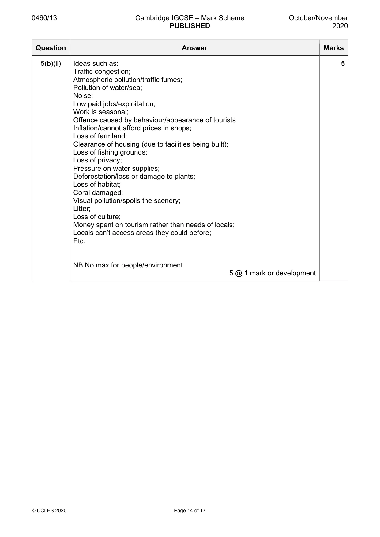
0460/13 Cambridge IGCSE – Mark Scheme PUBLISHED October/November 2020 © UCLES 2020 Page 14 of 17 Question Answer Marks 5(b)(ii) Ideas such as: Traffic congestion; Atmospheric pollution/traffic fumes; Pollution of water/sea; Noise; Low paid jobs/exploitation; Work is seasonal; Offence caused by behaviour/appearance of tourists Inflation/cannot afford prices in shops; Loss of farmland; Clearance of housing (due to facilities being built); Loss of fishing grounds; Loss of privacy; Pressure on water supplies; Deforestation/loss or damage to plants; Loss of habitat; Coral damaged; Visual pollution/spoils the scenery; Litter; Loss of culture; Money spent on tourism rather than needs of locals; Locals can’t access areas they could before; Etc. NB No max for people/environment 5 @ 1 mark or development 5
Mark scheme, page 15
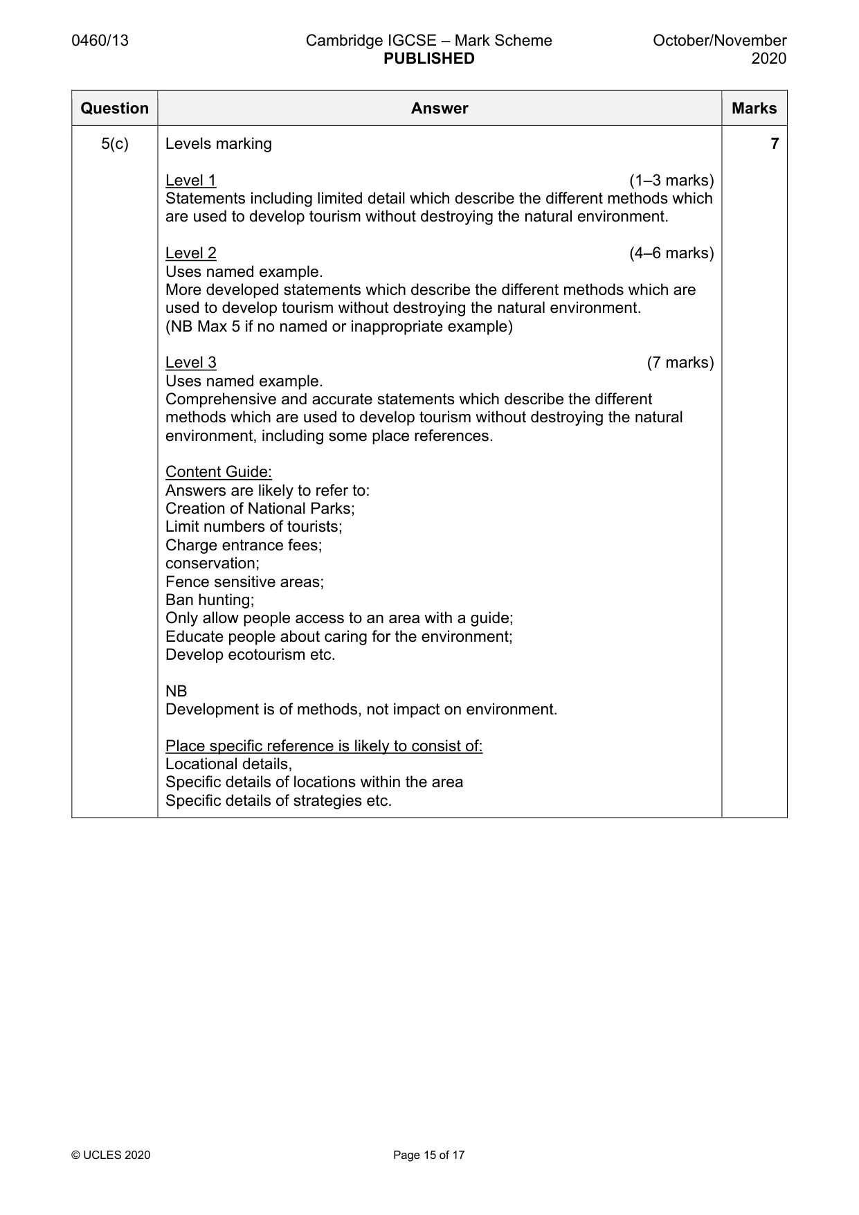
0460/13 Cambridge IGCSE – Mark Scheme PUBLISHED October/November 2020 © UCLES 2020 Page 15 of 17 Question Answer Marks 5(c) Levels marking Level 1 (1–3 marks) Statements including limited detail which describe the different methods which are used to develop tourism without destroying the natural environment. Level 2 (4–6 marks) Uses named example. More developed statements which describe the different methods which are used to develop tourism without destroying the natural environment. (NB Max 5 if no named or inappropriate example) Level 3 (7 marks) Uses named example. Comprehensive and accurate statements which describe the different methods which are used to develop tourism without destroying the natural environment, including some place references. Content Guide: Answers are likely to refer to: Creation of National Parks; Limit numbers of tourists; Charge entrance fees; conservation; Fence sensitive areas; Ban hunting; Only allow people access to an area with a guide; Educate people about caring for the environment; Develop ecotourism etc. NB Development is of methods, not impact on environment. Place specific reference is likely to consist of: Locational details, Specific details of locations within the area Specific details of strategies etc. 7
Mark scheme, page 16
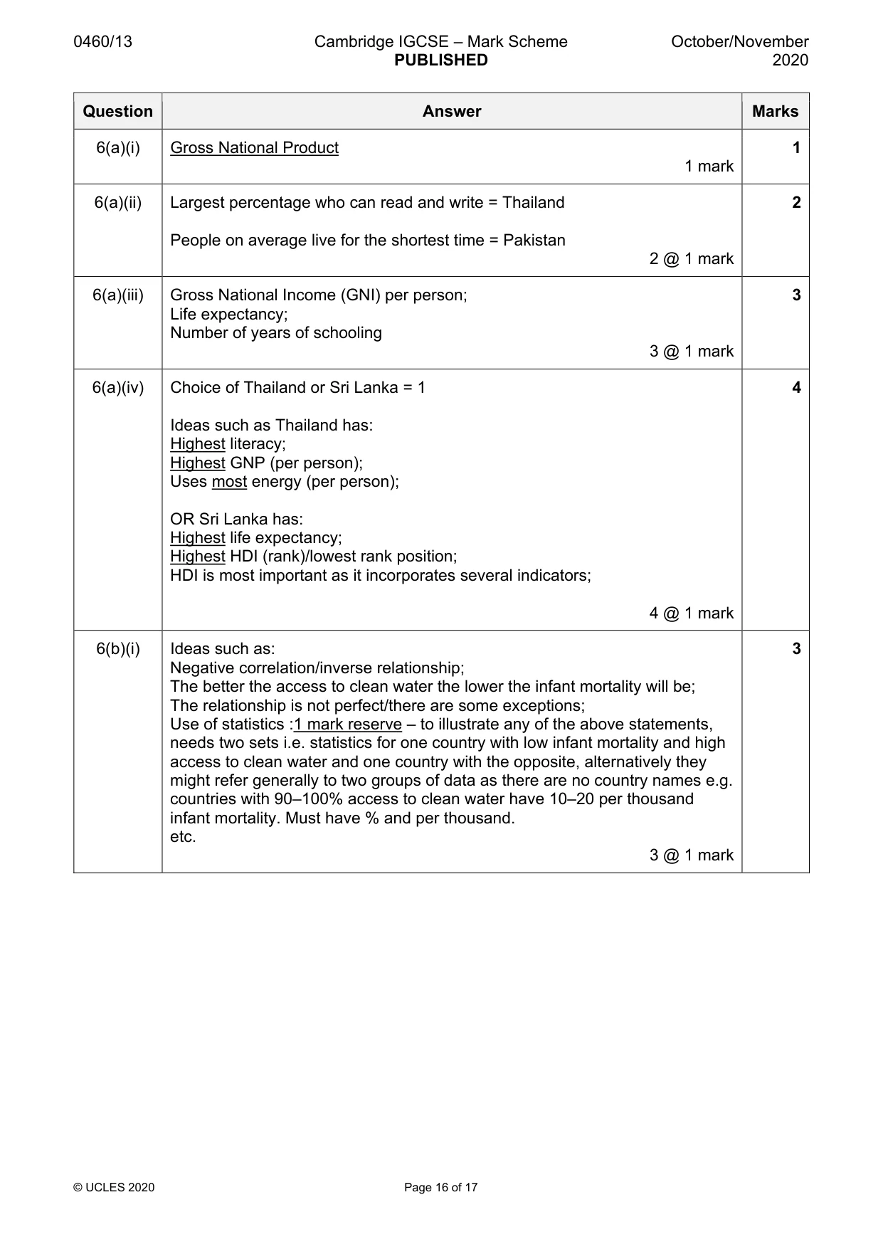
0460/13 Cambridge IGCSE – Mark Scheme PUBLISHED October/November 2020 © UCLES 2020 Page 16 of 17 Question Answer Marks 6(a)(i) Gross National Product 1 mark 1 6(a)(ii) Largest percentage who can read and write = Thailand People on average live for the shortest time = Pakistan 2 @ 1 mark 2 6(a)(iii) Gross National Income (GNI) per person; Life expectancy; Number of years of schooling 3 @ 1 mark 3 6(a)(iv) Choice of Thailand or Sri Lanka = 1 Ideas such as Thailand has: Highest literacy; Highest GNP (per person); Uses most energy (per person); OR Sri Lanka has: Highest life expectancy; Highest HDI (rank)/lowest rank position; HDI is most important as it incorporates several indicators; 4 @ 1 mark 4 6(b)(i) Ideas such as: Negative correlation/inverse relationship; The better the access to clean water the lower the infant mortality will be; The relationship is not perfect/there are some exceptions; Use of statistics :1 mark reserve – to illustrate any of the above statements, needs two sets i.e. statistics for one country with low infant mortality and high access to clean water and one country with the opposite, alternatively they might refer generally to two groups of data as there are no country names e.g. countries with 90–100% access to clean water have 10–20 per thousand infant mortality. Must have % and per thousand. etc. 3 @ 1 mark 3
Mark scheme, page 17
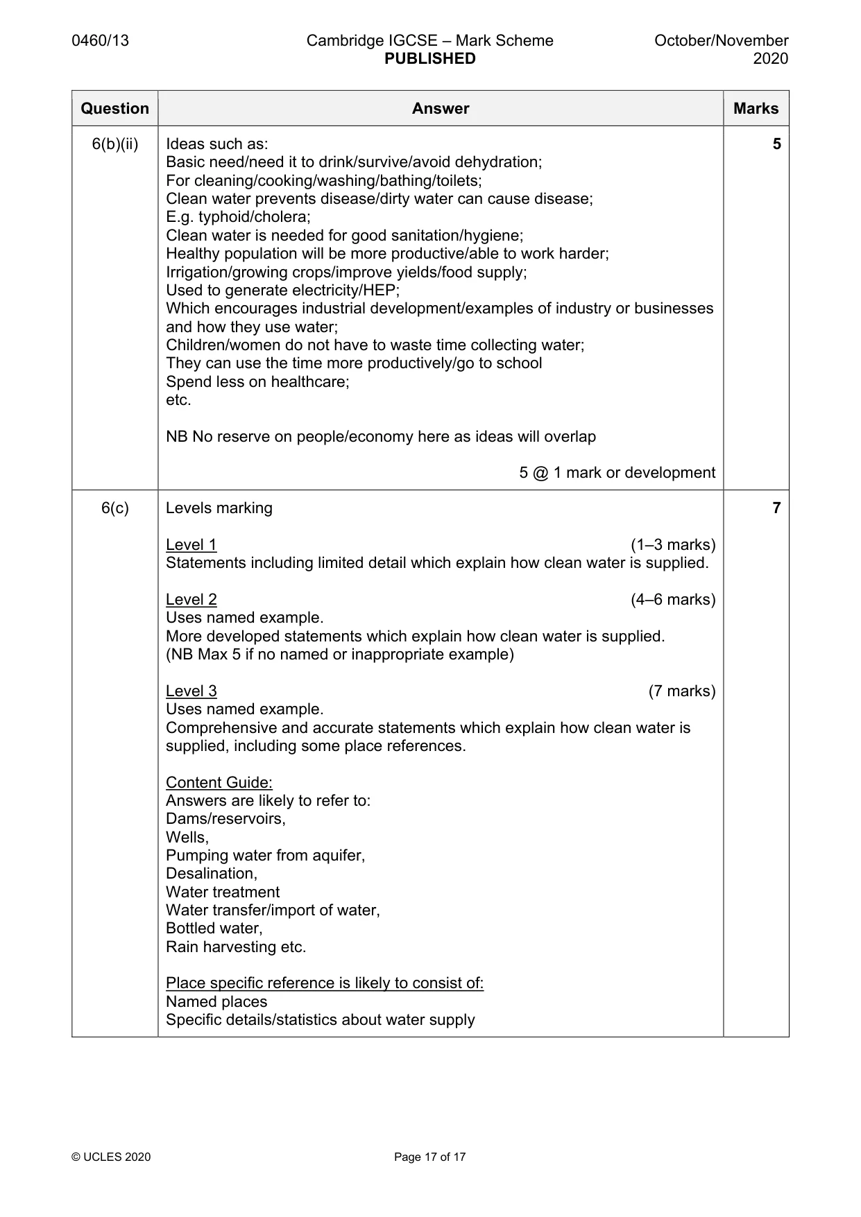
0460/13 Cambridge IGCSE – Mark Scheme PUBLISHED October/November 2020 © UCLES 2020 Page 17 of 17 Question Answer Marks 6(b)(ii) Ideas such as: Basic need/need it to drink/survive/avoid dehydration; For cleaning/cooking/washing/bathing/toilets; Clean water prevents disease/dirty water can cause disease; E.g. typhoid/cholera; Clean water is needed for good sanitation/hygiene; Healthy population will be more productive/able to work harder; Irrigation/growing crops/improve yields/food supply; Used to generate electricity/HEP; Which encourages industrial development/examples of industry or businesses and how they use water; Children/women do not have to waste time collecting water; They can use the time more productively/go to school Spend less on healthcare; etc. NB No reserve on people/economy here as ideas will overlap 5 @ 1 mark or development 5 6(c) Levels marking Level 1 (1–3 marks) Statements including limited detail which explain how clean water is supplied. Level 2 (4–6 marks) Uses named example. More developed statements which explain how clean water is supplied. (NB Max 5 if no named or inappropriate example) Level 3 (7 marks) Uses named example. Comprehensive and accurate statements which explain how clean water is supplied, including some place references. Content Guide: Answers are likely to refer to: Dams/reservoirs, Wells, Pumping water from aquifer, Desalination, Water treatment Water transfer/import of water, Bottled water, Rain harvesting etc. Place specific reference is likely to consist of: Named places Specific details/statistics about water supply 7
What you needed in this session
Cambridge’s own grade thresholds for 2020 Oct/Nov, Paper 1 · Variant 3. A higher threshold means an easier paper — the bar moves with how the cohort did.