Cambridge IGCSE Geography 0460 — 2013 Oct/Nov Paper 1 · Variant 1
0460/11/O/N/13 · 75 marks · ≈84 min
The question paper and its mark scheme, free to read here and free to download. This is Cambridge’s own paper, exactly as it was sat.
Question paper28 pages







Mark scheme12 pages
Answers below. Sit the paper first if you are practising.
Paper as text
Question paper, page 1
This document consists of 27 printed pages, 1 blank page and 1 Insert. DC (LEG/JG) 66066/4 © UCLES 2013 [Turn over UNIVERSITY OF CAMBRIDGE INTERNATIONAL EXAMINATIONS International General Certificate of Secondary Education * 0 8 8 3 4 5 0 1 7 6 * GEOGRAPHY 0460/11 Paper 1 October/November 2013 1 hour 45 minutes Candidates answer on the Question Paper. Additional Materials: Ruler Calculator READ THESE INSTRUCTIONS FIRST Write your Centre number, candidate number and name in the spaces provided. Write in dark blue or black pen. You may use a soft pencil for any diagrams, graphs or rough working. Do not use staples, paper clips, highlighters, glue or correction fluid. DO NOT WRITE ON ANY BARCODES. Write your answer to each question in the space provided. If additional space is required, you should use the lined page at the end of this booklet. The question number(s) must be clearly shown. Answer three questions. This Insert contains Figs 3A and 3B for Question 2, Photograph A for Question 3, Photograph B for Question 4, and Photographs C, D and E for Question 6. The Insert is not required by the Examiner. Sketch maps and diagrams should be drawn whenever they serve to illustrate an answer. At the end of the examination, fasten all your work securely together. The number of marks is given in brackets [ ] at the end of each question or part question. For Examiner’s Use Q1 Q2 Q3 Q4 Q5 Q6 Total www.theallpapers.com
Question paper, page 2
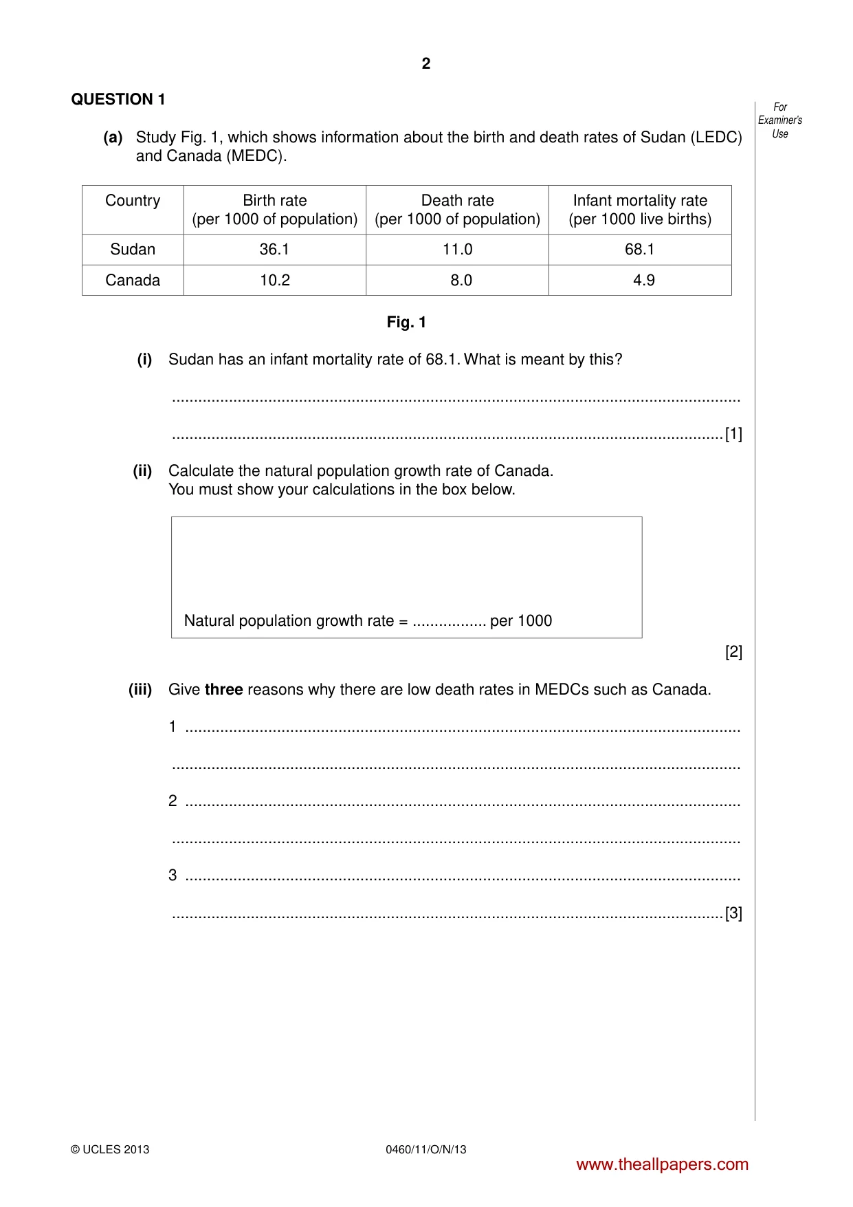
2 0460/11/O/N/13 © UCLES 2013 For Examiner’s Use QUESTION 1 (a) Study Fig. 1, which shows information about the birth and death rates of Sudan (LEDC) and Canada (MEDC). Country Birth rate (per 1000 of population) Death rate (per 1000 of population) Infant mortality rate (per 1000 live births) Sudan 36.1 11.0 68.1 Canada 10.2 8.0 4.9 Fig. 1 (i) Sudan has an infant mortality rate of 68.1. What is meant by this? … …[1] (ii) Calculate the natural population growth rate of Canada. You must show your calculations in the box below. Natural population growth rate = … per 1000 [2] (iii) Give three reasons why there are low death rates in MEDCs such as Canada. 1 … … 2 … … 3 … …[3] www.theallpapers.com
Question paper, page 3
3 0460/11/O/N/13 © UCLES 2013 [Turn over For Examiner’s Use (iv) Explain why there are high birth rates in LEDCs such as Sudan. … … … … … … … …[4] www.theallpapers.com
Question paper, page 4
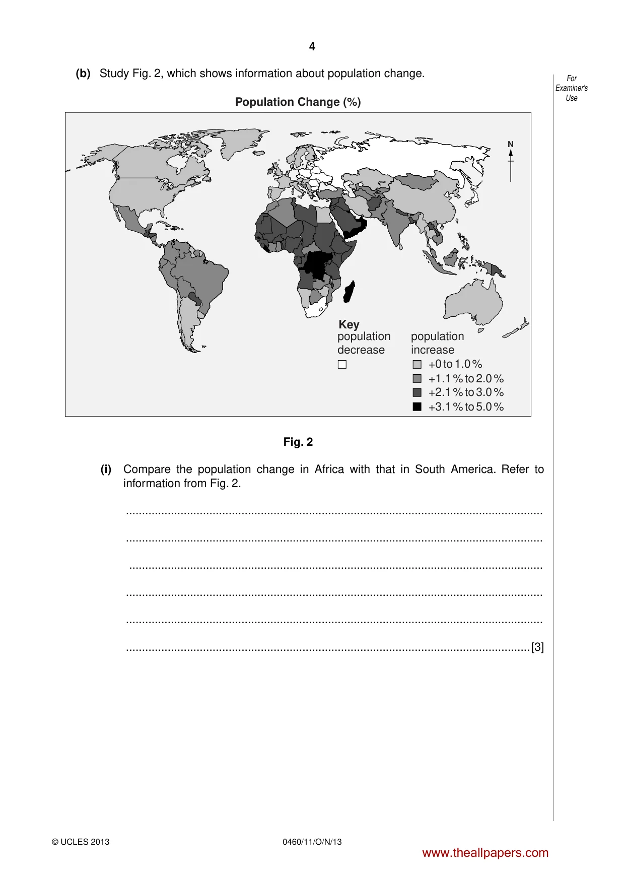
4 0460/11/O/N/13 © UCLES 2013 For Examiner’s Use (b) Study Fig. 2, which shows information about population change. Key N population increase population decrease +0 to 1.0 % +1.1 % to 2.0 % +2.1 % to 3.0 % +3.1 % to 5.0 % Population Change (%) Fig. 2 (i) Compare the population change in Africa with that in South America. Refer to information from Fig. 2. … … … … … …[3] www.theallpapers.com
Question paper, page 5
5 0460/11/O/N/13 © UCLES 2013 [Turn over For Examiner’s Use (ii) Explain why the governments of many LEDCs are trying to reduce their country’s rates of population growth. … … … … … … … … … …[5] www.theallpapers.com
Question paper, page 6
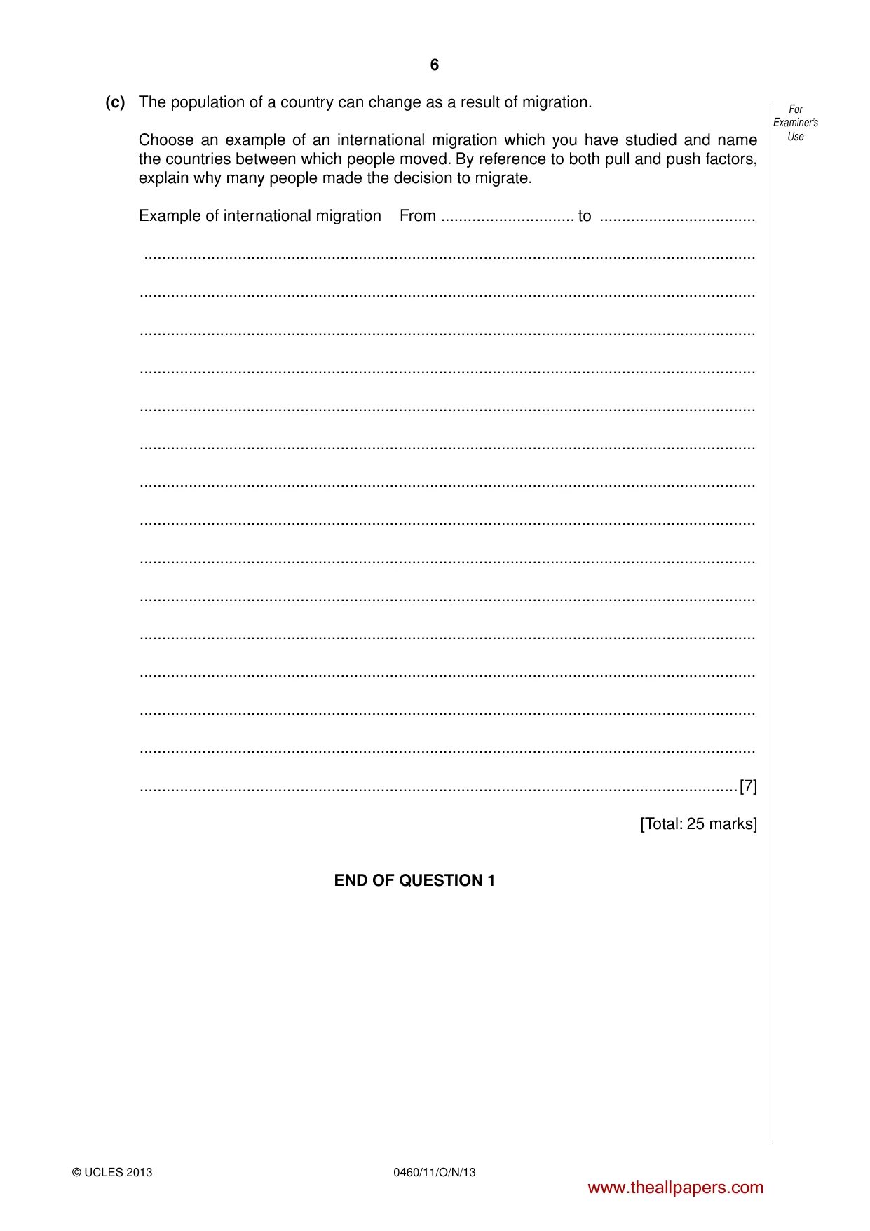
6 0460/11/O/N/13 © UCLES 2013 For Examiner’s Use (c) The population of a country can change as a result of migration. Choose an example of an international migration which you have studied and name the countries between which people moved. By reference to both pull and push factors, explain why many people made the decision to migrate. Example of international migration From … to … … … … … … … … … … … … … … … …[7] [Total: 25 marks] END OF QUESTION 1 www.theallpapers.com
Question paper, page 7
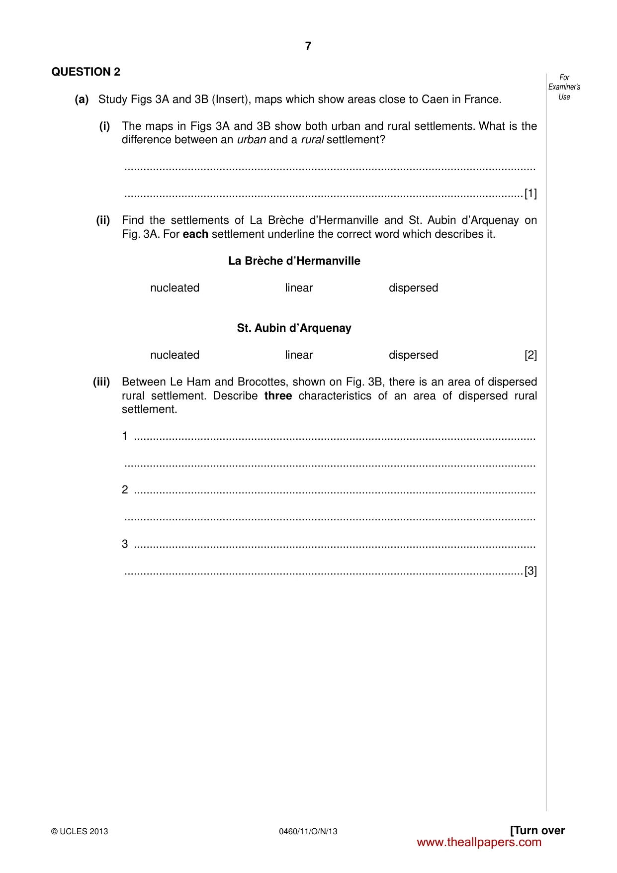
7 0460/11/O/N/13 © UCLES 2013 [Turn over For Examiner’s Use QUESTION 2 (a) Study Figs 3A and 3B (Insert), maps which show areas close to Caen in France. (i) The maps in Figs 3A and 3B show both urban and rural settlements. What is the difference between an urban and a rural settlement? … …[1] (ii) Find the settlements of La Brèche d’Hermanville and St. Aubin d’Arquenay on Fig. 3A. For each settlement underline the correct word which describes it. La Brèche d’Hermanville nucleated linear dispersed St. Aubin d’Arquenay nucleated linear dispersed [2] (iii) Between Le Ham and Brocottes, shown on Fig. 3B, there is an area of dispersed rural settlement. Describe three characteristics of an area of dispersed rural settlement. 1 … … 2 … … 3 … …[3] www.theallpapers.com
Question paper, page 8
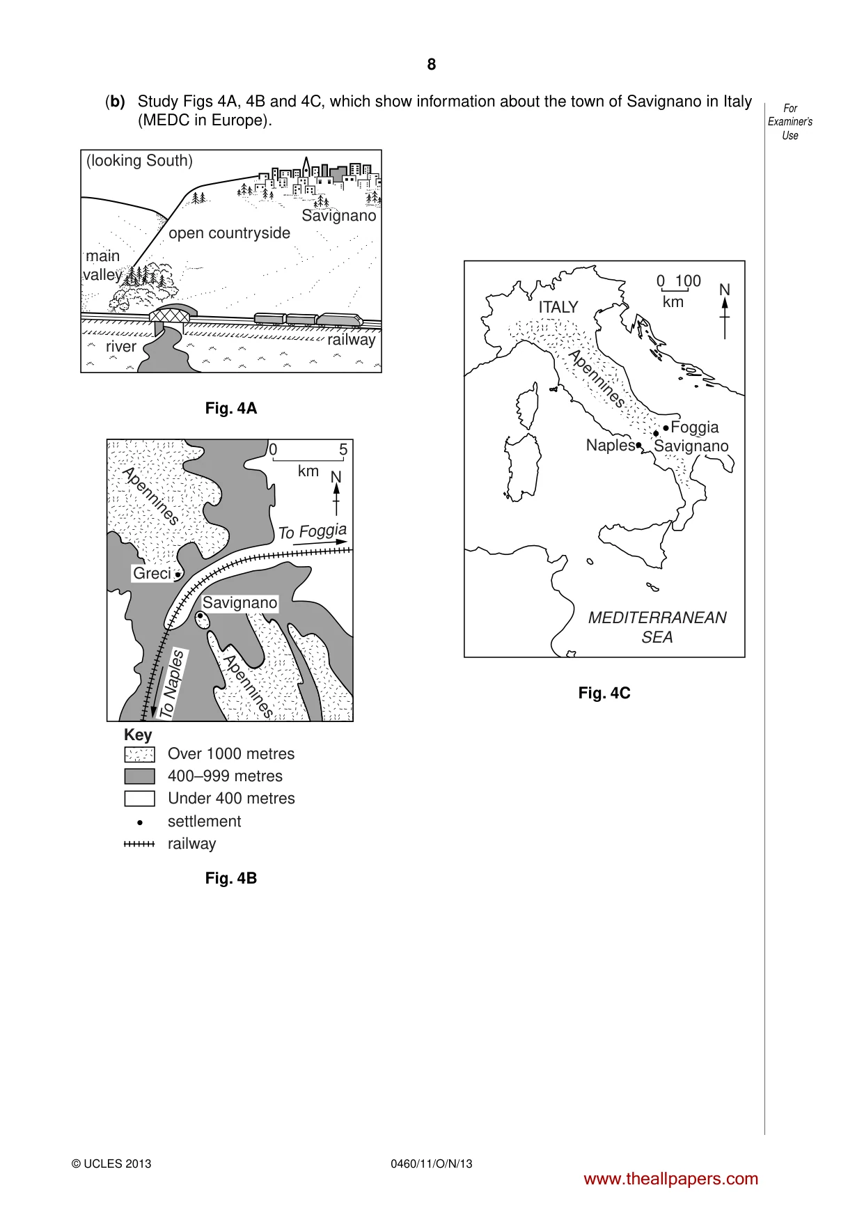
8 0460/11/O/N/13 © UCLES 2013 For Examiner’s Use (b) Study Figs 4A, 4B and 4C, which show information about the town of Savignano in Italy (MEDC in Europe). open countryside (looking South) Savignano railway river main valley Fig. 4A 0 5 km N To Foggia To Naples Savignano Greci Apennines Apennines Over 1000 metres 400–999 metres settlement railway Under 400 metres Key Fig. 4B 100 km 0 ITALY MEDITERRANEAN SEA Apennines N Foggia Savignano Naples Fig. 4C www.theallpapers.com
Question paper, page 9
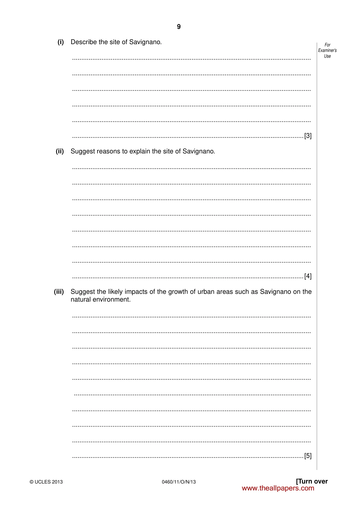
9 0460/11/O/N/13 © UCLES 2013 [Turn over For Examiner’s Use (i) Describe the site of Savignano. … … … … … …[3] (ii) Suggest reasons to explain the site of Savignano. … … … … … … … …[4] (iii) Suggest the likely impacts of the growth of urban areas such as Savignano on the natural environment. … … … … … … … … … …[5] www.theallpapers.com
Question paper, page 10
10 0460/11/O/N/13 © UCLES 2013 For Examiner’s Use (c) State one function of a large urban area which you have studied. Explain why the urban area has this function. Name of urban area … Function … … … … … … … … … … … … … … … …[7] [Total: 25 marks] END OF QUESTION 2 www.theallpapers.com
Question paper, page 11
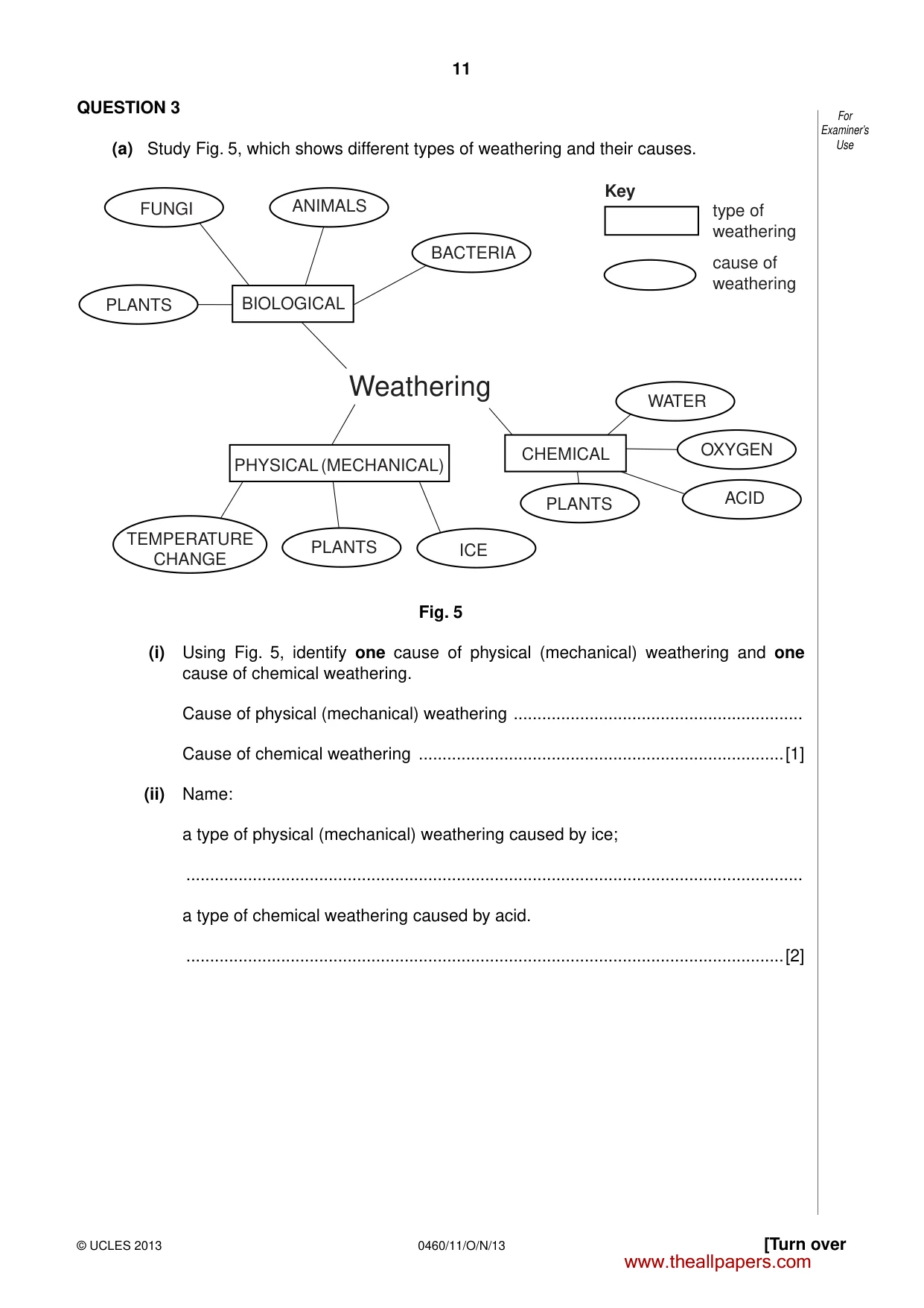
11 0460/11/O/N/13 © UCLES 2013 [Turn over For Examiner’s Use QUESTION 3 (a) Study Fig. 5, which shows different types of weathering and their causes. FUNGI ANIMALS BACTERIA type of weathering cause of weathering PLANTS BIOLOGICAL Weathering PHYSICAL (MECHANICAL) TEMPERATURE CHANGE PLANTS ICE PLANTS CHEMICAL ACID OXYGEN WATER Key Fig. 5 (i) Using Fig. 5, identify one cause of physical (mechanical) weathering and one cause of chemical weathering. Cause of physical (mechanical) weathering … Cause of chemical weathering …[1] (ii) Name: a type of physical (mechanical) weathering caused by ice; … a type of chemical weathering caused by acid. …[2] www.theallpapers.com
Question paper, page 12
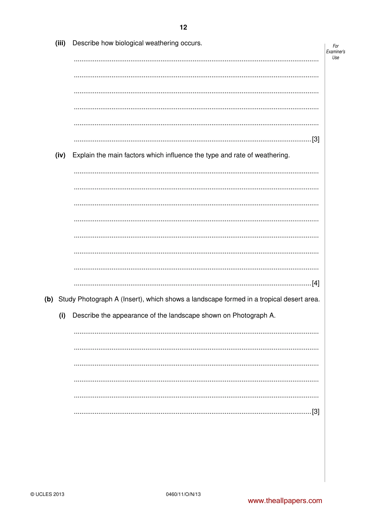
12 0460/11/O/N/13 © UCLES 2013 For Examiner’s Use (iii) Describe how biological weathering occurs. … … … … … …[3] (iv) Explain the main factors which influence the type and rate of weathering. … … … … … … … …[4] (b) Study Photograph A (Insert), which shows a landscape formed in a tropical desert area. (i) Describe the appearance of the landscape shown on Photograph A. … … … … … …[3] www.theallpapers.com
Question paper, page 13
13 0460/11/O/N/13 © UCLES 2013 [Turn over For Examiner’s Use (ii) Exfoliation is one process of weathering operating in the area shown in Photograph A. Describe how this process occurs. You may use a labelled diagram in your answer. … … … … … … … … … … [5] www.theallpapers.com
Question paper, page 14
14 0460/11/O/N/13 © UCLES 2013 For Examiner’s Use (c) For a named area of tropical desert which you have studied, describe and explain the characteristics of its climate. Name of tropical desert … … … … … … … … … … … … … … …[7] [Total: 25 marks] END OF QUESTION 3 www.theallpapers.com
Question paper, page 15
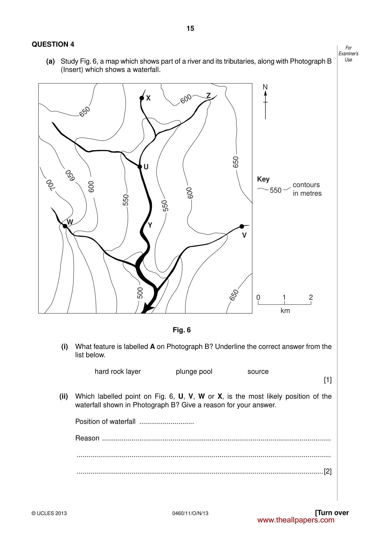
15 0460/11/O/N/13 © UCLES 2013 [Turn over For Examiner’s Use QUESTION 4 (a) Study Fig. 6, a map which shows part of a river and its tributaries, along with Photograph B (Insert) which shows a waterfall. 650 600 600 600 550 550 500 550 650 650 650 700 0 1 2 km N Key contours in metres W X Z V Y U Fig. 6 (i) What feature is labelled A on Photograph B? Underline the correct answer from the list below. hard rock layer plunge pool source [1] (ii) Which labelled point on Fig. 6, U, V, W or X, is the most likely position of the waterfall shown in Photograph B? Give a reason for your answer. Position of waterfall … Reason … … …[2] www.theallpapers.com
Question paper, page 16
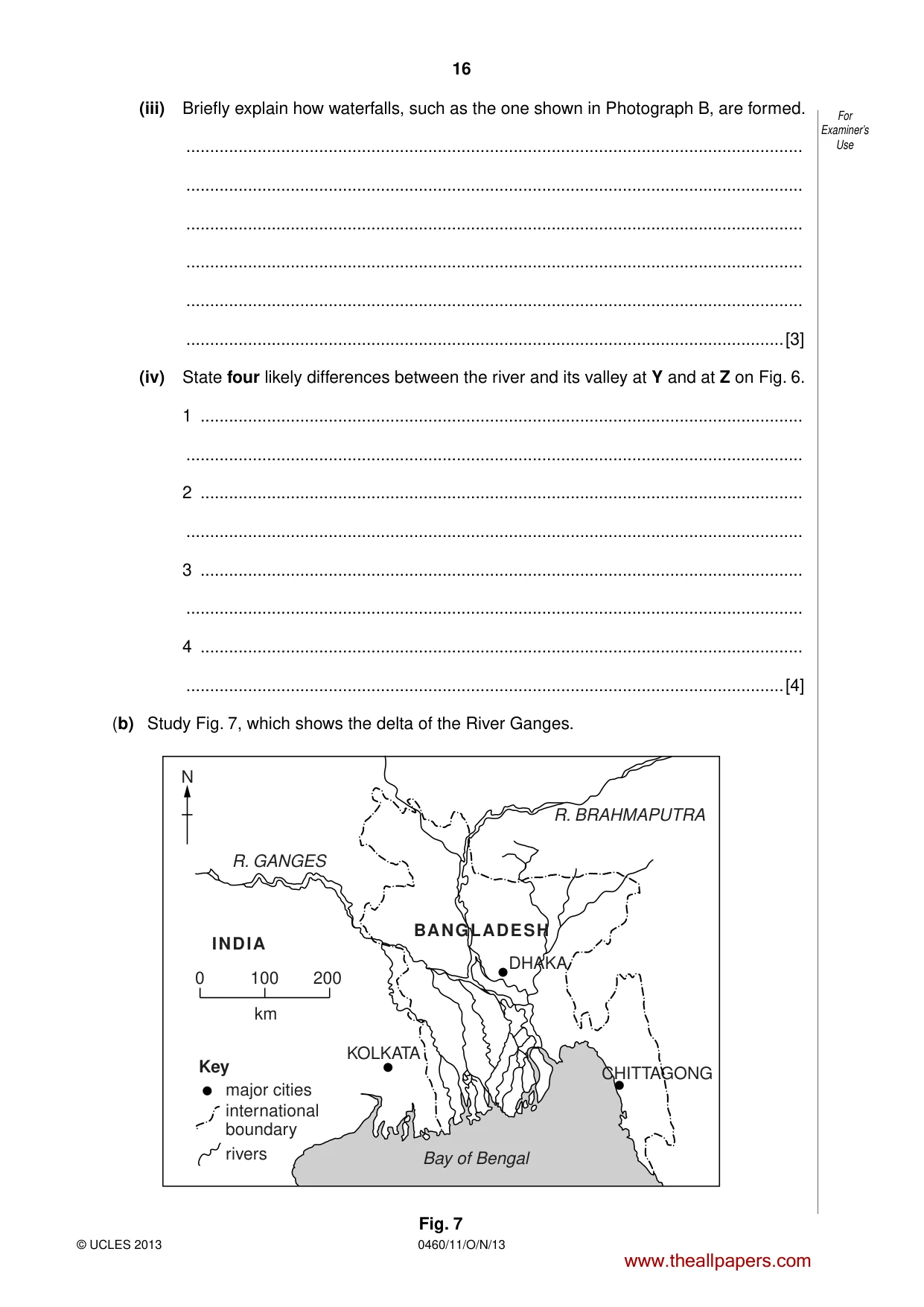
16 0460/11/O/N/13 © UCLES 2013 For Examiner’s Use (iii) Briefly explain how waterfalls, such as the one shown in Photograph B, are formed. … … … … … …[3] (iv) State four likely differences between the river and its valley at Y and at Z on Fig. 6. 1 … … 2 … … 3 … … 4 … …[4] (b) Study Fig. 7, which shows the delta of the River Ganges. N 0 100 200 km CHITTAGONG major cities international boundary rivers DHAKA BANGLADESH INDIA KOLKATA Key Bay of Bengal R. GANGES R. BRAHMAPUTRA Fig. 7 www.theallpapers.com
Question paper, page 17
17 0460/11/O/N/13 © UCLES 2013 [Turn over For Examiner’s Use (i) Using information from Fig. 7 only, describe three features of the Ganges Delta. 1 … … 2 … … 3 … …[3] (ii) Explain how a delta is formed. … … … … … … … … … …[5] www.theallpapers.com
Question paper, page 18
18 0460/11/O/N/13 © UCLES 2013 For Examiner’s Use (c) Describe the benefits and difficulties for people of living on a delta. You should refer to a named delta. Name of delta … … … … … … … … … … … … … … …[7] [Total: 25 marks] END OF QUESTION 4 www.theallpapers.com
Question paper, page 19
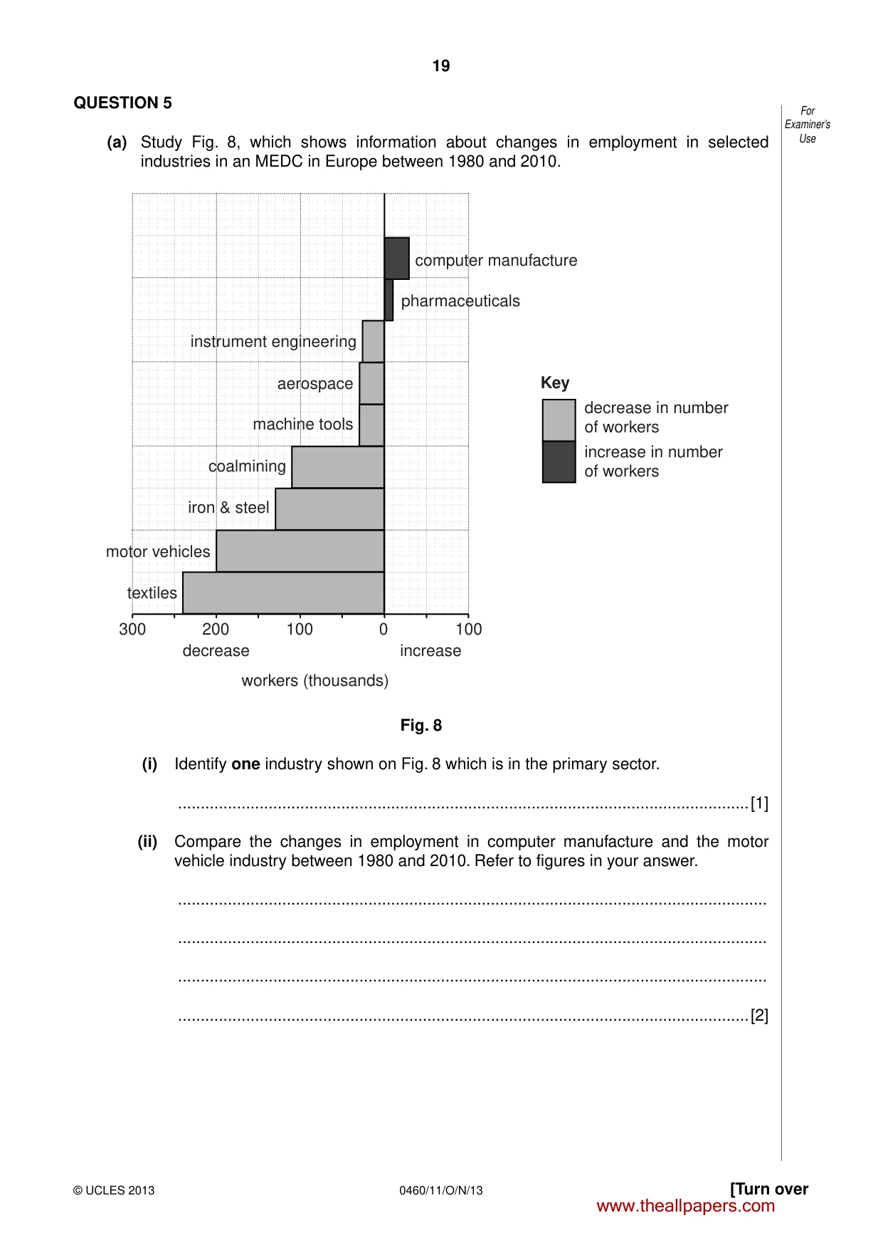
19 0460/11/O/N/13 © UCLES 2013 [Turn over For Examiner’s Use QUESTION 5 (a) Study Fig. 8, which shows information about changes in employment in selected industries in an MEDC in Europe between 1980 and 2010. computer manufacture pharmaceuticals instrument engineering aerospace machine tools coalmining iron & steel motor vehicles textiles 300 200 100 0 100 decrease decrease in number of workers increase in number of workers increase workers (thousands) Key Fig. 8 (i) Identify one industry shown on Fig. 8 which is in the primary sector. …[1] (ii) Compare the changes in employment in computer manufacture and the motor vehicle industry between 1980 and 2010. Refer to figures in your answer. … … … …[2] www.theallpapers.com
Question paper, page 20
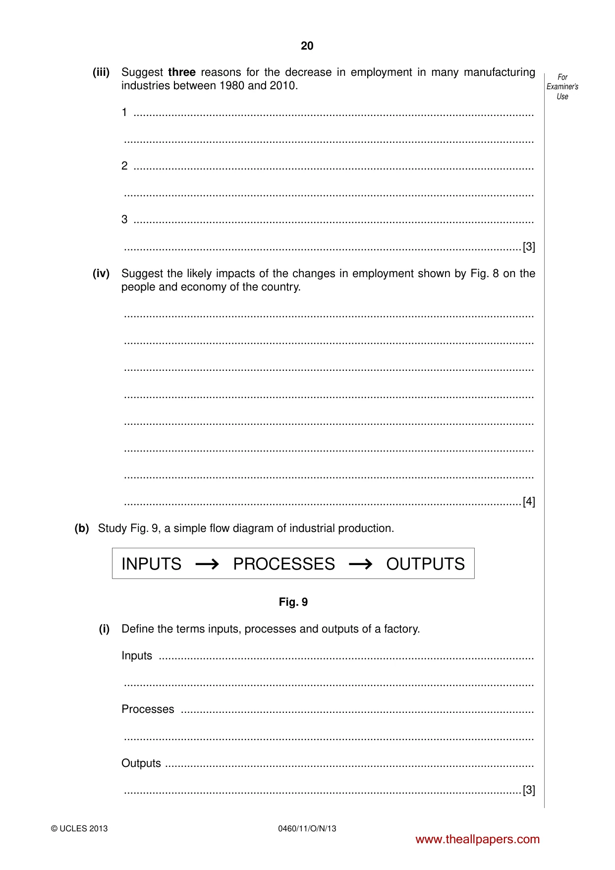
20 0460/11/O/N/13 © UCLES 2013 For Examiner’s Use (iii) Suggest three reasons for the decrease in employment in many manufacturing industries between 1980 and 2010. 1 … … 2 … … 3 … …[3] (iv) Suggest the likely impacts of the changes in employment shown by Fig. 8 on the people and economy of the country. … … … … … … … …[4] (b) Study Fig. 9, a simple flow diagram of industrial production. INPUTS PROCESSES OUTPUTS Fig. 9 (i) Define the terms inputs, processes and outputs of a factory. Inputs … … Processes … … Outputs … …[3] www.theallpapers.com
Question paper, page 21
21 0460/11/O/N/13 © UCLES 2013 [Turn over For Examiner’s Use (ii) Name a type of manufacturing (or processing) industry which you have studied. (You must NOT choose a high technology industry). To what extent did the raw materials used influence the location of the industry which you have named? Explain your answer. Type of manufacturing (or processing) industry … … … … … … … … … …[5] www.theallpapers.com
Question paper, page 22
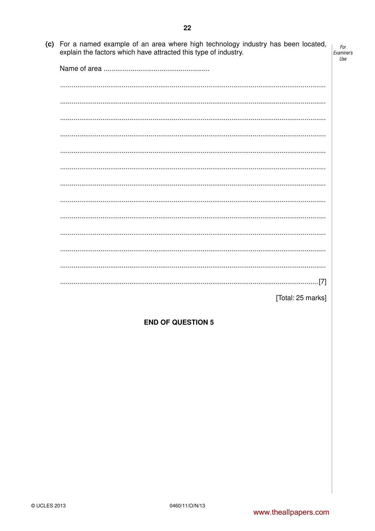
22 0460/11/O/N/13 © UCLES 2013 For Examiner’s Use (c) For a named example of an area where high technology industry has been located, explain the factors which have attracted this type of industry. Name of area … … … … … … … … … … … … … …[7] [Total: 25 marks] END OF QUESTION 5 www.theallpapers.com
Question paper, page 23
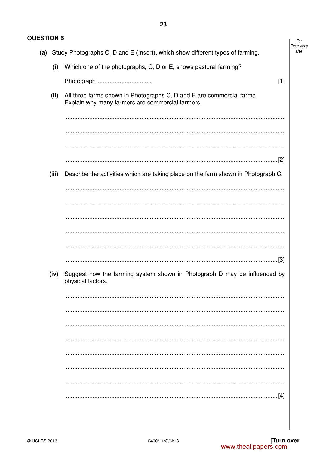
23 0460/11/O/N/13 © UCLES 2013 [Turn over For Examiner’s Use QUESTION 6 (a) Study Photographs C, D and E (Insert), which show different types of farming. (i) Which one of the photographs, C, D or E, shows pastoral farming? Photograph … [1] (ii) All three farms shown in Photographs C, D and E are commercial farms. Explain why many farmers are commercial farmers. … … … …[2] (iii) Describe the activities which are taking place on the farm shown in Photograph C. … … … … … …[3] (iv) Suggest how the farming system shown in Photograph D may be influenced by physical factors. … … … … … … … …[4] www.theallpapers.com
Question paper, page 24
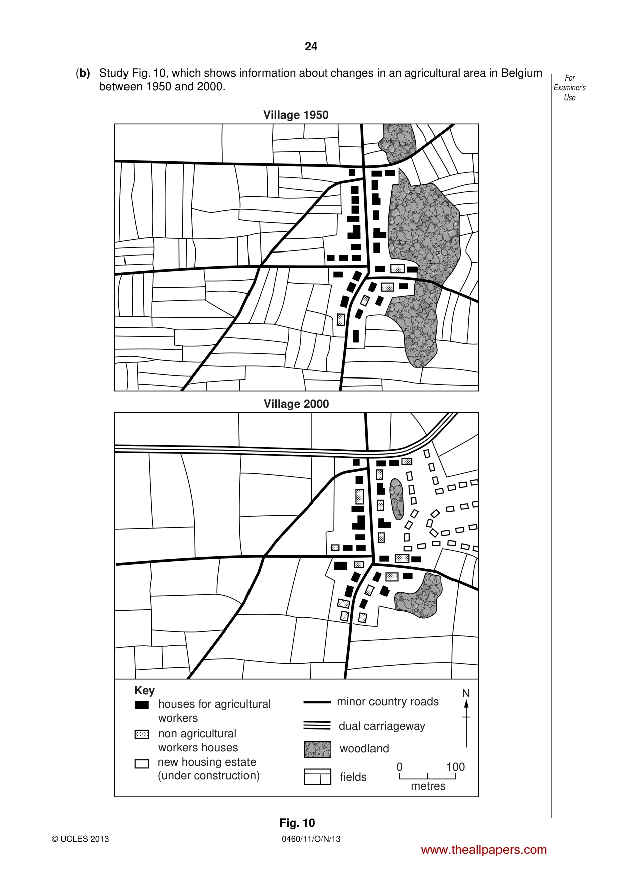
24 0460/11/O/N/13 © UCLES 2013 For Examiner’s Use (b) Study Fig. 10, which shows information about changes in an agricultural area in Belgium between 1950 and 2000. houses for agricultural workers non agricultural workers houses new housing estate (under construction) minor country roads dual carriageway woodland fields metres 0 100 N Key Village 2000 Village 1950 Fig. 10 www.theallpapers.com
Question paper, page 25
25 0460/11/O/N/13 © UCLES 2013 [Turn over For Examiner’s Use (i) Identify three changes which have taken place in the area shown by Fig. 10 between 1950 and 2000. 1 … … 2 … … 3 … …[3] (ii) Suggest ways in which commercial farmers in the area shown in Fig. 10 may have been able to increase their output. … … … … … … … … … …[5] www.theallpapers.com
Question paper, page 26
26 0460/11/O/N/13 © UCLES 2013 For Examiner’s Use (c) For a named area or country you have studied which suffers from food shortage, explain why there is a shortage of food. Name of area or country … … … … … … … … … … … … … … …[7] [Total: 25 marks] END OF QUESTION 6 www.theallpapers.com
Question paper, page 27
27 0460/11/O/N/13 © UCLES 2013 For Examiner’s Use Additional Page If you use the following lined page to complete the answer(s) to any question(s), the question number(s) must be clearly shown. … … … … … … … … … … … … … … … … … … … … … … … … … … www.theallpapers.com
Question paper, page 28
28 0460/11/O/N/13 © UCLES 2013 Copyright Acknowledgements: Question 2 Figs 3A & 3B © N Graves et al; People & Environment: A World Perspective; Heinemann Educational; 1987. Question 2 Figs 4A, 4B & 4C © J Baumber et al; Questioning Geography; Collins Educational; 1984. Question 3 Photograph A S. Sibley © UCLES. Question 4 Photograph B S. Sibley © UCLES. Question 6 Photographs C, D & E S. Sibley © UCLES. Permission to reproduce items where third-party owned material protected by copyright is included has been sought and cleared where possible. Every reasonable effort has been made by the publisher (UCLES) to trace copyright holders, but if any items requiring clearance have unwittingly been included, the publisher will be pleased to make amends at the earliest possible opportunity. University of Cambridge International Examinations is part of the Cambridge Assessment Group. Cambridge Assessment is the brand name of University of Cambridge Local Examinations Syndicate (UCLES), which is itself a department of the University of Cambridge. BLANK PAGE www.theallpapers.com
Mark scheme, page 1
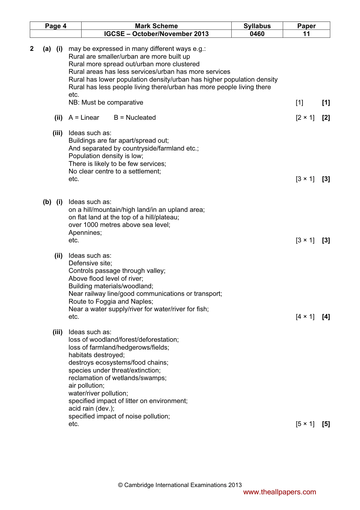
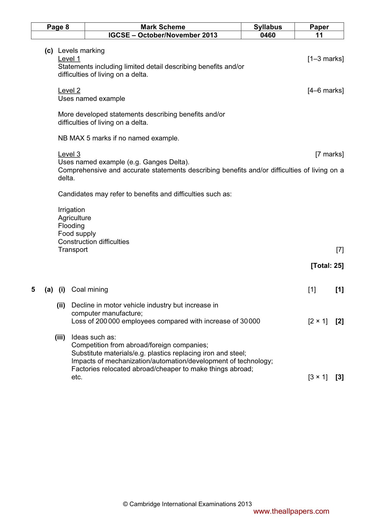
CAMBRIDGE INTERNATIONAL EXAMINATIONS International General Certificate of Secondary Education MARK SCHEME for the October/November 2013 series 0460 GEOGRAPHY 0460/11 Paper 1, maximum raw mark 75 This mark scheme is published as an aid to teachers and candidates, to indicate the requirements of the examination. It shows the basis on which Examiners were instructed to award marks. It does not indicate the details of the discussions that took place at an Examiners’ meeting before marking began, which would have considered the acceptability of alternative answers. Mark schemes should be read in conjunction with the question paper and the Principal Examiner Report for Teachers. Cambridge will not enter into discussions about these mark schemes. Cambridge is publishing the mark schemes for the October/November 2013 series for most IGCSE, GCE Advanced Level and Advanced Subsidiary Level components and some Ordinary Level components. www.theallpapers.com
Mark scheme, page 2
Page 2 Mark Scheme Syllabus Paper IGCSE – October/November 2013 0460 11 © Cambridge International Examinations 2013 1 (a) (i) 68.1babies/infants/children out of 1000 die in their 1st year/before their first birthday [1] [1] (ii) 10.2 – 8.00 [1] = 2.2 (per 1000) [1] [2 × 1] [2] (iii) Ideas such as: long life expectancy/higher life expectancy; good treatment of diseases/medicines/vaccinations/can afford medicines; good health care facilities/medical facilities/hospitals; investment in doctors/nurses etc.; investment in care homes/services for elderly; availability of pensions; good diet/food supply/no famine/no starvation/no hunger; no drought/good water supply; sanitation/hygiene; education/advertisements/government support about diseases/what’s good or bad for health; low levels of named diseases; etc. [3 × 1] [3] (iv) Ideas such as: Little availability of contraception/do not use protection/family planning; not educated re. Contraception/family planning; not likely to be able to afford contraception/family planning; likely to want children to work on the land; likely to want children to send out to earn money; likely to want children to look after parents in old age; not likely to be affected by government policy to reduce family size; likely to have large families due to tradition/culture; likely to have large families due to religious influences; high infant mortality rate/high death rate amongst children; want boys so keep trying; many women don’t work; male status/virility; people marry young; people have children from a younger age; etc. [4 × 1] [4] www.theallpapers.com
Mark scheme, page 3
Page 3 Mark Scheme Syllabus Paper IGCSE – October/November 2013 0460 11 © Cambridge International Examinations 2013 (b) (i) Ideas such as: Generally higher in Africa/lower in South America; Many between 2 and 3% in Africa most below 2% in South America; Some countries in both continents with same growth rates/some anomalies (or example of anomaly); Max 2 for evidence e.g.: 1 country & statistic from Africa; 1 country & statistic from South America; etc. [3 × 1] [3] (ii) Ideas such as: people do not have enough resources/overpopulation; such as food supplies/starvation occurs/famine (dev.); or overuse of agricultural land/overgrazing (dev.); lack of work; pressure on/poor access to/not enough education/want to improve education levels; want to reduce levels of disease or examples/not enough/poor access to health care/lack of hospitals/overcrowded hospitals/can’t afford hospitals; overcrowded housing/not enough space to live in/not enough houses; traffic congestion; atmospheric pollution; inadequate water supply/sanitation; deforestation/loss of natural vegetation; increased poverty; high cost for governments; low/less economic development; start to construct shanty towns; etc. NB: question is not about dependency [5 × 1] [5] (c) Levels marking Level 1 [1–3 marks)] Statements including limited detail which suggest reasons for international migration. Level 2 [4–6 marks] Uses named example. More developed statements which explain reasons for international migration. NB MAX 5 with no named example. Level 3 [7 marks] Uses named example (e.g. Turkey to Germany). Comprehensive and accurate statements referring to both pulls and pushes, including some place specific reference. [7] Candidates may refer to ideas such as: Employment opportunities Salary Services Food supply War Drought Natural disasters [Total: 25] www.theallpapers.com
Mark scheme, page 4
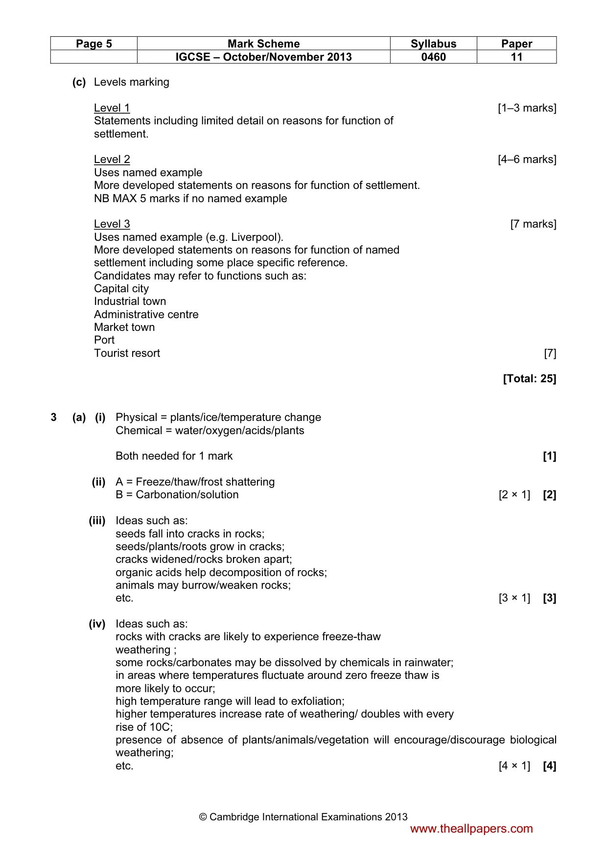
Page 4 Mark Scheme Syllabus Paper IGCSE – October/November 2013 0460 11 © Cambridge International Examinations 2013 2 (a) (i) may be expressed in many different ways e.g.: Rural are smaller/urban are more built up Rural more spread out/urban more clustered Rural areas has less services/urban has more services Rural has lower population density/urban has higher population density Rural has less people living there/urban has more people living there etc. NB: Must be comparative [1] [1] (ii) A = Linear B = Nucleated [2 × 1] [2] (iii) Ideas such as: Buildings are far apart/spread out; And separated by countryside/farmland etc.; Population density is low; There is likely to be few services; No clear centre to a settlement; etc. [3 × 1] [3] (b) (i) Ideas such as: on a hill/mountain/high land/in an upland area; on flat land at the top of a hill/plateau; over 1000 metres above sea level; Apennines; etc. [3 × 1] [3] (ii) Ideas such as: Defensive site; Controls passage through valley; Above flood level of river; Building materials/woodland; Near railway line/good communications or transport; Route to Foggia and Naples; Near a water supply/river for water/river for fish; etc. [4 × 1] [4] (iii) Ideas such as: loss of woodland/forest/deforestation; loss of farmland/hedgerows/fields; habitats destroyed; destroys ecosystems/food chains; species under threat/extinction; reclamation of wetlands/swamps; air pollution; water/river pollution; specified impact of litter on environment; acid rain (dev.); specified impact of noise pollution; etc. [5 × 1] [5] www.theallpapers.com
Mark scheme, page 5
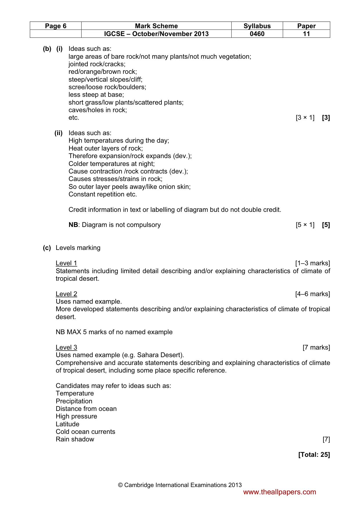
Page 5 Mark Scheme Syllabus Paper IGCSE – October/November 2013 0460 11 © Cambridge International Examinations 2013 (c) Levels marking Level 1 [1–3 marks] Statements including limited detail on reasons for function of settlement. Level 2 [4–6 marks] Uses named example More developed statements on reasons for function of settlement. NB MAX 5 marks if no named example Level 3 [7 marks] Uses named example (e.g. Liverpool). More developed statements on reasons for function of named settlement including some place specific reference. Candidates may refer to functions such as: Capital city Industrial town Administrative centre Market town Port Tourist resort [7] [Total: 25] 3 (a) (i) Physical = plants/ice/temperature change Chemical = water/oxygen/acids/plants Both needed for 1 mark [1] (ii) A = Freeze/thaw/frost shattering B = Carbonation/solution [2 × 1] [2] (iii) Ideas such as: seeds fall into cracks in rocks; seeds/plants/roots grow in cracks; cracks widened/rocks broken apart; organic acids help decomposition of rocks; animals may burrow/weaken rocks; etc. [3 × 1] [3] (iv) Ideas such as: rocks with cracks are likely to experience freeze-thaw weathering ; some rocks/carbonates may be dissolved by chemicals in rainwater; in areas where temperatures fluctuate around zero freeze thaw is more likely to occur; high temperature range will lead to exfoliation; higher temperatures increase rate of weathering/ doubles with every rise of 10C; presence of absence of plants/animals/vegetation will encourage/discourage biological weathering; etc. [4 × 1] [4] www.theallpapers.com
Mark scheme, page 6
Page 6 Mark Scheme Syllabus Paper IGCSE – October/November 2013 0460 11 © Cambridge International Examinations 2013 (b) (i) Ideas such as: large areas of bare rock/not many plants/not much vegetation; jointed rock/cracks; red/orange/brown rock; steep/vertical slopes/cliff; scree/loose rock/boulders; less steep at base; short grass/low plants/scattered plants; caves/holes in rock; etc. [3 × 1] [3] (ii) Ideas such as: High temperatures during the day; Heat outer layers of rock; Therefore expansion/rock expands (dev.); Colder temperatures at night; Cause contraction /rock contracts (dev.); Causes stresses/strains in rock; So outer layer peels away/like onion skin; Constant repetition etc. Credit information in text or labelling of diagram but do not double credit. NB: Diagram is not compulsory [5 × 1] [5] (c) Levels marking Level 1 [1–3 marks] Statements including limited detail describing and/or explaining characteristics of climate of tropical desert. Level 2 [4–6 marks] Uses named example. More developed statements describing and/or explaining characteristics of climate of tropical desert. NB MAX 5 marks of no named example Level 3 [7 marks] Uses named example (e.g. Sahara Desert). Comprehensive and accurate statements describing and explaining characteristics of climate of tropical desert, including some place specific reference. Candidates may refer to ideas such as: Temperature Precipitation Distance from ocean High pressure Latitude Cold ocean currents Rain shadow [7] [Total: 25] www.theallpapers.com
Mark scheme, page 7
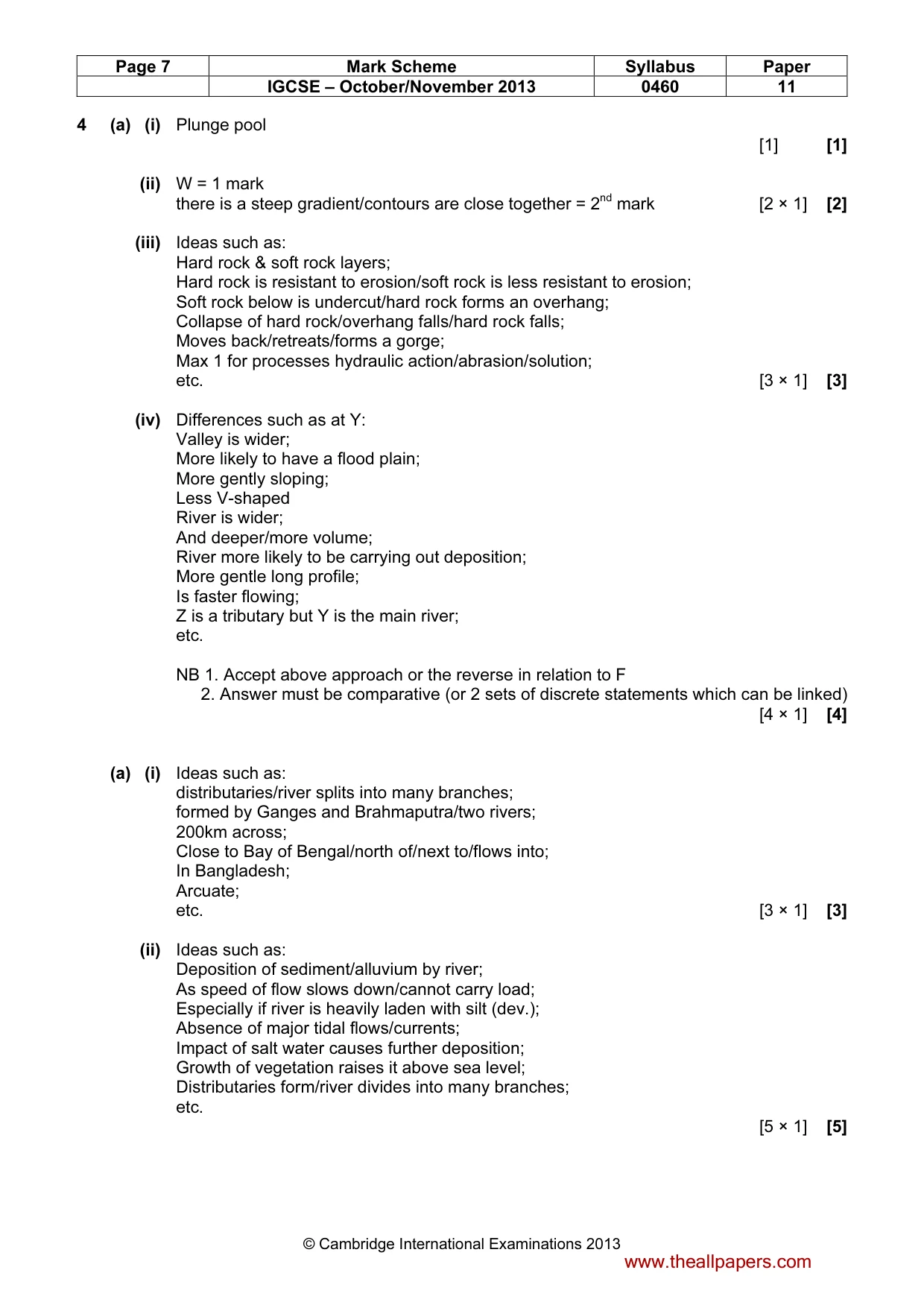
Page 7 Mark Scheme Syllabus Paper IGCSE – October/November 2013 0460 11 © Cambridge International Examinations 2013 4 (a) (i) Plunge pool [1] [1] (ii) W = 1 mark there is a steep gradient/contours are close together = 2nd mark [2 × 1] [2] (iii) Ideas such as: Hard rock & soft rock layers; Hard rock is resistant to erosion/soft rock is less resistant to erosion; Soft rock below is undercut/hard rock forms an overhang; Collapse of hard rock/overhang falls/hard rock falls; Moves back/retreats/forms a gorge; Max 1 for processes hydraulic action/abrasion/solution; etc. [3 × 1] [3] (iv) Differences such as at Y: Valley is wider; More likely to have a flood plain; More gently sloping; Less V-shaped River is wider; And deeper/more volume; River more likely to be carrying out deposition; More gentle long profile; Is faster flowing; Z is a tributary but Y is the main river; etc. NB 1. Accept above approach or the reverse in relation to F 2. Answer must be comparative (or 2 sets of discrete statements which can be linked) [4 × 1] [4] (a) (i) Ideas such as: distributaries/river splits into many branches; formed by Ganges and Brahmaputra/two rivers; 200km across; Close to Bay of Bengal/north of/next to/flows into; In Bangladesh; Arcuate; etc. [3 × 1] [3] (ii) Ideas such as: Deposition of sediment/alluvium by river; As speed of flow slows down/cannot carry load; Especially if river is heavily laden with silt (dev.); Absence of major tidal flows/currents; Impact of salt water causes further deposition; Growth of vegetation raises it above sea level; Distributaries form/river divides into many branches; etc. [5 × 1] [5] www.theallpapers.com
Mark scheme, page 8
Page 8 Mark Scheme Syllabus Paper IGCSE – October/November 2013 0460 11 © Cambridge International Examinations 2013 (c) Levels marking Level 1 [1–3 marks] Statements including limited detail describing benefits and/or difficulties of living on a delta. Level 2 [4–6 marks] Uses named example More developed statements describing benefits and/or difficulties of living on a delta. NB MAX 5 marks if no named example. Level 3 [7 marks] Uses named example (e.g. Ganges Delta). Comprehensive and accurate statements describing benefits and/or difficulties of living on a delta. Candidates may refer to benefits and difficulties such as: Irrigation Agriculture Flooding Food supply Construction difficulties Transport [7] [Total: 25] 5 (a) (i) Coal mining [1] [1] (ii) Decline in motor vehicle industry but increase in computer manufacture; Loss of 200 000 employees compared with increase of 30 000 [2 × 1] [2] (iii) Ideas such as: Competition from abroad/foreign companies; Substitute materials/e.g. plastics replacing iron and steel; Impacts of mechanization/automation/development of technology; Factories relocated abroad/cheaper to make things abroad; etc. [3 × 1] [3] www.theallpapers.com
Mark scheme, page 9
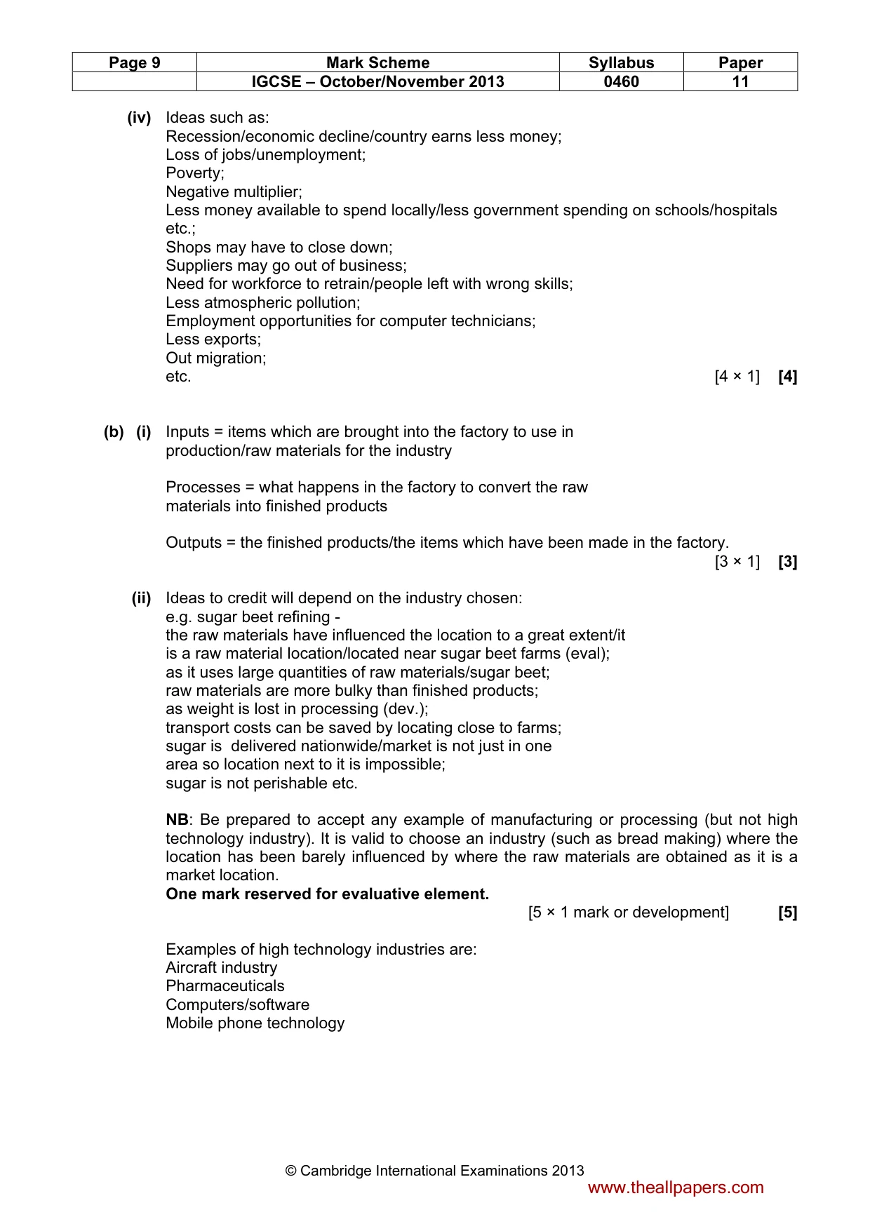
Page 9 Mark Scheme Syllabus Paper IGCSE – October/November 2013 0460 11 © Cambridge International Examinations 2013 (iv) Ideas such as: Recession/economic decline/country earns less money; Loss of jobs/unemployment; Poverty; Negative multiplier; Less money available to spend locally/less government spending on schools/hospitals etc.; Shops may have to close down; Suppliers may go out of business; Need for workforce to retrain/people left with wrong skills; Less atmospheric pollution; Employment opportunities for computer technicians; Less exports; Out migration; etc. [4 × 1] [4] (b) (i) Inputs = items which are brought into the factory to use in production/raw materials for the industry Processes = what happens in the factory to convert the raw materials into finished products Outputs = the finished products/the items which have been made in the factory. [3 × 1] [3] (ii) Ideas to credit will depend on the industry chosen: e.g. sugar beet refining - the raw materials have influenced the location to a great extent/it is a raw material location/located near sugar beet farms (eval); as it uses large quantities of raw materials/sugar beet; raw materials are more bulky than finished products; as weight is lost in processing (dev.); transport costs can be saved by locating close to farms; sugar is delivered nationwide/market is not just in one area so location next to it is impossible; sugar is not perishable etc. NB: Be prepared to accept any example of manufacturing or processing (but not high technology industry). It is valid to choose an industry (such as bread making) where the location has been barely influenced by where the raw materials are obtained as it is a market location. One mark reserved for evaluative element. [5 × 1 mark or development] [5] Examples of high technology industries are: Aircraft industry Pharmaceuticals Computers/software Mobile phone technology www.theallpapers.com
Mark scheme, page 10
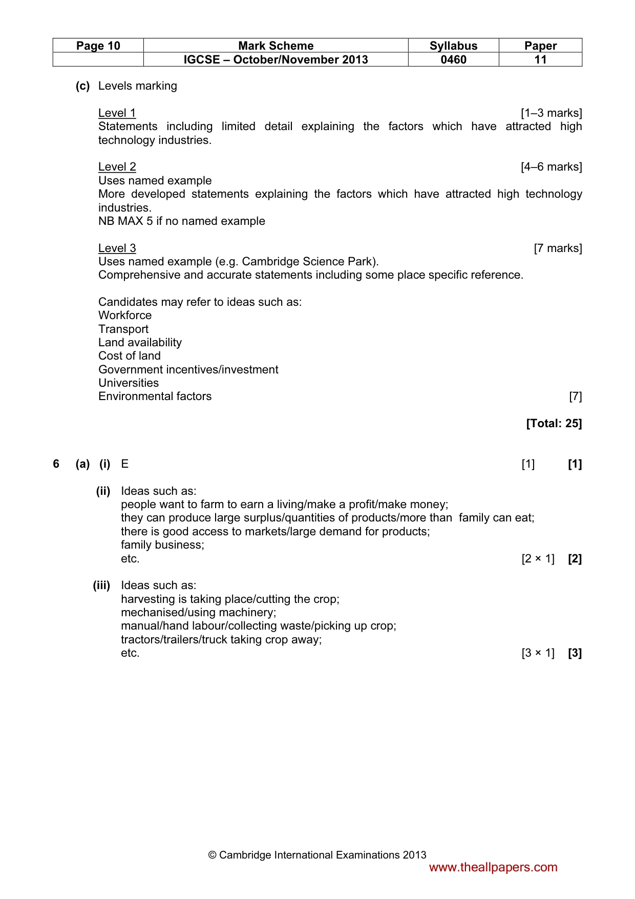
Page 10 Mark Scheme Syllabus Paper IGCSE – October/November 2013 0460 11 © Cambridge International Examinations 2013 (c) Levels marking Level 1 [1–3 marks] Statements including limited detail explaining the factors which have attracted high technology industries. Level 2 [4–6 marks] Uses named example More developed statements explaining the factors which have attracted high technology industries. NB MAX 5 if no named example Level 3 [7 marks] Uses named example (e.g. Cambridge Science Park). Comprehensive and accurate statements including some place specific reference. Candidates may refer to ideas such as: Workforce Transport Land availability Cost of land Government incentives/investment Universities Environmental factors [7] [Total: 25] 6 (a) (i) E [1] [1] (ii) Ideas such as: people want to farm to earn a living/make a profit/make money; they can produce large surplus/quantities of products/more than family can eat; there is good access to markets/large demand for products; family business; etc. [2 × 1] [2] (iii) Ideas such as: harvesting is taking place/cutting the crop; mechanised/using machinery; manual/hand labour/collecting waste/picking up crop; tractors/trailers/truck taking crop away; etc. [3 × 1] [3] www.theallpapers.com
Mark scheme, page 11
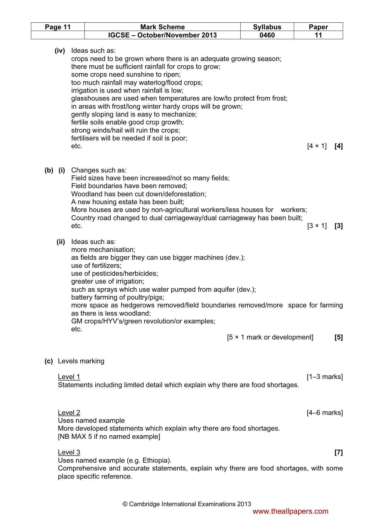
Page 11 Mark Scheme Syllabus Paper IGCSE – October/November 2013 0460 11 © Cambridge International Examinations 2013 (iv) Ideas such as: crops need to be grown where there is an adequate growing season; there must be sufficient rainfall for crops to grow; some crops need sunshine to ripen; too much rainfall may waterlog/flood crops; irrigation is used when rainfall is low; glasshouses are used when temperatures are low/to protect from frost; in areas with frost/long winter hardy crops will be grown; gently sloping land is easy to mechanize; fertile soils enable good crop growth; strong winds/hail will ruin the crops; fertilisers will be needed if soil is poor; etc. [4 × 1] [4] (b) (i) Changes such as: Field sizes have been increased/not so many fields; Field boundaries have been removed; Woodland has been cut down/deforestation; A new housing estate has been built; More houses are used by non-agricultural workers/less houses for workers; Country road changed to dual carriageway/dual carriageway has been built; etc. [3 × 1] [3] (ii) Ideas such as: more mechanisation; as fields are bigger they can use bigger machines (dev.); use of fertilizers; use of pesticides/herbicides; greater use of irrigation; such as sprays which use water pumped from aquifer (dev.); battery farming of poultry/pigs; more space as hedgerows removed/field boundaries removed/more space for farming as there is less woodland; GM crops/HYV’s/green revolution/or examples; etc. [5 × 1 mark or development] [5] (c) Levels marking Level 1 [1–3 marks] Statements including limited detail which explain why there are food shortages. Level 2 [4–6 marks] Uses named example More developed statements which explain why there are food shortages. [NB MAX 5 if no named example] Level 3 [7] Uses named example (e.g. Ethiopia). Comprehensive and accurate statements, explain why there are food shortages, with some place specific reference. www.theallpapers.com
Mark scheme, page 12
Page 12 Mark Scheme Syllabus Paper IGCSE – October/November 2013 0460 11 © Cambridge International Examinations 2013 Candidates may refer to ideas such as: Drought Extreme weather events Flooding Poor farming practices War Lack of agricultural technology/knowledge Natural disaster [7] [Total: 25] www.theallpapers.com
What you needed in this session
Cambridge’s own grade thresholds for 2013 Oct/Nov, Paper 1 · Variant 1. A higher threshold means an easier paper — the bar moves with how the cohort did.