Cambridge IGCSE Environmental Management 0680 — 2013 May/June Paper 2 · Variant 1
0680/21/M/J/13 · 80 marks · ≈90 min
The question paper and its mark scheme, free to read here and free to download. This is Cambridge’s own paper, exactly as it was sat.
Question paper16 pages


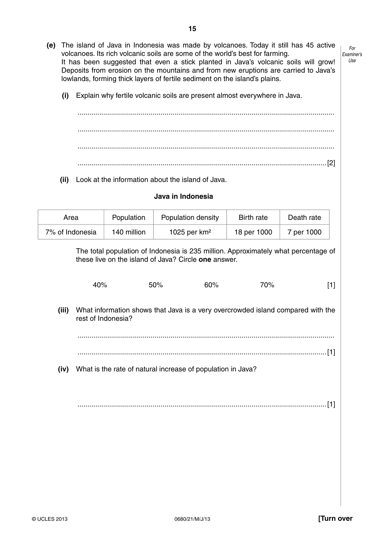
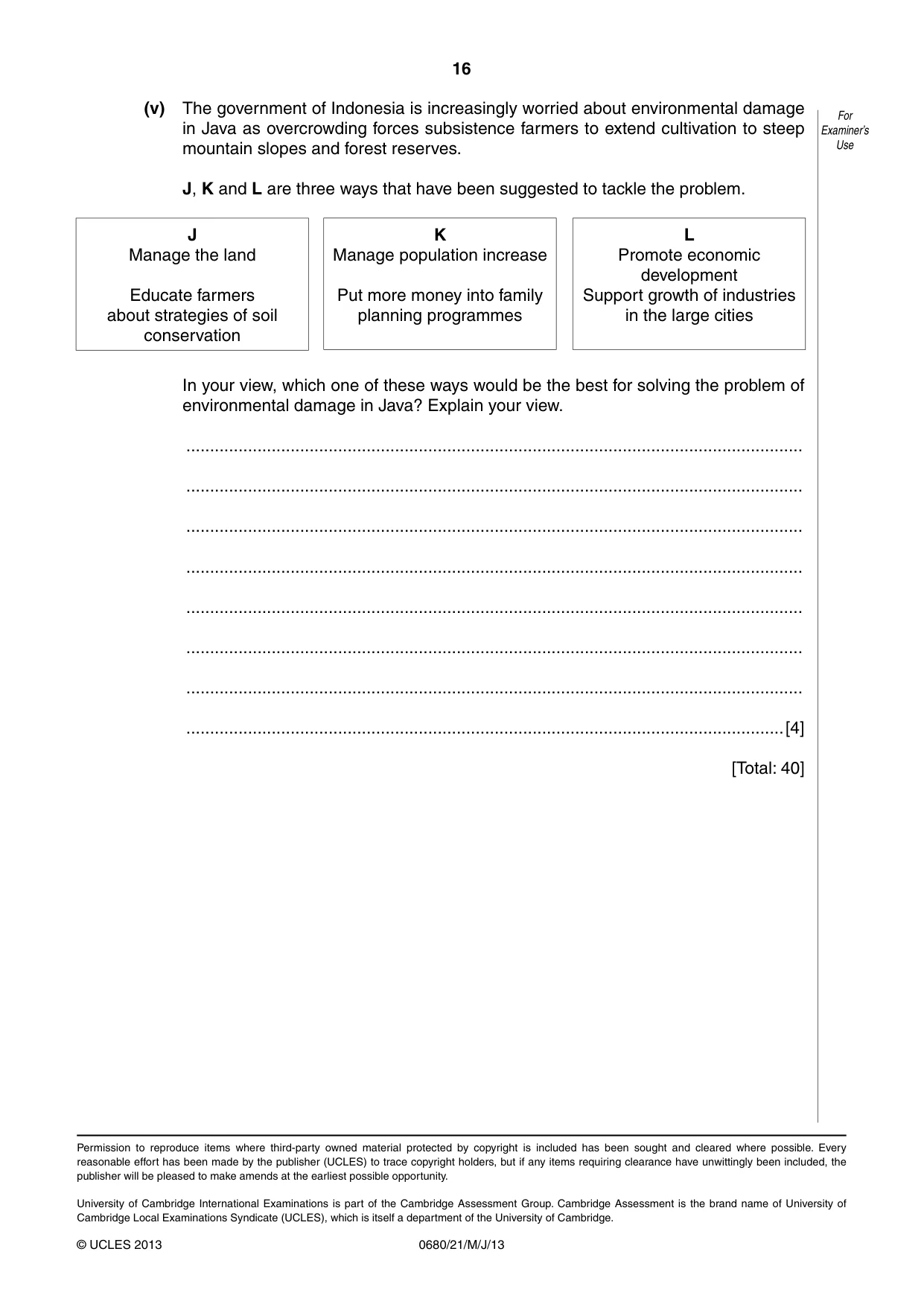
Mark scheme9 pages
Answers below. Sit the paper first if you are practising.

Paper as text
Question paper, page 1
This document consists of 16 printed pages. DC (LEG/JG) 61077/3 © UCLES 2013 [Turn over UNIVERSITY OF CAMBRIDGE INTERNATIONAL EXAMINATIONS International General Certificate of Secondary Education * 3 6 2 4 1 7 4 9 6 3 * ENVIRONMENTAL MANAGEMENT 0680/21 Paper 2 May/June 2013 1 hour 45 minutes Candidates answer on the Question Paper. Additional Materials: Ruler READ THESE INSTRUCTIONS FIRST Write your Centre number, candidate number and name on all the work you hand in. Write in dark blue or black pen. You may use a soft pencil for any diagrams, graphs or rough working. Do not use staples, paper clips, highlighters, glue or correction fluid. DO NOT WRITE IN ANY BARCODES. Electronic calculators may be used. Answer both questions. At the end of the examination, fasten all your work securely together. The number of marks is given in brackets [ ] at the end of each question or part question. For Examiner’s Use 1 2 Total
Question paper, page 2
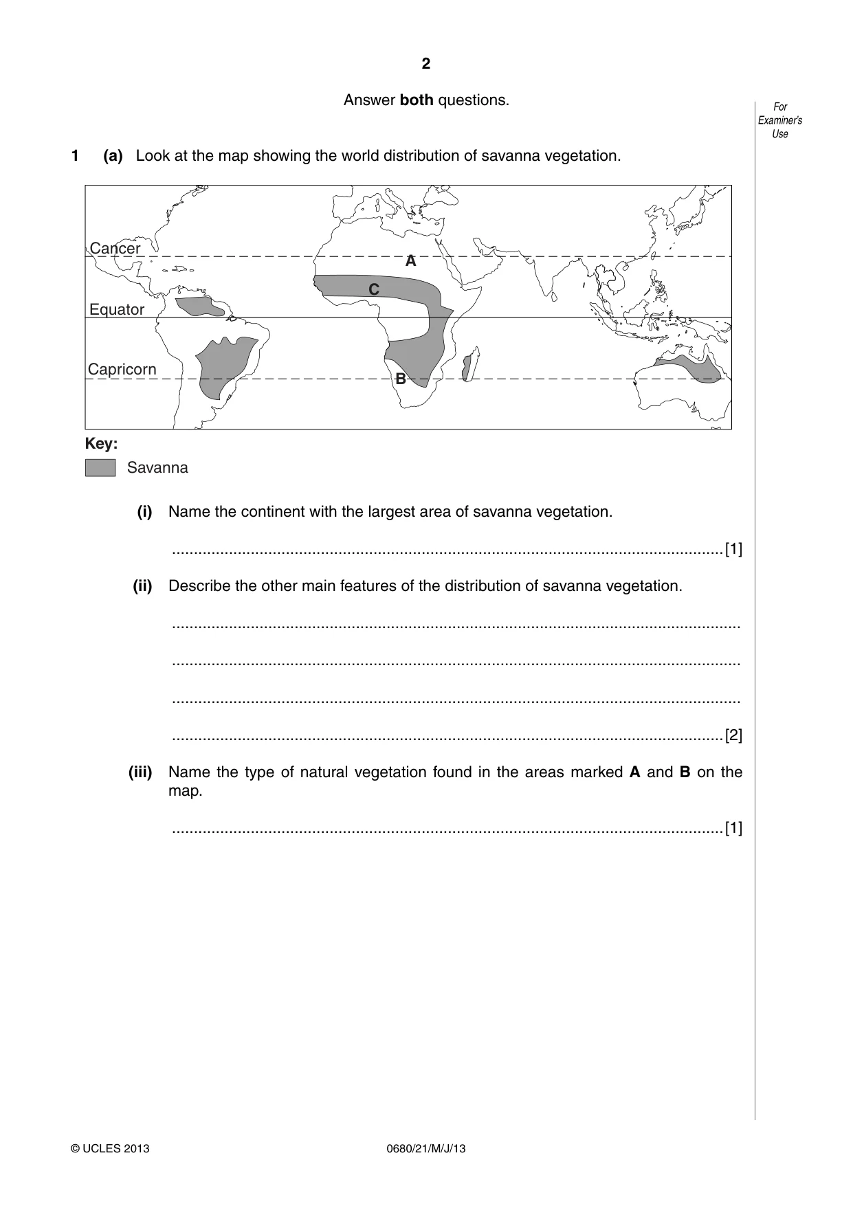
2 0680/21/M/J/13 © UCLES 2013 For Examiner’s Use Answer both questions. 1 (a) Look at the map showing the world distribution of savanna vegetation. A B C Cancer Capricorn Equator Savanna Key: (i) Name the continent with the largest area of savanna vegetation. …[1] (ii) Describe the other main features of the distribution of savanna vegetation. … … … …[2] (iii) Name the type of natural vegetation found in the areas marked A and B on the map. …[1]
Question paper, page 3
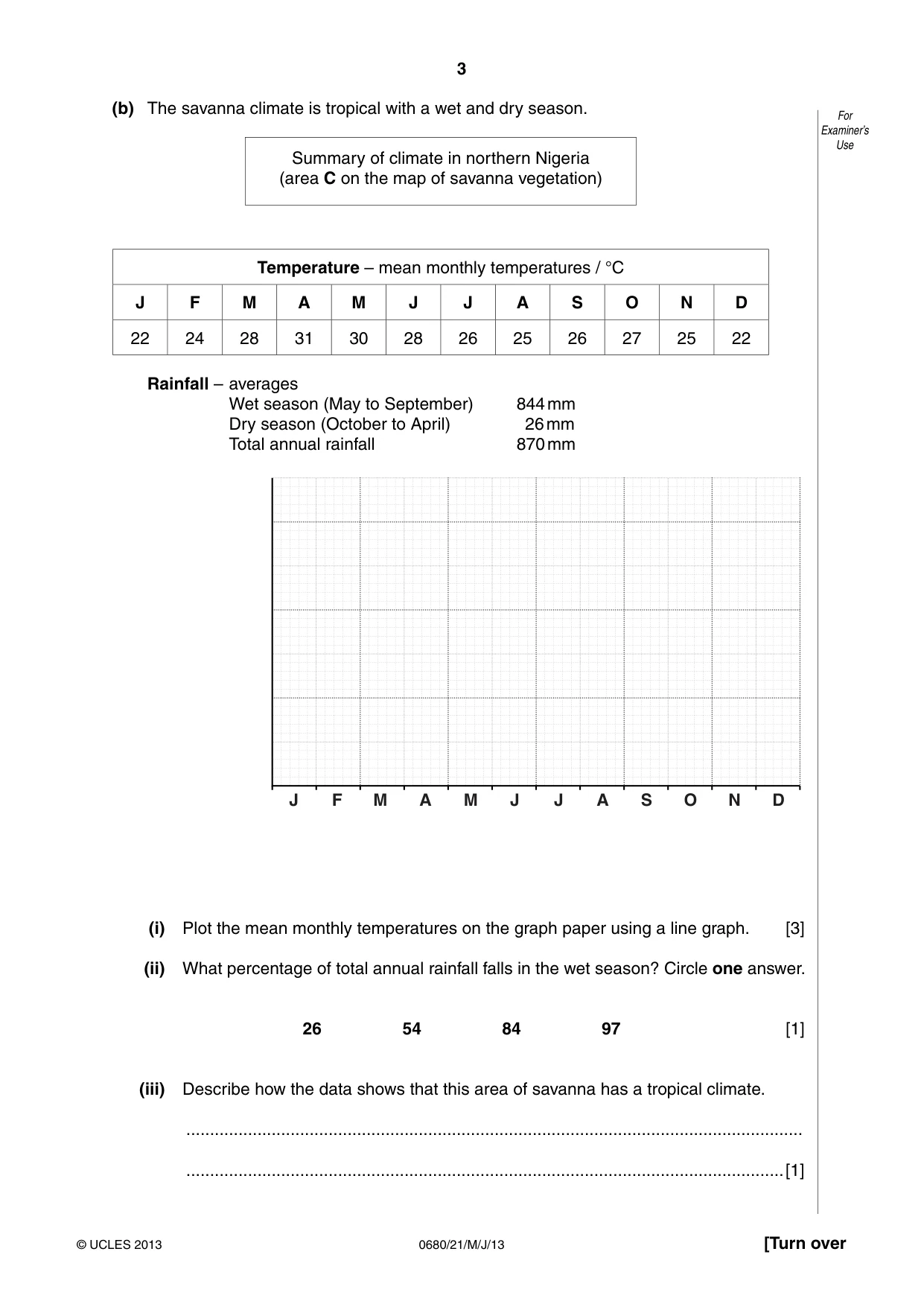
3 0680/21/M/J/13 © UCLES 2013 [Turn over For Examiner’s Use (b) The savanna climate is tropical with a wet and dry season. Summary of climate in northern Nigeria (area C on the map of savanna vegetation) Temperature – mean monthly temperatures / °C J F M A M J J A S O N D 22 24 28 31 30 28 26 25 26 27 25 22 Rainfall – averages Wet season (May to September) 844 mm Dry season (October to April) 26 mm Total annual rainfall 870 mm J F M A M J J A S O N D (i) Plot the mean monthly temperatures on the graph paper using a line graph. [3] (ii) What percentage of total annual rainfall falls in the wet season? Circle one answer. 26 54 84 97 [1] (iii) Describe how the data shows that this area of savanna has a tropical climate. … …[1]
Question paper, page 4
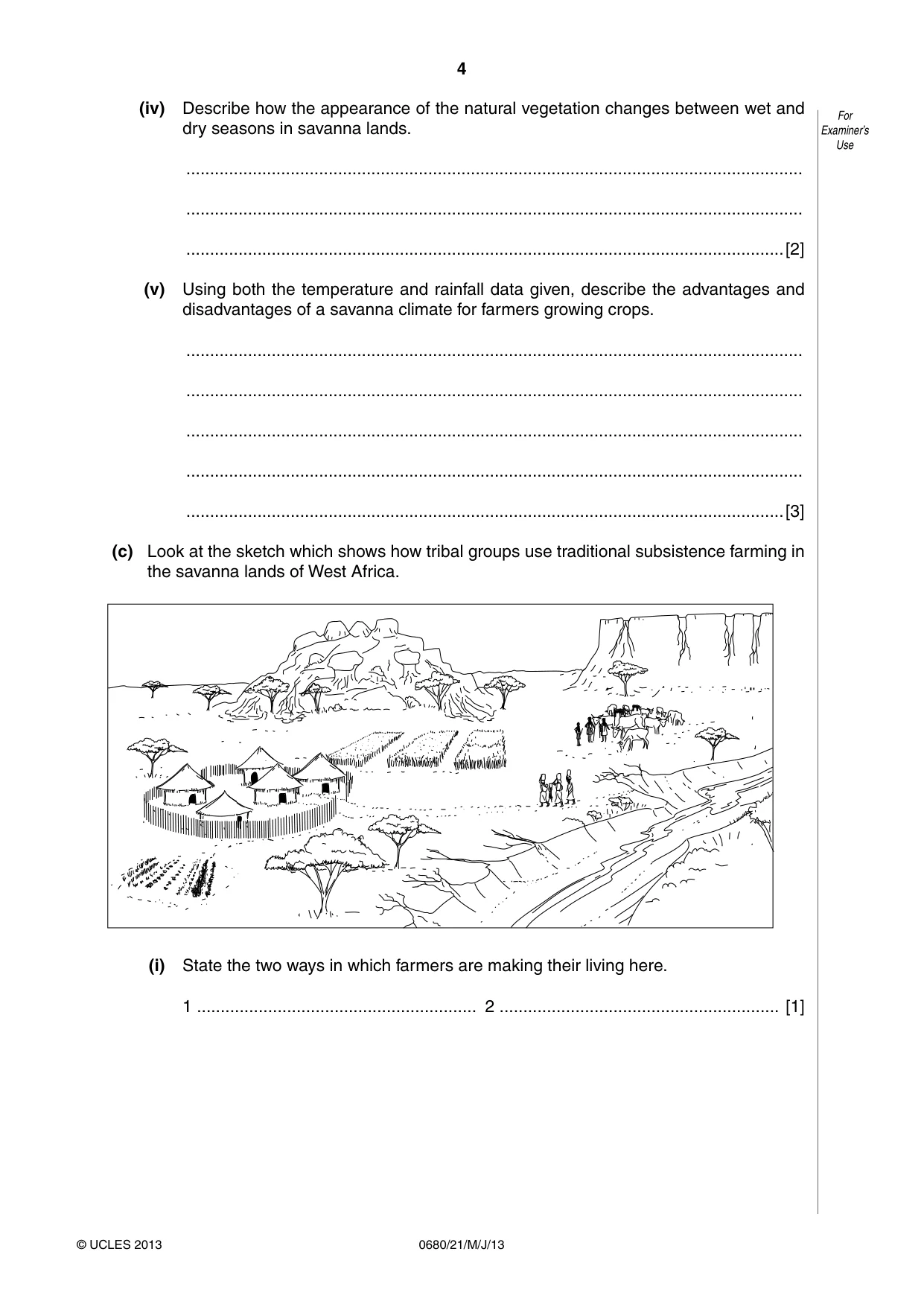
4 0680/21/M/J/13 © UCLES 2013 For Examiner’s Use (iv) Describe how the appearance of the natural vegetation changes between wet and dry seasons in savanna lands. … … …[2] (v) Using both the temperature and rainfall data given, describe the advantages and disadvantages of a savanna climate for farmers growing crops. … … … … …[3] (c) Look at the sketch which shows how tribal groups use traditional subsistence farming in the savanna lands of West Africa. (i) State the two ways in which farmers are making their living here. 1 … 2 … [1]
Question paper, page 5
5 0680/21/M/J/13 © UCLES 2013 [Turn over For Examiner’s Use (ii) Looking at the sketch, describe how it shows that this is an area of traditional subsistence farming. … … … … …[3] (iii) How different would the sketch look if this was an area of modern commercial farming instead of traditional subsistence farming? Suggest two ways. … … … …[2] (d) Population growth is increasing pressure on the land and the risk of soil erosion in many countries in the savanna lands of West Africa. (i) State the evidence from the sketch which shows that this area is at high risk of soil erosion. … … … …[2]
Question paper, page 6
6 0680/21/M/J/13 © UCLES 2013 For Examiner’s Use (ii) Four strategies of soil conservation are D tree planting E dry land farming F rural development programmes G community participation Choose two of these strategies. For each one, describe how it reduces the risk of soil erosion and helps with soil conservation. Letter … … … … … Letter … … … … …[4] (iii) Introducing strategies of soil conservation is difficult in areas like the one shown in the sketch on page 4. Suggest some of the difficulties. … … … … … …[3]
Question paper, page 7
7 0680/21/M/J/13 © UCLES 2013 [Turn over For Examiner’s Use (iv) Give reasons why population growth continues to be high in developing countries like those in the savanna land of West Africa. … … … … … … … … … …[5]
Question paper, page 8
8 0680/21/M/J/13 © UCLES 2013 For Examiner’s Use (e) Look at the rainfall diagram. It shows rainfall totals for the month of April at Kisumu in Kenya during a period of 30 years. Kisumu has a savanna climate and April is in the middle of the wet season. Each dot shows a rainfall total for April in one of the 30 years. How August rainfall totals varied during a period of 30 years Kisumu – Kenya 0 50 100 150 200 250 300 350 400 rainfall / mm (i) Average (mean) monthly rainfall at Kisumu in April is 188 mm. Show this average value on the diagram using a cross (X). [1] (ii) What is the size of the difference in the amount of rainfall (in mm) between the wettest and driest months of April during this 30 year period? … mm. [1]
Question paper, page 9
9 0680/21/M/J/13 © UCLES 2013 [Turn over For Examiner’s Use (iii) How and why do rainfall variations from year to year, like the ones shown in Kisumu, cause problems for subsistence farmers living in savanna lands? Refer to years with both higher and lower than average values. … … … … … … … …[4] [Total: 40]
Question paper, page 10
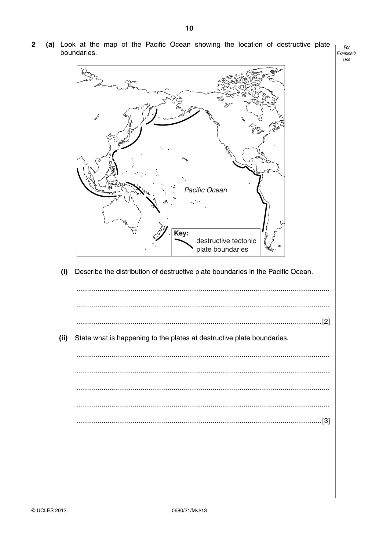
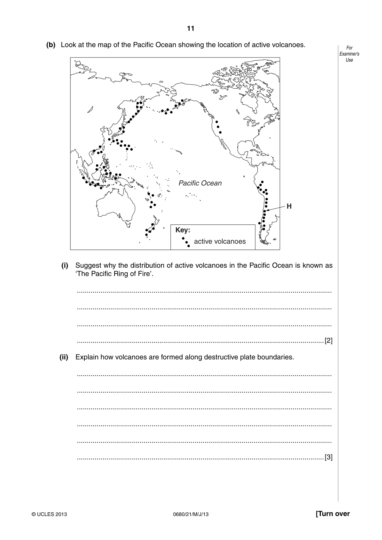
10 0680/21/M/J/13 © UCLES 2013 For Examiner’s Use 2 (a) Look at the map of the Pacific Ocean showing the location of destructive plate boundaries. Pacific Ocean Key: destructive tectonic plate boundaries (i) Describe the distribution of destructive plate boundaries in the Pacific Ocean. … … …[2] (ii) State what is happening to the plates at destructive plate boundaries. … … … … …[3]
Question paper, page 11
11 0680/21/M/J/13 © UCLES 2013 [Turn over For Examiner’s Use (b) Look at the map of the Pacific Ocean showing the location of active volcanoes. H Pacific Ocean Key: active volcanoes (i) Suggest why the distribution of active volcanoes in the Pacific Ocean is known as ‘The Pacific Ring of Fire’. … … … …[2] (ii) Explain how volcanoes are formed along destructive plate boundaries. … … … … … …[3]
Question paper, page 12
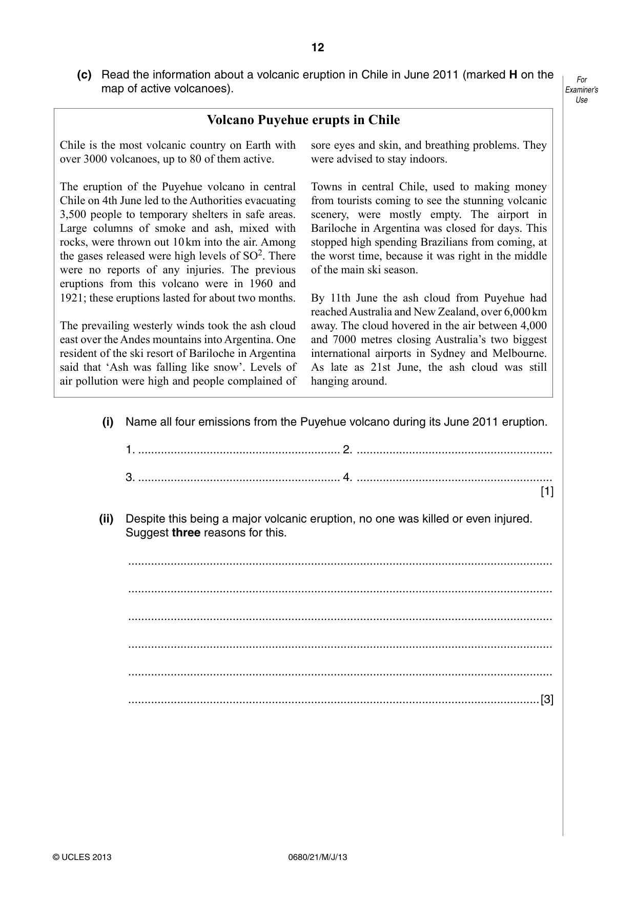
12 0680/21/M/J/13 © UCLES 2013 For Examiner’s Use (c) Read the information about a volcanic eruption in Chile in June 2011 (marked H on the map of active volcanoes). Volcano Puyehue erupts in Chile Chile is the most volcanic country on Earth with over 3000 volcanoes, up to 80 of them active. The eruption of the Puyehue volcano in central Chile on 4th June led to the Authorities evacuating 3,500 people to temporary shelters in safe areas. Large columns of smoke and ash, mixed with rocks, were thrown out 10 km into the air. Among the gases released were high levels of SO2. There were no reports of any injuries. The previous eruptions from this volcano were in 1960 and 1921; these eruptions lasted for about two months. The prevailing westerly winds took the ash cloud east over the Andes mountains into Argentina. One resident of the ski resort of Bariloche in Argentina said that ‘Ash was falling like snow’. Levels of air pollution were high and people complained of sore eyes and skin, and breathing problems. They were advised to stay indoors. Towns in central Chile, used to making money from tourists coming to see the stunning volcanic scenery, were mostly empty. The airport in Bariloche in Argentina was closed for days. This stopped high spending Brazilians from coming, at the worst time, because it was right in the middle of the main ski season. By 11th June the ash cloud from Puyehue had reached Australia and New Zealand, over 6,000 km away. The cloud hovered in the air between 4,000 and 7000 metres closing Australia’s two biggest international airports in Sydney and Melbourne. As late as 21st June, the ash cloud was still hanging around. (i) Name all four emissions from the Puyehue volcano during its June 2011 eruption. 1. … 2. … 3. … 4. … [1] (ii) Despite this being a major volcanic eruption, no one was killed or even injured. Suggest three reasons for this. … … … … … …[3]
Question paper, page 13
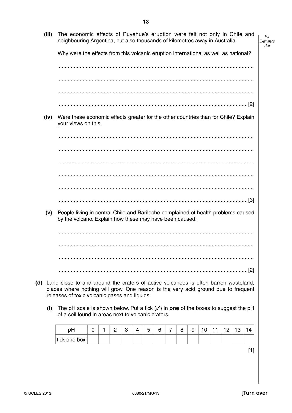
13 0680/21/M/J/13 © UCLES 2013 [Turn over For Examiner’s Use (iii) The economic effects of Puyehue’s eruption were felt not only in Chile and neighbouring Argentina, but also thousands of kilometres away in Australia. Why were the effects from this volcanic eruption international as well as national? … … … …[2] (iv) Were these economic effects greater for the other countries than for Chile? Explain your views on this. … … … … … …[3] (v) People living in central Chile and Bariloche complained of health problems caused by the volcano. Explain how these may have been caused. … … … …[2] (d) Land close to and around the craters of active volcanoes is often barren wasteland, places where nothing will grow. One reason is the very acid ground due to frequent releases of toxic volcanic gases and liquids. (i) The pH scale is shown below. Put a tick (✓) in one of the boxes to suggest the pH of a soil found in areas next to volcanic craters. pH 0 1 2 3 4 5 6 7 8 9 10 11 12 13 14 tick one box [1]
Question paper, page 14
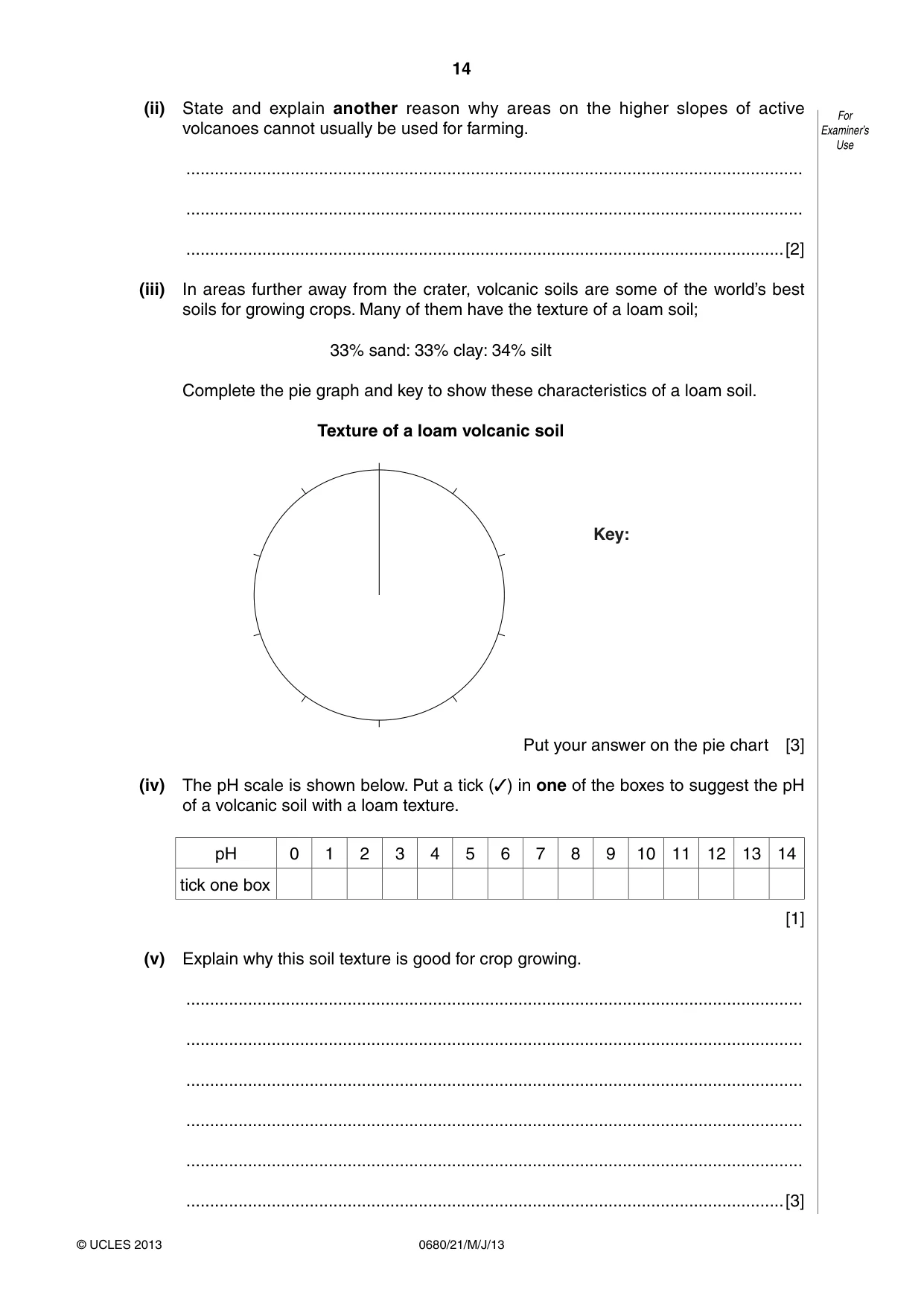
14 0680/21/M/J/13 © UCLES 2013 For Examiner’s Use (ii) State and explain another reason why areas on the higher slopes of active volcanoes cannot usually be used for farming. … … …[2] (iii) In areas further away from the crater, volcanic soils are some of the world’s best soils for growing crops. Many of them have the texture of a loam soil; 33% sand: 33% clay: 34% silt Complete the pie graph and key to show these characteristics of a loam soil. Texture of a loam volcanic soil Key: Put your answer on the pie chart [3] (iv) The pH scale is shown below. Put a tick (✓) in one of the boxes to suggest the pH of a volcanic soil with a loam texture. pH 0 1 2 3 4 5 6 7 8 9 10 11 12 13 14 tick one box [1] (v) Explain why this soil texture is good for crop growing. … … … … … …[3]
Question paper, page 15
15 0680/21/M/J/13 © UCLES 2013 [Turn over For Examiner’s Use (e) The island of Java in Indonesia was made by volcanoes. Today it still has 45 active volcanoes. Its rich volcanic soils are some of the world’s best for farming. It has been suggested that even a stick planted in Java’s volcanic soils will grow! Deposits from erosion on the mountains and from new eruptions are carried to Java’s lowlands, forming thick layers of fertile sediment on the island’s plains. (i) Explain why fertile volcanic soils are present almost everywhere in Java. … … … …[2] (ii) Look at the information about the island of Java. Java in Indonesia Area Population Population density Birth rate Death rate 7% of Indonesia 140 million 1025 per km² 18 per 1000 7 per 1000 The total population of Indonesia is 235 million. Approximately what percentage of these live on the island of Java? Circle one answer. 40% 50% 60% 70% [1] (iii) What information shows that Java is a very overcrowded island compared with the rest of Indonesia? … …[1] (iv) What is the rate of natural increase of population in Java? …[1]
Question paper, page 16
16 0680/21/M/J/13 © UCLES 2013 For Examiner’s Use (v) The government of Indonesia is increasingly worried about environmental damage in Java as overcrowding forces subsistence farmers to extend cultivation to steep mountain slopes and forest reserves. J, K and L are three ways that have been suggested to tackle the problem. J Manage the land Educate farmers about strategies of soil conservation K Manage population increase Put more money into family planning programmes L Promote economic development Support growth of industries in the large cities In your view, which one of these ways would be the best for solving the problem of environmental damage in Java? Explain your view. … … … … … … … …[4] [Total: 40] Permission to reproduce items where third-party owned material protected by copyright is included has been sought and cleared where possible. Every reasonable effort has been made by the publisher (UCLES) to trace copyright holders, but if any items requiring clearance have unwittingly been included, the publisher will be pleased to make amends at the earliest possible opportunity. University of Cambridge International Examinations is part of the Cambridge Assessment Group. Cambridge Assessment is the brand name of University of Cambridge Local Examinations Syndicate (UCLES), which is itself a department of the University of Cambridge.
Mark scheme, page 1
CAMBRIDGE INTERNATIONAL EXAMINATIONS International General Certificate of Secondary Education MARK SCHEME for the May/June 2013 series 0680 ENVIRONMENTAL MANAGEMENT 0680/21 Paper 2, maximum raw mark 80 This mark scheme is published as an aid to teachers and candidates, to indicate the requirements of the examination. It shows the basis on which Examiners were instructed to award marks. It does not indicate the details of the discussions that took place at an Examiners’ meeting before marking began, which would have considered the acceptability of alternative answers. Mark schemes should be read in conjunction with the question paper and the Principal Examiner Report for Teachers. Cambridge will not enter into discussions about these mark schemes. Cambridge is publishing the mark schemes for the May/June 2013 series for most IGCSE, GCE Advanced Level and Advanced Subsidiary Level components and some Ordinary Level components.
Mark scheme, page 2
Page 2 Mark Scheme Syllabus Paper IGCSE – May/June 2013 0680 21 © Cambridge International Examinations 2013 General notes Symbols used in Environmental Management mark schemes. / separates alternatives for a marking point – other valid ways of expressing the same idea are also credited ; separates points for the award of a mark [3] indicates the number of marks available italic indicates that this is information about the marking points and is not required to gain credit italic text is also used for comments about alternatives that should be accepted, ignored or rejected ora or reverse argument – shows that an argument from an alternative viewpoint will be credited AW alternative wording, sometimes called ‘or words to that effect’ – AW is used when there are many different ways of expressing the same idea ( ) the word / phrase in brackets is not required to gain marks but sets the context of the response for credit e.g. (nuclear) waste – nuclear is not needed but if it was described as a domestic waste then no mark is awarded volcanic underlined words – the answer must contain exactly this word ecf error carried forward – if an incorrect answer is given to part of a question, and this answer is subsequently used by a candidate in later parts of the question, this indicates that the candidate’s incorrect answer will be used as a starting point for marking the later parts of the question
Mark scheme, page 3
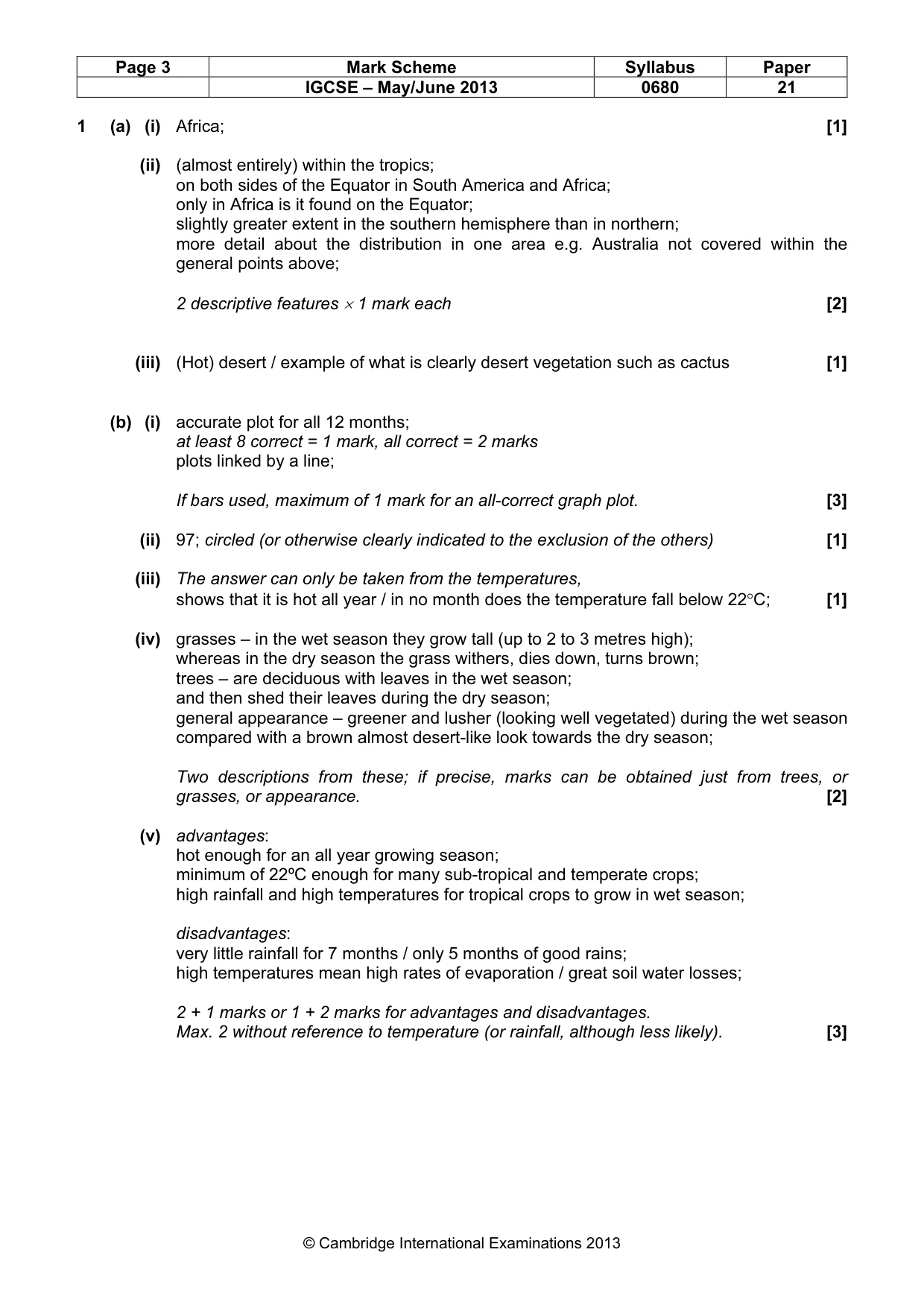
Page 3 Mark Scheme Syllabus Paper IGCSE – May/June 2013 0680 21 © Cambridge International Examinations 2013 1 (a) (i) Africa; [1] (ii) (almost entirely) within the tropics; on both sides of the Equator in South America and Africa; only in Africa is it found on the Equator; slightly greater extent in the southern hemisphere than in northern; more detail about the distribution in one area e.g. Australia not covered within the general points above; 2 descriptive features × 1 mark each [2] (iii) (Hot) desert / example of what is clearly desert vegetation such as cactus [1] (b) (i) accurate plot for all 12 months; at least 8 correct = 1 mark, all correct = 2 marks plots linked by a line; If bars used, maximum of 1 mark for an all-correct graph plot. [3] (ii) 97; circled (or otherwise clearly indicated to the exclusion of the others) [1] (iii) The answer can only be taken from the temperatures, shows that it is hot all year / in no month does the temperature fall below 22°C; [1] (iv) grasses – in the wet season they grow tall (up to 2 to 3 metres high); whereas in the dry season the grass withers, dies down, turns brown; trees – are deciduous with leaves in the wet season; and then shed their leaves during the dry season; general appearance – greener and lusher (looking well vegetated) during the wet season compared with a brown almost desert-like look towards the dry season; Two descriptions from these; if precise, marks can be obtained just from trees, or grasses, or appearance. [2] (v) advantages: hot enough for an all year growing season; minimum of 22ºC enough for many sub-tropical and temperate crops; high rainfall and high temperatures for tropical crops to grow in wet season; disadvantages: very little rainfall for 7 months / only 5 months of good rains; high temperatures mean high rates of evaporation / great soil water losses; 2 + 1 marks or 1 + 2 marks for advantages and disadvantages. Max. 2 without reference to temperature (or rainfall, although less likely). [3]
Mark scheme, page 4
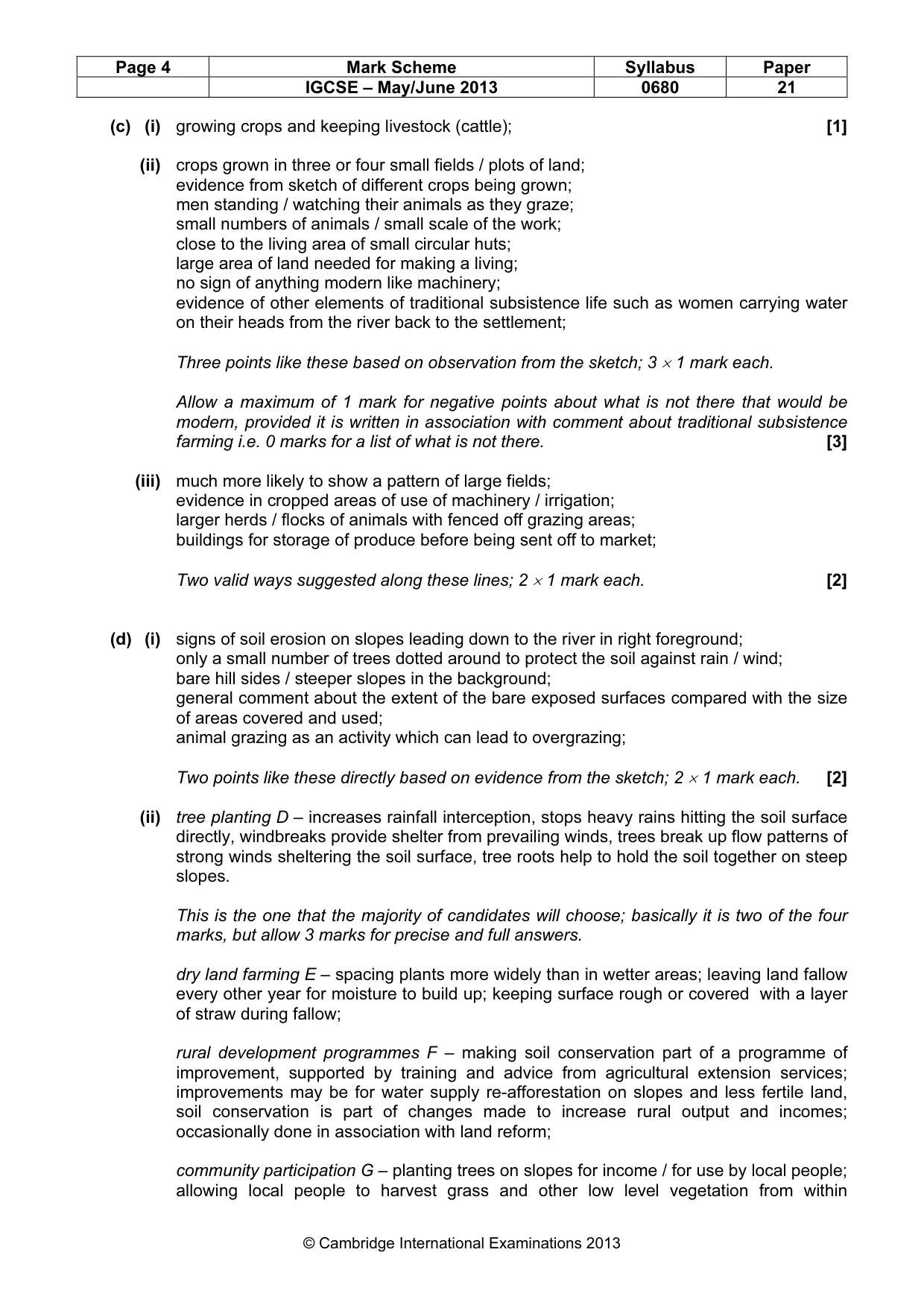
Page 4 Mark Scheme Syllabus Paper IGCSE – May/June 2013 0680 21 © Cambridge International Examinations 2013 (c) (i) growing crops and keeping livestock (cattle); [1] (ii) crops grown in three or four small fields / plots of land; evidence from sketch of different crops being grown; men standing / watching their animals as they graze; small numbers of animals / small scale of the work; close to the living area of small circular huts; large area of land needed for making a living; no sign of anything modern like machinery; evidence of other elements of traditional subsistence life such as women carrying water on their heads from the river back to the settlement; Three points like these based on observation from the sketch; 3 × 1 mark each. Allow a maximum of 1 mark for negative points about what is not there that would be modern, provided it is written in association with comment about traditional subsistence farming i.e. 0 marks for a list of what is not there. [3] (iii) much more likely to show a pattern of large fields; evidence in cropped areas of use of machinery / irrigation; larger herds / flocks of animals with fenced off grazing areas; buildings for storage of produce before being sent off to market; Two valid ways suggested along these lines; 2 × 1 mark each. [2] (d) (i) signs of soil erosion on slopes leading down to the river in right foreground; only a small number of trees dotted around to protect the soil against rain / wind; bare hill sides / steeper slopes in the background; general comment about the extent of the bare exposed surfaces compared with the size of areas covered and used; animal grazing as an activity which can lead to overgrazing; Two points like these directly based on evidence from the sketch; 2 × 1 mark each. [2] (ii) tree planting D – increases rainfall interception, stops heavy rains hitting the soil surface directly, windbreaks provide shelter from prevailing winds, trees break up flow patterns of strong winds sheltering the soil surface, tree roots help to hold the soil together on steep slopes. This is the one that the majority of candidates will choose; basically it is two of the four marks, but allow 3 marks for precise and full answers. dry land farming E – spacing plants more widely than in wetter areas; leaving land fallow every other year for moisture to build up; keeping surface rough or covered with a layer of straw during fallow; rural development programmes F – making soil conservation part of a programme of improvement, supported by training and advice from agricultural extension services; improvements may be for water supply re-afforestation on slopes and less fertile land, soil conservation is part of changes made to increase rural output and incomes; occasionally done in association with land reform; community participation G – planting trees on slopes for income / for use by local people; allowing local people to harvest grass and other low level vegetation from within
Mark scheme, page 5
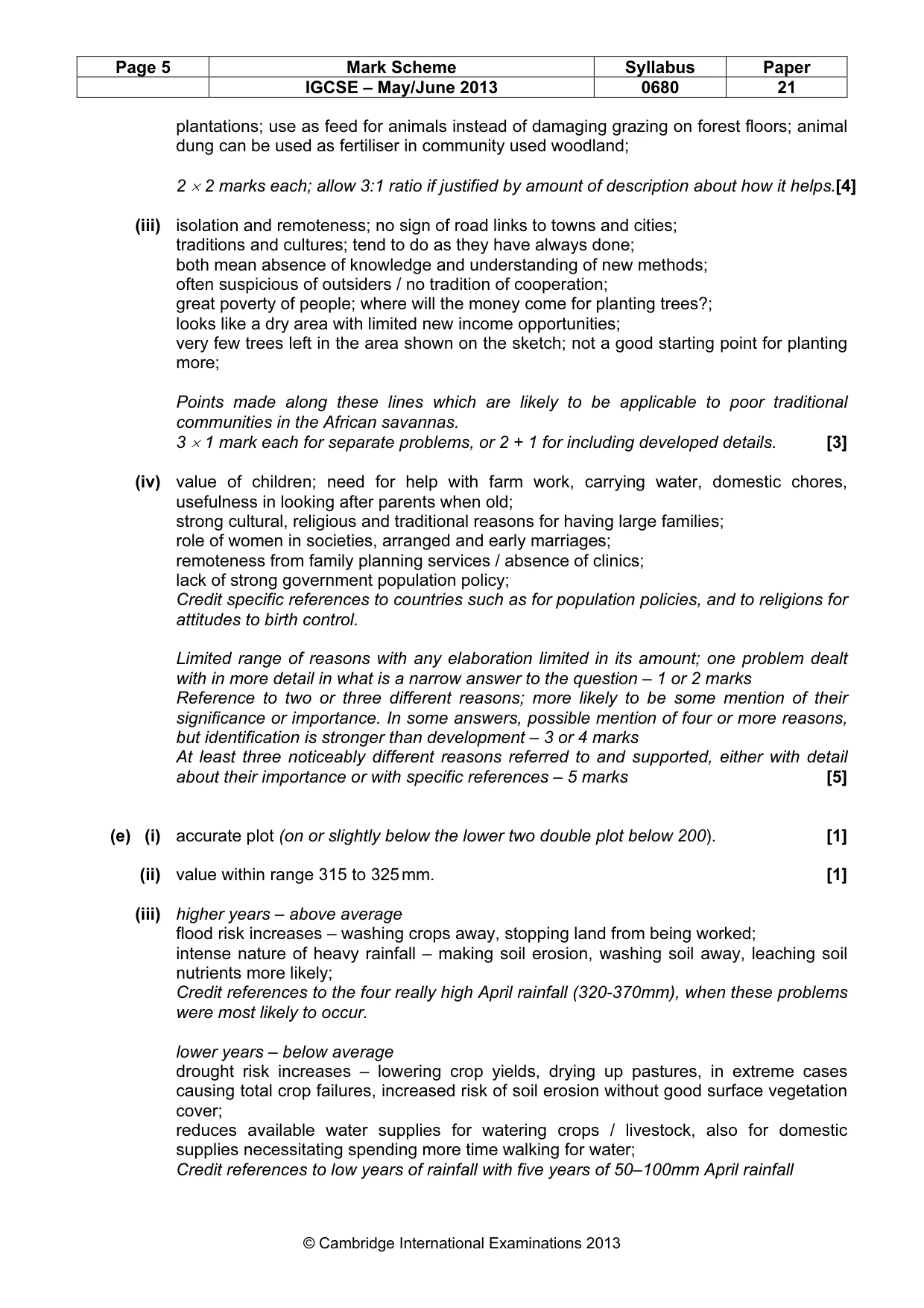
Page 5 Mark Scheme Syllabus Paper IGCSE – May/June 2013 0680 21 © Cambridge International Examinations 2013 plantations; use as feed for animals instead of damaging grazing on forest floors; animal dung can be used as fertiliser in community used woodland; 2 × 2 marks each; allow 3:1 ratio if justified by amount of description about how it helps.[4] (iii) isolation and remoteness; no sign of road links to towns and cities; traditions and cultures; tend to do as they have always done; both mean absence of knowledge and understanding of new methods; often suspicious of outsiders / no tradition of cooperation; great poverty of people; where will the money come for planting trees?; looks like a dry area with limited new income opportunities; very few trees left in the area shown on the sketch; not a good starting point for planting more; Points made along these lines which are likely to be applicable to poor traditional communities in the African savannas. 3 × 1 mark each for separate problems, or 2 + 1 for including developed details. [3] (iv) value of children; need for help with farm work, carrying water, domestic chores, usefulness in looking after parents when old; strong cultural, religious and traditional reasons for having large families; role of women in societies, arranged and early marriages; remoteness from family planning services / absence of clinics; lack of strong government population policy; Credit specific references to countries such as for population policies, and to religions for attitudes to birth control. Limited range of reasons with any elaboration limited in its amount; one problem dealt with in more detail in what is a narrow answer to the question – 1 or 2 marks Reference to two or three different reasons; more likely to be some mention of their significance or importance. In some answers, possible mention of four or more reasons, but identification is stronger than development – 3 or 4 marks At least three noticeably different reasons referred to and supported, either with detail about their importance or with specific references – 5 marks [5] (e) (i) accurate plot (on or slightly below the lower two double plot below 200). [1] (ii) value within range 315 to 325 mm. [1] (iii) higher years – above average flood risk increases – washing crops away, stopping land from being worked; intense nature of heavy rainfall – making soil erosion, washing soil away, leaching soil nutrients more likely; Credit references to the four really high April rainfall (320-370mm), when these problems were most likely to occur. lower years – below average drought risk increases – lowering crop yields, drying up pastures, in extreme cases causing total crop failures, increased risk of soil erosion without good surface vegetation cover; reduces available water supplies for watering crops / livestock, also for domestic supplies necessitating spending more time walking for water; Credit references to low years of rainfall with five years of 50–100mm April rainfall
Mark scheme, page 6
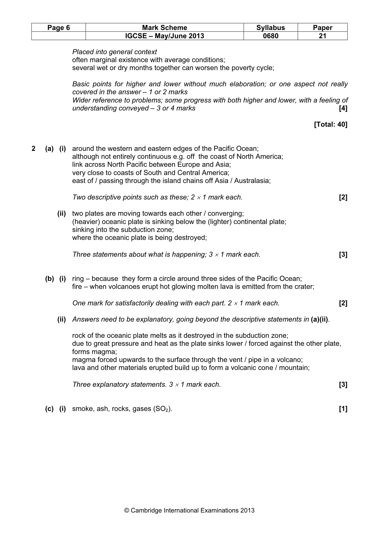
Page 6 Mark Scheme Syllabus Paper IGCSE – May/June 2013 0680 21 © Cambridge International Examinations 2013 Placed into general context often marginal existence with average conditions; several wet or dry months together can worsen the poverty cycle; Basic points for higher and lower without much elaboration; or one aspect not really covered in the answer – 1 or 2 marks Wider reference to problems; some progress with both higher and lower, with a feeling of understanding conveyed – 3 or 4 marks [4] [Total: 40] 2 (a) (i) around the western and eastern edges of the Pacific Ocean; although not entirely continuous e.g. off the coast of North America; link across North Pacific between Europe and Asia; very close to coasts of South and Central America; east of / passing through the island chains off Asia / Australasia; Two descriptive points such as these; 2 × 1 mark each. [2] (ii) two plates are moving towards each other / converging; (heavier) oceanic plate is sinking below the (lighter) continental plate; sinking into the subduction zone; where the oceanic plate is being destroyed; Three statements about what is happening; 3 × 1 mark each. [3] (b) (i) ring – because they form a circle around three sides of the Pacific Ocean; fire – when volcanoes erupt hot glowing molten lava is emitted from the crater; One mark for satisfactorily dealing with each part. 2 × 1 mark each. [2] (ii) Answers need to be explanatory, going beyond the descriptive statements in (a)(ii). rock of the oceanic plate melts as it destroyed in the subduction zone; due to great pressure and heat as the plate sinks lower / forced against the other plate, forms magma; magma forced upwards to the surface through the vent / pipe in a volcano; lava and other materials erupted build up to form a volcanic cone / mountain; Three explanatory statements. 3 × 1 mark each. [3] (c) (i) smoke, ash, rocks, gases (SO2). [1]
Mark scheme, page 7
Page 7 Mark Scheme Syllabus Paper IGCSE – May/June 2013 0680 21 © Cambridge International Examinations 2013 (ii) authorities evacuated 3,500 people to temporary shelters in safe areas; previous volcanic eruptions in the area (1960 & 1921) meant that the risks were known / had previous experience so that the authorities were prepared / warning systems in place / monitoring; suggestion that not a large population in the area if only 3500 were evacuated; suggestion that many people had already moved from the area after earlier eruptions; Three reasons such as these; 3 × 1 mark each. [3] (iii) prevailing westerly winds carried the ash clouds eastwards; thrown out to high levels in the air (10km) which is why the winds could carry it so far / free flow of winds at high levels away from friction / relief of surface / great thickness and size of the cloud second mark for explaining why it was carried so far 2 × 1 mark each. [2] (iv) Evidence of economic effects are: tourist towns in Chile for visits to the stunning volcanic scenery were empty; airport closed at Bariloche in Argentina stopping skiers from reaching town; airports closed in Melbourne and Sydney in Australia; Strength of economic effects: right in the middle of ski tourist season in Argentina; airport closure stopped arrival of high spending Brazilians at the worst time of the year; the two Australian airports that were closed were the country's two biggest international airports, and therefore likely to cause most economic disruption; These comments in the information suggest that the effects would appear to be more serious outside Chile; this appears to be the easier view to justify; Mark the explanation not the view expressed. Recognition of what is meant by economic effects / examples of economic effects without additional comment = 1 mark Explanation with comment towards the view expressed = 2 marks [3] (v) sore eyes and skin – most likely to be caused by release of gases such as SO²; one of the main constituents of acid rain; OR chest infections – reference to air pollution and falling ash probably more relevant here; air full of choking ash and dust which people would be forced; More general answers elaborating upon high levels of air pollution or part answers to one of the above = 1 mark. [2] (d) (i) 3 or any point lower marked on the pH scale; [1]
Mark scheme, page 8
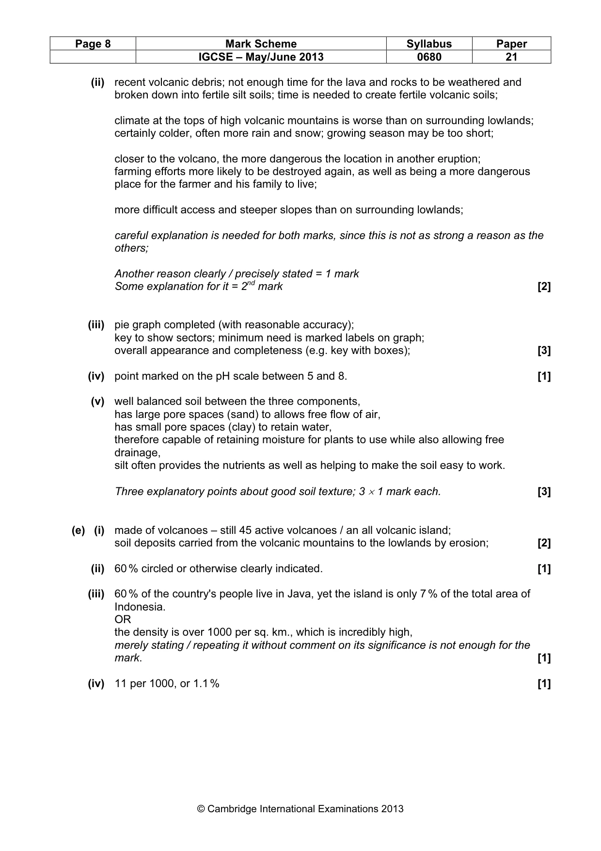
Page 8 Mark Scheme Syllabus Paper IGCSE – May/June 2013 0680 21 © Cambridge International Examinations 2013 (ii) recent volcanic debris; not enough time for the lava and rocks to be weathered and broken down into fertile silt soils; time is needed to create fertile volcanic soils; climate at the tops of high volcanic mountains is worse than on surrounding lowlands; certainly colder, often more rain and snow; growing season may be too short; closer to the volcano, the more dangerous the location in another eruption; farming efforts more likely to be destroyed again, as well as being a more dangerous place for the farmer and his family to live; more difficult access and steeper slopes than on surrounding lowlands; careful explanation is needed for both marks, since this is not as strong a reason as the others; Another reason clearly / precisely stated = 1 mark Some explanation for it = 2nd mark [2] (iii) pie graph completed (with reasonable accuracy); key to show sectors; minimum need is marked labels on graph; overall appearance and completeness (e.g. key with boxes); [3] (iv) point marked on the pH scale between 5 and 8. [1] (v) well balanced soil between the three components, has large pore spaces (sand) to allows free flow of air, has small pore spaces (clay) to retain water, therefore capable of retaining moisture for plants to use while also allowing free drainage, silt often provides the nutrients as well as helping to make the soil easy to work. Three explanatory points about good soil texture; 3 × 1 mark each. [3] (e) (i) made of volcanoes – still 45 active volcanoes / an all volcanic island; soil deposits carried from the volcanic mountains to the lowlands by erosion; [2] (ii) 60 % circled or otherwise clearly indicated. [1] (iii) 60 % of the country's people live in Java, yet the island is only 7 % of the total area of Indonesia. OR the density is over 1000 per sq. km., which is incredibly high, merely stating / repeating it without comment on its significance is not enough for the mark. [1] (iv) 11 per 1000, or 1.1 % [1]
Mark scheme, page 9
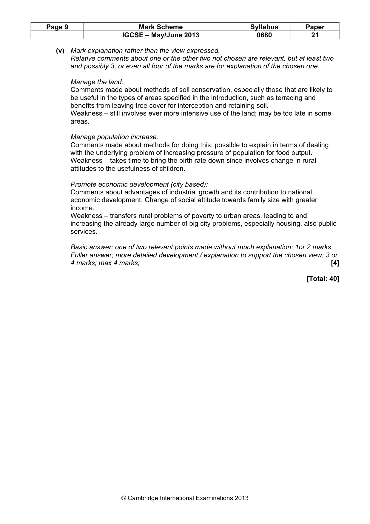
Page 9 Mark Scheme Syllabus Paper IGCSE – May/June 2013 0680 21 © Cambridge International Examinations 2013 (v) Mark explanation rather than the view expressed. Relative comments about one or the other two not chosen are relevant, but at least two and possibly 3, or even all four of the marks are for explanation of the chosen one. Manage the land: Comments made about methods of soil conservation, especially those that are likely to be useful in the types of areas specified in the introduction, such as terracing and benefits from leaving tree cover for interception and retaining soil. Weakness – still involves ever more intensive use of the land; may be too late in some areas. Manage population increase: Comments made about methods for doing this; possible to explain in terms of dealing with the underlying problem of increasing pressure of population for food output. Weakness – takes time to bring the birth rate down since involves change in rural attitudes to the usefulness of children. Promote economic development (city based): Comments about advantages of industrial growth and its contribution to national economic development. Change of social attitude towards family size with greater income. Weakness – transfers rural problems of poverty to urban areas, leading to and increasing the already large number of big city problems, especially housing, also public services. Basic answer; one of two relevant points made without much explanation; 1or 2 marks Fuller answer; more detailed development / explanation to support the chosen view; 3 or 4 marks; max 4 marks; [4] [Total: 40]
What you needed in this session
Cambridge’s own grade thresholds for 2013 May/June, Paper 2 · Variant 1. A higher threshold means an easier paper — the bar moves with how the cohort did.