Cambridge IGCSE Geography (9-1) 0976 — 2023 Oct/Nov Paper 1 · Variant 2
0976/12/O/N/23 · 75 marks · ≈84 min
The question paper and its mark scheme, free to read here and free to download. This is Cambridge’s own paper, exactly as it was sat.
Question paper28 pages












Mark scheme25 pages
Answers below. Sit the paper first if you are practising.
Paper as text
Question paper, page 1
This document has 28 pages. Any blank pages are indicated. [Turn over Cambridge IGCSE™(9–1) GEOGRAPHY 0976/12 Paper 1 Geographical Themes October/November 2023 1 hour 45 minutes You must answer on the question paper. You will need: Insert (enclosed) Ruler Calculator Protractor INSTRUCTIONS ● Answer three questions in total, one from each section. ● Use a black or dark blue pen. You may use an HB pencil for any diagrams or graphs. ● Write your name, centre number and candidate number in the boxes at the top of the page. ● Write your answer to each question in the space provided. ● Do not use an erasable pen or correction fluid. ● Do not write on any bar codes. ● If additional space is needed, you should use the lined pages at the end of this booklet; the question number or numbers must be clearly shown. INFORMATION ● The total mark for this paper is 75. ● The number of marks for each question or part question is shown in brackets [ ]. ● The insert contains additional resources referred to in the questions. Definitions MEDCs – More Economically Developed Countries LEDCs – Less Economically Developed Countries * 4 4 0 2 6 7 0 9 4 0 * DC (SL) 333752 © UCLES 2023
Question paper, page 2
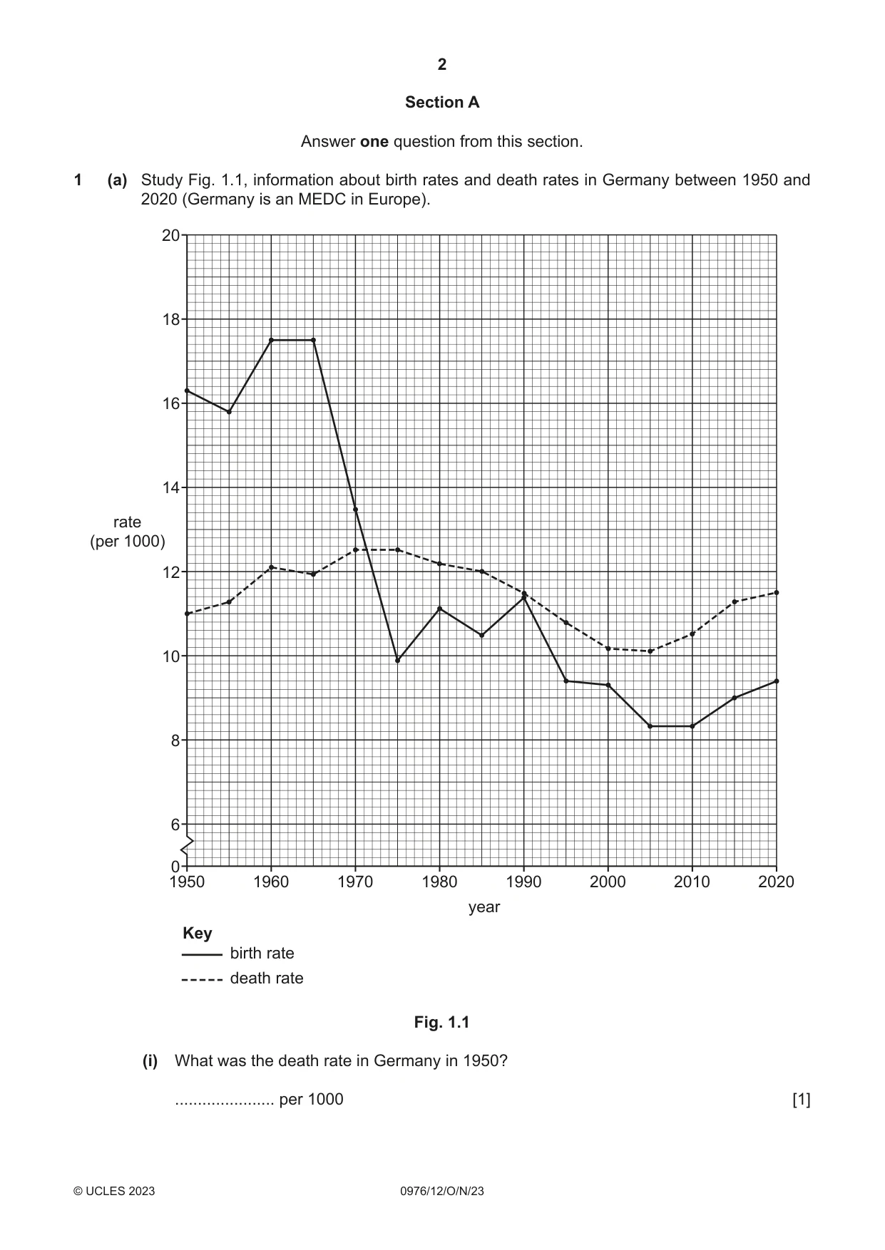
2 0976/12/O/N/23 © UCLES 2023 Section A Answer one question from this section. 1 (a) Study Fig. 1.1, information about birth rates and death rates in Germany between 1950 and 2020 (Germany is an MEDC in Europe). Key birth rate death rate 1950 6 0 8 10 12 rate (per 1000) 14 16 18 20 1960 1970 1980 1990 year 2000 2010 2020 Fig. 1.1 (i) What was the death rate in Germany in 1950? … per 1000 [1]
Question paper, page 3
3 0976/12/O/N/23 © UCLES 2023 [Turn over (ii) What evidence in Fig. 1.1 suggests that: – there was a decrease in the natural population growth rate in Germany between 1965 and 1970? … … – natural population decline occurred in Germany between 1990 and 2000? … … [2] (iii) Calculate the natural population growth rate in Germany in 1960. You should show your calculations in the box below. … per 1000 [3] (iv) Explain why birth rates are low in MEDCs such as Germany. … … … … … … … … [4]
Question paper, page 4
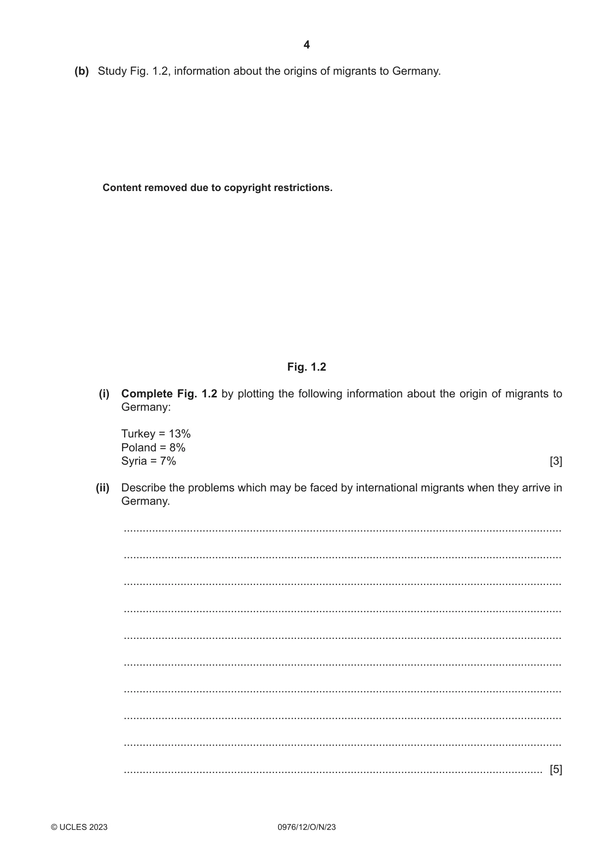
4 0976/12/O/N/23 © UCLES 2023 (b) Study Fig. 1.2, information about the origins of migrants to Germany. Fig. 1.2 (i) Complete Fig. 1.2 by plotting the following information about the origin of migrants to Germany: Turkey = 13% Poland = 8% Syria = 7% [3] (ii) Describe the problems which may be faced by international migrants when they arrive in Germany. … … … … … … … … … … [5] Content removed due to copyright restrictions.
Question paper, page 5
5 0976/12/O/N/23 © UCLES 2023 [Turn over (c) For an example you have studied, explain why international migration has taken place. Migration from … to … … … … … … … … … … … … … … … … … … … … … … … … … … [7] [Total: 25]
Question paper, page 6
6 0976/12/O/N/23 © UCLES 2023 2 (a) Study Fig. 2.1 (Insert), a photograph taken in Dhaka, Bangladesh (an LEDC in Asia). (i) What type of settlement is shown at X in Fig. 2.1? Circle one of the following. dispersed settlement rural settlement squatter settlement [1] (ii) Using evidence from Fig. 2.1, suggest two problems faced by people living in the settlement shown at X. 1 … … 2 … … [2] (iii) In many urban areas there are inequalities. Suggest reasons for the inequalities which may exist between the people living in settlements X and Y in Fig. 2.1. … … … … … … [3] (iv) Suggest two different types of pollution in the area shown in Fig. 2.1. For each type of pollution explain why it may occur. type of pollution 1 … … explanation … … type of pollution 2 … … explanation … … [4]
Question paper, page 7
7 0976/12/O/N/23 © UCLES 2023 [Turn over (b) Study Fig. 2.2 (Insert), a photograph showing part of the metro in Kuala Lumpur, Malaysia (a country in Southeast Asia). (i) Explain how a public transport system, such as the Kuala Lumpur Metro, reduces traffic congestion. … … … … … … [3] (ii) Describe other strategies which can be used to reduce traffic congestion in urban areas. … … … … … … … … … … [5]
Question paper, page 8
8 0976/12/O/N/23 © UCLES 2023 (c) For a named urban area you have studied, explain why the population is increasing due to rural‑urban migration. Name of urban area … … … … … … … … … … … … … … … … … … … … … … … … … … [7] [Total: 25]
Question paper, page 9
9 0976/12/O/N/23 © UCLES 2023 [Turn over BLANK PAGE
Question paper, page 10
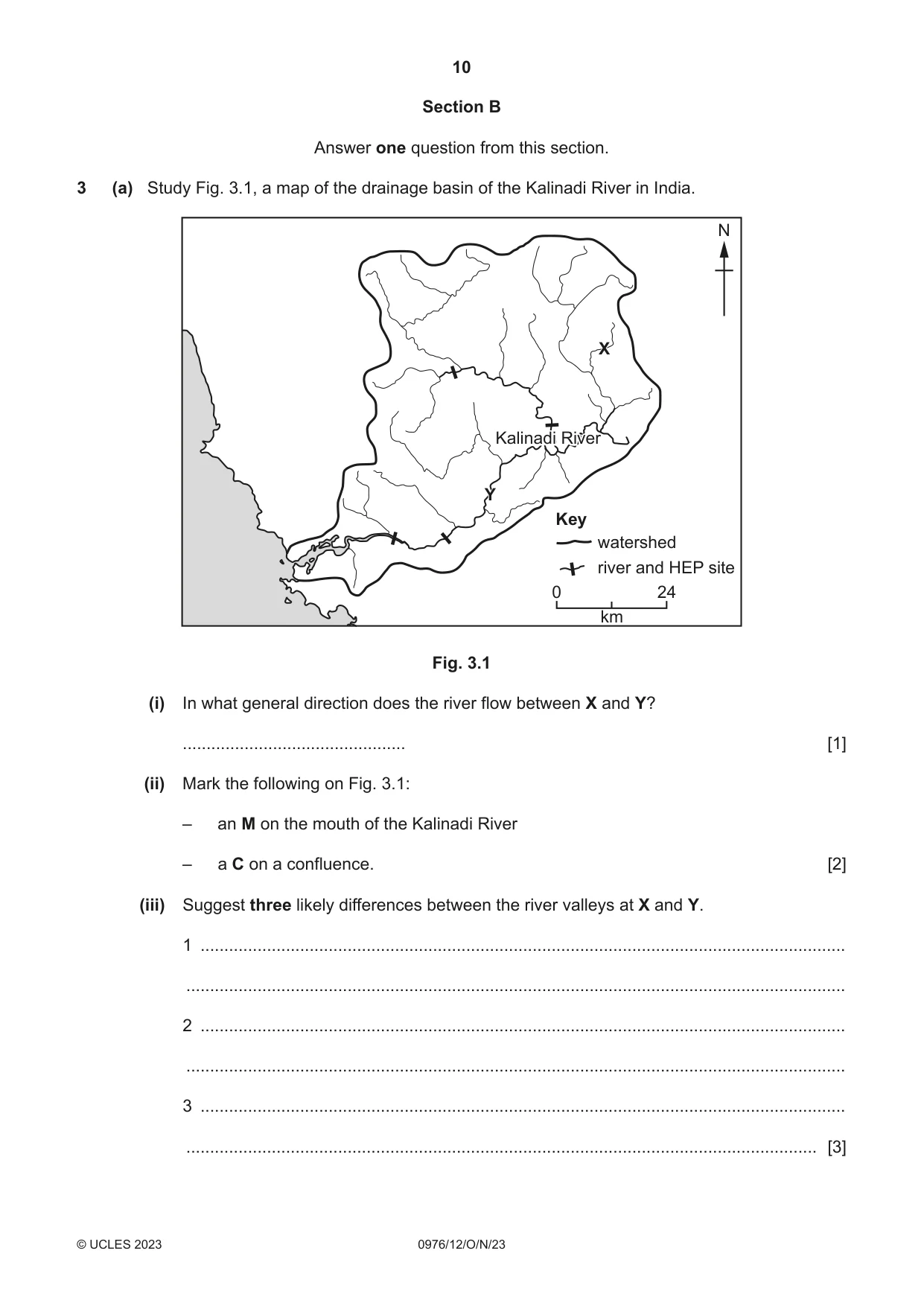
10 0976/12/O/N/23 © UCLES 2023 Section B Answer one question from this section. 3 (a) Study Fig. 3.1, a map of the drainage basin of the Kalinadi River in India. 0 24 km Key watershed river and HEP site N X Y Kalinadi River Kalinadi River Fig. 3.1 (i) In what general direction does the river flow between X and Y? … [1] (ii) Mark the following on Fig. 3.1: – an M on the mouth of the Kalinadi River – a C on a confluence. [2] (iii) Suggest three likely differences between the river valleys at X and Y. 1 … … 2 … … 3 … … [3]
Question paper, page 11
11 0976/12/O/N/23 © UCLES 2023 [Turn over (iv) One benefit of living in the drainage basin of the Kalinadi River is that hydroelectric power (HEP) can be generated. Suggest reasons why hydroelectric power can be generated at the sites shown in Fig. 3.1. … … … … … … … … [4]
Question paper, page 12
12 0976/12/O/N/23 © UCLES 2023 (b) Study Fig. 3.2 (Insert), a photograph of a waterfall. (i) Describe the features of the waterfall shown in Fig. 3.2. … … … … … … [3] (ii) Suggest how the waterfall shown in Fig. 3.2 was formed. … … … … … … … … … … [5]
Question paper, page 13
13 0976/12/O/N/23 © UCLES 2023 [Turn over (c) Describe the main features of an oxbow lake and explain its formation. You may use a labelled diagram or diagrams. … … … … … … … … … … … … … … … … [7] [Total: 25]
Question paper, page 14
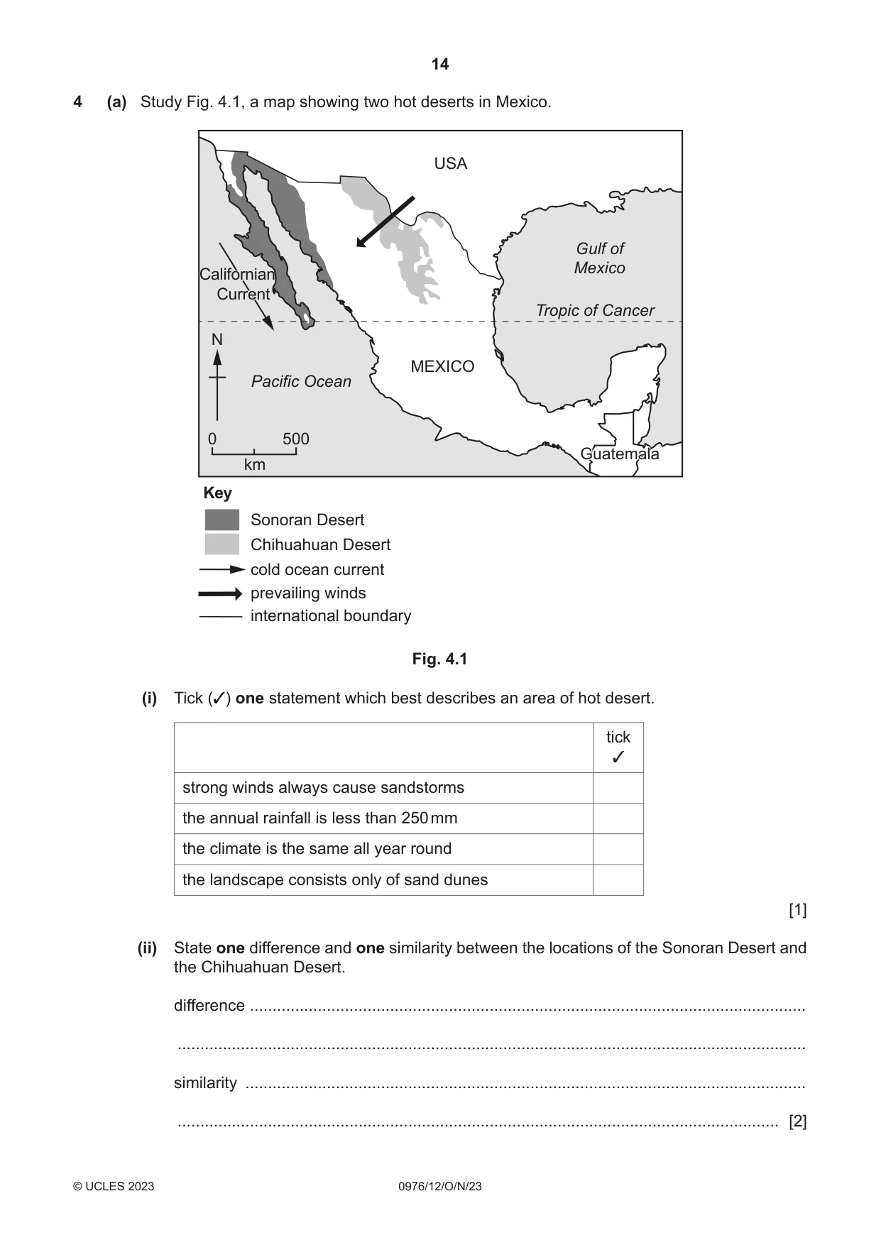
14 0976/12/O/N/23 © UCLES 2023 4 (a) Study Fig. 4.1, a map showing two hot deserts in Mexico. 0 500 Key Sonoran Desert Chihuahuan Desert cold ocean current Californian Current Californian Current prevailing winds international boundary km USA MEXICO Pacific Ocean Tropic of Cancer Gulf of Mexico N Guatemala Guatemala Fig. 4.1 (i) Tick (✓) one statement which best describes an area of hot desert. tick ✓ strong winds always cause sandstorms the annual rainfall is less than 250 mm the climate is the same all year round the landscape consists only of sand dunes [1] (ii) State one difference and one similarity between the locations of the Sonoran Desert and the Chihuahuan Desert. difference … … similarity … … [2]
Question paper, page 15
15 0976/12/O/N/23 © UCLES 2023 [Turn over (iii) Explain why there is a big difference in temperatures between day and night in deserts such as the Sonoran Desert and the Chihuahuan Desert. … … … … … … [3] (iv) Using evidence from Fig. 4.1, explain why the Sonoran Desert and the Chihuahuan Desert do not receive much rainfall. … … … … … … … … [4]
Question paper, page 16
16 0976/12/O/N/23 © UCLES 2023 (b) Study Fig. 4.2 (Insert), a photograph of vegetation growing in an area of hot desert. (i) Using Fig. 4.2, identify three features of the vegetation shown which help it to survive in areas of low rainfall. 1 … … 2 … … 3 … … [3] (ii) Describe other methods which vegetation uses to survive in a hot desert. … … … … … … … … … … [5]
Question paper, page 17
17 0976/12/O/N/23 © UCLES 2023 [Turn over (c) For a named area you have studied, describe and explain the characteristics of an equatorial climate. Name of area … … … … … … … … … … … … … … … … … … … … … … … … … … [7] [Total: 25]
Question paper, page 18
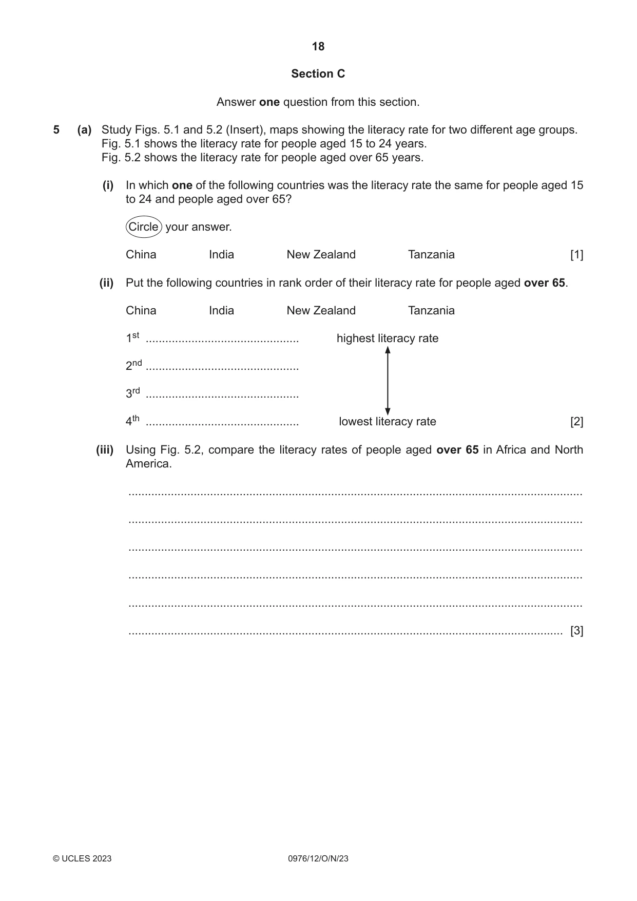
18 0976/12/O/N/23 © UCLES 2023 Section C Answer one question from this section. 5 (a) Study Figs. 5.1 and 5.2 (Insert), maps showing the literacy rate for two different age groups. Fig. 5.1 shows the literacy rate for people aged 15 to 24 years. Fig. 5.2 shows the literacy rate for people aged over 65 years. (i) In which one of the following countries was the literacy rate the same for people aged 15 to 24 and people aged over 65? Circle your answer. China India New Zealand Tanzania [1] (ii) Put the following countries in rank order of their literacy rate for people aged over 65. China India New Zealand Tanzania 1st … highest literacy rate 2nd … 3rd … 4th … lowest literacy rate [2] (iii) Using Fig. 5.2, compare the literacy rates of people aged over 65 in Africa and North America. … … … … … … [3]
Question paper, page 19
19 0976/12/O/N/23 © UCLES 2023 [Turn over (iv) Name two other development indicators. For each one explain how it shows the level of development of a country. indicator 1 … … … … indicator 2 … … … … [4]
Question paper, page 20
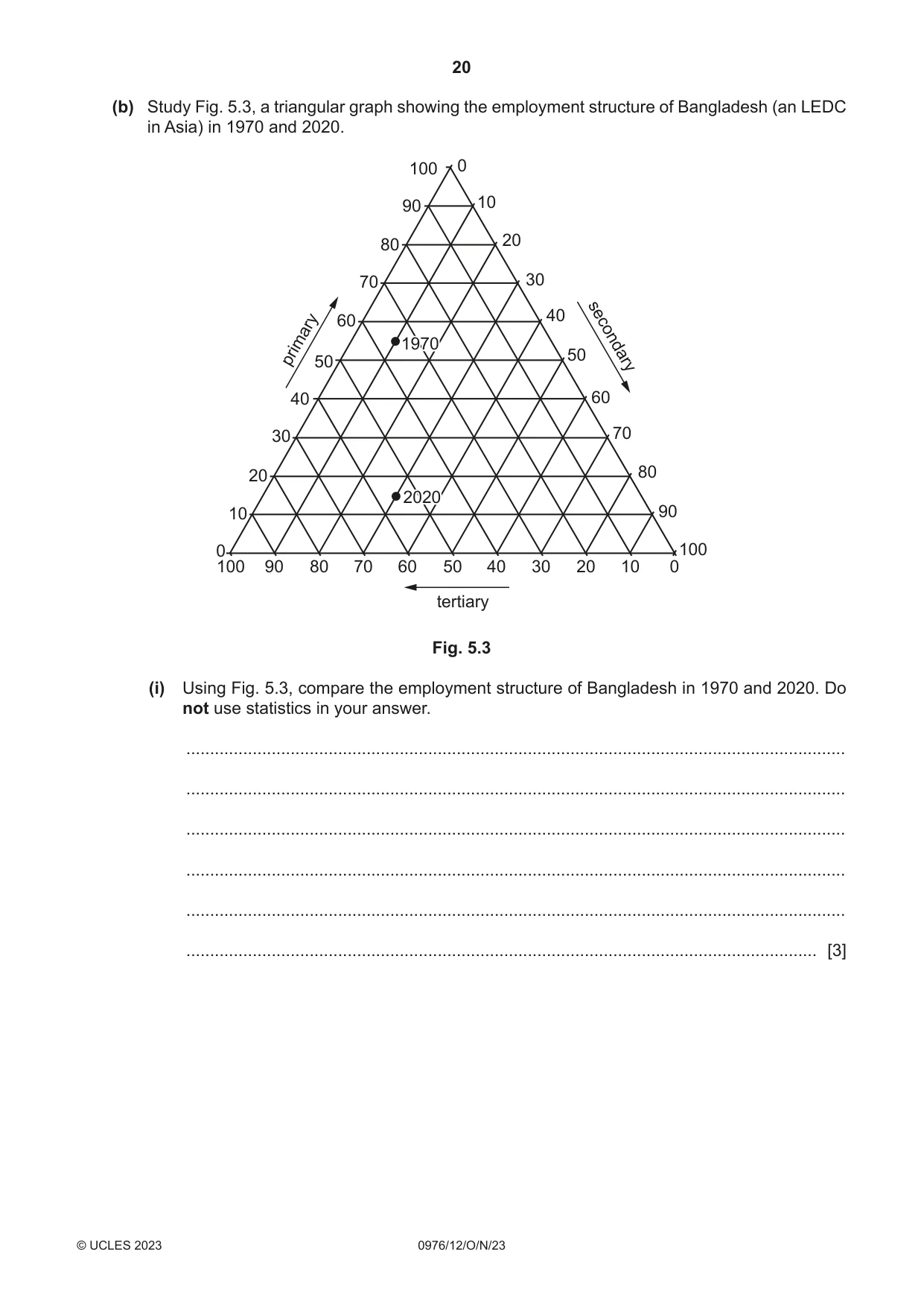
20 0976/12/O/N/23 © UCLES 2023 (b) Study Fig. 5.3, a triangular graph showing the employment structure of Bangladesh (an LEDC in Asia) in 1970 and 2020. tertiary primary secondary 100 100 100 90 90 90 80 80 80 70 70 70 60 60 60 50 50 50 40 40 40 30 30 30 20 20 20 10 10 10 0 0 0 2020 2020 1970 1970 Fig. 5.3 (i) Using Fig. 5.3, compare the employment structure of Bangladesh in 1970 and 2020. Do not use statistics in your answer. … … … … … … [3]
Question paper, page 21
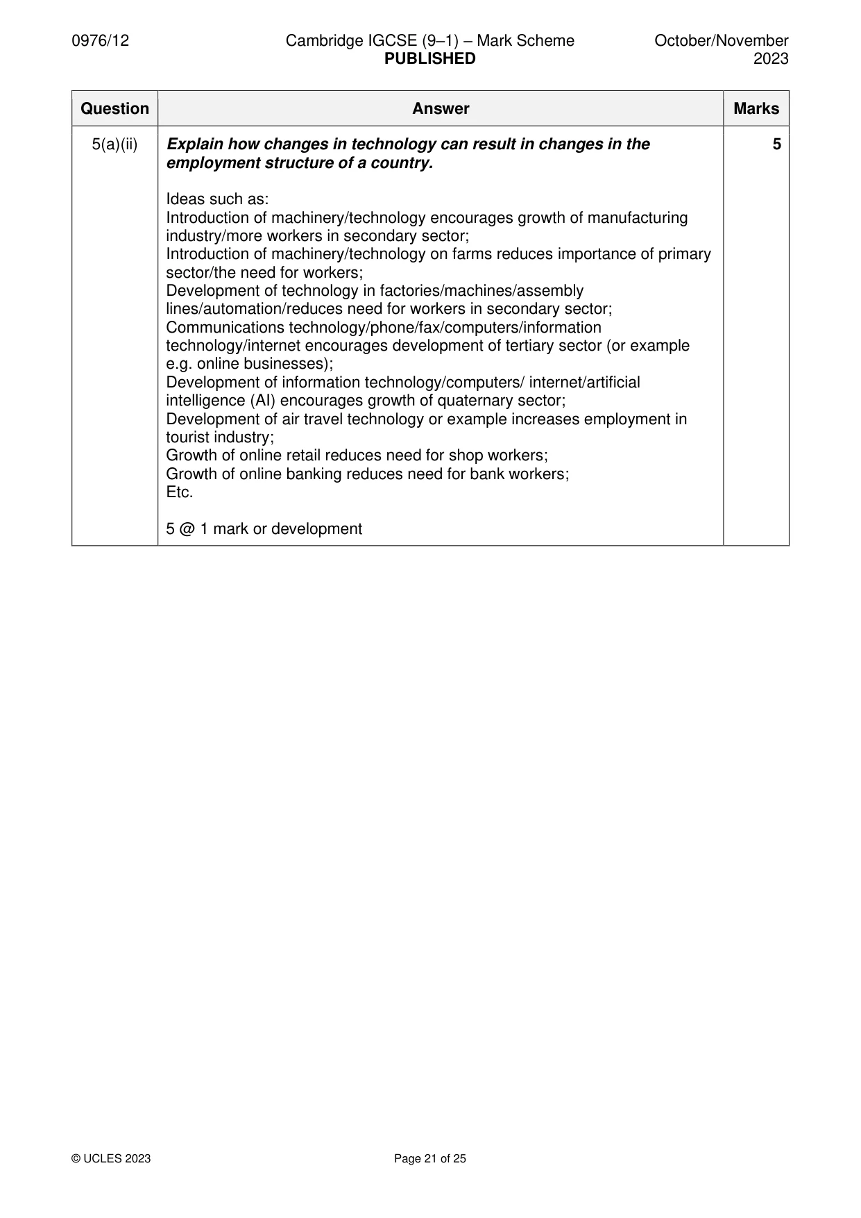
21 0976/12/O/N/23 © UCLES 2023 [Turn over (ii) Explain how changes in technology can result in changes in the employment structure of a country. … … … … … … … … … … [5]
Question paper, page 22
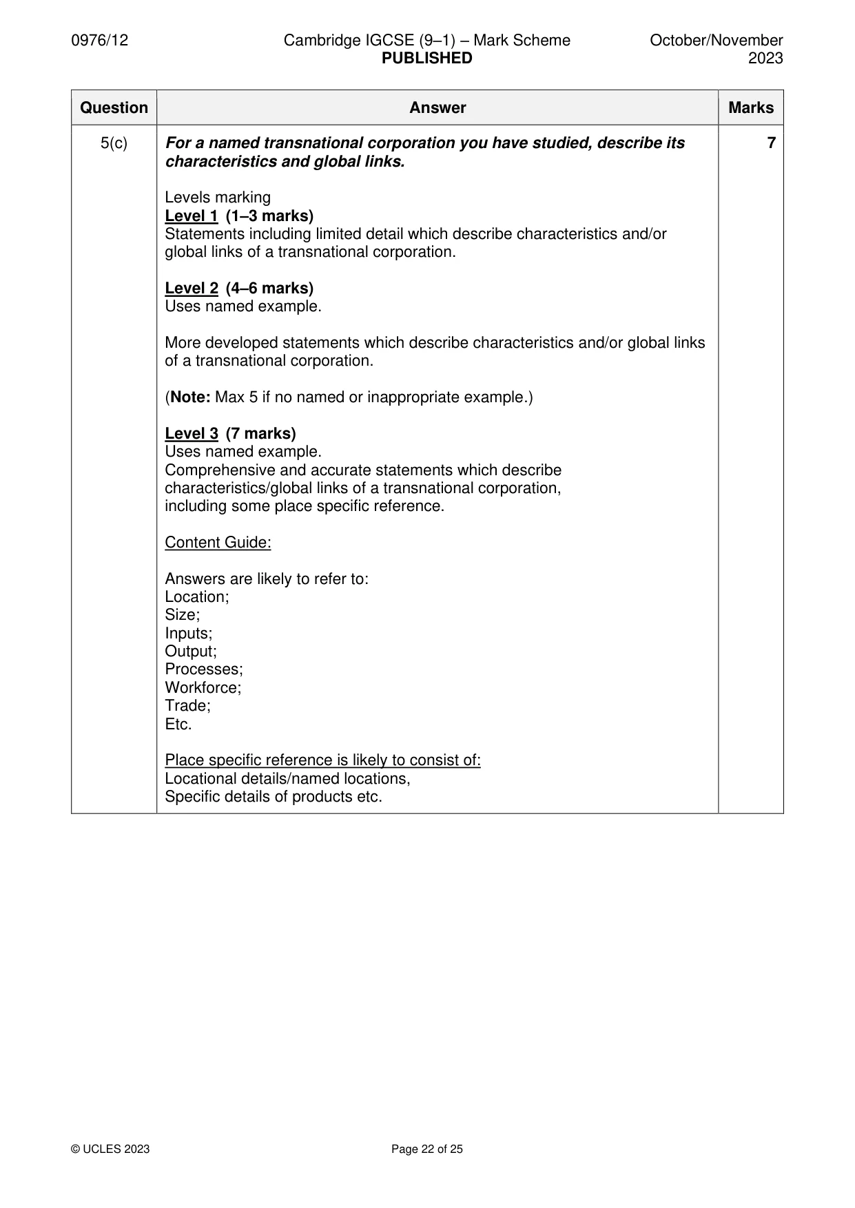
22 0976/12/O/N/23 © UCLES 2023 (c) For a named transnational corporation you have studied, describe its characteristics and global links. Name of transnational corporation … … … … … … … … … … … … … … … … … … … … … … … … … … [7] [Total: 25]
Question paper, page 23
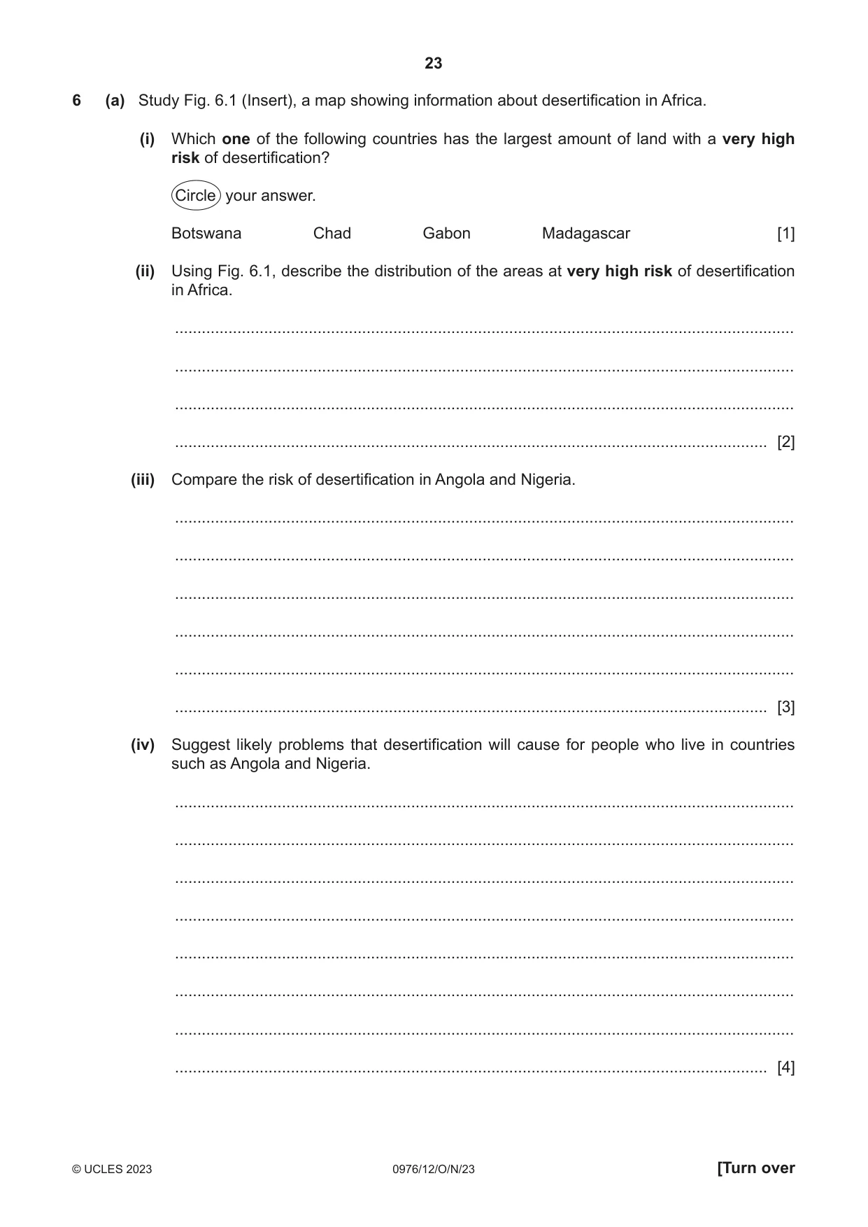
23 0976/12/O/N/23 © UCLES 2023 [Turn over 6 (a) Study Fig. 6.1 (Insert), a map showing information about desertification in Africa. (i) Which one of the following countries has the largest amount of land with a very high risk of desertification? Circle your answer. Botswana Chad Gabon Madagascar [1] (ii) Using Fig. 6.1, describe the distribution of the areas at very high risk of desertification in Africa. … … … … [2] (iii) Compare the risk of desertification in Angola and Nigeria. … … … … … … [3] (iv) Suggest likely problems that desertification will cause for people who live in countries such as Angola and Nigeria. … … … … … … … … [4]
Question paper, page 24
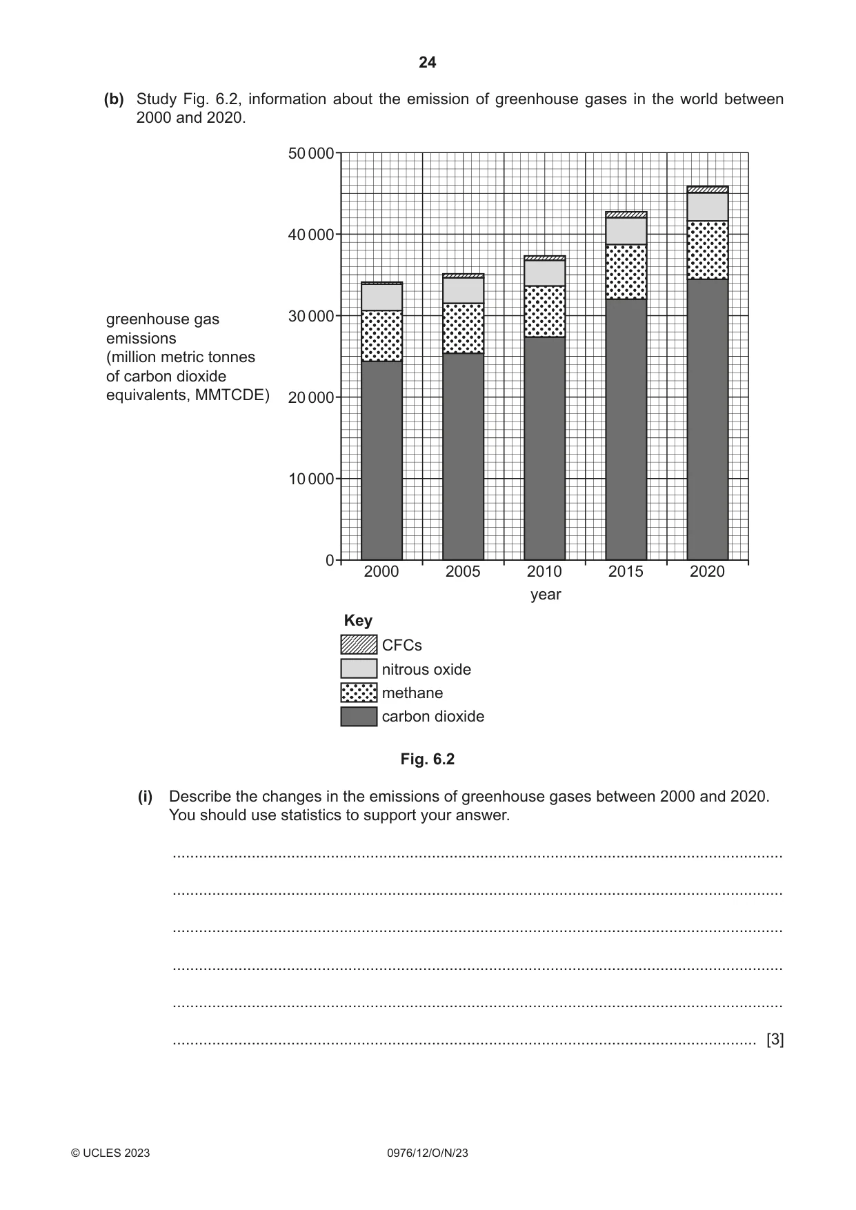
24 0976/12/O/N/23 © UCLES 2023 (b) Study Fig. 6.2, information about the emission of greenhouse gases in the world between 2000 and 2020. 2000 0 10 000 20 000 30 000 greenhouse gas emissions (million metric tonnes of carbon dioxide equivalents, MMTCDE) 40 000 50 000 2005 2010 2015 2020 year Key CFCs nitrous oxide methane carbon dioxide Fig. 6.2 (i) Describe the changes in the emissions of greenhouse gases between 2000 and 2020. You should use statistics to support your answer. … … … … … … [3]
Question paper, page 25
25 0976/12/O/N/23 © UCLES 2023 [Turn over (ii) Explain why global warming occurs. … … … … … … … … … … [5]
Question paper, page 26
26 0976/12/O/N/23 © UCLES 2023 (c) Describe the impacts of global warming. You should refer to different named places. … … … … … … … … … … … … … … … … … … … … … … … … … [7] [Total: 25]
Question paper, page 27
27 0976/12/O/N/23 © UCLES 2023 Additional pages If you use the following pages to complete the answer to any question, the question number must be clearly shown. … … … … … … … … … … … … … … … … … … … … … … … … … …
Question paper, page 28
28 0976/12/O/N/23 © UCLES 2023 … … … … … … … … … … … … … … … … … … … … … … The boundaries and names shown, the designations used and the presentation of material on any maps contained in this question paper/insert do not imply official endorsement or acceptance by Cambridge Assessment International Education concerning the legal status of any country, territory, or area or any of its authorities, or of the delimitation of its frontiers or boundaries. Permission to reproduce items where third‑party owned material protected by copyright is included has been sought and cleared where possible. Every reasonable effort has been made by the publisher (UCLES) to trace copyright holders, but if any items requiring clearance have unwittingly been included, the publisher will be pleased to make amends at the earliest possible opportunity. To avoid the issue of disclosure of answer‑related information to candidates, all copyright acknowledgements are reproduced online in the Cambridge Assessment International Education Copyright Acknowledgements Booklet. This is produced for each series of examinations and is freely available to download at www.cambridgeinternational.org after the live examination series. Cambridge Assessment International Education is part of Cambridge Assessment. Cambridge Assessment is the brand name of the University of Cambridge Local Examinations Syndicate (UCLES), which is a department of the University of Cambridge.
Mark scheme, page 1
This document consists of 25 printed pages. © UCLES 2023 [Turn over Cambridge IGCSE™ (9–1) GEOGRAPHY 0976/12 Paper 1 Geographical Themes October/November 2023 MARK SCHEME Maximum Mark: 75 Published This mark scheme is published as an aid to teachers and candidates, to indicate the requirements of the examination. It shows the basis on which Examiners were instructed to award marks. It does not indicate the details of the discussions that took place at an Examiners’ meeting before marking began, which would have considered the acceptability of alternative answers. Mark schemes should be read in conjunction with the question paper and the Principal Examiner Report for Teachers. Cambridge International will not enter into discussions about these mark schemes. Cambridge International is publishing the mark schemes for the October/November 2023 series for most Cambridge IGCSE, Cambridge International A and AS Level components, and some Cambridge O Level components.
Mark scheme, page 2
0976/12 Cambridge IGCSE (9–1) – Mark Scheme PUBLISHED October/November 2023 © UCLES 2023 Page 2 of 25 Generic Marking Principles These general marking principles must be applied by all examiners when marking candidate answers. They should be applied alongside the specific content of the mark scheme or generic level descriptors for a question. Each question paper and mark scheme will also comply with these marking principles. GENERIC MARKING PRINCIPLE 1: Marks must be awarded in line with: • the specific content of the mark scheme or the generic level descriptors for the question • the specific skills defined in the mark scheme or in the generic level descriptors for the question • the standard of response required by a candidate as exemplified by the standardisation scripts. GENERIC MARKING PRINCIPLE 2: Marks awarded are always whole marks (not half marks, or other fractions). GENERIC MARKING PRINCIPLE 3: Marks must be awarded positively: • marks are awarded for correct/valid answers, as defined in the mark scheme. However, credit is given for valid answers which go beyond the scope of the syllabus and mark scheme, referring to your Team Leader as appropriate • marks are awarded when candidates clearly demonstrate what they know and can do • marks are not deducted for errors • marks are not deducted for omissions • answers should only be judged on the quality of spelling, punctuation and grammar when these features are specifically assessed by the question as indicated by the mark scheme. The meaning, however, should be unambiguous. GENERIC MARKING PRINCIPLE 4: Rules must be applied consistently, e.g. in situations where candidates have not followed instructions or in the application of generic level descriptors. GENERIC MARKING PRINCIPLE 5: Marks should be awarded using the full range of marks defined in the mark scheme for the question (however; the use of the full mark range may be limited according to the quality of the candidate responses seen). GENERIC MARKING PRINCIPLE 6: Marks awarded are based solely on the requirements as defined in the mark scheme. Marks should not be awarded with grade thresholds or grade descriptors in mind.
Mark scheme, page 3
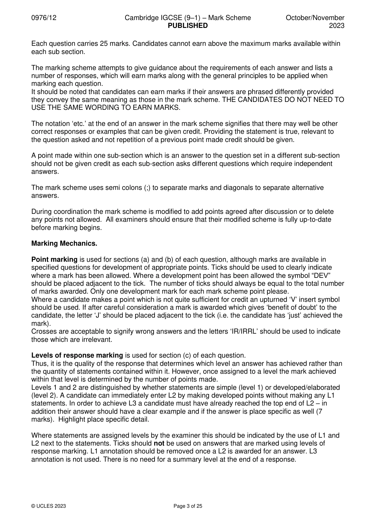
0976/12 Cambridge IGCSE (9–1) – Mark Scheme PUBLISHED October/November 2023 © UCLES 2023 Page 3 of 25 Each question carries 25 marks. Candidates cannot earn above the maximum marks available within each sub section. The marking scheme attempts to give guidance about the requirements of each answer and lists a number of responses, which will earn marks along with the general principles to be applied when marking each question. It should be noted that candidates can earn marks if their answers are phrased differently provided they convey the same meaning as those in the mark scheme. THE CANDIDATES DO NOT NEED TO USE THE SAME WORDING TO EARN MARKS. The notation ‘etc.’ at the end of an answer in the mark scheme signifies that there may well be other correct responses or examples that can be given credit. Providing the statement is true, relevant to the question asked and not repetition of a previous point made credit should be given. A point made within one sub-section which is an answer to the question set in a different sub-section should not be given credit as each sub-section asks different questions which require independent answers. The mark scheme uses semi colons (;) to separate marks and diagonals to separate alternative answers. During coordination the mark scheme is modified to add points agreed after discussion or to delete any points not allowed. All examiners should ensure that their modified scheme is fully up-to-date before marking begins. Marking Mechanics. Point marking is used for sections (a) and (b) of each question, although marks are available in specified questions for development of appropriate points. Ticks should be used to clearly indicate where a mark has been allowed. Where a development point has been allowed the symbol “DEV” should be placed adjacent to the tick. The number of ticks should always be equal to the total number of marks awarded. Only one development mark for each mark scheme point please. Where a candidate makes a point which is not quite sufficient for credit an upturned ‘V’ insert symbol should be used. If after careful consideration a mark is awarded which gives ‘benefit of doubt’ to the candidate, the letter ‘J’ should be placed adjacent to the tick (i.e. the candidate has ‘just’ achieved the mark). Crosses are acceptable to signify wrong answers and the letters ‘IR/IRRL’ should be used to indicate those which are irrelevant. Levels of response marking is used for section (c) of each question. Thus, it is the quality of the response that determines which level an answer has achieved rather than the quantity of statements contained within it. However, once assigned to a level the mark achieved within that level is determined by the number of points made. Levels 1 and 2 are distinguished by whether statements are simple (level 1) or developed/elaborated (level 2). A candidate can immediately enter L2 by making developed points without making any L1 statements. In order to achieve L3 a candidate must have already reached the top end of L2 – in addition their answer should have a clear example and if the answer is place specific as well (7 marks). Highlight place specific detail. Where statements are assigned levels by the examiner this should be indicated by the use of L1 and L2 next to the statements. Ticks should not be used on answers that are marked using levels of response marking. L1 annotation should be removed once a L2 is awarded for an answer. L3 annotation is not used. There is no need for a summary level at the end of a response.
Mark scheme, page 4
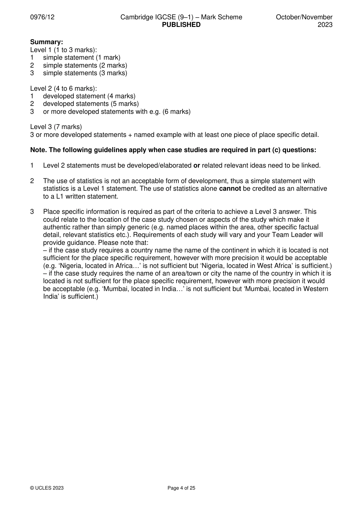
0976/12 Cambridge IGCSE (9–1) – Mark Scheme PUBLISHED October/November 2023 © UCLES 2023 Page 4 of 25 Summary: Level 1 (1 to 3 marks): 1 simple statement (1 mark) 2 simple statements (2 marks) 3 simple statements (3 marks) Level 2 (4 to 6 marks): 1 developed statement (4 marks) 2 developed statements (5 marks) 3 or more developed statements with e.g. (6 marks) Level 3 (7 marks) 3 or more developed statements + named example with at least one piece of place specific detail. Note. The following guidelines apply when case studies are required in part (c) questions: 1 Level 2 statements must be developed/elaborated or related relevant ideas need to be linked. 2 The use of statistics is not an acceptable form of development, thus a simple statement with statistics is a Level 1 statement. The use of statistics alone cannot be credited as an alternative to a L1 written statement. 3 Place specific information is required as part of the criteria to achieve a Level 3 answer. This could relate to the location of the case study chosen or aspects of the study which make it authentic rather than simply generic (e.g. named places within the area, other specific factual detail, relevant statistics etc.). Requirements of each study will vary and your Team Leader will provide guidance. Please note that: – if the case study requires a country name the name of the continent in which it is located is not sufficient for the place specific requirement, however with more precision it would be acceptable (e.g. ‘Nigeria, located in Africa…’ is not sufficient but ‘Nigeria, located in West Africa’ is sufficient.) – if the case study requires the name of an area/town or city the name of the country in which it is located is not sufficient for the place specific requirement, however with more precision it would be acceptable (e.g. ‘Mumbai, located in India…’ is not sufficient but ‘Mumbai, located in Western India’ is sufficient.)
Mark scheme, page 5
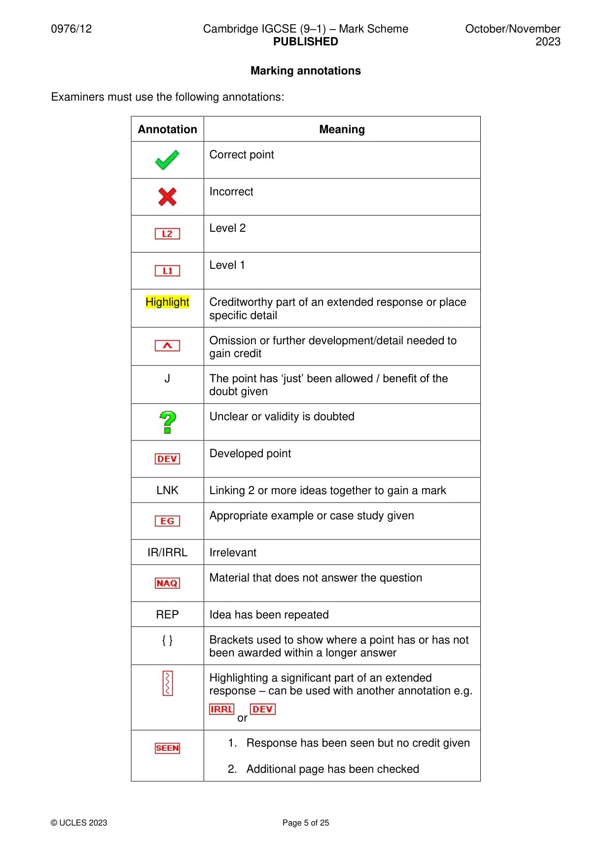
0976/12 Cambridge IGCSE (9–1) – Mark Scheme PUBLISHED October/November 2023 © UCLES 2023 Page 5 of 25 Marking annotations Examiners must use the following annotations: Annotation Meaning Correct point Incorrect Level 2 Level 1 Highlight Creditworthy part of an extended response or place specific detail Omission or further development/detail needed to gain credit J The point has ‘just’ been allowed / benefit of the doubt given Unclear or validity is doubted Developed point LNK Linking 2 or more ideas together to gain a mark Appropriate example or case study given IR/IRRL Irrelevant Material that does not answer the question REP Idea has been repeated { } Brackets used to show where a point has or has not been awarded within a longer answer Highlighting a significant part of an extended response – can be used with another annotation e.g. or 1. Response has been seen but no credit given 2. Additional page has been checked
Mark scheme, page 6
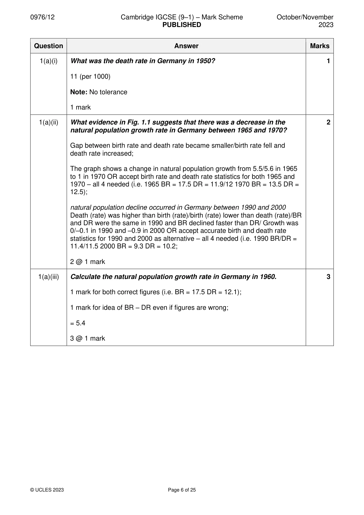
0976/12 Cambridge IGCSE (9–1) – Mark Scheme PUBLISHED October/November 2023 © UCLES 2023 Page 6 of 25 Question Answer Marks 1(a)(i) What was the death rate in Germany in 1950? 11 (per 1000) Note: No tolerance 1 mark 1 1(a)(ii) What evidence in Fig. 1.1 suggests that there was a decrease in the natural population growth rate in Germany between 1965 and 1970? Gap between birth rate and death rate became smaller/birth rate fell and death rate increased; The graph shows a change in natural population growth from 5.5/5.6 in 1965 to 1 in 1970 OR accept birth rate and death rate statistics for both 1965 and 1970 – all 4 needed (i.e. 1965 BR = 17.5 DR = 11.9/12 1970 BR = 13.5 DR = 12.5); natural population decline occurred in Germany between 1990 and 2000 Death (rate) was higher than birth (rate)/birth (rate) lower than death (rate)/BR and DR were the same in 1990 and BR declined faster than DR/ Growth was 0/–0.1 in 1990 and –0.9 in 2000 OR accept accurate birth and death rate statistics for 1990 and 2000 as alternative – all 4 needed (i.e. 1990 BR/DR = 11.4/11.5 2000 BR = 9.3 DR = 10.2; 2 @ 1 mark 2 1(a)(iii) Calculate the natural population growth rate in Germany in 1960. 1 mark for both correct figures (i.e. BR = 17.5 DR = 12.1); 1 mark for idea of BR – DR even if figures are wrong; = 5.4 3 @ 1 mark 3
Mark scheme, page 7
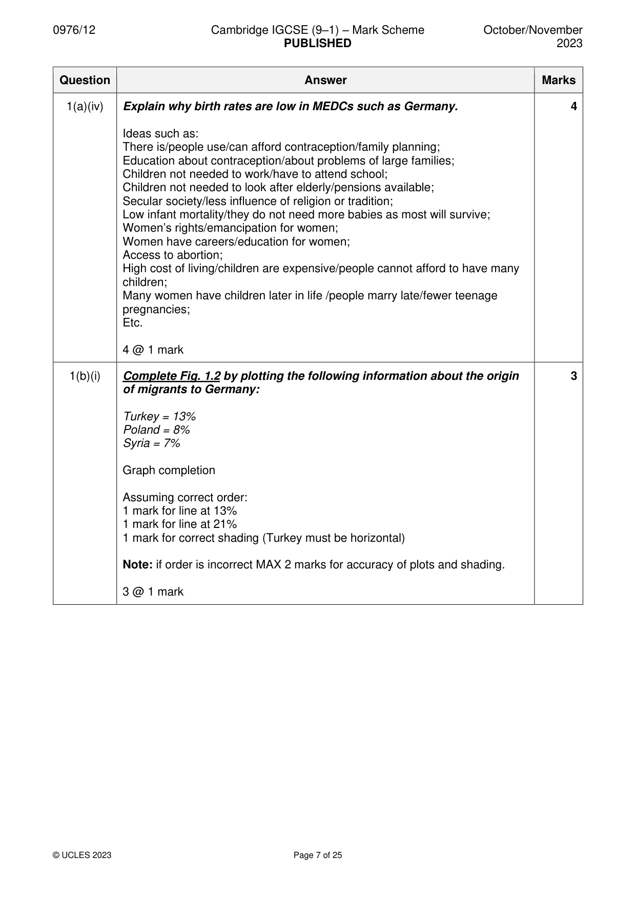
0976/12 Cambridge IGCSE (9–1) – Mark Scheme PUBLISHED October/November 2023 © UCLES 2023 Page 7 of 25 Question Answer Marks 1(a)(iv) Explain why birth rates are low in MEDCs such as Germany. Ideas such as: There is/people use/can afford contraception/family planning; Education about contraception/about problems of large families; Children not needed to work/have to attend school; Children not needed to look after elderly/pensions available; Secular society/less influence of religion or tradition; Low infant mortality/they do not need more babies as most will survive; Women’s rights/emancipation for women; Women have careers/education for women; Access to abortion; High cost of living/children are expensive/people cannot afford to have many children; Many women have children later in life /people marry late/fewer teenage pregnancies; Etc. 4 @ 1 mark 4 1(b)(i) Complete Fig. 1.2 by plotting the following information about the origin of migrants to Germany: Turkey = 13% Poland = 8% Syria = 7% Graph completion Assuming correct order: 1 mark for line at 13% 1 mark for line at 21% 1 mark for correct shading (Turkey must be horizontal) Note: if order is incorrect MAX 2 marks for accuracy of plots and shading. 3 @ 1 mark 3
Mark scheme, page 8
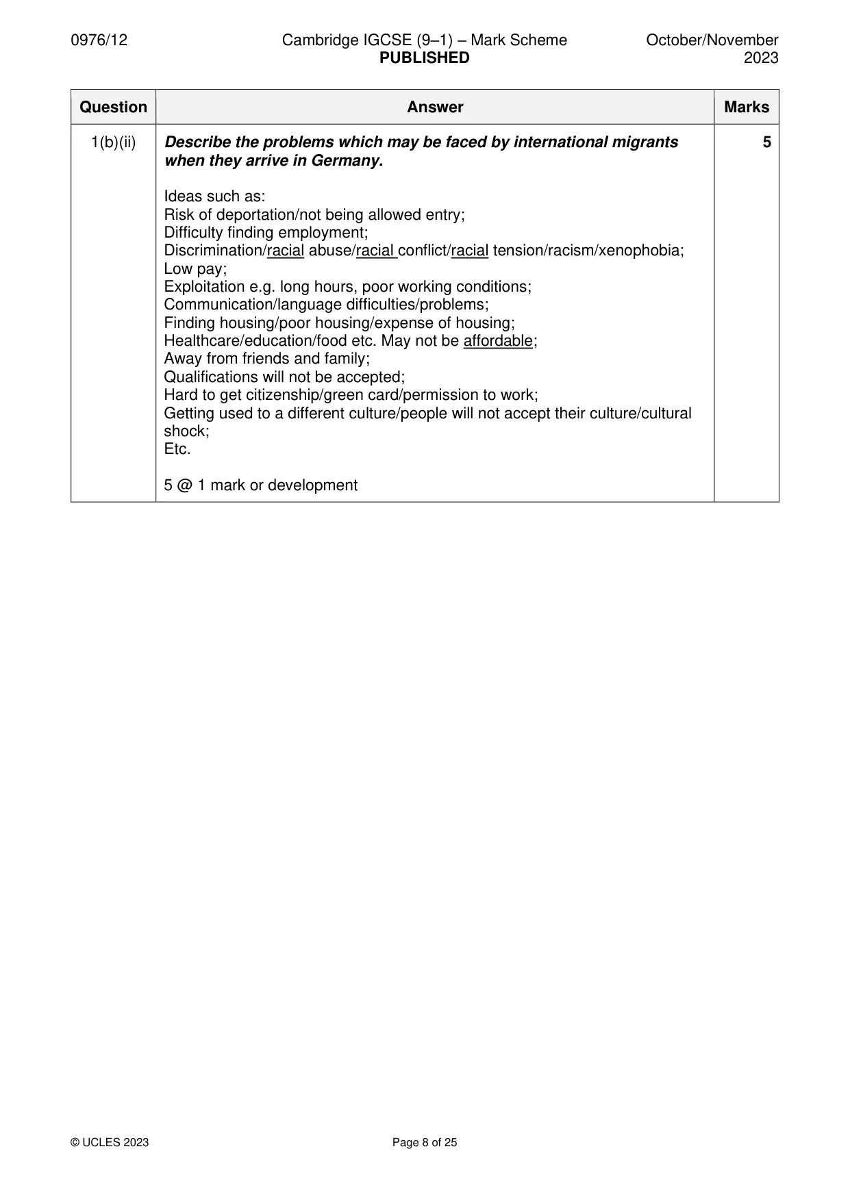
0976/12 Cambridge IGCSE (9–1) – Mark Scheme PUBLISHED October/November 2023 © UCLES 2023 Page 8 of 25 Question Answer Marks 1(b)(ii) Describe the problems which may be faced by international migrants when they arrive in Germany. Ideas such as: Risk of deportation/not being allowed entry; Difficulty finding employment; Discrimination/racial abuse/racial conflict/racial tension/racism/xenophobia; Low pay; Exploitation e.g. long hours, poor working conditions; Communication/language difficulties/problems; Finding housing/poor housing/expense of housing; Healthcare/education/food etc. May not be affordable; Away from friends and family; Qualifications will not be accepted; Hard to get citizenship/green card/permission to work; Getting used to a different culture/people will not accept their culture/cultural shock; Etc. 5 @ 1 mark or development 5
Mark scheme, page 9
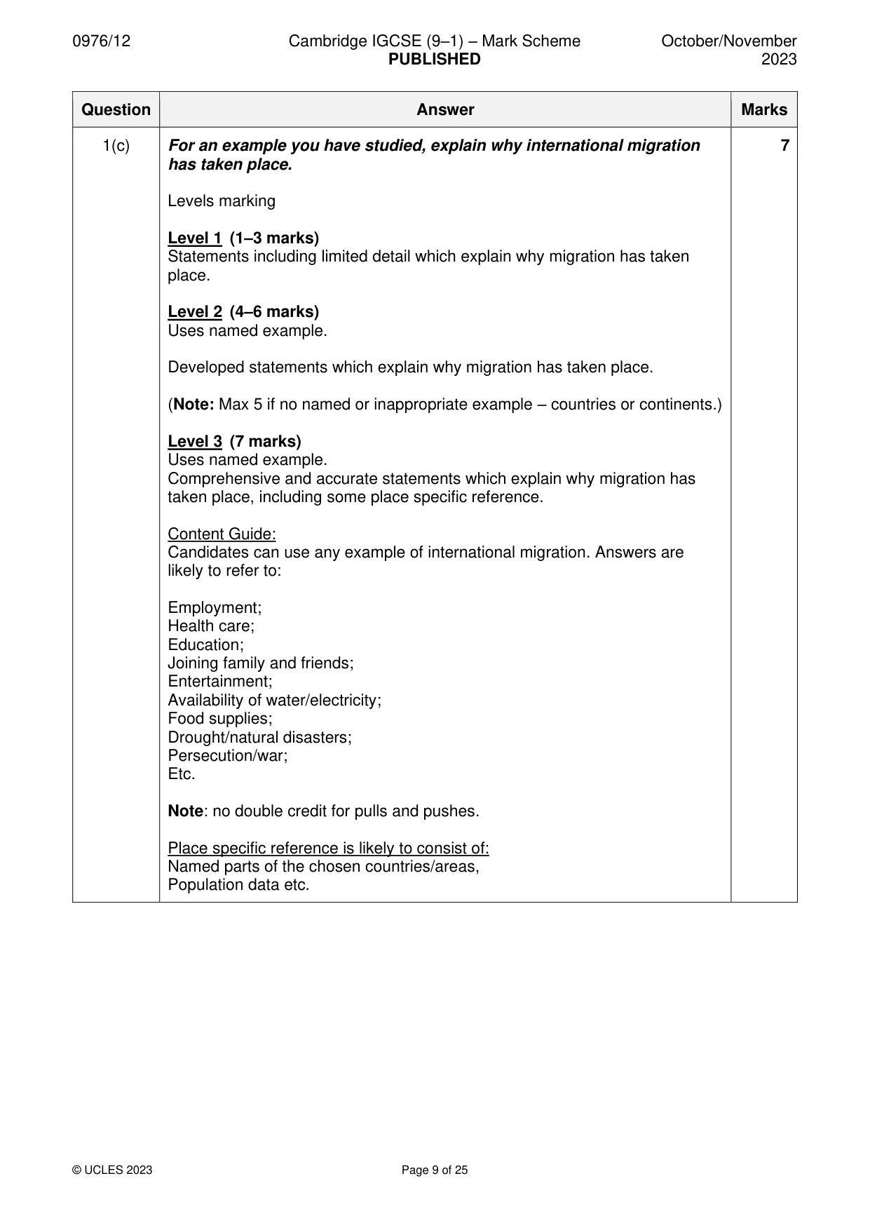
0976/12 Cambridge IGCSE (9–1) – Mark Scheme PUBLISHED October/November 2023 © UCLES 2023 Page 9 of 25 Question Answer Marks 1(c) For an example you have studied, explain why international migration has taken place. Levels marking Level 1 (1–3 marks) Statements including limited detail which explain why migration has taken place. Level 2 (4–6 marks) Uses named example. Developed statements which explain why migration has taken place. (Note: Max 5 if no named or inappropriate example – countries or continents.) Level 3 (7 marks) Uses named example. Comprehensive and accurate statements which explain why migration has taken place, including some place specific reference. Content Guide: Candidates can use any example of international migration. Answers are likely to refer to: Employment; Health care; Education; Joining family and friends; Entertainment; Availability of water/electricity; Food supplies; Drought/natural disasters; Persecution/war; Etc. Note: no double credit for pulls and pushes. Place specific reference is likely to consist of: Named parts of the chosen countries/areas, Population data etc. 7
Mark scheme, page 10
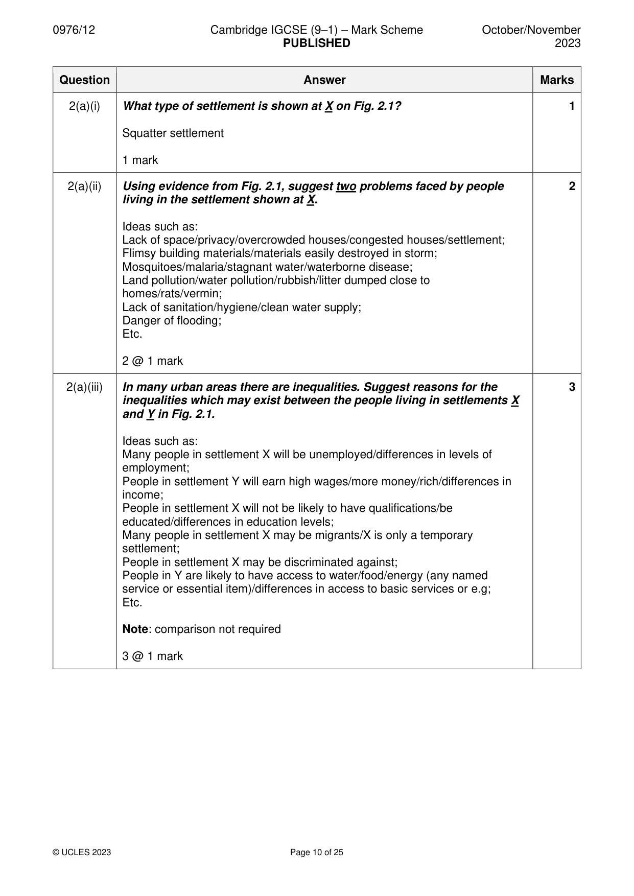
0976/12 Cambridge IGCSE (9–1) – Mark Scheme PUBLISHED October/November 2023 © UCLES 2023 Page 10 of 25 Question Answer Marks 2(a)(i) What type of settlement is shown at X on Fig. 2.1? Squatter settlement 1 mark 1 2(a)(ii) Using evidence from Fig. 2.1, suggest two problems faced by people living in the settlement shown at X. Ideas such as: Lack of space/privacy/overcrowded houses/congested houses/settlement; Flimsy building materials/materials easily destroyed in storm; Mosquitoes/malaria/stagnant water/waterborne disease; Land pollution/water pollution/rubbish/litter dumped close to homes/rats/vermin; Lack of sanitation/hygiene/clean water supply; Danger of flooding; Etc. 2 @ 1 mark 2 2(a)(iii) In many urban areas there are inequalities. Suggest reasons for the inequalities which may exist between the people living in settlements X and Y in Fig. 2.1. Ideas such as: Many people in settlement X will be unemployed/differences in levels of employment; People in settlement Y will earn high wages/more money/rich/differences in income; People in settlement X will not be likely to have qualifications/be educated/differences in education levels; Many people in settlement X may be migrants/X is only a temporary settlement; People in settlement X may be discriminated against; People in Y are likely to have access to water/food/energy (any named service or essential item)/differences in access to basic services or e.g; Etc. Note: comparison not required 3 @ 1 mark 3
Mark scheme, page 11
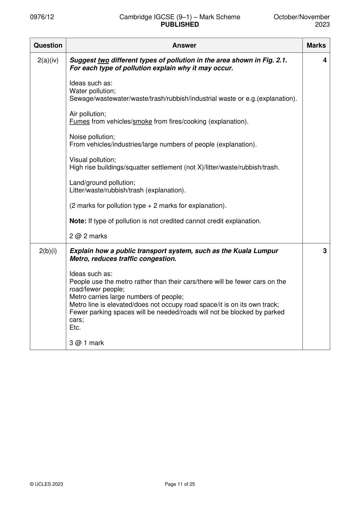
0976/12 Cambridge IGCSE (9–1) – Mark Scheme PUBLISHED October/November 2023 © UCLES 2023 Page 11 of 25 Question Answer Marks 2(a)(iv) Suggest two different types of pollution in the area shown in Fig. 2.1. For each type of pollution explain why it may occur. Ideas such as: Water pollution; Sewage/wastewater/waste/trash/rubbish/industrial waste or e.g.(explanation). Air pollution; Fumes from vehicles/smoke from fires/cooking (explanation). Noise pollution; From vehicles/industries/large numbers of people (explanation). Visual pollution; High rise buildings/squatter settlement (not X)/litter/waste/rubbish/trash. Land/ground pollution; Litter/waste/rubbish/trash (explanation). (2 marks for pollution type + 2 marks for explanation). Note: If type of pollution is not credited cannot credit explanation. 2 @ 2 marks 4 2(b)(i) Explain how a public transport system, such as the Kuala Lumpur Metro, reduces traffic congestion. Ideas such as: People use the metro rather than their cars/there will be fewer cars on the road/fewer people; Metro carries large numbers of people; Metro line is elevated/does not occupy road space/it is on its own track; Fewer parking spaces will be needed/roads will not be blocked by parked cars; Etc. 3 @ 1 mark 3
Mark scheme, page 12
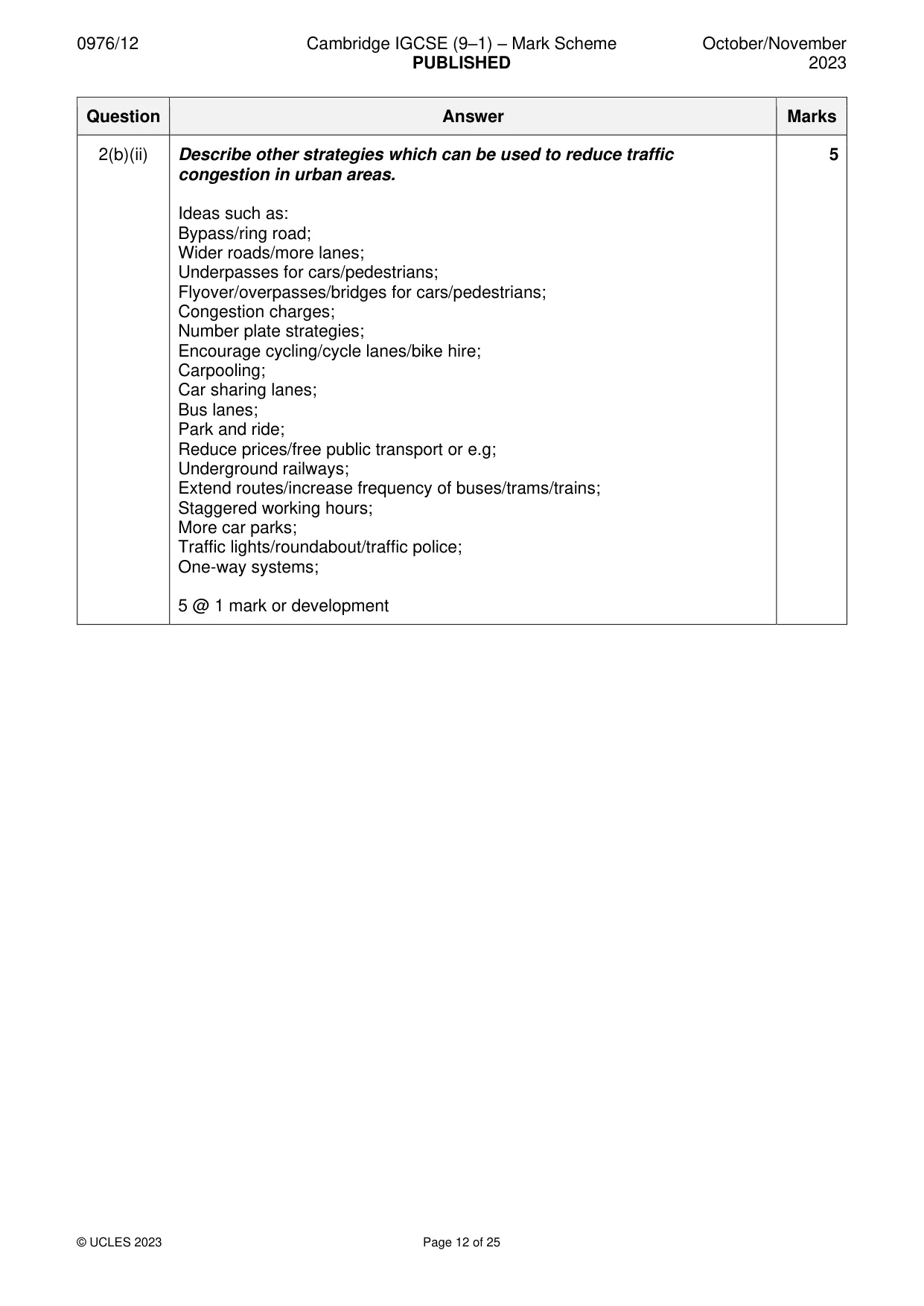
0976/12 Cambridge IGCSE (9–1) – Mark Scheme PUBLISHED October/November 2023 © UCLES 2023 Page 12 of 25 Question Answer Marks 2(b)(ii) Describe other strategies which can be used to reduce traffic congestion in urban areas. Ideas such as: Bypass/ring road; Wider roads/more lanes; Underpasses for cars/pedestrians; Flyover/overpasses/bridges for cars/pedestrians; Congestion charges; Number plate strategies; Encourage cycling/cycle lanes/bike hire; Carpooling; Car sharing lanes; Bus lanes; Park and ride; Reduce prices/free public transport or e.g; Underground railways; Extend routes/increase frequency of buses/trams/trains; Staggered working hours; More car parks; Traffic lights/roundabout/traffic police; One-way systems; 5 @ 1 mark or development 5
Mark scheme, page 13
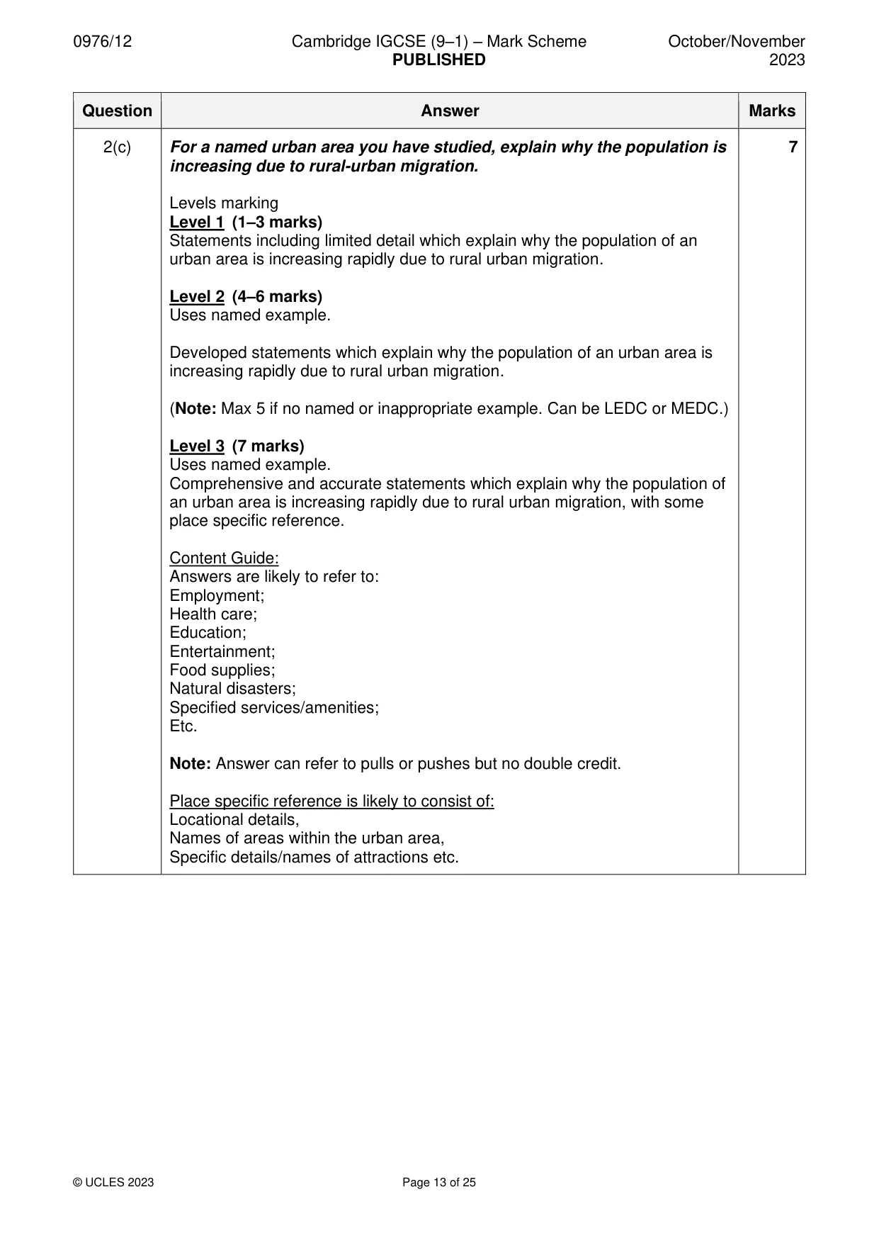
0976/12 Cambridge IGCSE (9–1) – Mark Scheme PUBLISHED October/November 2023 © UCLES 2023 Page 13 of 25 Question Answer Marks 2(c) For a named urban area you have studied, explain why the population is increasing due to rural-urban migration. Levels marking Level 1 (1–3 marks) Statements including limited detail which explain why the population of an urban area is increasing rapidly due to rural urban migration. Level 2 (4–6 marks) Uses named example. Developed statements which explain why the population of an urban area is increasing rapidly due to rural urban migration. (Note: Max 5 if no named or inappropriate example. Can be LEDC or MEDC.) Level 3 (7 marks) Uses named example. Comprehensive and accurate statements which explain why the population of an urban area is increasing rapidly due to rural urban migration, with some place specific reference. Content Guide: Answers are likely to refer to: Employment; Health care; Education; Entertainment; Food supplies; Natural disasters; Specified services/amenities; Etc. Note: Answer can refer to pulls or pushes but no double credit. Place specific reference is likely to consist of: Locational details, Names of areas within the urban area, Specific details/names of attractions etc. 7
Mark scheme, page 14
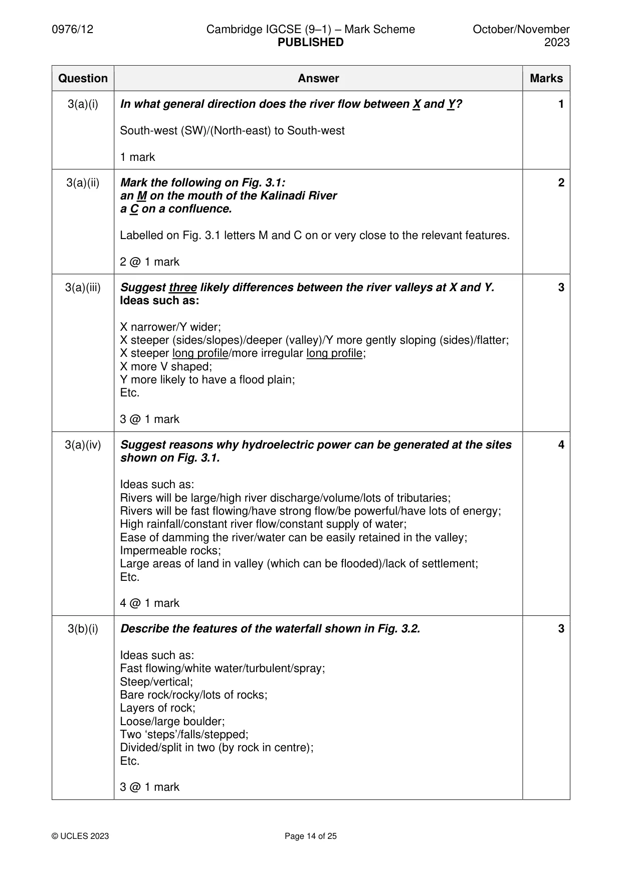
0976/12 Cambridge IGCSE (9–1) – Mark Scheme PUBLISHED October/November 2023 © UCLES 2023 Page 14 of 25 Question Answer Marks 3(a)(i) In what general direction does the river flow between X and Y? South-west (SW)/(North-east) to South-west 1 mark 1 3(a)(ii) Mark the following on Fig. 3.1: an M on the mouth of the Kalinadi River a C on a confluence. Labelled on Fig. 3.1 letters M and C on or very close to the relevant features. 2 @ 1 mark 2 3(a)(iii) Suggest three likely differences between the river valleys at X and Y. Ideas such as: X narrower/Y wider; X steeper (sides/slopes)/deeper (valley)/Y more gently sloping (sides)/flatter; X steeper long profile/more irregular long profile; X more V shaped; Y more likely to have a flood plain; Etc. 3 @ 1 mark 3 3(a)(iv) Suggest reasons why hydroelectric power can be generated at the sites shown on Fig. 3.1. Ideas such as: Rivers will be large/high river discharge/volume/lots of tributaries; Rivers will be fast flowing/have strong flow/be powerful/have lots of energy; High rainfall/constant river flow/constant supply of water; Ease of damming the river/water can be easily retained in the valley; Impermeable rocks; Large areas of land in valley (which can be flooded)/lack of settlement; Etc. 4 @ 1 mark 4 3(b)(i) Describe the features of the waterfall shown in Fig. 3.2. Ideas such as: Fast flowing/white water/turbulent/spray; Steep/vertical; Bare rock/rocky/lots of rocks; Layers of rock; Loose/large boulder; Two ‘steps’/falls/stepped; Divided/split in two (by rock in centre); Etc. 3 @ 1 mark 3
Mark scheme, page 15
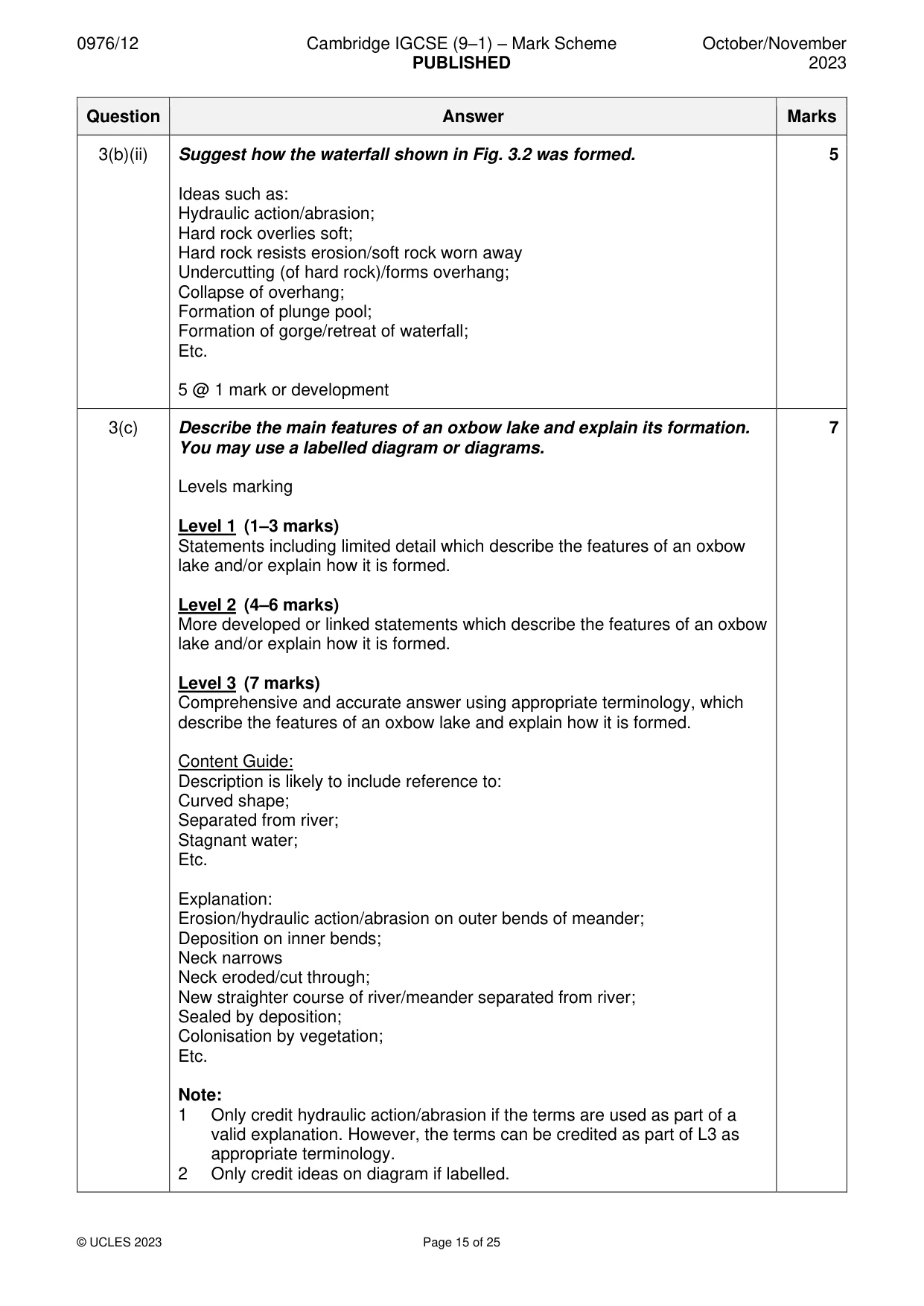
0976/12 Cambridge IGCSE (9–1) – Mark Scheme PUBLISHED October/November 2023 © UCLES 2023 Page 15 of 25 Question Answer Marks 3(b)(ii) Suggest how the waterfall shown in Fig. 3.2 was formed. Ideas such as: Hydraulic action/abrasion; Hard rock overlies soft; Hard rock resists erosion/soft rock worn away Undercutting (of hard rock)/forms overhang; Collapse of overhang; Formation of plunge pool; Formation of gorge/retreat of waterfall; Etc. 5 @ 1 mark or development 5 3(c) Describe the main features of an oxbow lake and explain its formation. You may use a labelled diagram or diagrams. Levels marking Level 1 (1–3 marks) Statements including limited detail which describe the features of an oxbow lake and/or explain how it is formed. Level 2 (4–6 marks) More developed or linked statements which describe the features of an oxbow lake and/or explain how it is formed. Level 3 (7 marks) Comprehensive and accurate answer using appropriate terminology, which describe the features of an oxbow lake and explain how it is formed. Content Guide: Description is likely to include reference to: Curved shape; Separated from river; Stagnant water; Etc. Explanation: Erosion/hydraulic action/abrasion on outer bends of meander; Deposition on inner bends; Neck narrows Neck eroded/cut through; New straighter course of river/meander separated from river; Sealed by deposition; Colonisation by vegetation; Etc. Note: 1 Only credit hydraulic action/abrasion if the terms are used as part of a valid explanation. However, the terms can be credited as part of L3 as appropriate terminology. 2 Only credit ideas on diagram if labelled. 7
Mark scheme, page 16
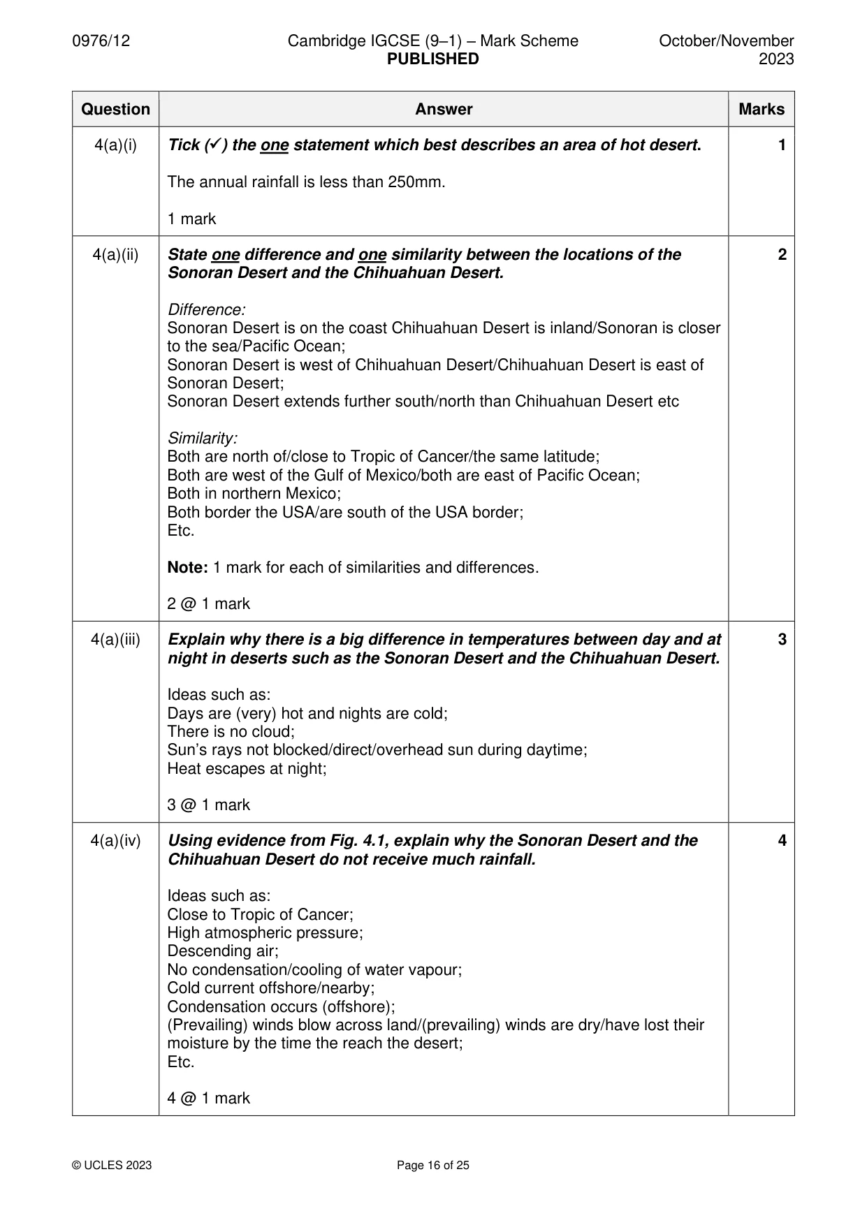
0976/12 Cambridge IGCSE (9–1) – Mark Scheme PUBLISHED October/November 2023 © UCLES 2023 Page 16 of 25 Question Answer Marks 4(a)(i) Tick (✓) the one statement which best describes an area of hot desert. The annual rainfall is less than 250mm. 1 mark 1 4(a)(ii) State one difference and one similarity between the locations of the Sonoran Desert and the Chihuahuan Desert. Difference: Sonoran Desert is on the coast Chihuahuan Desert is inland/Sonoran is closer to the sea/Pacific Ocean; Sonoran Desert is west of Chihuahuan Desert/Chihuahuan Desert is east of Sonoran Desert; Sonoran Desert extends further south/north than Chihuahuan Desert etc Similarity: Both are north of/close to Tropic of Cancer/the same latitude; Both are west of the Gulf of Mexico/both are east of Pacific Ocean; Both in northern Mexico; Both border the USA/are south of the USA border; Etc. Note: 1 mark for each of similarities and differences. 2 @ 1 mark 2 4(a)(iii) Explain why there is a big difference in temperatures between day and at night in deserts such as the Sonoran Desert and the Chihuahuan Desert. Ideas such as: Days are (very) hot and nights are cold; There is no cloud; Sun’s rays not blocked/direct/overhead sun during daytime; Heat escapes at night; 3 @ 1 mark 3 4(a)(iv) Using evidence from Fig. 4.1, explain why the Sonoran Desert and the Chihuahuan Desert do not receive much rainfall. Ideas such as: Close to Tropic of Cancer; High atmospheric pressure; Descending air; No condensation/cooling of water vapour; Cold current offshore/nearby; Condensation occurs (offshore); (Prevailing) winds blow across land/(prevailing) winds are dry/have lost their moisture by the time the reach the desert; Etc. 4 @ 1 mark 4
Mark scheme, page 17
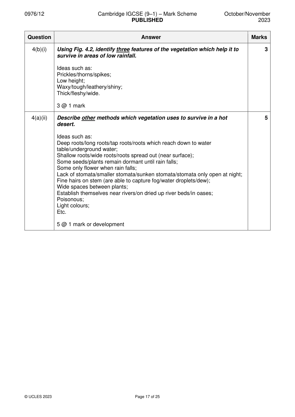
0976/12 Cambridge IGCSE (9–1) – Mark Scheme PUBLISHED October/November 2023 © UCLES 2023 Page 17 of 25 Question Answer Marks 4(b)(i) Using Fig. 4.2, identify three features of the vegetation which help it to survive in areas of low rainfall. Ideas such as: Prickles/thorns/spikes; Low height; Waxy/tough/leathery/shiny; Thick/fleshy/wide. 3 @ 1 mark 3 4(a)(ii) Describe other methods which vegetation uses to survive in a hot desert. Ideas such as: Deep roots/long roots/tap roots/roots which reach down to water table/underground water; Shallow roots/wide roots/roots spread out (near surface); Some seeds/plants remain dormant until rain falls; Some only flower when rain falls; Lack of stomata/smaller stomata/sunken stomata/stomata only open at night; Fine hairs on stem (are able to capture fog/water droplets/dew); Wide spaces between plants; Establish themselves near rivers/on dried up river beds/in oases; Poisonous; Light colours; Etc. 5 @ 1 mark or development 5
Mark scheme, page 18
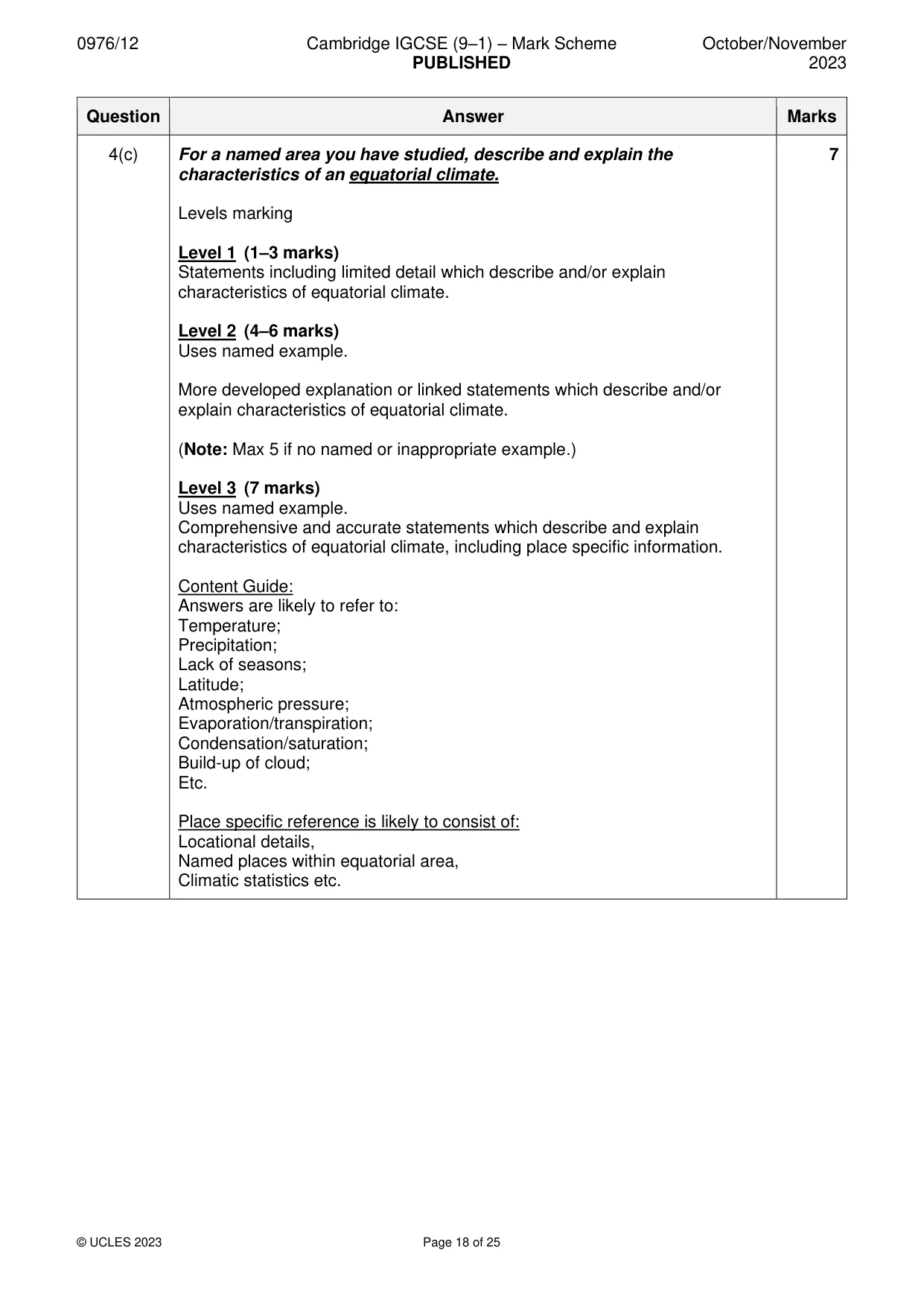
0976/12 Cambridge IGCSE (9–1) – Mark Scheme PUBLISHED October/November 2023 © UCLES 2023 Page 18 of 25 Question Answer Marks 4(c) For a named area you have studied, describe and explain the characteristics of an equatorial climate. Levels marking Level 1 (1–3 marks) Statements including limited detail which describe and/or explain characteristics of equatorial climate. Level 2 (4–6 marks) Uses named example. More developed explanation or linked statements which describe and/or explain characteristics of equatorial climate. (Note: Max 5 if no named or inappropriate example.) Level 3 (7 marks) Uses named example. Comprehensive and accurate statements which describe and explain characteristics of equatorial climate, including place specific information. Content Guide: Answers are likely to refer to: Temperature; Precipitation; Lack of seasons; Latitude; Atmospheric pressure; Evaporation/transpiration; Condensation/saturation; Build-up of cloud; Etc. Place specific reference is likely to consist of: Locational details, Named places within equatorial area, Climatic statistics etc. 7
Mark scheme, page 19
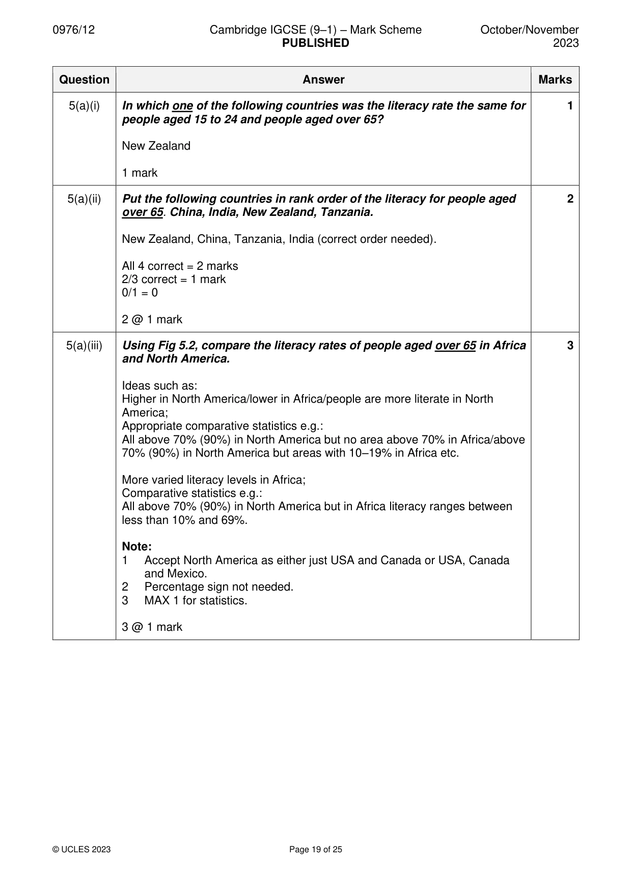
0976/12 Cambridge IGCSE (9–1) – Mark Scheme PUBLISHED October/November 2023 © UCLES 2023 Page 19 of 25 Question Answer Marks 5(a)(i) In which one of the following countries was the literacy rate the same for people aged 15 to 24 and people aged over 65? New Zealand 1 mark 1 5(a)(ii) Put the following countries in rank order of the literacy for people aged over 65. China, India, New Zealand, Tanzania. New Zealand, China, Tanzania, India (correct order needed). All 4 correct = 2 marks 2/3 correct = 1 mark 0/1 = 0 2 @ 1 mark 2 5(a)(iii) Using Fig 5.2, compare the literacy rates of people aged over 65 in Africa and North America. Ideas such as: Higher in North America/lower in Africa/people are more literate in North America; Appropriate comparative statistics e.g.: All above 70% (90%) in North America but no area above 70% in Africa/above 70% (90%) in North America but areas with 10–19% in Africa etc. More varied literacy levels in Africa; Comparative statistics e.g.: All above 70% (90%) in North America but in Africa literacy ranges between less than 10% and 69%. Note: 1 Accept North America as either just USA and Canada or USA, Canada and Mexico. 2 Percentage sign not needed. 3 MAX 1 for statistics. 3 @ 1 mark 3
Mark scheme, page 20
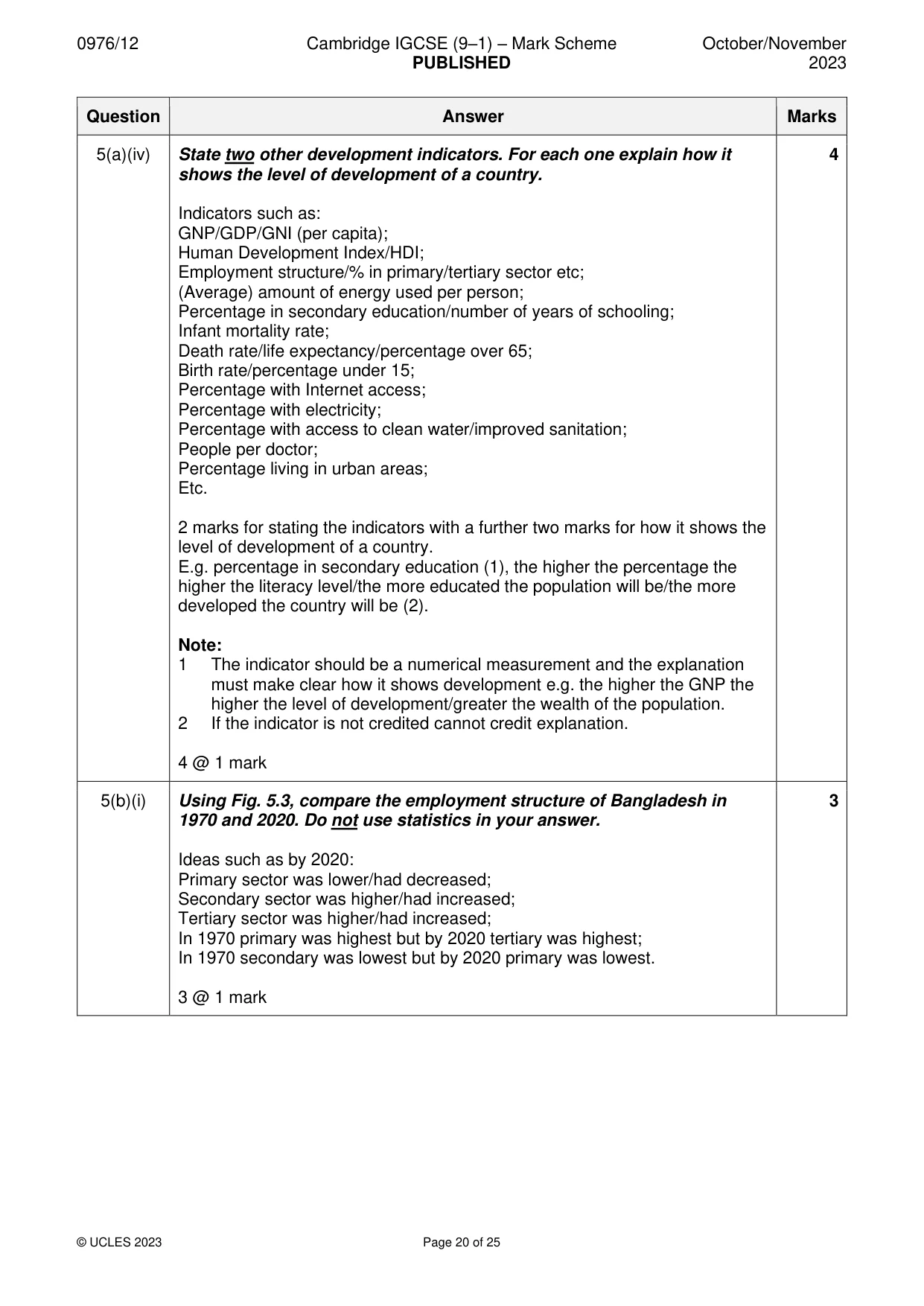
0976/12 Cambridge IGCSE (9–1) – Mark Scheme PUBLISHED October/November 2023 © UCLES 2023 Page 20 of 25 Question Answer Marks 5(a)(iv) State two other development indicators. For each one explain how it shows the level of development of a country. Indicators such as: GNP/GDP/GNI (per capita); Human Development Index/HDI; Employment structure/% in primary/tertiary sector etc; (Average) amount of energy used per person; Percentage in secondary education/number of years of schooling; Infant mortality rate; Death rate/life expectancy/percentage over 65; Birth rate/percentage under 15; Percentage with Internet access; Percentage with electricity; Percentage with access to clean water/improved sanitation; People per doctor; Percentage living in urban areas; Etc. 2 marks for stating the indicators with a further two marks for how it shows the level of development of a country. E.g. percentage in secondary education (1), the higher the percentage the higher the literacy level/the more educated the population will be/the more developed the country will be (2). Note: 1 The indicator should be a numerical measurement and the explanation must make clear how it shows development e.g. the higher the GNP the higher the level of development/greater the wealth of the population. 2 If the indicator is not credited cannot credit explanation. 4 @ 1 mark 4 5(b)(i) Using Fig. 5.3, compare the employment structure of Bangladesh in 1970 and 2020. Do not use statistics in your answer. Ideas such as by 2020: Primary sector was lower/had decreased; Secondary sector was higher/had increased; Tertiary sector was higher/had increased; In 1970 primary was highest but by 2020 tertiary was highest; In 1970 secondary was lowest but by 2020 primary was lowest. 3 @ 1 mark 3
Mark scheme, page 21
0976/12 Cambridge IGCSE (9–1) – Mark Scheme PUBLISHED October/November 2023 © UCLES 2023 Page 21 of 25 Question Answer Marks 5(a)(ii) Explain how changes in technology can result in changes in the employment structure of a country. Ideas such as: Introduction of machinery/technology encourages growth of manufacturing industry/more workers in secondary sector; Introduction of machinery/technology on farms reduces importance of primary sector/the need for workers; Development of technology in factories/machines/assembly lines/automation/reduces need for workers in secondary sector; Communications technology/phone/fax/computers/information technology/internet encourages development of tertiary sector (or example e.g. online businesses); Development of information technology/computers/ internet/artificial intelligence (AI) encourages growth of quaternary sector; Development of air travel technology or example increases employment in tourist industry; Growth of online retail reduces need for shop workers; Growth of online banking reduces need for bank workers; Etc. 5 @ 1 mark or development 5
Mark scheme, page 22
0976/12 Cambridge IGCSE (9–1) – Mark Scheme PUBLISHED October/November 2023 © UCLES 2023 Page 22 of 25 Question Answer Marks 5(c) For a named transnational corporation you have studied, describe its characteristics and global links. Levels marking Level 1 (1–3 marks) Statements including limited detail which describe characteristics and/or global links of a transnational corporation. Level 2 (4–6 marks) Uses named example. More developed statements which describe characteristics and/or global links of a transnational corporation. (Note: Max 5 if no named or inappropriate example.) Level 3 (7 marks) Uses named example. Comprehensive and accurate statements which describe characteristics/global links of a transnational corporation, including some place specific reference. Content Guide: Answers are likely to refer to: Location; Size; Inputs; Output; Processes; Workforce; Trade; Etc. Place specific reference is likely to consist of: Locational details/named locations, Specific details of products etc. 7
Mark scheme, page 23
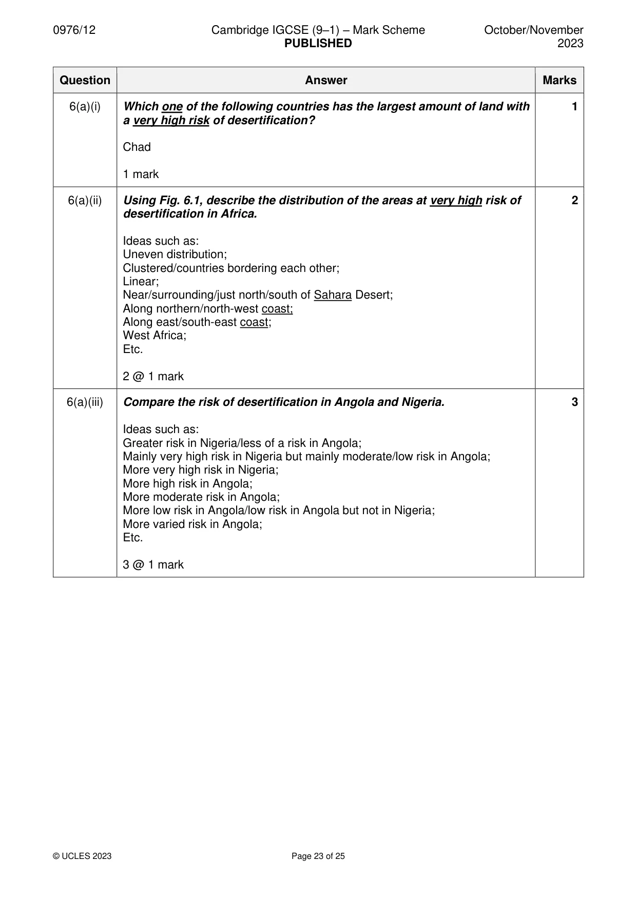
0976/12 Cambridge IGCSE (9–1) – Mark Scheme PUBLISHED October/November 2023 © UCLES 2023 Page 23 of 25 Question Answer Marks 6(a)(i) Which one of the following countries has the largest amount of land with a very high risk of desertification? Chad 1 mark 1 6(a)(ii) Using Fig. 6.1, describe the distribution of the areas at very high risk of desertification in Africa. Ideas such as: Uneven distribution; Clustered/countries bordering each other; Linear; Near/surrounding/just north/south of Sahara Desert; Along northern/north-west coast; Along east/south-east coast; West Africa; Etc. 2 @ 1 mark 2 6(a)(iii) Compare the risk of desertification in Angola and Nigeria. Ideas such as: Greater risk in Nigeria/less of a risk in Angola; Mainly very high risk in Nigeria but mainly moderate/low risk in Angola; More very high risk in Nigeria; More high risk in Angola; More moderate risk in Angola; More low risk in Angola/low risk in Angola but not in Nigeria; More varied risk in Angola; Etc. 3 @ 1 mark 3
Mark scheme, page 24
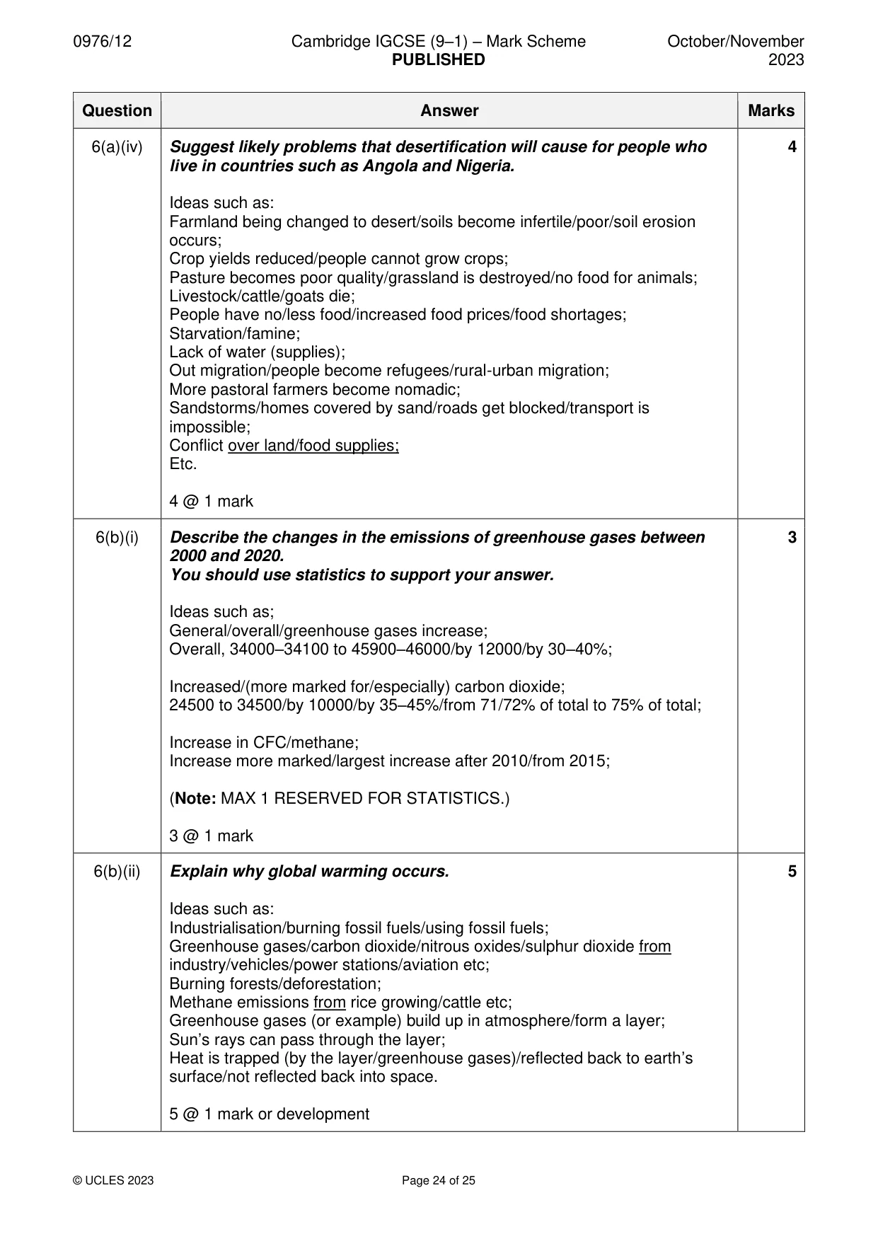
0976/12 Cambridge IGCSE (9–1) – Mark Scheme PUBLISHED October/November 2023 © UCLES 2023 Page 24 of 25 Question Answer Marks 6(a)(iv) Suggest likely problems that desertification will cause for people who live in countries such as Angola and Nigeria. Ideas such as: Farmland being changed to desert/soils become infertile/poor/soil erosion occurs; Crop yields reduced/people cannot grow crops; Pasture becomes poor quality/grassland is destroyed/no food for animals; Livestock/cattle/goats die; People have no/less food/increased food prices/food shortages; Starvation/famine; Lack of water (supplies); Out migration/people become refugees/rural-urban migration; More pastoral farmers become nomadic; Sandstorms/homes covered by sand/roads get blocked/transport is impossible; Conflict over land/food supplies; Etc. 4 @ 1 mark 4 6(b)(i) Describe the changes in the emissions of greenhouse gases between 2000 and 2020. You should use statistics to support your answer. Ideas such as; General/overall/greenhouse gases increase; Overall, 34000–34100 to 45900–46000/by 12000/by 30–40%; Increased/(more marked for/especially) carbon dioxide; 24500 to 34500/by 10000/by 35–45%/from 71/72% of total to 75% of total; Increase in CFC/methane; Increase more marked/largest increase after 2010/from 2015; (Note: MAX 1 RESERVED FOR STATISTICS.) 3 @ 1 mark 3 6(b)(ii) Explain why global warming occurs. Ideas such as: Industrialisation/burning fossil fuels/using fossil fuels; Greenhouse gases/carbon dioxide/nitrous oxides/sulphur dioxide from industry/vehicles/power stations/aviation etc; Burning forests/deforestation; Methane emissions from rice growing/cattle etc; Greenhouse gases (or example) build up in atmosphere/form a layer; Sun’s rays can pass through the layer; Heat is trapped (by the layer/greenhouse gases)/reflected back to earth’s surface/not reflected back into space. 5 @ 1 mark or development 5
Mark scheme, page 25
0976/12 Cambridge IGCSE (9–1) – Mark Scheme PUBLISHED October/November 2023 © UCLES 2023 Page 25 of 25 Question Answer Marks 6(c) Describe the impacts of global warming. You should refer to different named places. Levels marking Level 1 (1–3 marks) Statements including limited detail which describe the impacts of global warming. E.g. coastal land flooded. Level 2 (4–6 marks) More developed statements which describe the impacts of global warming. e.g. ice melts and sea level increases. (Note: MAX 5 if no place references, MAX 6 if one place reference Accept countries or larger areas e.g. Antarctica if valid.) Level 3 (7 marks) Comprehensive and accurate statements which describe the impacts of global warming, including some place references. Must refer to two place references. Content Guide: Answers are likely to refer to: Changing rainfall patterns/drought/desertification; Difficulty producing food; Lack of water supplies; Melting of ice caps/glaciers; Impacts on species/biodiversity; Food chains; Flooding of coastal lowlands/low islands; Spread of tropical diseases to other areas; Loss of habitat; Heat stroke; Forest fires; Bleaching of coral; Oceans warming; Etc. Note: Accept positive impacts e.g. growth/ripening of vines in temperate countries etc. 7
What you needed in this session
Cambridge’s own grade thresholds for 2023 Oct/Nov, Paper 1 · Variant 2. A higher threshold means an easier paper — the bar moves with how the cohort did.