Cambridge IGCSE Geography 0460 — 2009 May/June Paper 1 · Variant 1
0460/11/M/J/09
The question paper and its mark scheme, free to read here and free to download. This is Cambridge’s own paper, exactly as it was sat.
Question paper29 pages



Mark scheme31 pages
Answers below. Sit the paper first if you are practising.


Paper as text
Question paper, page 1
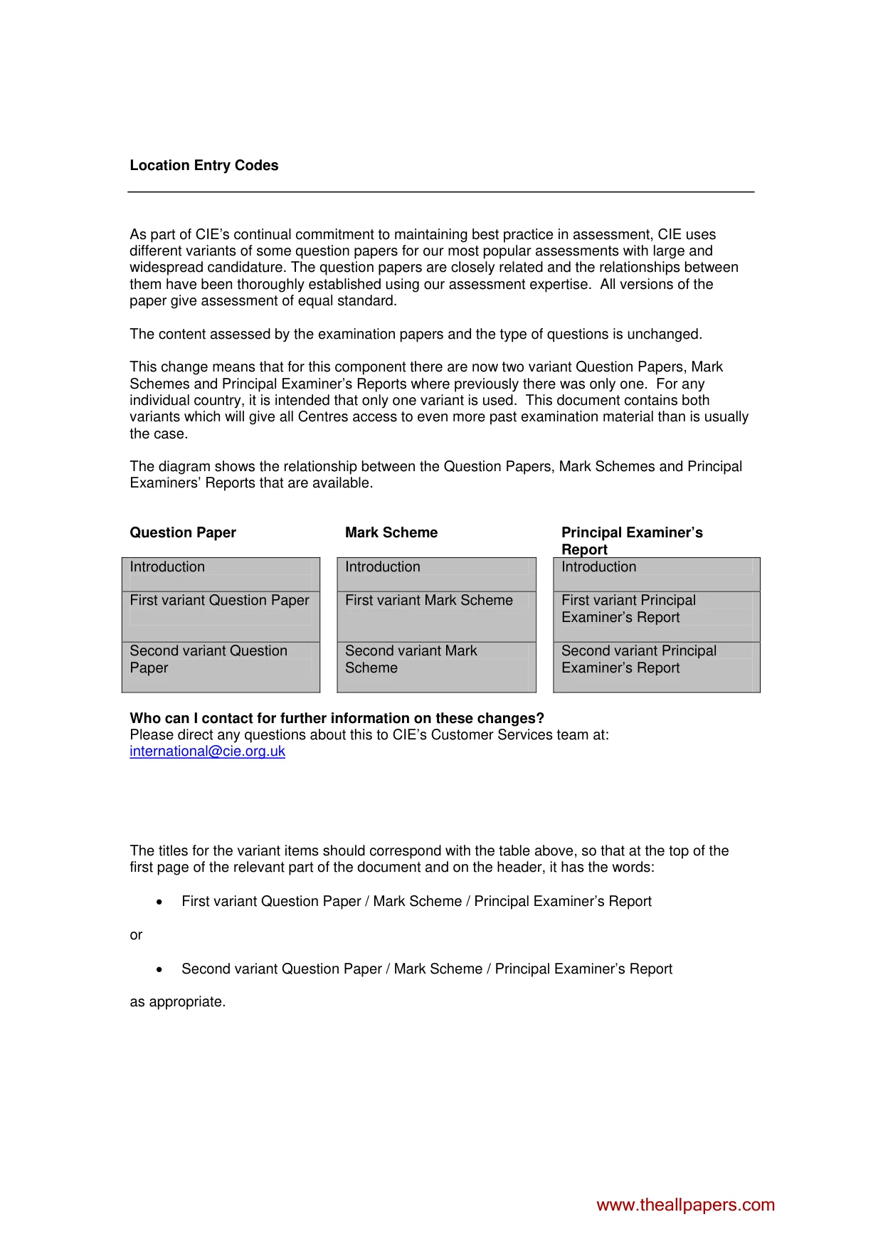
Location Entry Codes As part of CIE’s continual commitment to maintaining best practice in assessment, CIE uses different variants of some question papers for our most popular assessments with large and widespread candidature. The question papers are closely related and the relationships between them have been thoroughly established using our assessment expertise. All versions of the paper give assessment of equal standard. The content assessed by the examination papers and the type of questions is unchanged. This change means that for this component there are now two variant Question Papers, Mark Schemes and Principal Examiner’s Reports where previously there was only one. For any individual country, it is intended that only one variant is used. This document contains both variants which will give all Centres access to even more past examination material than is usually the case. The diagram shows the relationship between the Question Papers, Mark Schemes and Principal Examiners’ Reports that are available. Question Paper Mark Scheme Principal Examiner’s Report Introduction Introduction Introduction First variant Question Paper First variant Mark Scheme First variant Principal Examiner’s Report Second variant Question Paper Second variant Mark Scheme Second variant Principal Examiner’s Report Who can I contact for further information on these changes? Please direct any questions about this to CIE’s Customer Services team at: international@cie.org.uk The titles for the variant items should correspond with the table above, so that at the top of the first page of the relevant part of the document and on the header, it has the words: • First variant Question Paper / Mark Scheme / Principal Examiner’s Report or • Second variant Question Paper / Mark Scheme / Principal Examiner’s Report as appropriate. www.theallpapers.com
Question paper, page 2
This document consists of 11 printed pages and 1 blank page and 1 Insert. SP (CM/CGW) V04936/5 R © UCLES 2009 [Turn over UNIVERSITY OF CAMBRIDGE INTERNATIONAL EXAMINATIONS International General Certificate of Secondary Education READ THESE INSTRUCTIONS FIRST If you have been given an Answer Booklet, follow the instructions on the front cover of the Booklet. Write your Centre number, candidate number and name on all the work you hand in. Write in dark blue or black pen. You may use a soft pencil for any diagrams, graphs or rough working. Do not use staples, paper clips, highlighters, glue or correction fluid. Answer three questions. Sketch maps and diagrams should be drawn whenever they serve to illustrate an answer. The Insert contains Photographs A, B and C for Question 2, Photograph D for Question 3, Photograph E for Question 4 and Photograph F for Question 6. At the end of the examination, fasten all your work securely together. The number of marks is given in brackets [ ] at the end of each question or part question. * 5 6 5 0 0 4 2 3 9 1 * GEOGRAPHY 0460/11 Paper 1 May/June 2009 1 hour 45 minutes Additional Materials: Answer Booklet/Paper Ruler www.theallpapers.com First Variant Question Paper
Question paper, page 3
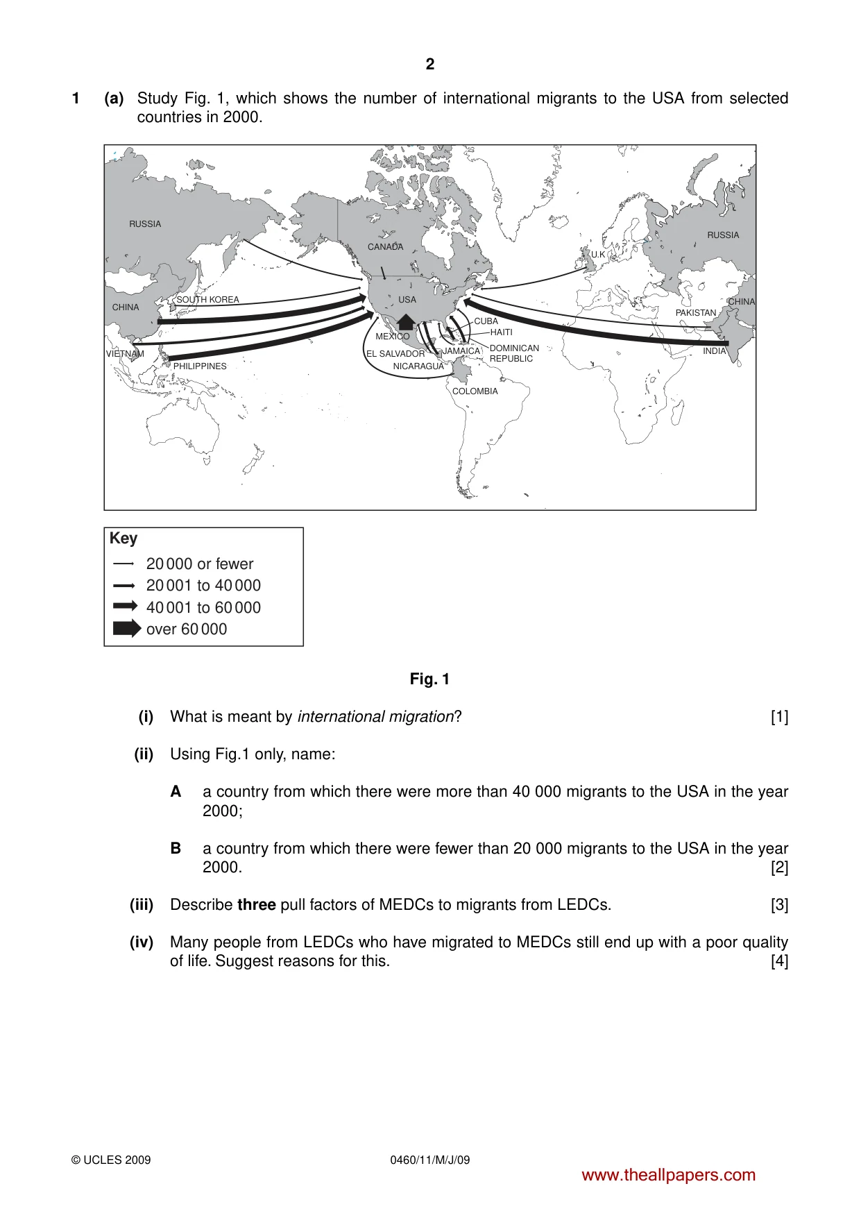
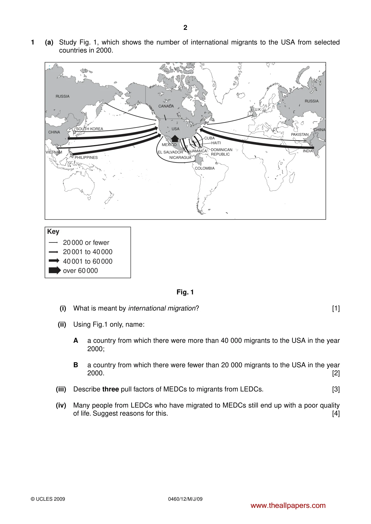
2 0460/11/M/J/09 © UCLES 2009 1 (a) Study Fig. 1, which shows the number of international migrants to the USA from selected countries in 2000. RUSSIA MEXICO NICARAGUA EL SALVADOR CHINA SOUTH KOREA VIETNAM PHILIPPINES over 60 000 40 001 to 60 000 20 001 to 40 000 20 000 or fewer CANADA USA RUSSIA U.K CHINA INDIA PAKISTAN COLOMBIA Key JAMAICA DOMINICAN REPUBLIC HAITI CUBA Fig. 1 (i) What is meant by international migration? [1] (ii) Using Fig.1 only, name: A a country from which there were more than 40 000 migrants to the USA in the year 2000; B a country from which there were fewer than 20 000 migrants to the USA in the year 2000. [2] (iii) Describe three pull factors of MEDCs to migrants from LEDCs. [3] (iv) Many people from LEDCs who have migrated to MEDCs still end up with a poor quality of life. Suggest reasons for this. [4] www.theallpapers.com
Question paper, page 4
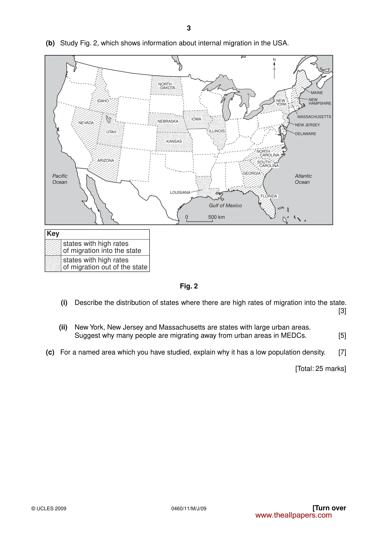
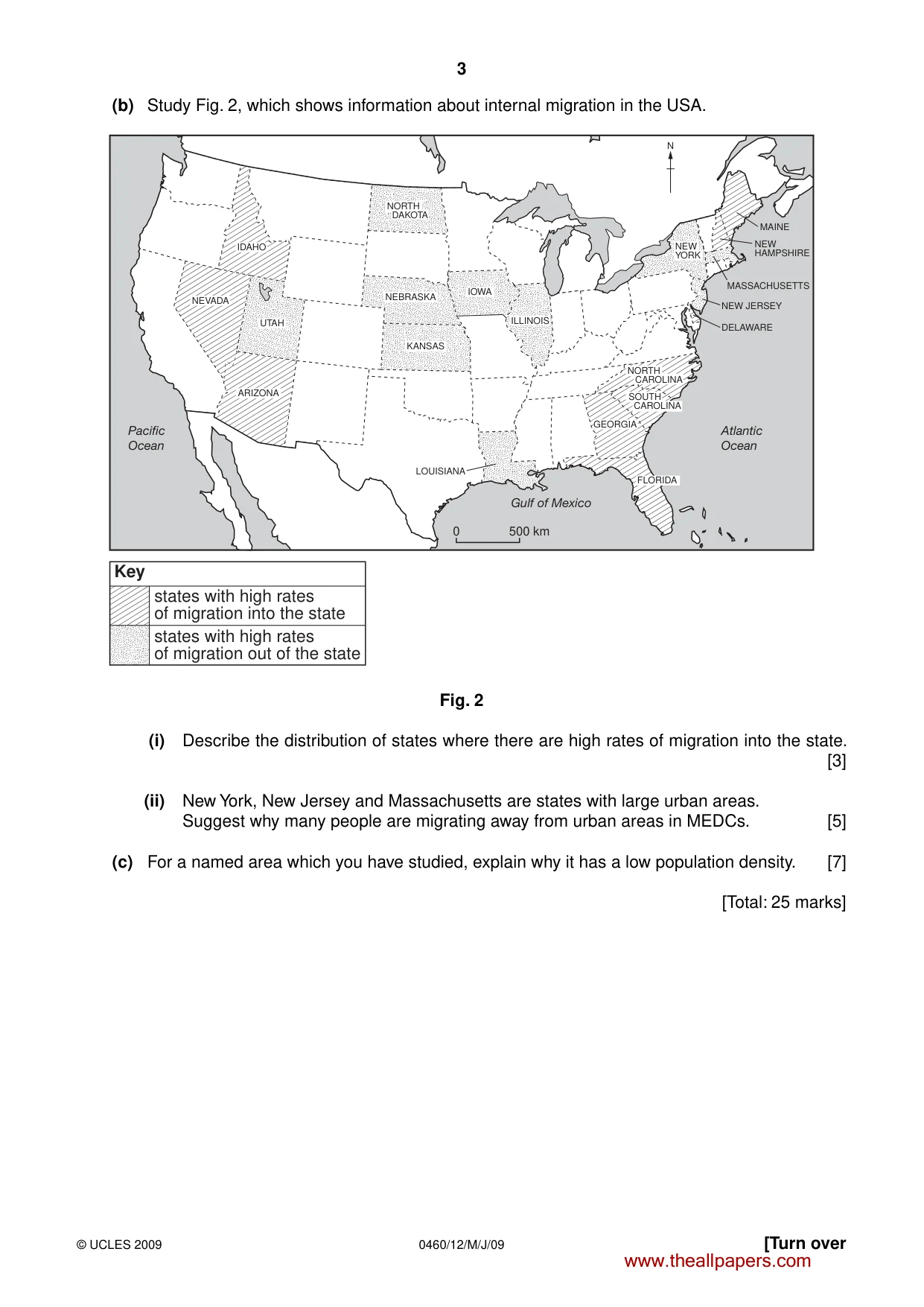
3 0460/11/M/J/09 © UCLES 2009 [Turn over (b) Study Fig. 2, which shows information about internal migration in the USA. IDAHO NEVADA UTAH ARIZONA NORTH DAKOTA NEBRASKA KANSAS NORTH CAROLINA SOUTH CAROLINA IOWA ILLINOIS GEORGIA FLORIDA NEW YORK N MAINE MASSACHUSETTS NEW JERSEY DELAWARE NEW HAMPSHIRE LOUISIANA 0 500 km Pacific Ocean Atlantic Ocean Gulf of Mexico Key states with high rates of migration into the state states with high rates of migration out of the state Fig. 2 (i) Describe the distribution of states where there are high rates of migration into the state. [3] (ii) New York, New Jersey and Massachusetts are states with large urban areas. Suggest why many people are migrating away from urban areas in MEDCs. [5] (c) For a named area which you have studied, explain why it has a low population density. [7] [Total: 25 marks] www.theallpapers.com
Question paper, page 5
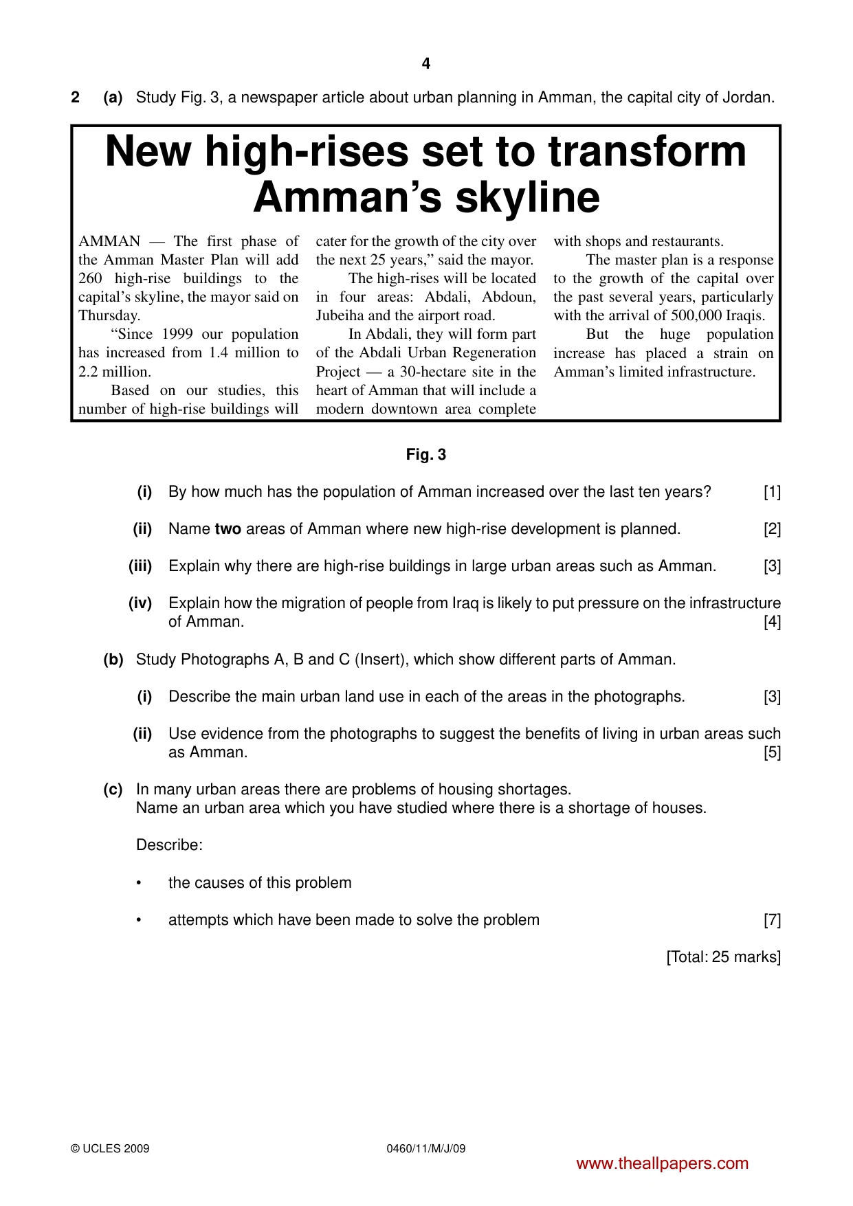
4 0460/11/M/J/09 © UCLES 2009 2 (a) Study Fig. 3, a newspaper article about urban planning in Amman, the capital city of Jordan. AMMAN — The first phase of the Amman Master Plan will add 260 high-rise buildings to the capital’s skyline, the mayor said on Thursday. “Since 1999 our population has increased from 1.4 million to 2.2 million. Based on our studies, this number of high-rise buildings will cater for the growth of the city over the next 25 years,” said the mayor. The high-rises will be located in four areas: Abdali, Abdoun, Jubeiha and the airport road. In Abdali, they will form part of the Abdali Urban Regeneration Project — a 30-hectare site in the heart of Amman that will include a modern downtown area complete with shops and restaurants. The master plan is a response to the growth of the capital over the past several years, particularly with the arrival of 500,000 Iraqis. But the huge population increase has placed a strain on Amman’s limited infrastructure. New high-rises set to transform Amman’s skyline Fig. 3 (i) By how much has the population of Amman increased over the last ten years? [1] (ii) Name two areas of Amman where new high-rise development is planned. [2] (iii) Explain why there are high-rise buildings in large urban areas such as Amman. [3] (iv) Explain how the migration of people from Iraq is likely to put pressure on the infrastructure of Amman. [4] (b) Study Photographs A, B and C (Insert), which show different parts of Amman. (i) Describe the main urban land use in each of the areas in the photographs. [3] (ii) Use evidence from the photographs to suggest the benefits of living in urban areas such as Amman. [5] (c) In many urban areas there are problems of housing shortages. Name an urban area which you have studied where there is a shortage of houses. Describe: • the causes of this problem • attempts which have been made to solve the problem [7] [Total: 25 marks] www.theallpapers.com
Question paper, page 6
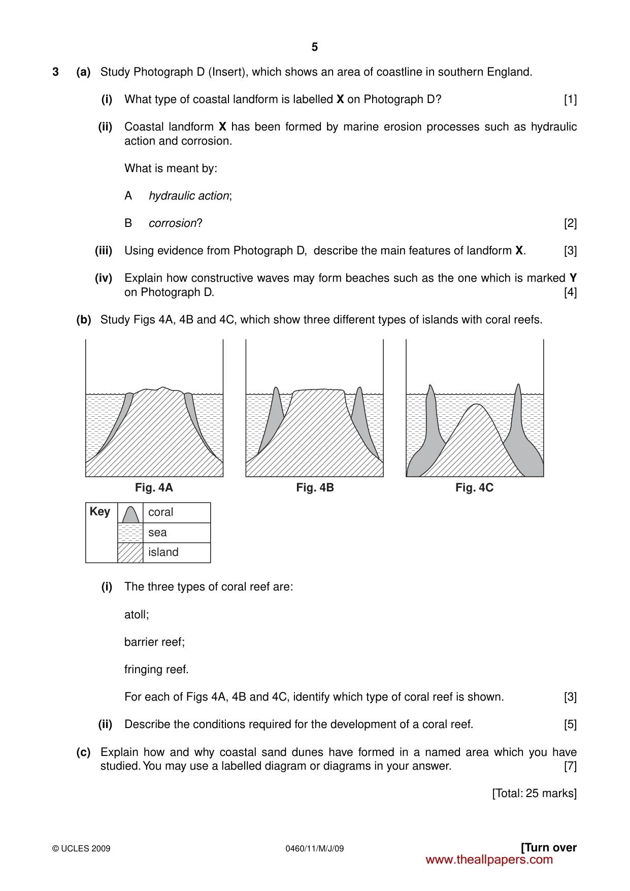
5 0460/11/M/J/09 © UCLES 2009 [Turn over 3 (a) Study Photograph D (Insert), which shows an area of coastline in southern England. (i) What type of coastal landform is labelled X on Photograph D? [1] (ii) Coastal landform X has been formed by marine erosion processes such as hydraulic action and corrosion. What is meant by: A hydraulic action; B corrosion? [2] (iii) Using evidence from Photograph D, describe the main features of landform X. [3] (iv) Explain how constructive waves may form beaches such as the one which is marked Y on Photograph D. [4] (b) Study Figs 4A, 4B and 4C, which show three different types of islands with coral reefs. Key coral sea island Fig. 4A Fig. 4B Fig. 4C (i) The three types of coral reef are: atoll; barrier reef; fringing reef. For each of Figs 4A, 4B and 4C, identify which type of coral reef is shown. [3] (ii) Describe the conditions required for the development of a coral reef. [5] (c) Explain how and why coastal sand dunes have formed in a named area which you have studied. You may use a labelled diagram or diagrams in your answer. [7] [Total: 25 marks] www.theallpapers.com
Question paper, page 7
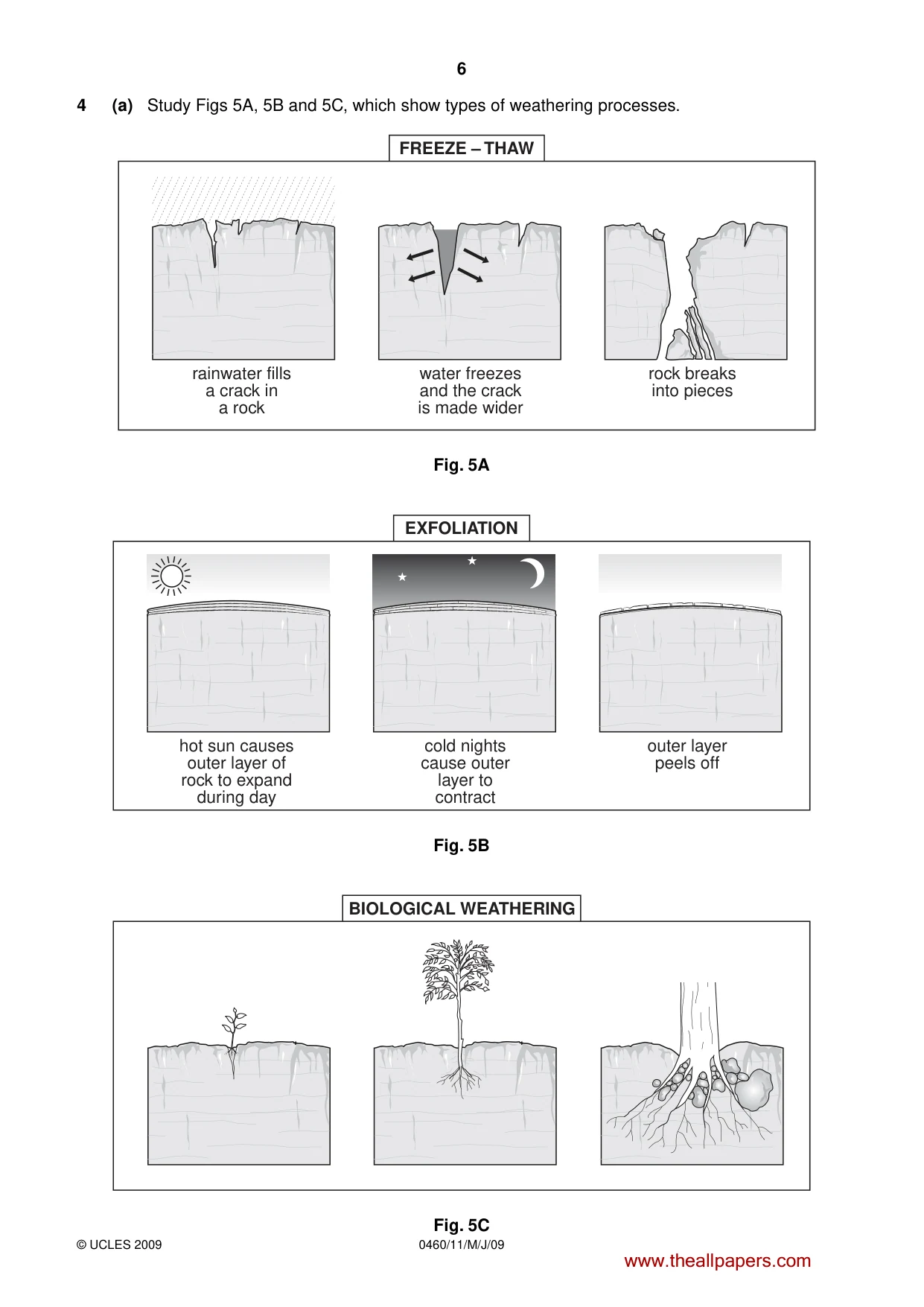
6 0460/11/M/J/09 © UCLES 2009 4 (a) Study Figs 5A, 5B and 5C, which show types of weathering processes. rainwater fills a crack in a rock water freezes and the crack is made wider FREEZE – THAW rock breaks into pieces Fig. 5A hot sun causes outer layer of rock to expand during day cold nights cause outer layer to contract EXFOLIATION outer layer peels off Fig. 5B BIOLOGICAL WEATHERING Fig. 5C www.theallpapers.com
Question paper, page 8
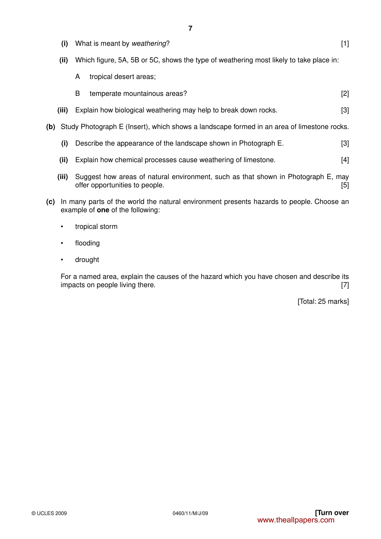
7 0460/11/M/J/09 © UCLES 2009 [Turn over (i) What is meant by weathering? [1] (ii) Which figure, 5A, 5B or 5C, shows the type of weathering most likely to take place in: A tropical desert areas; B temperate mountainous areas? [2] (iii) Explain how biological weathering may help to break down rocks. [3] (b) Study Photograph E (Insert), which shows a landscape formed in an area of limestone rocks. (i) Describe the appearance of the landscape shown in Photograph E. [3] (ii) Explain how chemical processes cause weathering of limestone. [4] (iii) Suggest how areas of natural environment, such as that shown in Photograph E, may offer opportunities to people. [5] (c) In many parts of the world the natural environment presents hazards to people. Choose an example of one of the following: • tropical storm • flooding • drought For a named area, explain the causes of the hazard which you have chosen and describe its impacts on people living there. [7] [Total: 25 marks] www.theallpapers.com
Question paper, page 9
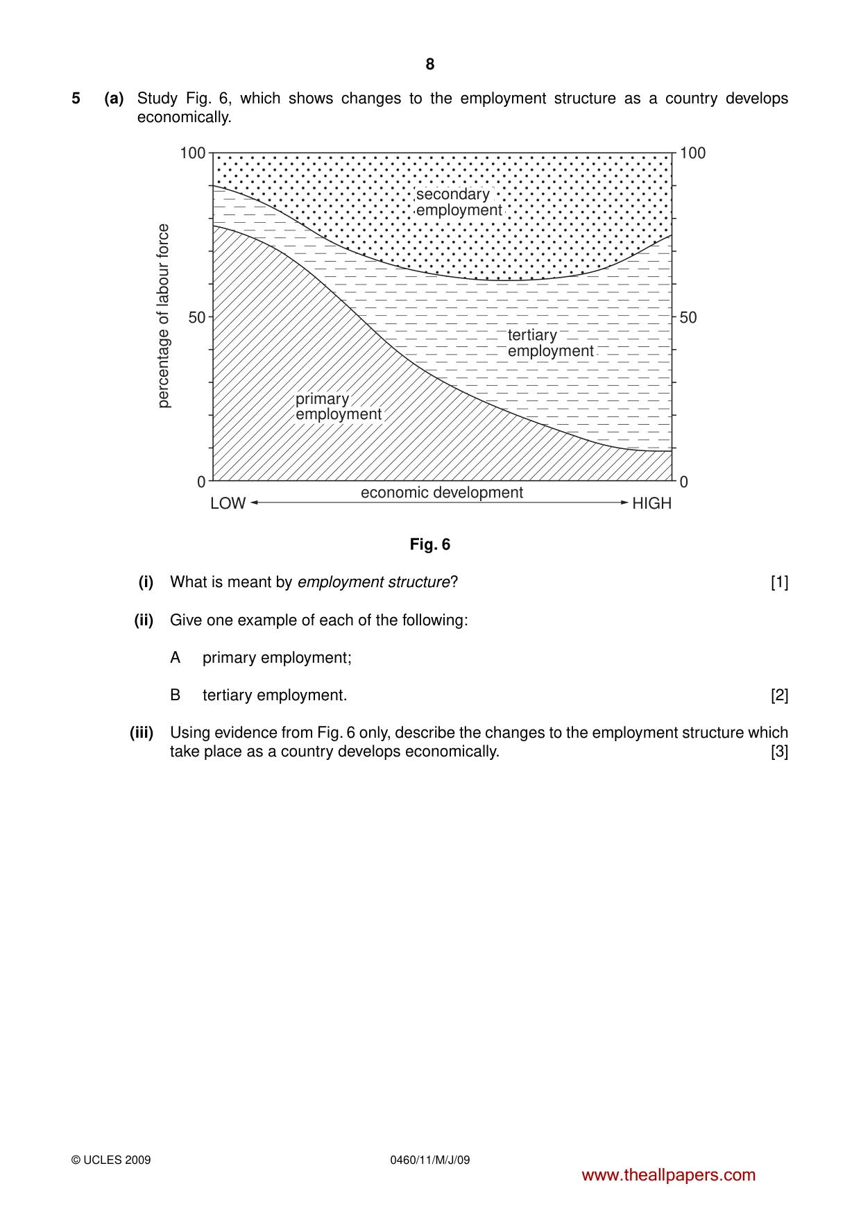
8 0460/11/M/J/09 © UCLES 2009 5 (a) Study Fig. 6, which shows changes to the employment structure as a country develops economically. 100 50 economic development LOW HIGH percentage of labour force 0 100 50 0 secondary employment tertiary employment primary employment Fig. 6 (i) What is meant by employment structure? [1] (ii) Give one example of each of the following: A primary employment; B tertiary employment. [2] (iii) Using evidence from Fig. 6 only, describe the changes to the employment structure which take place as a country develops economically. [3] www.theallpapers.com
Question paper, page 10
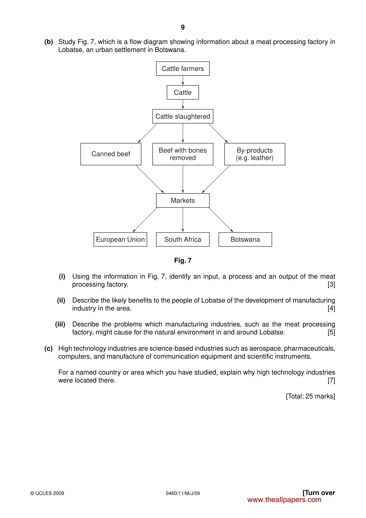
9 0460/11/M/J/09 © UCLES 2009 [Turn over (b) Study Fig. 7, which is a flow diagram showing information about a meat processing factory in Lobatse, an urban settlement in Botswana. Cattle farmers Markets South Africa European Union Botswana Cattle Cattle slaughtered Beef with bones removed By-products (e.g. leather) Canned beef Fig. 7 (i) Using the information in Fig. 7, identify an input, a process and an output of the meat processing factory. [3] (ii) Describe the likely benefits to the people of Lobatse of the development of manufacturing industry in the area. [4] (iii) Describe the problems which manufacturing industries, such as the meat processing factory, might cause for the natural environment in and around Lobatse. [5] (c) High technology industries are science-based industries such as aerospace, pharmaceuticals, computers, and manufacture of communication equipment and scientific instruments. For a named country or area which you have studied, explain why high technology industries were located there. [7] [Total: 25 marks] www.theallpapers.com
Question paper, page 11
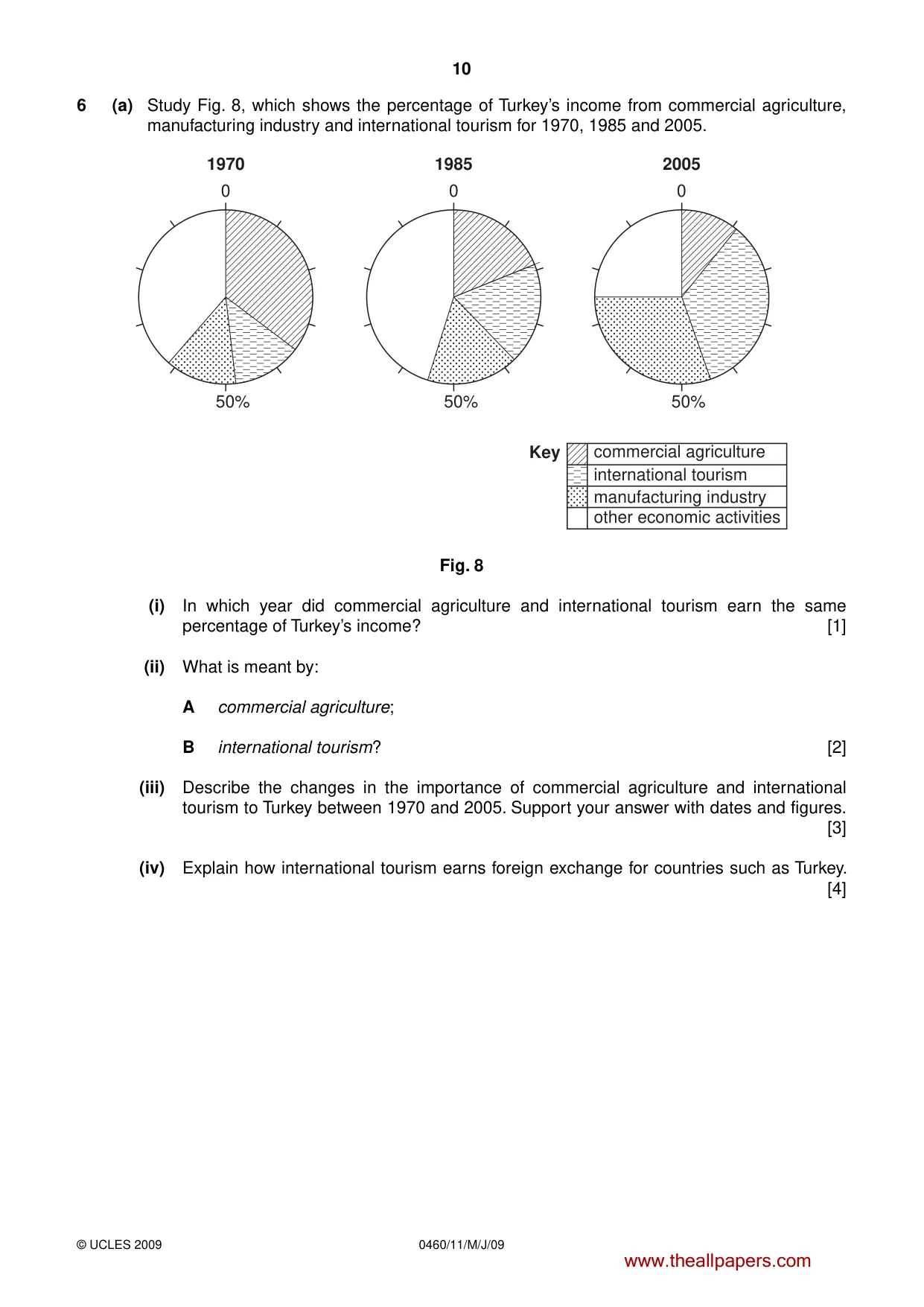
10 0460/11/M/J/09 © UCLES 2009 6 (a) Study Fig. 8, which shows the percentage of Turkey’s income from commercial agriculture, manufacturing industry and international tourism for 1970, 1985 and 2005. 1970 1985 2005 0 0 0 50% 50% 50% commercial agriculture Key manufacturing industry international tourism other economic activities Fig. 8 (i) In which year did commercial agriculture and international tourism earn the same percentage of Turkey’s income? [1] (ii) What is meant by: A commercial agriculture; B international tourism? [2] (iii) Describe the changes in the importance of commercial agriculture and international tourism to Turkey between 1970 and 2005. Support your answer with dates and figures. [3] (iv) Explain how international tourism earns foreign exchange for countries such as Turkey. [4] www.theallpapers.com
Question paper, page 12
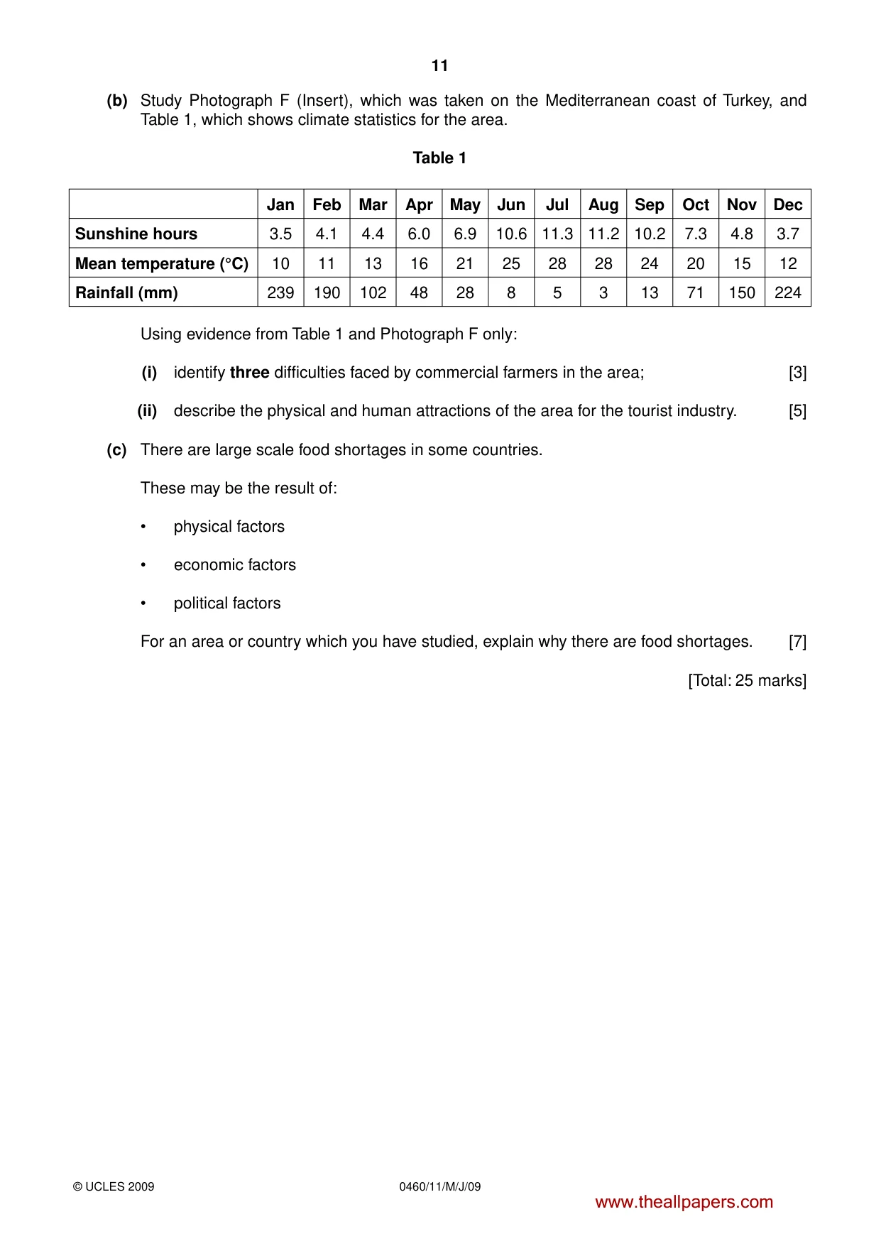
11 0460/11/M/J/09 © UCLES 2009 (b) Study Photograph F (Insert), which was taken on the Mediterranean coast of Turkey, and Table 1, which shows climate statistics for the area. Table 1 Jan Feb Mar Apr May Jun Jul Aug Sep Oct Nov Dec Sunshine hours 3.5 4.1 4.4 6.0 6.9 10.6 11.3 11.2 10.2 7.3 4.8 3.7 Mean temperature (°C) 10 11 13 16 21 25 28 28 24 20 15 12 Rainfall (mm) 239 190 102 48 28 8 5 3 13 71 150 224 Using evidence from Table 1 and Photograph F only: (i) identify three difficulties faced by commercial farmers in the area; [3] (ii) describe the physical and human attractions of the area for the tourist industry. [5] (c) There are large scale food shortages in some countries. These may be the result of: • physical factors • economic factors • political factors For an area or country which you have studied, explain why there are food shortages. [7] [Total: 25 marks] www.theallpapers.com
Question paper, page 13
12 0460/11/M/J/09 BLANK PAGE Copyright Acknowledgements: Question 2 Fig. 3 © Jordan Times, 23 February 2007. Question 2 Photograph A S. Sibley © UCLES. Question 2 Photograph B S. Sibley © UCLES. Question 2 Photograph C S. Sibley © UCLES. Question 3 Photograph D S. Sibley © UCLES. Question 4 Photograph E S. Sibley © UCLES. Question 6 Photograph F S. Sibley © UCLES. Permission to reproduce items where third-party owned material protected by copyright is included has been sought and cleared where possible. Every reasonable effort has been made by the publisher (UCLES) to trace copyright holders, but if any items requiring clearance have unwittingly been included, the publisher will be pleased to make amends at the earliest possible opportunity. University of Cambridge International Examinations is part of the Cambridge Assessment Group. Cambridge Assessment is the brand name of University of Cambridge Local Examinations Syndicate (UCLES), which is itself a department of the University of Cambridge. www.theallpapers.com
Question paper, page 14
This document consists of 12 printed pages and 4 blank pages and 1 Insert. SP (CM/CGW) T61863/5 © UCLES 2009 [Turn over UNIVERSITY OF CAMBRIDGE INTERNATIONAL EXAMINATIONS International General Certificate of Secondary Education READ THESE INSTRUCTIONS FIRST If you have been given an Answer Booklet, follow the instructions on the front cover of the Booklet. Write your Centre number, candidate number and name on all the work you hand in. Write in dark blue or black pen. You may use a soft pencil for any diagrams, graphs or rough working. Do not use staples, paper clips, highlighters, glue or correction fluid. Answer three questions. Sketch maps and diagrams should be drawn whenever they serve to illustrate an answer. The Insert contains Photographs A, B and C for Question 2, Photograph D for Question 3 and Photograph E for Question 4. At the end of the examination, fasten all your work securely together. The number of marks is given in brackets [ ] at the end of each question or part question. * 7 5 3 6 6 3 6 3 1 2 * GEOGRAPHY 0460/12 Paper 1 May/June 2009 1 hour 45 minutes Additional Materials: Answer Booklet/Paper Ruler www.theallpapers.com Second Variant Question Paper
Question paper, page 15
2 0460/12/M/J/09 © UCLES 2009 1 (a) Study Fig. 1, which shows the number of international migrants to the USA from selected countries in 2000. RUSSIA MEXICO NICARAGUA EL SALVADOR CHINA SOUTH KOREA VIETNAM PHILIPPINES over 60 000 40 001 to 60 000 20 001 to 40 000 20 000 or fewer CANADA USA RUSSIA U.K CHINA INDIA PAKISTAN COLOMBIA Key JAMAICA DOMINICAN REPUBLIC HAITI CUBA Fig. 1 (i) What is meant by international migration? [1] (ii) Using Fig.1 only, name: A a country from which there were more than 40 000 migrants to the USA in the year 2000; B a country from which there were fewer than 20 000 migrants to the USA in the year 2000. [2] (iii) Describe three pull factors of MEDCs to migrants from LEDCs. [3] (iv) Many people from LEDCs who have migrated to MEDCs still end up with a poor quality of life. Suggest reasons for this. [4] www.theallpapers.com
Question paper, page 16
3 0460/12/M/J/09 © UCLES 2009 [Turn over (b) Study Fig. 2, which shows information about internal migration in the USA. IDAHO NEVADA UTAH ARIZONA NORTH DAKOTA NEBRASKA KANSAS NORTH CAROLINA SOUTH CAROLINA IOWA ILLINOIS GEORGIA FLORIDA NEW YORK N MAINE MASSACHUSETTS NEW JERSEY DELAWARE NEW HAMPSHIRE LOUISIANA 0 500 km Pacific Ocean Atlantic Ocean Gulf of Mexico Key states with high rates of migration into the state states with high rates of migration out of the state Fig. 2 (i) Describe the distribution of states where there are high rates of migration into the state. [3] (ii) New York, New Jersey and Massachusetts are states with large urban areas. Suggest why many people are migrating away from urban areas in MEDCs. [5] (c) For a named area which you have studied, explain why it has a low population density. [7] [Total: 25 marks] www.theallpapers.com
Question paper, page 17
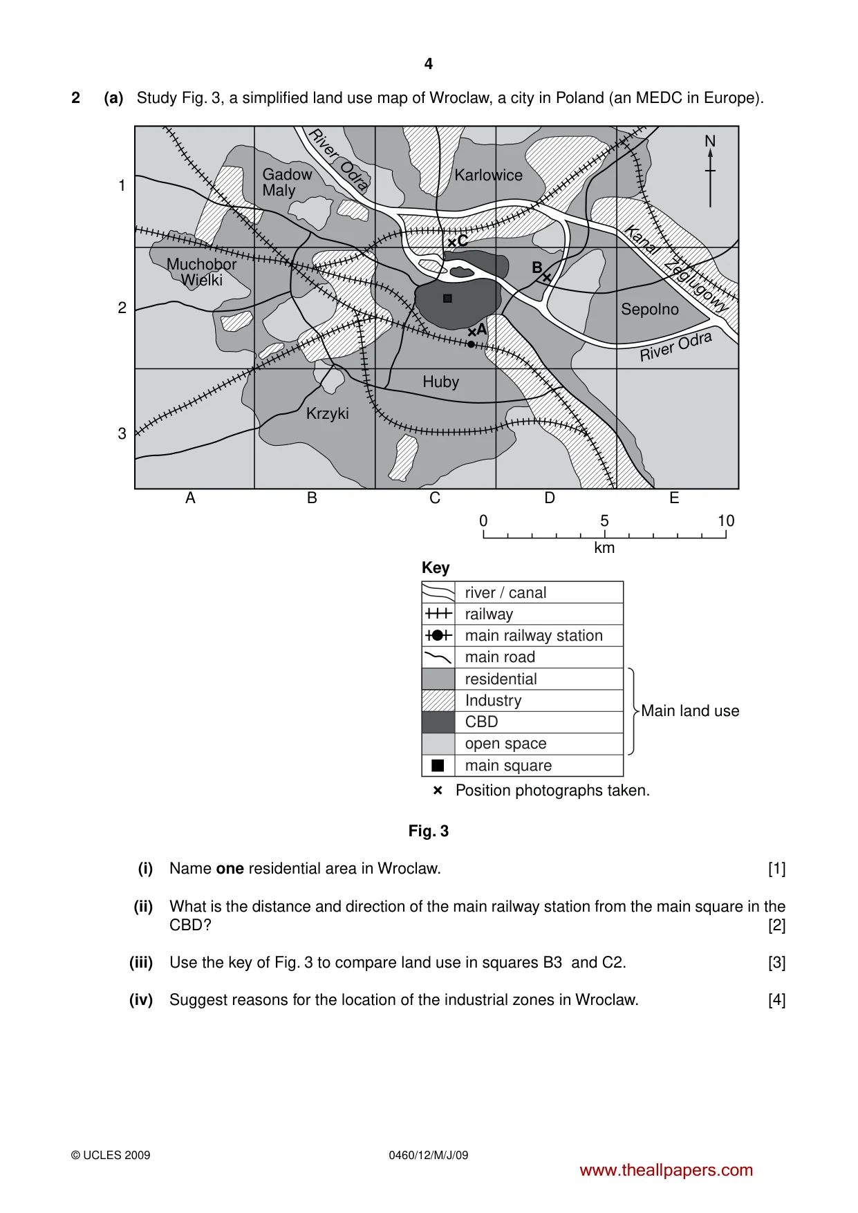
4 0460/12/M/J/09 © UCLES 2009 2 (a) Study Fig. 3, a simplified land use map of Wroclaw, a city in Poland (an MEDC in Europe). Gadow Maly Muchobor Wielki Krzyki Huby Karlowice C Sepolno Kanal Zeglugowy River Odra River Odra N A 1 2 3 B C D 0 5 km 10 E A B river / canal railway main railway station main road residential Industry CBD open space main square Key Main land use Position photographs taken. Fig. 3 (i) Name one residential area in Wroclaw. [1] (ii) What is the distance and direction of the main railway station from the main square in the CBD? [2] (iii) Use the key of Fig. 3 to compare land use in squares B3 and C2. [3] (iv) Suggest reasons for the location of the industrial zones in Wroclaw. [4] www.theallpapers.com
Question paper, page 18
5 0460/12/M/J/09 © UCLES 2009 [Turn over (b) Study Photographs A, B and C (Insert) which show apartment blocks in different residential areas in Wroclaw. The location of each photograph is shown on Fig. 3. Use evidence from the photographs and Fig. 3 to: (i) describe the differences between the apartment blocks shown in Photographs A and B; [3] (ii) suggest the likely benefits and problems of living in the apartment blocks shown in Photograph C. [5] (c) In many urban areas there are problems of traffic congestion. Name an urban area which you have studied where there is traffic congestion. Describe: • the causes of this problem • attempts which have been made to solve the problem [7] [Total: 25 marks] www.theallpapers.com
Question paper, page 19
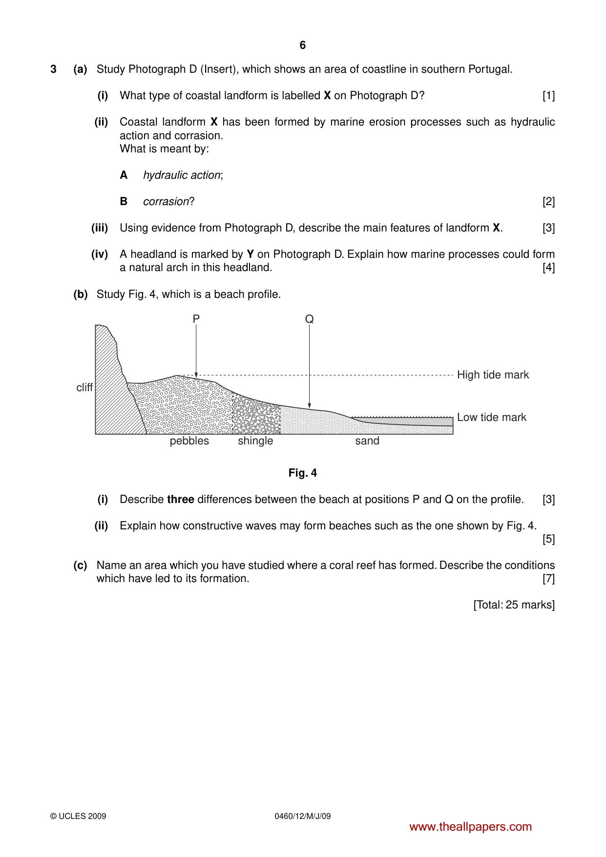
6 0460/12/M/J/09 © UCLES 2009 3 (a) Study Photograph D (Insert), which shows an area of coastline in southern Portugal. (i) What type of coastal landform is labelled X on Photograph D? [1] (ii) Coastal landform X has been formed by marine erosion processes such as hydraulic action and corrasion. What is meant by: A hydraulic action; B corrasion? [2] (iii) Using evidence from Photograph D, describe the main features of landform X. [3] (iv) A headland is marked by Y on Photograph D. Explain how marine processes could form a natural arch in this headland. [4] (b) Study Fig. 4, which is a beach profile. cliff pebbles P Q shingle sand High tide mark Low tide mark Fig. 4 (i) Describe three differences between the beach at positions P and Q on the profile. [3] (ii) Explain how constructive waves may form beaches such as the one shown by Fig. 4. [5] (c) Name an area which you have studied where a coral reef has formed. Describe the conditions which have led to its formation. [7] [Total: 25 marks] www.theallpapers.com
Question paper, page 20
7 0460/12/M/J/09 [Turn over BLANK PAGE www.theallpapers.com
Question paper, page 21
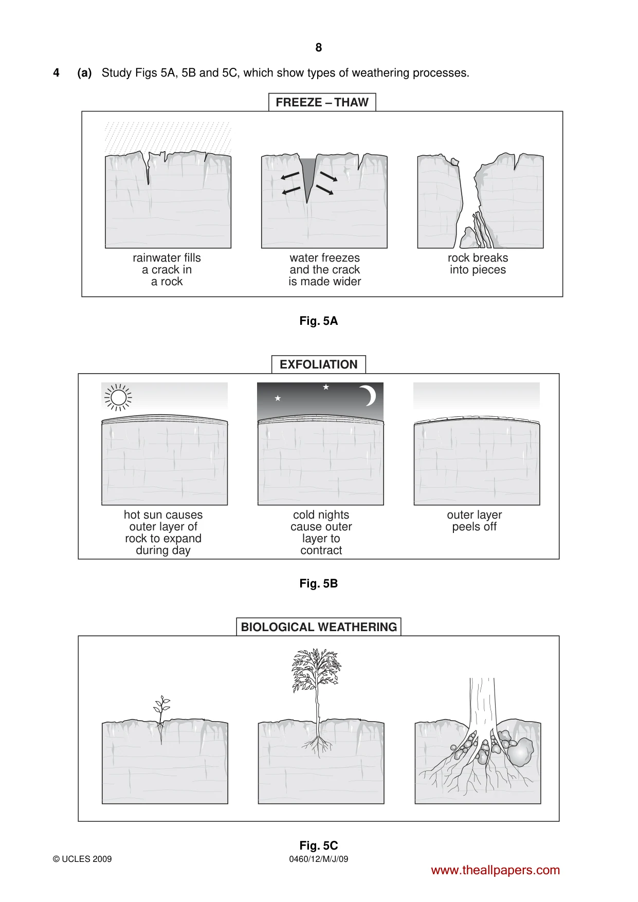
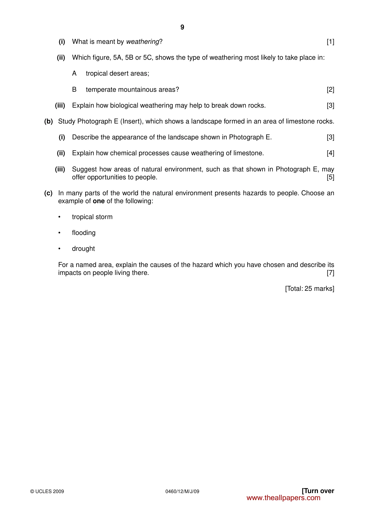
8 0460/12/M/J/09 © UCLES 2009 4 (a) Study Figs 5A, 5B and 5C, which show types of weathering processes. rainwater fills a crack in a rock water freezes and the crack is made wider FREEZE – THAW rock breaks into pieces Fig. 5A hot sun causes outer layer of rock to expand during day cold nights cause outer layer to contract EXFOLIATION outer layer peels off Fig. 5B BIOLOGICAL WEATHERING Fig. 5C www.theallpapers.com
Question paper, page 22
9 0460/12/M/J/09 © UCLES 2009 [Turn over (i) What is meant by weathering? [1] (ii) Which figure, 5A, 5B or 5C, shows the type of weathering most likely to take place in: A tropical desert areas; B temperate mountainous areas? [2] (iii) Explain how biological weathering may help to break down rocks. [3] (b) Study Photograph E (Insert), which shows a landscape formed in an area of limestone rocks. (i) Describe the appearance of the landscape shown in Photograph E. [3] (ii) Explain how chemical processes cause weathering of limestone. [4] (iii) Suggest how areas of natural environment, such as that shown in Photograph E, may offer opportunities to people. [5] (c) In many parts of the world the natural environment presents hazards to people. Choose an example of one of the following: • tropical storm • flooding • drought For a named area, explain the causes of the hazard which you have chosen and describe its impacts on people living there. [7] [Total: 25 marks] www.theallpapers.com
Question paper, page 23
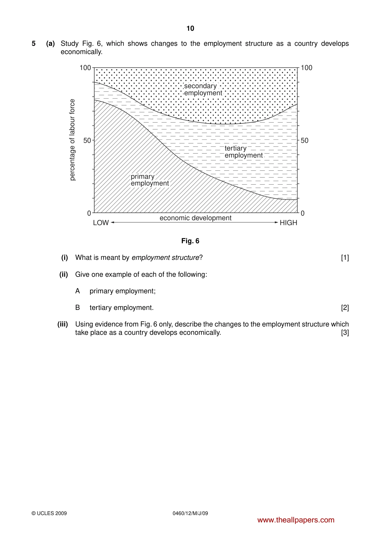
10 0460/12/M/J/09 © UCLES 2009 5 (a) Study Fig. 6, which shows changes to the employment structure as a country develops economically. 100 50 economic development LOW HIGH percentage of labour force 0 100 50 0 secondary employment tertiary employment primary employment Fig. 6 (i) What is meant by employment structure? [1] (ii) Give one example of each of the following: A primary employment; B tertiary employment. [2] (iii) Using evidence from Fig. 6 only, describe the changes to the employment structure which take place as a country develops economically. [3] www.theallpapers.com
Question paper, page 24
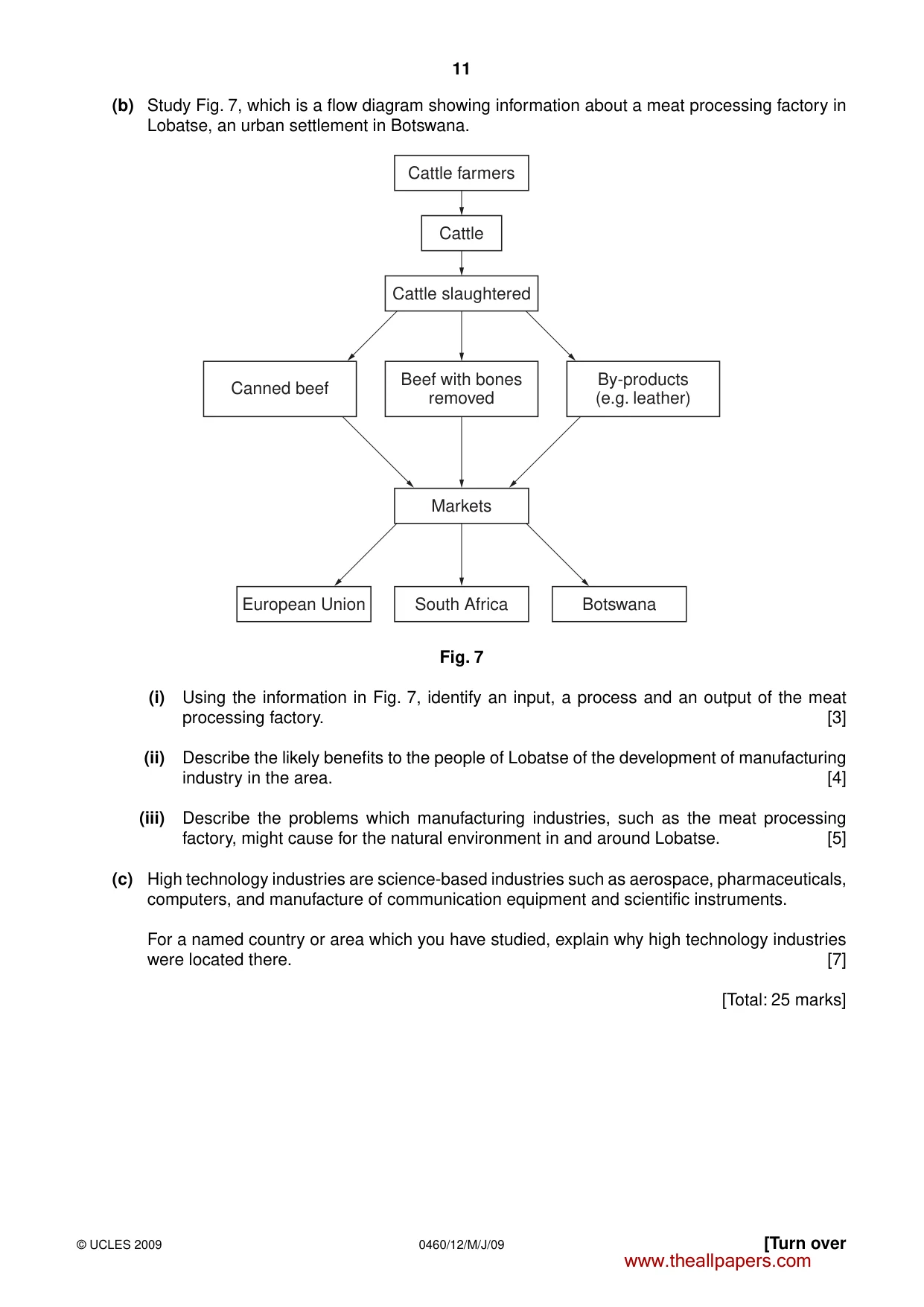
11 0460/12/M/J/09 © UCLES 2009 (b) Study Fig. 7, which is a flow diagram showing information about a meat processing factory in Lobatse, an urban settlement in Botswana. Cattle farmers Markets South Africa European Union Botswana Cattle Cattle slaughtered Beef with bones removed By-products (e.g. leather) Canned beef Fig. 7 (i) Using the information in Fig. 7, identify an input, a process and an output of the meat processing factory. [3] (ii) Describe the likely benefits to the people of Lobatse of the development of manufacturing industry in the area. [4] (iii) Describe the problems which manufacturing industries, such as the meat processing factory, might cause for the natural environment in and around Lobatse. [5] (c) High technology industries are science-based industries such as aerospace, pharmaceuticals, computers, and manufacture of communication equipment and scientific instruments. For a named country or area which you have studied, explain why high technology industries were located there. [7] [Total: 25 marks] [Turn over www.theallpapers.com
Question paper, page 25
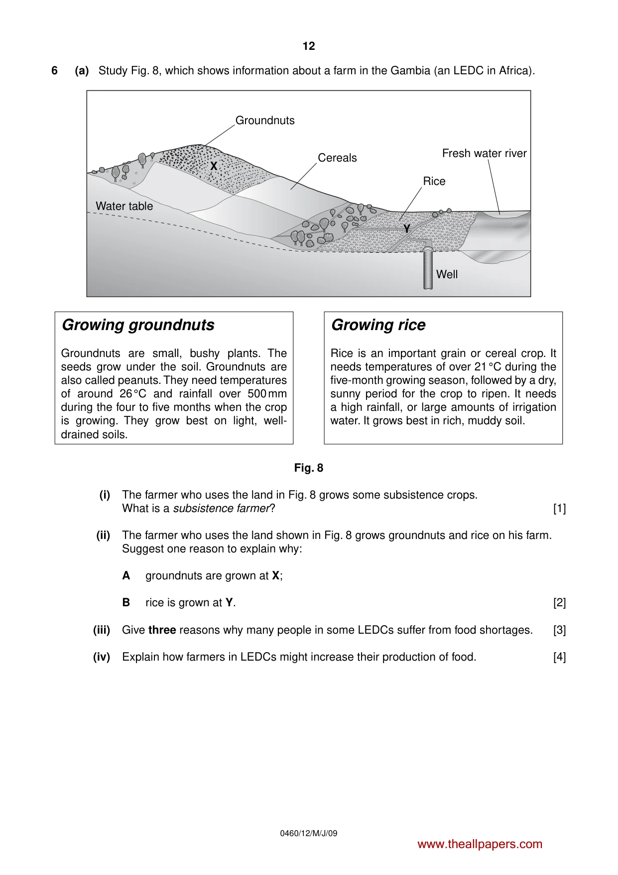
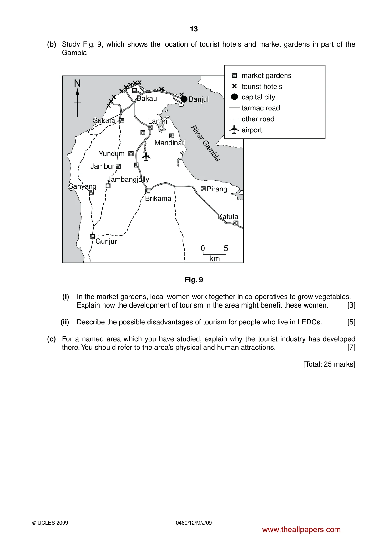
12 0460/12/M/J/09 6 (a) Study Fig. 8, which shows information about a farm in the Gambia (an LEDC in Africa). Growing groundnuts Groundnuts are small, bushy plants. The seeds grow under the soil. Groundnuts are also called peanuts. They need temperatures of around 26 °C and rainfall over 500 mm during the four to five months when the crop is growing. They grow best on light, well- drained soils. Growing rice Rice is an important grain or cereal crop. It needs temperatures of over 21 °C during the five-month growing season, followed by a dry, sunny period for the crop to ripen. It needs a high rainfall, or large amounts of irrigation water. It grows best in rich, muddy soil. Well Rice Fresh water river Cereals Groundnuts Water table X Y Fig. 8 (i) The farmer who uses the land in Fig. 8 grows some subsistence crops. What is a subsistence farmer? [1] (ii) The farmer who uses the land shown in Fig. 8 grows groundnuts and rice on his farm. Suggest one reason to explain why: A groundnuts are grown at X; B rice is grown at Y. [2] (iii) Give three reasons why many people in some LEDCs suffer from food shortages. [3] (iv) Explain how farmers in LEDCs might increase their production of food. [4] www.theallpapers.com
Question paper, page 26
13 0460/12/M/J/09 © UCLES 2009 (b) Study Fig. 9, which shows the location of tourist hotels and market gardens in part of the Gambia. market gardens tourist hotels capital city tarmac road other road airport N Bakau Bakau Bakau Banjul Banjul Jambur Pirang 0 5 km Gunjur Lamin Lamin Sukuta Sukuta Yundum Yundum Sanyang Sanyang Brikama Brikama Kafuta Kafuta Jambangjally Jambangjally Mandinari Mandinari Lamin Sukuta Yundum Sanyang Brikama Kafuta Jambangjally Mandinari River Gambia Banjul Fig. 9 (i) In the market gardens, local women work together in co-operatives to grow vegetables. Explain how the development of tourism in the area might benefit these women. [3] (ii) Describe the possible disadvantages of tourism for people who live in LEDCs. [5] (c) For a named area which you have studied, explain why the tourist industry has developed there. You should refer to the area’s physical and human attractions. [7] [Total: 25 marks] www.theallpapers.com
Question paper, page 27
14 0460/12/M/J/09 BLANK PAGE www.theallpapers.com
Question paper, page 28
15 0460/12/M/J/09 BLANK PAGE www.theallpapers.com
Question paper, page 29
16 0460/12/M/J/09 © UCLES 2009 BLANK PAGE Copyright Acknowledgements: Question 2 Photograph A S. Sibley © UCLES. Question 2 Photograph B S. Sibley © UCLES. Question 2 Photograph C S. Sibley © UCLES. Question 3 Photograph D S. Sibley © UCLES. Question 4 Photograph E S. Sibley © UCLES. Question 6 Figs 8 & 9 © John Hopkin & Roger Sanders; People and the Land; Heinemann Educational; 1991. Permission to reproduce items where third-party owned material protected by copyright is included has been sought and cleared where possible. Every reasonable effort has been made by the publisher (UCLES) to trace copyright holders, but if any items requiring clearance have unwittingly been included, the publisher will be pleased to make amends at the earliest possible opportunity. University of Cambridge International Examinations is part of the Cambridge Assessment Group. Cambridge Assessment is the brand name of University of Cambridge Local Examinations Syndicate (UCLES), which is itself a department of the University of Cambridge. www.theallpapers.com
Mark scheme, page 1
Location Entry Codes As part of CIE’s continual commitment to maintaining best practice in assessment, CIE has begun to use different variants of some question papers for our most popular assessments with extremely large and widespread candidature, The question papers are closely related and the relationships between them have been thoroughly established using our assessment expertise. All versions of the paper give assessment of equal standard. The content assessed by the examination papers and the type of questions are unchanged. This change means that for this component there are now two variant Question Papers, Mark Schemes and Principal Examiner’s Reports where previously there was only one. For any individual country, it is intended that only one variant is used. This document contains both variants which will give all Centres access to even more past examination material than is usually the case. The diagram shows the relationship between the Question Papers, Mark Schemes and Principal Examiner’s Reports. Question Paper Mark Scheme Principal Examiner’s Report Introduction Introduction Introduction First variant Question Paper First variant Mark Scheme First variant Principal Examiner’s Report Second variant Question Paper Second variant Mark Scheme Second variant Principal Examiner’s Report Who can I contact for further information on these changes? Please direct any questions about this to CIE’s Customer Services team at: international@cie.org.uk www.theallpapers.com
Mark scheme, page 2
UNIVERSITY OF CAMBRIDGE INTERNATIONAL EXAMINATIONS International General Certificate of Secondary Education MARK SCHEME for the May/June 2009 question paper for the guidance of teachers 0460 GEOGRAPHY 0460/11 Paper 1, maximum raw mark 75 This mark scheme is published as an aid to teachers and candidates, to indicate the requirements of the examination. It shows the basis on which Examiners were instructed to award marks. It does not indicate the details of the discussions that took place at an Examiners’ meeting before marking began, which would have considered the acceptability of alternative answers. Mark schemes must be read in conjunction with the question papers and the report on the examination. • CIE will not enter into discussions or correspondence in connection with these mark schemes. CIE is publishing the mark schemes for the May/June 2009 question papers for most IGCSE, GCE Advanced Level and Advanced Subsidiary Level syllabuses and some Ordinary Level syllabuses. www.theallpapers.com FirstvariantMarkScheme
Mark scheme, page 3
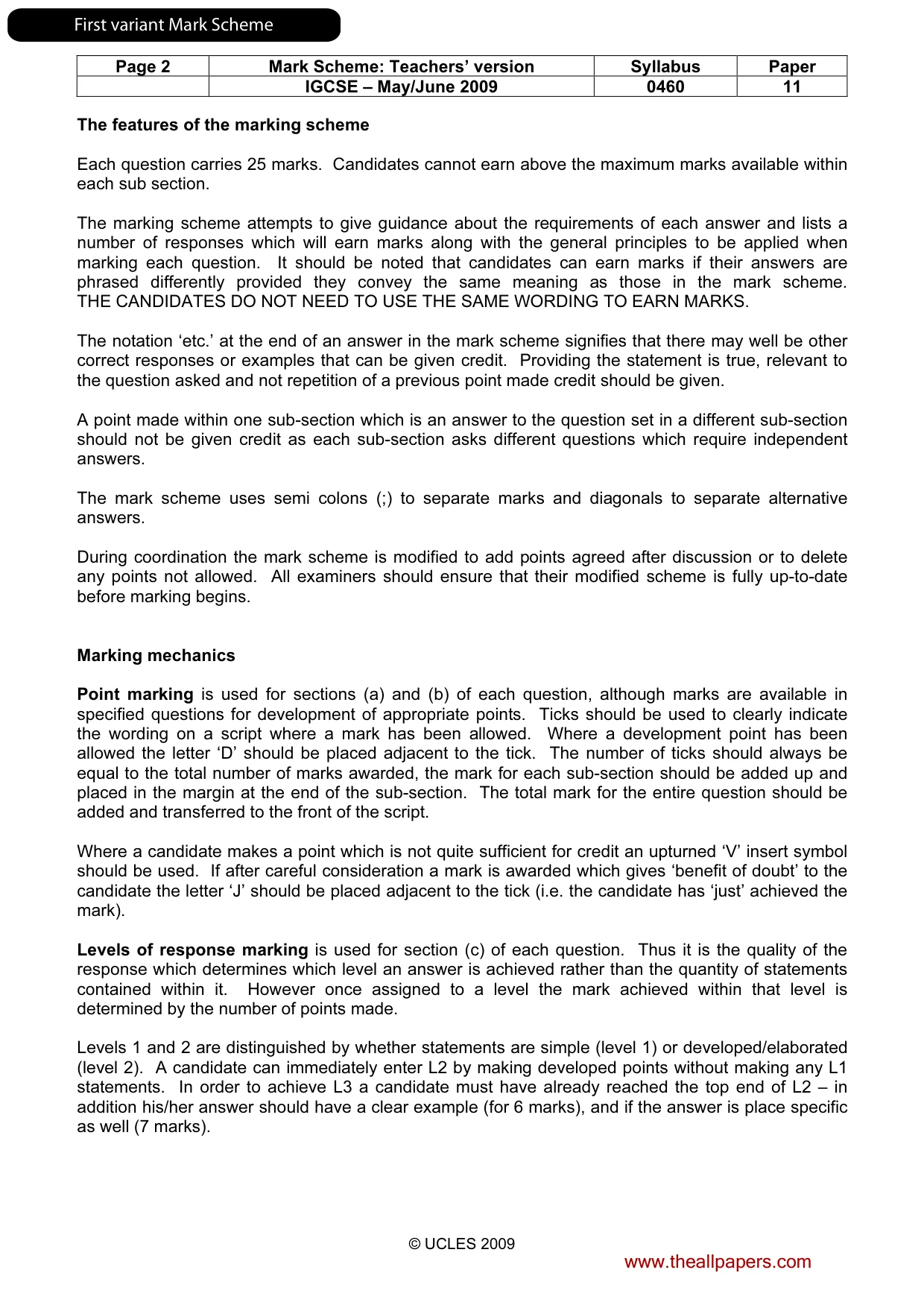
Page 2 Mark Scheme: Teachers’ version Syllabus Paper IGCSE – May/June 2009 0460 11 © UCLES 2009 The features of the marking scheme Each question carries 25 marks. Candidates cannot earn above the maximum marks available within each sub section. The marking scheme attempts to give guidance about the requirements of each answer and lists a number of responses which will earn marks along with the general principles to be applied when marking each question. It should be noted that candidates can earn marks if their answers are phrased differently provided they convey the same meaning as those in the mark scheme. THE CANDIDATES DO NOT NEED TO USE THE SAME WORDING TO EARN MARKS. The notation ‘etc.’ at the end of an answer in the mark scheme signifies that there may well be other correct responses or examples that can be given credit. Providing the statement is true, relevant to the question asked and not repetition of a previous point made credit should be given. A point made within one sub-section which is an answer to the question set in a different sub-section should not be given credit as each sub-section asks different questions which require independent answers. The mark scheme uses semi colons (;) to separate marks and diagonals to separate alternative answers. During coordination the mark scheme is modified to add points agreed after discussion or to delete any points not allowed. All examiners should ensure that their modified scheme is fully up-to-date before marking begins. Marking mechanics Point marking is used for sections (a) and (b) of each question, although marks are available in specified questions for development of appropriate points. Ticks should be used to clearly indicate the wording on a script where a mark has been allowed. Where a development point has been allowed the letter ‘D’ should be placed adjacent to the tick. The number of ticks should always be equal to the total number of marks awarded, the mark for each sub-section should be added up and placed in the margin at the end of the sub-section. The total mark for the entire question should be added and transferred to the front of the script. Where a candidate makes a point which is not quite sufficient for credit an upturned ‘V’ insert symbol should be used. If after careful consideration a mark is awarded which gives ‘benefit of doubt’ to the candidate the letter ‘J’ should be placed adjacent to the tick (i.e. the candidate has ‘just’ achieved the mark). Levels of response marking is used for section (c) of each question. Thus it is the quality of the response which determines which level an answer is achieved rather than the quantity of statements contained within it. However once assigned to a level the mark achieved within that level is determined by the number of points made. Levels 1 and 2 are distinguished by whether statements are simple (level 1) or developed/elaborated (level 2). A candidate can immediately enter L2 by making developed points without making any L1 statements. In order to achieve L3 a candidate must have already reached the top end of L2 – in addition his/her answer should have a clear example (for 6 marks), and if the answer is place specific as well (7 marks). www.theallpapers.com FirstvariantMarkScheme
Mark scheme, page 4
Page 3 Mark Scheme: Teachers’ version Syllabus Paper IGCSE – May/June 2009 0460 11 © UCLES 2009 Where statements are assigned levels by the examiner this should be indicated by the use of L1, L2 and L3 next to the statements. A summary of the overall level and mark awarded should be written at the end of the answer. Ticks should not be used on answers which are marked using levels of response marking. All answers, whether marked by point marking or levels, should have signs of having been assessed by the examiner. Crosses are acceptable to signify wrong answers and a red line accompanied by the letters ‘I/R’ should be used to indicate those which are irrelevant. www.theallpapers.com FirstvariantMarkScheme
Mark scheme, page 5
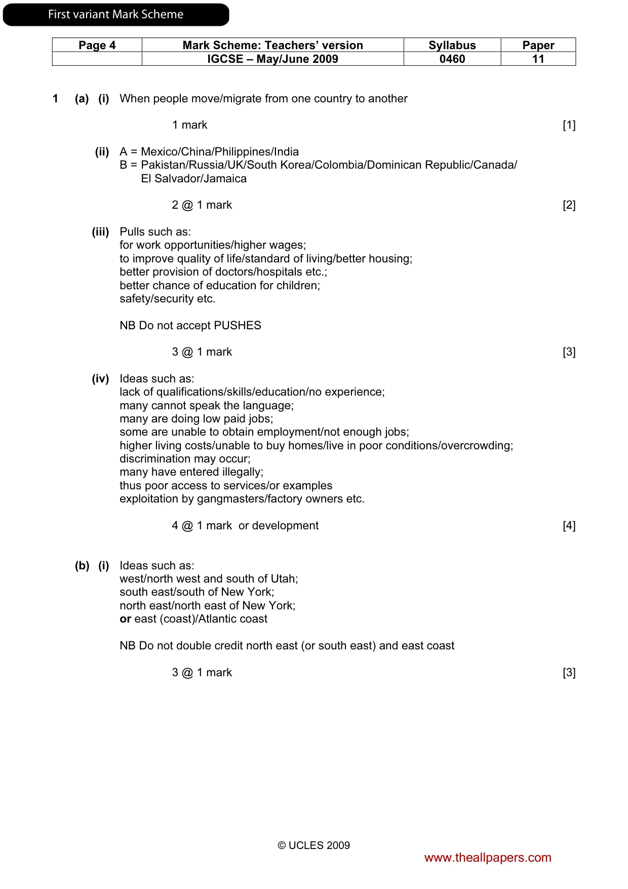
Page 4 Mark Scheme: Teachers’ version Syllabus Paper IGCSE – May/June 2009 0460 11 © UCLES 2009 1 (a) (i) When people move/migrate from one country to another 1 mark [1] (ii) A = Mexico/China/Philippines/India B = Pakistan/Russia/UK/South Korea/Colombia/Dominican Republic/Canada/ El Salvador/Jamaica 2 @ 1 mark [2] (iii) Pulls such as: for work opportunities/higher wages; to improve quality of life/standard of living/better housing; better provision of doctors/hospitals etc.; better chance of education for children; safety/security etc. NB Do not accept PUSHES 3 @ 1 mark [3] (iv) Ideas such as: lack of qualifications/skills/education/no experience; many cannot speak the language; many are doing low paid jobs; some are unable to obtain employment/not enough jobs; higher living costs/unable to buy homes/live in poor conditions/overcrowding; discrimination may occur; many have entered illegally; thus poor access to services/or examples exploitation by gangmasters/factory owners etc. 4 @ 1 mark or development [4] (b) (i) Ideas such as: west/north west and south of Utah; south east/south of New York; north east/north east of New York; or east (coast)/Atlantic coast NB Do not double credit north east (or south east) and east coast 3 @ 1 mark [3] www.theallpapers.com FirstvariantMarkScheme
Mark scheme, page 6
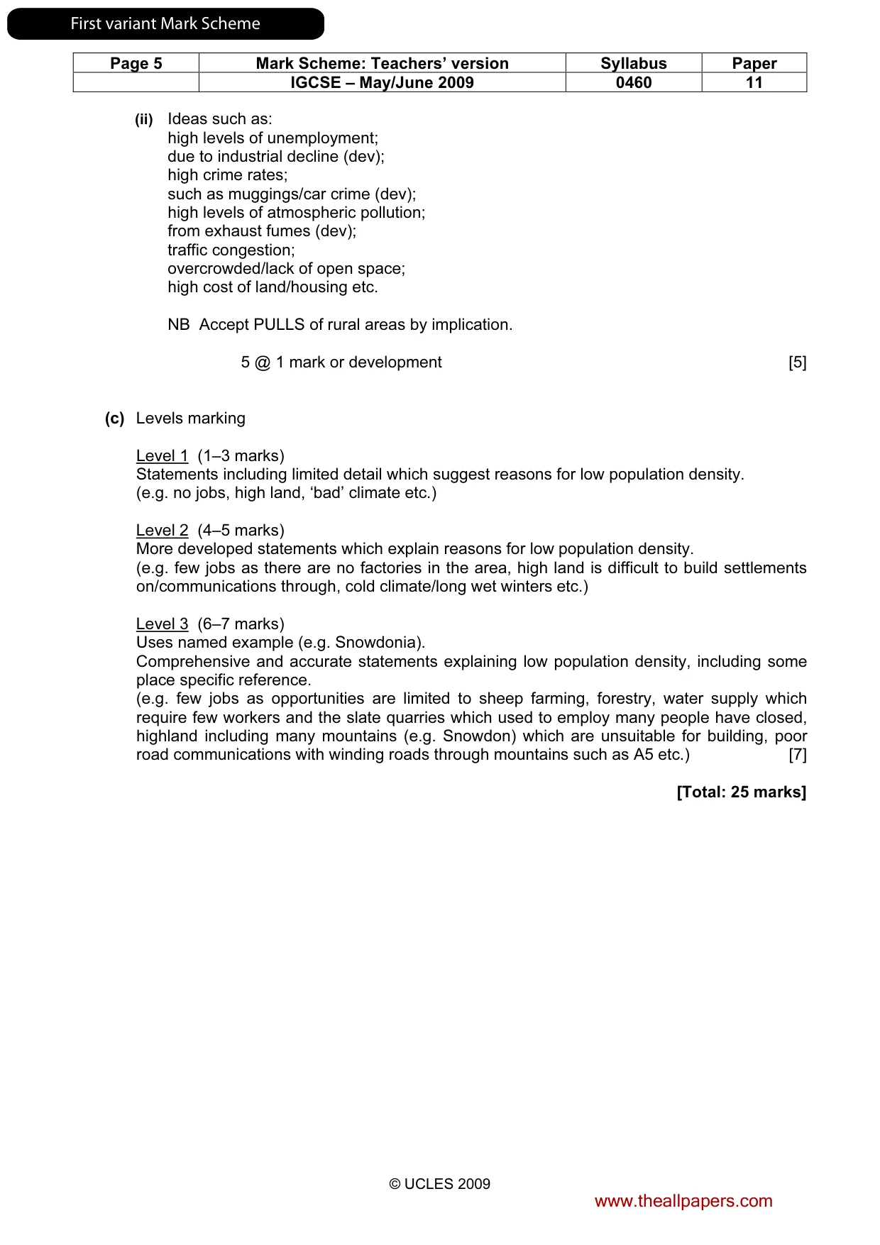
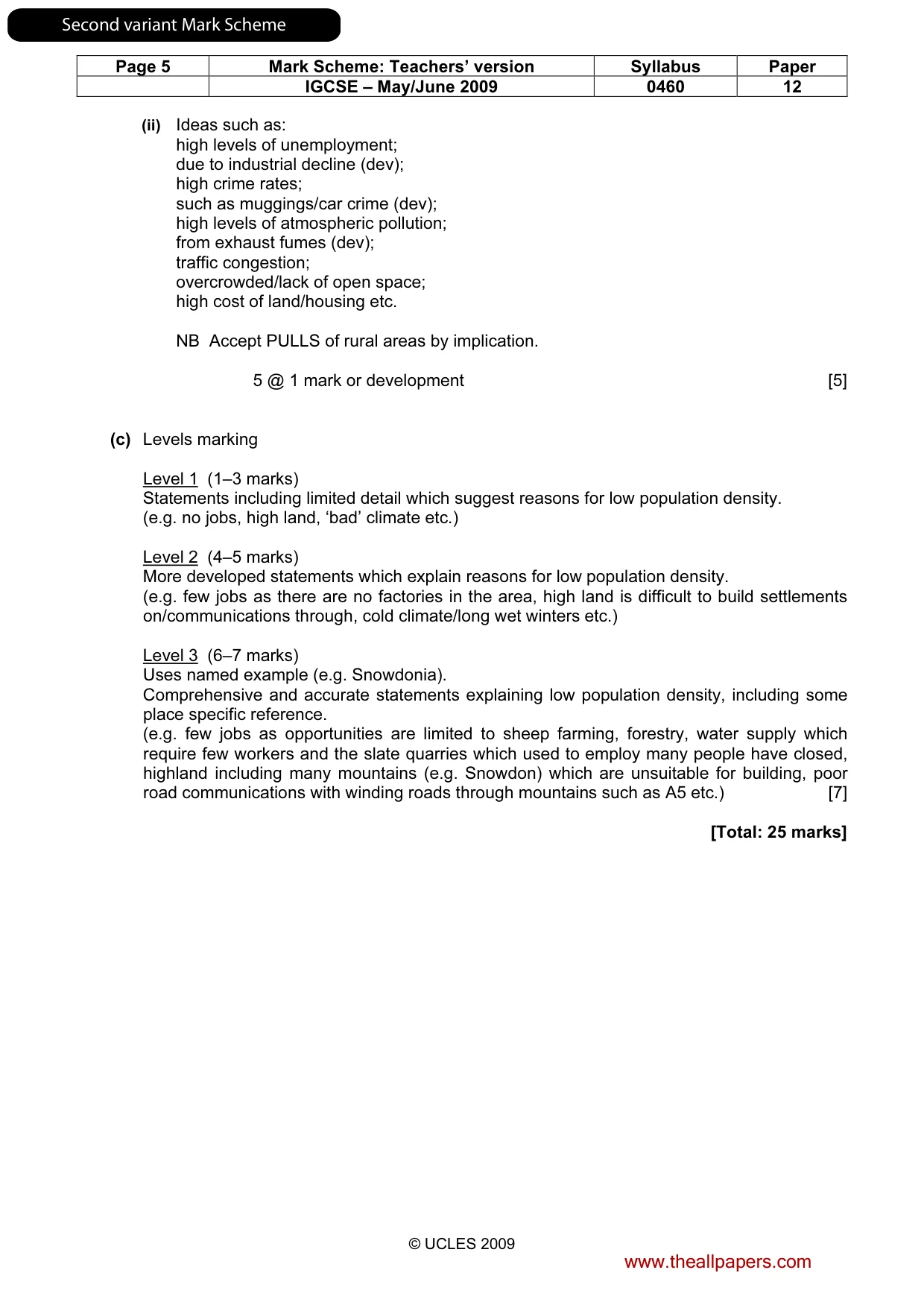
Page 5 Mark Scheme: Teachers’ version Syllabus Paper IGCSE – May/June 2009 0460 11 © UCLES 2009 (ii) Ideas such as: high levels of unemployment; due to industrial decline (dev); high crime rates; such as muggings/car crime (dev); high levels of atmospheric pollution; from exhaust fumes (dev); traffic congestion; overcrowded/lack of open space; high cost of land/housing etc. NB Accept PULLS of rural areas by implication. 5 @ 1 mark or development [5] (c) Levels marking Level 1 (1–3 marks) Statements including limited detail which suggest reasons for low population density. (e.g. no jobs, high land, ‘bad’ climate etc.) Level 2 (4–5 marks) More developed statements which explain reasons for low population density. (e.g. few jobs as there are no factories in the area, high land is difficult to build settlements on/communications through, cold climate/long wet winters etc.) Level 3 (6–7 marks) Uses named example (e.g. Snowdonia). Comprehensive and accurate statements explaining low population density, including some place specific reference. (e.g. few jobs as opportunities are limited to sheep farming, forestry, water supply which require few workers and the slate quarries which used to employ many people have closed, highland including many mountains (e.g. Snowdon) which are unsuitable for building, poor road communications with winding roads through mountains such as A5 etc.) [7] [Total: 25 marks] www.theallpapers.com FirstvariantMarkScheme
Mark scheme, page 7
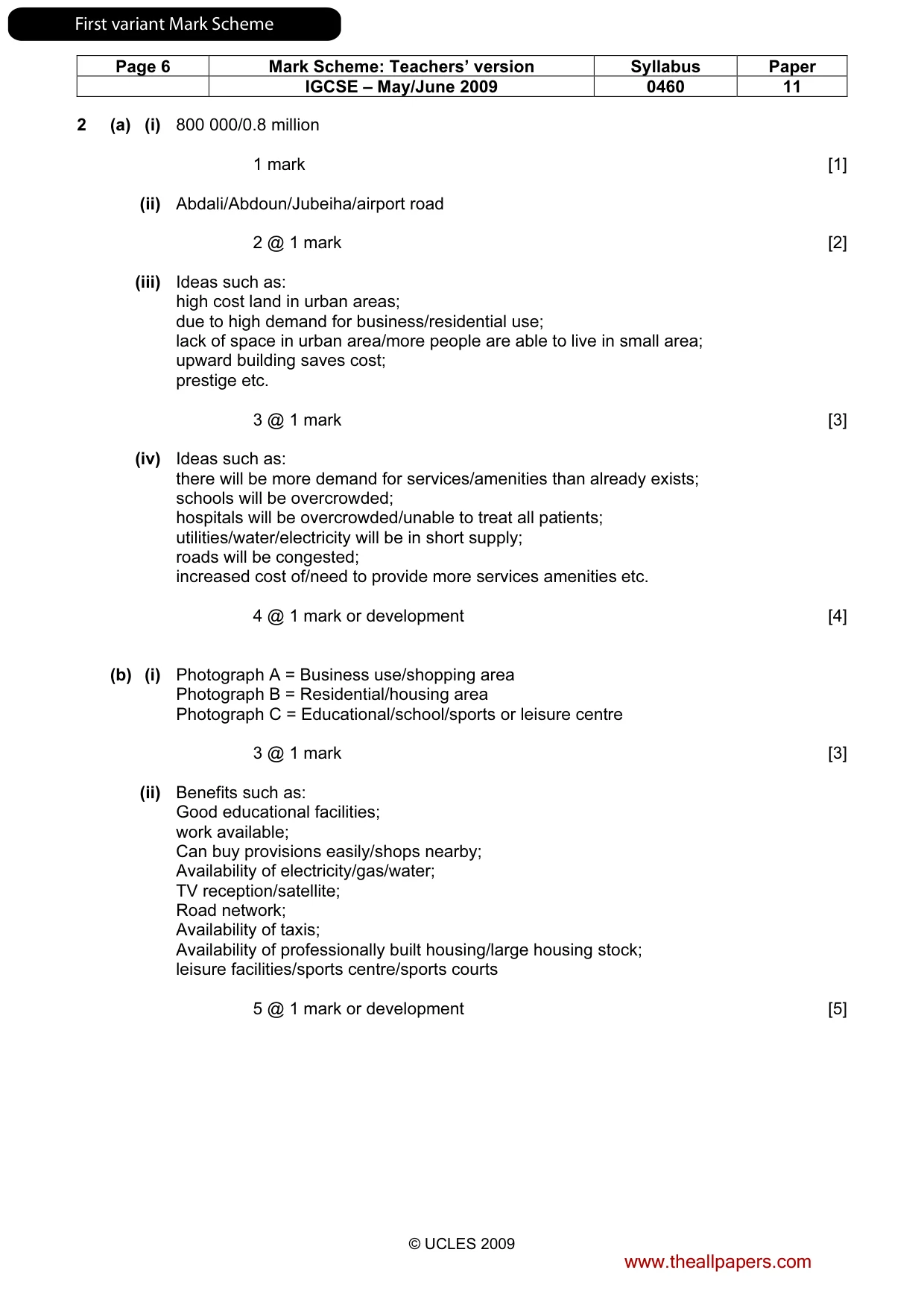
Page 6 Mark Scheme: Teachers’ version Syllabus Paper IGCSE – May/June 2009 0460 11 © UCLES 2009 2 (a) (i) 800 000/0.8 million 1 mark [1] (ii) Abdali/Abdoun/Jubeiha/airport road 2 @ 1 mark [2] (iii) Ideas such as: high cost land in urban areas; due to high demand for business/residential use; lack of space in urban area/more people are able to live in small area; upward building saves cost; prestige etc. 3 @ 1 mark [3] (iv) Ideas such as: there will be more demand for services/amenities than already exists; schools will be overcrowded; hospitals will be overcrowded/unable to treat all patients; utilities/water/electricity will be in short supply; roads will be congested; increased cost of/need to provide more services amenities etc. 4 @ 1 mark or development [4] (b) (i) Photograph A = Business use/shopping area Photograph B = Residential/housing area Photograph C = Educational/school/sports or leisure centre 3 @ 1 mark [3] (ii) Benefits such as: Good educational facilities; work available; Can buy provisions easily/shops nearby; Availability of electricity/gas/water; TV reception/satellite; Road network; Availability of taxis; Availability of professionally built housing/large housing stock; leisure facilities/sports centre/sports courts 5 @ 1 mark or development [5] www.theallpapers.com FirstvariantMarkScheme
Mark scheme, page 8
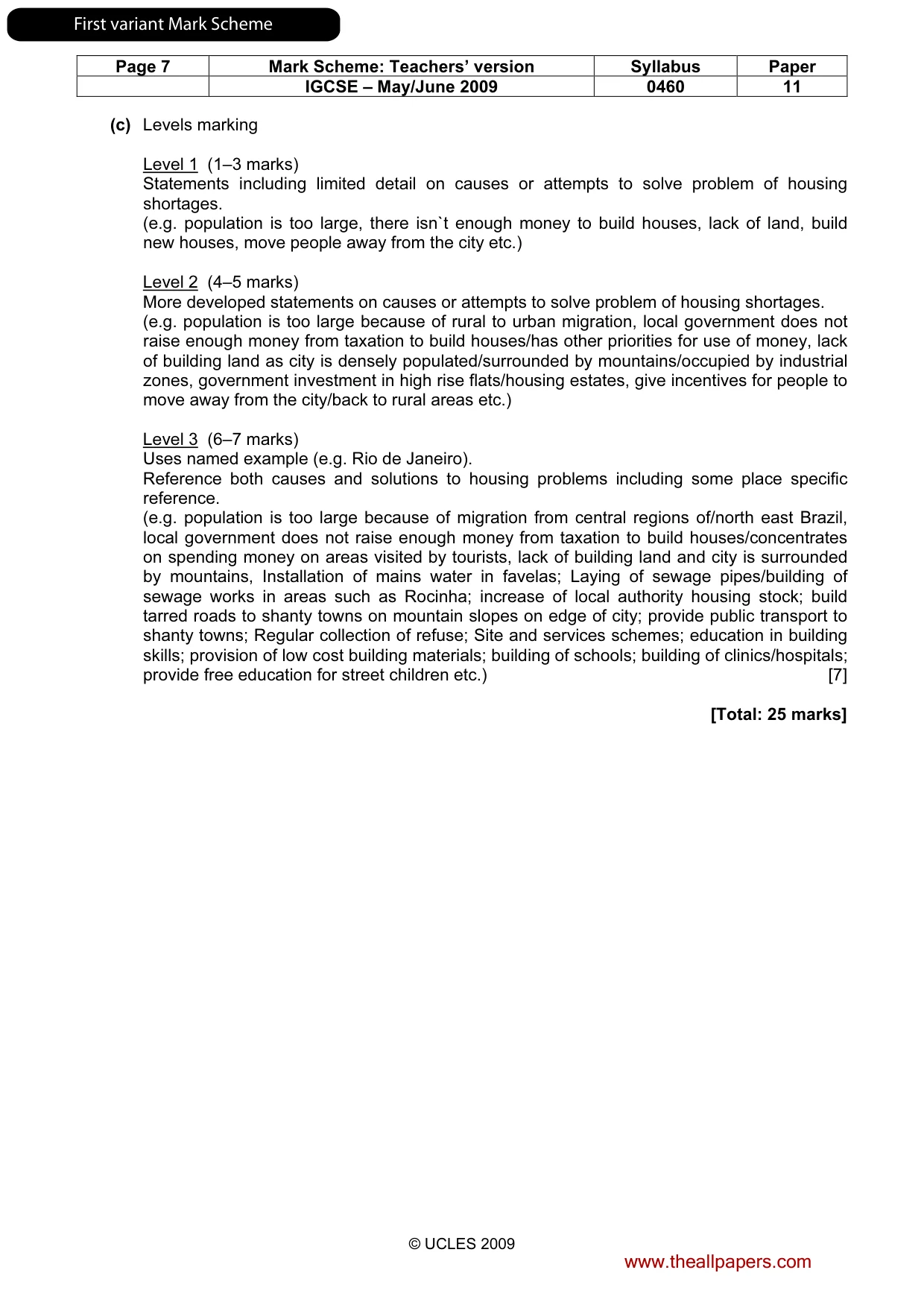
Page 7 Mark Scheme: Teachers’ version Syllabus Paper IGCSE – May/June 2009 0460 11 © UCLES 2009 (c) Levels marking Level 1 (1–3 marks) Statements including limited detail on causes or attempts to solve problem of housing shortages. (e.g. population is too large, there isn`t enough money to build houses, lack of land, build new houses, move people away from the city etc.) Level 2 (4–5 marks) More developed statements on causes or attempts to solve problem of housing shortages. (e.g. population is too large because of rural to urban migration, local government does not raise enough money from taxation to build houses/has other priorities for use of money, lack of building land as city is densely populated/surrounded by mountains/occupied by industrial zones, government investment in high rise flats/housing estates, give incentives for people to move away from the city/back to rural areas etc.) Level 3 (6–7 marks) Uses named example (e.g. Rio de Janeiro). Reference both causes and solutions to housing problems including some place specific reference. (e.g. population is too large because of migration from central regions of/north east Brazil, local government does not raise enough money from taxation to build houses/concentrates on spending money on areas visited by tourists, lack of building land and city is surrounded by mountains, Installation of mains water in favelas; Laying of sewage pipes/building of sewage works in areas such as Rocinha; increase of local authority housing stock; build tarred roads to shanty towns on mountain slopes on edge of city; provide public transport to shanty towns; Regular collection of refuse; Site and services schemes; education in building skills; provision of low cost building materials; building of schools; building of clinics/hospitals; provide free education for street children etc.) [7] [Total: 25 marks] www.theallpapers.com FirstvariantMarkScheme
Mark scheme, page 9
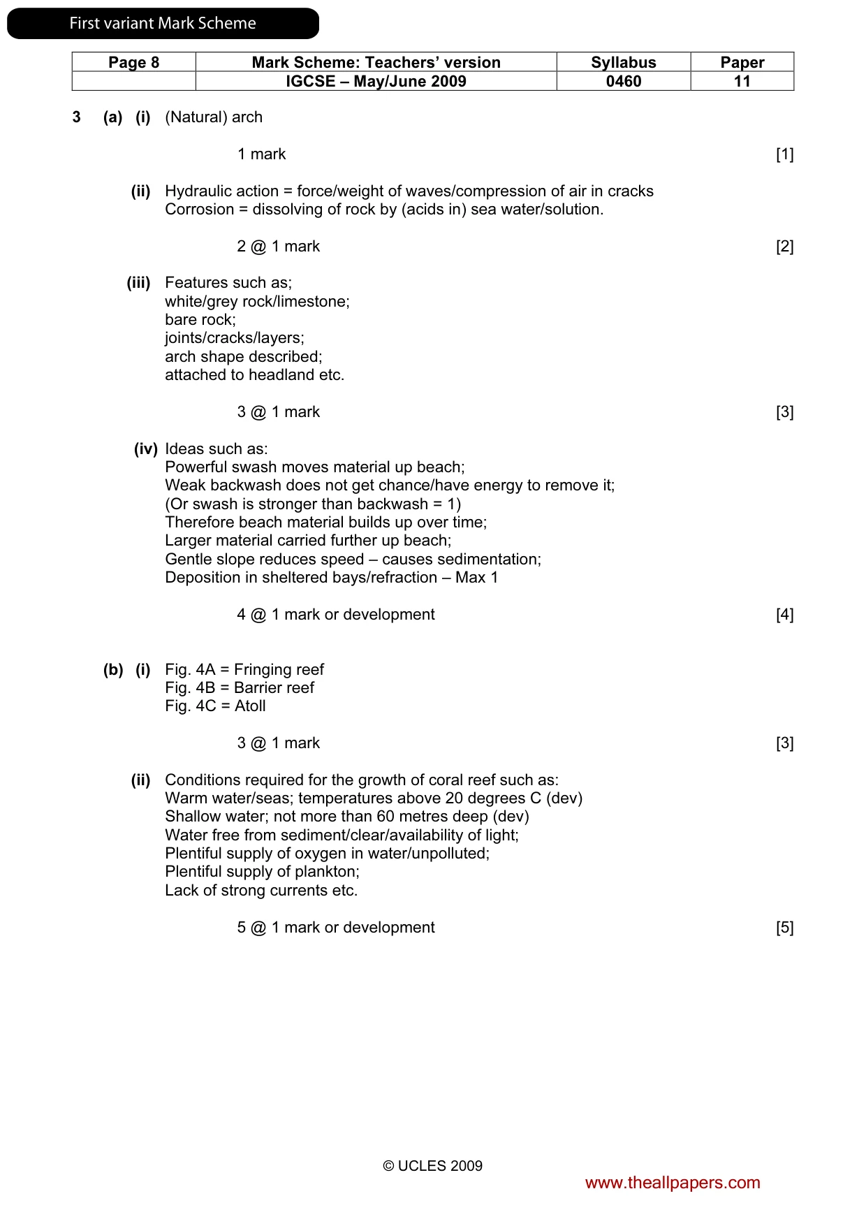
Page 8 Mark Scheme: Teachers’ version Syllabus Paper IGCSE – May/June 2009 0460 11 © UCLES 2009 3 (a) (i) (Natural) arch 1 mark [1] (ii) Hydraulic action = force/weight of waves/compression of air in cracks Corrosion = dissolving of rock by (acids in) sea water/solution. 2 @ 1 mark [2] (iii) Features such as; white/grey rock/limestone; bare rock; joints/cracks/layers; arch shape described; attached to headland etc. 3 @ 1 mark [3] (iv) Ideas such as: Powerful swash moves material up beach; Weak backwash does not get chance/have energy to remove it; (Or swash is stronger than backwash = 1) Therefore beach material builds up over time; Larger material carried further up beach; Gentle slope reduces speed – causes sedimentation; Deposition in sheltered bays/refraction – Max 1 4 @ 1 mark or development [4] (b) (i) Fig. 4A = Fringing reef Fig. 4B = Barrier reef Fig. 4C = Atoll 3 @ 1 mark [3] (ii) Conditions required for the growth of coral reef such as: Warm water/seas; temperatures above 20 degrees C (dev) Shallow water; not more than 60 metres deep (dev) Water free from sediment/clear/availability of light; Plentiful supply of oxygen in water/unpolluted; Plentiful supply of plankton; Lack of strong currents etc. 5 @ 1 mark or development [5] www.theallpapers.com FirstvariantMarkScheme
Mark scheme, page 10
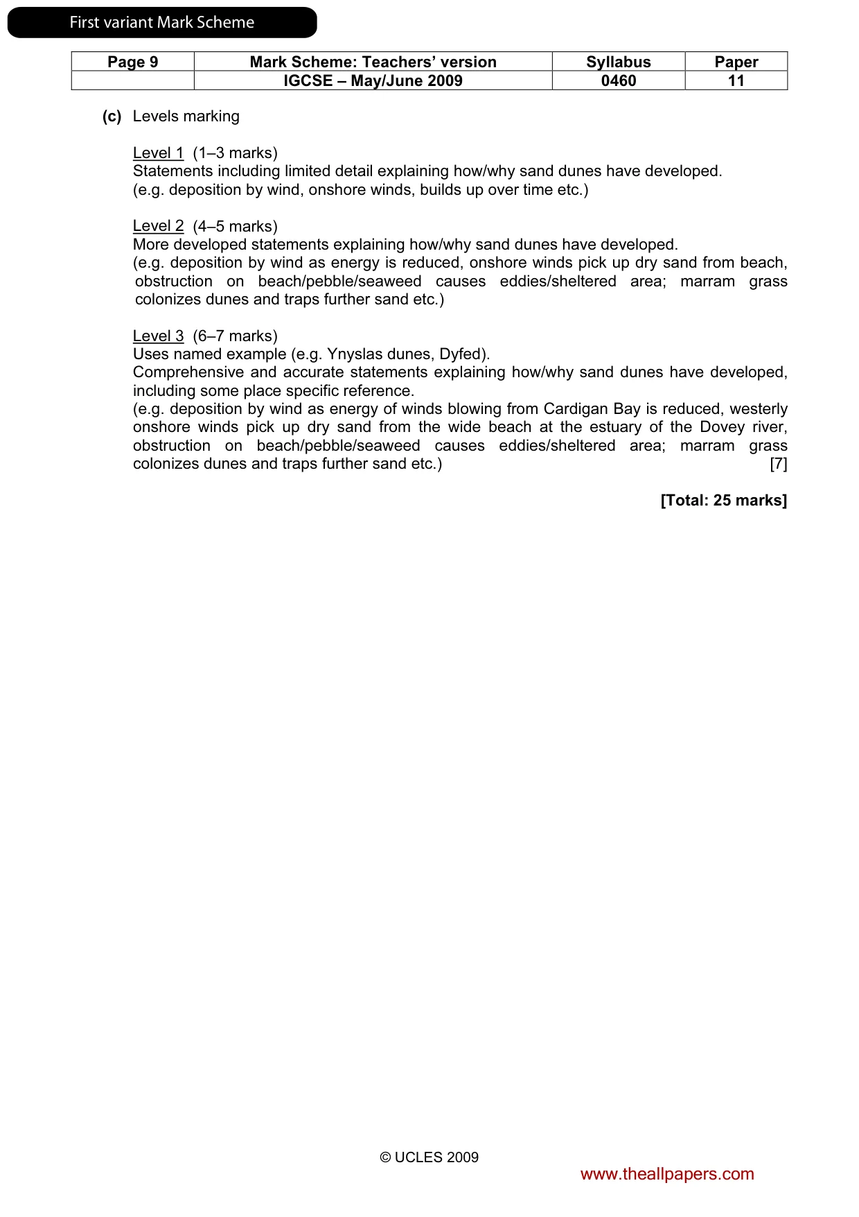
Page 9 Mark Scheme: Teachers’ version Syllabus Paper IGCSE – May/June 2009 0460 11 © UCLES 2009 (c) Levels marking Level 1 (1–3 marks) Statements including limited detail explaining how/why sand dunes have developed. (e.g. deposition by wind, onshore winds, builds up over time etc.) Level 2 (4–5 marks) More developed statements explaining how/why sand dunes have developed. (e.g. deposition by wind as energy is reduced, onshore winds pick up dry sand from beach, obstruction on beach/pebble/seaweed causes eddies/sheltered area; marram grass colonizes dunes and traps further sand etc.) Level 3 (6–7 marks) Uses named example (e.g. Ynyslas dunes, Dyfed). Comprehensive and accurate statements explaining how/why sand dunes have developed, including some place specific reference. (e.g. deposition by wind as energy of winds blowing from Cardigan Bay is reduced, westerly onshore winds pick up dry sand from the wide beach at the estuary of the Dovey river, obstruction on beach/pebble/seaweed causes eddies/sheltered area; marram grass colonizes dunes and traps further sand etc.) [7] [Total: 25 marks] www.theallpapers.com FirstvariantMarkScheme
Mark scheme, page 11
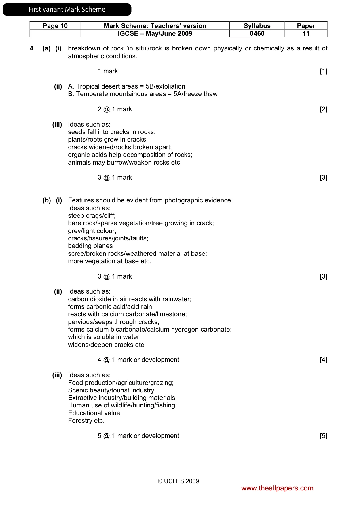
Page 10 Mark Scheme: Teachers’ version Syllabus Paper IGCSE – May/June 2009 0460 11 © UCLES 2009 4 (a) (i) breakdown of rock ‘in situ’/rock is broken down physically or chemically as a result of atmospheric conditions. 1 mark [1] (ii) A. Tropical desert areas = 5B/exfoliation B. Temperate mountainous areas = 5A/freeze thaw 2 @ 1 mark [2] (iii) Ideas such as: seeds fall into cracks in rocks; plants/roots grow in cracks; cracks widened/rocks broken apart; organic acids help decomposition of rocks; animals may burrow/weaken rocks etc. 3 @ 1 mark [3] (b) (i) Features should be evident from photographic evidence. Ideas such as: steep crags/cliff; bare rock/sparse vegetation/tree growing in crack; grey/light colour; cracks/fissures/joints/faults; bedding planes scree/broken rocks/weathered material at base; more vegetation at base etc. 3 @ 1 mark [3] (ii) Ideas such as: carbon dioxide in air reacts with rainwater; forms carbonic acid/acid rain; reacts with calcium carbonate/limestone; pervious/seeps through cracks; forms calcium bicarbonate/calcium hydrogen carbonate; which is soluble in water; widens/deepen cracks etc. 4 @ 1 mark or development [4] (iii) Ideas such as: Food production/agriculture/grazing; Scenic beauty/tourist industry; Extractive industry/building materials; Human use of wildlife/hunting/fishing; Educational value; Forestry etc. 5 @ 1 mark or development [5] www.theallpapers.com FirstvariantMarkScheme
Mark scheme, page 12
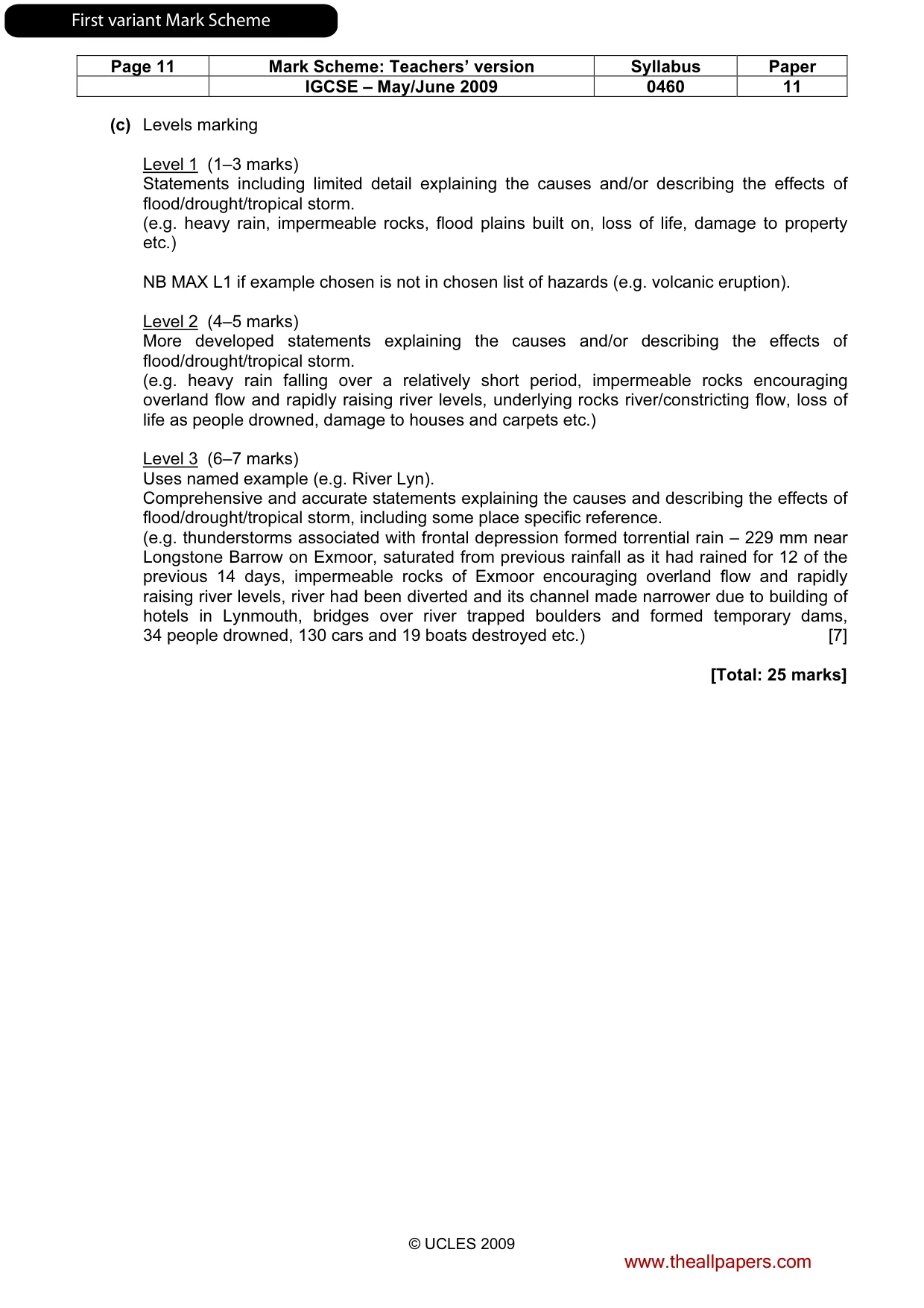
Page 11 Mark Scheme: Teachers’ version Syllabus Paper IGCSE – May/June 2009 0460 11 © UCLES 2009 (c) Levels marking Level 1 (1–3 marks) Statements including limited detail explaining the causes and/or describing the effects of flood/drought/tropical storm. (e.g. heavy rain, impermeable rocks, flood plains built on, loss of life, damage to property etc.) NB MAX L1 if example chosen is not in chosen list of hazards (e.g. volcanic eruption). Level 2 (4–5 marks) More developed statements explaining the causes and/or describing the effects of flood/drought/tropical storm. (e.g. heavy rain falling over a relatively short period, impermeable rocks encouraging overland flow and rapidly raising river levels, underlying rocks river/constricting flow, loss of life as people drowned, damage to houses and carpets etc.) Level 3 (6–7 marks) Uses named example (e.g. River Lyn). Comprehensive and accurate statements explaining the causes and describing the effects of flood/drought/tropical storm, including some place specific reference. (e.g. thunderstorms associated with frontal depression formed torrential rain – 229 mm near Longstone Barrow on Exmoor, saturated from previous rainfall as it had rained for 12 of the previous 14 days, impermeable rocks of Exmoor encouraging overland flow and rapidly raising river levels, river had been diverted and its channel made narrower due to building of hotels in Lynmouth, bridges over river trapped boulders and formed temporary dams, 34 people drowned, 130 cars and 19 boats destroyed etc.) [7] [Total: 25 marks] www.theallpapers.com FirstvariantMarkScheme
Mark scheme, page 13
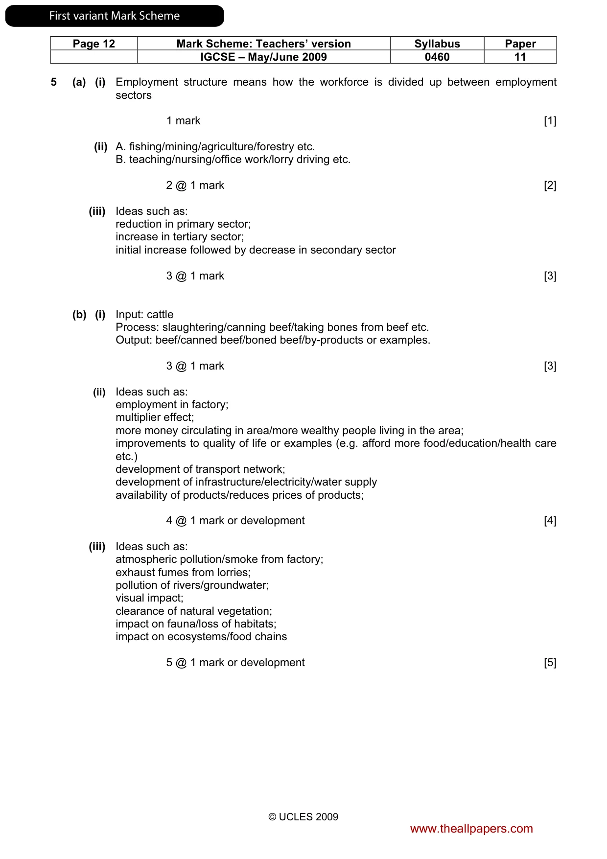
Page 12 Mark Scheme: Teachers’ version Syllabus Paper IGCSE – May/June 2009 0460 11 © UCLES 2009 5 (a) (i) Employment structure means how the workforce is divided up between employment sectors 1 mark [1] (ii) A. fishing/mining/agriculture/forestry etc. B. teaching/nursing/office work/lorry driving etc. 2 @ 1 mark [2] (iii) Ideas such as: reduction in primary sector; increase in tertiary sector; initial increase followed by decrease in secondary sector 3 @ 1 mark [3] (b) (i) Input: cattle Process: slaughtering/canning beef/taking bones from beef etc. Output: beef/canned beef/boned beef/by-products or examples. 3 @ 1 mark [3] (ii) Ideas such as: employment in factory; multiplier effect; more money circulating in area/more wealthy people living in the area; improvements to quality of life or examples (e.g. afford more food/education/health care etc.) development of transport network; development of infrastructure/electricity/water supply availability of products/reduces prices of products; 4 @ 1 mark or development [4] (iii) Ideas such as: atmospheric pollution/smoke from factory; exhaust fumes from lorries; pollution of rivers/groundwater; visual impact; clearance of natural vegetation; impact on fauna/loss of habitats; impact on ecosystems/food chains 5 @ 1 mark or development [5] www.theallpapers.com FirstvariantMarkScheme
Mark scheme, page 14
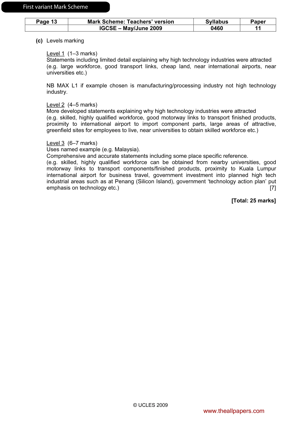
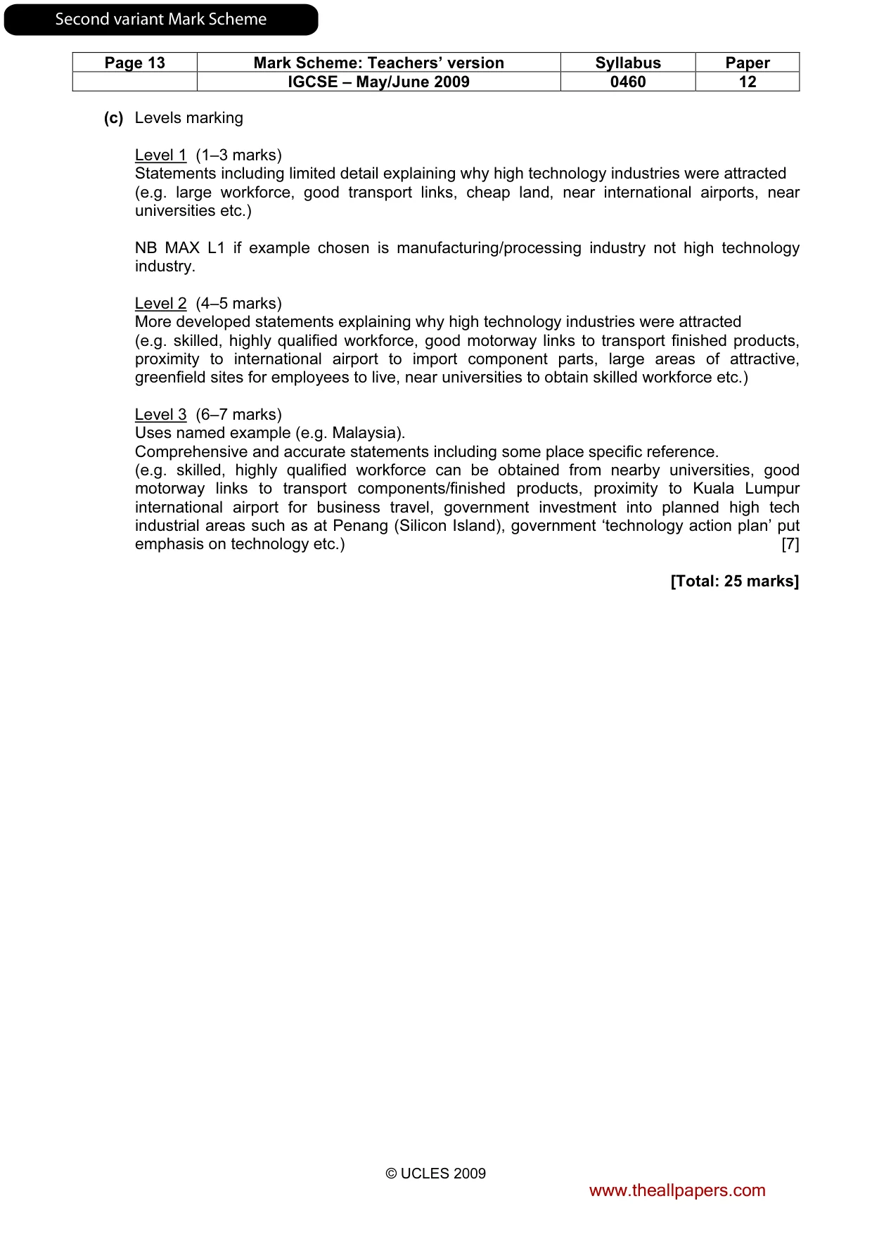
Page 13 Mark Scheme: Teachers’ version Syllabus Paper IGCSE – May/June 2009 0460 11 © UCLES 2009 (c) Levels marking Level 1 (1–3 marks) Statements including limited detail explaining why high technology industries were attracted (e.g. large workforce, good transport links, cheap land, near international airports, near universities etc.) NB MAX L1 if example chosen is manufacturing/processing industry not high technology industry. Level 2 (4–5 marks) More developed statements explaining why high technology industries were attracted (e.g. skilled, highly qualified workforce, good motorway links to transport finished products, proximity to international airport to import component parts, large areas of attractive, greenfield sites for employees to live, near universities to obtain skilled workforce etc.) Level 3 (6–7 marks) Uses named example (e.g. Malaysia). Comprehensive and accurate statements including some place specific reference. (e.g. skilled, highly qualified workforce can be obtained from nearby universities, good motorway links to transport components/finished products, proximity to Kuala Lumpur international airport for business travel, government investment into planned high tech industrial areas such as at Penang (Silicon Island), government ‘technology action plan’ put emphasis on technology etc.) [7] [Total: 25 marks] www.theallpapers.com FirstvariantMarkScheme
Mark scheme, page 15
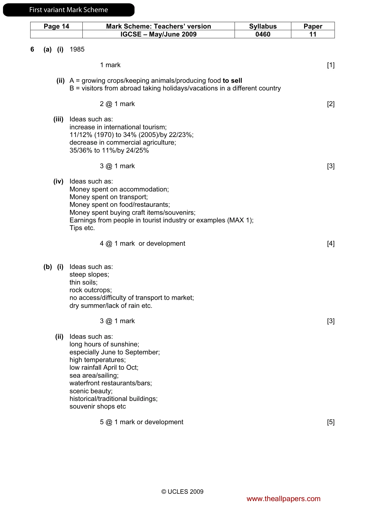
Page 14 Mark Scheme: Teachers’ version Syllabus Paper IGCSE – May/June 2009 0460 11 © UCLES 2009 6 (a) (i) 1985 1 mark [1] (ii) A = growing crops/keeping animals/producing food to sell B = visitors from abroad taking holidays/vacations in a different country 2 @ 1 mark [2] (iii) Ideas such as: increase in international tourism; 11/12% (1970) to 34% (2005)/by 22/23%; decrease in commercial agriculture; 35/36% to 11%/by 24/25% 3 @ 1 mark [3] (iv) Ideas such as: Money spent on accommodation; Money spent on transport; Money spent on food/restaurants; Money spent buying craft items/souvenirs; Earnings from people in tourist industry or examples (MAX 1); Tips etc. 4 @ 1 mark or development [4] (b) (i) Ideas such as: steep slopes; thin soils; rock outcrops; no access/difficulty of transport to market; dry summer/lack of rain etc. 3 @ 1 mark [3] (ii) Ideas such as: long hours of sunshine; especially June to September; high temperatures; low rainfall April to Oct; sea area/sailing; waterfront restaurants/bars; scenic beauty; historical/traditional buildings; souvenir shops etc 5 @ 1 mark or development [5] www.theallpapers.com FirstvariantMarkScheme
Mark scheme, page 16
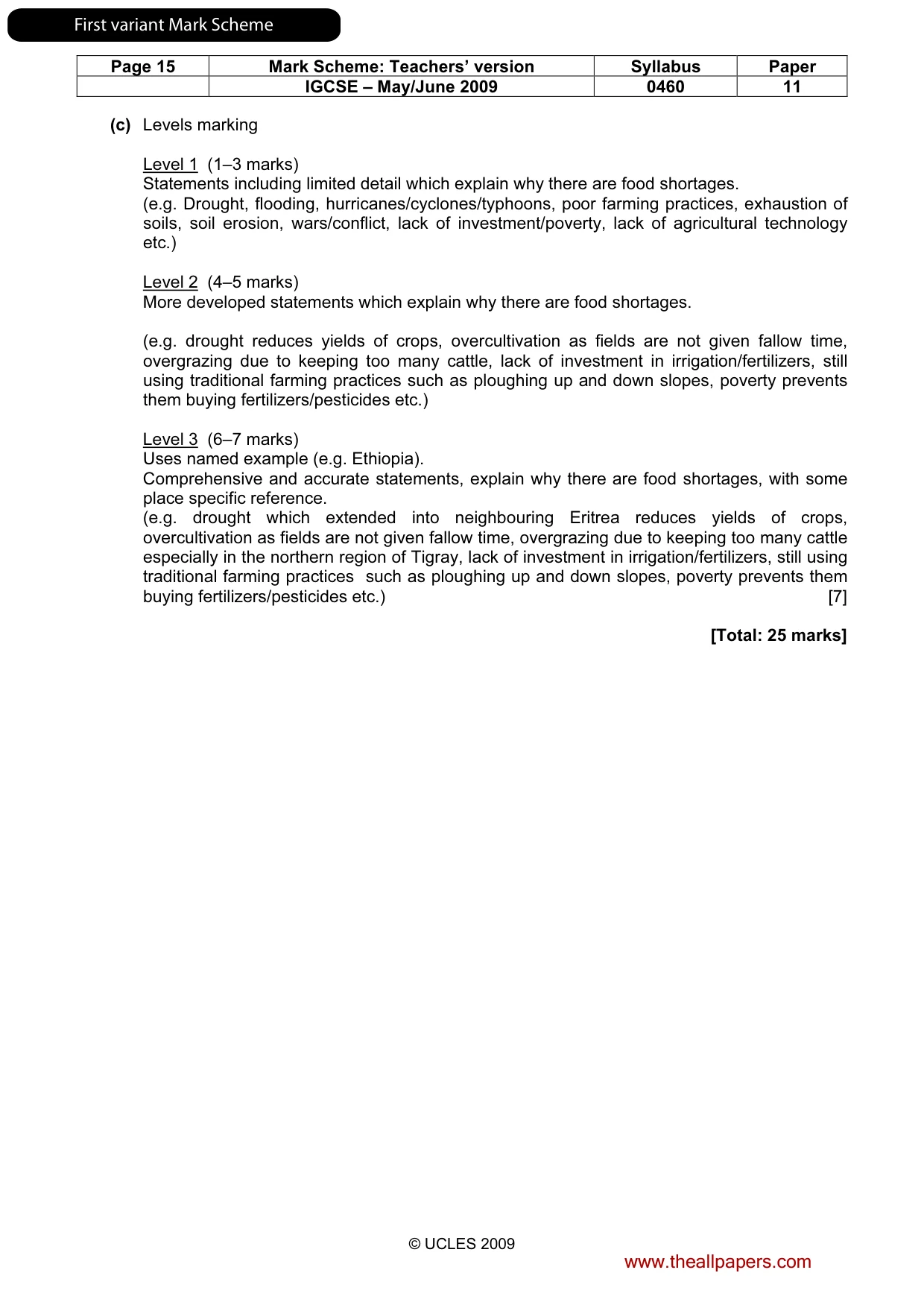
Page 15 Mark Scheme: Teachers’ version Syllabus Paper IGCSE – May/June 2009 0460 11 © UCLES 2009 (c) Levels marking Level 1 (1–3 marks) Statements including limited detail which explain why there are food shortages. (e.g. Drought, flooding, hurricanes/cyclones/typhoons, poor farming practices, exhaustion of soils, soil erosion, wars/conflict, lack of investment/poverty, lack of agricultural technology etc.) Level 2 (4–5 marks) More developed statements which explain why there are food shortages. (e.g. drought reduces yields of crops, overcultivation as fields are not given fallow time, overgrazing due to keeping too many cattle, lack of investment in irrigation/fertilizers, still using traditional farming practices such as ploughing up and down slopes, poverty prevents them buying fertilizers/pesticides etc.) Level 3 (6–7 marks) Uses named example (e.g. Ethiopia). Comprehensive and accurate statements, explain why there are food shortages, with some place specific reference. (e.g. drought which extended into neighbouring Eritrea reduces yields of crops, overcultivation as fields are not given fallow time, overgrazing due to keeping too many cattle especially in the northern region of Tigray, lack of investment in irrigation/fertilizers, still using traditional farming practices such as ploughing up and down slopes, poverty prevents them buying fertilizers/pesticides etc.) [7] [Total: 25 marks] www.theallpapers.com FirstvariantMarkScheme
Mark scheme, page 17
UNIVERSITY OF CAMBRIDGE INTERNATIONAL EXAMINATIONS International General Certificate of Secondary Education MARK SCHEME for the May/June 2009 question paper for the guidance of teachers 0460 GEOGRAPHY 0460/12 Paper 1, maximum raw mark 75 This mark scheme is published as an aid to teachers and candidates, to indicate the requirements of the examination. It shows the basis on which Examiners were instructed to award marks. It does not indicate the details of the discussions that took place at an Examiners’ meeting before marking began, which would have considered the acceptability of alternative answers. Mark schemes must be read in conjunction with the question papers and the report on the examination. • CIE will not enter into discussions or correspondence in connection with these mark schemes. CIE is publishing the mark schemes for the May/June 2009 question papers for most IGCSE, GCE Advanced Level and Advanced Subsidiary Level syllabuses and some Ordinary Level syllabuses. www.theallpapers.com SecondvariantMarkScheme
Mark scheme, page 18
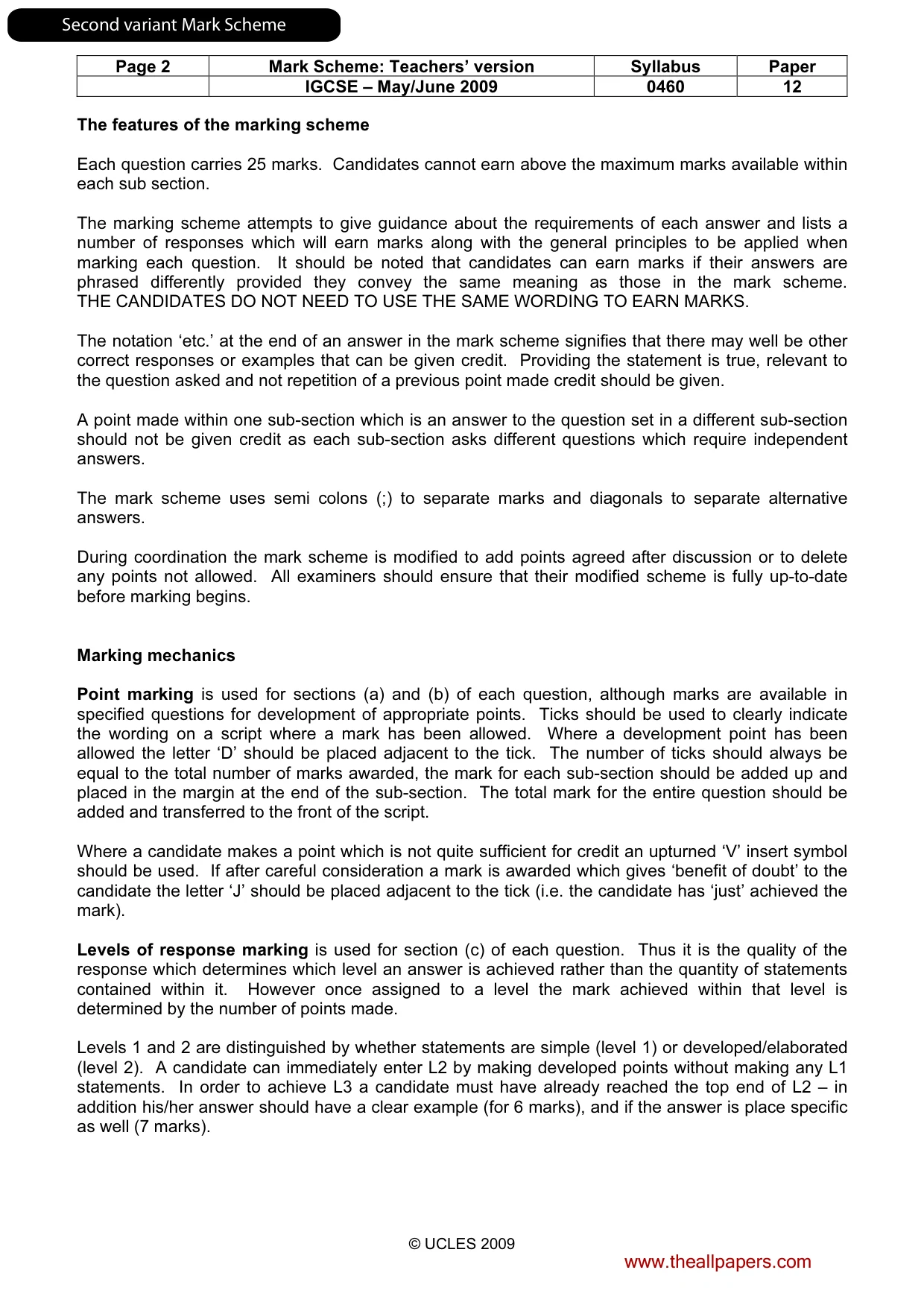
Page 2 Mark Scheme: Teachers’ version Syllabus Paper IGCSE – May/June 2009 0460 12 © UCLES 2009 The features of the marking scheme Each question carries 25 marks. Candidates cannot earn above the maximum marks available within each sub section. The marking scheme attempts to give guidance about the requirements of each answer and lists a number of responses which will earn marks along with the general principles to be applied when marking each question. It should be noted that candidates can earn marks if their answers are phrased differently provided they convey the same meaning as those in the mark scheme. THE CANDIDATES DO NOT NEED TO USE THE SAME WORDING TO EARN MARKS. The notation ‘etc.’ at the end of an answer in the mark scheme signifies that there may well be other correct responses or examples that can be given credit. Providing the statement is true, relevant to the question asked and not repetition of a previous point made credit should be given. A point made within one sub-section which is an answer to the question set in a different sub-section should not be given credit as each sub-section asks different questions which require independent answers. The mark scheme uses semi colons (;) to separate marks and diagonals to separate alternative answers. During coordination the mark scheme is modified to add points agreed after discussion or to delete any points not allowed. All examiners should ensure that their modified scheme is fully up-to-date before marking begins. Marking mechanics Point marking is used for sections (a) and (b) of each question, although marks are available in specified questions for development of appropriate points. Ticks should be used to clearly indicate the wording on a script where a mark has been allowed. Where a development point has been allowed the letter ‘D’ should be placed adjacent to the tick. The number of ticks should always be equal to the total number of marks awarded, the mark for each sub-section should be added up and placed in the margin at the end of the sub-section. The total mark for the entire question should be added and transferred to the front of the script. Where a candidate makes a point which is not quite sufficient for credit an upturned ‘V’ insert symbol should be used. If after careful consideration a mark is awarded which gives ‘benefit of doubt’ to the candidate the letter ‘J’ should be placed adjacent to the tick (i.e. the candidate has ‘just’ achieved the mark). Levels of response marking is used for section (c) of each question. Thus it is the quality of the response which determines which level an answer is achieved rather than the quantity of statements contained within it. However once assigned to a level the mark achieved within that level is determined by the number of points made. Levels 1 and 2 are distinguished by whether statements are simple (level 1) or developed/elaborated (level 2). A candidate can immediately enter L2 by making developed points without making any L1 statements. In order to achieve L3 a candidate must have already reached the top end of L2 – in addition his/her answer should have a clear example (for 6 marks), and if the answer is place specific as well (7 marks). www.theallpapers.com SecondvariantMarkScheme
Mark scheme, page 19
Page 3 Mark Scheme: Teachers’ version Syllabus Paper IGCSE – May/June 2009 0460 12 © UCLES 2009 Where statements are assigned levels by the examiner this should be indicated by the use of L1, L2 and L3 next to the statements. A summary of the overall level and mark awarded should be written at the end of the answer. Ticks should not be used on answers which are marked using levels of response marking. All answers, whether marked by point marking or levels, should have signs of having been assessed by the examiner. Crosses are acceptable to signify wrong answers and a red line accompanied by the letters ‘I/R’ should be used to indicate those which are irrelevant. www.theallpapers.com SecondvariantMarkScheme
Mark scheme, page 20
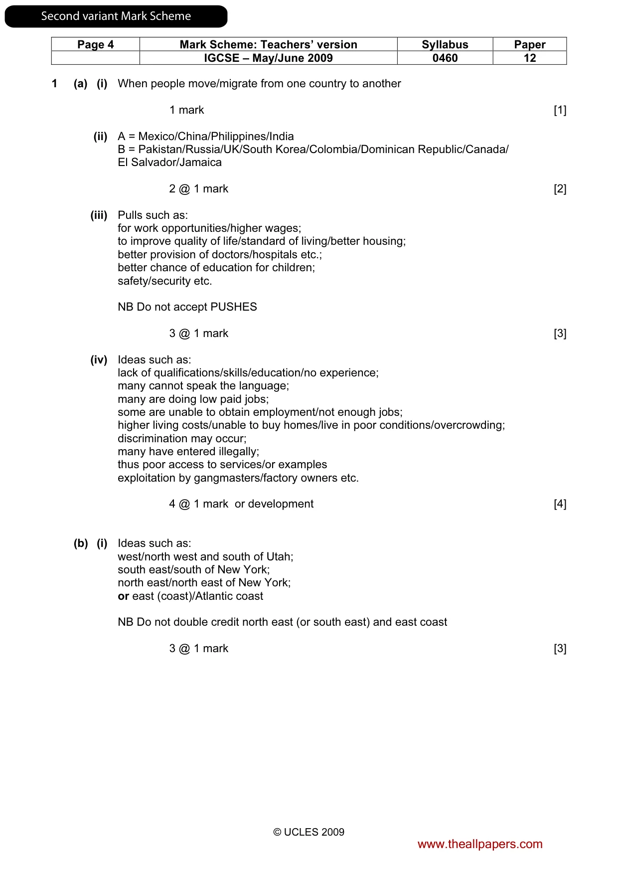
Page 4 Mark Scheme: Teachers’ version Syllabus Paper IGCSE – May/June 2009 0460 12 © UCLES 2009 1 (a) (i) When people move/migrate from one country to another 1 mark [1] (ii) A = Mexico/China/Philippines/India B = Pakistan/Russia/UK/South Korea/Colombia/Dominican Republic/Canada/ El Salvador/Jamaica 2 @ 1 mark [2] (iii) Pulls such as: for work opportunities/higher wages; to improve quality of life/standard of living/better housing; better provision of doctors/hospitals etc.; better chance of education for children; safety/security etc. NB Do not accept PUSHES 3 @ 1 mark [3] (iv) Ideas such as: lack of qualifications/skills/education/no experience; many cannot speak the language; many are doing low paid jobs; some are unable to obtain employment/not enough jobs; higher living costs/unable to buy homes/live in poor conditions/overcrowding; discrimination may occur; many have entered illegally; thus poor access to services/or examples exploitation by gangmasters/factory owners etc. 4 @ 1 mark or development [4] (b) (i) Ideas such as: west/north west and south of Utah; south east/south of New York; north east/north east of New York; or east (coast)/Atlantic coast NB Do not double credit north east (or south east) and east coast 3 @ 1 mark [3] www.theallpapers.com SecondvariantMarkScheme
Mark scheme, page 21
Page 5 Mark Scheme: Teachers’ version Syllabus Paper IGCSE – May/June 2009 0460 12 © UCLES 2009 (ii) Ideas such as: high levels of unemployment; due to industrial decline (dev); high crime rates; such as muggings/car crime (dev); high levels of atmospheric pollution; from exhaust fumes (dev); traffic congestion; overcrowded/lack of open space; high cost of land/housing etc. NB Accept PULLS of rural areas by implication. 5 @ 1 mark or development [5] (c) Levels marking Level 1 (1–3 marks) Statements including limited detail which suggest reasons for low population density. (e.g. no jobs, high land, ‘bad’ climate etc.) Level 2 (4–5 marks) More developed statements which explain reasons for low population density. (e.g. few jobs as there are no factories in the area, high land is difficult to build settlements on/communications through, cold climate/long wet winters etc.) Level 3 (6–7 marks) Uses named example (e.g. Snowdonia). Comprehensive and accurate statements explaining low population density, including some place specific reference. (e.g. few jobs as opportunities are limited to sheep farming, forestry, water supply which require few workers and the slate quarries which used to employ many people have closed, highland including many mountains (e.g. Snowdon) which are unsuitable for building, poor road communications with winding roads through mountains such as A5 etc.) [7] [Total: 25 marks] www.theallpapers.com SecondvariantMarkScheme
Mark scheme, page 22
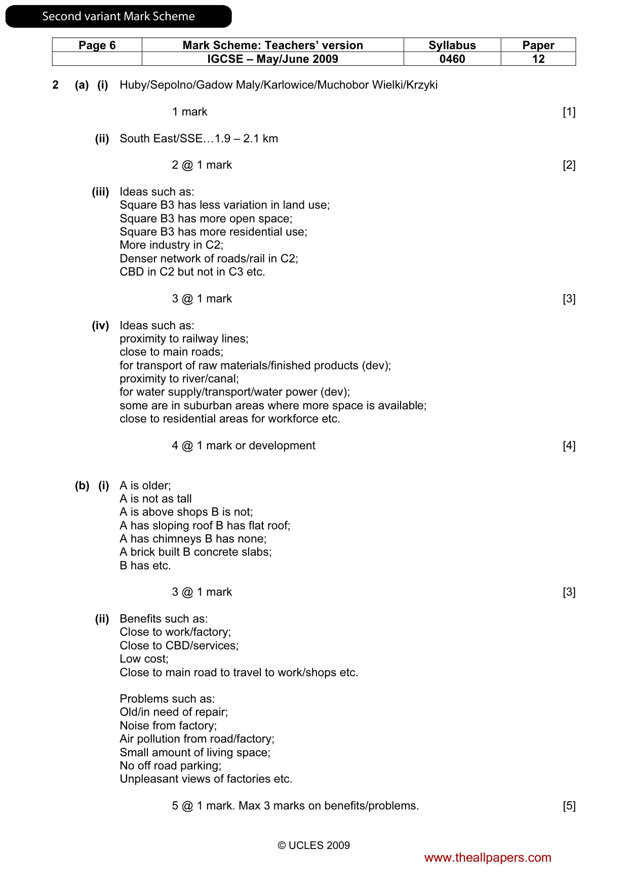
Page 6 Mark Scheme: Teachers’ version Syllabus Paper IGCSE – May/June 2009 0460 12 © UCLES 2009 2 (a) (i) Huby/Sepolno/Gadow Maly/Karlowice/Muchobor Wielki/Krzyki 1 mark [1] (ii) South East/SSE…1.9 – 2.1 km 2 @ 1 mark [2] (iii) Ideas such as: Square B3 has less variation in land use; Square B3 has more open space; Square B3 has more residential use; More industry in C2; Denser network of roads/rail in C2; CBD in C2 but not in C3 etc. 3 @ 1 mark [3] (iv) Ideas such as: proximity to railway lines; close to main roads; for transport of raw materials/finished products (dev); proximity to river/canal; for water supply/transport/water power (dev); some are in suburban areas where more space is available; close to residential areas for workforce etc. 4 @ 1 mark or development [4] (b) (i) A is older; A is not as tall A is above shops B is not; A has sloping roof B has flat roof; A has chimneys B has none; A brick built B concrete slabs; B has etc. 3 @ 1 mark [3] (ii) Benefits such as: Close to work/factory; Close to CBD/services; Low cost; Close to main road to travel to work/shops etc. Problems such as: Old/in need of repair; Noise from factory; Air pollution from road/factory; Small amount of living space; No off road parking; Unpleasant views of factories etc. 5 @ 1 mark. Max 3 marks on benefits/problems. [5] www.theallpapers.com SecondvariantMarkScheme
Mark scheme, page 23
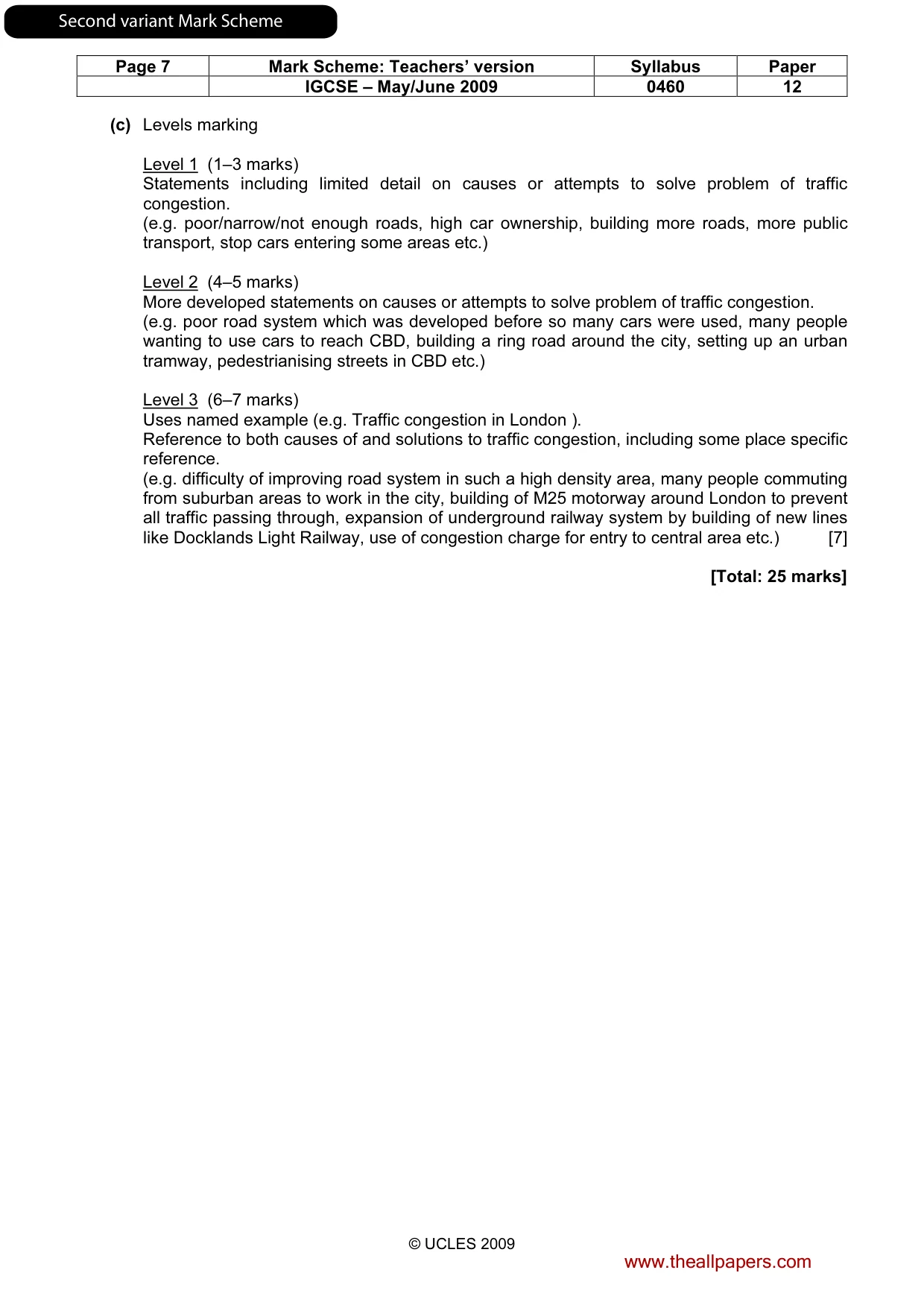
Page 7 Mark Scheme: Teachers’ version Syllabus Paper IGCSE – May/June 2009 0460 12 © UCLES 2009 (c) Levels marking Level 1 (1–3 marks) Statements including limited detail on causes or attempts to solve problem of traffic congestion. (e.g. poor/narrow/not enough roads, high car ownership, building more roads, more public transport, stop cars entering some areas etc.) Level 2 (4–5 marks) More developed statements on causes or attempts to solve problem of traffic congestion. (e.g. poor road system which was developed before so many cars were used, many people wanting to use cars to reach CBD, building a ring road around the city, setting up an urban tramway, pedestrianising streets in CBD etc.) Level 3 (6–7 marks) Uses named example (e.g. Traffic congestion in London ). Reference to both causes of and solutions to traffic congestion, including some place specific reference. (e.g. difficulty of improving road system in such a high density area, many people commuting from suburban areas to work in the city, building of M25 motorway around London to prevent all traffic passing through, expansion of underground railway system by building of new lines like Docklands Light Railway, use of congestion charge for entry to central area etc.) [7] [Total: 25 marks] www.theallpapers.com SecondvariantMarkScheme
Mark scheme, page 24
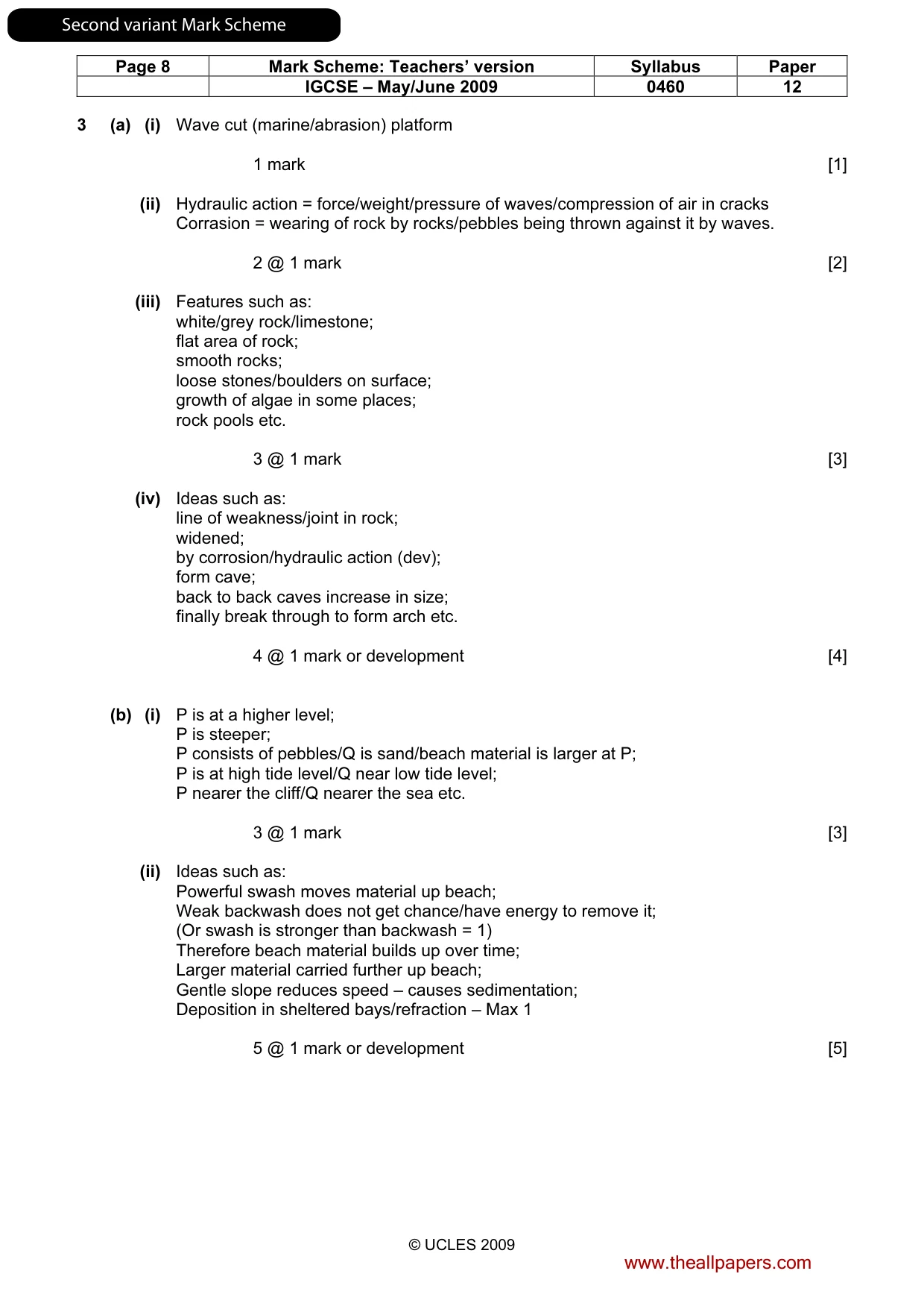
Page 8 Mark Scheme: Teachers’ version Syllabus Paper IGCSE – May/June 2009 0460 12 © UCLES 2009 3 (a) (i) Wave cut (marine/abrasion) platform 1 mark [1] (ii) Hydraulic action = force/weight/pressure of waves/compression of air in cracks Corrasion = wearing of rock by rocks/pebbles being thrown against it by waves. 2 @ 1 mark [2] (iii) Features such as: white/grey rock/limestone; flat area of rock; smooth rocks; loose stones/boulders on surface; growth of algae in some places; rock pools etc. 3 @ 1 mark [3] (iv) Ideas such as: line of weakness/joint in rock; widened; by corrosion/hydraulic action (dev); form cave; back to back caves increase in size; finally break through to form arch etc. 4 @ 1 mark or development [4] (b) (i) P is at a higher level; P is steeper; P consists of pebbles/Q is sand/beach material is larger at P; P is at high tide level/Q near low tide level; P nearer the cliff/Q nearer the sea etc. 3 @ 1 mark [3] (ii) Ideas such as: Powerful swash moves material up beach; Weak backwash does not get chance/have energy to remove it; (Or swash is stronger than backwash = 1) Therefore beach material builds up over time; Larger material carried further up beach; Gentle slope reduces speed – causes sedimentation; Deposition in sheltered bays/refraction – Max 1 5 @ 1 mark or development [5] www.theallpapers.com SecondvariantMarkScheme
Mark scheme, page 25
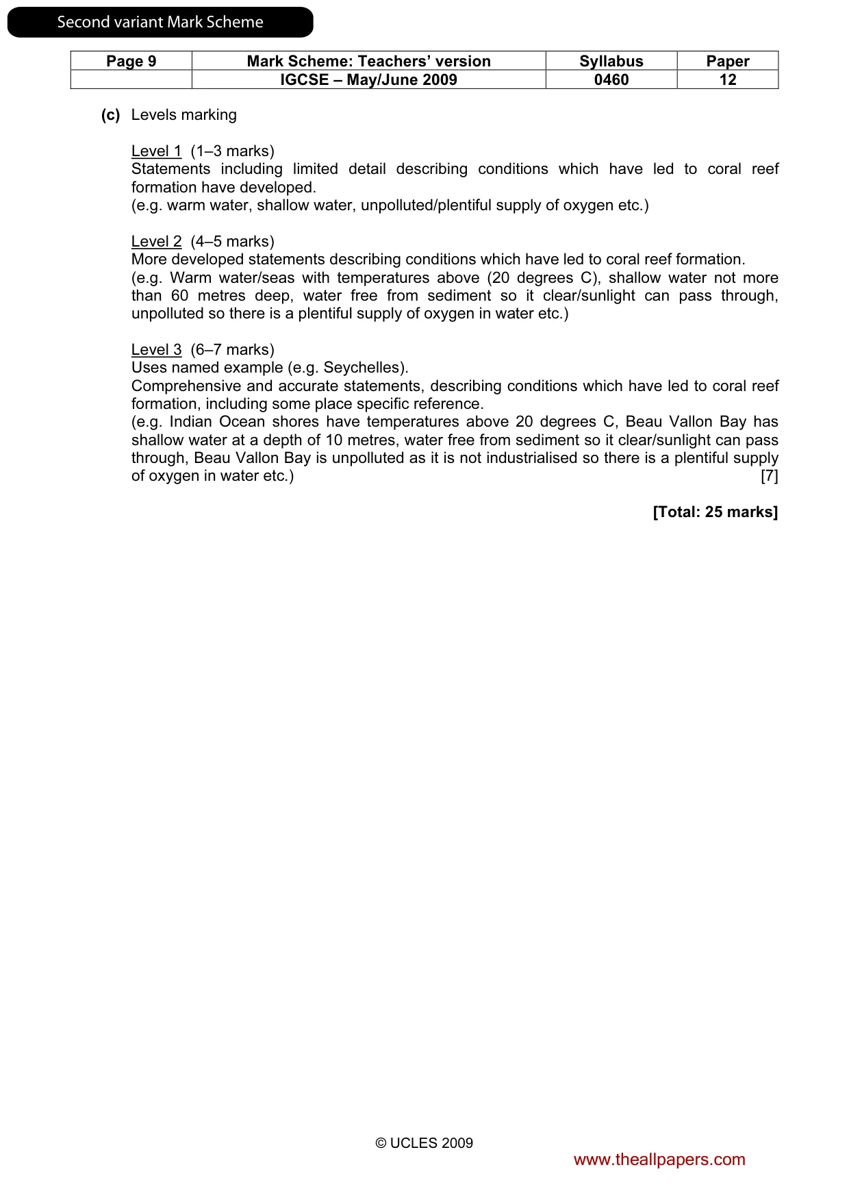
Page 9 Mark Scheme: Teachers’ version Syllabus Paper IGCSE – May/June 2009 0460 12 © UCLES 2009 (c) Levels marking Level 1 (1–3 marks) Statements including limited detail describing conditions which have led to coral reef formation have developed. (e.g. warm water, shallow water, unpolluted/plentiful supply of oxygen etc.) Level 2 (4–5 marks) More developed statements describing conditions which have led to coral reef formation. (e.g. Warm water/seas with temperatures above (20 degrees C), shallow water not more than 60 metres deep, water free from sediment so it clear/sunlight can pass through, unpolluted so there is a plentiful supply of oxygen in water etc.) Level 3 (6–7 marks) Uses named example (e.g. Seychelles). Comprehensive and accurate statements, describing conditions which have led to coral reef formation, including some place specific reference. (e.g. Indian Ocean shores have temperatures above 20 degrees C, Beau Vallon Bay has shallow water at a depth of 10 metres, water free from sediment so it clear/sunlight can pass through, Beau Vallon Bay is unpolluted as it is not industrialised so there is a plentiful supply of oxygen in water etc.) [7] [Total: 25 marks] www.theallpapers.com SecondvariantMarkScheme
Mark scheme, page 26
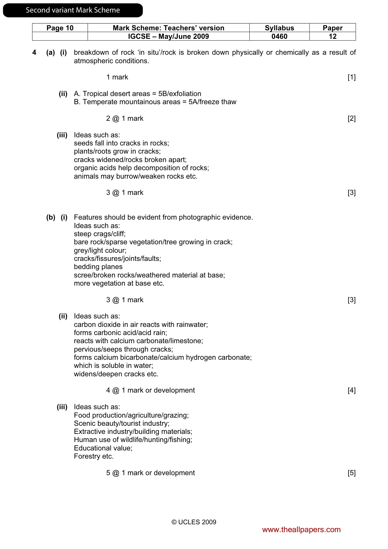
Page 10 Mark Scheme: Teachers’ version Syllabus Paper IGCSE – May/June 2009 0460 12 © UCLES 2009 4 (a) (i) breakdown of rock ‘in situ’/rock is broken down physically or chemically as a result of atmospheric conditions. 1 mark [1] (ii) A. Tropical desert areas = 5B/exfoliation B. Temperate mountainous areas = 5A/freeze thaw 2 @ 1 mark [2] (iii) Ideas such as: seeds fall into cracks in rocks; plants/roots grow in cracks; cracks widened/rocks broken apart; organic acids help decomposition of rocks; animals may burrow/weaken rocks etc. 3 @ 1 mark [3] (b) (i) Features should be evident from photographic evidence. Ideas such as: steep crags/cliff; bare rock/sparse vegetation/tree growing in crack; grey/light colour; cracks/fissures/joints/faults; bedding planes scree/broken rocks/weathered material at base; more vegetation at base etc. 3 @ 1 mark [3] (ii) Ideas such as: carbon dioxide in air reacts with rainwater; forms carbonic acid/acid rain; reacts with calcium carbonate/limestone; pervious/seeps through cracks; forms calcium bicarbonate/calcium hydrogen carbonate; which is soluble in water; widens/deepen cracks etc. 4 @ 1 mark or development [4] (iii) Ideas such as: Food production/agriculture/grazing; Scenic beauty/tourist industry; Extractive industry/building materials; Human use of wildlife/hunting/fishing; Educational value; Forestry etc. 5 @ 1 mark or development [5] www.theallpapers.com SecondvariantMarkScheme
Mark scheme, page 27
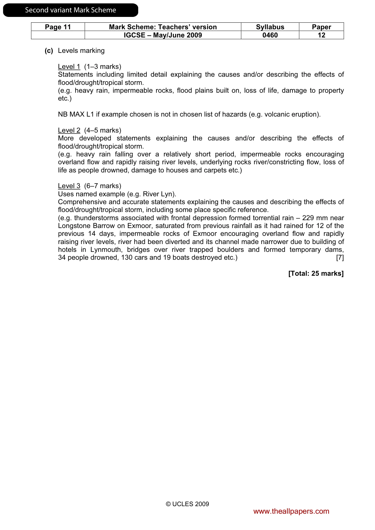
Page 11 Mark Scheme: Teachers’ version Syllabus Paper IGCSE – May/June 2009 0460 12 © UCLES 2009 (c) Levels marking Level 1 (1–3 marks) Statements including limited detail explaining the causes and/or describing the effects of flood/drought/tropical storm. (e.g. heavy rain, impermeable rocks, flood plains built on, loss of life, damage to property etc.) NB MAX L1 if example chosen is not in chosen list of hazards (e.g. volcanic eruption). Level 2 (4–5 marks) More developed statements explaining the causes and/or describing the effects of flood/drought/tropical storm. (e.g. heavy rain falling over a relatively short period, impermeable rocks encouraging overland flow and rapidly raising river levels, underlying rocks river/constricting flow, loss of life as people drowned, damage to houses and carpets etc.) Level 3 (6–7 marks) Uses named example (e.g. River Lyn). Comprehensive and accurate statements explaining the causes and describing the effects of flood/drought/tropical storm, including some place specific reference. (e.g. thunderstorms associated with frontal depression formed torrential rain – 229 mm near Longstone Barrow on Exmoor, saturated from previous rainfall as it had rained for 12 of the previous 14 days, impermeable rocks of Exmoor encouraging overland flow and rapidly raising river levels, river had been diverted and its channel made narrower due to building of hotels in Lynmouth, bridges over river trapped boulders and formed temporary dams, 34 people drowned, 130 cars and 19 boats destroyed etc.) [7] [Total: 25 marks] www.theallpapers.com SecondvariantMarkScheme
Mark scheme, page 28
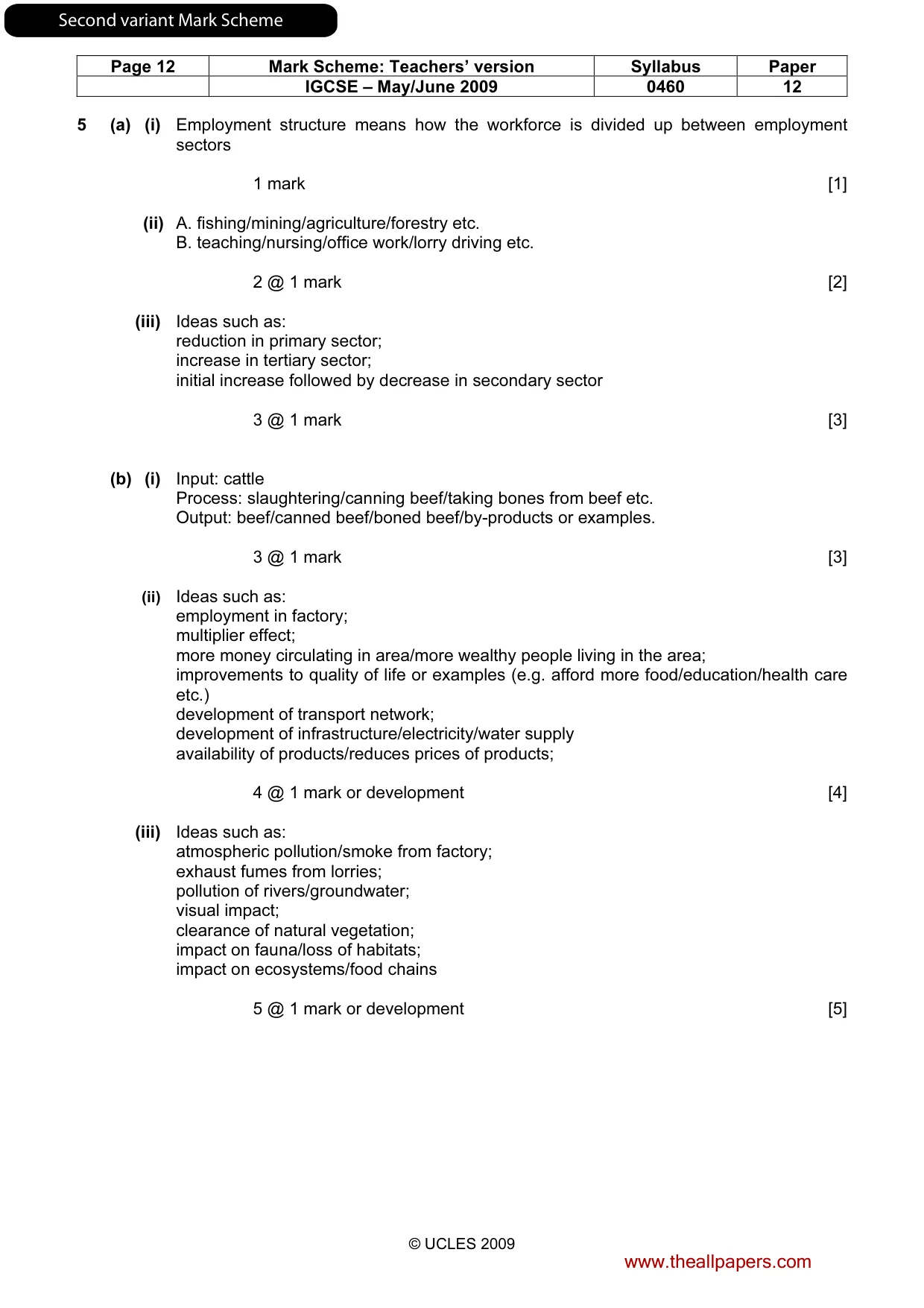
Page 12 Mark Scheme: Teachers’ version Syllabus Paper IGCSE – May/June 2009 0460 12 © UCLES 2009 5 (a) (i) Employment structure means how the workforce is divided up between employment sectors 1 mark [1] (ii) A. fishing/mining/agriculture/forestry etc. B. teaching/nursing/office work/lorry driving etc. 2 @ 1 mark [2] (iii) Ideas such as: reduction in primary sector; increase in tertiary sector; initial increase followed by decrease in secondary sector 3 @ 1 mark [3] (b) (i) Input: cattle Process: slaughtering/canning beef/taking bones from beef etc. Output: beef/canned beef/boned beef/by-products or examples. 3 @ 1 mark [3] (ii) Ideas such as: employment in factory; multiplier effect; more money circulating in area/more wealthy people living in the area; improvements to quality of life or examples (e.g. afford more food/education/health care etc.) development of transport network; development of infrastructure/electricity/water supply availability of products/reduces prices of products; 4 @ 1 mark or development [4] (iii) Ideas such as: atmospheric pollution/smoke from factory; exhaust fumes from lorries; pollution of rivers/groundwater; visual impact; clearance of natural vegetation; impact on fauna/loss of habitats; impact on ecosystems/food chains 5 @ 1 mark or development [5] www.theallpapers.com SecondvariantMarkScheme
Mark scheme, page 29
Page 13 Mark Scheme: Teachers’ version Syllabus Paper IGCSE – May/June 2009 0460 12 © UCLES 2009 (c) Levels marking Level 1 (1–3 marks) Statements including limited detail explaining why high technology industries were attracted (e.g. large workforce, good transport links, cheap land, near international airports, near universities etc.) NB MAX L1 if example chosen is manufacturing/processing industry not high technology industry. Level 2 (4–5 marks) More developed statements explaining why high technology industries were attracted (e.g. skilled, highly qualified workforce, good motorway links to transport finished products, proximity to international airport to import component parts, large areas of attractive, greenfield sites for employees to live, near universities to obtain skilled workforce etc.) Level 3 (6–7 marks) Uses named example (e.g. Malaysia). Comprehensive and accurate statements including some place specific reference. (e.g. skilled, highly qualified workforce can be obtained from nearby universities, good motorway links to transport components/finished products, proximity to Kuala Lumpur international airport for business travel, government investment into planned high tech industrial areas such as at Penang (Silicon Island), government ‘technology action plan’ put emphasis on technology etc.) [7] [Total: 25 marks] www.theallpapers.com SecondvariantMarkScheme
Mark scheme, page 30
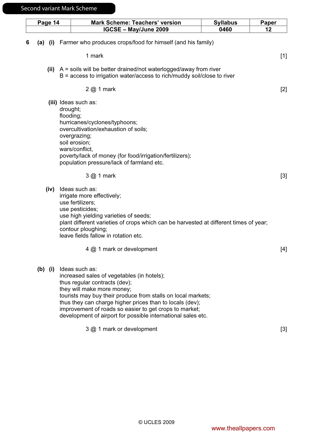
Page 14 Mark Scheme: Teachers’ version Syllabus Paper IGCSE – May/June 2009 0460 12 © UCLES 2009 6 (a) (i) Farmer who produces crops/food for himself (and his family) 1 mark [1] (ii) A = soils will be better drained/not waterlogged/away from river B = access to irrigation water/access to rich/muddy soil/close to river 2 @ 1 mark [2] (iii) Ideas such as: drought; flooding; hurricanes/cyclones/typhoons; overcultivation/exhaustion of soils; overgrazing; soil erosion; wars/conflict, poverty/lack of money (for food/irrigation/fertilizers); population pressure/lack of farmland etc. 3 @ 1 mark [3] (iv) Ideas such as: irrigate more effectively; use fertilizers; use pesticides; use high yielding varieties of seeds; plant different varieties of crops which can be harvested at different times of year; contour ploughing; leave fields fallow in rotation etc. 4 @ 1 mark or development [4] (b) (i) Ideas such as: increased sales of vegetables (in hotels); thus regular contracts (dev); they will make more money; tourists may buy their produce from stalls on local markets; thus they can charge higher prices than to locals (dev); improvement of roads so easier to get crops to market; development of airport for possible international sales etc. 3 @ 1 mark or development [3] www.theallpapers.com SecondvariantMarkScheme
Mark scheme, page 31
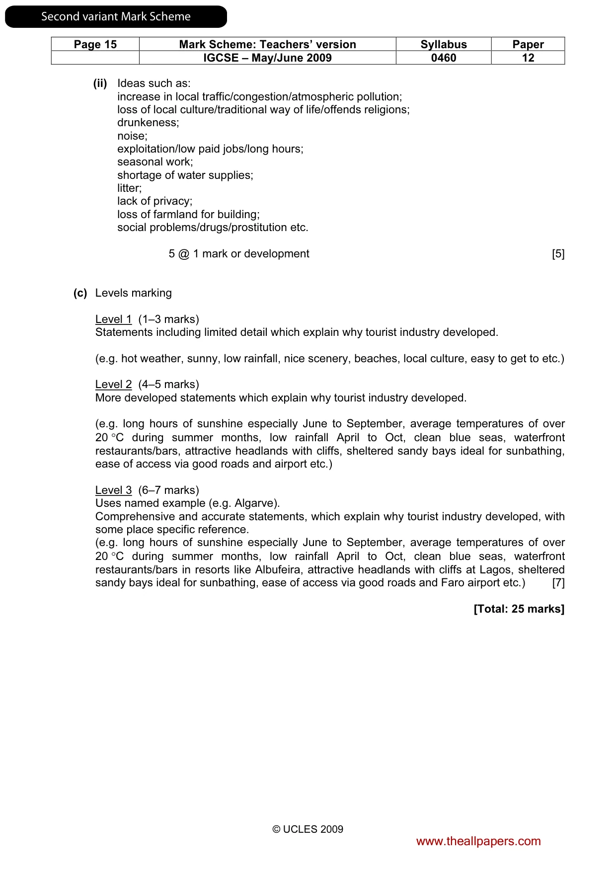
Page 15 Mark Scheme: Teachers’ version Syllabus Paper IGCSE – May/June 2009 0460 12 © UCLES 2009 (ii) Ideas such as: increase in local traffic/congestion/atmospheric pollution; loss of local culture/traditional way of life/offends religions; drunkeness; noise; exploitation/low paid jobs/long hours; seasonal work; shortage of water supplies; litter; lack of privacy; loss of farmland for building; social problems/drugs/prostitution etc. 5 @ 1 mark or development [5] (c) Levels marking Level 1 (1–3 marks) Statements including limited detail which explain why tourist industry developed. (e.g. hot weather, sunny, low rainfall, nice scenery, beaches, local culture, easy to get to etc.) Level 2 (4–5 marks) More developed statements which explain why tourist industry developed. (e.g. long hours of sunshine especially June to September, average temperatures of over 20 °C during summer months, low rainfall April to Oct, clean blue seas, waterfront restaurants/bars, attractive headlands with cliffs, sheltered sandy bays ideal for sunbathing, ease of access via good roads and airport etc.) Level 3 (6–7 marks) Uses named example (e.g. Algarve). Comprehensive and accurate statements, which explain why tourist industry developed, with some place specific reference. (e.g. long hours of sunshine especially June to September, average temperatures of over 20 °C during summer months, low rainfall April to Oct, clean blue seas, waterfront restaurants/bars in resorts like Albufeira, attractive headlands with cliffs at Lagos, sheltered sandy bays ideal for sunbathing, ease of access via good roads and Faro airport etc.) [7] [Total: 25 marks] www.theallpapers.com SecondvariantMarkScheme