Cambridge IGCSE Geography 0460 — 2005 May/June Paper 1 · Variant 1
0460/11/M/J/05
The question paper and its mark scheme, free to read here and free to download. This is Cambridge’s own paper, exactly as it was sat.
Question paper12 pages
Mark scheme15 pages
Answers below. Sit the paper first if you are practising.
Paper as text
Question paper, page 1
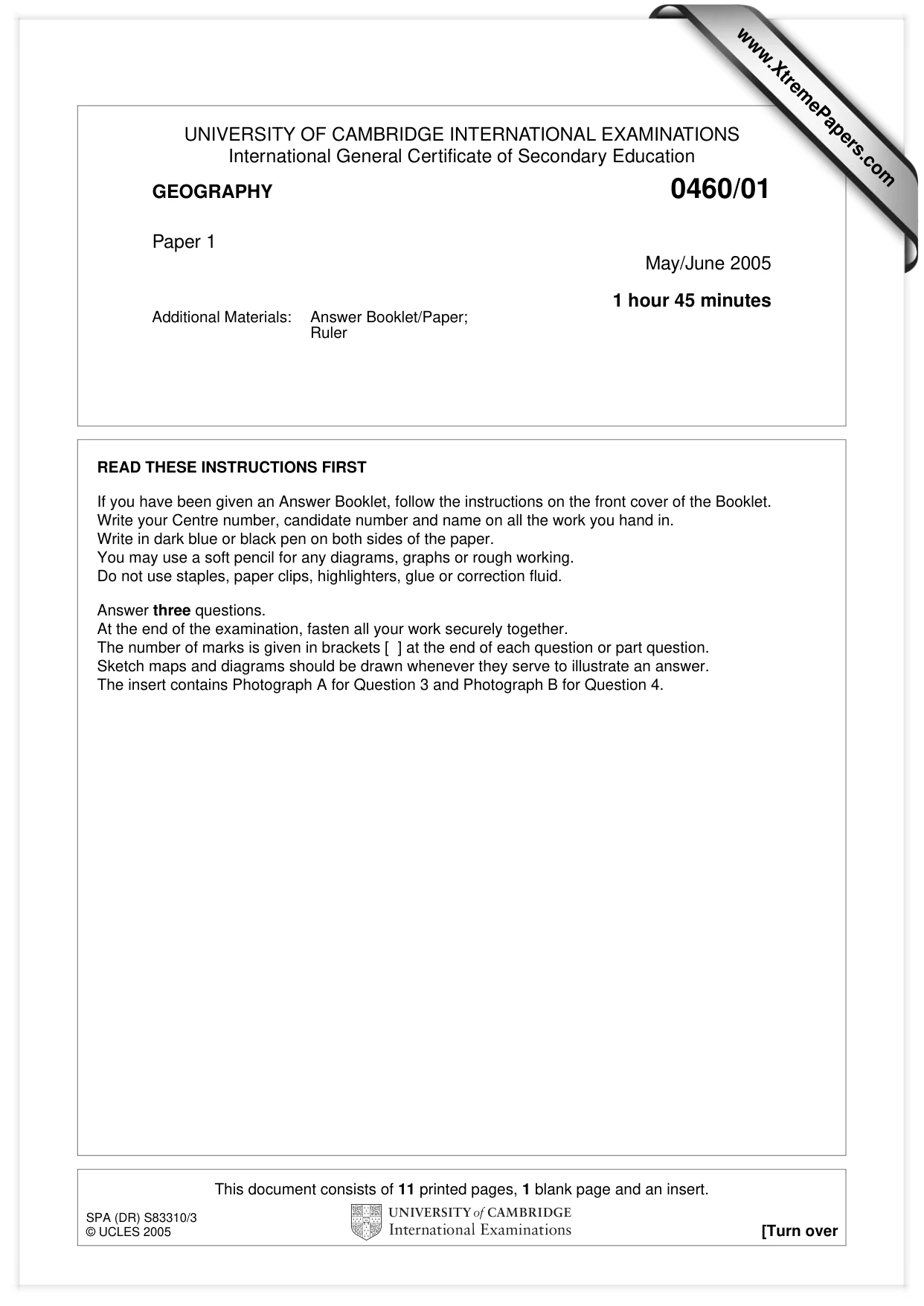
This document consists of 11 printed pages, 1 blank page and an insert. SPA (DR) S83310/3 © UCLES 2005 [Turn over UNIVERSITY OF CAMBRIDGE INTERNATIONAL EXAMINATIONS International General Certificate of Secondary Education GEOGRAPHY 0460/01 Paper 1 May/June 2005 1 hour 45 minutes Additional Materials: Answer Booklet/Paper; Ruler READ THESE INSTRUCTIONS FIRST If you have been given an Answer Booklet, follow the instructions on the front cover of the Booklet. Write your Centre number, candidate number and name on all the work you hand in. Write in dark blue or black pen on both sides of the paper. You may use a soft pencil for any diagrams, graphs or rough working. Do not use staples, paper clips, highlighters, glue or correction fluid. Answer three questions. At the end of the examination, fasten all your work securely together. The number of marks is given in brackets [ ] at the end of each question or part question. Sketch maps and diagrams should be drawn whenever they serve to illustrate an answer. The insert contains Photograph A for Question 3 and Photograph B for Question 4. www.XtremePapers.com
Question paper, page 2
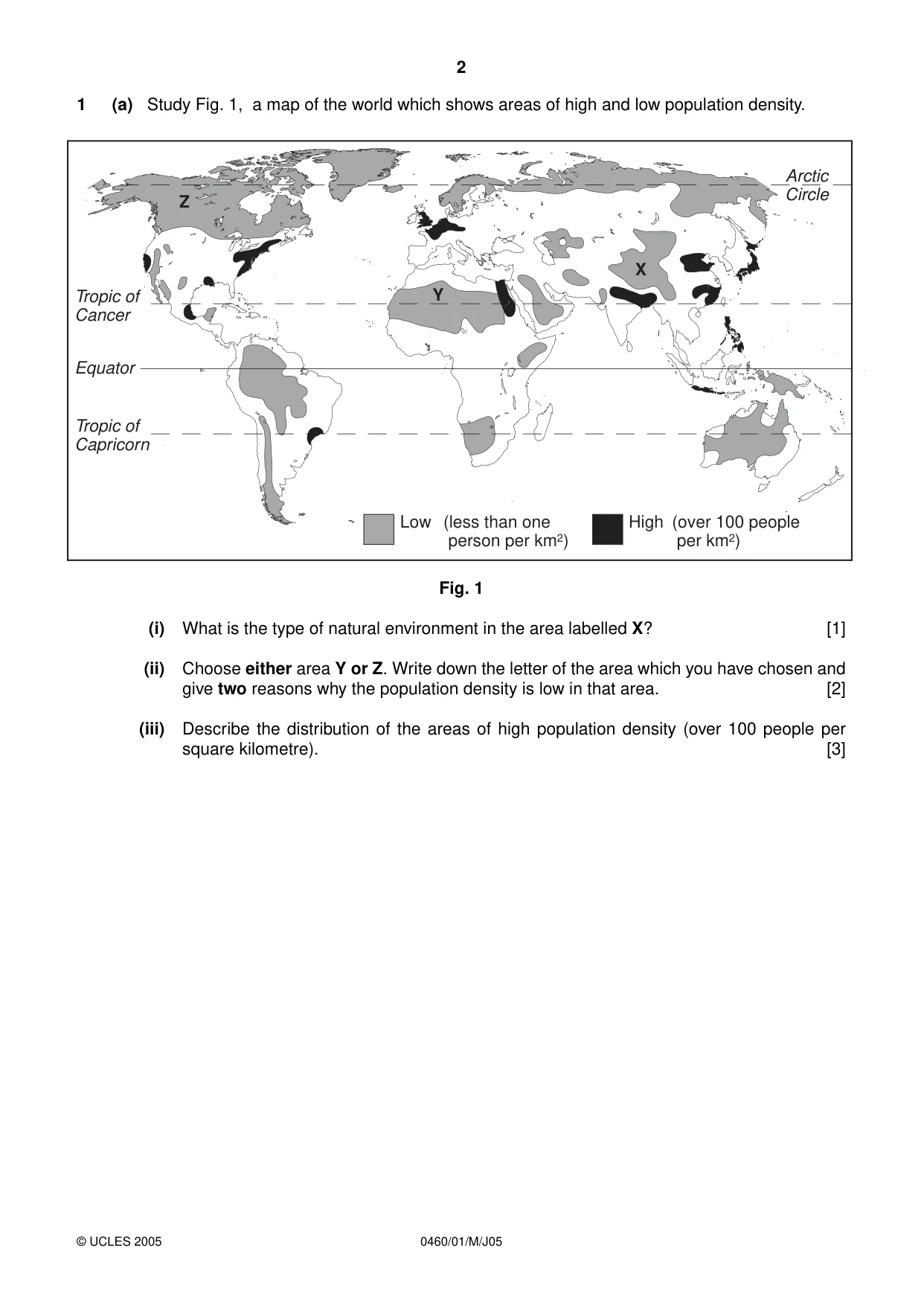
2 0460/01/M/J05 1 (a) Study Fig. 1, a map of the world which shows areas of high and low population density. Fig. 1 (i) What is the type of natural environment in the area labelled X? [1] (ii) Choose either area Y or Z. Write down the letter of the area which you have chosen and give two reasons why the population density is low in that area. [2] (iii) Describe the distribution of the areas of high population density (over 100 people per square kilometre). [3] © UCLES 2005 Low (less than one person per km2) High (over 100 people per km2) Tropic of Cancer Tropic of Capricorn Equator Arctic Circle Z Y X
Question paper, page 3
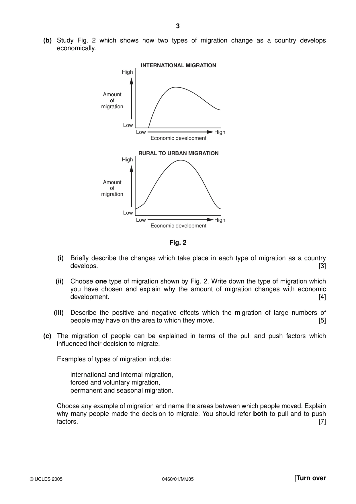
3 0460/01/M/J05 [Turn over (b) Study Fig. 2 which shows how two types of migration change as a country develops economically. Fig. 2 (i) Briefly describe the changes which take place in each type of migration as a country develops. [3] (ii) Choose one type of migration shown by Fig. 2. Write down the type of migration which you have chosen and explain why the amount of migration changes with economic development. [4] (iii) Describe the positive and negative effects which the migration of large numbers of people may have on the area to which they move. [5] (c) The migration of people can be explained in terms of the pull and push factors which influenced their decision to migrate. Examples of types of migration include: international and internal migration, forced and voluntary migration, permanent and seasonal migration. Choose any example of migration and name the areas between which people moved. Explain why many people made the decision to migrate. You should refer both to pull and to push factors. [7] High Low Low High Economic development Amount of migration INTERNATIONAL MIGRATION High Low Low High Economic development Amount of migration RURAL TO URBAN MIGRATION © UCLES 2005
Question paper, page 4
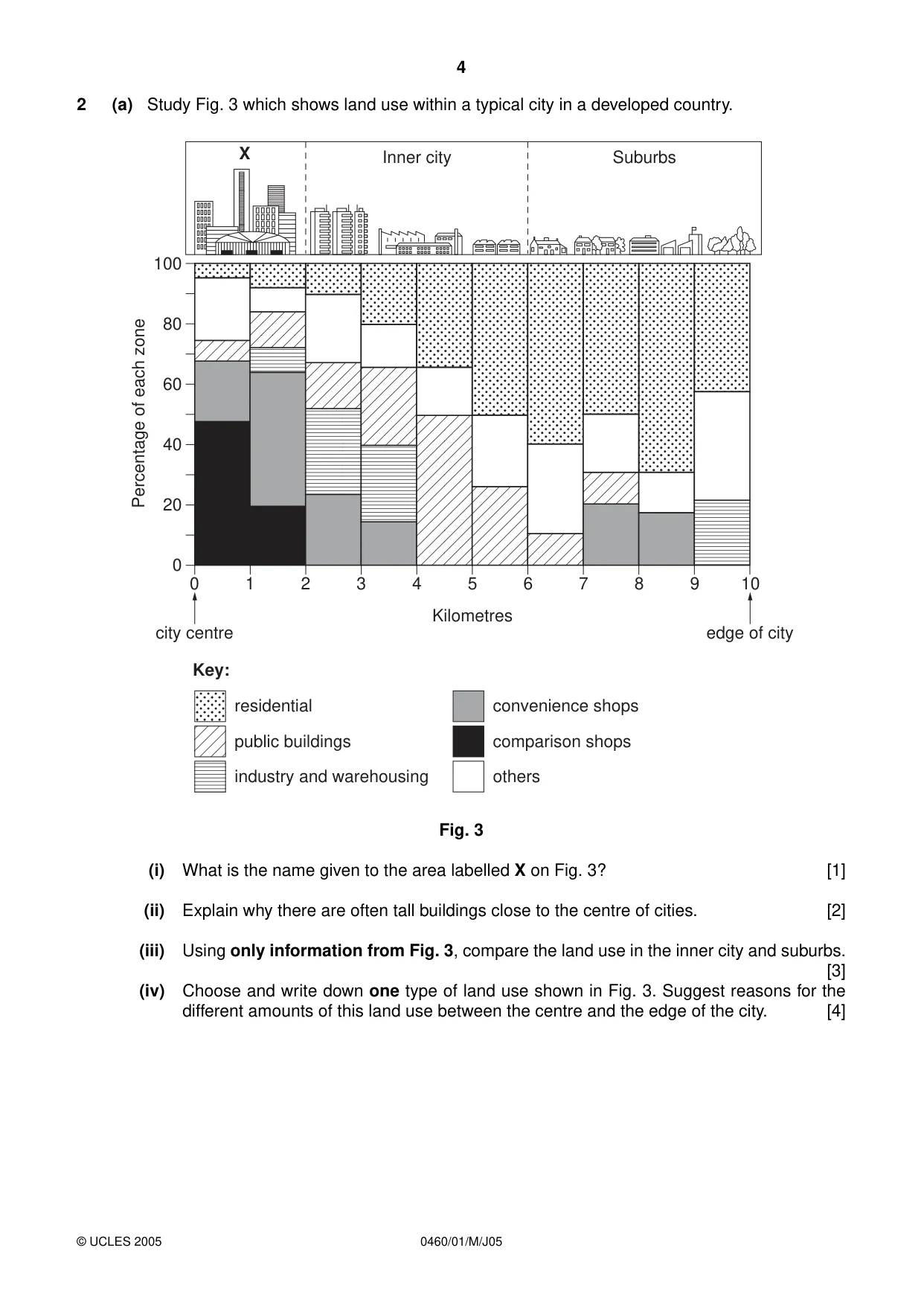
4 0460/01/M/J05 2 (a) Study Fig. 3 which shows land use within a typical city in a developed country. Fig. 3 (i) What is the name given to the area labelled X on Fig. 3? [1] (ii) Explain why there are often tall buildings close to the centre of cities. [2] (iii) Using only information from Fig. 3, compare the land use in the inner city and suburbs. [3] (iv) Choose and write down one type of land use shown in Fig. 3. Suggest reasons for the different amounts of this land use between the centre and the edge of the city. [4] 100 80 60 40 20 0 0 1 2 3 4 5 Kilometres 6 7 8 9 10 X Inner city Suburbs city centre edge of city Percentage of each zone residential public buildings industry and warehousing convenience shops comparison shops others Key: © UCLES 2005
Question paper, page 5
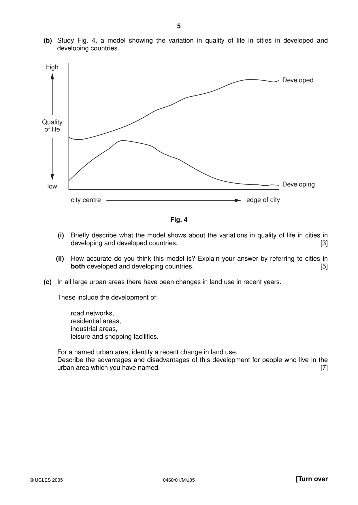
5 0460/01/M/J05 [Turn over (b) Study Fig. 4, a model showing the variation in quality of life in cities in developed and developing countries. Fig. 4 (i) Briefly describe what the model shows about the variations in quality of life in cities in developing and developed countries. [3] (ii) How accurate do you think this model is? Explain your answer by referring to cities in both developed and developing countries. [5] (c) In all large urban areas there have been changes in land use in recent years. These include the development of: road networks, residential areas, industrial areas, leisure and shopping facilities. For a named urban area, identify a recent change in land use. Describe the advantages and disadvantages of this development for people who live in the urban area which you have named. [7] city centre edge of city Quality of life high low Developed Developing © UCLES 2005
Question paper, page 6
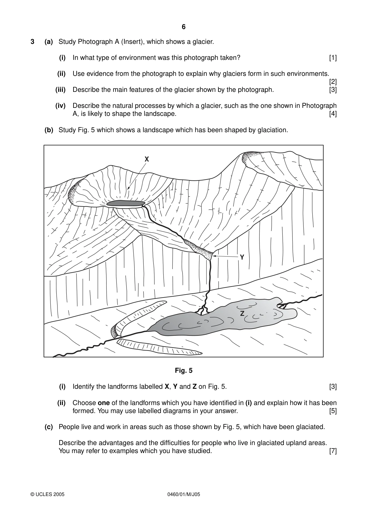
6 0460/01/M/J05 3 (a) Study Photograph A (Insert), which shows a glacier. (i) In what type of environment was this photograph taken? [1] (ii) Use evidence from the photograph to explain why glaciers form in such environments. [2] (iii) Describe the main features of the glacier shown by the photograph. [3] (iv) Describe the natural processes by which a glacier, such as the one shown in Photograph A, is likely to shape the landscape. [4] (b) Study Fig. 5 which shows a landscape which has been shaped by glaciation. Fig. 5 (i) Identify the landforms labelled X, Y and Z on Fig. 5. [3] (ii) Choose one of the landforms which you have identified in (i) and explain how it has been formed. You may use labelled diagrams in your answer. [5] (c) People live and work in areas such as those shown by Fig. 5, which have been glaciated. Describe the advantages and the difficulties for people who live in glaciated upland areas. You may refer to examples which you have studied. [7] X Y Z © UCLES 2005
Question paper, page 7
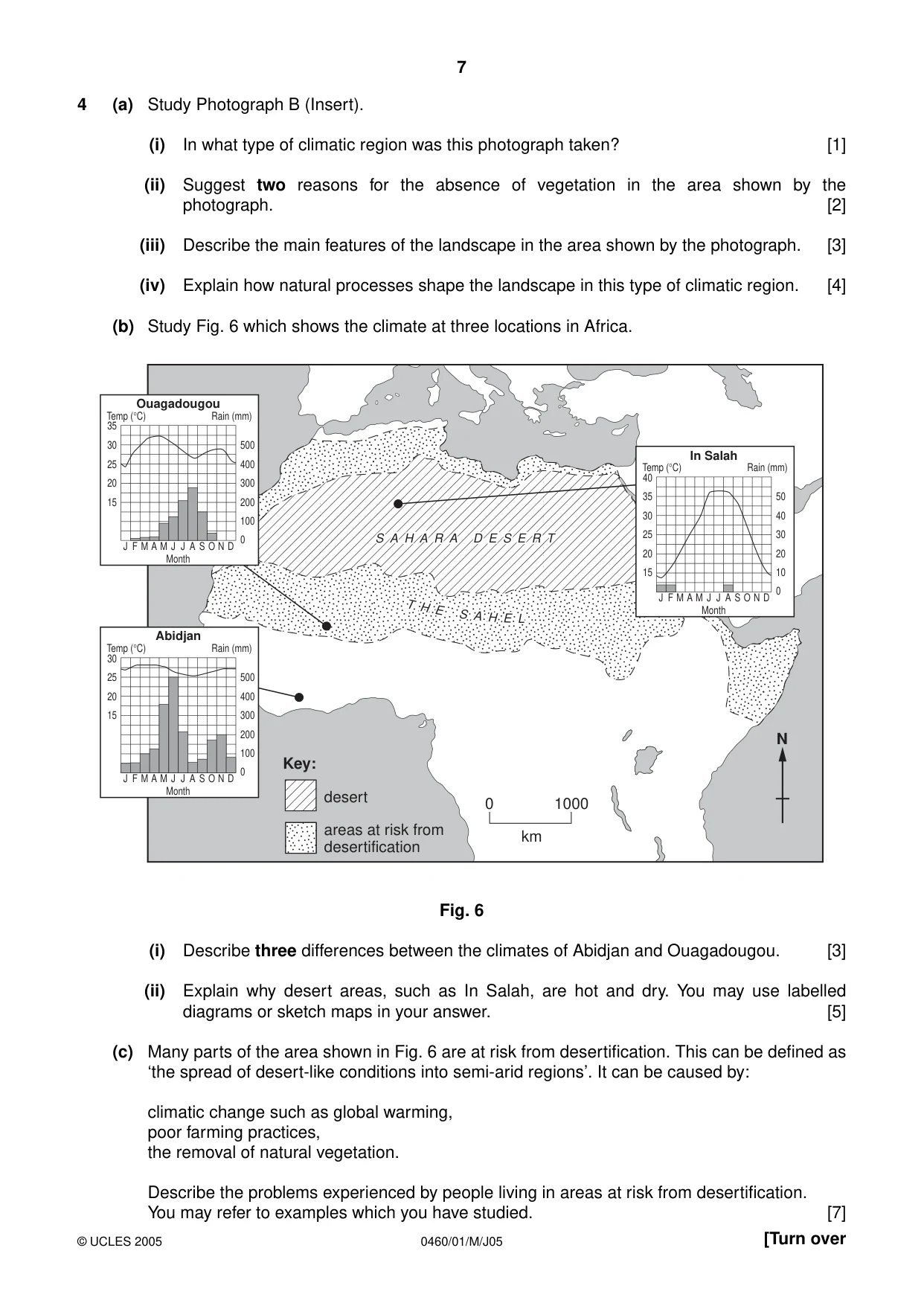
7 0460/01/M/J05 [Turn over 4 (a) Study Photograph B (Insert). (i) In what type of climatic region was this photograph taken? [1] (ii) Suggest two reasons for the absence of vegetation in the area shown by the photograph. [2] (iii) Describe the main features of the landscape in the area shown by the photograph. [3] (iv) Explain how natural processes shape the landscape in this type of climatic region. [4] (b) Study Fig. 6 which shows the climate at three locations in Africa. Fig. 6 (i) Describe three differences between the climates of Abidjan and Ouagadougou. [3] (ii) Explain why desert areas, such as In Salah, are hot and dry. You may use labelled diagrams or sketch maps in your answer. [5] (c) Many parts of the area shown in Fig. 6 are at risk from desertification. This can be defined as ‘the spread of desert-like conditions into semi-arid regions’. It can be caused by: climatic change such as global warming, poor farming practices, the removal of natural vegetation. Describe the problems experienced by people living in areas at risk from desertification. You may refer to examples which you have studied. [7] N S A H A R A D E S E R T S A H A R A D E S E R T T H E S A H E L S A H A R A D E S E R T T H E S A H E L 0 1000 km desert Key: areas at risk from desertification In Salah Temp (°C) Rain (mm) 15 20 25 30 35 10 0 20 30 40 50 40 J F M A M J J A S O N D Month Abidjan Temp (°C) Rain (mm) 15 20 25 100 0 200 300 400 500 30 J F M A M J J A S O N D Month Ouagadougou Temp (°C) Rain (mm) 20 15 25 30 100 0 200 300 400 500 35 J F M A M J J A S O N D Month © UCLES 2005
Question paper, page 8
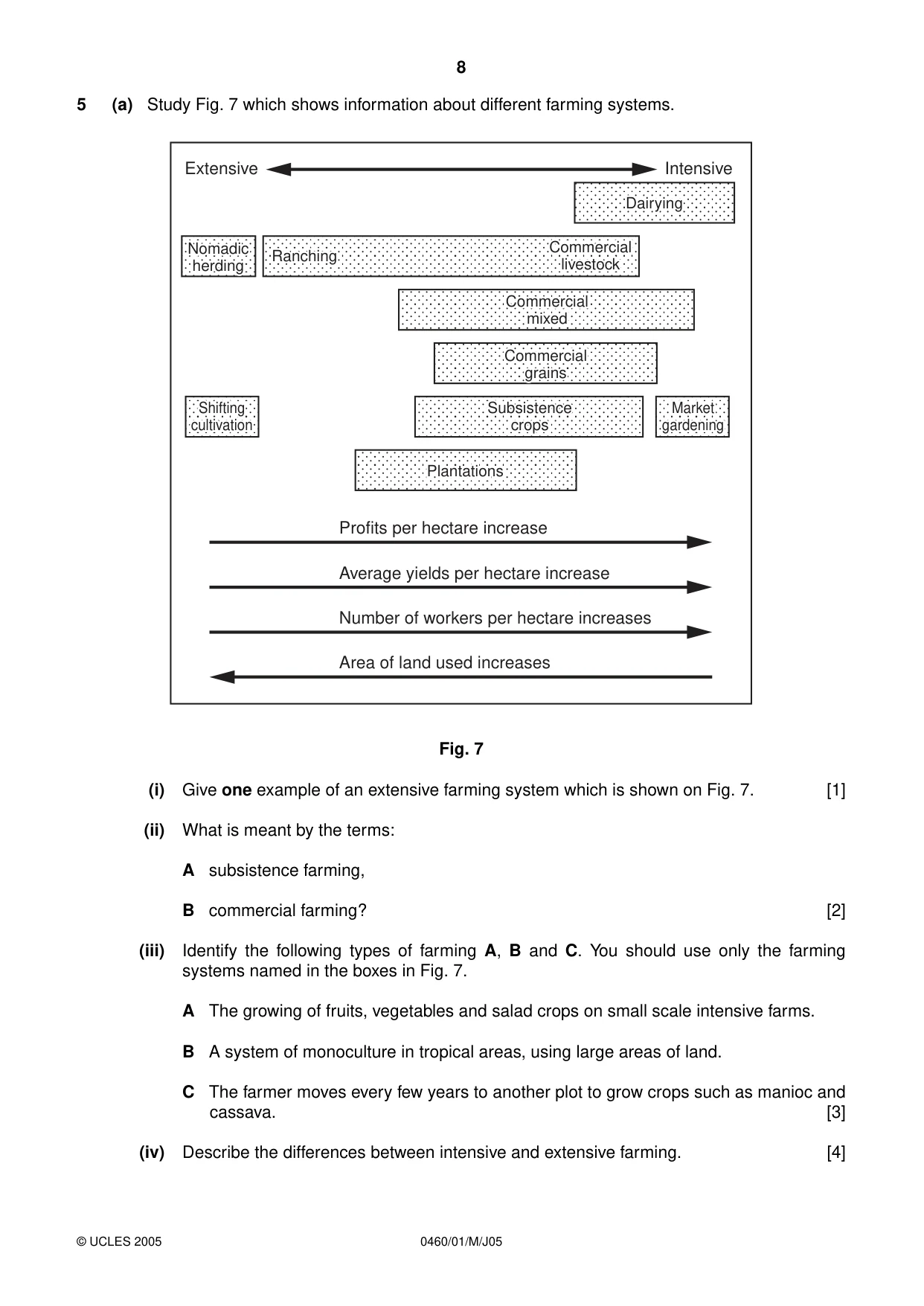
8 0460/01/M/J05 5 (a) Study Fig. 7 which shows information about different farming systems. Fig. 7 (i) Give one example of an extensive farming system which is shown on Fig. 7. [1] (ii) What is meant by the terms: A subsistence farming, B commercial farming? [2] (iii) Identify the following types of farming A, B and C. You should use only the farming systems named in the boxes in Fig. 7. A The growing of fruits, vegetables and salad crops on small scale intensive farms. B A system of monoculture in tropical areas, using large areas of land. C The farmer moves every few years to another plot to grow crops such as manioc and cassava. [3] (iv) Describe the differences between intensive and extensive farming. [4] Extensive Intensive Dairying Dairying Nomadic Nomadic herding herding Shifting Shifting cultivation cultivation Ranching Ranching Commercial Commercial livestock livestock Commercial Commercial mixed mixed Subsistence Subsistence crops crops Market Market gardening gardening Plantations Plantations Dairying Nomadic herding Shifting cultivation Ranching Commercial livestock Commercial mixed Commercial Commercial grains grains Commercial grains Subsistence crops Market gardening Plantations Profits per hectare increase Average yields per hectare increase Number of workers per hectare increases Area of land used increases © UCLES 2005
Question paper, page 9
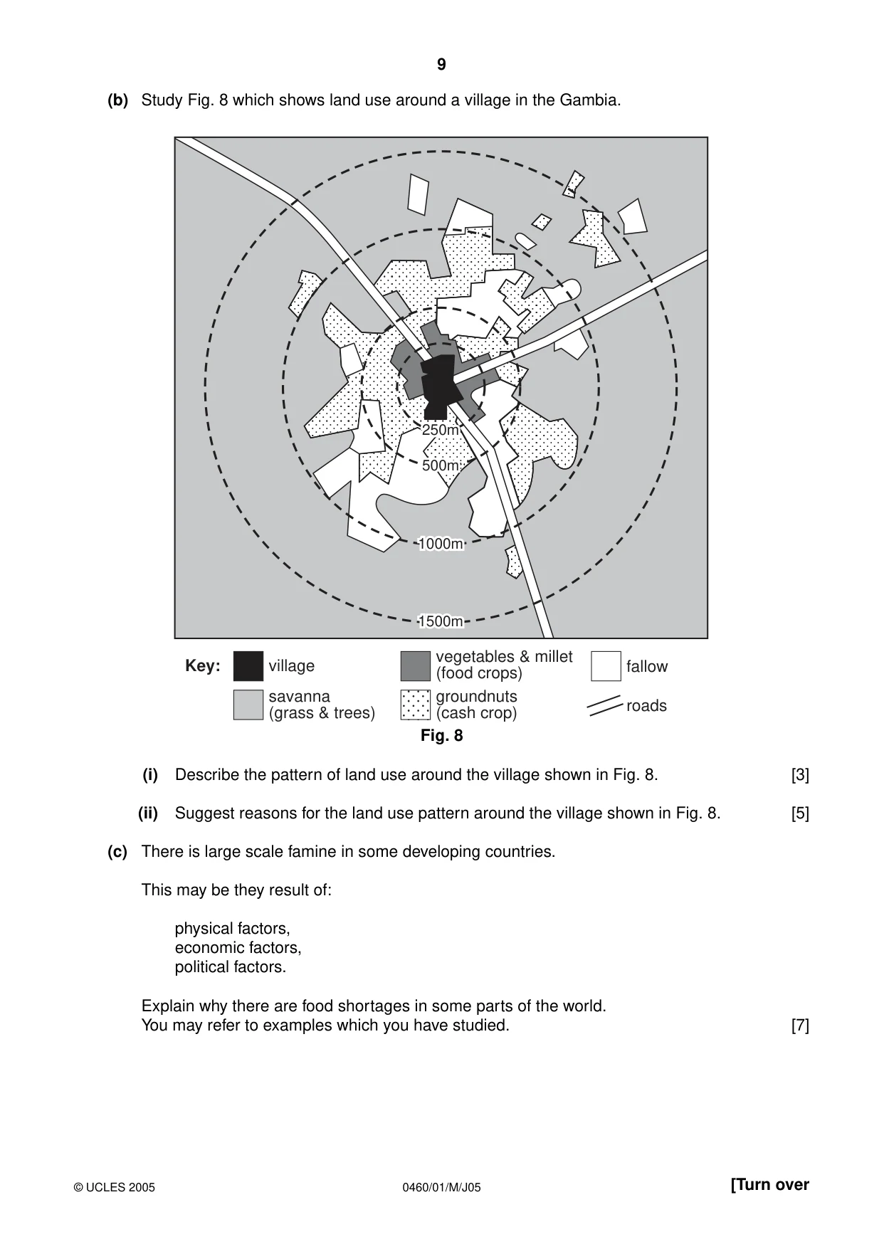
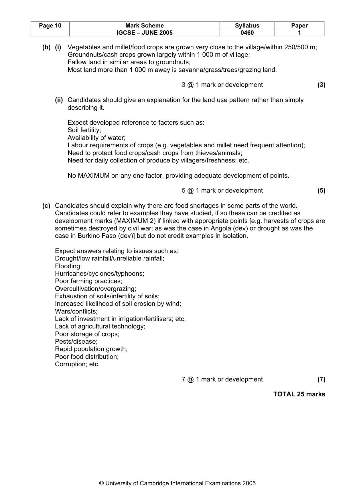
9 0460/01/M/J05 [Turn over (b) Study Fig. 8 which shows land use around a village in the Gambia. Fig. 8 (i) Describe the pattern of land use around the village shown in Fig. 8. [3] (ii) Suggest reasons for the land use pattern around the village shown in Fig. 8. [5] (c) There is large scale famine in some developing countries. This may be they result of: physical factors, economic factors, political factors. Explain why there are food shortages in some parts of the world. You may refer to examples which you have studied. [7] 250m 250m 500m 500m 1000m 1000m 1500m 1500m 250m 500m 1000m 1500m village savanna (grass & trees) vegetables & millet (food crops) groundnuts (cash crop) fallow roads Key: © UCLES 2005
Question paper, page 10
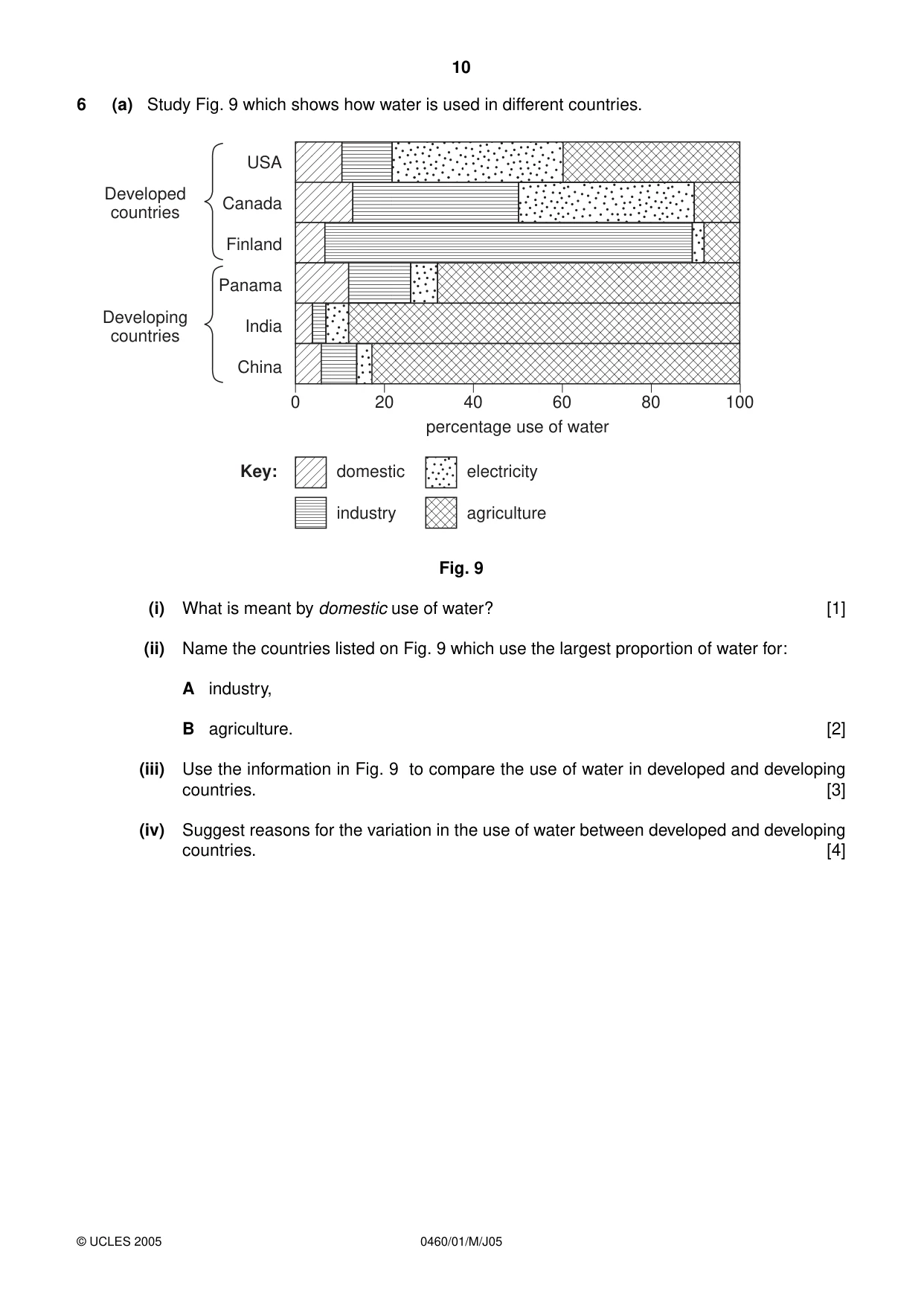
10 0460/01/M/J05 6 (a) Study Fig. 9 which shows how water is used in different countries. Fig. 9 (i) What is meant by domestic use of water? [1] (ii) Name the countries listed on Fig. 9 which use the largest proportion of water for: A industry, B agriculture. [2] (iii) Use the information in Fig. 9 to compare the use of water in developed and developing countries. [3] (iv) Suggest reasons for the variation in the use of water between developed and developing countries. [4] 0 20 40 60 80 100 percentage use of water USA Canada Finland Panama India China Developed countries Developing countries domestic industry electricity agriculture Key: © UCLES 2005
Question paper, page 11
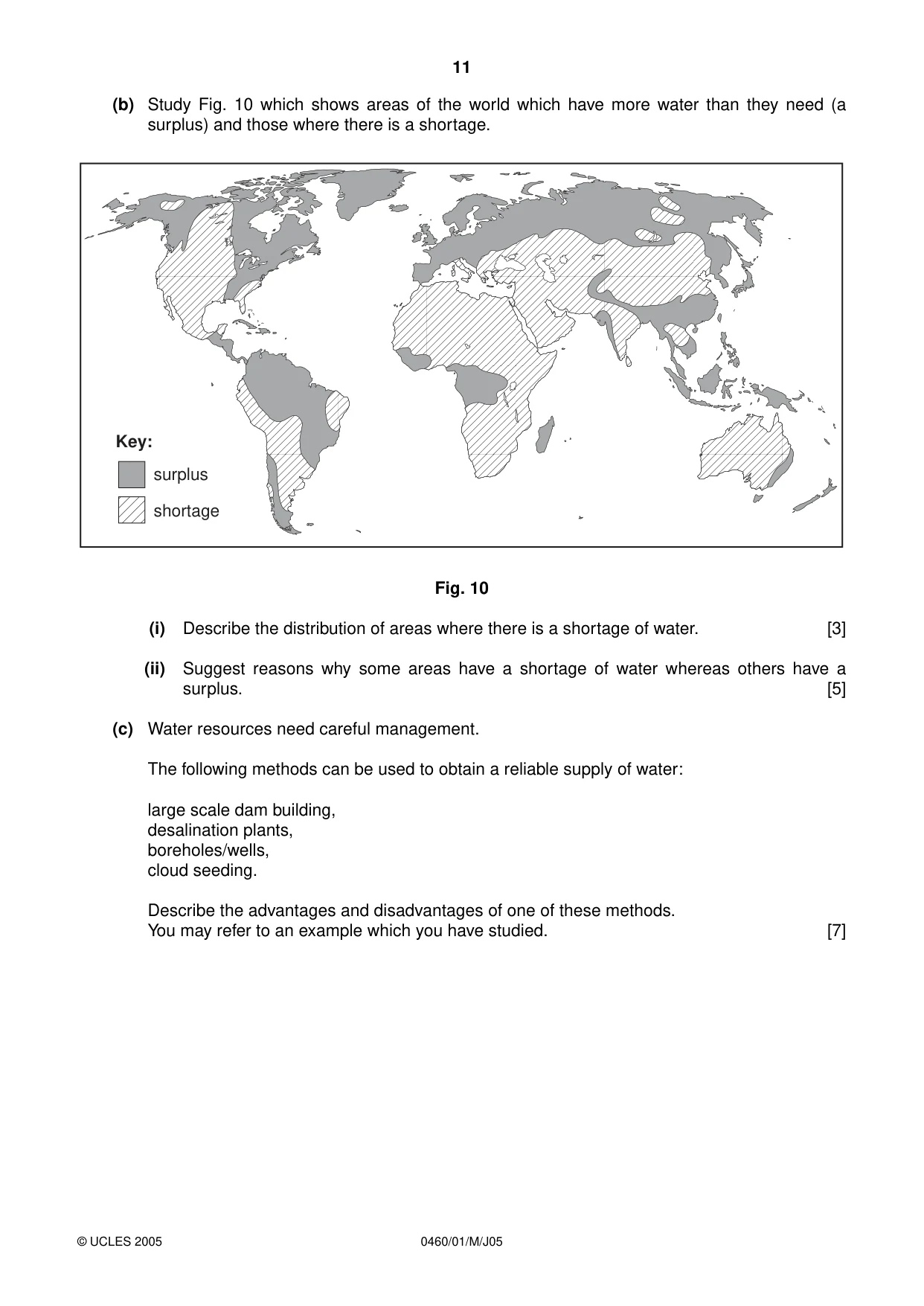
11 0460/01/M/J05 (b) Study Fig. 10 which shows areas of the world which have more water than they need (a surplus) and those where there is a shortage. Fig. 10 (i) Describe the distribution of areas where there is a shortage of water. [3] (ii) Suggest reasons why some areas have a shortage of water whereas others have a surplus. [5] (c) Water resources need careful management. The following methods can be used to obtain a reliable supply of water: large scale dam building, desalination plants, boreholes/wells, cloud seeding. Describe the advantages and disadvantages of one of these methods. You may refer to an example which you have studied. [7] Key: surplus shortage © UCLES 2005
Question paper, page 12
12 0460/01/M/J05 BLANK PAGE © UCLES 2005 Copyright Acknowledgements: Fig. 6, Question 4. © S. Catlin; Outset Geography; Copymasters Bk. 2; Oliver & Boyd; 1988. Fig. 10, Question 6. © Brian Knapp, Simon Ross, Duncan McCrae: The Challenge of the Natural Environment (Advanced Geographies S.); Longman; 1989. Photograph A. S. Sibley © UCLES. Photograph B. S. Sibley © UCLES. Permission to reproduce items where third-party owned material protected by copyright is included has been sought and cleared where possible. Every reasonable effort has been made by the publisher (UCLES) to trace copyright holders, but if any items requiring clearance have unwittingly been included, the publisher will be pleased to make amends at the earliest possible opportunity. University of Cambridge International Examinations is part of the University of Cambridge Local Examinations Syndicate (UCLES), which is itself a department of the University of Cambridge.
Mark scheme, page 1
UNIVERSITY OF CAMBRIDGE INTERNATIONAL EXAMINATIONS International General Certificate of Secondary Education MARK SCHEME for the June 2005 question paper 0460 GEOGRAPHY 0460/01 Paper 1, maximum mark 75 This mark scheme is published as an aid to teachers and students, to indicate the requirements of the examination. It shows the basis on which Examiners were initially instructed to award marks. It does not indicate the details of the discussions that took place at an Examiners’ meeting before marking began. Any substantial changes to the mark scheme that arose from these discussions will be recorded in the published Report on the Examination. All Examiners are instructed that alternative correct answers and unexpected approaches in candidates’ scripts must be given marks that fairly reflect the relevant knowledge and skills demonstrated. Mark schemes must be read in conjunction with the question papers and the Report on the Examination. CIE will not enter into discussion or correspondence in connection with these mark schemes. CIE is publishing the mark schemes for the June 2005 question papers for most IGCSE and GCE Advanced Level and Advanced Subsidiary Level syllabuses and some Ordinary Level syllabuses. www.XtremePapers.com
Mark scheme, page 2
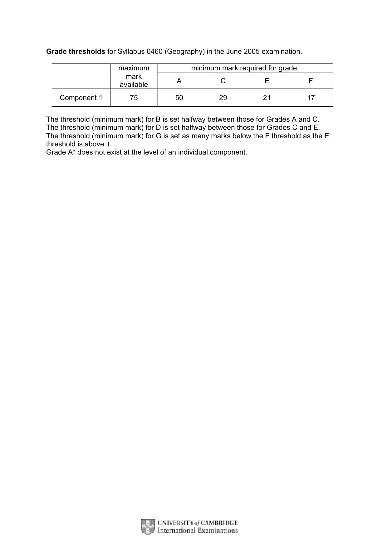
Grade thresholds for Syllabus 0460 (Geography) in the June 2005 examination. minimum mark required for grade: maximum mark available A C E F Component 1 75 50 29 21 17 The threshold (minimum mark) for B is set halfway between those for Grades A and C. The threshold (minimum mark) for D is set halfway between those for Grades C and E. The threshold (minimum mark) for G is set as many marks below the F threshold as the E threshold is above it. Grade A* does not exist at the level of an individual component.
Mark scheme, page 3
June 2005 IGCSE MARK SCHEME MAXIMUM MARK: 75 SYLLABUS/COMPONENT: 0460/01 GEOGRAPHY Paper 1
Mark scheme, page 4
Page 1 Mark Scheme Syllabus Paper IGCSE – JUNE 2005 0460 1 © University of Cambridge International Examinations 2005 The features of the marking scheme Each question carries 25 marks. Candidates cannot earn above the maximum marks available within each sub section. The marking scheme attempts to give guidance about the requirements of each answer and lists a number of responses which will earn marks along with the general principles to be applied when marking each question. It should be noted that candidates can earn marks if their answers are phrased differently provided they convey the same meaning as those in the mark scheme. THE CANDIDATES DO NOT NEED TO USE THE SAME WORDING TO EARN MARKS. The notation ‘etc.’ at the end of an answer in the mark scheme signifies that there may well be other correct responses or examples that can be given credit. Providing the statement is true, relevant to the question asked and not repetition of a previous point made credit should be given. A point made within one sub-section which is an answer to the question set in a different sub-section should not be given credit as each sub-section asks different questions which require independent answers. The mark scheme uses semi colons (;) to separate marks and diagonals (/) to separate alternative answers.
Mark scheme, page 5
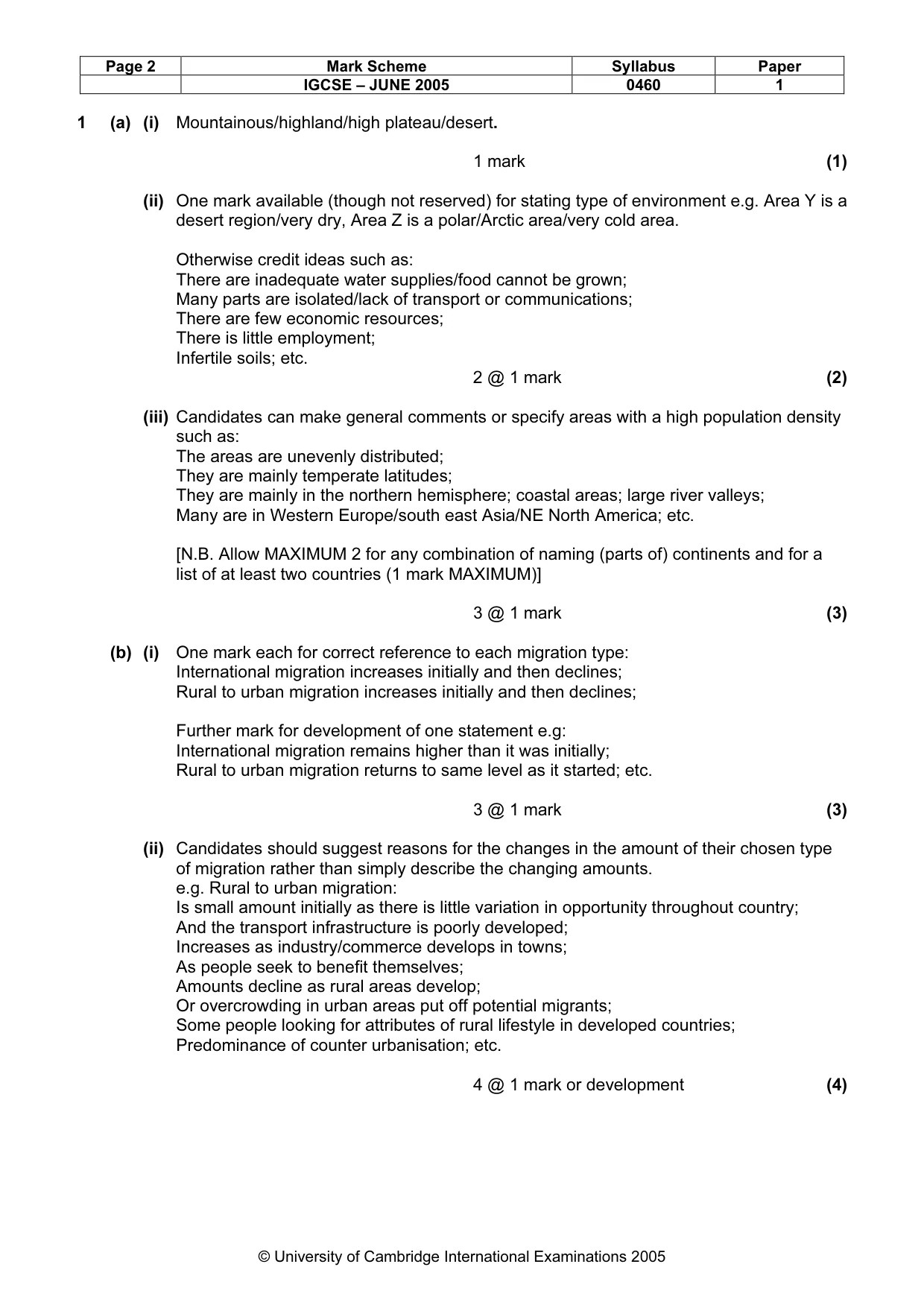
Page 2 Mark Scheme Syllabus Paper IGCSE – JUNE 2005 0460 1 © University of Cambridge International Examinations 2005 1 (a) (i) Mountainous/highland/high plateau/desert. 1 mark (1) (ii) One mark available (though not reserved) for stating type of environment e.g. Area Y is a desert region/very dry, Area Z is a polar/Arctic area/very cold area. Otherwise credit ideas such as: There are inadequate water supplies/food cannot be grown; Many parts are isolated/lack of transport or communications; There are few economic resources; There is little employment; Infertile soils; etc. 2 @ 1 mark (2) (iii) Candidates can make general comments or specify areas with a high population density such as: The areas are unevenly distributed; They are mainly temperate latitudes; They are mainly in the northern hemisphere; coastal areas; large river valleys; Many are in Western Europe/south east Asia/NE North America; etc. [N.B. Allow MAXIMUM 2 for any combination of naming (parts of) continents and for a list of at least two countries (1 mark MAXIMUM)] 3 @ 1 mark (3) (b) (i) One mark each for correct reference to each migration type: International migration increases initially and then declines; Rural to urban migration increases initially and then declines; Further mark for development of one statement e.g: International migration remains higher than it was initially; Rural to urban migration returns to same level as it started; etc. 3 @ 1 mark (3) (ii) Candidates should suggest reasons for the changes in the amount of their chosen type of migration rather than simply describe the changing amounts. e.g. Rural to urban migration: Is small amount initially as there is little variation in opportunity throughout country; And the transport infrastructure is poorly developed; Increases as industry/commerce develops in towns; As people seek to benefit themselves; Amounts decline as rural areas develop; Or overcrowding in urban areas put off potential migrants; Some people looking for attributes of rural lifestyle in developed countries; Predominance of counter urbanisation; etc. 4 @ 1 mark or development (4)
Mark scheme, page 6
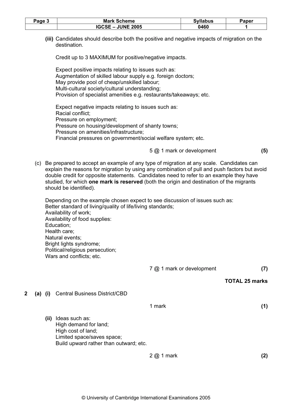
Page 3 Mark Scheme Syllabus Paper IGCSE – JUNE 2005 0460 1 © University of Cambridge International Examinations 2005 (iii) Candidates should describe both the positive and negative impacts of migration on the destination. Credit up to 3 MAXIMUM for positive/negative impacts. Expect positive impacts relating to issues such as: Augmentation of skilled labour supply e.g. foreign doctors; May provide pool of cheap/unskilled labour; Multi-cultural society/cultural understanding; Provision of specialist amenities e.g. restaurants/takeaways; etc. Expect negative impacts relating to issues such as: Racial conflict; Pressure on employment; Pressure on housing/development of shanty towns; Pressure on amenities/infrastructure; Financial pressures on government/social welfare system; etc. 5 @ 1 mark or development (5) (c) Be prepared to accept an example of any type of migration at any scale. Candidates can explain the reasons for migration by using any combination of pull and push factors but avoid double credit for opposite statements. Candidates need to refer to an example they have studied, for which one mark is reserved (both the origin and destination of the migrants should be identified). Depending on the example chosen expect to see discussion of issues such as: Better standard of living/quality of life/living standards; Availability of work; Availability of food supplies: Education; Health care; Natural events; Bright lights syndrome; Political/religious persecution; Wars and conflicts; etc. 7 @ 1 mark or development (7) TOTAL 25 marks 2 (a) (i) Central Business District/CBD 1 mark (1) (ii) Ideas such as: High demand for land; High cost of land; Limited space/saves space; Build upward rather than outward; etc. 2 @ 1 mark (2)
Mark scheme, page 7
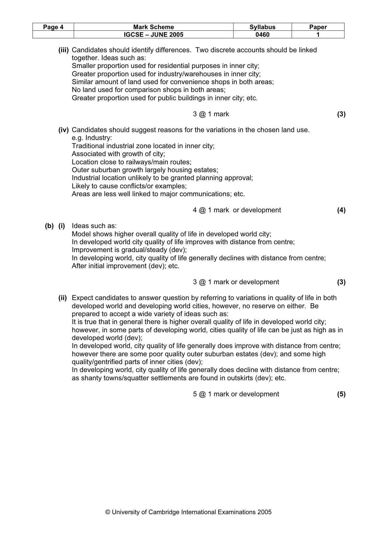
Page 4 Mark Scheme Syllabus Paper IGCSE – JUNE 2005 0460 1 © University of Cambridge International Examinations 2005 (iii) Candidates should identify differences. Two discrete accounts should be linked together. Ideas such as: Smaller proportion used for residential purposes in inner city; Greater proportion used for industry/warehouses in inner city; Similar amount of land used for convenience shops in both areas; No land used for comparison shops in both areas; Greater proportion used for public buildings in inner city; etc. 3 @ 1 mark (3) (iv) Candidates should suggest reasons for the variations in the chosen land use. e.g. Industry: Traditional industrial zone located in inner city; Associated with growth of city; Location close to railways/main routes; Outer suburban growth largely housing estates; Industrial location unlikely to be granted planning approval; Likely to cause conflicts/or examples; Areas are less well linked to major communications; etc. 4 @ 1 mark or development (4) (b) (i) Ideas such as: Model shows higher overall quality of life in developed world city; In developed world city quality of life improves with distance from centre; Improvement is gradual/steady (dev); In developing world, city quality of life generally declines with distance from centre; After initial improvement (dev); etc. 3 @ 1 mark or development (3) (ii) Expect candidates to answer question by referring to variations in quality of life in both developed world and developing world cities, however, no reserve on either. Be prepared to accept a wide variety of ideas such as: It is true that in general there is higher overall quality of life in developed world city; however, in some parts of developing world, cities quality of life can be just as high as in developed world (dev); In developed world, city quality of life generally does improve with distance from centre; however there are some poor quality outer suburban estates (dev); and some high quality/gentrified parts of inner cities (dev); In developing world, city quality of life generally does decline with distance from centre; as shanty towns/squatter settlements are found in outskirts (dev); etc. 5 @ 1 mark or development (5)
Mark scheme, page 8
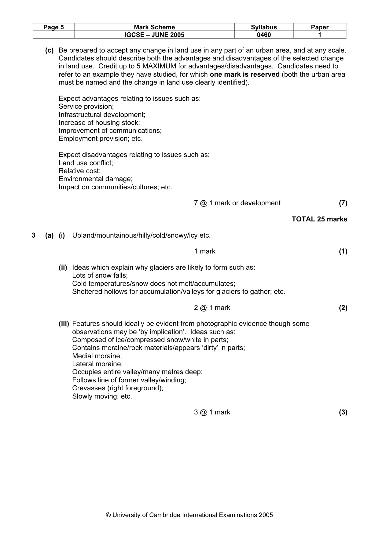
Page 5 Mark Scheme Syllabus Paper IGCSE – JUNE 2005 0460 1 © University of Cambridge International Examinations 2005 (c) Be prepared to accept any change in land use in any part of an urban area, and at any scale. Candidates should describe both the advantages and disadvantages of the selected change in land use. Credit up to 5 MAXIMUM for advantages/disadvantages. Candidates need to refer to an example they have studied, for which one mark is reserved (both the urban area must be named and the change in land use clearly identified). Expect advantages relating to issues such as: Service provision; Infrastructural development; Increase of housing stock; Improvement of communications; Employment provision; etc. Expect disadvantages relating to issues such as: Land use conflict; Relative cost; Environmental damage; Impact on communities/cultures; etc. 7 @ 1 mark or development (7) TOTAL 25 marks 3 (a) (i) Upland/mountainous/hilly/cold/snowy/icy etc. 1 mark (1) (ii) Ideas which explain why glaciers are likely to form such as: Lots of snow falls; Cold temperatures/snow does not melt/accumulates; Sheltered hollows for accumulation/valleys for glaciers to gather; etc. 2 @ 1 mark (2) (iii) Features should ideally be evident from photographic evidence though some observations may be ‘by implication’. Ideas such as: Composed of ice/compressed snow/white in parts; Contains moraine/rock materials/appears ‘dirty’ in parts; Medial moraine; Lateral moraine; Occupies entire valley/many metres deep; Follows line of former valley/winding; Crevasses (right foreground); Slowly moving; etc. 3 @ 1 mark (3)
Mark scheme, page 9
Page 6 Mark Scheme Syllabus Paper IGCSE – JUNE 2005 0460 1 © University of Cambridge International Examinations 2005 (iv) Candidates should describe how the glacier will shape the land rather than simply naming processes. Credit development for reference to how these processes shape the landscape. Ideas such as: Plucking breaks off pieces of rock; shaping downslope side of roche moutonee (dev); Abrasion scrapes at the surrounding rock; leaving ‘striations’ on rocks; deepening/ widening the valley (dev); Transportation carries the rock material/moraine away; Deposition of materials when ice melts at snout of glacier; forms terminal moraine (dev); Meltwater creates fluvioglacial features; etc. (NB 1 mark MAXIMUM for simply naming at least 2 of plucking/abrasion/freeze thaw) 4 @ 1 mark or development (4) (b) (i) X = Corrie/cwm/cirque/tarn Y = Hanging Valley Z = Ribbon/finger Lake 3 @ 1 mark (3) (ii) Candidates should explain how the chosen landform has been formed rather than simply describing its features. Credit written answers or information included as part of labelled diagrams (do not double credit here). e.g. Landform X (corrie): Snow gathers in hollow on mountain side; Build up above snow line; Compression creates firn/ice; Ice moves out of hollow; Crevasse/bergschrund created; Freeze/thaw steepens back wall; Plucking/abrasion deepens hollow Deposited material forms corrie lip; Melting of water creates tarn; etc. e.g. Landform Y (hanging valley): Snow gathers in mountains; Build up above snow line; Glacier forms in pre-glacial river valleys; Widens and deepens valley; Greater erosion of main valley than tributary valleys; Ice melts eventually; Former tributary valley now much higher than main valley; River falls vertically/waterfall created; etc. e.g. Landform Z (ribbon lake): Snow gathers in mountains; Build up above snow line; Glacier forms in pre-glacial river valleys; Deepens valley; Over deepens where rock is less resistant/tributary glacier joins; Ice melts eventually; Hollows filled up with water/valley dammed by terminal moraine; etc. 5 @ 1 mark or development (5)
Mark scheme, page 10
Page 7 Mark Scheme Syllabus Paper IGCSE – JUNE 2005 0460 1 © University of Cambridge International Examinations 2005 (c) Candidates should describe both the advantages and disadvantages for people of living in a glaciated upland area. Credit up to 5 MAXIMUM for advantages/disadvantages. Candidates could refer to examples they have studied, if so these can be credited as development marks (MAXIMUM 2) if linked with appropriate points [e.g. people can make a living from tourism; as they do in Snowdonia (dev)] but do not credit examples in isolation. Expect advantages relating to issues such as: Tourism/income; HEP generation; Quarrying; Water supply; Flat valley floors are good for agriculture/transport routes; Peace/tranquillity/scenic beauty/fresh air; etc. Expect disadvantages relating to issues such as: Weather/climate; Communications; Infertile soils; Lack of industrial/commercial employment; Difficulty of construction; Avalanche/landslide; etc. 7 @ 1 mark or development (7) TOTAL 25 marks 4 (a) (i) Desert 1 mark (1) (ii) Ideas which explain why vegetation is unlikely to grow in the area shown such as: Low precipitation/aridity; Unreliable rainfall; High rates of evaporation; Little cover of soil/sand/bare rock surfaces/infertile soils; etc. 2 @ 1 mark (2) (iii) Features should ideally be evident from photographic evidence though some observations may be ‘by implication’. Ideas such as: Composed of sand; Contains some stones/broken rocks; Large area of flat land in foreground; Dunes in middle distance; Scattered vegetation/scrub; etc. 3 @ 1 mark (3)
Mark scheme, page 11
Page 8 Mark Scheme Syllabus Paper IGCSE – JUNE 2005 0460 1 © University of Cambridge International Examinations 2005 (iv) Candidates should describe how natural processes will shape the land in deserts rather than simply naming processes. Credit reference to any desert processes/features not just those shown in the photograph, allowing development marks where appropriate. Expect ideas such as: Sandblasting forms mushroom rocks; Deflation hollows caused by wind blowing away dry, loosened sand; Erg/barchans/seif dunes formed by deposition of sand; Reg/stony desert formed when stones left after sand has been removed; Evidence/impacts of exfoliation; Wadi formed by intermittent streams. 4 @ 1 mark or development (4) (b) (i) Candidates should identify differences here although two discrete accounts should be linked together. Ideas such as: Abidjan has more precipitation than Ouagadougou; Maximum of precipitation is May/June in Abidjan, July/Aug in Ouagadougou; Greater temperature range in Ouagadougou; Higher maximum temperature in Ouagadougou; etc. (N.B. Allow MAXIMUM of 2 marks on temperature/precipitation) 3 @ 1 mark or development (3) (ii) Candidates should explain why deserts are hot and dry rather than simply describing their climatic features. Credit written answers or information included as part of labelled diagrams or sketch maps (do not double credit here). Expect reference to ideas such as: Distance from oceans; Absence of moderating influence of water body Wind direction/trade winds; Blow over large areas of land hence no source of moisture; Lack of evaporation; Absence of cloud cover, therefore, hotter; Influence of overhead sun; High pressure; etc. N.B. MAXIMUM of 4 marks on each of hot/dry 5 @ 1 mark or development (5)
Mark scheme, page 12
Page 9 Mark Scheme Syllabus Paper IGCSE – JUNE 2005 0460 1 © University of Cambridge International Examinations 2005 (c) Candidates should describe the hazards experienced by people living in areas at risk from drought/desertification. Candidates could refer to examples they have studied, if so these can be credited as development marks (MAXIMUM 2) if linked with appropriate points [e.g. yields of crops will be reduced by lack of water; as they have done in Burkino Faso (dev)] but do not credit examples in isolation. Expect hazards relating to issues such as: Impact on crop yields; Lack of food/starvation; Farmers unable to leave land fallow; Therefore soils exhausted; And overgrazing of livestock takes place; Increased likelihood of soil erosion by wind; Loss of vegetation leads to more rapid run off; Therefore less moisture trapped in soil; And greater potential for flash floods; etc. 7 @ 1 mark or development (7) TOTAL 25 marks 5 (a) (i) Nomadic herding/ranching/shifting cultivation 1 mark (1) (ii) A Producing crops/animal products for self/family/tribe B Producing crops/animal products for sale 2 @ 1 mark (2) (iii) A Market gardening B Plantations C Shifting cultivation 3 @ 1 mark (3) (iv) Candidates should identify differences here although two discrete accounts should be linked together. Ideas such as: Intensive farming has higher yield per hectare; Intensive farming gains more profit per hectare; Intensive farming has larger number of workers per hectare; Intensive farms are smaller size; Intensive farms have more capital input or examples; etc. 4 @ 1 mark or development (4)
Mark scheme, page 13
Page 10 Mark Scheme Syllabus Paper IGCSE – JUNE 2005 0460 1 © University of Cambridge International Examinations 2005 (b) (i) Vegetables and millet/food crops are grown very close to the village/within 250/500 m; Groundnuts/cash crops grown largely within 1 000 m of village; Fallow land in similar areas to groundnuts; Most land more than 1 000 m away is savanna/grass/trees/grazing land. 3 @ 1 mark or development (3) (ii) Candidates should give an explanation for the land use pattern rather than simply describing it. Expect developed reference to factors such as: Soil fertility; Availability of water; Labour requirements of crops (e.g. vegetables and millet need frequent attention); Need to protect food crops/cash crops from thieves/animals; Need for daily collection of produce by villagers/freshness; etc. No MAXIMUM on any one factor, providing adequate development of points. 5 @ 1 mark or development (5) (c) Candidates should explain why there are food shortages in some parts of the world. Candidates could refer to examples they have studied, if so these can be credited as development marks (MAXIMUM 2) if linked with appropriate points [e.g. harvests of crops are sometimes destroyed by civil war; as was the case in Angola (dev) or drought as was the case in Burkino Faso (dev)] but do not credit examples in isolation. Expect answers relating to issues such as: Drought/low rainfall/unreliable rainfall; Flooding; Hurricanes/cyclones/typhoons; Poor farming practices; Overcultivation/overgrazing; Exhaustion of soils/infertility of soils; Increased likelihood of soil erosion by wind; Wars/conflicts; Lack of investment in irrigation/fertilisers; etc; Lack of agricultural technology; Poor storage of crops; Pests/disease; Rapid population growth; Poor food distribution; Corruption; etc. 7 @ 1 mark or development (7) TOTAL 25 marks
Mark scheme, page 14
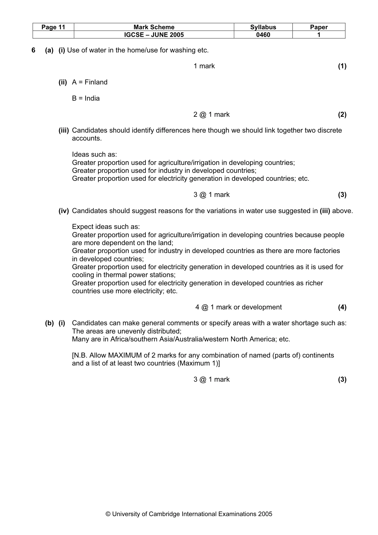
Page 11 Mark Scheme Syllabus Paper IGCSE – JUNE 2005 0460 1 © University of Cambridge International Examinations 2005 6 (a) (i) Use of water in the home/use for washing etc. 1 mark (1) (ii) A = Finland B = India 2 @ 1 mark (2) (iii) Candidates should identify differences here though we should link together two discrete accounts. Ideas such as: Greater proportion used for agriculture/irrigation in developing countries; Greater proportion used for industry in developed countries; Greater proportion used for electricity generation in developed countries; etc. 3 @ 1 mark (3) (iv) Candidates should suggest reasons for the variations in water use suggested in (iii) above. Expect ideas such as: Greater proportion used for agriculture/irrigation in developing countries because people are more dependent on the land; Greater proportion used for industry in developed countries as there are more factories in developed countries; Greater proportion used for electricity generation in developed countries as it is used for cooling in thermal power stations; Greater proportion used for electricity generation in developed countries as richer countries use more electricity; etc. 4 @ 1 mark or development (4) (b) (i) Candidates can make general comments or specify areas with a water shortage such as: The areas are unevenly distributed; Many are in Africa/southern Asia/Australia/western North America; etc. [N.B. Allow MAXIMUM of 2 marks for any combination of named (parts of) continents and a list of at least two countries (Maximum 1)] 3 @ 1 mark (3)
Mark scheme, page 15
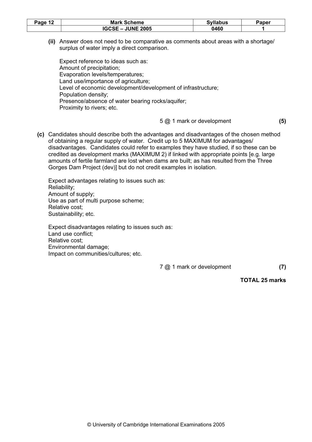
Page 12 Mark Scheme Syllabus Paper IGCSE – JUNE 2005 0460 1 © University of Cambridge International Examinations 2005 (ii) Answer does not need to be comparative as comments about areas with a shortage/ surplus of water imply a direct comparison. Expect reference to ideas such as: Amount of precipitation; Evaporation levels/temperatures; Land use/importance of agriculture; Level of economic development/development of infrastructure; Population density; Presence/absence of water bearing rocks/aquifer; Proximity to rivers; etc. 5 @ 1 mark or development (5) (c) Candidates should describe both the advantages and disadvantages of the chosen method of obtaining a regular supply of water. Credit up to 5 MAXIMUM for advantages/ disadvantages. Candidates could refer to examples they have studied, if so these can be credited as development marks (MAXIMUM 2) if linked with appropriate points [e.g. large amounts of fertile farmland are lost when dams are built; as has resulted from the Three Gorges Dam Project (dev)] but do not credit examples in isolation. Expect advantages relating to issues such as: Reliability; Amount of supply; Use as part of multi purpose scheme; Relative cost; Sustainability; etc. Expect disadvantages relating to issues such as: Land use conflict; Relative cost; Environmental damage; Impact on communities/cultures; etc. 7 @ 1 mark or development (7) TOTAL 25 marks