Cambridge IGCSE Geography 0460 — 2022 May/June Paper 1 · Variant 3
0460/13/M/J/22 · 75 marks · ≈84 min
The question paper and its mark scheme, free to read here and free to download. This is Cambridge’s own paper, exactly as it was sat.
Question paper32 pages


Mark scheme17 pages
Answers below. Sit the paper first if you are practising.
Paper as text
Question paper, page 1
This document has 32 pages. Any blank pages are indicated. [Turn over Cambridge IGCSE™ * 4 3 5 3 7 9 5 1 3 7 * GEOGRAPHY 0460/13 Paper 1 Geographical Themes May/June 2022 1 hour 45 minutes You must answer on the question paper. You will need: Insert (enclosed) Calculator Ruler INSTRUCTIONS ● Answer three questions in total, one from each section. ● Use a black or dark blue pen. You may use an HB pencil for any diagrams or graphs. ● Write your name, centre number and candidate number in the boxes at the top of the page. ● Write your answer to each question in the space provided. ● Do not use an erasable pen or correction fluid. ● Do not write on any bar codes. ● If additional space is needed, you should use the lined pages at the end of this booklet; the question number or numbers must be clearly shown. INFORMATION ● The total mark for this paper is 75. ● The number of marks for each question or part question is shown in brackets [ ]. ● The insert contains additional resources referred to in the questions. Definitions MEDCs – More Economically Developed Countries LEDCs – Less Economically Developed Countries DC (CJ/CT) 304209/4 © UCLES 2022
Question paper, page 2
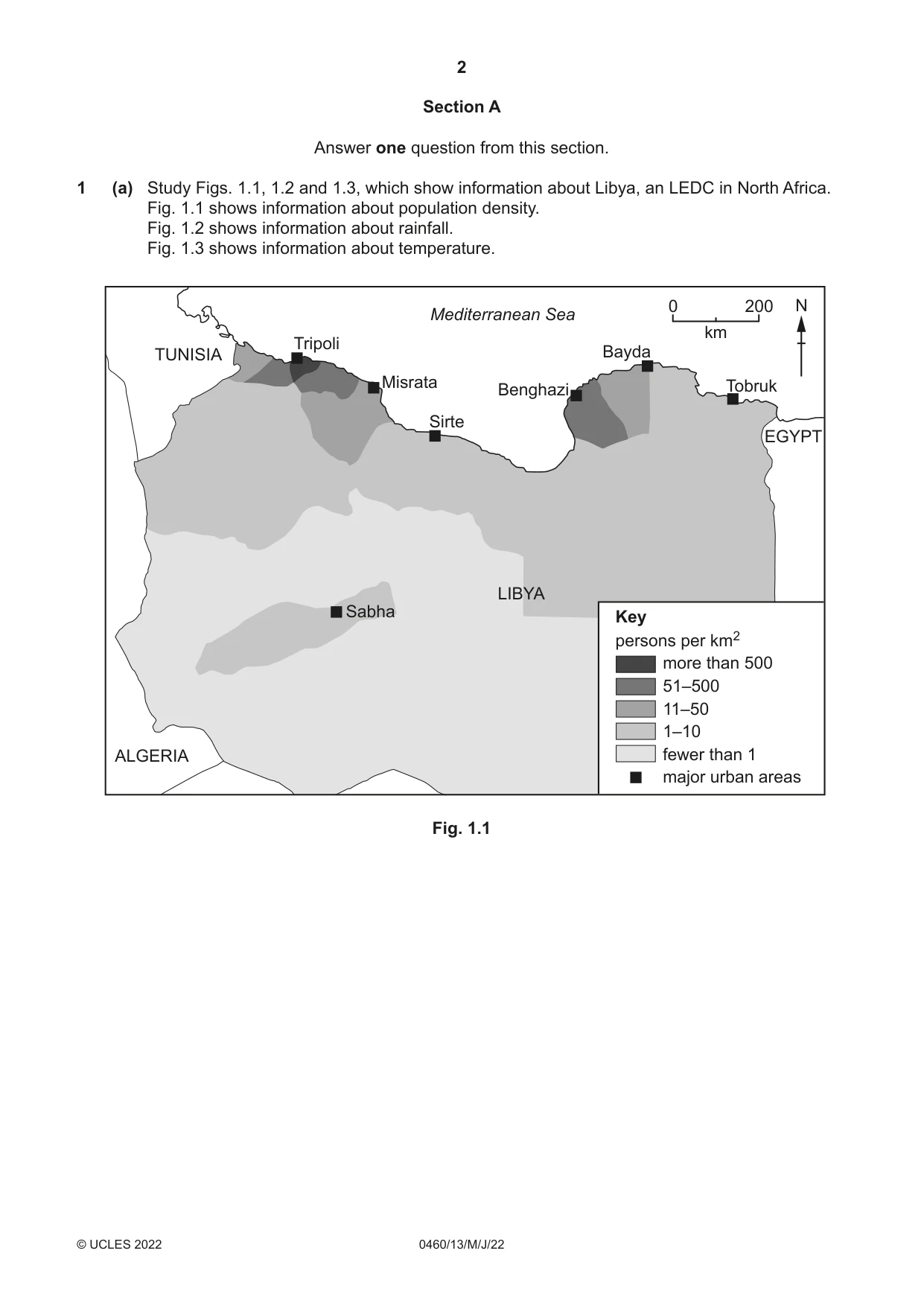
2 0460/13/M/J/22 © UCLES 2022 Section A Answer one question from this section. 1 (a) Study Figs. 1.1, 1.2 and 1.3, which show information about Libya, an LEDC in North Africa. Fig. 1.1 shows information about population density. Fig. 1.2 shows information about rainfall. Fig. 1.3 shows information about temperature. LIBYA ALGERIA TUNISIA EGYPT Sabha Tripoli Misrata Sirte Benghazi Bayda Tobruk Mediterranean Sea Key persons per km2 more than 500 51–500 11–50 1–10 fewer than 1 major urban areas 0 200 km N Fig. 1.1
Question paper, page 3
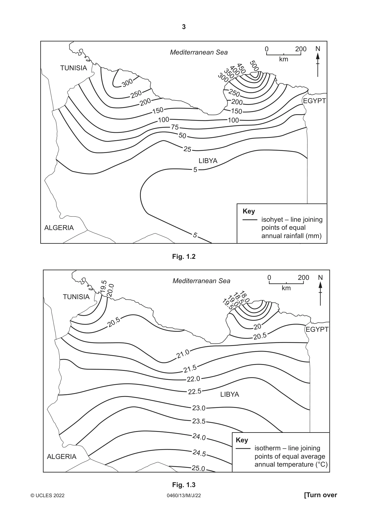
3 0460/13/M/J/22 © UCLES 2022 [Turn over LIBYA ALGERIA TUNISIA EGYPT Mediterranean Sea 5 25 50 75 100 200 150 250 300 5 100 150 200 250 300 350 400 450 500 Key isohyet – line joining points of equal annual rainfall (mm) 0 200 km N Fig. 1.2 LIBYA ALGERIA TUNISIA EGYPT Mediterranean Sea 21.0 19.5 19.0 Key isotherm – line joining points of equal average annual temperature (°C) 21.5 20.0 19.5 20.5 22.0 22.5 20.5 23.0 23.5 24.0 24.5 25.0 20 18.5 18.0 0 200 km N Fig. 1.3
Question paper, page 4
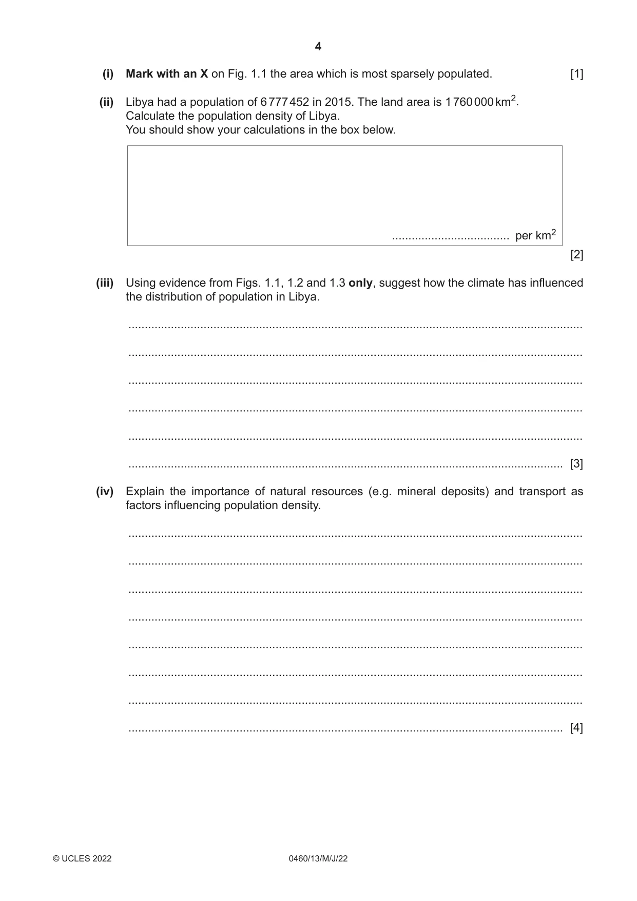
4 0460/13/M/J/22 © UCLES 2022 (i) Mark with an X on Fig. 1.1 the area which is most sparsely populated. [1] (ii) Libya had a population of 6 777 452 in 2015. The land area is 1 760 000 km2. Calculate the population density of Libya. You should show your calculations in the box below. [2] (iii) Using evidence from Figs. 1.1, 1.2 and 1.3 only, suggest how the climate has influenced the distribution of population in Libya. … … … … … … [3] (iv) Explain the importance of natural resources (e.g. mineral deposits) and transport as factors influencing population density. … … … … … … … … [4] … per km2
Question paper, page 5
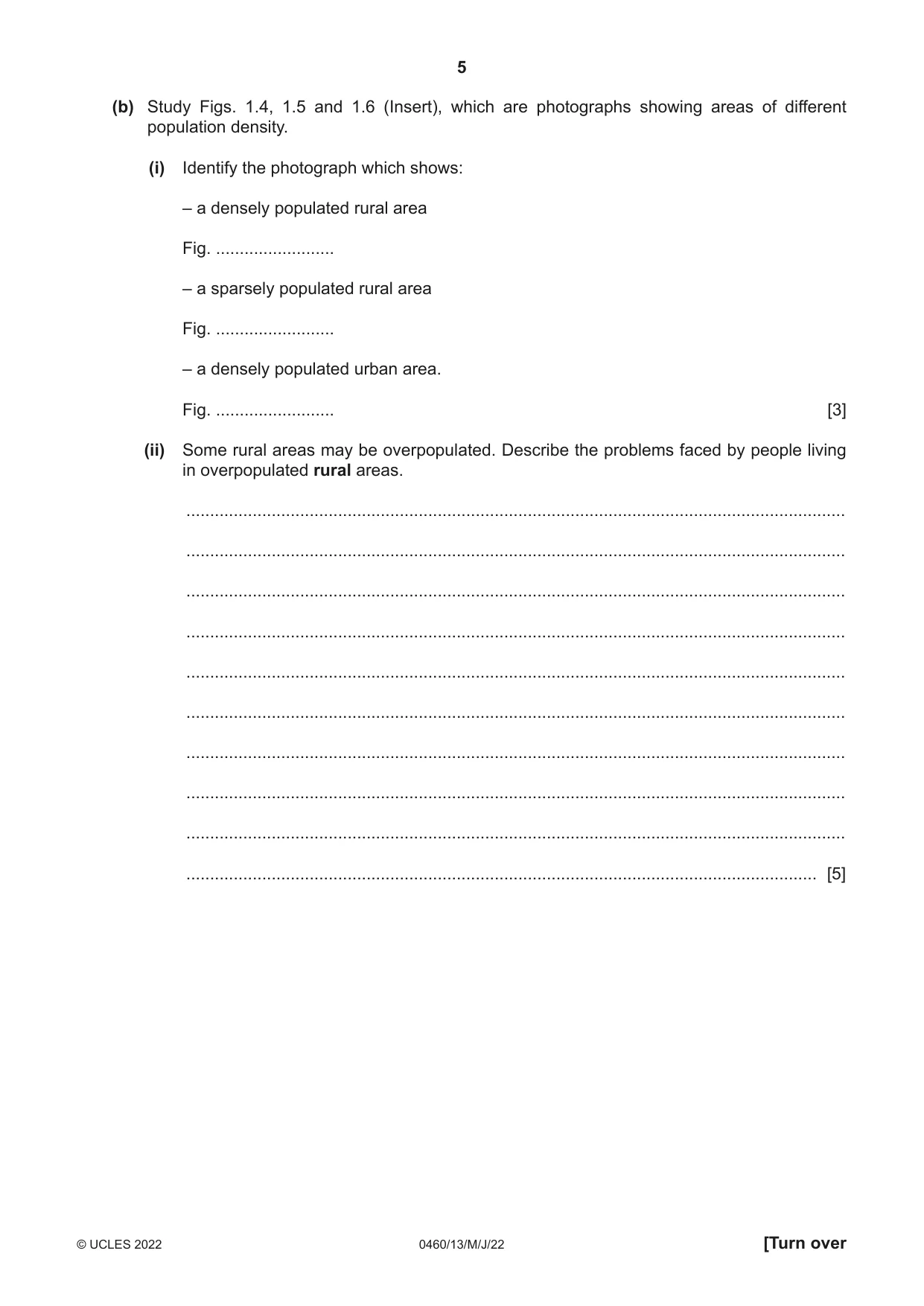
5 0460/13/M/J/22 © UCLES 2022 [Turn over (b) Study Figs. 1.4, 1.5 and 1.6 (Insert), which are photographs showing areas of different population density. (i) Identify the photograph which shows: – a densely populated rural area Fig. … – a sparsely populated rural area Fig. … – a densely populated urban area. Fig. … [3] (ii) Some rural areas may be overpopulated. Describe the problems faced by people living in overpopulated rural areas. … … … … … … … … … … [5]
Question paper, page 6
6 0460/13/M/J/22 © UCLES 2022 (c) For a named country you have studied, explain why it has attracted large numbers of international migrants. Name of country … … … … … … … … … … … … … … … … … … … … … … … … … … [7] [Total: 25]
Question paper, page 7
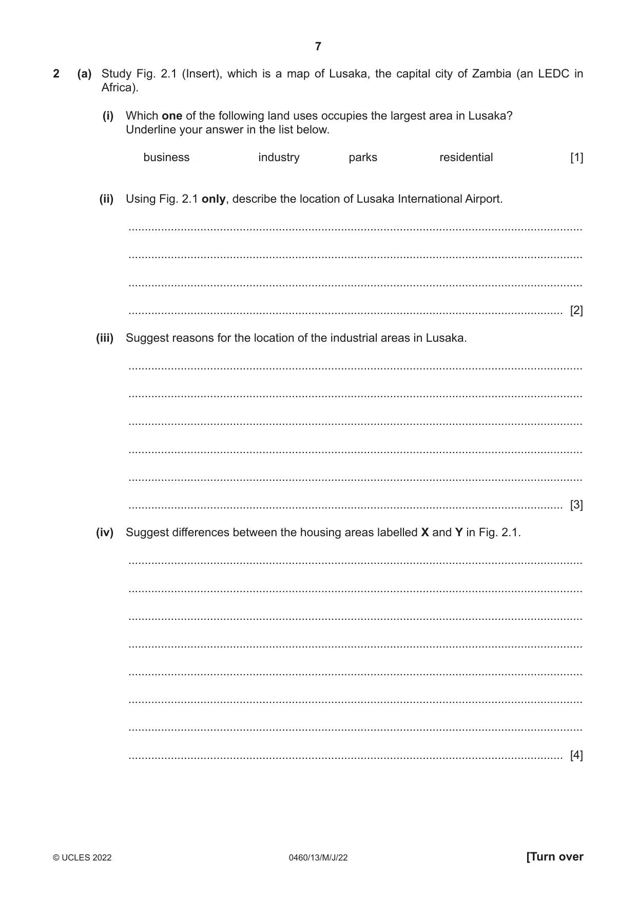
7 0460/13/M/J/22 © UCLES 2022 [Turn over 2 (a) Study Fig. 2.1 (Insert), which is a map of Lusaka, the capital city of Zambia (an LEDC in Africa). (i) Which one of the following land uses occupies the largest area in Lusaka? Underline your answer in the list below. business industry parks residential [1] (ii) Using Fig. 2.1 only, describe the location of Lusaka International Airport. … … … … [2] (iii) Suggest reasons for the location of the industrial areas in Lusaka. … … … … … … [3] (iv) Suggest differences between the housing areas labelled X and Y in Fig. 2.1. … … … … … … … … [4]
Question paper, page 8
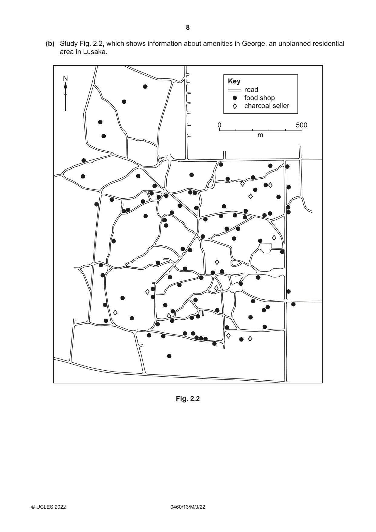
8 0460/13/M/J/22 © UCLES 2022 (b) Study Fig. 2.2, which shows information about amenities in George, an unplanned residential area in Lusaka. Key road food shop charcoal seller 0 500 m N Fig. 2.2
Question paper, page 9
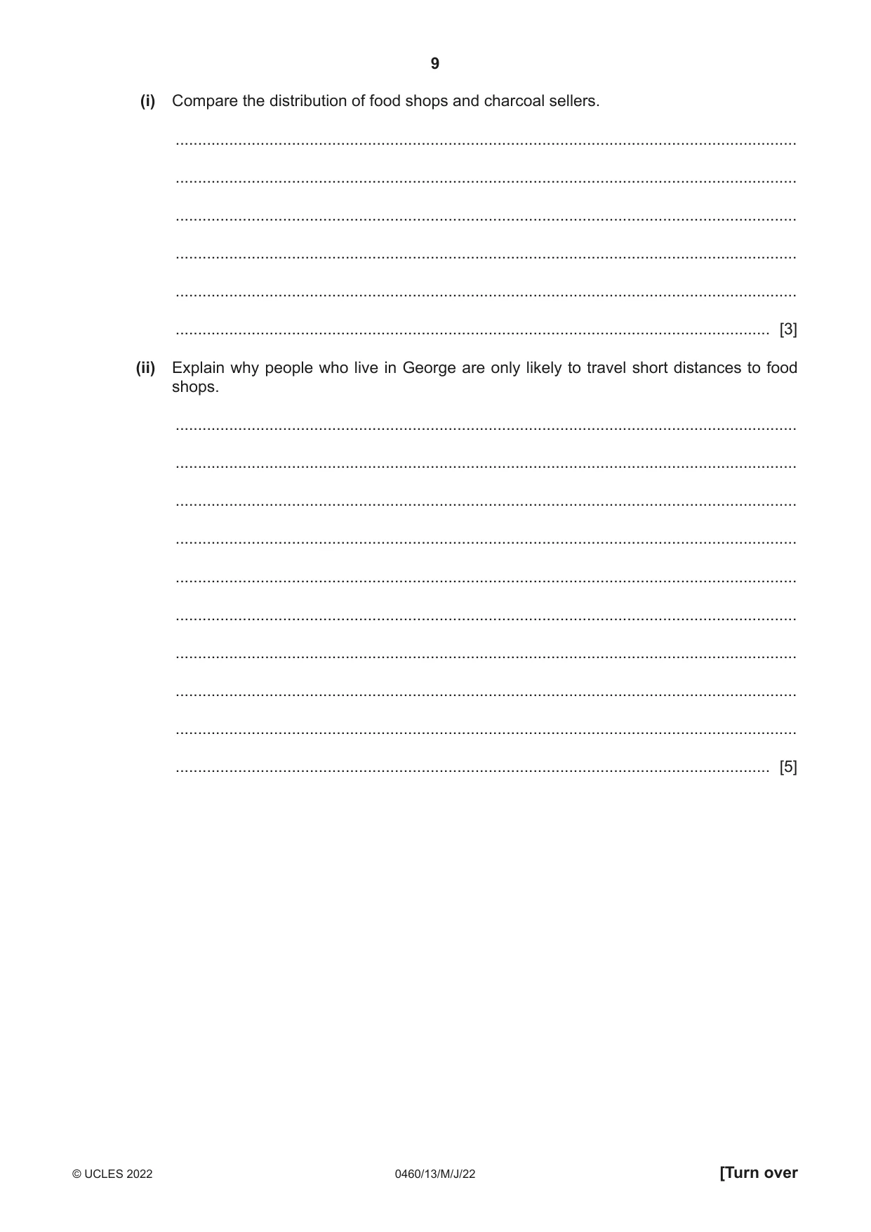
9 0460/13/M/J/22 © UCLES 2022 [Turn over (i) Compare the distribution of food shops and charcoal sellers. … … … … … … [3] (ii) Explain why people who live in George are only likely to travel short distances to food shops. … … … … … … … … … … [5]
Question paper, page 10
10 0460/13/M/J/22 © UCLES 2022 (c) For a named urban area you have studied, describe and explain the characteristics of its Central Business District (CBD). Name of urban area … … … … … … … … … … … … … … … … … … … … … … … … … [7] [Total: 25]
Question paper, page 11
11 0460/13/M/J/22 © UCLES 2022 [Turn over TURN PAGE FOR QUESTION 3
Question paper, page 12
12 0460/13/M/J/22 © UCLES 2022 Section B Answer one question from this section. 3 (a) Study Fig. 3.1 (Insert), which is a photograph showing an area which has been created by coastal erosion. (i) What is meant by coastal erosion? … … [1] (ii) Which two of the following can be seen in Fig. 3.1? Tick (3) the correct statements in the table. tick (3) bays and headlands delta mangrove swamps sand dunes wave cut platforms [2] (iii) Explain how the process of corrosion (solution) may have formed the caves shown in Fig. 3.1. … … … … … … [3]
Question paper, page 13
13 0460/13/M/J/22 © UCLES 2022 [Turn over (iv) State two benefits and two disadvantages of living close to the coast. Benefits 1 … … 2 … … Disadvantages 1 … … 2 … … [4] (b) Study Fig. 3.2 (Insert), which is a map of Orford Ness, a spit. (i) Using Fig. 3.2 only, describe three features of Orford Ness. 1 … … 2 … … 3 … … [3] (ii) Suggest how the spit at Orford Ness was formed. … … … … … … … … … … [5]
Question paper, page 14
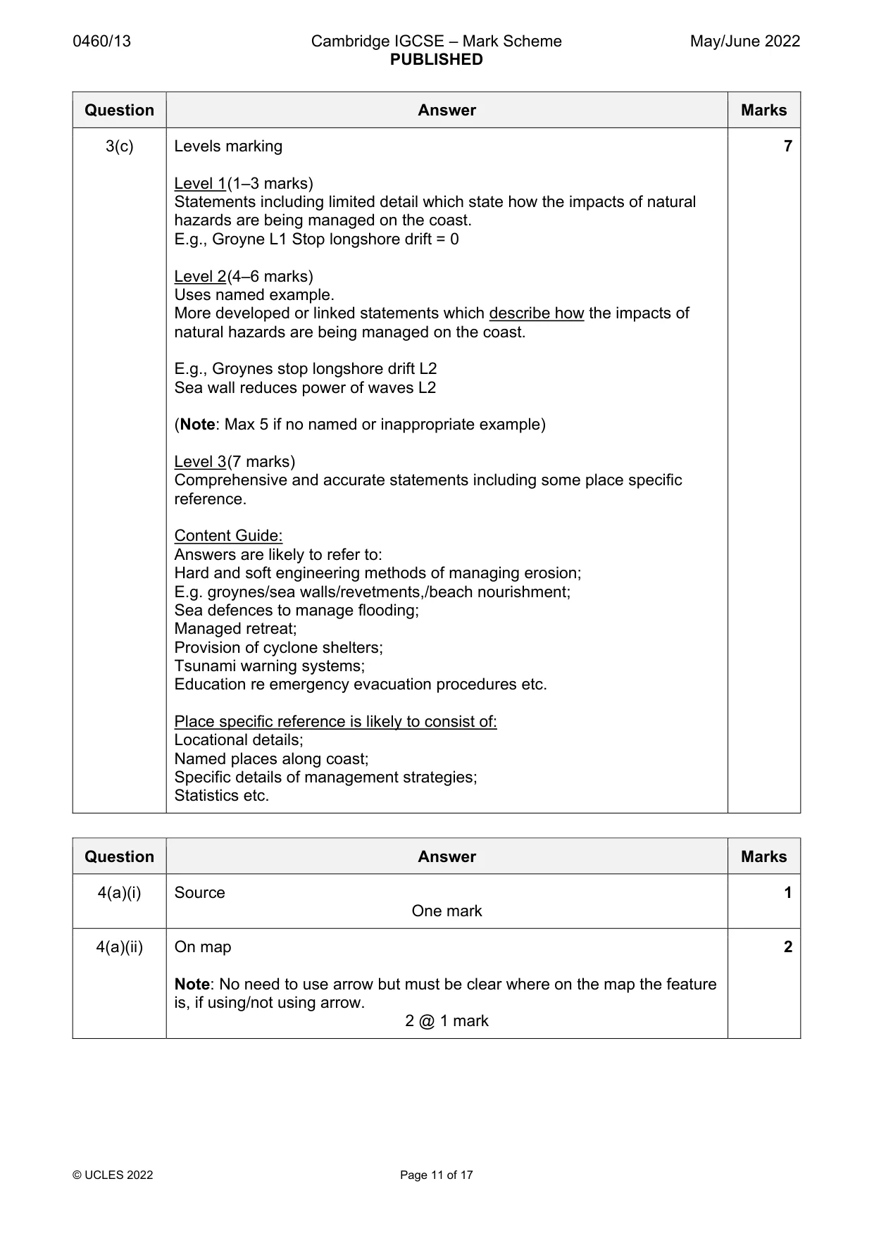
14 0460/13/M/J/22 © UCLES 2022 (c) For a named coastal area you have studied, describe how the impacts of natural hazards are being managed. Name of area … … … … … … … … … … … … … … … … … … … … … … … … … … [7] [Total: 25]
Question paper, page 15
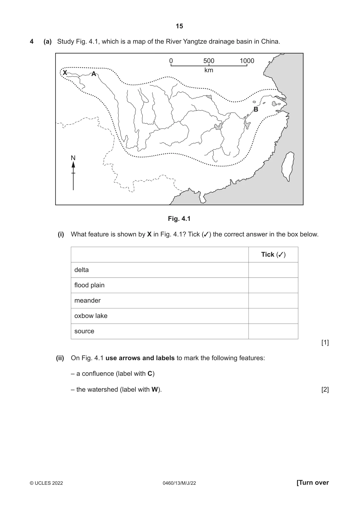
15 0460/13/M/J/22 © UCLES 2022 [Turn over 4 (a) Study Fig. 4.1, which is a map of the River Yangtze drainage basin in China. X A B X A B 0 500 km 1000 N Fig. 4.1 (i) What feature is shown by X in Fig. 4.1? Tick (3) the correct answer in the box below. Tick (3) delta flood plain meander oxbow lake source [1] (ii) On Fig. 4.1 use arrows and labels to mark the following features: – a confluence (label with C) – the watershed (label with W). [2]
Question paper, page 16
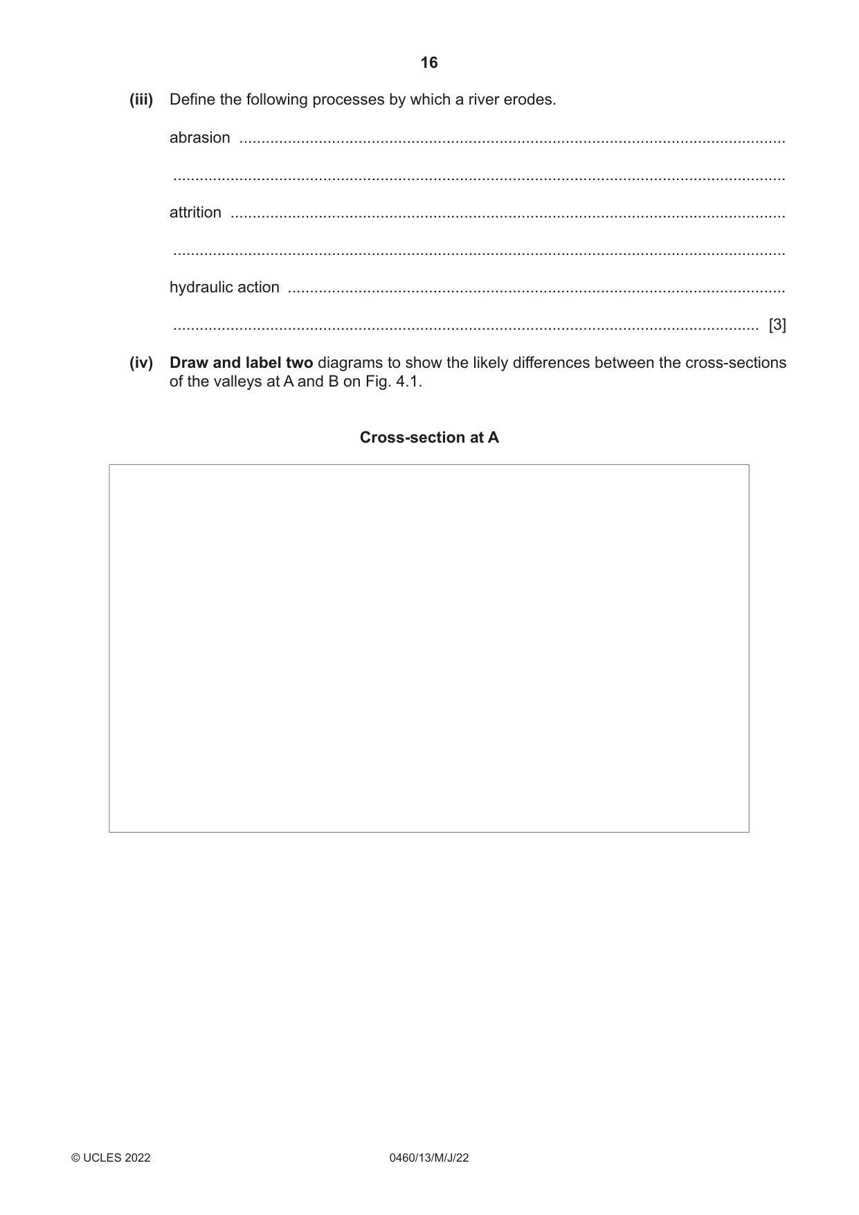
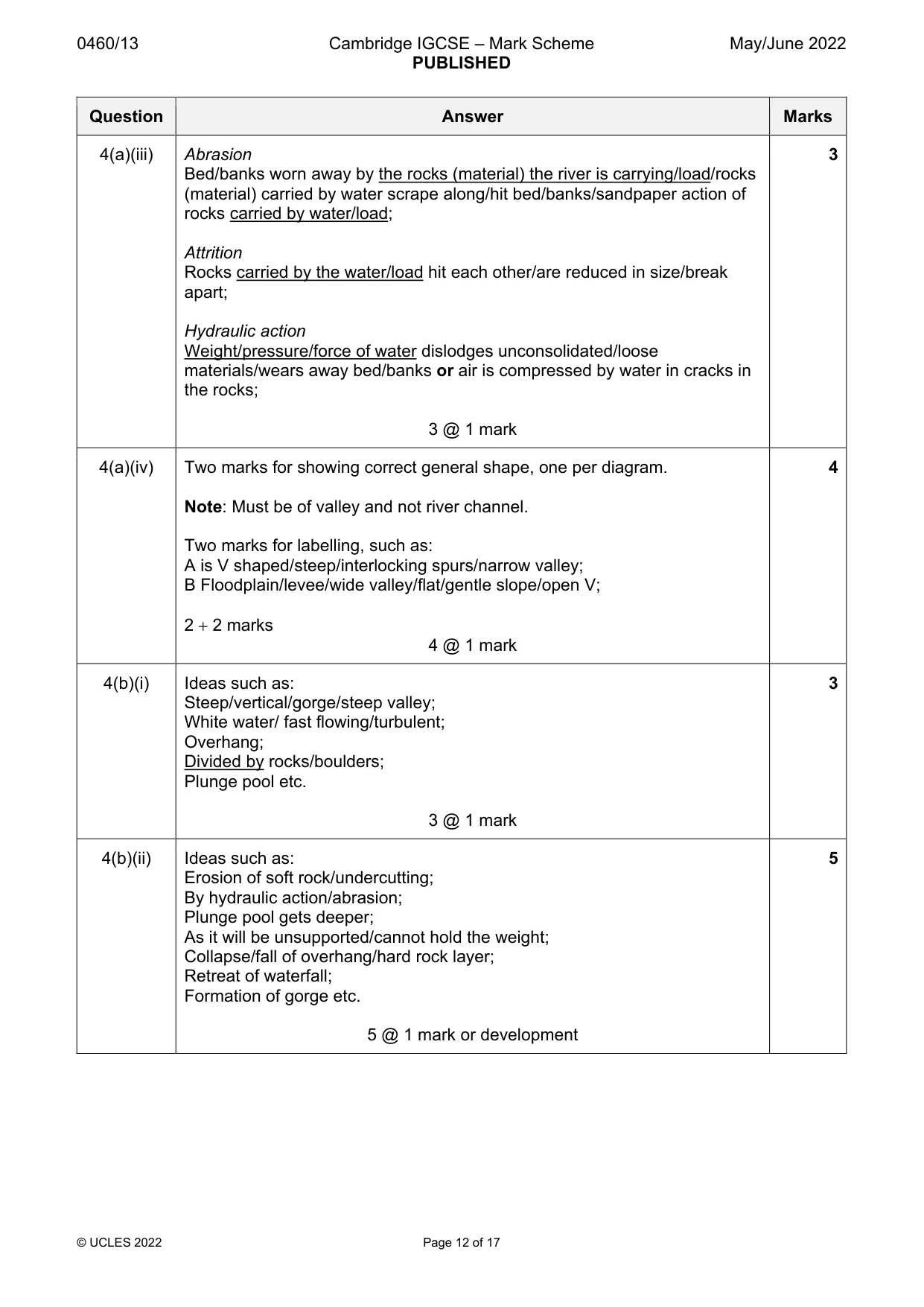
16 0460/13/M/J/22 © UCLES 2022 (iii) Define the following processes by which a river erodes. abrasion … … attrition … … hydraulic action … … [3] (iv) Draw and label two diagrams to show the likely differences between the cross-sections of the valleys at A and B on Fig. 4.1. Cross-section at A
Question paper, page 17
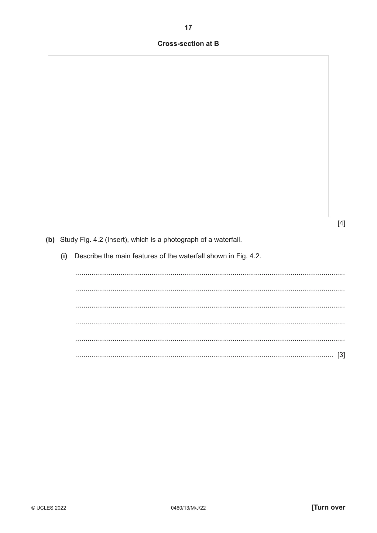
17 0460/13/M/J/22 © UCLES 2022 [Turn over Cross-section at B [4] (b) Study Fig. 4.2 (Insert), which is a photograph of a waterfall. (i) Describe the main features of the waterfall shown in Fig. 4.2. … … … … … … [3]
Question paper, page 18
18 0460/13/M/J/22 © UCLES 2022 (ii) Explain how and why the waterfall shown in Fig. 4.2 is likely to change in the future. … … … … … … … … … … [5]
Question paper, page 19
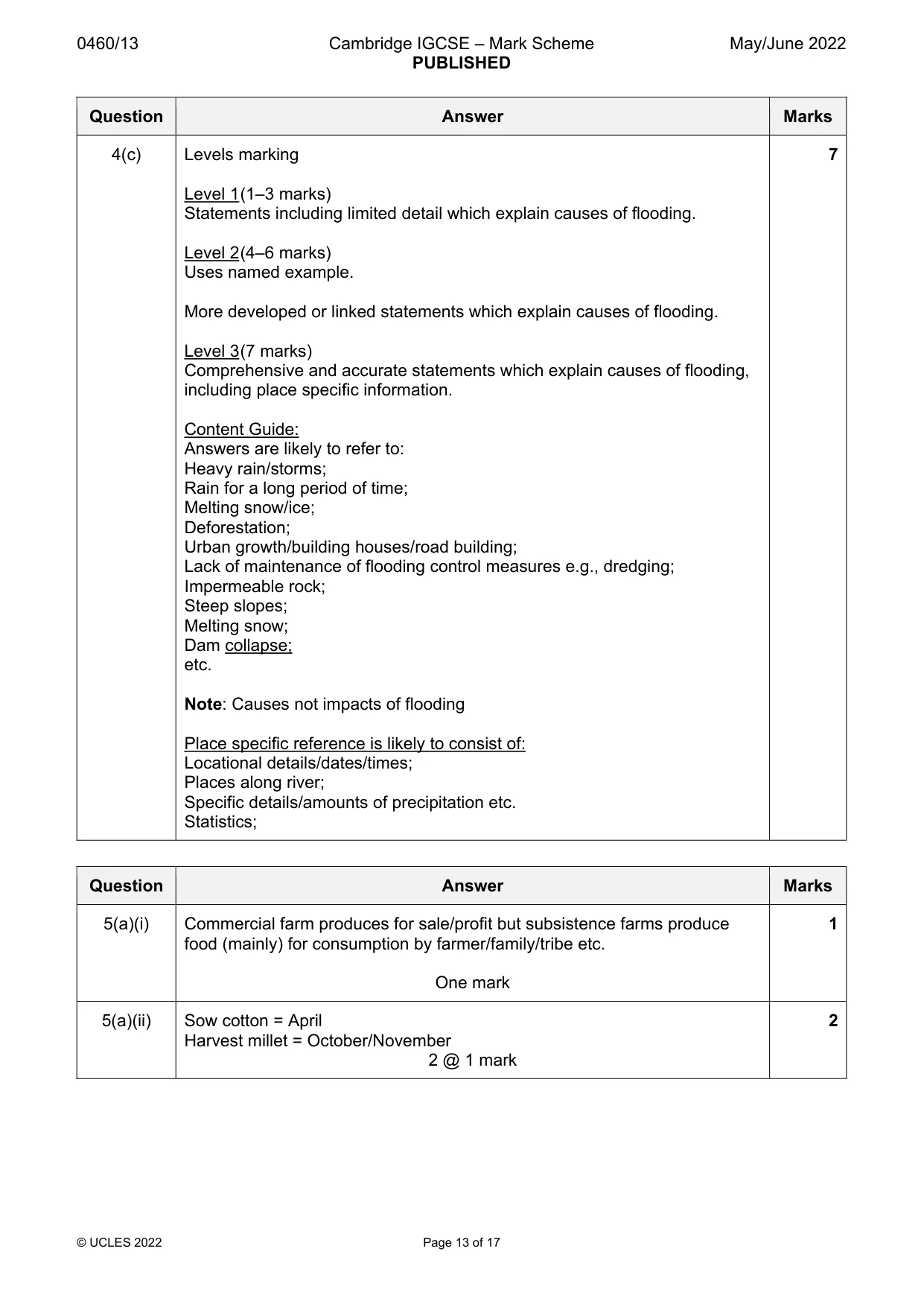
19 0460/13/M/J/22 © UCLES 2022 [Turn over (c) For a named river you have studied, explain the causes of flooding. Name of river … … … … … … … … … … … … … … … … … … … … … … … … … … [7] [Total: 25]
Question paper, page 20
20 0460/13/M/J/22 © UCLES 2022 Section C Answer one question from this section. 5 (a) Study Fig. 5.1, which is information about farming and climate around the villages of Chak Jinda and Jullundur, which are in the Punjab state of India (an LEDC). Fig. 5.1 (i) There are both commercial and subsistence farms in the Punjab. What is the difference between a commercial farm and a subsistence farm? … … … [1] Content removed due to copyright restrictions.
Question paper, page 21
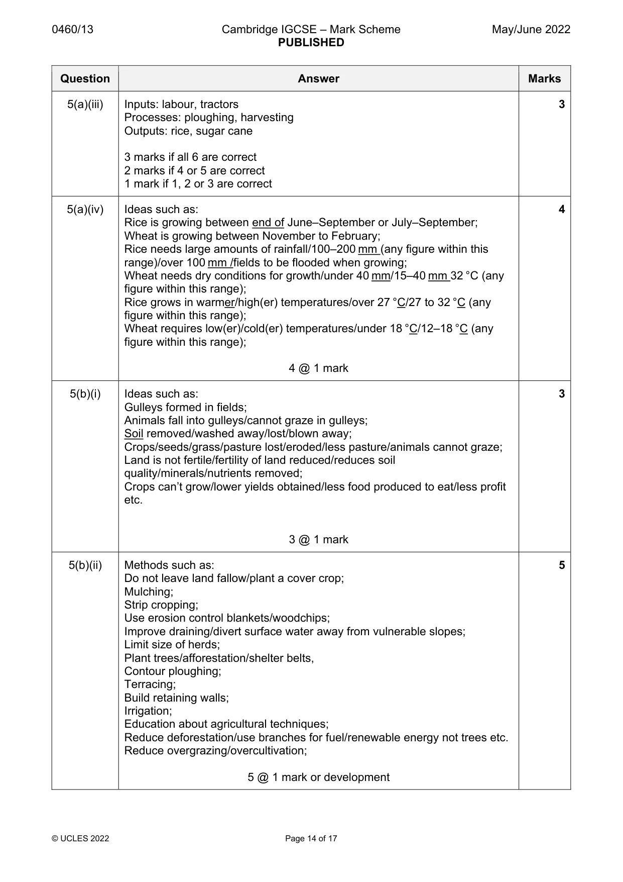
21 0460/13/M/J/22 © UCLES 2022 [Turn over (ii) Using Fig. 5.1, identify a month when farmers in the Punjab will: – sow cotton … – harvest millet. … [2] (iii) Insert the following words into the table below to show examples of inputs, processes and outputs of farms in the Punjab. Choose from the words below. harvesting labour ploughing tractors sugar cane rice inputs processes outputs [3] (iv) Using Fig. 5.1, identify the months when rice and wheat are growing in the Punjab. Suggest reasons for the different months when these crops are growing. … … … … … … … … [4]
Question paper, page 22
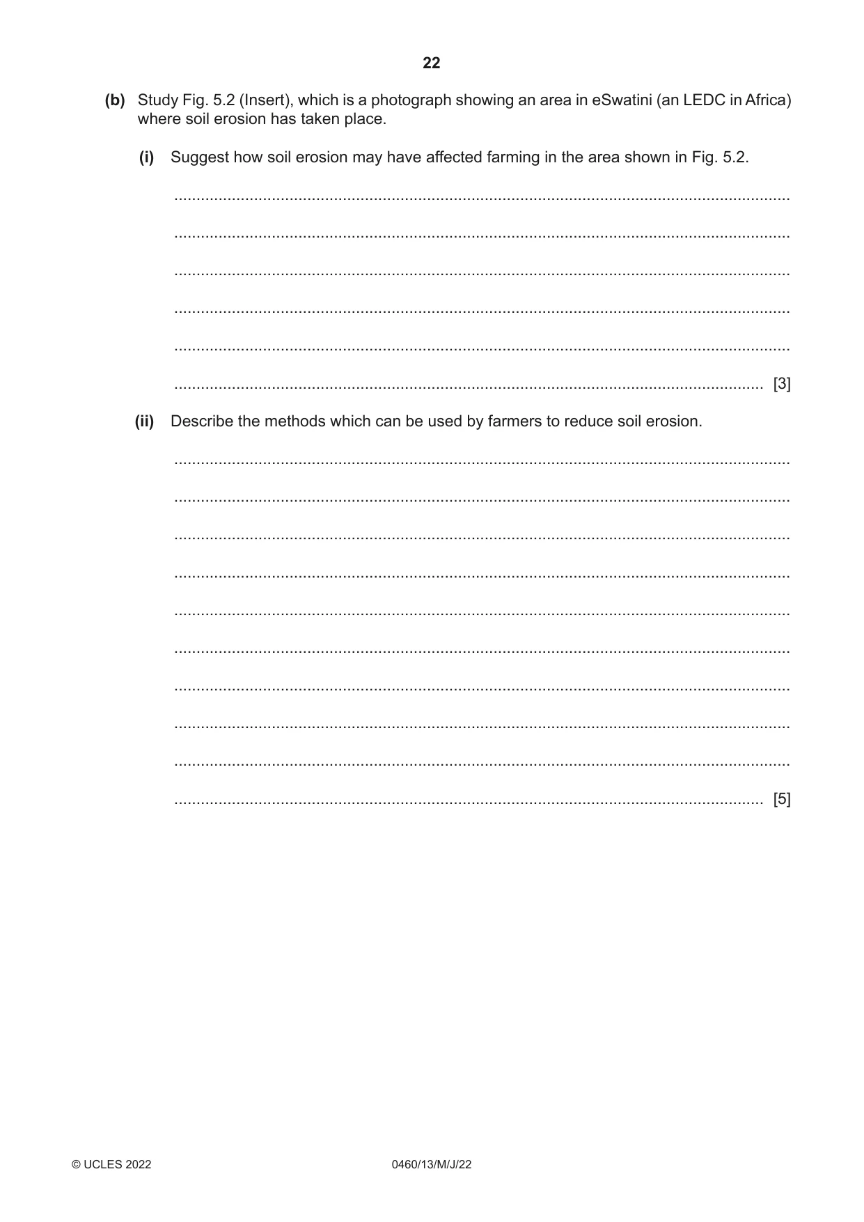
22 0460/13/M/J/22 © UCLES 2022 (b) Study Fig. 5.2 (Insert), which is a photograph showing an area in eSwatini (an LEDC in Africa) where soil erosion has taken place. (i) Suggest how soil erosion may have affected farming in the area shown in Fig. 5.2. … … … … … … [3] (ii) Describe the methods which can be used by farmers to reduce soil erosion. … … … … … … … … … … [5]
Question paper, page 23
23 0460/13/M/J/22 © UCLES 2022 [Turn over (c) For a named country or region you have studied, explain how human actions have contributed to food shortages. Name of country or region … … … … … … … … … … … … … … … … … … … … … … … … … … [7] [Total: 25]
Question paper, page 24
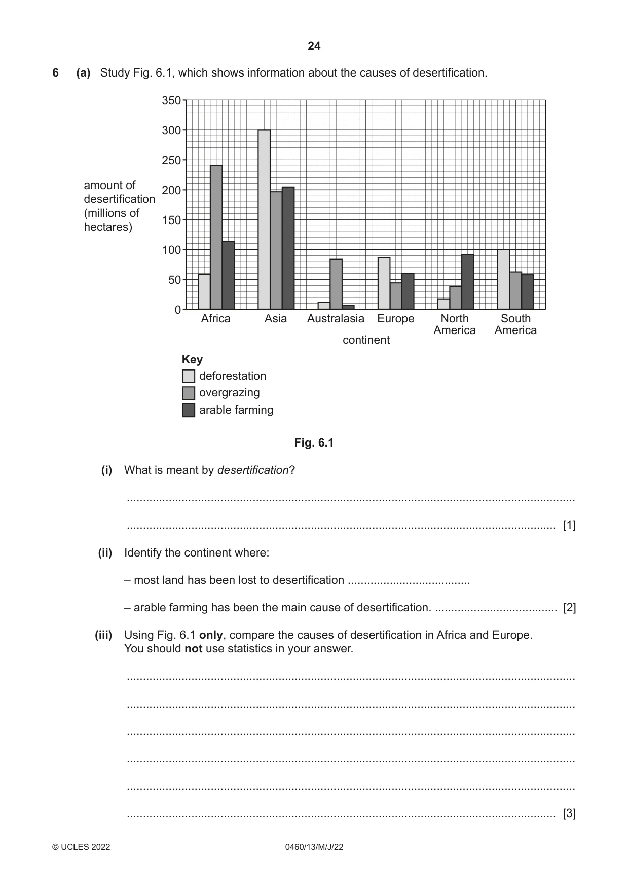
24 0460/13/M/J/22 © UCLES 2022 6 (a) Study Fig. 6.1, which shows information about the causes of desertification. Africa Asia Australasia Europe North America South America 0 50 100 150 200 250 350 300 amount of desertification (millions of hectares) continent Key deforestation overgrazing arable farming Fig. 6.1 (i) What is meant by desertification? … … [1] (ii) Identify the continent where: – most land has been lost to desertification … – arable farming has been the main cause of desertification. … [2] (iii) Using Fig. 6.1 only, compare the causes of desertification in Africa and Europe. You should not use statistics in your answer. … … … … … … [3]
Question paper, page 25
25 0460/13/M/J/22 © UCLES 2022 [Turn over (iv) Explain how overgrazing may cause desertification. … … … … … … … … [4]
Question paper, page 26
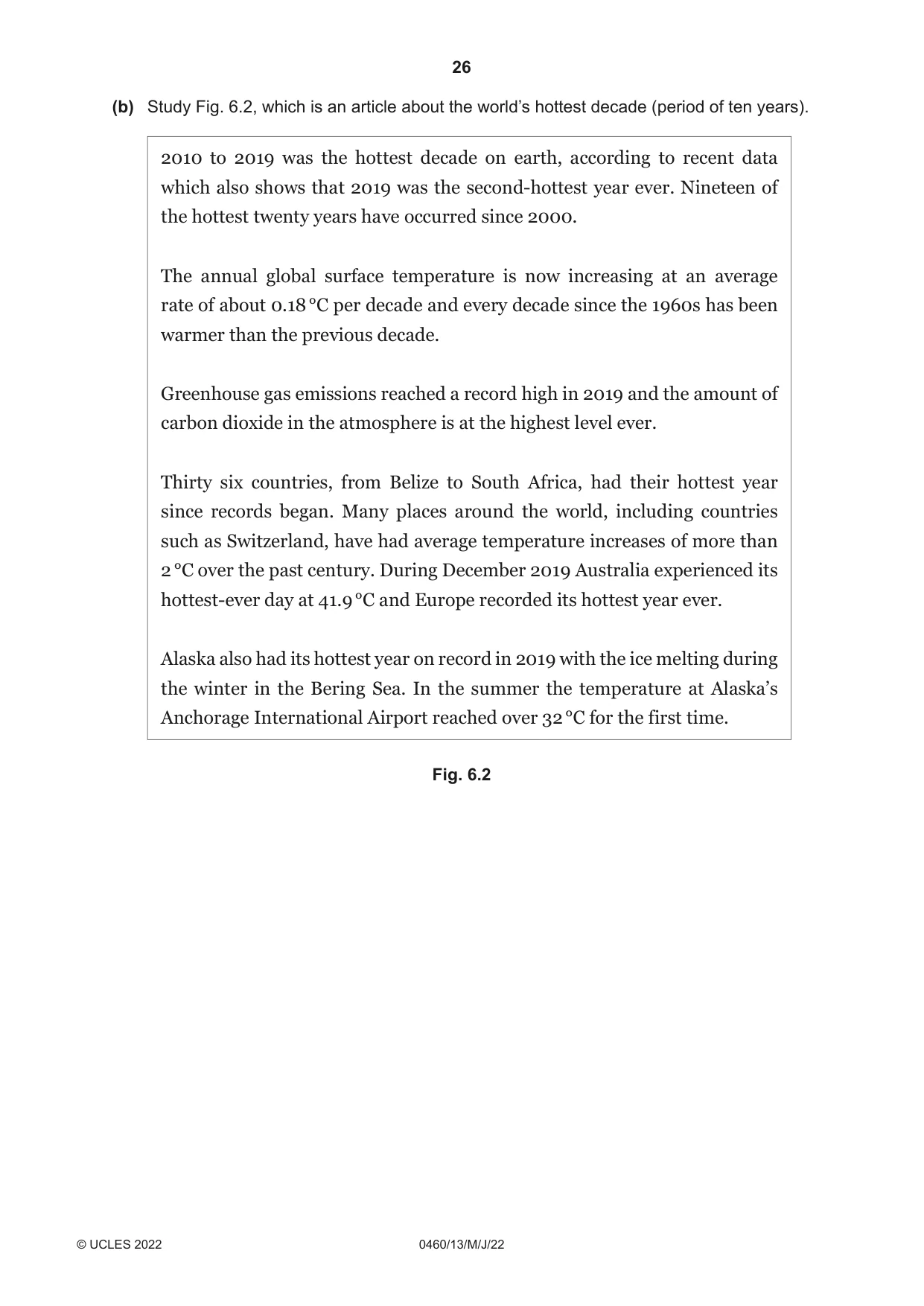
26 0460/13/M/J/22 © UCLES 2022 (b) Study Fig. 6.2, which is an article about the world’s hottest decade (period of ten years). 2010 to 2019 was the hottest decade on earth, according to recent data which also shows that 2019 was the second-hottest year ever. Nineteen of the hottest twenty years have occurred since 2000. The annual global surface temperature is now increasing at an average rate of about 0.18 °C per decade and every decade since the 1960s has been warmer than the previous decade. Greenhouse gas emissions reached a record high in 2019 and the amount of carbon dioxide in the atmosphere is at the highest level ever. Thirty six countries, from Belize to South Africa, had their hottest year since records began. Many places around the world, including countries such as Switzerland, have had average temperature increases of more than 2 °C over the past century. During December 2019 Australia experienced its hottest-ever day at 41.9 °C and Europe recorded its hottest year ever. Alaska also had its hottest year on record in 2019 with the ice melting during the winter in the Bering Sea. In the summer the temperature at Alaska’s Anchorage International Airport reached over 32 °C for the first time. Fig. 6.2
Question paper, page 27
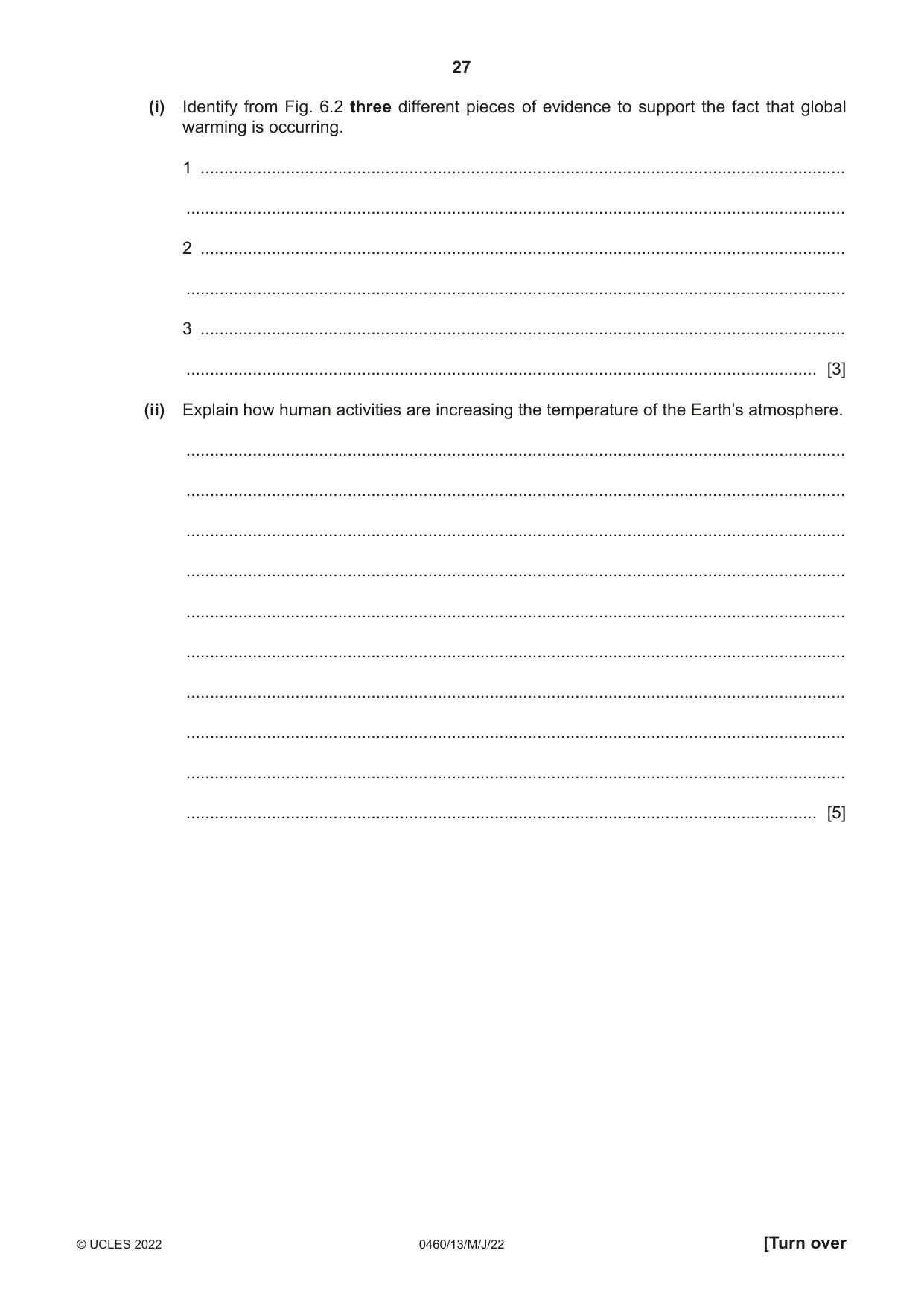
27 0460/13/M/J/22 © UCLES 2022 [Turn over (i) Identify from Fig. 6.2 three different pieces of evidence to support the fact that global warming is occurring. 1 … … 2 … … 3 … … [3] (ii) Explain how human activities are increasing the temperature of the Earth’s atmosphere. … … … … … … … … … … [5]
Question paper, page 28
28 0460/13/M/J/22 © UCLES 2022 (c) Describe the problems caused by global warming for people and the natural environment. You should refer to named areas affected. … … … … … … … … … … … … … … … … … … … … … … … … … … [7] [Total: 25]
Question paper, page 29
29 0460/13/M/J/22 © UCLES 2022 Additional pages If you use the following pages to complete the answer to any question, the question number must be clearly shown. … … … … … … … … … … … … … … … … … … … … … … … … … …
Question paper, page 30
30 0460/13/M/J/22 © UCLES 2022 … … … … … … … … … … … … … … … … … … … … … … … … … … … …
Question paper, page 31
31 0460/13/M/J/22 © UCLES 2022 BLANK PAGE
Question paper, page 32
32 0460/13/M/J/22 © UCLES 2022 The boundaries and names shown, the designations used and the presentation of material on any maps contained in this question paper/insert do not imply official endorsement or acceptance by Cambridge Assessment International Education concerning the legal status of any country, territory, or area or any of its authorities, or of the delimitation of its frontiers or boundaries. Permission to reproduce items where third-party owned material protected by copyright is included has been sought and cleared where possible. Every reasonable effort has been made by the publisher (UCLES) to trace copyright holders, but if any items requiring clearance have unwittingly been included, the publisher will be pleased to make amends at the earliest possible opportunity. To avoid the issue of disclosure of answer-related information to candidates, all copyright acknowledgements are reproduced online in the Cambridge Assessment International Education Copyright Acknowledgements Booklet. This is produced for each series of examinations and is freely available to download at www.cambridgeinternational.org after the live examination series. Cambridge Assessment International Education is part of Cambridge Assessment. Cambridge Assessment is the brand name of the University of Cambridge Local Examinations Syndicate (UCLES), which is a department of the University of Cambridge. BLANK PAGE
Mark scheme, page 1
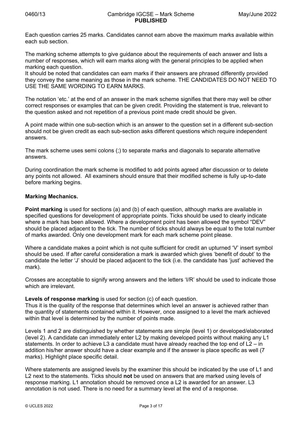
This document consists of 17 printed pages. © UCLES 2022 [Turn over Cambridge IGCSE™ GEOGRAPHY 0460/13 Paper 1 Geographical Themes May/June 2022 MARK SCHEME Maximum Mark: 75 Published This mark scheme is published as an aid to teachers and candidates, to indicate the requirements of the examination. It shows the basis on which Examiners were instructed to award marks. It does not indicate the details of the discussions that took place at an Examiners’ meeting before marking began, which would have considered the acceptability of alternative answers. Mark schemes should be read in conjunction with the question paper and the Principal Examiner Report for Teachers. Cambridge International will not enter into discussions about these mark schemes. Cambridge International is publishing the mark schemes for the May/June 2022 series for most Cambridge IGCSE, Cambridge International A and AS Level and Cambridge Pre-U components, and some Cambridge O Level components.
Mark scheme, page 2
0460/13 Cambridge IGCSE – Mark Scheme PUBLISHED May/June 2022 © UCLES 2022 Page 2 of 17 Generic Marking Principles These general marking principles must be applied by all examiners when marking candidate answers. They should be applied alongside the specific content of the mark scheme or generic level descriptors for a question. Each question paper and mark scheme will also comply with these marking principles. GENERIC MARKING PRINCIPLE 1: Marks must be awarded in line with: the specific content of the mark scheme or the generic level descriptors for the question the specific skills defined in the mark scheme or in the generic level descriptors for the question the standard of response required by a candidate as exemplified by the standardisation scripts. GENERIC MARKING PRINCIPLE 2: Marks awarded are always whole marks (not half marks, or other fractions). GENERIC MARKING PRINCIPLE 3: Marks must be awarded positively: marks are awarded for correct/valid answers, as defined in the mark scheme. However, credit is given for valid answers which go beyond the scope of the syllabus and mark scheme, referring to your Team Leader as appropriate marks are awarded when candidates clearly demonstrate what they know and can do marks are not deducted for errors marks are not deducted for omissions answers should only be judged on the quality of spelling, punctuation and grammar when these features are specifically assessed by the question as indicated by the mark scheme. The meaning, however, should be unambiguous. GENERIC MARKING PRINCIPLE 4: Rules must be applied consistently, e.g. in situations where candidates have not followed instructions or in the application of generic level descriptors. GENERIC MARKING PRINCIPLE 5: Marks should be awarded using the full range of marks defined in the mark scheme for the question (however; the use of the full mark range may be limited according to the quality of the candidate responses seen). GENERIC MARKING PRINCIPLE 6: Marks awarded are based solely on the requirements as defined in the mark scheme. Marks should not be awarded with grade thresholds or grade descriptors in mind.
Mark scheme, page 3
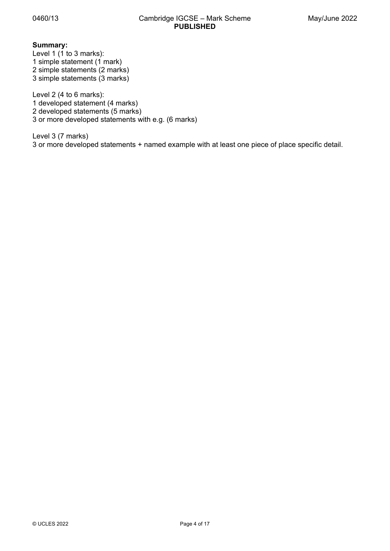
0460/13 Cambridge IGCSE – Mark Scheme PUBLISHED May/June 2022 © UCLES 2022 Page 3 of 17 Each question carries 25 marks. Candidates cannot earn above the maximum marks available within each sub section. The marking scheme attempts to give guidance about the requirements of each answer and lists a number of responses, which will earn marks along with the general principles to be applied when marking each question. It should be noted that candidates can earn marks if their answers are phrased differently provided they convey the same meaning as those in the mark scheme. THE CANDIDATES DO NOT NEED TO USE THE SAME WORDING TO EARN MARKS. The notation ‘etc.’ at the end of an answer in the mark scheme signifies that there may well be other correct responses or examples that can be given credit. Providing the statement is true, relevant to the question asked and not repetition of a previous point made credit should be given. A point made within one sub-section which is an answer to the question set in a different sub-section should not be given credit as each sub-section asks different questions which require independent answers. The mark scheme uses semi colons (;) to separate marks and diagonals to separate alternative answers. During coordination the mark scheme is modified to add points agreed after discussion or to delete any points not allowed. All examiners should ensure that their modified scheme is fully up-to-date before marking begins. Marking Mechanics. Point marking is used for sections (a) and (b) of each question, although marks are available in specified questions for development of appropriate points. Ticks should be used to clearly indicate where a mark has been allowed. Where a development point has been allowed the symbol “DEV” should be placed adjacent to the tick. The number of ticks should always be equal to the total number of marks awarded. Only one development mark for each mark scheme point please. Where a candidate makes a point which is not quite sufficient for credit an upturned ‘V’ insert symbol should be used. If after careful consideration a mark is awarded which gives ‘benefit of doubt’ to the candidate the letter ‘J’ should be placed adjacent to the tick (i.e. the candidate has ‘just’ achieved the mark). Crosses are acceptable to signify wrong answers and the letters ‘I/R’ should be used to indicate those which are irrelevant. Levels of response marking is used for section (c) of each question. Thus it is the quality of the response that determines which level an answer is achieved rather than the quantity of statements contained within it. However, once assigned to a level the mark achieved within that level is determined by the number of points made. Levels 1 and 2 are distinguished by whether statements are simple (level 1) or developed/elaborated (level 2). A candidate can immediately enter L2 by making developed points without making any L1 statements. In order to achieve L3 a candidate must have already reached the top end of L2 – in addition his/her answer should have a clear example and if the answer is place specific as well (7 marks). Highlight place specific detail. Where statements are assigned levels by the examiner this should be indicated by the use of L1 and L2 next to the statements. Ticks should not be used on answers that are marked using levels of response marking. L1 annotation should be removed once a L2 is awarded for an answer. L3 annotation is not used. There is no need for a summary level at the end of a response.
Mark scheme, page 4
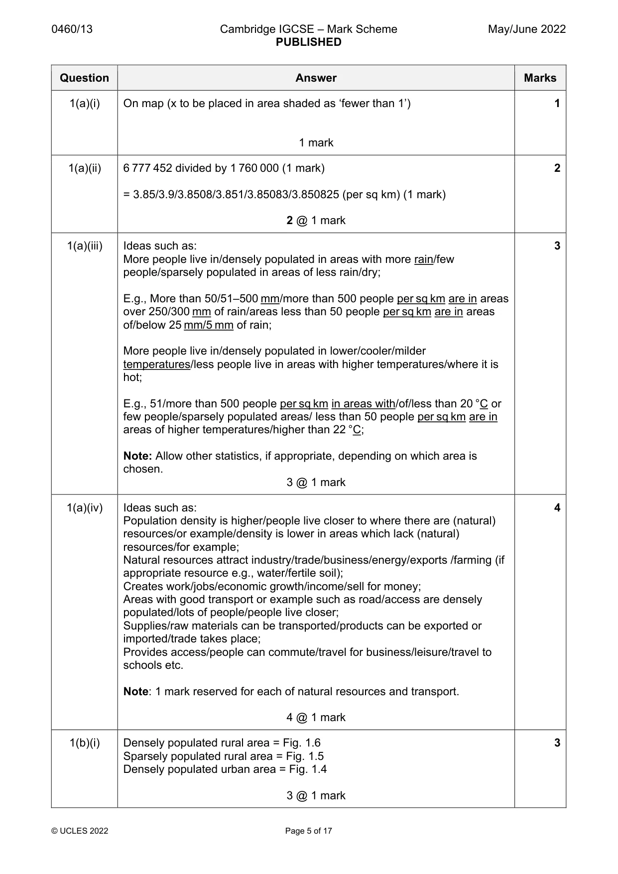
0460/13 Cambridge IGCSE – Mark Scheme PUBLISHED May/June 2022 © UCLES 2022 Page 4 of 17 Summary: Level 1 (1 to 3 marks): 1 simple statement (1 mark) 2 simple statements (2 marks) 3 simple statements (3 marks) Level 2 (4 to 6 marks): 1 developed statement (4 marks) 2 developed statements (5 marks) 3 or more developed statements with e.g. (6 marks) Level 3 (7 marks) 3 or more developed statements + named example with at least one piece of place specific detail.
Mark scheme, page 5
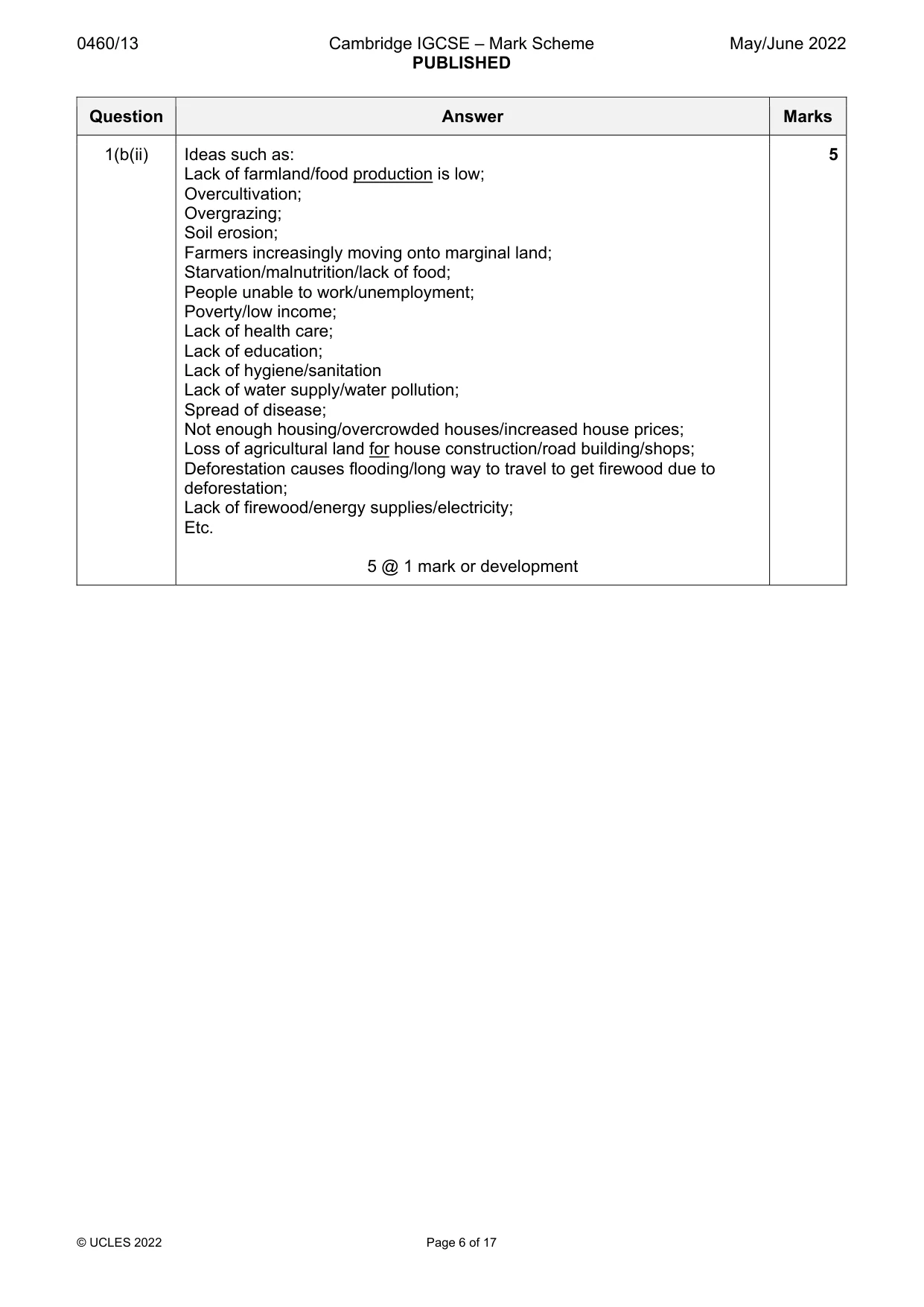
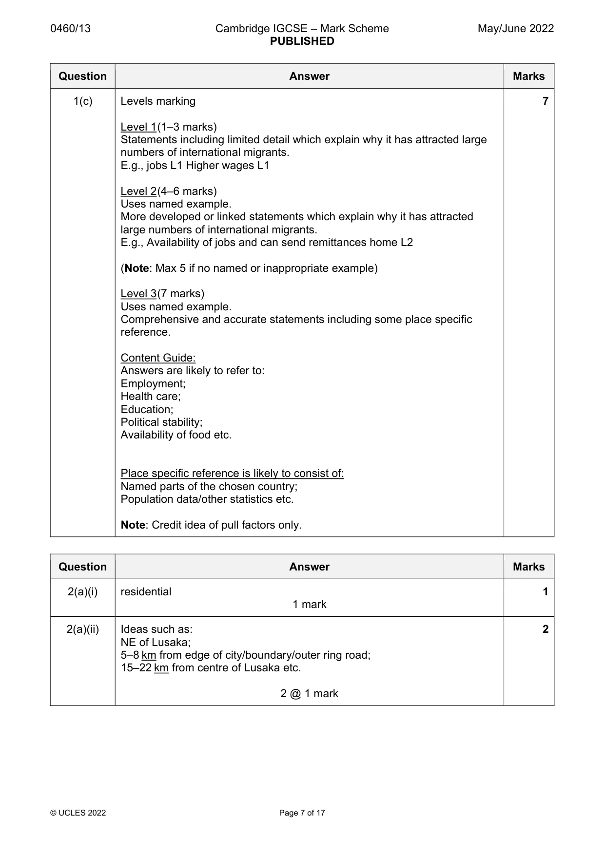
0460/13 Cambridge IGCSE – Mark Scheme PUBLISHED May/June 2022 © UCLES 2022 Page 5 of 17 Question Answer Marks 1(a)(i) On map (x to be placed in area shaded as ‘fewer than 1’) 1 mark 1 1(a)(ii) 6 777 452 divided by 1 760 000 (1 mark) = 3.85/3.9/3.8508/3.851/3.85083/3.850825 (per sq km) (1 mark) 2 @ 1 mark 2 1(a)(iii) Ideas such as: More people live in/densely populated in areas with more rain/few people/sparsely populated in areas of less rain/dry; E.g., More than 50/51–500 mm/more than 500 people per sq km are in areas over 250/300 mm of rain/areas less than 50 people per sq km are in areas of/below 25 mm/5 mm of rain; More people live in/densely populated in lower/cooler/milder temperatures/less people live in areas with higher temperatures/where it is hot; E.g., 51/more than 500 people per sq km in areas with/of/less than 20 °C or few people/sparsely populated areas/ less than 50 people per sq km are in areas of higher temperatures/higher than 22 °C; Note: Allow other statistics, if appropriate, depending on which area is chosen. 3 @ 1 mark 3 1(a)(iv) Ideas such as: Population density is higher/people live closer to where there are (natural) resources/or example/density is lower in areas which lack (natural) resources/for example; Natural resources attract industry/trade/business/energy/exports /farming (if appropriate resource e.g., water/fertile soil); Creates work/jobs/economic growth/income/sell for money; Areas with good transport or example such as road/access are densely populated/lots of people/people live closer; Supplies/raw materials can be transported/products can be exported or imported/trade takes place; Provides access/people can commute/travel for business/leisure/travel to schools etc. Note: 1 mark reserved for each of natural resources and transport. 4 @ 1 mark 4 1(b)(i) Densely populated rural area = Fig. 1.6 Sparsely populated rural area = Fig. 1.5 Densely populated urban area = Fig. 1.4 3 @ 1 mark 3
Mark scheme, page 6
0460/13 Cambridge IGCSE – Mark Scheme PUBLISHED May/June 2022 © UCLES 2022 Page 6 of 17 Question Answer Marks 1(b(ii) Ideas such as: Lack of farmland/food production is low; Overcultivation; Overgrazing; Soil erosion; Farmers increasingly moving onto marginal land; Starvation/malnutrition/lack of food; People unable to work/unemployment; Poverty/low income; Lack of health care; Lack of education; Lack of hygiene/sanitation Lack of water supply/water pollution; Spread of disease; Not enough housing/overcrowded houses/increased house prices; Loss of agricultural land for house construction/road building/shops; Deforestation causes flooding/long way to travel to get firewood due to deforestation; Lack of firewood/energy supplies/electricity; Etc. 5 @ 1 mark or development 5
Mark scheme, page 7
0460/13 Cambridge IGCSE – Mark Scheme PUBLISHED May/June 2022 © UCLES 2022 Page 7 of 17 Question Answer Marks 1(c) Levels marking Level 1 (1–3 marks) Statements including limited detail which explain why it has attracted large numbers of international migrants. E.g., jobs L1 Higher wages L1 Level 2 (4–6 marks) Uses named example. More developed or linked statements which explain why it has attracted large numbers of international migrants. E.g., Availability of jobs and can send remittances home L2 (Note: Max 5 if no named or inappropriate example) Level 3 (7 marks) Uses named example. Comprehensive and accurate statements including some place specific reference. Content Guide: Answers are likely to refer to: Employment; Health care; Education; Political stability; Availability of food etc. Place specific reference is likely to consist of: Named parts of the chosen country; Population data/other statistics etc. Note: Credit idea of pull factors only. 7 Question Answer Marks 2(a)(i) residential 1 mark 1 2(a)(ii) Ideas such as: NE of Lusaka; 5–8 km from edge of city/boundary/outer ring road; 15–22 km from centre of Lusaka etc. 2 @ 1 mark 2
Mark scheme, page 8
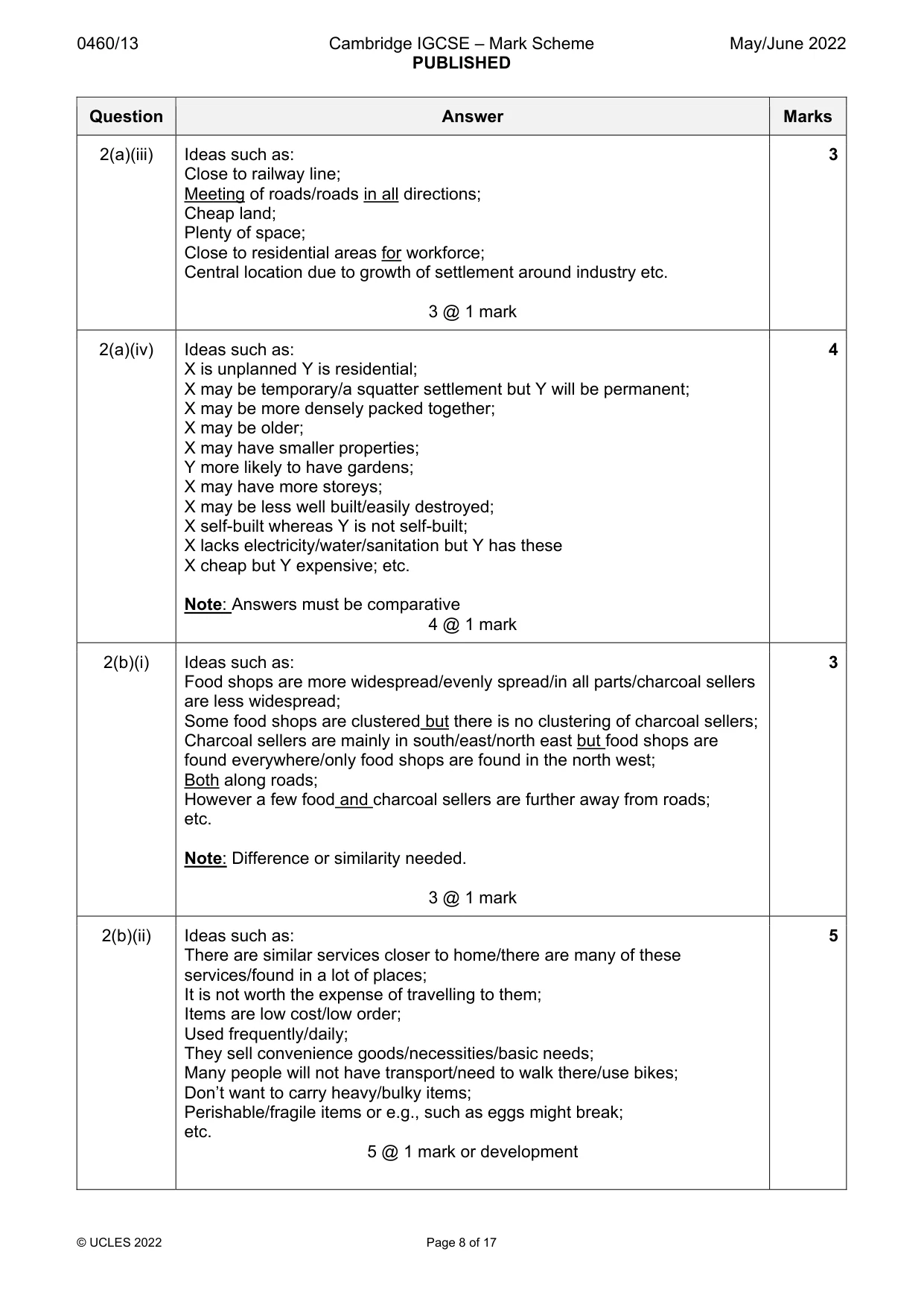
0460/13 Cambridge IGCSE – Mark Scheme PUBLISHED May/June 2022 © UCLES 2022 Page 8 of 17 Question Answer Marks 2(a)(iii) Ideas such as: Close to railway line; Meeting of roads/roads in all directions; Cheap land; Plenty of space; Close to residential areas for workforce; Central location due to growth of settlement around industry etc. 3 @ 1 mark 3 2(a)(iv) Ideas such as: X is unplanned Y is residential; X may be temporary/a squatter settlement but Y will be permanent; X may be more densely packed together; X may be older; X may have smaller properties; Y more likely to have gardens; X may have more storeys; X may be less well built/easily destroyed; X self-built whereas Y is not self-built; X lacks electricity/water/sanitation but Y has these X cheap but Y expensive; etc. Note: Answers must be comparative 4 @ 1 mark 4 2(b)(i) Ideas such as: Food shops are more widespread/evenly spread/in all parts/charcoal sellers are less widespread; Some food shops are clustered but there is no clustering of charcoal sellers; Charcoal sellers are mainly in south/east/north east but food shops are found everywhere/only food shops are found in the north west; Both along roads; However a few food and charcoal sellers are further away from roads; etc. Note: Difference or similarity needed. 3 @ 1 mark 3 2(b)(ii) Ideas such as: There are similar services closer to home/there are many of these services/found in a lot of places; It is not worth the expense of travelling to them; Items are low cost/low order; Used frequently/daily; They sell convenience goods/necessities/basic needs; Many people will not have transport/need to walk there/use bikes; Don’t want to carry heavy/bulky items; Perishable/fragile items or e.g., such as eggs might break; etc. 5 @ 1 mark or development 5
Mark scheme, page 9
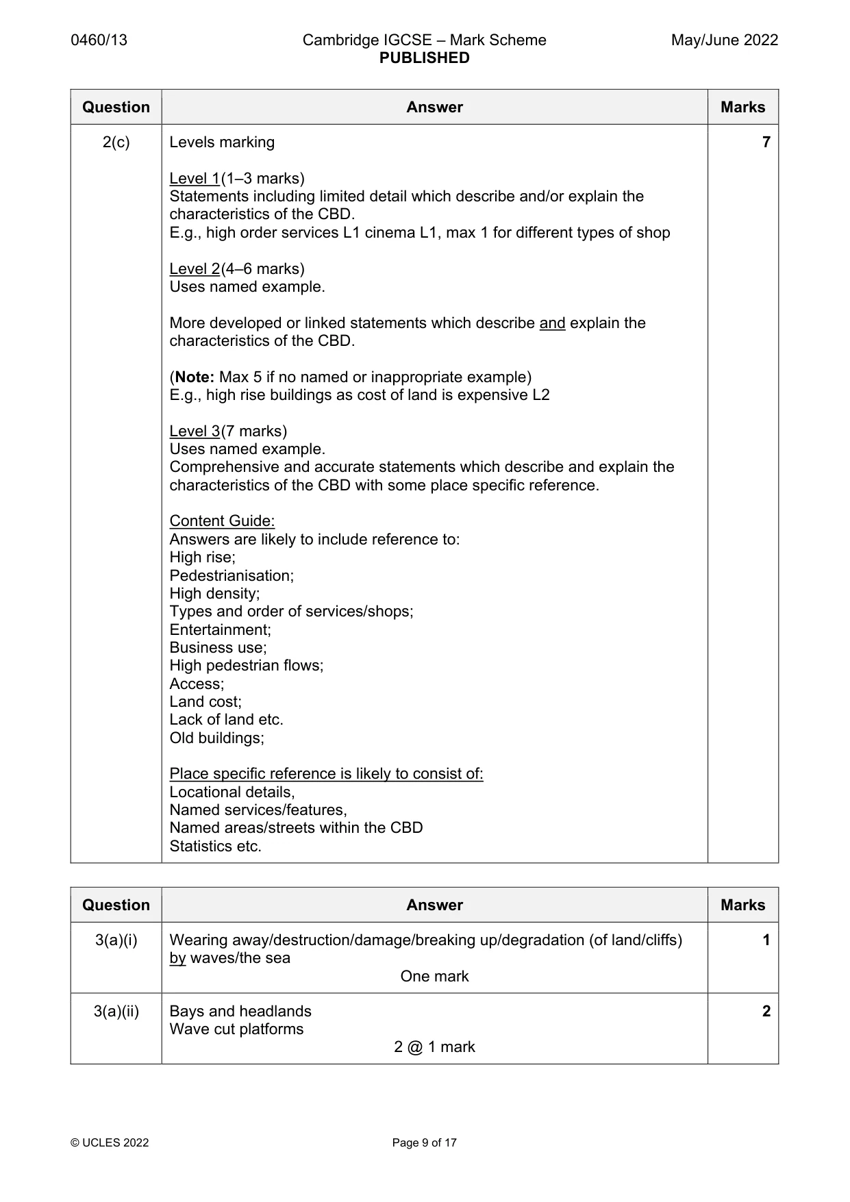
0460/13 Cambridge IGCSE – Mark Scheme PUBLISHED May/June 2022 © UCLES 2022 Page 9 of 17 Question Answer Marks 2(c) Levels marking Level 1 (1–3 marks) Statements including limited detail which describe and/or explain the characteristics of the CBD. E.g., high order services L1 cinema L1, max 1 for different types of shop Level 2 (4–6 marks) Uses named example. More developed or linked statements which describe and explain the characteristics of the CBD. (Note: Max 5 if no named or inappropriate example) E.g., high rise buildings as cost of land is expensive L2 Level 3 (7 marks) Uses named example. Comprehensive and accurate statements which describe and explain the characteristics of the CBD with some place specific reference. Content Guide: Answers are likely to include reference to: High rise; Pedestrianisation; High density; Types and order of services/shops; Entertainment; Business use; High pedestrian flows; Access; Land cost; Lack of land etc. Old buildings; Place specific reference is likely to consist of: Locational details, Named services/features, Named areas/streets within the CBD Statistics etc. 7 Question Answer Marks 3(a)(i) Wearing away/destruction/damage/breaking up/degradation (of land/cliffs) by waves/the sea One mark 1 3(a)(ii) Bays and headlands Wave cut platforms 2 @ 1 mark 2
Mark scheme, page 10
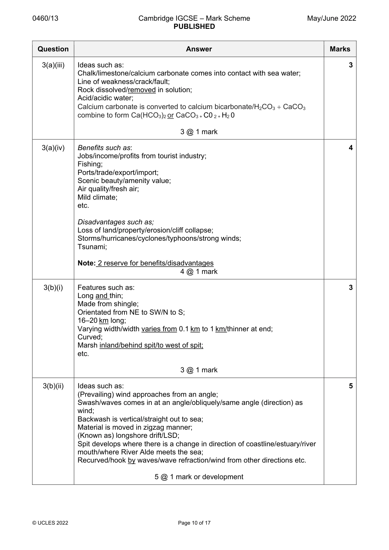
0460/13 Cambridge IGCSE – Mark Scheme PUBLISHED May/June 2022 © UCLES 2022 Page 10 of 17 Question Answer Marks 3(a)(iii) Ideas such as: Chalk/limestone/calcium carbonate comes into contact with sea water; Line of weakness/crack/fault; Rock dissolved/removed in solution; Acid/acidic water; Calcium carbonate is converted to calcium bicarbonate/H2CO3 CaCO3 combine to form Ca(HCO3)2 or CaCO3 + C0 2 + H2 0 3 @ 1 mark 3 3(a)(iv) Benefits such as: Jobs/income/profits from tourist industry; Fishing; Ports/trade/export/import; Scenic beauty/amenity value; Air quality/fresh air; Mild climate; etc. Disadvantages such as; Loss of land/property/erosion/cliff collapse; Storms/hurricanes/cyclones/typhoons/strong winds; Tsunami; Note: 2 reserve for benefits/disadvantages 4 @ 1 mark 4 3(b)(i) Features such as: Long and thin; Made from shingle; Orientated from NE to SW/N to S; 16–20 km long; Varying width/width varies from 0.1 km to 1 km/thinner at end; Curved; Marsh inland/behind spit/to west of spit; etc. 3 @ 1 mark 3 3(b)(ii) Ideas such as: (Prevailing) wind approaches from an angle; Swash/waves comes in at an angle/obliquely/same angle (direction) as wind; Backwash is vertical/straight out to sea; Material is moved in zigzag manner; (Known as) longshore drift/LSD; Spit develops where there is a change in direction of coastline/estuary/river mouth/where River Alde meets the sea; Recurved/hook by waves/wave refraction/wind from other directions etc. 5 @ 1 mark or development 5
Mark scheme, page 11
0460/13 Cambridge IGCSE – Mark Scheme PUBLISHED May/June 2022 © UCLES 2022 Page 11 of 17 Question Answer Marks 3(c) Levels marking Level 1 (1–3 marks) Statements including limited detail which state how the impacts of natural hazards are being managed on the coast. E.g., Groyne L1 Stop longshore drift = 0 Level 2 (4–6 marks) Uses named example. More developed or linked statements which describe how the impacts of natural hazards are being managed on the coast. E.g., Groynes stop longshore drift L2 Sea wall reduces power of waves L2 (Note: Max 5 if no named or inappropriate example) Level 3 (7 marks) Comprehensive and accurate statements including some place specific reference. Content Guide: Answers are likely to refer to: Hard and soft engineering methods of managing erosion; E.g. groynes/sea walls/revetments,/beach nourishment; Sea defences to manage flooding; Managed retreat; Provision of cyclone shelters; Tsunami warning systems; Education re emergency evacuation procedures etc. Place specific reference is likely to consist of: Locational details; Named places along coast; Specific details of management strategies; Statistics etc. 7 Question Answer Marks 4(a)(i) Source One mark 1 4(a)(ii) On map Note: No need to use arrow but must be clear where on the map the feature is, if using/not using arrow. 2 @ 1 mark 2
Mark scheme, page 12
0460/13 Cambridge IGCSE – Mark Scheme PUBLISHED May/June 2022 © UCLES 2022 Page 12 of 17 Question Answer Marks 4(a)(iii) Abrasion Bed/banks worn away by the rocks (material) the river is carrying/load/rocks (material) carried by water scrape along/hit bed/banks/sandpaper action of rocks carried by water/load; Attrition Rocks carried by the water/load hit each other/are reduced in size/break apart; Hydraulic action Weight/pressure/force of water dislodges unconsolidated/loose materials/wears away bed/banks or air is compressed by water in cracks in the rocks; 3 @ 1 mark 3 4(a)(iv) Two marks for showing correct general shape, one per diagram. Note: Must be of valley and not river channel. Two marks for labelling, such as: A is V shaped/steep/interlocking spurs/narrow valley; B Floodplain/levee/wide valley/flat/gentle slope/open V; 2 2 marks 4 @ 1 mark 4 4(b)(i) Ideas such as: Steep/vertical/gorge/steep valley; White water/ fast flowing/turbulent; Overhang; Divided by rocks/boulders; Plunge pool etc. 3 @ 1 mark 3 4(b)(ii) Ideas such as: Erosion of soft rock/undercutting; By hydraulic action/abrasion; Plunge pool gets deeper; As it will be unsupported/cannot hold the weight; Collapse/fall of overhang/hard rock layer; Retreat of waterfall; Formation of gorge etc. 5 @ 1 mark or development 5
Mark scheme, page 13
0460/13 Cambridge IGCSE – Mark Scheme PUBLISHED May/June 2022 © UCLES 2022 Page 13 of 17 Question Answer Marks 4(c) Levels marking Level 1 (1–3 marks) Statements including limited detail which explain causes of flooding. Level 2 (4–6 marks) Uses named example. More developed or linked statements which explain causes of flooding. Level 3 (7 marks) Comprehensive and accurate statements which explain causes of flooding, including place specific information. Content Guide: Answers are likely to refer to: Heavy rain/storms; Rain for a long period of time; Melting snow/ice; Deforestation; Urban growth/building houses/road building; Lack of maintenance of flooding control measures e.g., dredging; Impermeable rock; Steep slopes; Melting snow; Dam collapse; etc. Note: Causes not impacts of flooding Place specific reference is likely to consist of: Locational details/dates/times; Places along river; Specific details/amounts of precipitation etc. Statistics; 7 Question Answer Marks 5(a)(i) Commercial farm produces for sale/profit but subsistence farms produce food (mainly) for consumption by farmer/family/tribe etc. One mark 1 5(a)(ii) Sow cotton = April Harvest millet = October/November 2 @ 1 mark 2
Mark scheme, page 14
0460/13 Cambridge IGCSE – Mark Scheme PUBLISHED May/June 2022 © UCLES 2022 Page 14 of 17 Question Answer Marks 5(a)(iii) Inputs: labour, tractors Processes: ploughing, harvesting Outputs: rice, sugar cane 3 marks if all 6 are correct 2 marks if 4 or 5 are correct 1 mark if 1, 2 or 3 are correct 3 5(a)(iv) Ideas such as: Rice is growing between end of June–September or July–September; Wheat is growing between November to February; Rice needs large amounts of rainfall/100–200 mm (any figure within this range)/over 100 mm /fields to be flooded when growing; Wheat needs dry conditions for growth/under 40 mm/15–40 mm 32 °C (any figure within this range); Rice grows in warmer/high(er) temperatures/over 27 °C/27 to 32 °C (any figure within this range); Wheat requires low(er)/cold(er) temperatures/under 18 °C/12–18 °C (any figure within this range); 4 @ 1 mark 4 5(b)(i) Ideas such as: Gulleys formed in fields; Animals fall into gulleys/cannot graze in gulleys; Soil removed/washed away/lost/blown away; Crops/seeds/grass/pasture lost/eroded/less pasture/animals cannot graze; Land is not fertile/fertility of land reduced/reduces soil quality/minerals/nutrients removed; Crops can’t grow/lower yields obtained/less food produced to eat/less profit etc. 3 @ 1 mark 3 5(b)(ii) Methods such as: Do not leave land fallow/plant a cover crop; Mulching; Strip cropping; Use erosion control blankets/woodchips; Improve draining/divert surface water away from vulnerable slopes; Limit size of herds; Plant trees/afforestation/shelter belts, Contour ploughing; Terracing; Build retaining walls; Irrigation; Education about agricultural techniques; Reduce deforestation/use branches for fuel/renewable energy not trees etc. Reduce overgrazing/overcultivation; 5 @ 1 mark or development 5
Mark scheme, page 15
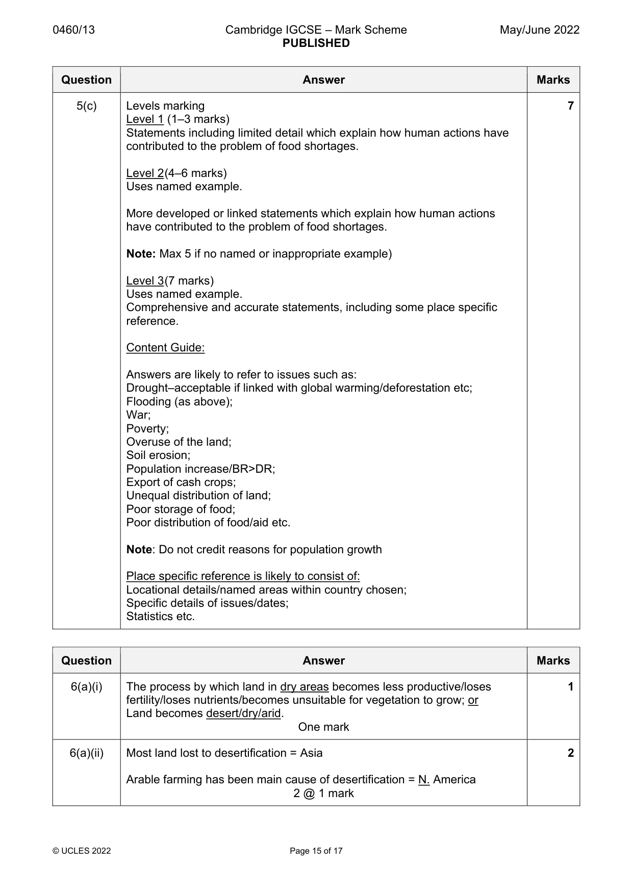
0460/13 Cambridge IGCSE – Mark Scheme PUBLISHED May/June 2022 © UCLES 2022 Page 15 of 17 Question Answer Marks 5(c) Levels marking Level 1 (1–3 marks) Statements including limited detail which explain how human actions have contributed to the problem of food shortages. Level 2 (4–6 marks) Uses named example. More developed or linked statements which explain how human actions have contributed to the problem of food shortages. Note: Max 5 if no named or inappropriate example) Level 3 (7 marks) Uses named example. Comprehensive and accurate statements, including some place specific reference. Content Guide: Answers are likely to refer to issues such as: Drought–acceptable if linked with global warming/deforestation etc; Flooding (as above); War; Poverty; Overuse of the land; Soil erosion; Population increase/BR>DR; Export of cash crops; Unequal distribution of land; Poor storage of food; Poor distribution of food/aid etc. Note: Do not credit reasons for population growth Place specific reference is likely to consist of: Locational details/named areas within country chosen; Specific details of issues/dates; Statistics etc. 7 Question Answer Marks 6(a)(i) The process by which land in dry areas becomes less productive/loses fertility/loses nutrients/becomes unsuitable for vegetation to grow; or Land becomes desert/dry/arid. One mark 1 6(a)(ii) Most land lost to desertification = Asia Arable farming has been main cause of desertification = N. America 2 @ 1 mark 2
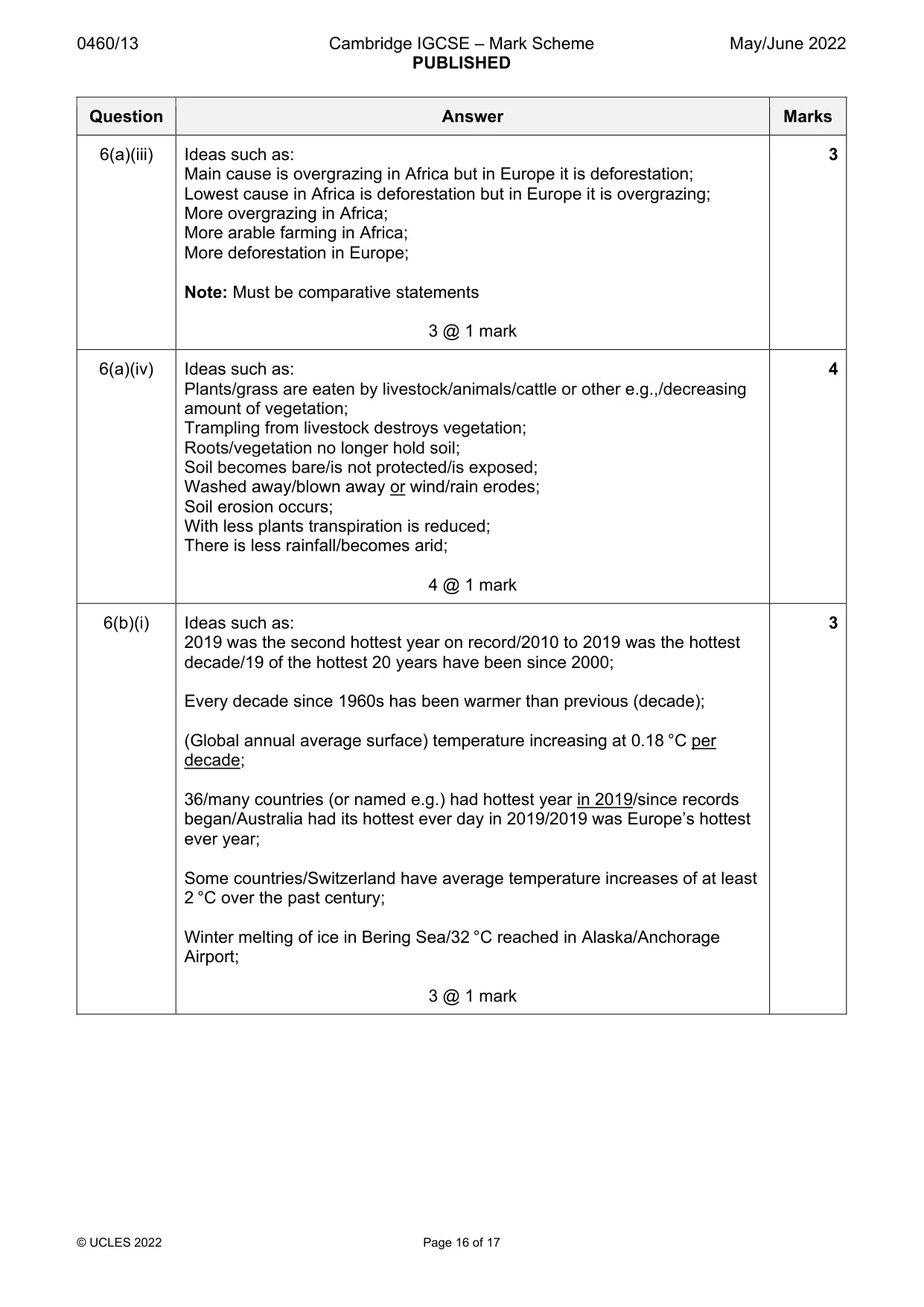
Mark scheme, page 16
0460/13 Cambridge IGCSE – Mark Scheme PUBLISHED May/June 2022 © UCLES 2022 Page 16 of 17 Question Answer Marks 6(a)(iii) Ideas such as: Main cause is overgrazing in Africa but in Europe it is deforestation; Lowest cause in Africa is deforestation but in Europe it is overgrazing; More overgrazing in Africa; More arable farming in Africa; More deforestation in Europe; Note: Must be comparative statements 3 @ 1 mark 3 6(a)(iv) Ideas such as: Plants/grass are eaten by livestock/animals/cattle or other e.g.,/decreasing amount of vegetation; Trampling from livestock destroys vegetation; Roots/vegetation no longer hold soil; Soil becomes bare/is not protected/is exposed; Washed away/blown away or wind/rain erodes; Soil erosion occurs; With less plants transpiration is reduced; There is less rainfall/becomes arid; 4 @ 1 mark 4 6(b)(i) Ideas such as: 2019 was the second hottest year on record/2010 to 2019 was the hottest decade/19 of the hottest 20 years have been since 2000; Every decade since 1960s has been warmer than previous (decade); (Global annual average surface) temperature increasing at 0.18 °C per decade; 36/many countries (or named e.g.) had hottest year in 2019/since records began/Australia had its hottest ever day in 2019/2019 was Europe’s hottest ever year; Some countries/Switzerland have average temperature increases of at least 2 °C over the past century; Winter melting of ice in Bering Sea/32 °C reached in Alaska/Anchorage Airport; 3 @ 1 mark 3
Mark scheme, page 17
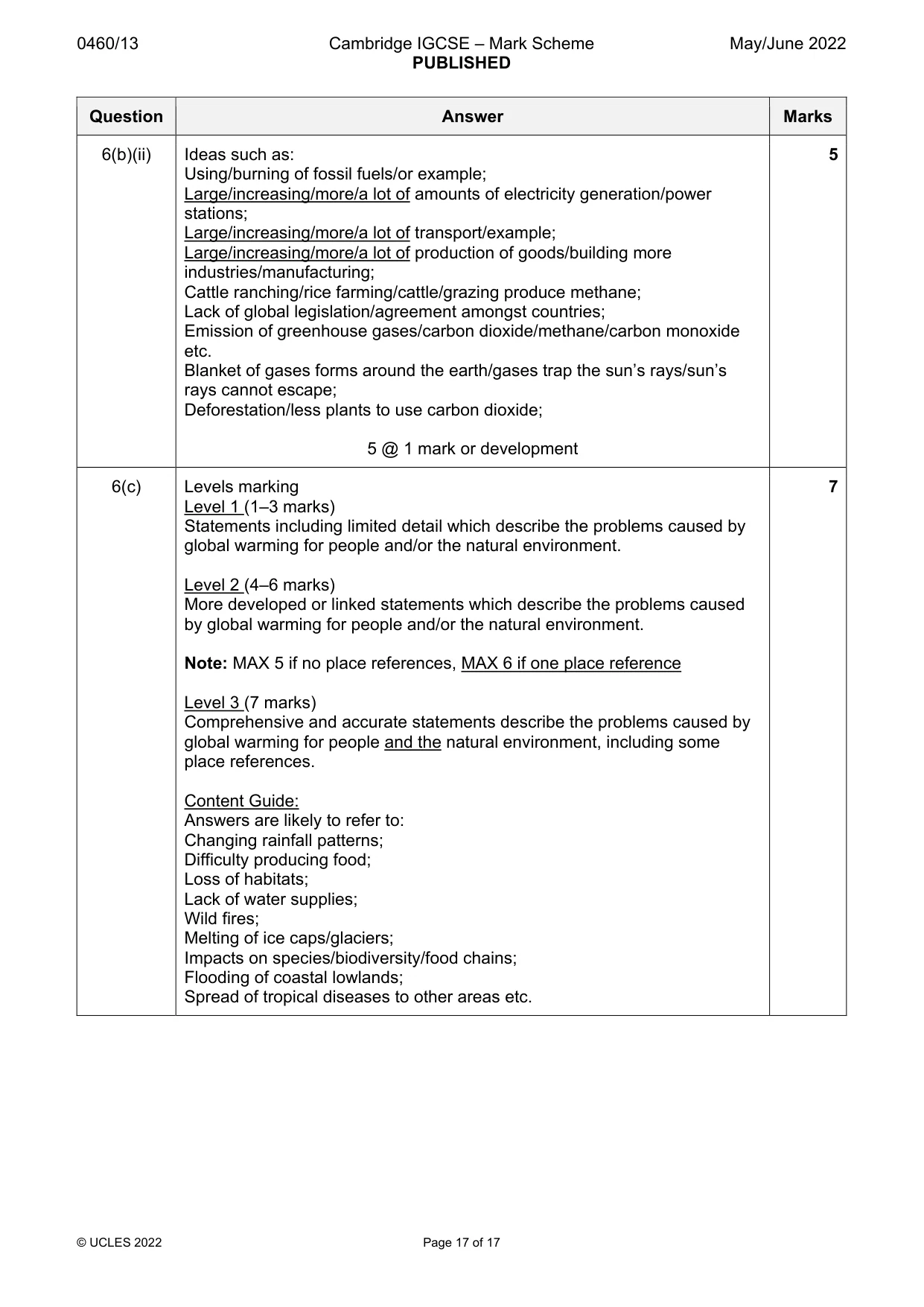
0460/13 Cambridge IGCSE – Mark Scheme PUBLISHED May/June 2022 © UCLES 2022 Page 17 of 17 Question Answer Marks 6(b)(ii) Ideas such as: Using/burning of fossil fuels/or example; Large/increasing/more/a lot of amounts of electricity generation/power stations; Large/increasing/more/a lot of transport/example; Large/increasing/more/a lot of production of goods/building more industries/manufacturing; Cattle ranching/rice farming/cattle/grazing produce methane; Lack of global legislation/agreement amongst countries; Emission of greenhouse gases/carbon dioxide/methane/carbon monoxide etc. Blanket of gases forms around the earth/gases trap the sun’s rays/sun’s rays cannot escape; Deforestation/less plants to use carbon dioxide; 5 @ 1 mark or development 5 6(c) Levels marking Level 1 (1–3 marks) Statements including limited detail which describe the problems caused by global warming for people and/or the natural environment. Level 2 (4–6 marks) More developed or linked statements which describe the problems caused by global warming for people and/or the natural environment. Note: MAX 5 if no place references, MAX 6 if one place reference Level 3 (7 marks) Comprehensive and accurate statements describe the problems caused by global warming for people and the natural environment, including some place references. Content Guide: Answers are likely to refer to: Changing rainfall patterns; Difficulty producing food; Loss of habitats; Lack of water supplies; Wild fires; Melting of ice caps/glaciers; Impacts on species/biodiversity/food chains; Flooding of coastal lowlands; Spread of tropical diseases to other areas etc. 7
What you needed in this session
Cambridge’s own grade thresholds for 2022 May/June, Paper 1 · Variant 3. A higher threshold means an easier paper — the bar moves with how the cohort did.