Cambridge IGCSE Geography 0460 — 2019 May/June Paper 1 · Variant 2
0460/12/M/J/19 · 75 marks · ≈84 min
The question paper and its mark scheme, free to read here and free to download. This is Cambridge’s own paper, exactly as it was sat.
Question paper28 pages


Mark scheme21 pages
Answers below. Sit the paper first if you are practising.
Paper as text
Question paper, page 1
This document consists of 27 printed pages, 1 blank page and 1 Insert. DC (NH/TP) 162373/4 © UCLES 2019 [Turn over Cambridge Assessment International Education Cambridge International General Certificate of Secondary Education * 6 7 4 6 3 6 3 4 2 0 * GEOGRAPHY 0460/12 Paper 1 May/June 2019 1 hour 45 minutes Candidates answer on the Question Paper. Additional Materials: Ruler Calculator READ THESE INSTRUCTIONS FIRST Write your centre number, candidate number and name in the spaces provided. Write in dark blue or black pen. You may use an HB pencil for any diagrams or graphs. Do not use staples, paper clips, glue or correction fluid. DO NOT WRITE IN ANY BARCODES. Write your answer to each question in the space provided. If additional space is required, you should use the lined pages at the end of this booklet. The question number(s) must be clearly shown. Answer three questions, one from each section. The Insert contains Figs. 3.1 and 3.2 for Question 3, Fig. 4.1 for Question 4, Figs. 5.2 and 5.3 for Question 5, and Fig. 6.1 for Question 6. The Insert is not required by the Examiner. Sketch maps and diagrams should be drawn whenever they serve to illustrate an answer. At the end of the examination, fasten all your work securely together. The number of marks is given in brackets [ ] at the end of each question or part question. Definitions MEDCs – More Economically Developed Countries LEDCs – Less Economically Developed Countries This syllabus is regulated for use in England, Wales and Northern Ireland as a Cambridge International Level 1/Level 2 Certificate.
Question paper, page 2
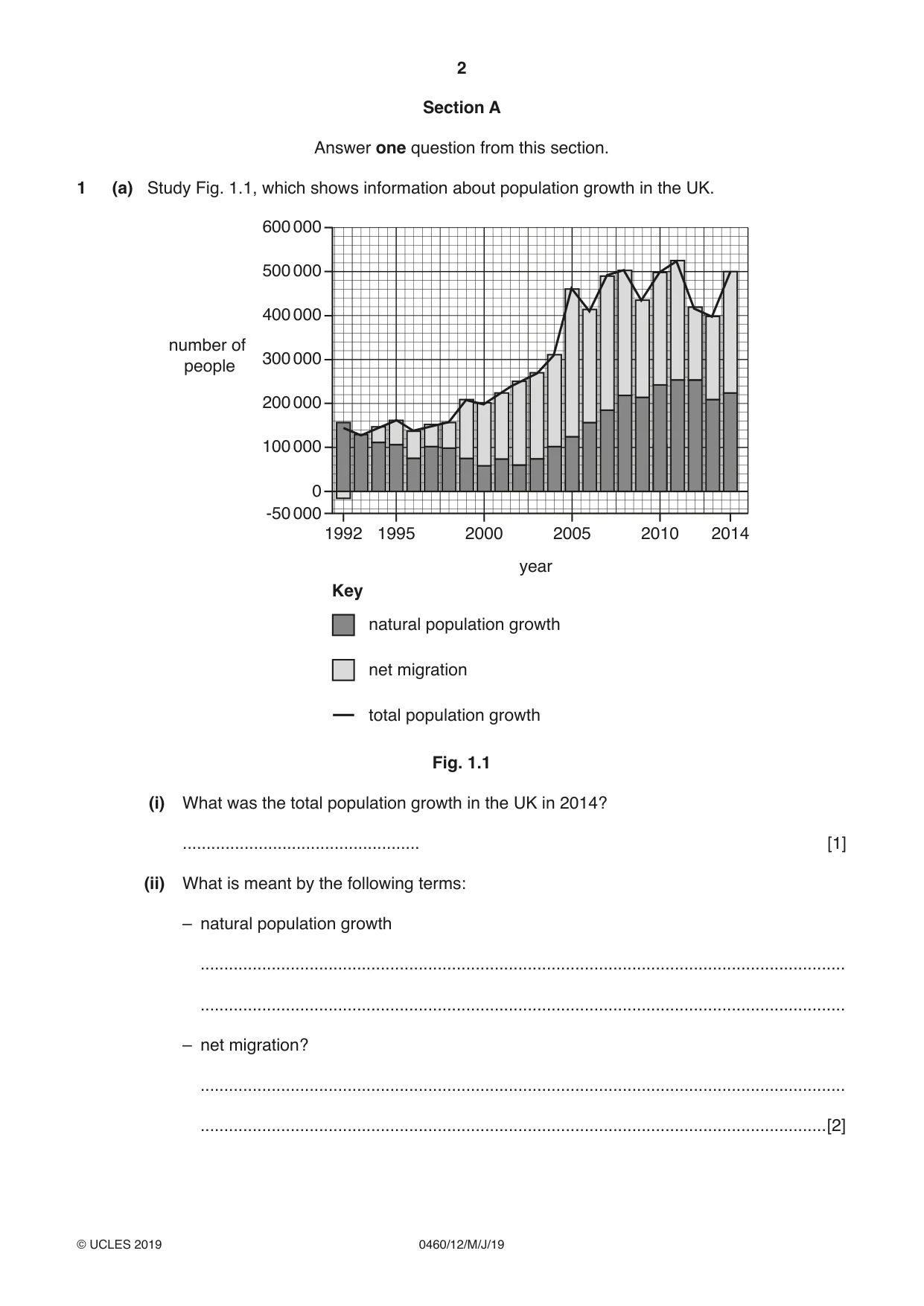
2 0460/12/M/J/19 © UCLES 2019 Section A Answer one question from this section. 1 (a) Study Fig. 1.1, which shows information about population growth in the UK. 1992 2000 1995 2010 2005 2014 0 100 000 200 000 300 000 400 000 500 000 600 000 -50 000 number of people natural population growth net migration total population growth Key year Fig. 1.1 (i) What was the total population growth in the UK in 2014? … [1] (ii) What is meant by the following terms: – natural population growth … … – net migration? … …[2]
Question paper, page 3
3 0460/12/M/J/19 © UCLES 2019 [Turn over (iii) Identify from Fig. 1.1 a year when: – net migration was greater than natural population growth … – there were more emigrants than immigrants … – the largest total population growth occurred. … [3] (iv) Explain why there are low rates of natural population growth in MEDCs such as the UK. … … … … … … … …[4]
Question paper, page 4
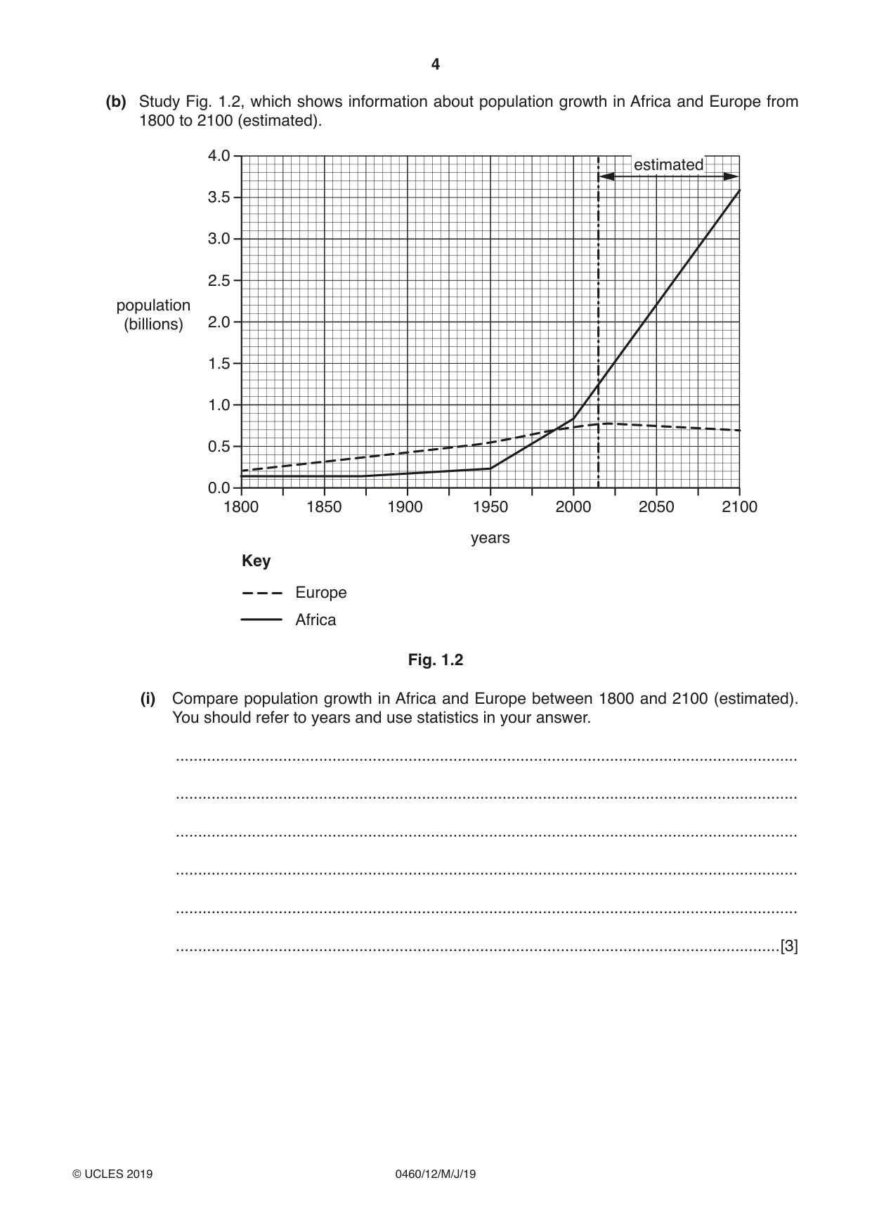
4 0460/12/M/J/19 © UCLES 2019 (b) Study Fig. 1.2, which shows information about population growth in Africa and Europe from 1800 to 2100 (estimated). 1900 1950 2000 2050 2100 1850 1800 years 4.0 3.5 3.0 2.5 2.0 1.5 1.0 0.5 0.0 population (billions) estimated Europe Africa Key Fig. 1.2 (i) Compare population growth in Africa and Europe between 1800 and 2100 (estimated). You should refer to years and use statistics in your answer. … … … … … …[3]
Question paper, page 5
5 0460/12/M/J/19 © UCLES 2019 [Turn over (ii) Suggest problems which are likely to occur in Africa as a result of its population growth. … … … … … … … … … …[5]
Question paper, page 6
6 0460/12/M/J/19 © UCLES 2019 (c) For a named country you have studied, describe a population policy which has been used to influence its population growth. Comment on how successful this policy was. Name of country … … … … … … … … … … … … … … … … … … … … … … … … … …[7] [Total: 25]
Question paper, page 7
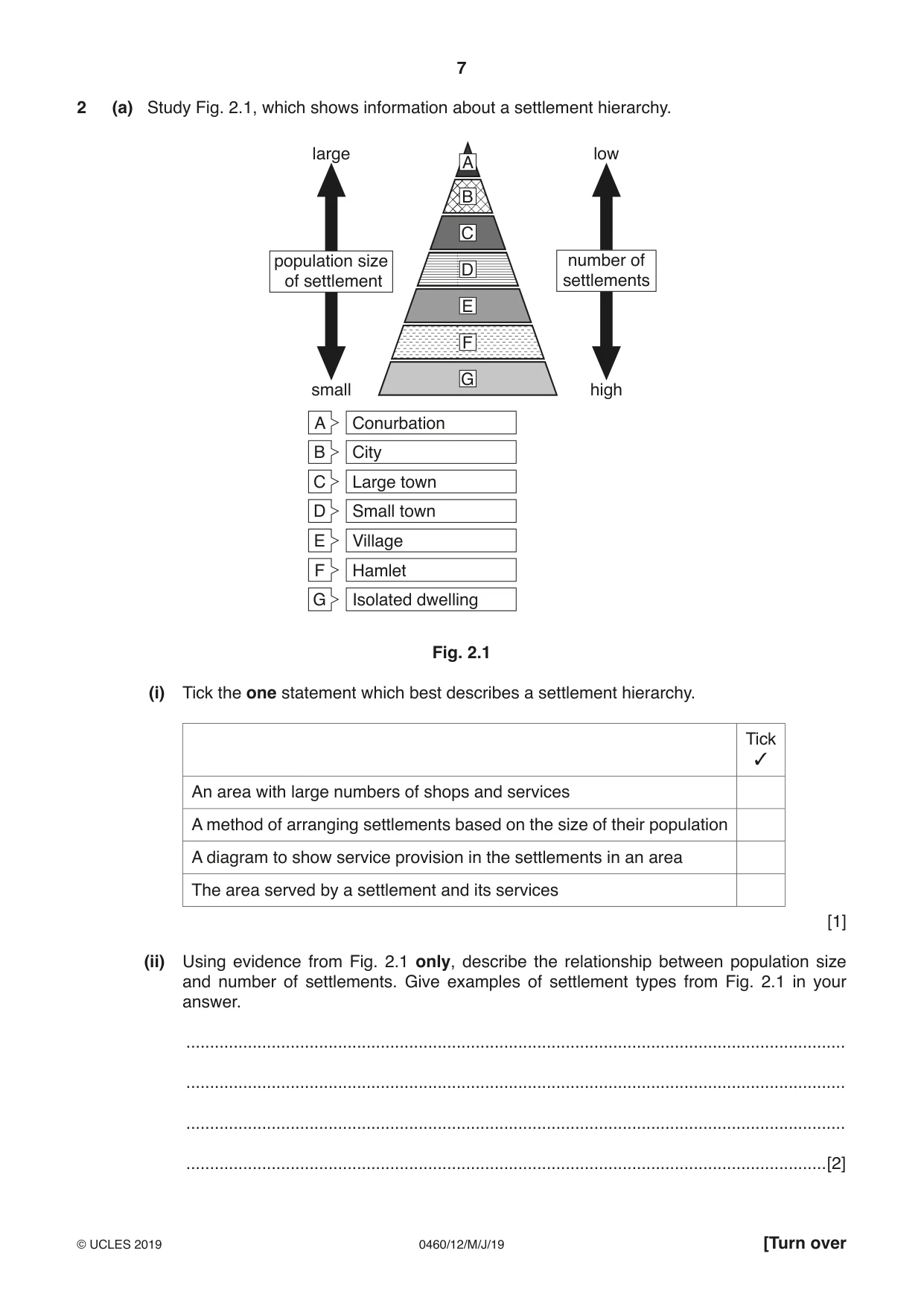
7 0460/12/M/J/19 © UCLES 2019 [Turn over 2 (a) Study Fig. 2.1, which shows information about a settlement hierarchy. A A B C D E F G high number of settlements small large Conurbation B City C Large town D Small town E Village F Hamlet G Isolated dwelling low population size of settlement Fig. 2.1 (i) Tick the one statement which best describes a settlement hierarchy. Tick 3 An area with large numbers of shops and services A method of arranging settlements based on the size of their population A diagram to show service provision in the settlements in an area The area served by a settlement and its services [1] (ii) Using evidence from Fig. 2.1 only, describe the relationship between population size and number of settlements. Give examples of settlement types from Fig. 2.1 in your answer. … … … …[2]
Question paper, page 8
8 0460/12/M/J/19 © UCLES 2019 (iii) Give three examples of high order services which are likely to be located in large cities, such as capital cities. 1 … 2 … 3 …[3] (iv) Explain why large cities, such as capital cities, have many high order services. … … … … … … … …[4]
Question paper, page 9
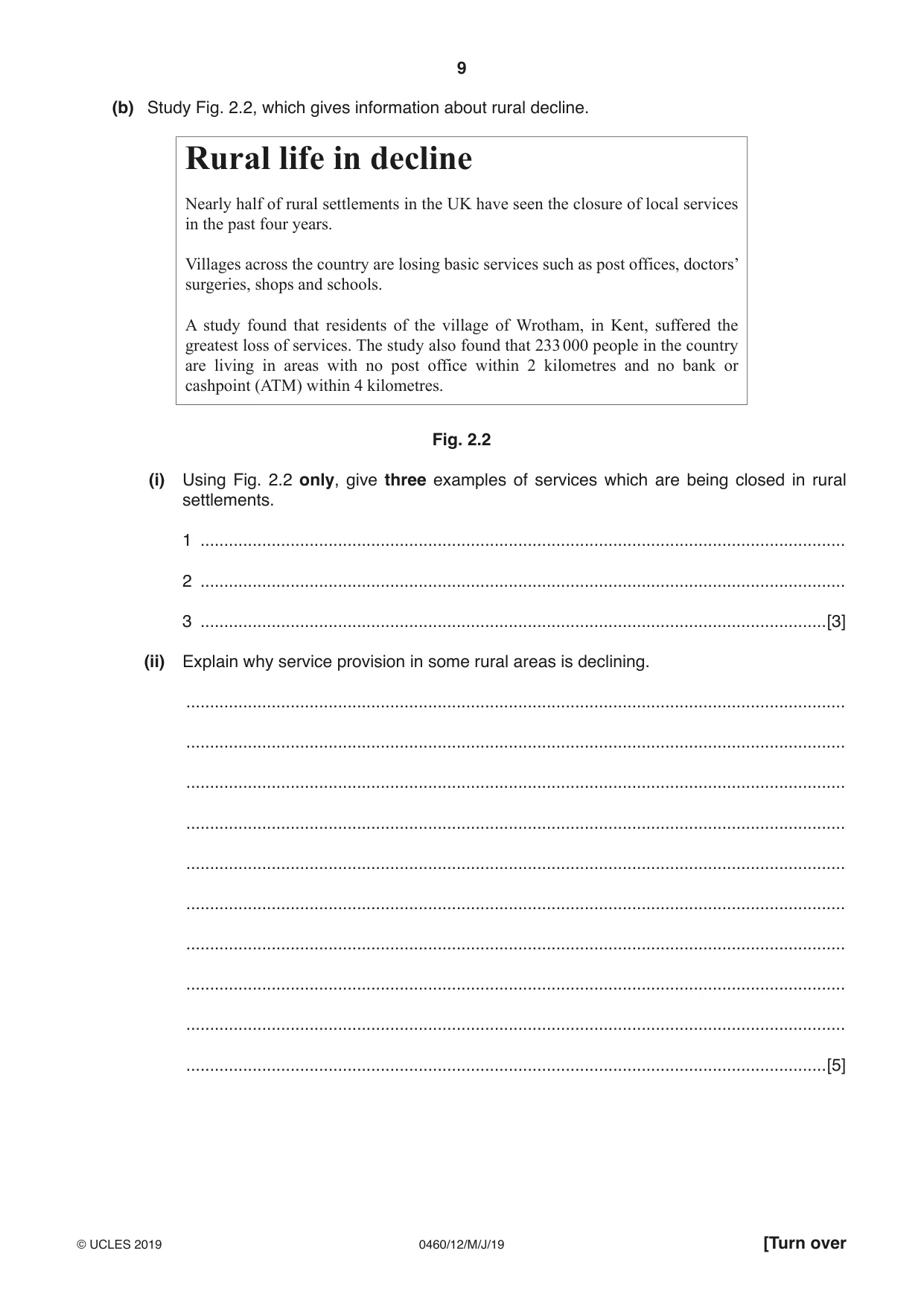
9 0460/12/M/J/19 © UCLES 2019 [Turn over (b) Study Fig. 2.2, which gives information about rural decline. Rural life in decline Nearly half of rural settlements in the UK have seen the closure of local services in the past four years. Villages across the country are losing basic services such as post offices, doctors’ surgeries, shops and schools. A study found that residents of the village of Wrotham, in Kent, suffered the greatest loss of services. The study also found that 233 000 people in the country are living in areas with no post office within 2 kilometres and no bank or cashpoint (ATM) within 4 kilometres. Fig. 2.2 (i) Using Fig. 2.2 only, give three examples of services which are being closed in rural settlements. 1 … 2 … 3 …[3] (ii) Explain why service provision in some rural areas is declining. … … … … … … … … … …[5]
Question paper, page 10
10 0460/12/M/J/19 © UCLES 2019 (c) Name a settlement you have studied. Describe and explain its functions. Name of settlement … … … … … … … … … … … … … … … … … … … … … … … … … …[7] [Total: 25]
Question paper, page 11
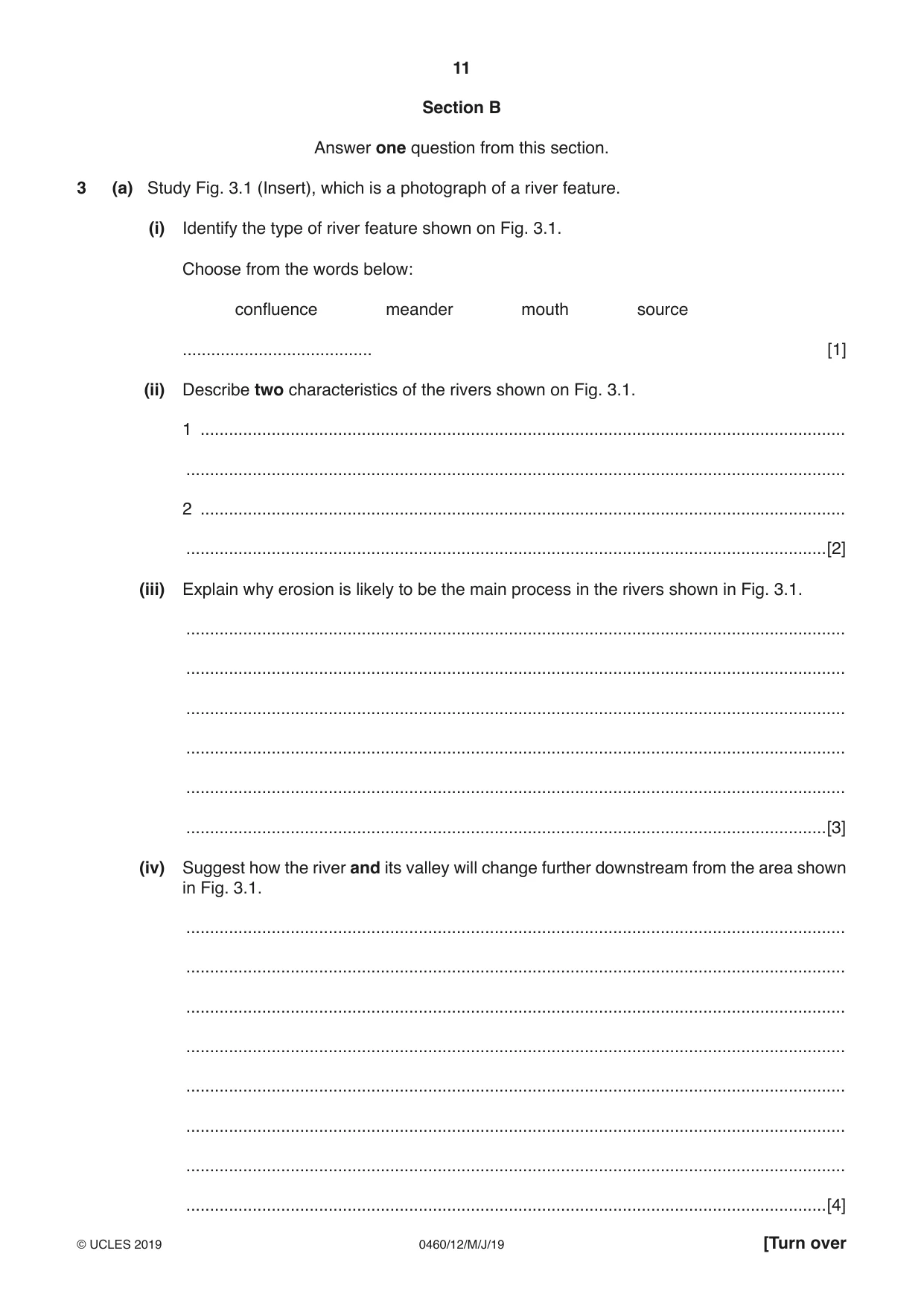
11 0460/12/M/J/19 © UCLES 2019 [Turn over Section B Answer one question from this section. 3 (a) Study Fig. 3.1 (Insert), which is a photograph of a river feature. (i) Identify the type of river feature shown on Fig. 3.1. Choose from the words below: confluence meander mouth source … [1] (ii) Describe two characteristics of the rivers shown on Fig. 3.1. 1 … … 2 … …[2] (iii) Explain why erosion is likely to be the main process in the rivers shown in Fig. 3.1. … … … … … …[3] (iv) Suggest how the river and its valley will change further downstream from the area shown in Fig. 3.1. … … … … … … … …[4]
Question paper, page 12
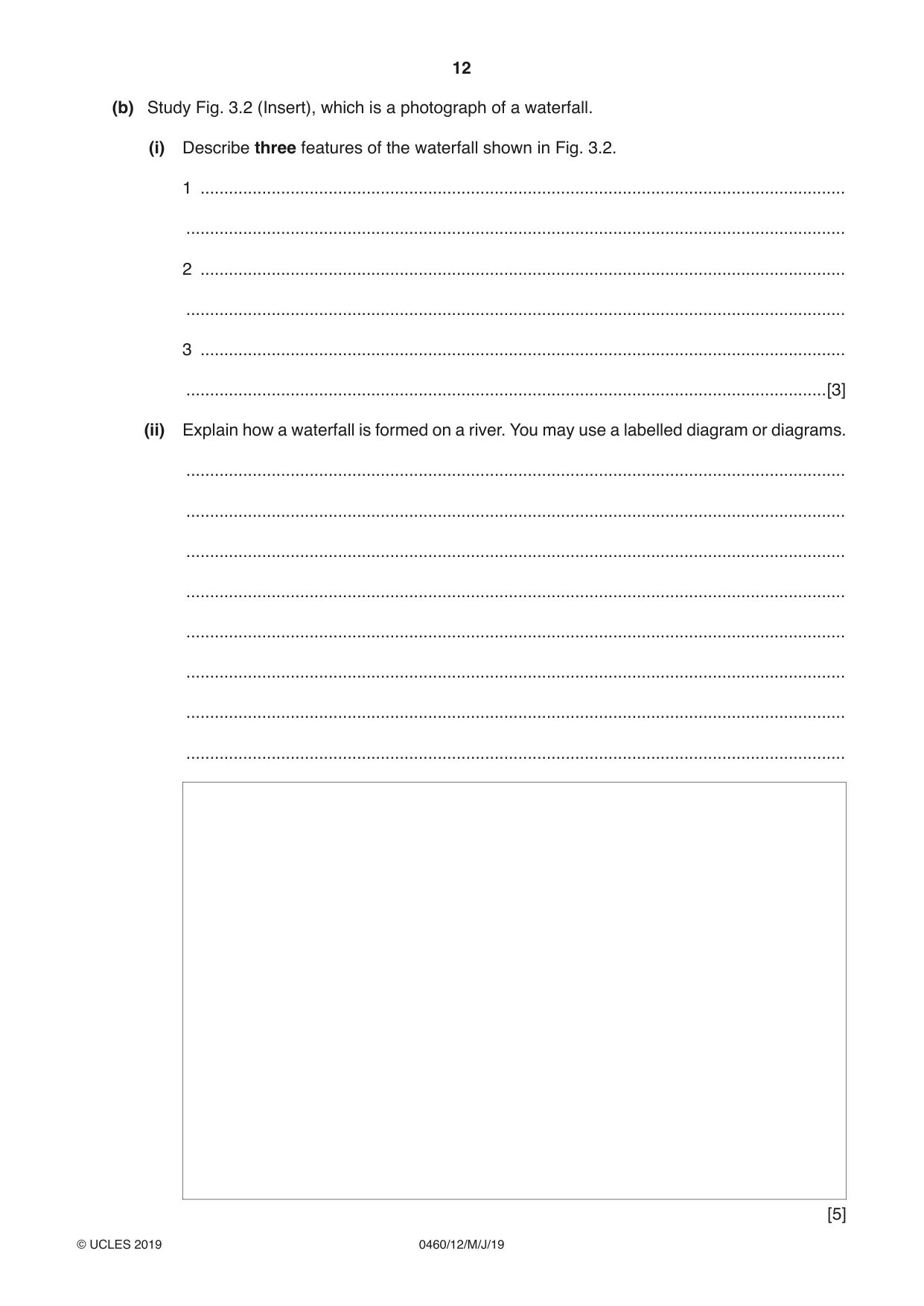
12 0460/12/M/J/19 © UCLES 2019 (b) Study Fig. 3.2 (Insert), which is a photograph of a waterfall. (i) Describe three features of the waterfall shown in Fig. 3.2. 1 … … 2 … … 3 … …[3] (ii) Explain how a waterfall is formed on a river. You may use a labelled diagram or diagrams. … … … … … … … … [5]
Question paper, page 13
13 0460/12/M/J/19 © UCLES 2019 [Turn over (c) For a named river you have studied, explain the causes of flooding. Named river … … … … … … … … … … … … … … … … … … … … … … … … … …[7] [Total: 25]
Question paper, page 14
14 0460/12/M/J/19 © UCLES 2019 4 (a) Study Fig. 4.1 (Insert), which is a map which shows the Pacific Ring of Fire. (i) Explain why the shaded area is known as the Pacific Ring of Fire. … …[1] (ii) Compare the location of Mauna Loa and Ruapehu volcanoes. … … … …[2] (iii) Explain why there are active volcanoes on converging plate boundaries. … … … … … …[3]
Question paper, page 15
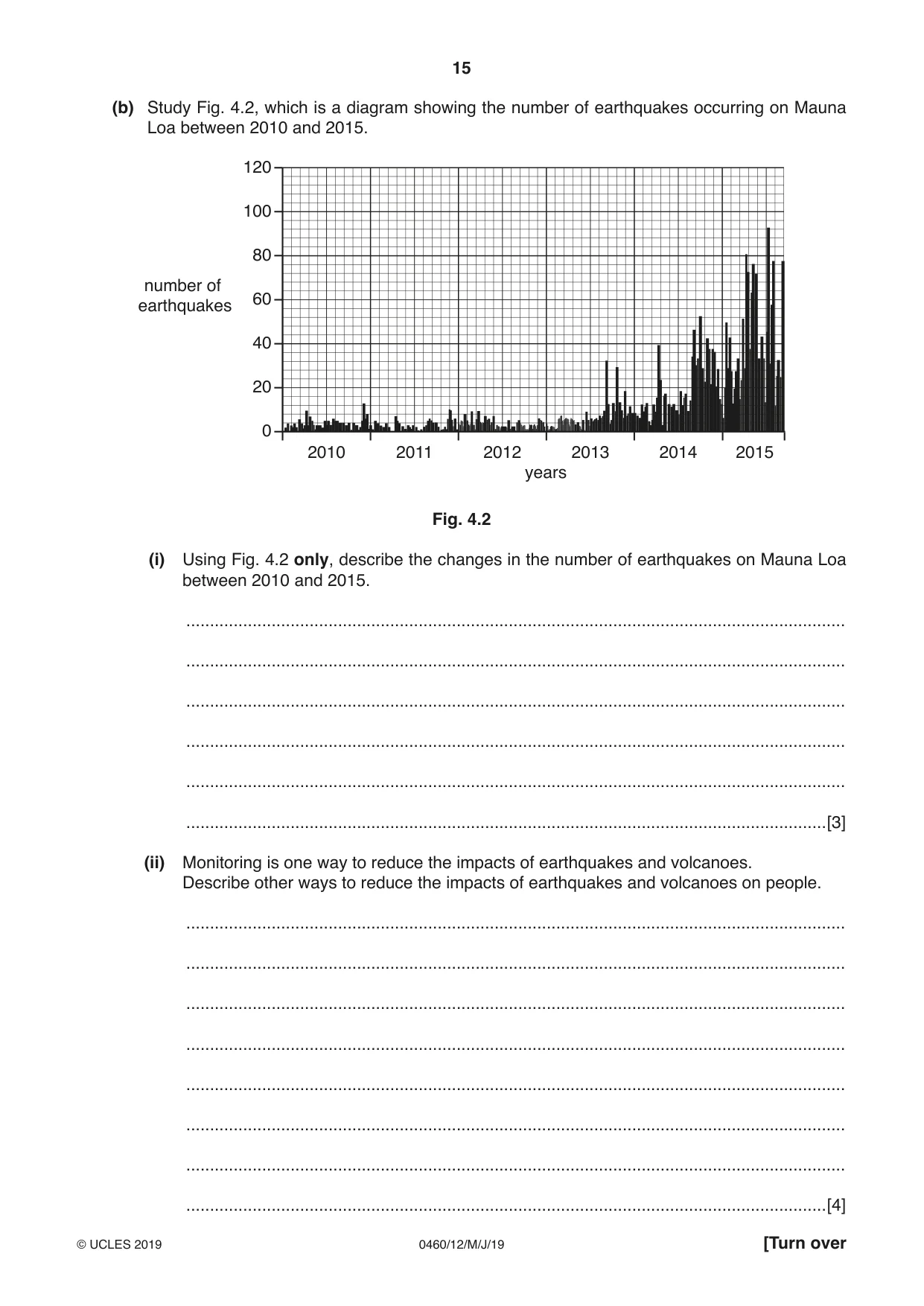
15 0460/12/M/J/19 © UCLES 2019 [Turn over (b) Study Fig. 4.2, which is a diagram showing the number of earthquakes occurring on Mauna Loa between 2010 and 2015. 120 100 80 60 40 20 0 number of earthquakes 2010 years 2011 2012 2013 2014 2015 Fig. 4.2 (i) Using Fig. 4.2 only, describe the changes in the number of earthquakes on Mauna Loa between 2010 and 2015. … … … … … …[3] (ii) Monitoring is one way to reduce the impacts of earthquakes and volcanoes. Describe other ways to reduce the impacts of earthquakes and volcanoes on people. … … … … … … … …[4]
Question paper, page 16
16 0460/12/M/J/19 © UCLES 2019 (iii) Explain why earthquakes and volcanoes cause more deaths and injuries in LEDCs than MEDCs. … … … … … … … … … …[5]
Question paper, page 17
17 0460/12/M/J/19 © UCLES 2019 [Turn over (c) For a named example you have studied, explain why people live close to an active volcano. Name of example … … … … … … … … … … … … … … … … … … … … … … … … … …[7] [Total: 25]
Question paper, page 18
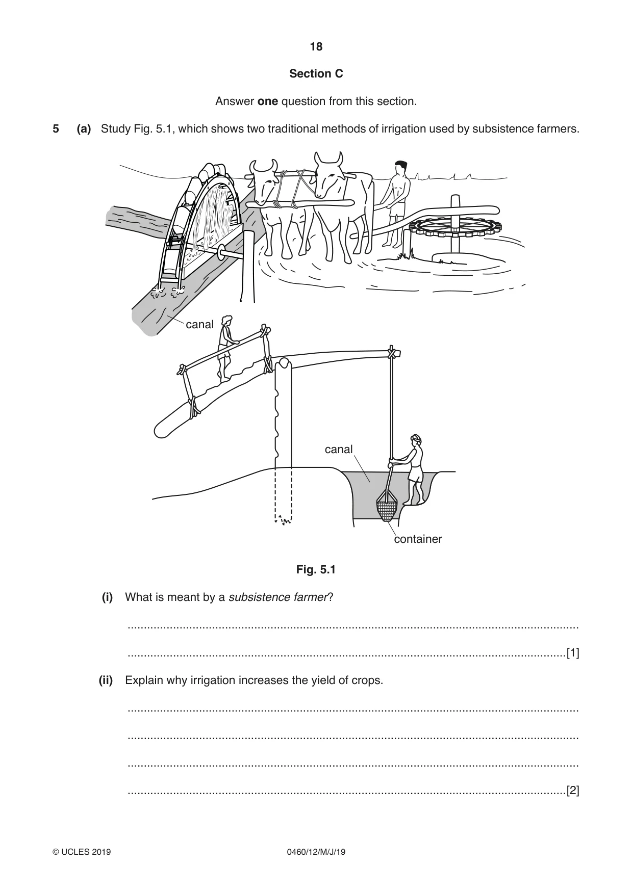
18 0460/12/M/J/19 © UCLES 2019 Section C Answer one question from this section. 5 (a) Study Fig. 5.1, which shows two traditional methods of irrigation used by subsistence farmers. canal canal container Fig. 5.1 (i) What is meant by a subsistence farmer? … …[1] (ii) Explain why irrigation increases the yield of crops. … … … …[2]
Question paper, page 19
19 0460/12/M/J/19 © UCLES 2019 [Turn over (iii) Explain why the methods of irrigation shown in Fig. 5.1 are suitable to use in LEDCs. … … … … … …[3] (iv) Describe four other methods which farmers can use to increase the yield of crops. 1 … … 2 … … 3 … … 4 … …[4]
Question paper, page 20
20 0460/12/M/J/19 © UCLES 2019 (b) Study Figs. 5.2 and 5.3 (Insert), which are photographs taken on a mixed farm. (i) State three processes which will take place on the mixed farm shown in Figs. 5.2 and 5.3. 1 … … 2 … … 3 … …[3] (ii) Describe the advantages of mixed farming. … … … … … … … … … …[5]
Question paper, page 21
21 0460/12/M/J/19 © UCLES 2019 [Turn over (c) For a named country or region you have studied, explain why there have been food shortages. Name of country or region … … … … … … … … … … … … … … … … … … … … … … … … … …[7] [Total: 25]
Question paper, page 22
22 0460/12/M/J/19 © UCLES 2019 6 (a) Study Fig. 6.1 (Insert), which shows information about sources of electricity in Mexico (an LEDC). (i) State the number of nuclear power stations in Mexico. … [1] (ii) Using Fig. 6.1 only, name one renewable and one non-renewable source of electricity in Mexico. – renewable … – non-renewable …[2] (iii) Compare the importance of different sources of electricity in the states of Sonora and Sinaloa. … … … … … …[3] (iv) Suggest reasons why some parts of Mexico are able to generate large amounts of electricity from hydro-electric power (HEP). … … … … … … … … …[4]
Question paper, page 23
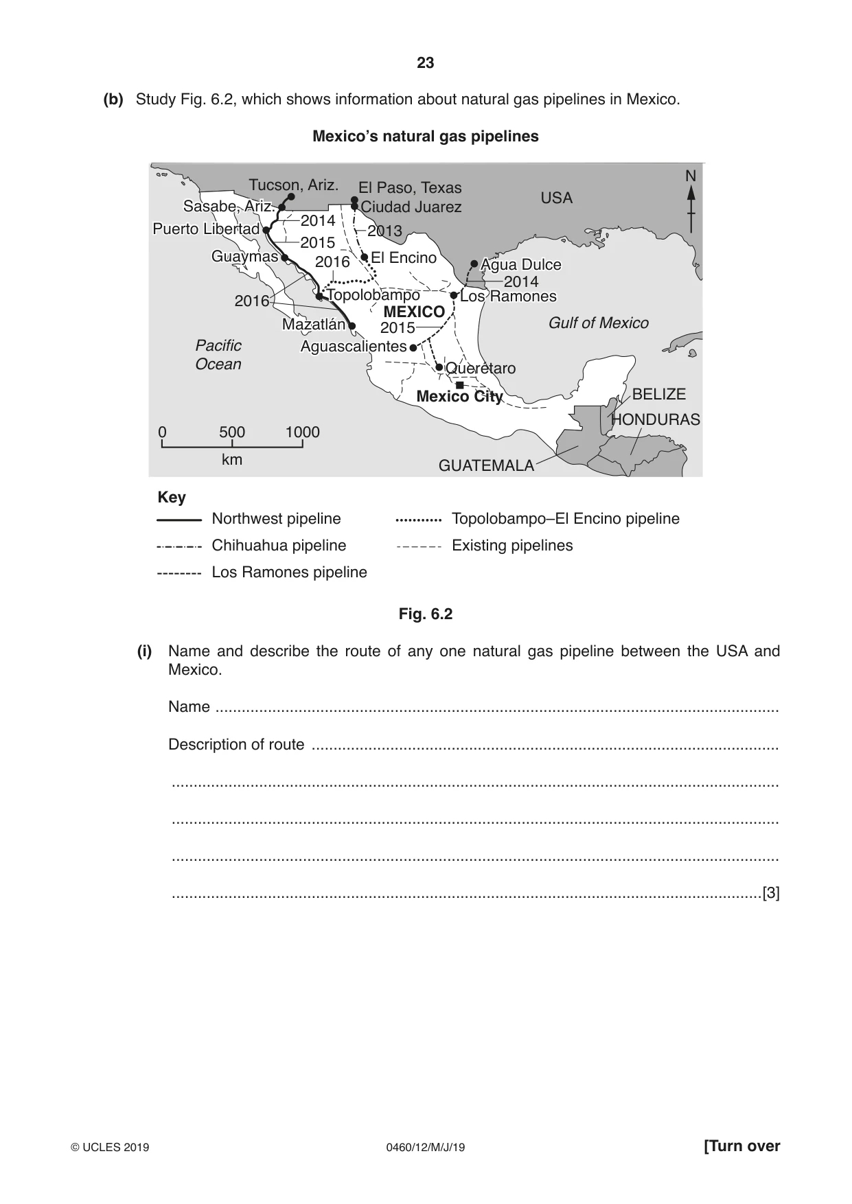
23 0460/12/M/J/19 © UCLES 2019 [Turn over (b) Study Fig. 6.2, which shows information about natural gas pipelines in Mexico. Mexico’s natural gas pipelines N Pacific Ocean Gulf of Mexico 0 500 km 1000 USA MEXICO BELIZE GUATEMALA HONDURAS Key Northwest pipeline Chihuahua pipeline Los Ramones pipeline Topolobampo–El Encino pipeline Existing pipelines El Encino Puerto Libertad Ciudad Juarez El Paso, Texas Sasabe, Ariz. Guaymas Mazatlán Aguascalientes Tucson, Ariz. Agua Dulce Los Ramones Querétaro Mexico City Topolobampo 2013 2016 2016 2015 2014 2014 2015 Fig. 6.2 (i) Name and describe the route of any one natural gas pipeline between the USA and Mexico. Name … Description of route … … … … …[3]
Question paper, page 24
24 0460/12/M/J/19 © UCLES 2019 (ii) Mexico imports large amounts of natural gas from the USA. Explain why relying on imports of natural gas could cause problems for Mexico. … … … … … … … … … …[5]
Question paper, page 25
25 0460/12/M/J/19 © UCLES 2019 (c) Name and state the location of a type of economic activity you have studied. Explain how the economic activity may cause the natural environment to be at risk. Type of economic activity … Location … How the economic activity may cause the natural environment to be at risk. … … … … … … … … … … … … … … … … … … … … … … …[7] [Total: 25]
Question paper, page 26
26 0460/12/M/J/19 © UCLES 2019 Additional Pages If you use the following lined pages to complete the answer(s) to any question(s), the question number(s) must be clearly shown. … … … … … … … … … … … … … … … … … … … … … … … … … …
Question paper, page 27
27 0460/12/M/J/19 © UCLES 2019 … … … … … … … … … … … … … … … … … … … … … … … … … … … …
Question paper, page 28
28 0460/12/M/J/19 © UCLES 2019 Permission to reproduce items where third-party owned material protected by copyright is included has been sought and cleared where possible. Every reasonable effort has been made by the publisher (UCLES) to trace copyright holders, but if any items requiring clearance have unwittingly been included, the publisher will be pleased to make amends at the earliest possible opportunity. To avoid the issue of disclosure of answer-related information to candidates, all copyright acknowledgements are reproduced online in the Cambridge Assessment International Education Copyright Acknowledgements Booklet. This is produced for each series of examinations and is freely available to download at www.cambridgeinternational.org after the live examination series. Cambridge Assessment International Education is part of the Cambridge Assessment Group. Cambridge Assessment is the brand name of the University of Cambridge Local Examinations Syndicate (UCLES), which itself is a department of the University of Cambridge. BLANK PAGE
Mark scheme, page 1
This syllabus is regulated for use in England, Wales and Northern Ireland as a Cambridge International Level 1/Level 2 Certificate. This document consists of 21 printed pages. © UCLES 2019 [Turn over Cambridge Assessment International Education Cambridge International General Certificate of Secondary Education GEOGRAPHY 0460/12 Paper 1 May/June 2019 MARK SCHEME Maximum Mark: 75 Published This mark scheme is published as an aid to teachers and candidates, to indicate the requirements of the examination. It shows the basis on which Examiners were instructed to award marks. It does not indicate the details of the discussions that took place at an Examiners’ meeting before marking began, which would have considered the acceptability of alternative answers. Mark schemes should be read in conjunction with the question paper and the Principal Examiner Report for Teachers. Cambridge International will not enter into discussions about these mark schemes. Cambridge International is publishing the mark schemes for the May/June 2019 series for most Cambridge IGCSE™, Cambridge International A and AS Level and Cambridge Pre-U components, and some Cambridge O Level components.
Mark scheme, page 2
0460/12 Cambridge IGCSE – Mark Scheme PUBLISHED May/June 2019 © UCLES 2019 Page 2 of 21 Generic Marking Principles These general marking principles must be applied by all examiners when marking candidate answers. They should be applied alongside the specific content of the mark scheme or generic level descriptors for a question. Each question paper and mark scheme will also comply with these marking principles. GENERIC MARKING PRINCIPLE 1: Marks must be awarded in line with: • the specific content of the mark scheme or the generic level descriptors for the question • the specific skills defined in the mark scheme or in the generic level descriptors for the question • the standard of response required by a candidate as exemplified by the standardisation scripts. GENERIC MARKING PRINCIPLE 2: Marks awarded are always whole marks (not half marks, or other fractions). GENERIC MARKING PRINCIPLE 3: Marks must be awarded positively: • marks are awarded for correct/valid answers, as defined in the mark scheme. However, credit is given for valid answers which go beyond the scope of the syllabus and mark scheme, referring to your Team Leader as appropriate • marks are awarded when candidates clearly demonstrate what they know and can do • marks are not deducted for errors • marks are not deducted for omissions • answers should only be judged on the quality of spelling, punctuation and grammar when these features are specifically assessed by the question as indicated by the mark scheme. The meaning, however, should be unambiguous. GENERIC MARKING PRINCIPLE 4: Rules must be applied consistently e.g. in situations where candidates have not followed instructions or in the application of generic level descriptors. GENERIC MARKING PRINCIPLE 5: Marks should be awarded using the full range of marks defined in the mark scheme for the question (however; the use of the full mark range may be limited according to the quality of the candidate responses seen). GENERIC MARKING PRINCIPLE 6: Marks awarded are based solely on the requirements as defined in the mark scheme. Marks should not be awarded with grade thresholds or grade descriptors in mind.
Mark scheme, page 3
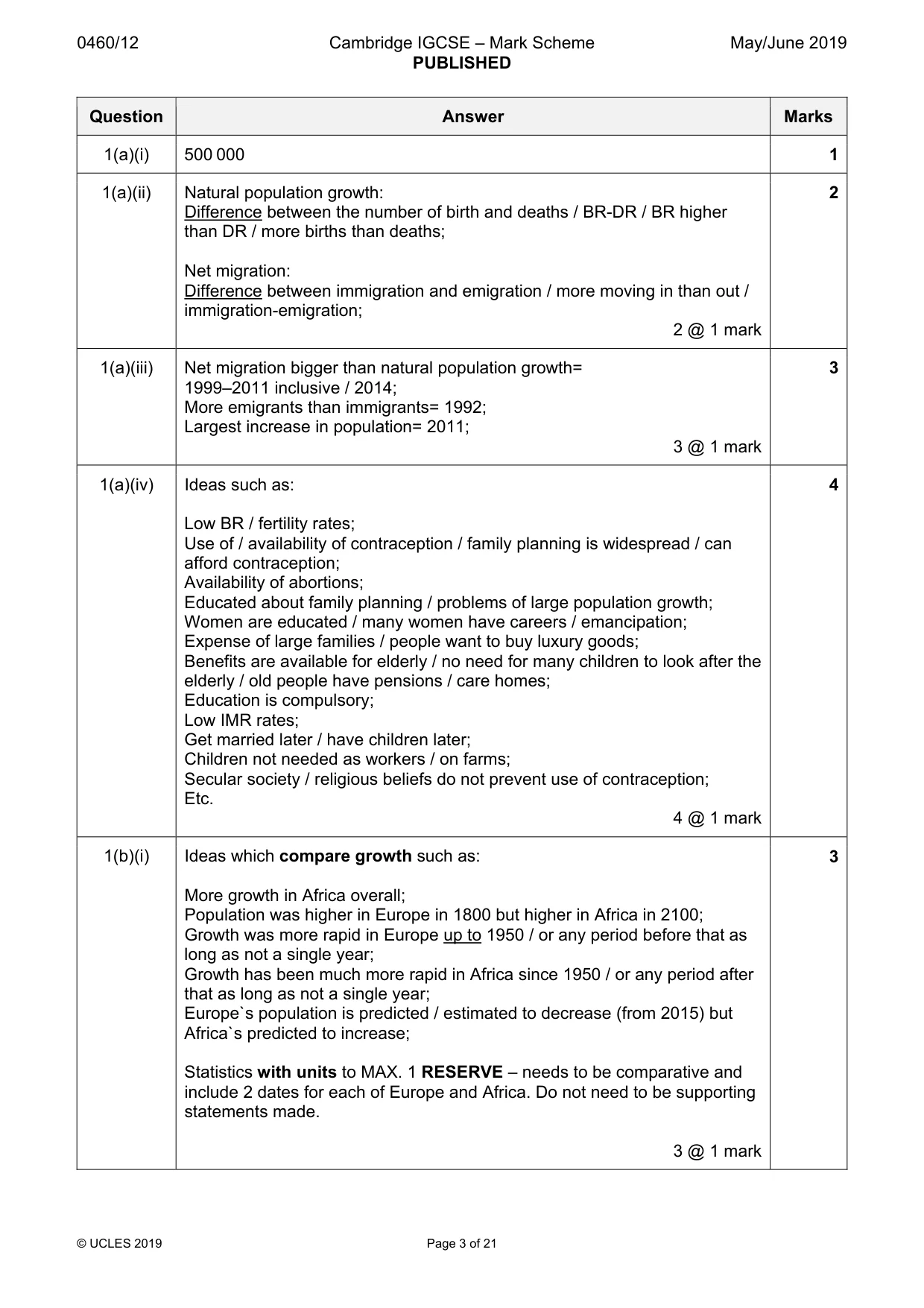
0460/12 Cambridge IGCSE – Mark Scheme PUBLISHED May/June 2019 © UCLES 2019 Page 3 of 21 Question Answer Marks 1(a)(i) 500 000 1 1(a)(ii) Natural population growth: Difference between the number of birth and deaths / BR-DR / BR higher than DR / more births than deaths; Net migration: Difference between immigration and emigration / more moving in than out / immigration-emigration; 2 @ 1 mark 2 1(a)(iii) Net migration bigger than natural population growth= 1999–2011 inclusive / 2014; More emigrants than immigrants= 1992; Largest increase in population= 2011; 3 @ 1 mark 3 1(a)(iv) Ideas such as: Low BR / fertility rates; Use of / availability of contraception / family planning is widespread / can afford contraception; Availability of abortions; Educated about family planning / problems of large population growth; Women are educated / many women have careers / emancipation; Expense of large families / people want to buy luxury goods; Benefits are available for elderly / no need for many children to look after the elderly / old people have pensions / care homes; Education is compulsory; Low IMR rates; Get married later / have children later; Children not needed as workers / on farms; Secular society / religious beliefs do not prevent use of contraception; Etc. 4 @ 1 mark 4 1(b)(i) Ideas which compare growth such as: More growth in Africa overall; Population was higher in Europe in 1800 but higher in Africa in 2100; Growth was more rapid in Europe up to 1950 / or any period before that as long as not a single year; Growth has been much more rapid in Africa since 1950 / or any period after that as long as not a single year; Europe`s population is predicted / estimated to decrease (from 2015) but Africa`s predicted to increase; Statistics with units to MAX. 1 RESERVE – needs to be comparative and include 2 dates for each of Europe and Africa. Do not need to be supporting statements made. 3 @ 1 mark 3
Mark scheme, page 4
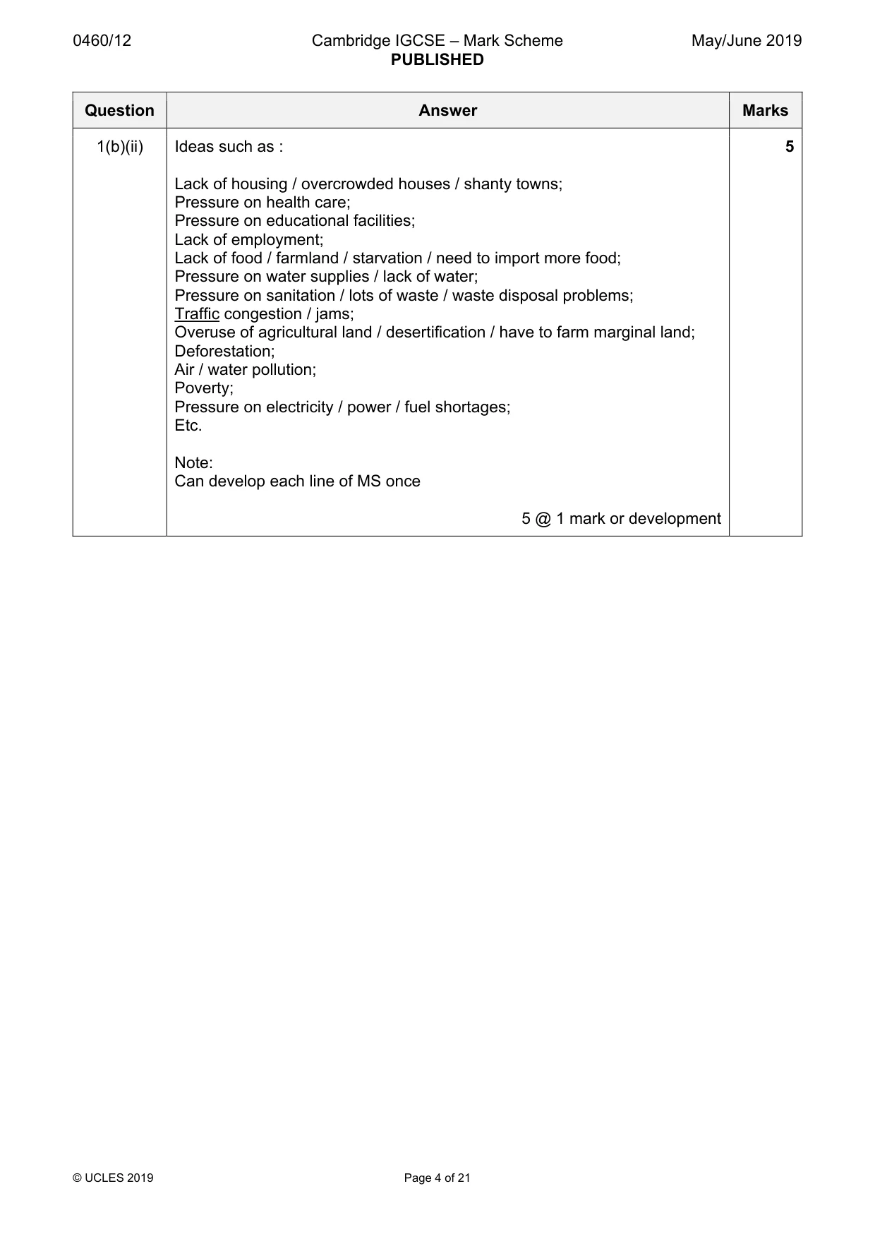
0460/12 Cambridge IGCSE – Mark Scheme PUBLISHED May/June 2019 © UCLES 2019 Page 4 of 21 Question Answer Marks 1(b)(ii) Ideas such as : Lack of housing / overcrowded houses / shanty towns; Pressure on health care; Pressure on educational facilities; Lack of employment; Lack of food / farmland / starvation / need to import more food; Pressure on water supplies / lack of water; Pressure on sanitation / lots of waste / waste disposal problems; Traffic congestion / jams; Overuse of agricultural land / desertification / have to farm marginal land; Deforestation; Air / water pollution; Poverty; Pressure on electricity / power / fuel shortages; Etc. Note: Can develop each line of MS once 5 @ 1 mark or development 5
Mark scheme, page 5
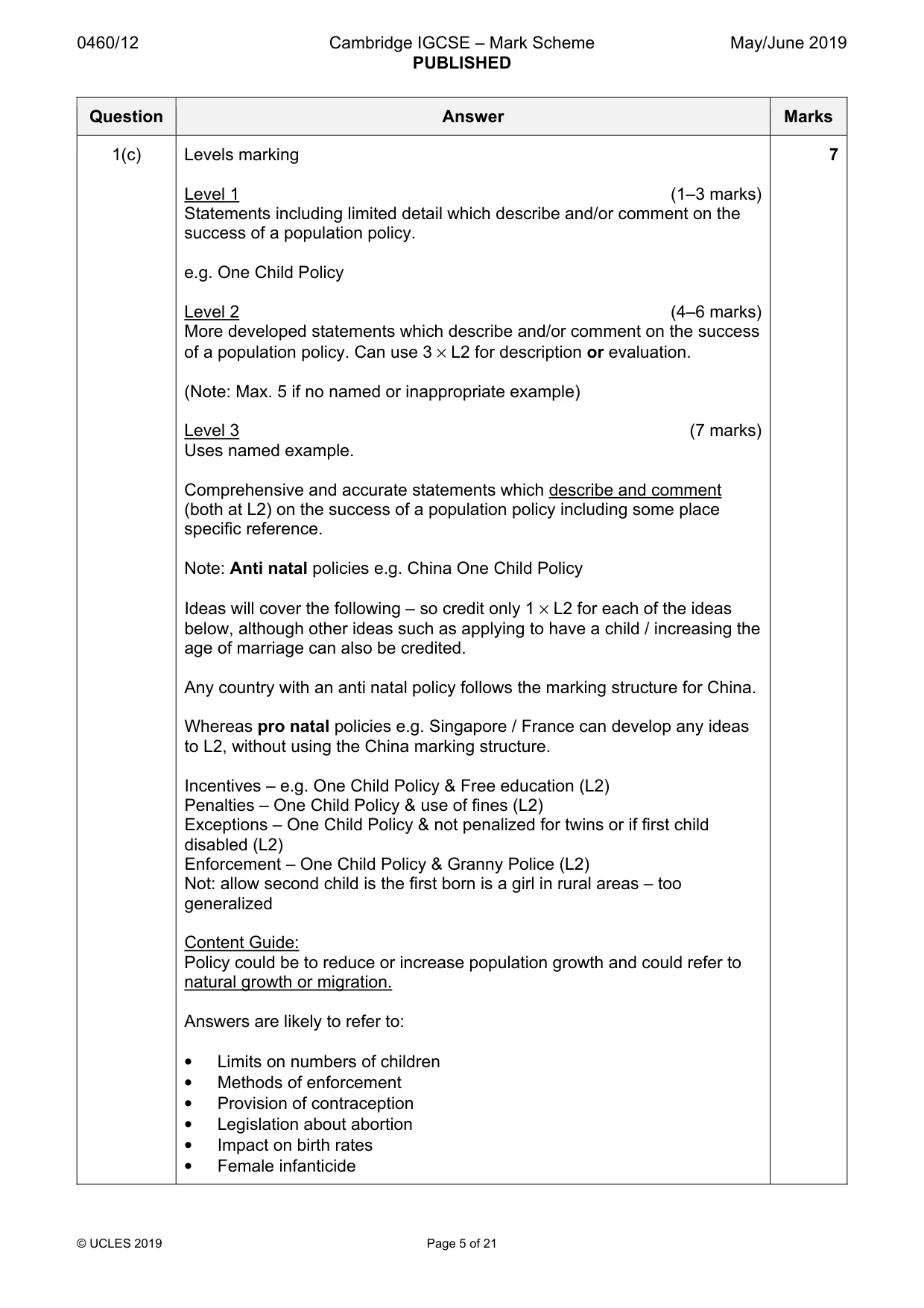
0460/12 Cambridge IGCSE – Mark Scheme PUBLISHED May/June 2019 © UCLES 2019 Page 5 of 21 Question Answer Marks 1(c) Levels marking Level 1 (1–3 marks) Statements including limited detail which describe and/or comment on the success of a population policy. e.g. One Child Policy Level 2 (4–6 marks) More developed statements which describe and/or comment on the success of a population policy. Can use 3 × L2 for description or evaluation. (Note: Max. 5 if no named or inappropriate example) Level 3 (7 marks) Uses named example. Comprehensive and accurate statements which describe and comment (both at L2) on the success of a population policy including some place specific reference. Note: Anti natal policies e.g. China One Child Policy Ideas will cover the following – so credit only 1 × L2 for each of the ideas below, although other ideas such as applying to have a child / increasing the age of marriage can also be credited. Any country with an anti natal policy follows the marking structure for China. Whereas pro natal policies e.g. Singapore / France can develop any ideas to L2, without using the China marking structure. Incentives – e.g. One Child Policy & Free education (L2) Penalties – One Child Policy & use of fines (L2) Exceptions – One Child Policy & not penalized for twins or if first child disabled (L2) Enforcement – One Child Policy & Granny Police (L2) Not: allow second child is the first born is a girl in rural areas – too generalized Content Guide: Policy could be to reduce or increase population growth and could refer to natural growth or migration. Answers are likely to refer to: • Limits on numbers of children • Methods of enforcement • Provision of contraception • Legislation about abortion • Impact on birth rates • Female infanticide 7
Mark scheme, page 6
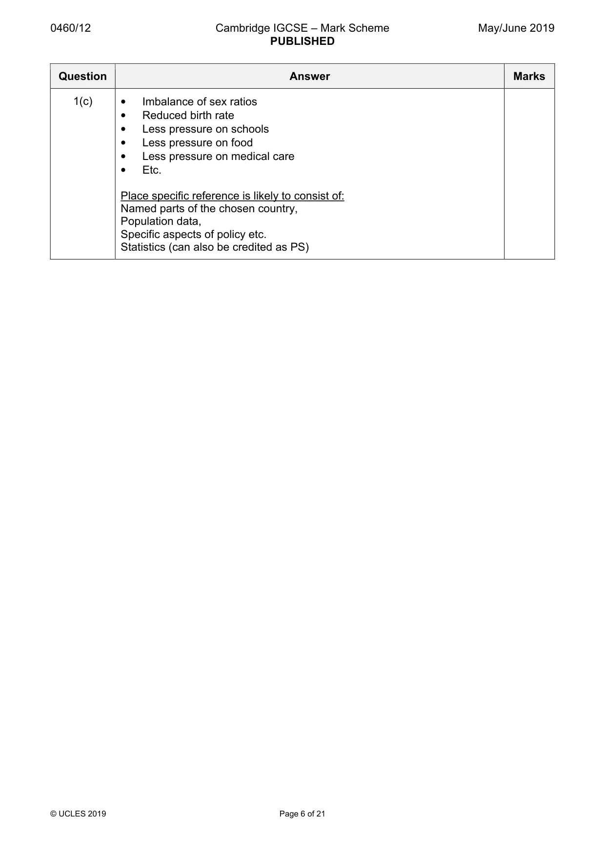
0460/12 Cambridge IGCSE – Mark Scheme PUBLISHED May/June 2019 © UCLES 2019 Page 6 of 21 Question Answer Marks 1(c) • Imbalance of sex ratios • Reduced birth rate • Less pressure on schools • Less pressure on food • Less pressure on medical care • Etc. Place specific reference is likely to consist of: Named parts of the chosen country, Population data, Specific aspects of policy etc. Statistics (can also be credited as PS)
Mark scheme, page 7
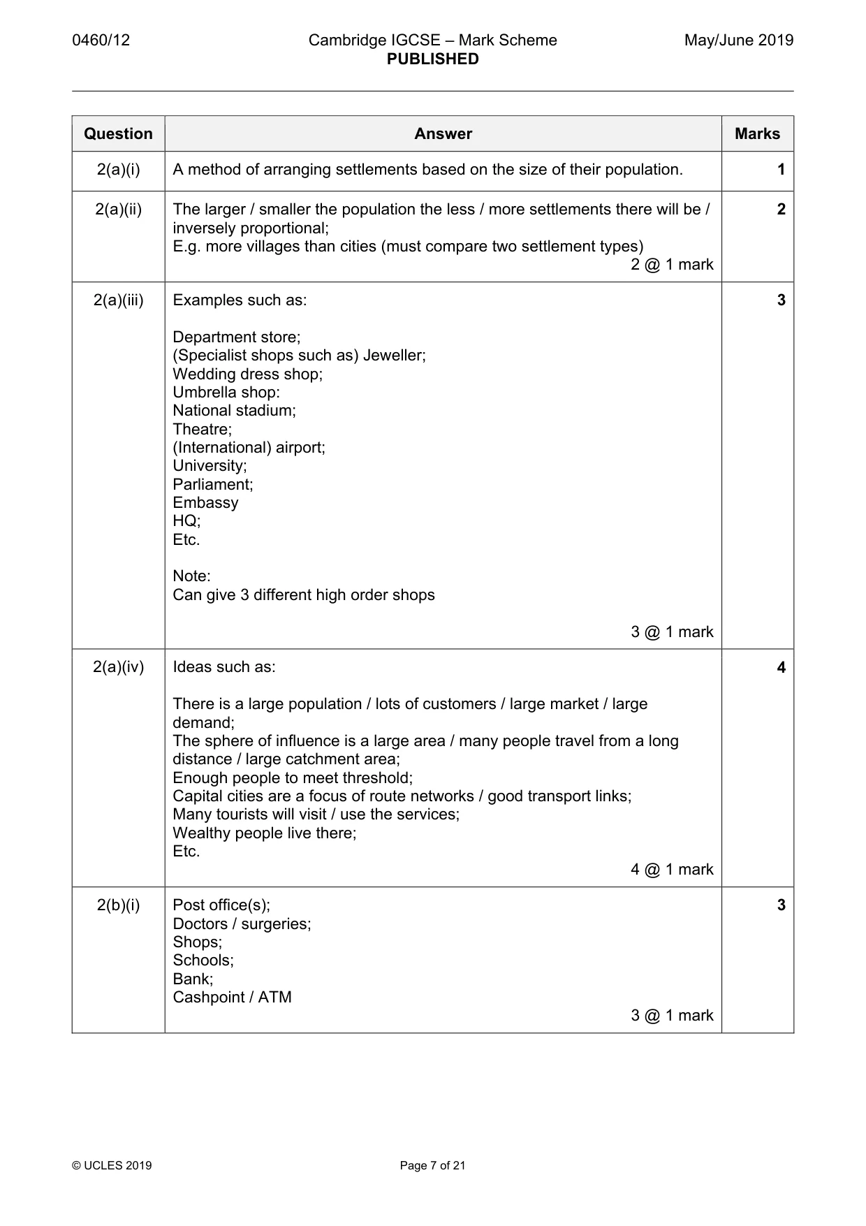
0460/12 Cambridge IGCSE – Mark Scheme PUBLISHED May/June 2019 © UCLES 2019 Page 7 of 21 Question Answer Marks 2(a)(i) A method of arranging settlements based on the size of their population. 1 2(a)(ii) The larger / smaller the population the less / more settlements there will be / inversely proportional; E.g. more villages than cities (must compare two settlement types) 2 @ 1 mark 2 2(a)(iii) Examples such as: Department store; (Specialist shops such as) Jeweller; Wedding dress shop; Umbrella shop: National stadium; Theatre; (International) airport; University; Parliament; Embassy HQ; Etc. Note: Can give 3 different high order shops 3 @ 1 mark 3 2(a)(iv) Ideas such as: There is a large population / lots of customers / large market / large demand; The sphere of influence is a large area / many people travel from a long distance / large catchment area; Enough people to meet threshold; Capital cities are a focus of route networks / good transport links; Many tourists will visit / use the services; Wealthy people live there; Etc. 4 @ 1 mark 4 2(b)(i) Post office(s); Doctors / surgeries; Shops; Schools; Bank; Cashpoint / ATM 3 @ 1 mark 3
Mark scheme, page 8
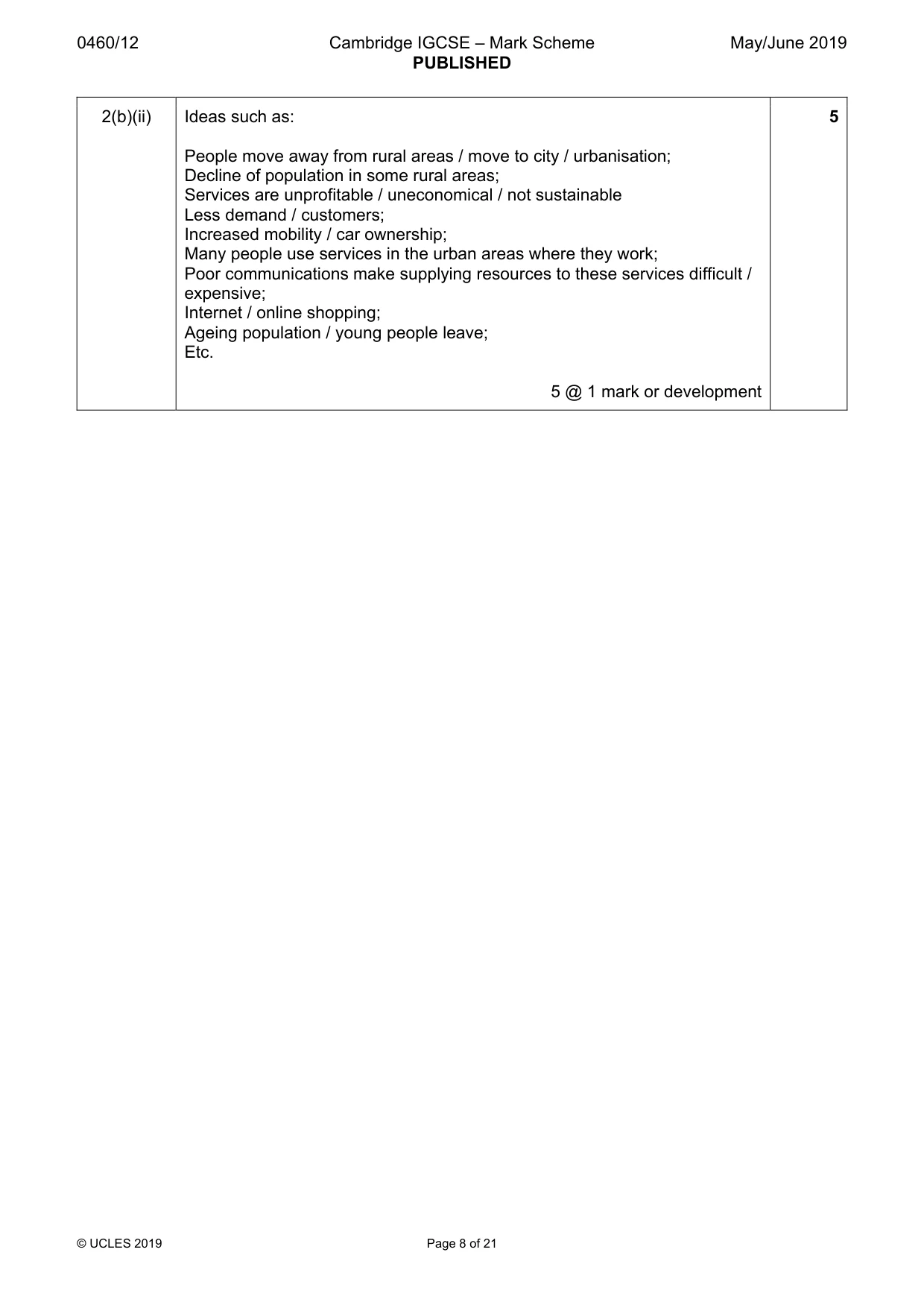
0460/12 Cambridge IGCSE – Mark Scheme PUBLISHED May/June 2019 © UCLES 2019 Page 8 of 21 2(b)(ii) Ideas such as: People move away from rural areas / move to city / urbanisation; Decline of population in some rural areas; Services are unprofitable / uneconomical / not sustainable Less demand / customers; Increased mobility / car ownership; Many people use services in the urban areas where they work; Poor communications make supplying resources to these services difficult / expensive; Internet / online shopping; Ageing population / young people leave; Etc. 5 @ 1 mark or development 5
Mark scheme, page 9
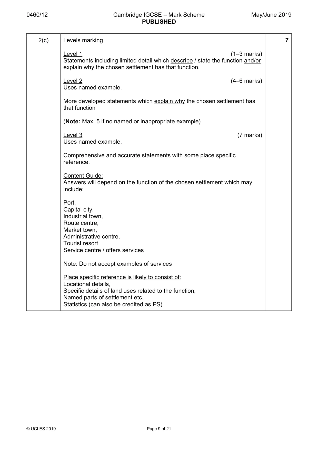
0460/12 Cambridge IGCSE – Mark Scheme PUBLISHED May/June 2019 © UCLES 2019 Page 9 of 21 2(c) Levels marking Level 1 (1–3 marks) Statements including limited detail which describe / state the function and/or explain why the chosen settlement has that function. Level 2 (4–6 marks) Uses named example. More developed statements which explain why the chosen settlement has that function (Note: Max. 5 if no named or inappropriate example) Level 3 (7 marks) Uses named example. Comprehensive and accurate statements with some place specific reference. Content Guide: Answers will depend on the function of the chosen settlement which may include: Port, Capital city, Industrial town, Route centre, Market town, Administrative centre, Tourist resort Service centre / offers services Note: Do not accept examples of services Place specific reference is likely to consist of: Locational details, Specific details of land uses related to the function, Named parts of settlement etc. Statistics (can also be credited as PS) 7
Mark scheme, page 10
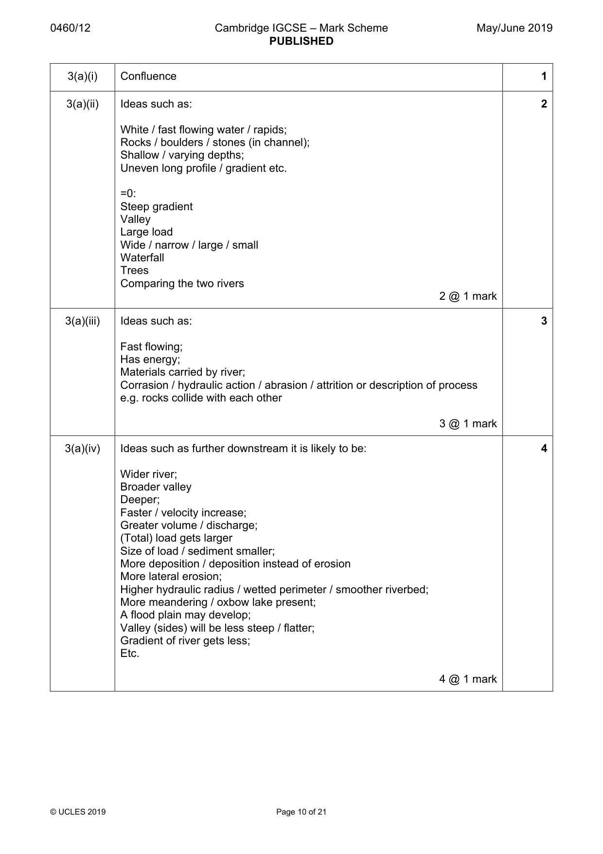
0460/12 Cambridge IGCSE – Mark Scheme PUBLISHED May/June 2019 © UCLES 2019 Page 10 of 21 3(a)(i) Confluence 1 3(a)(ii) Ideas such as: White / fast flowing water / rapids; Rocks / boulders / stones (in channel); Shallow / varying depths; Uneven long profile / gradient etc. =0: Steep gradient Valley Large load Wide / narrow / large / small Waterfall Trees Comparing the two rivers 2 @ 1 mark 2 3(a)(iii) Ideas such as: Fast flowing; Has energy; Materials carried by river; Corrasion / hydraulic action / abrasion / attrition or description of process e.g. rocks collide with each other 3 @ 1 mark 3 3(a)(iv) Ideas such as further downstream it is likely to be: Wider river; Broader valley Deeper; Faster / velocity increase; Greater volume / discharge; (Total) load gets larger Size of load / sediment smaller; More deposition / deposition instead of erosion More lateral erosion; Higher hydraulic radius / wetted perimeter / smoother riverbed; More meandering / oxbow lake present; A flood plain may develop; Valley (sides) will be less steep / flatter; Gradient of river gets less; Etc. 4 @ 1 mark 4
Mark scheme, page 11
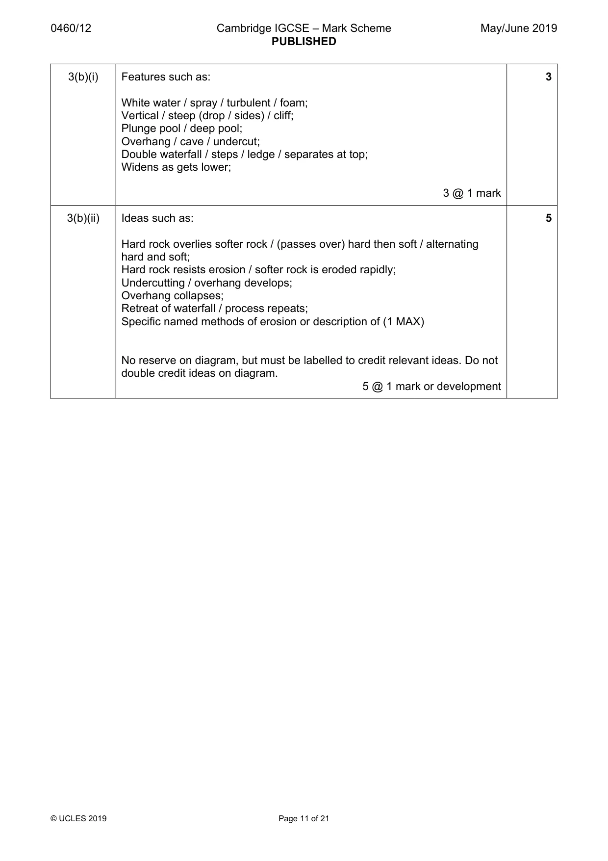
0460/12 Cambridge IGCSE – Mark Scheme PUBLISHED May/June 2019 © UCLES 2019 Page 11 of 21 3(b)(i) Features such as: White water / spray / turbulent / foam; Vertical / steep (drop / sides) / cliff; Plunge pool / deep pool; Overhang / cave / undercut; Double waterfall / steps / ledge / separates at top; Widens as gets lower; 3 @ 1 mark 3 3(b)(ii) Ideas such as: Hard rock overlies softer rock / (passes over) hard then soft / alternating hard and soft; Hard rock resists erosion / softer rock is eroded rapidly; Undercutting / overhang develops; Overhang collapses; Retreat of waterfall / process repeats; Specific named methods of erosion or description of (1 MAX) No reserve on diagram, but must be labelled to credit relevant ideas. Do not double credit ideas on diagram. 5 @ 1 mark or development 5
Mark scheme, page 12
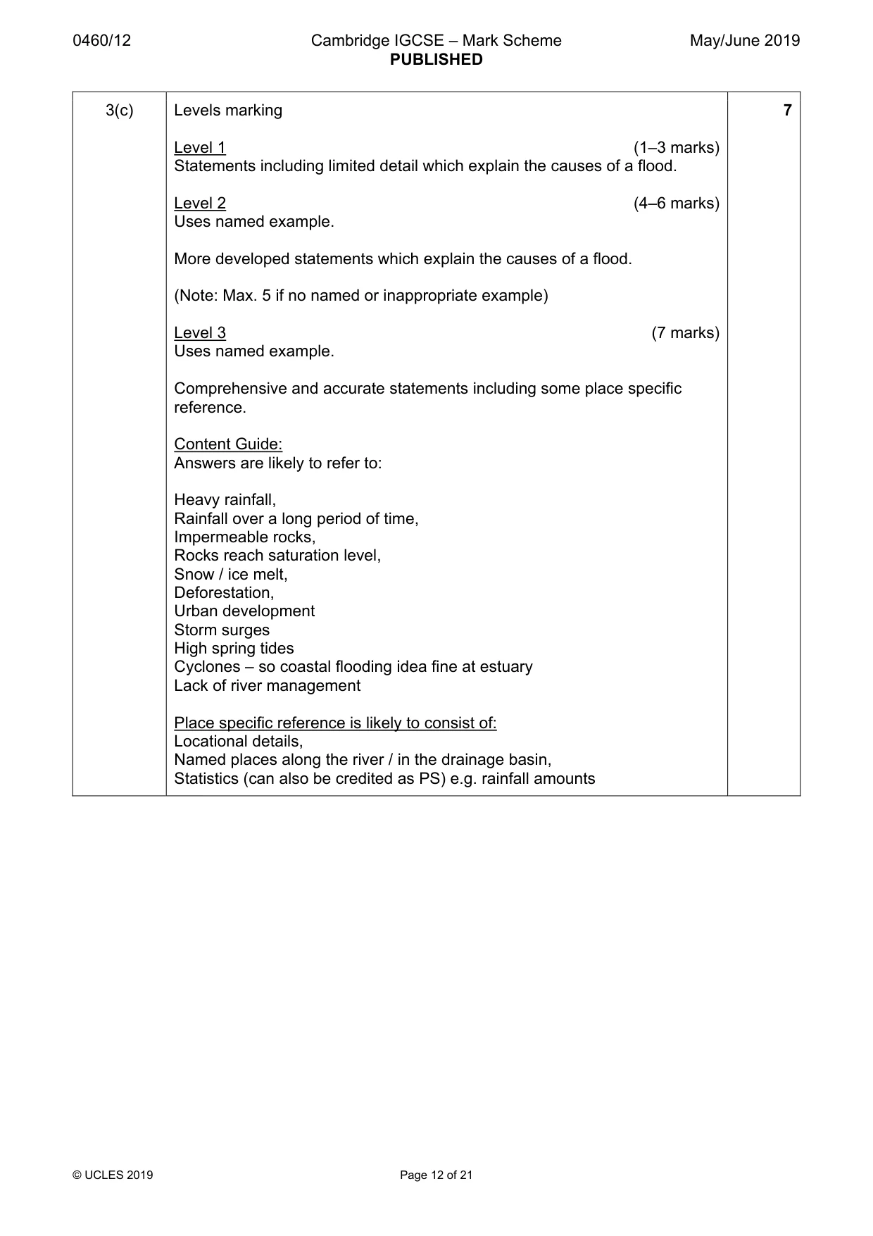
0460/12 Cambridge IGCSE – Mark Scheme PUBLISHED May/June 2019 © UCLES 2019 Page 12 of 21 3(c) Levels marking Level 1 (1–3 marks) Statements including limited detail which explain the causes of a flood. Level 2 (4–6 marks) Uses named example. More developed statements which explain the causes of a flood. (Note: Max. 5 if no named or inappropriate example) Level 3 (7 marks) Uses named example. Comprehensive and accurate statements including some place specific reference. Content Guide: Answers are likely to refer to: Heavy rainfall, Rainfall over a long period of time, Impermeable rocks, Rocks reach saturation level, Snow / ice melt, Deforestation, Urban development Storm surges High spring tides Cyclones – so coastal flooding idea fine at estuary Lack of river management Place specific reference is likely to consist of: Locational details, Named places along the river / in the drainage basin, Statistics (can also be credited as PS) e.g. rainfall amounts 7
Mark scheme, page 13
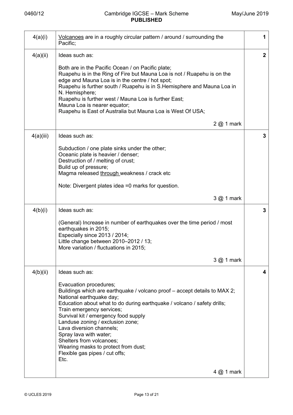
0460/12 Cambridge IGCSE – Mark Scheme PUBLISHED May/June 2019 © UCLES 2019 Page 13 of 21 4(a)(i) Volcanoes are in a roughly circular pattern / around / surrounding the Pacific; 1 4(a)(ii) Ideas such as: Both are in the Pacific Ocean / on Pacific plate; Ruapehu is in the Ring of Fire but Mauna Loa is not / Ruapehu is on the edge and Mauna Loa is in the centre / hot spot; Ruapehu is further south / Ruapehu is in S.Hemisphere and Mauna Loa in N. Hemisphere; Ruapehu is further west / Mauna Loa is further East; Mauna Loa is nearer equator; Ruapehu is East of Australia but Mauna Loa is West Of USA; 2 @ 1 mark 2 4(a)(iii) Ideas such as: Subduction / one plate sinks under the other; Oceanic plate is heavier / denser; Destruction of / melting of crust; Build up of pressure; Magma released through weakness / crack etc Note: Divergent plates idea =0 marks for question. 3 @ 1 mark 3 4(b)(i) Ideas such as: (General) Increase in number of earthquakes over the time period / most earthquakes in 2015; Especially since 2013 / 2014; Little change between 2010–2012 / 13; More variation / fluctuations in 2015; 3 @ 1 mark 3 4(b)(ii) Ideas such as: Evacuation procedures; Buildings which are earthquake / volcano proof – accept details to MAX 2; National earthquake day; Education about what to do during earthquake / volcano / safety drills; Train emergency services; Survival kit / emergency food supply Landuse zoning / exclusion zone; Lava diversion channels; Spray lava with water; Shelters from volcanoes; Wearing masks to protect from dust; Flexible gas pipes / cut offs; Etc. 4 @ 1 mark 4
Mark scheme, page 14
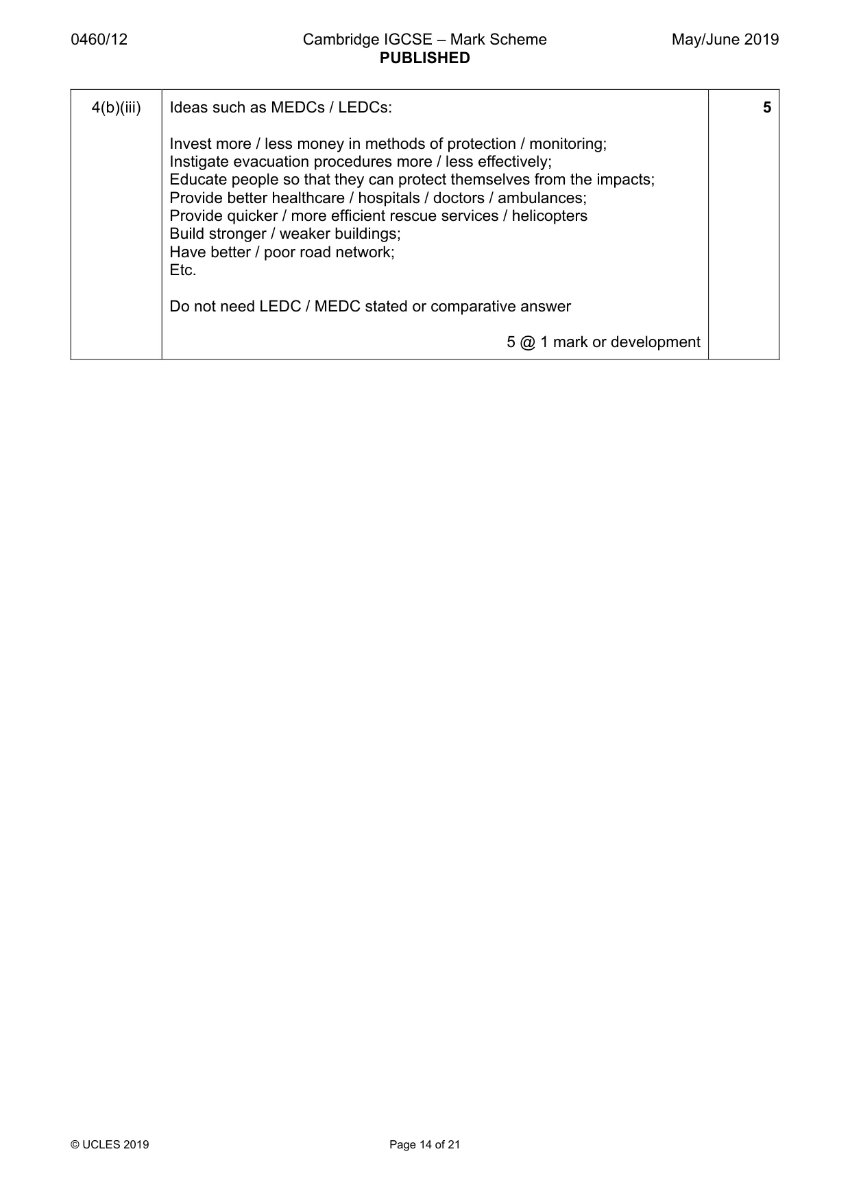
0460/12 Cambridge IGCSE – Mark Scheme PUBLISHED May/June 2019 © UCLES 2019 Page 14 of 21 4(b)(iii) Ideas such as MEDCs / LEDCs: Invest more / less money in methods of protection / monitoring; Instigate evacuation procedures more / less effectively; Educate people so that they can protect themselves from the impacts; Provide better healthcare / hospitals / doctors / ambulances; Provide quicker / more efficient rescue services / helicopters Build stronger / weaker buildings; Have better / poor road network; Etc. Do not need LEDC / MEDC stated or comparative answer 5 @ 1 mark or development 5
Mark scheme, page 15
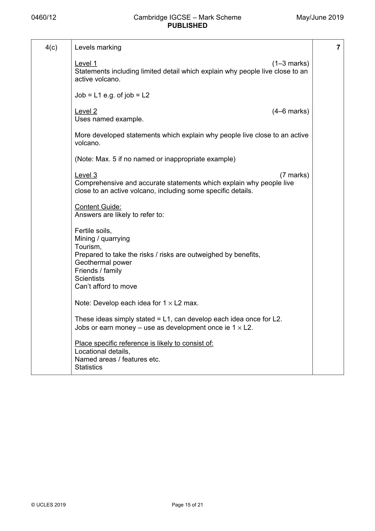
0460/12 Cambridge IGCSE – Mark Scheme PUBLISHED May/June 2019 © UCLES 2019 Page 15 of 21 4(c) Levels marking Level 1 (1–3 marks) Statements including limited detail which explain why people live close to an active volcano. Job = L1 e.g. of job = L2 Level 2 (4–6 marks) Uses named example. More developed statements which explain why people live close to an active volcano. (Note: Max. 5 if no named or inappropriate example) Level 3 (7 marks) Comprehensive and accurate statements which explain why people live close to an active volcano, including some specific details. Content Guide: Answers are likely to refer to: Fertile soils, Mining / quarrying Tourism, Prepared to take the risks / risks are outweighed by benefits, Geothermal power Friends / family Scientists Can’t afford to move Note: Develop each idea for 1 × L2 max. These ideas simply stated = L1, can develop each idea once for L2. Jobs or earn money – use as development once ie 1 × L2. Place specific reference is likely to consist of: Locational details, Named areas / features etc. Statistics 7
Mark scheme, page 16
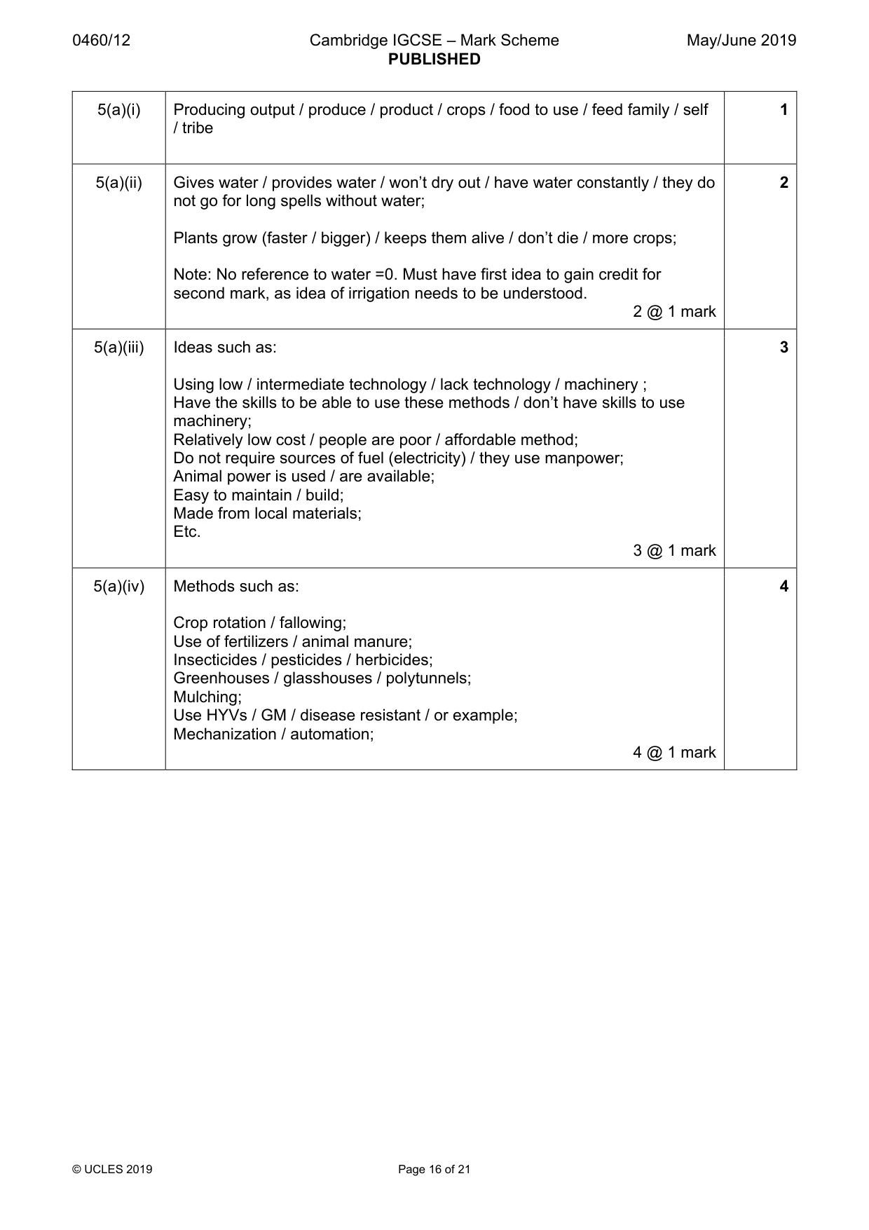
0460/12 Cambridge IGCSE – Mark Scheme PUBLISHED May/June 2019 © UCLES 2019 Page 16 of 21 5(a)(i) Producing output / produce / product / crops / food to use / feed family / self / tribe 1 5(a)(ii) Gives water / provides water / won’t dry out / have water constantly / they do not go for long spells without water; Plants grow (faster / bigger) / keeps them alive / don’t die / more crops; Note: No reference to water =0. Must have first idea to gain credit for second mark, as idea of irrigation needs to be understood. 2 @ 1 mark 2 5(a)(iii) Ideas such as: Using low / intermediate technology / lack technology / machinery ; Have the skills to be able to use these methods / don’t have skills to use machinery; Relatively low cost / people are poor / affordable method; Do not require sources of fuel (electricity) / they use manpower; Animal power is used / are available; Easy to maintain / build; Made from local materials; Etc. 3 @ 1 mark 3 5(a)(iv) Methods such as: Crop rotation / fallowing; Use of fertilizers / animal manure; Insecticides / pesticides / herbicides; Greenhouses / glasshouses / polytunnels; Mulching; Use HYVs / GM / disease resistant / or example; Mechanization / automation; 4 @ 1 mark 4
Mark scheme, page 17
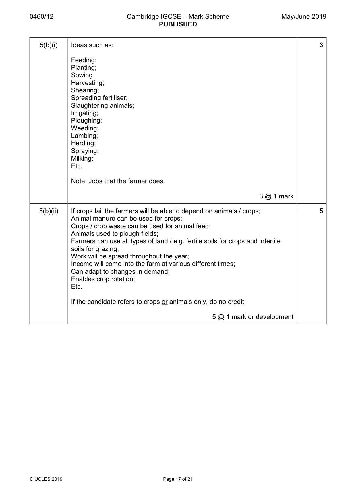
0460/12 Cambridge IGCSE – Mark Scheme PUBLISHED May/June 2019 © UCLES 2019 Page 17 of 21 5(b)(i) Ideas such as: Feeding; Planting; Sowing Harvesting; Shearing; Spreading fertiliser; Slaughtering animals; Irrigating; Ploughing; Weeding; Lambing; Herding; Spraying; Milking; Etc. Note: Jobs that the farmer does. 3 @ 1 mark 3 5(b)(ii) If crops fail the farmers will be able to depend on animals / crops; Animal manure can be used for crops; Crops / crop waste can be used for animal feed; Animals used to plough fields; Farmers can use all types of land / e.g. fertile soils for crops and infertile soils for grazing; Work will be spread throughout the year; Income will come into the farm at various different times; Can adapt to changes in demand; Enables crop rotation; Etc. If the candidate refers to crops or animals only, do no credit. 5 @ 1 mark or development 5
Mark scheme, page 18
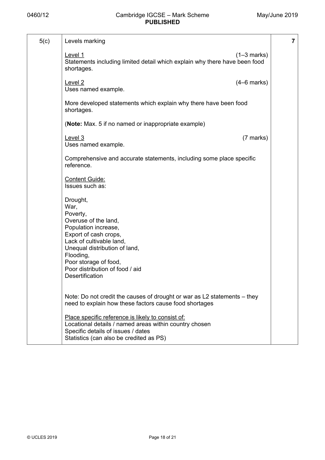
0460/12 Cambridge IGCSE – Mark Scheme PUBLISHED May/June 2019 © UCLES 2019 Page 18 of 21 5(c) Levels marking Level 1 (1–3 marks) Statements including limited detail which explain why there have been food shortages. Level 2 (4–6 marks) Uses named example. More developed statements which explain why there have been food shortages. (Note: Max. 5 if no named or inappropriate example) Level 3 (7 marks) Uses named example. Comprehensive and accurate statements, including some place specific reference. Content Guide: Issues such as: Drought, War, Poverty, Overuse of the land, Population increase, Export of cash crops, Lack of cultivable land, Unequal distribution of land, Flooding, Poor storage of food, Poor distribution of food / aid Desertification Note: Do not credit the causes of drought or war as L2 statements – they need to explain how these factors cause food shortages Place specific reference is likely to consist of: Locational details / named areas within country chosen Specific details of issues / dates Statistics (can also be credited as PS) 7
Mark scheme, page 19
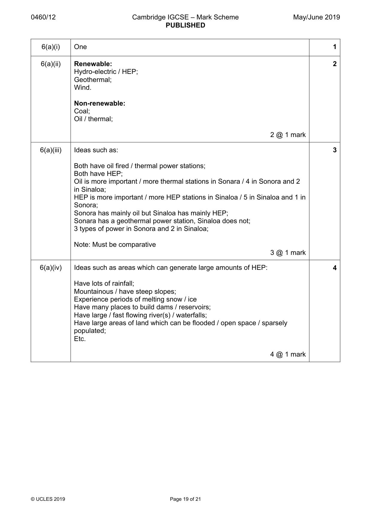
0460/12 Cambridge IGCSE – Mark Scheme PUBLISHED May/June 2019 © UCLES 2019 Page 19 of 21 6(a)(i) One 1 6(a)(ii) Renewable: Hydro-electric / HEP; Geothermal; Wind. Non-renewable: Coal; Oil / thermal; 2 @ 1 mark 2 6(a)(iii) Ideas such as: Both have oil fired / thermal power stations; Both have HEP; Oil is more important / more thermal stations in Sonara / 4 in Sonora and 2 in Sinaloa; HEP is more important / more HEP stations in Sinaloa / 5 in Sinaloa and 1 in Sonora; Sonora has mainly oil but Sinaloa has mainly HEP; Sonara has a geothermal power station, Sinaloa does not; 3 types of power in Sonora and 2 in Sinaloa; Note: Must be comparative 3 @ 1 mark 3 6(a)(iv) Ideas such as areas which can generate large amounts of HEP: Have lots of rainfall; Mountainous / have steep slopes; Experience periods of melting snow / ice Have many places to build dams / reservoirs; Have large / fast flowing river(s) / waterfalls; Have large areas of land which can be flooded / open space / sparsely populated; Etc. 4 @ 1 mark 4
Mark scheme, page 20
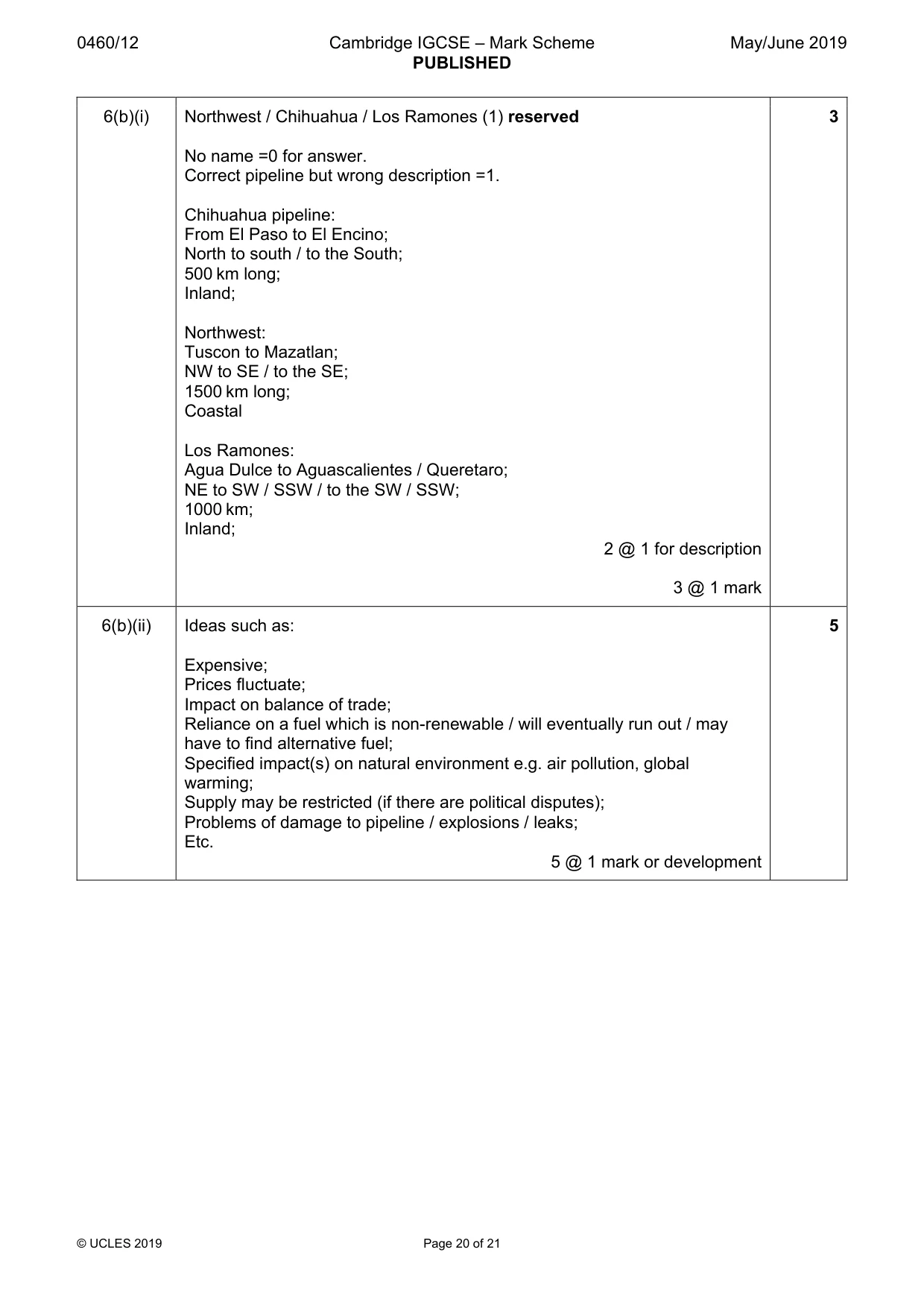
0460/12 Cambridge IGCSE – Mark Scheme PUBLISHED May/June 2019 © UCLES 2019 Page 20 of 21 6(b)(i) Northwest / Chihuahua / Los Ramones (1) reserved No name =0 for answer. Correct pipeline but wrong description =1. Chihuahua pipeline: From El Paso to El Encino; North to south / to the South; 500 km long; Inland; Northwest: Tuscon to Mazatlan; NW to SE / to the SE; 1500 km long; Coastal Los Ramones: Agua Dulce to Aguascalientes / Queretaro; NE to SW / SSW / to the SW / SSW; 1000 km; Inland; 2 @ 1 for description 3 @ 1 mark 3 6(b)(ii) Ideas such as: Expensive; Prices fluctuate; Impact on balance of trade; Reliance on a fuel which is non-renewable / will eventually run out / may have to find alternative fuel; Specified impact(s) on natural environment e.g. air pollution, global warming; Supply may be restricted (if there are political disputes); Problems of damage to pipeline / explosions / leaks; Etc. 5 @ 1 mark or development 5
Mark scheme, page 21
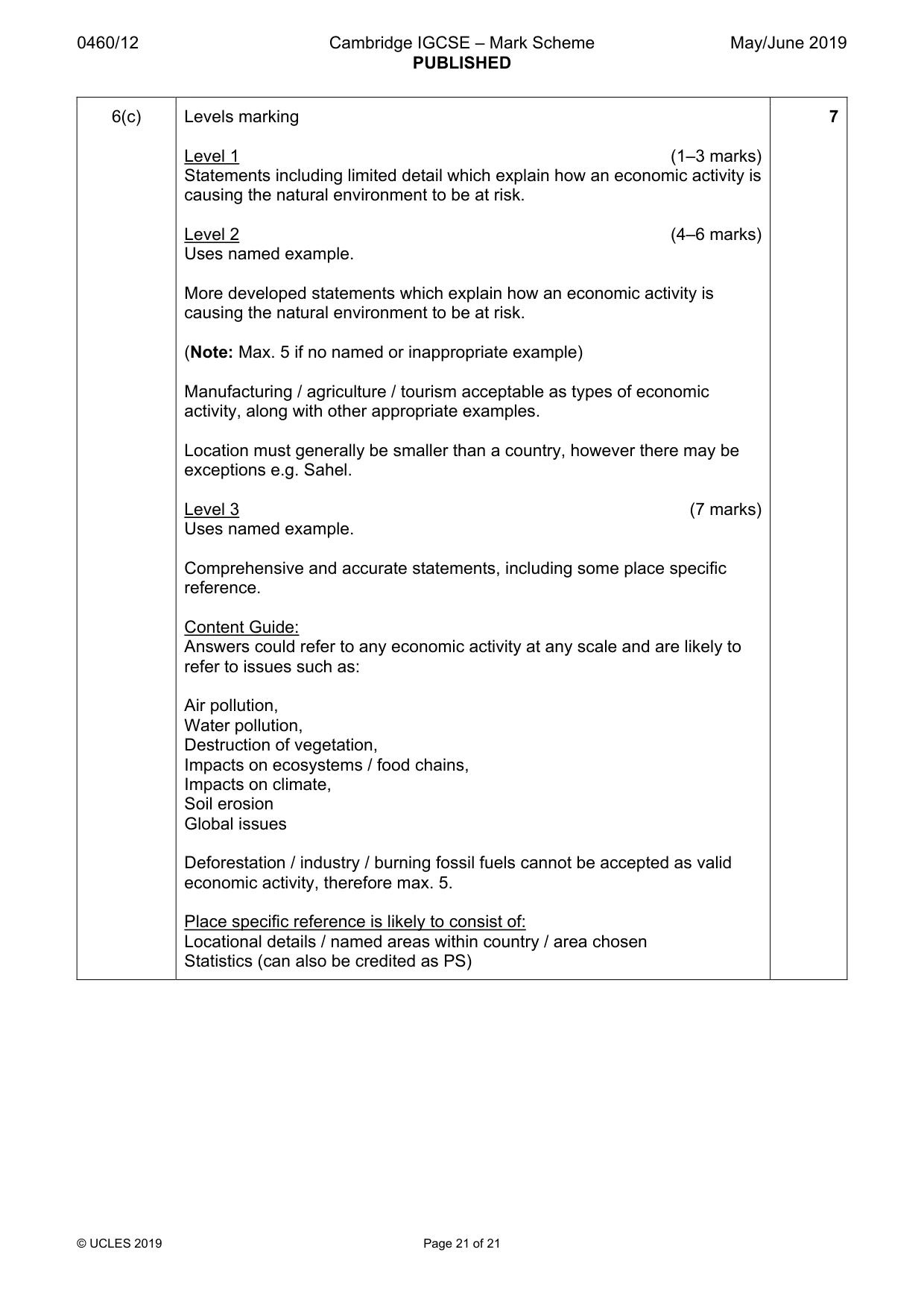
0460/12 Cambridge IGCSE – Mark Scheme PUBLISHED May/June 2019 © UCLES 2019 Page 21 of 21 6(c) Levels marking Level 1 (1–3 marks) Statements including limited detail which explain how an economic activity is causing the natural environment to be at risk. Level 2 (4–6 marks) Uses named example. More developed statements which explain how an economic activity is causing the natural environment to be at risk. (Note: Max. 5 if no named or inappropriate example) Manufacturing / agriculture / tourism acceptable as types of economic activity, along with other appropriate examples. Location must generally be smaller than a country, however there may be exceptions e.g. Sahel. Level 3 (7 marks) Uses named example. Comprehensive and accurate statements, including some place specific reference. Content Guide: Answers could refer to any economic activity at any scale and are likely to refer to issues such as: Air pollution, Water pollution, Destruction of vegetation, Impacts on ecosystems / food chains, Impacts on climate, Soil erosion Global issues Deforestation / industry / burning fossil fuels cannot be accepted as valid economic activity, therefore max. 5. Place specific reference is likely to consist of: Locational details / named areas within country / area chosen Statistics (can also be credited as PS) 7
What you needed in this session
Cambridge’s own grade thresholds for 2019 May/June, Paper 1 · Variant 2. A higher threshold means an easier paper — the bar moves with how the cohort did.