Cambridge IGCSE Geography 0460 — 2017 May/June Paper 1 · Variant 2
0460/12/M/J/17 · 75 marks · ≈84 min
The question paper and its mark scheme, free to read here and free to download. This is Cambridge’s own paper, exactly as it was sat.
Question paper28 pages


Mark scheme18 pages
Answers below. Sit the paper first if you are practising.
Paper as text
Question paper, page 1
This document consists of 27 printed pages, 1 blank page and 1 Insert. DC (LK/FD) 144767/7 R © UCLES 2017 [Turn over Cambridge International Examinations Cambridge International General Certificate of Secondary Education * 0 9 3 2 3 4 0 0 2 9 * GEOGRAPHY 0460/12 Paper 1 May/June 2017 1 hour 45 minutes Candidates answer on the Question Paper. Additional Materials: Ruler Calculator READ THESE INSTRUCTIONS FIRST Write your Centre number, candidate number and name in the spaces provided. Write in dark blue or black pen. You may use an HB pencil for any diagrams or graphs. Do not use staples, paper clips, glue or correction fluid. DO NOT WRITE IN ANY BARCODES. Write your answer to each question in the space provided. If additional space is required, you should use the lined pages at the end of this booklet. The question number(s) must be clearly shown. Answer three questions, one from each section. The Insert contains Fig. 3 and Photographs A, B and C for Question 2, and Photograph D for Question 6. The Insert is not required by the Examiner. Sketch maps and diagrams should be drawn whenever they serve to illustrate an answer. At the end of the examination, fasten all your work securely together. The number of marks is given in brackets [ ] at the end of each question or part question. Definitions MEDCs – More Economically Developed Countries LEDCs – Less Economically Developed Countries The syllabus is approved for use in England, Wales and Northern Ireland as a Cambridge International Level 1/Level 2 Certificate.
Question paper, page 2
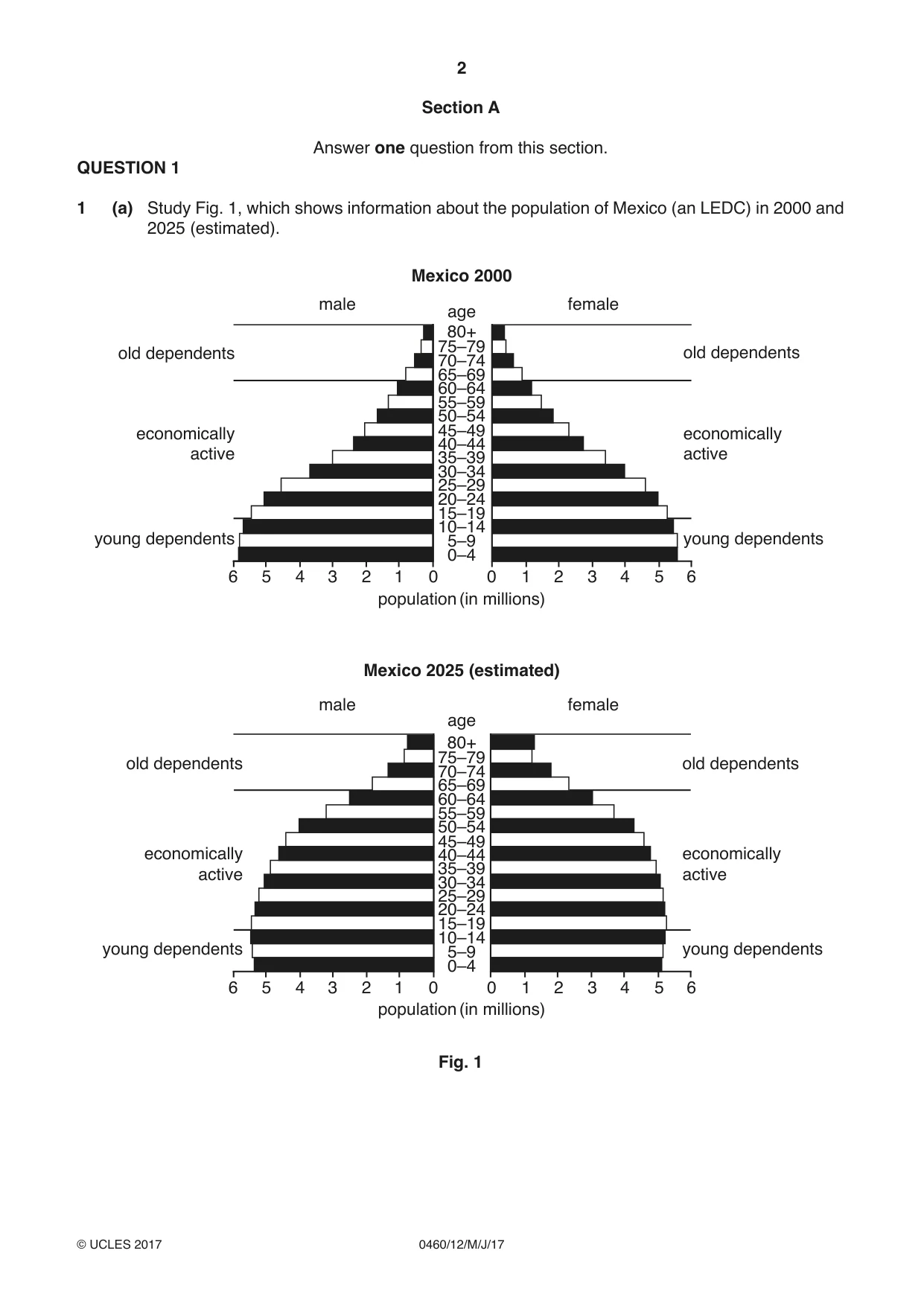
2 0460/12/M/J/17 © UCLES 2017 Section A Answer one question from this section. QUESTION 1 1 (a) Study Fig. 1, which shows information about the population of Mexico (an LEDC) in 2000 and 2025 (estimated). 0 1 2 3 4 5 6 6 5 4 3 2 1 0 0–4 population (in millions) 5–9 10–14 15–19 20–24 25–29 30–34 35–39 40–44 45–49 50–54 55–59 60–64 65–69 70–74 75–79 old dependents male female young dependents economically active 80+ age age Mexico 2000 0 1 2 3 4 5 6 6 5 4 3 2 1 0 0–4 5–9 10–14 15–19 20–24 25–29 30–34 35–39 40–44 45–49 50–54 55–59 60–64 65–69 70–74 75–79 old dependents old dependents male female young dependents 80+ Mexico 2025 (estimated) young dependents population (in millions) economically active economically active old dependents young dependents economically active Fig. 1
Question paper, page 3
3 0460/12/M/J/17 © UCLES 2017 [Turn over (i) Estimate the number of young dependents in Mexico in 2000. Choose from the list below and circle your answer. 6 million 17 million 32 million 60 million [1] (ii) Using Fig. 1, describe how the numbers of young and old dependents in Mexico are likely to change between 2000 and 2025. Young dependents … … Old dependents … …[2] (iii) Give three reasons why the number of young dependents in LEDCs, such as Mexico, is high. 1 … … 2 … … 3 … …[3] (iv) Describe how the population structure of an MEDC is likely to be different from the population structure of LEDCs such as Mexico. … … … … … … … …[4]
Question paper, page 4
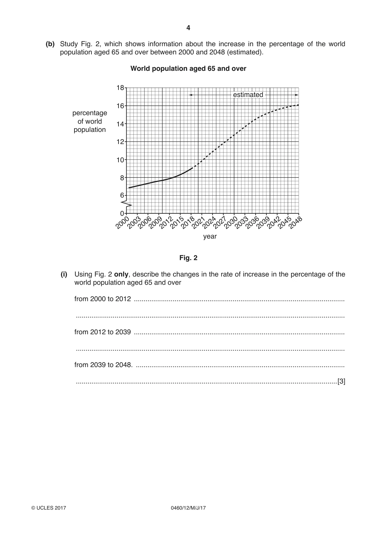
4 0460/12/M/J/17 © UCLES 2017 (b) Study Fig. 2, which shows information about the increase in the percentage of the world population aged 65 and over between 2000 and 2048 (estimated). World population aged 65 and over 2000 2003 2006 2009 2012 2015 2018 2021 2024 2027 2030 2033 2036 2039 2042 2045 2048 year 0 6 8 10 12 14 percentage of world population 16 18 estimated Fig. 2 (i) Using Fig. 2 only, describe the changes in the rate of increase in the percentage of the world population aged 65 and over from 2000 to 2012 … … from 2012 to 2039 … … from 2039 to 2048. … …[3]
Question paper, page 5
5 0460/12/M/J/17 © UCLES 2017 [Turn over (ii) Explain why the percentage of old dependents in the world is increasing. … … … … … … … … … …[5]
Question paper, page 6
6 0460/12/M/J/17 © UCLES 2017 (c) For a named country you have studied, describe the problems caused by an increasing percentage of young or old dependents. Name of country … … … … … … … … … … … … … … … … … … … … … … … … … [7] [Total: 25 marks] END OF QUESTION 1
Question paper, page 7
7 0460/12/M/J/17 © UCLES 2017 [Turn over QUESTION 2 2 (a) Study Fig. 3 (Insert), a map showing selected land uses in Ipswich, an urban area in the UK (MEDC). (i) Identify the main land use in Ipswich. … …[1] (ii) Suggest why area X is likely to have a higher building density than area Y. … … … …[2] (iii) Using Fig. 3 only, describe the distribution of industry in Ipswich. … … … … … …[3] (iv) Suggest reasons for the location of the industry labelled Z. … … … … … … … …[4]
Question paper, page 8
8 0460/12/M/J/17 © UCLES 2017 (b) Study Photographs A, B and C (Insert), which show three different types of land use in the rural-urban fringe of cities. (i) Identify the main land use in each of Photographs A, B and C. Photograph A … Photograph B … Photograph C …[3] (ii) Explain why land uses such as those shown in Photographs A, B and C are located in the rural-urban fringe. … … … … … … … … … …[5]
Question paper, page 9
9 0460/12/M/J/17 © UCLES 2017 [Turn over (c) For a named urban area you have studied, describe the problems which are caused by urban sprawl. Name of urban area … … … … … … … … … … … … … … … … … … … … … … … … … [7] [Total: 25 marks] END OF QUESTION 2
Question paper, page 10
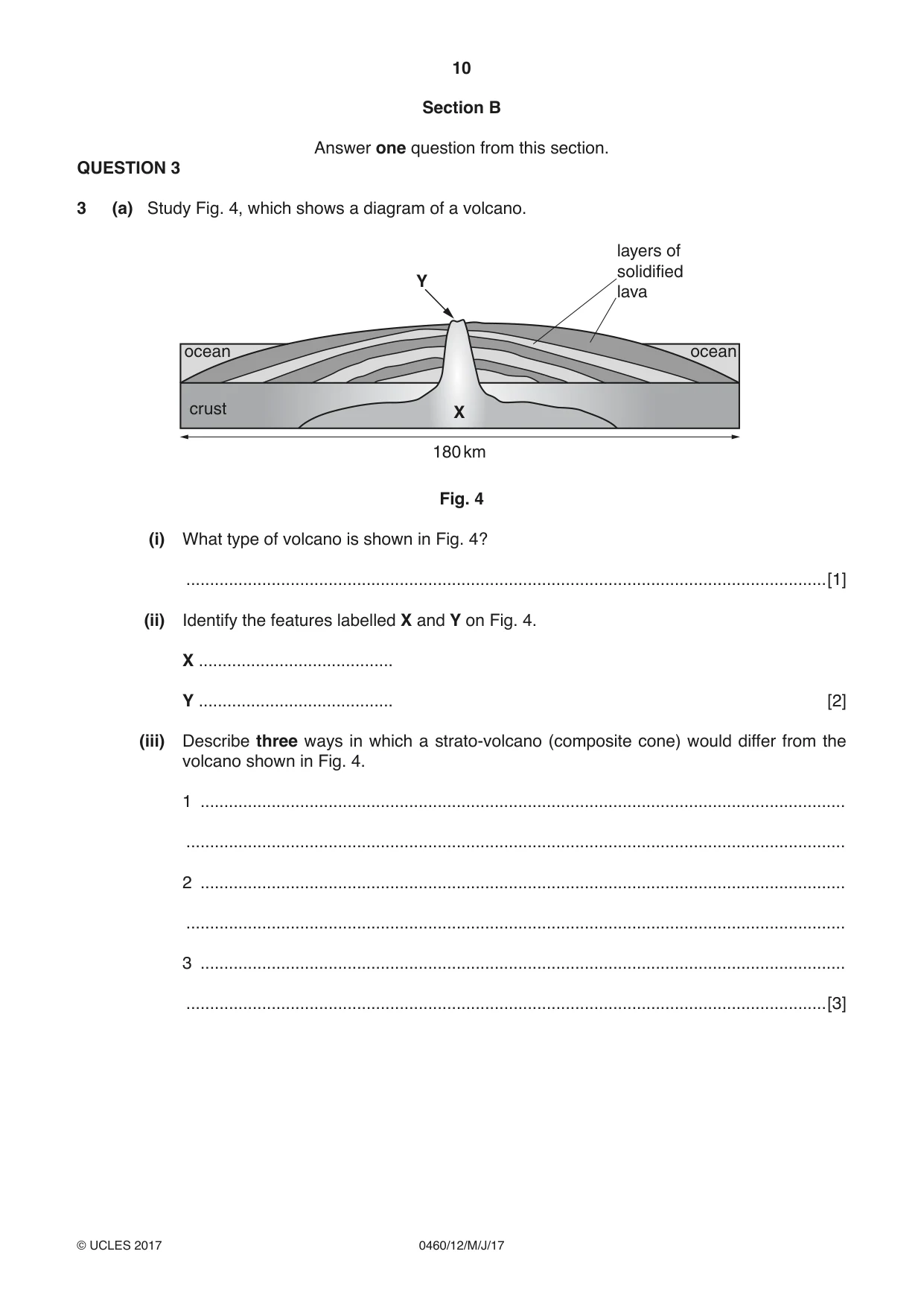
10 0460/12/M/J/17 © UCLES 2017 Section B Answer one question from this section. QUESTION 3 3 (a) Study Fig. 4, which shows a diagram of a volcano. 180 km layers of solidified lava crust ocean ocean X Y Fig. 4 (i) What type of volcano is shown in Fig. 4? …[1] (ii) Identify the features labelled X and Y on Fig. 4. X … Y … [2] (iii) Describe three ways in which a strato-volcano (composite cone) would differ from the volcano shown in Fig. 4. 1 … … 2 … … 3 … …[3]
Question paper, page 11
11 0460/12/M/J/17 © UCLES 2017 [Turn over (iv) Describe the distribution of volcanoes in the world. … … … … … … … …[4]
Question paper, page 12
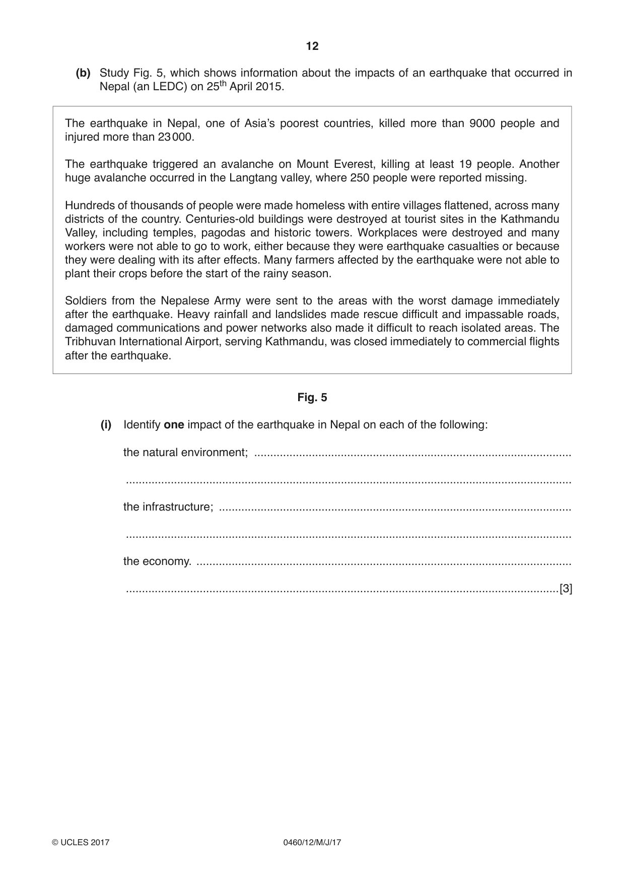
12 0460/12/M/J/17 © UCLES 2017 (b) Study Fig. 5, which shows information about the impacts of an earthquake that occurred in Nepal (an LEDC) on 25th April 2015. The earthquake in Nepal, one of Asia’s poorest countries, killed more than 9000 people and injured more than 23 000. The earthquake triggered an avalanche on Mount Everest, killing at least 19 people. Another huge avalanche occurred in the Langtang valley, where 250 people were reported missing. Hundreds of thousands of people were made homeless with entire villages flattened, across many districts of the country. Centuries-old buildings were destroyed at tourist sites in the Kathmandu Valley, including temples, pagodas and historic towers. Workplaces were destroyed and many workers were not able to go to work, either because they were earthquake casualties or because they were dealing with its after effects. Many farmers affected by the earthquake were not able to plant their crops before the start of the rainy season. Soldiers from the Nepalese Army were sent to the areas with the worst damage immediately after the earthquake. Heavy rainfall and landslides made rescue difficult and impassable roads, damaged communications and power networks also made it difficult to reach isolated areas. The Tribhuvan International Airport, serving Kathmandu, was closed immediately to commercial flights after the earthquake. Fig. 5 (i) Identify one impact of the earthquake in Nepal on each of the following: the natural environment; … … the infrastructure; … … the economy. … …[3]
Question paper, page 13
13 0460/12/M/J/17 © UCLES 2017 [Turn over (ii) Explain what can be done to reduce the impacts of earthquakes on local people. … … … … … … … … … …[5]
Question paper, page 14
14 0460/12/M/J/17 © UCLES 2017 (c) Explain the causes of an earthquake in a named area you have studied. Name of area … … … … … … … … … … … … … … … … … … … … … … … … … …[7] [Total: 25 marks] END OF QUESTION 3
Question paper, page 15
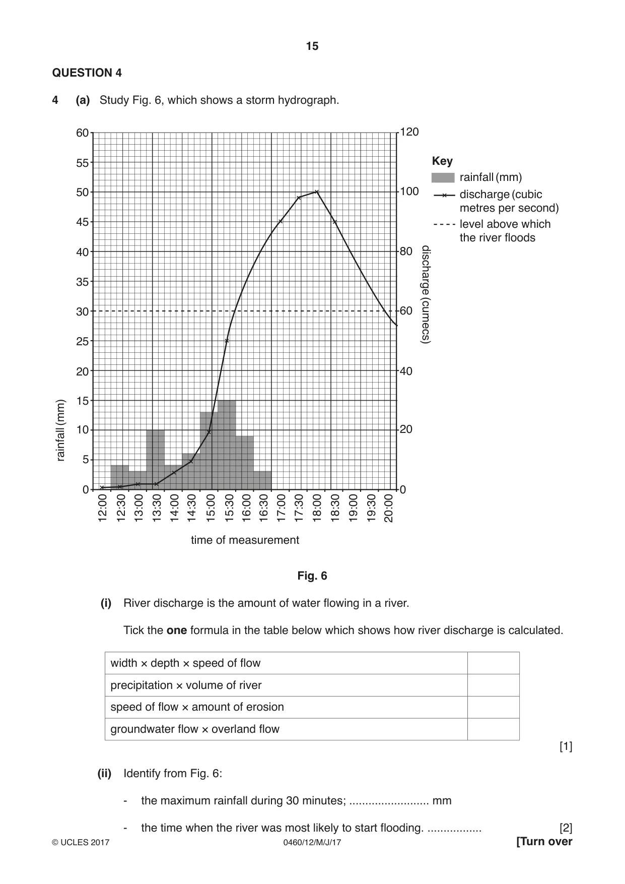
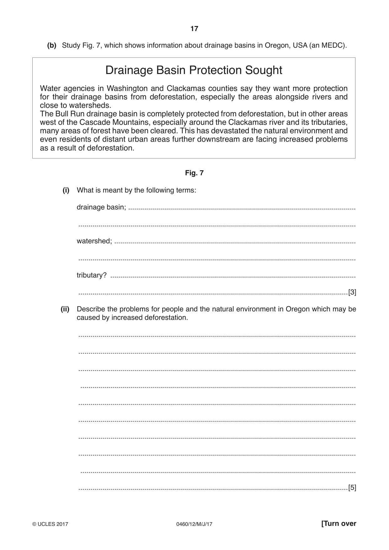
15 0460/12/M/J/17 © UCLES 2017 [Turn over QUESTION 4 4 (a) Study Fig. 6, which shows a storm hydrograph. 60 120 55 50 100 45 rainfall (mm) discharge (cumecs) 40 80 35 30 60 25 time of measurement rainfall (mm) Key discharge (cubic metres per second) level above which the river floods 20 40 15 10 20 5 0 0 12:00 12:30 13:00 13:30 14:00 14:30 15:00 15:30 16:00 16:30 17:00 17:30 18:00 18:30 19:00 19:30 20:00 Fig. 6 (i) River discharge is the amount of water flowing in a river. Tick the one formula in the table below which shows how river discharge is calculated. width × depth × speed of flow precipitation × volume of river speed of flow × amount of erosion groundwater flow × overland flow [1] (ii) Identify from Fig. 6: - the maximum rainfall during 30 minutes; … mm - the time when the river was most likely to start flooding. … [2]
Question paper, page 16
16 0460/12/M/J/17 © UCLES 2017 (iii) Explain why rivers sometimes continue to flood for many hours after the end of a period of heavy rain. … … … … … …[3] (iv) Explain why an increase in discharge of a river will influence the amount of erosion and transportation taking place. … … … … … … … …[4]
Question paper, page 17
17 0460/12/M/J/17 © UCLES 2017 [Turn over (b) Study Fig. 7, which shows information about drainage basins in Oregon, USA (an MEDC). Drainage Basin Protection Sought Water agencies in Washington and Clackamas counties say they want more protection for their drainage basins from deforestation, especially the areas alongside rivers and close to watersheds. The Bull Run drainage basin is completely protected from deforestation, but in other areas west of the Cascade Mountains, especially around the Clackamas river and its tributaries, many areas of forest have been cleared. This has devastated the natural environment and even residents of distant urban areas further downstream are facing increased problems as a result of deforestation. Fig. 7 (i) What is meant by the following terms: drainage basin; … … watershed; … … tributary? … …[3] (ii) Describe the problems for people and the natural environment in Oregon which may be caused by increased deforestation. … … … … … … … … … …[5]
Question paper, page 18
18 0460/12/M/J/17 © UCLES 2017 (c) Describe the opportunities of living near a named river you have studied. Name of river … … … … … … … … … … … … … … … … … … … … … … … … …[7] [Total: 25 marks] END OF QUESTION 4
Question paper, page 19
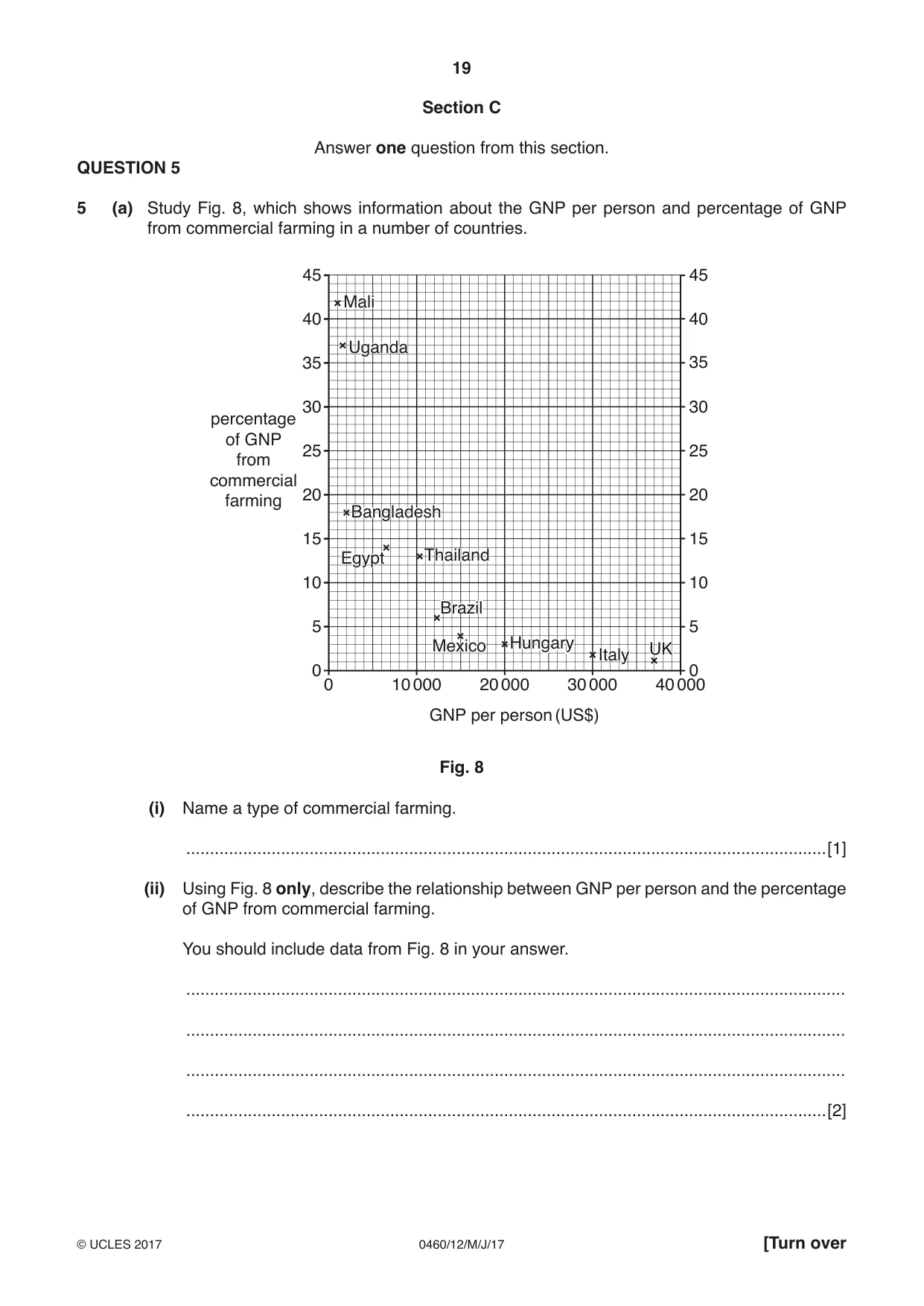
19 0460/12/M/J/17 © UCLES 2017 [Turn over Section C Answer one question from this section. QUESTION 5 5 (a) Study Fig. 8, which shows information about the GNP per person and percentage of GNP from commercial farming in a number of countries. 0 0 10 000 20 000 GNP per person (US$) Mali Uganda Bangladesh Egypt Thailand Brazil Mexico Hungary Italy UK 30 000 40 000 5 10 15 20 25 30 percentage of GNP from commercial farming 35 40 45 0 5 10 15 20 25 30 35 40 45 Mali Uganda Bangladesh Egypt Thailand Brazil Mexico Hungary Italy UK Fig. 8 (i) Name a type of commercial farming. …[1] (ii) Using Fig. 8 only, describe the relationship between GNP per person and the percentage of GNP from commercial farming. You should include data from Fig. 8 in your answer. … … … …[2]
Question paper, page 20
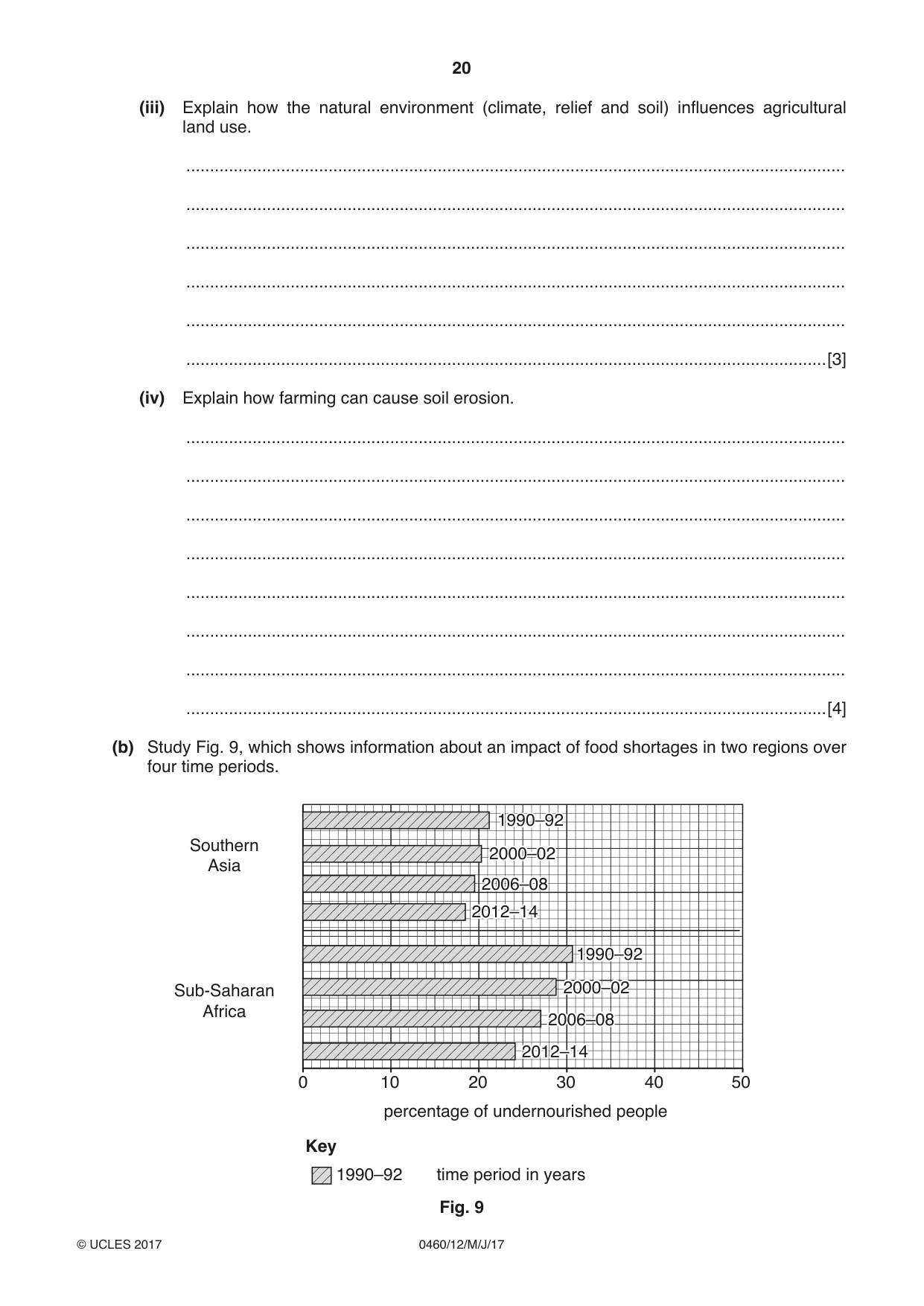
20 0460/12/M/J/17 © UCLES 2017 (iii) Explain how the natural environment (climate, relief and soil) influences agricultural land use. … … … … … …[3] (iv) Explain how farming can cause soil erosion. … … … … … … … …[4] (b) Study Fig. 9, which shows information about an impact of food shortages in two regions over four time periods. 0 10 20 30 percentage of undernourished people Key time period in years 1990–92 Sub-Saharan Africa Southern Asia 1990–92 2000–02 2006–08 2012–14 1990–92 2000–02 2006–08 2012–14 1990–92 2000–02 2006–08 2012–14 1990–92 2000–02 2006–08 2012–14 40 50 Fig. 9
Question paper, page 21
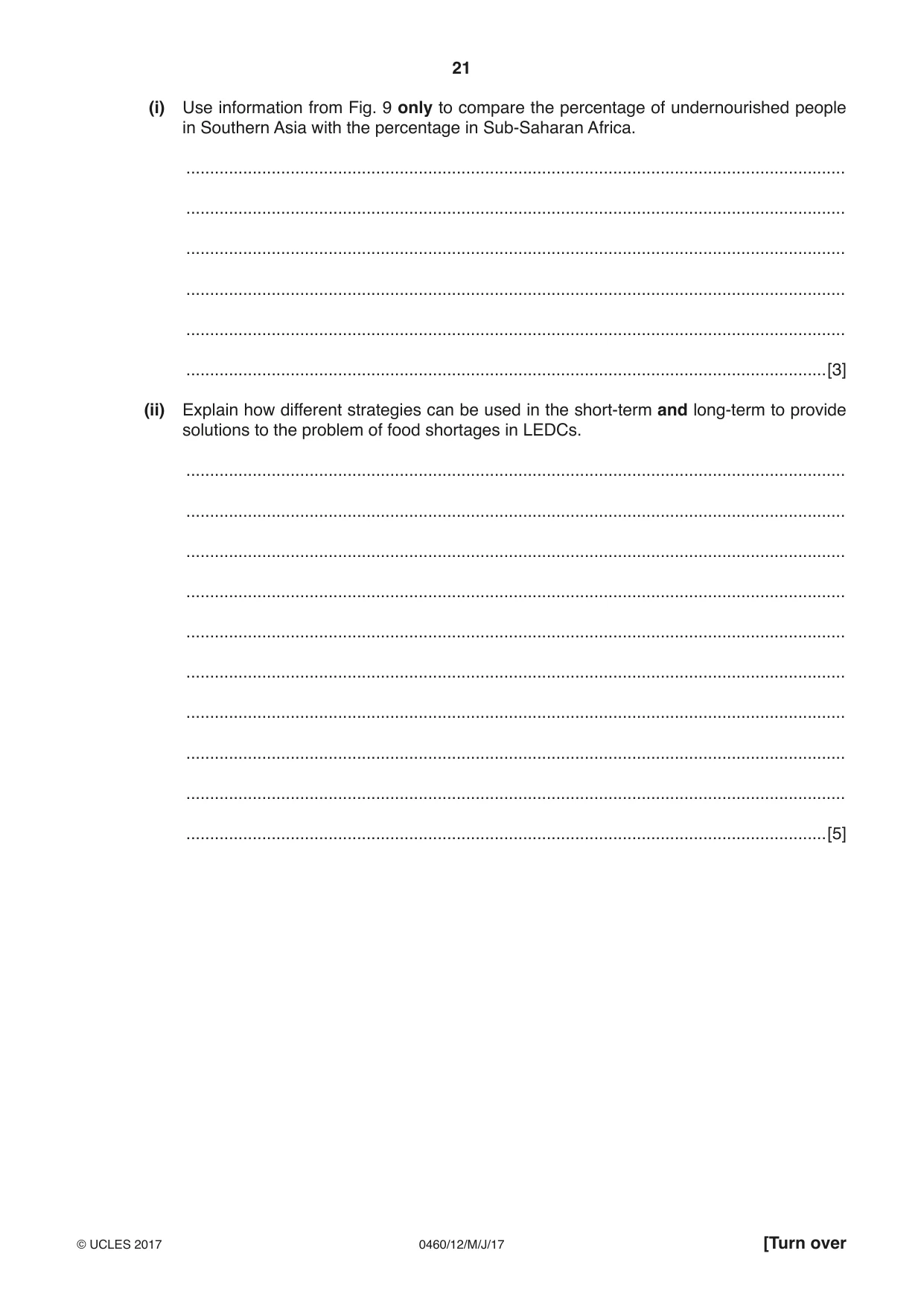
21 0460/12/M/J/17 © UCLES 2017 [Turn over (i) Use information from Fig. 9 only to compare the percentage of undernourished people in Southern Asia with the percentage in Sub-Saharan Africa. … … … … … …[3] (ii) Explain how different strategies can be used in the short-term and long-term to provide solutions to the problem of food shortages in LEDCs. … … … … … … … … … …[5]
Question paper, page 22
22 0460/12/M/J/17 © UCLES 2017 (c) For a named farm or agricultural area you have studied, describe the farming system. Name of farm or agricultural area … … … … … … … … … … … … … … … … … … … … … … … … …[7] [Total: 25 marks] END OF QUESTION 5
Question paper, page 23
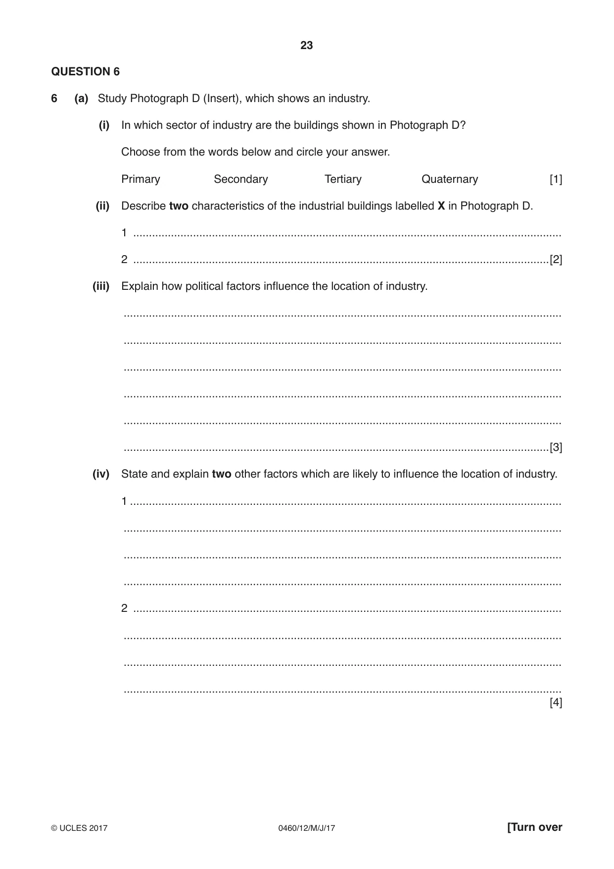
23 0460/12/M/J/17 © UCLES 2017 [Turn over QUESTION 6 6 (a) Study Photograph D (Insert), which shows an industry. (i) In which sector of industry are the buildings shown in Photograph D? Choose from the words below and circle your answer. Primary Secondary Tertiary Quaternary [1] (ii) Describe two characteristics of the industrial buildings labelled X in Photograph D. 1 … 2 …[2] (iii) Explain how political factors influence the location of industry. … … … … … …[3] (iv) State and explain two other factors which are likely to influence the location of industry. 1 … … … … 2 … … … … [4]
Question paper, page 24
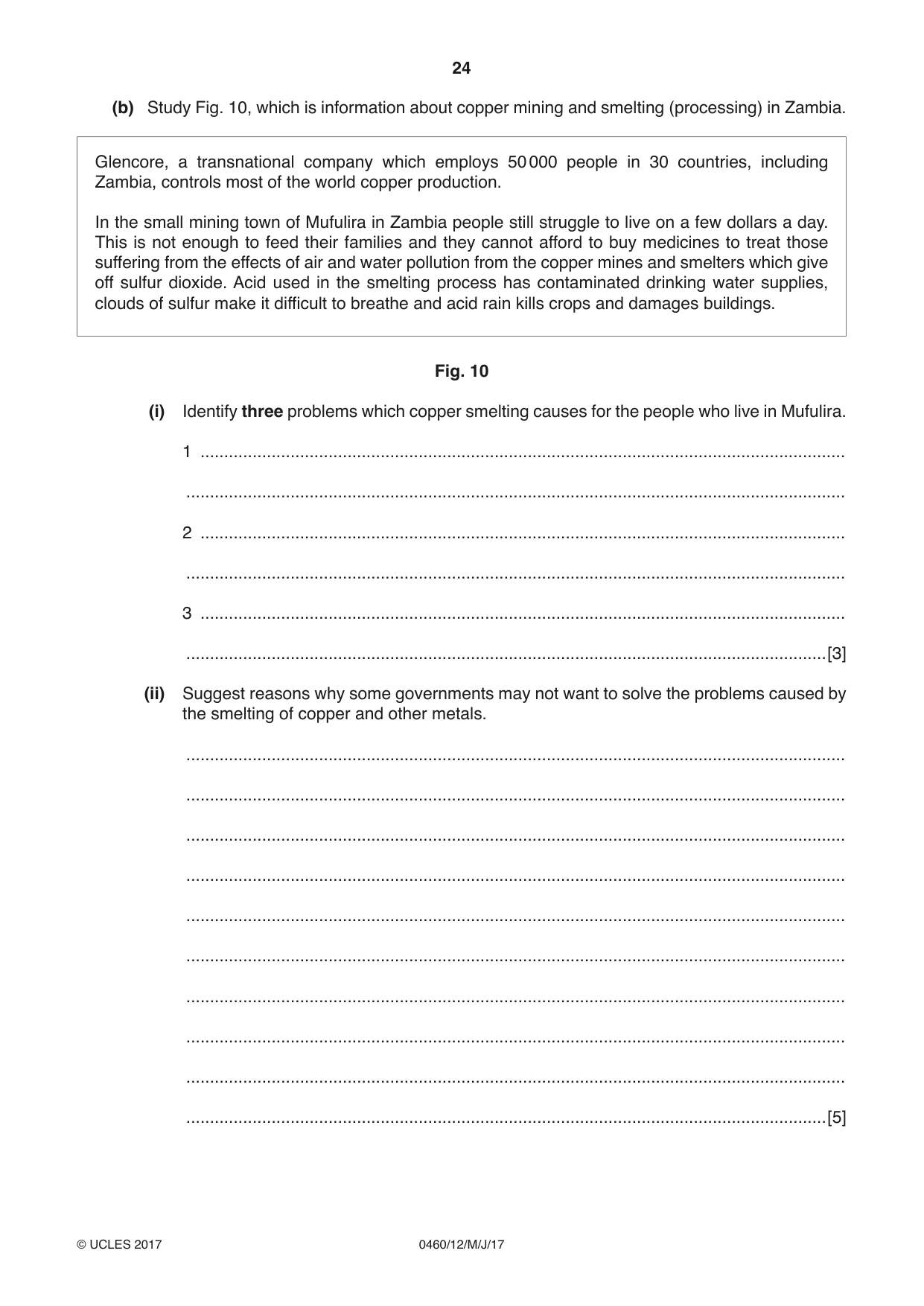
24 0460/12/M/J/17 © UCLES 2017 (b) Study Fig. 10, which is information about copper mining and smelting (processing) in Zambia. Glencore, a transnational company which employs 50 000 people in 30 countries, including Zambia, controls most of the world copper production. In the small mining town of Mufulira in Zambia people still struggle to live on a few dollars a day. This is not enough to feed their families and they cannot afford to buy medicines to treat those suffering from the effects of air and water pollution from the copper mines and smelters which give off sulfur dioxide. Acid used in the smelting process has contaminated drinking water supplies, clouds of sulfur make it difficult to breathe and acid rain kills crops and damages buildings. Fig. 10 (i) Identify three problems which copper smelting causes for the people who live in Mufulira. 1 … … 2 … … 3 … …[3] (ii) Suggest reasons why some governments may not want to solve the problems caused by the smelting of copper and other metals. … … … … … … … … … …[5]
Question paper, page 25
25 0460/12/M/J/17 © UCLES 2017 (c) Another economic activity is tourism. For a named example of an area you have studied, explain why the physical and human landscapes attract tourists. Name of area … … … … … … … … … … … … … … … … … … … … … … … … …[7] [Total: 25 marks] END OF QUESTION 6
Question paper, page 26
26 0460/12/M/J/17 © UCLES 2017 Additional Pages If you use the following lined pages to complete the answer(s) to any question(s), the question number(s) must be clearly shown. … … … … … … … … … … … … … … … … … … … … … … … … … …
Question paper, page 27
27 0460/12/M/J/17 © UCLES 2017 … … … … … … … … … … … … … … … … … … … … … … … … … … … …
Question paper, page 28
28 0460/12/M/J/17 © UCLES 2017 Permission to reproduce items where third-party owned material protected by copyright is included has been sought and cleared where possible. Every reasonable effort has been made by the publisher (UCLES) to trace copyright holders, but if any items requiring clearance have unwittingly been included, the publisher will be pleased to make amends at the earliest possible opportunity. To avoid the issue of disclosure of answer-related information to candidates, all copyright acknowledgements are reproduced online in the Cambridge International Examinations Copyright Acknowledgements Booklet. This is produced for each series of examinations and is freely available to download at www.cie.org.uk after the live examination series. Cambridge International Examinations is part of the Cambridge Assessment Group. Cambridge Assessment is the brand name of University of Cambridge Local Examinations Syndicate (UCLES), which is itself a department of the University of Cambridge. BLANK PAGE
Mark scheme, page 1
® IGCSE is a registered trademark. This syllabus is approved for use in England, Wales and Northern Ireland as a Cambridge International Level 1/Level 2 Certificate. This document consists of 18 printed pages. © UCLES 2017 [Turn over Cambridge International Examinations Cambridge International General Certificate of Secondary Education GEOGRAPHY 0460/12 Paper 1 May/June 2017 MARK SCHEME Maximum Mark: 75 Published This mark scheme is published as an aid to teachers and candidates, to indicate the requirements of the examination. It shows the basis on which Examiners were instructed to award marks. It does not indicate the details of the discussions that took place at an Examiners’ meeting before marking began, which would have considered the acceptability of alternative answers. Mark schemes should be read in conjunction with the question paper and the Principal Examiner Report for Teachers. Cambridge will not enter into discussions about these mark schemes. Cambridge is publishing the mark schemes for the May/June 2017 series for most Cambridge IGCSE®, Cambridge International A and AS Level and Cambridge Pre-U components, and some Cambridge O Level components.
Mark scheme, page 2
0460/12 Cambridge IGCSE – Mark Scheme PUBLISHED May/June 2017 © UCLES 2017 Page 2 of 18 Levels of response marking is used for section (c) of each question. Thus it is the quality of the response that determines which level an answer is achieved rather than the quantity of statements contained within it. However, once assigned to a level the mark achieved within that level is determined by the number of points made. Levels 1 and 2 are distinguished by whether statements are simple (level 1) or developed/elaborated (level 2). A candidate can immediately enter L2 by making developed points without making any L1 statements. In order to achieve L3 a candidate must have already reached the top end of L2 – in addition his/her answer should have a clear example and if the answer is place specific as well (7 marks). Highlight place specific detail. Where statements are assigned levels by the examiner this should be indicated by the use of L1 and L2 next to the statements. Ticks should not be used on answers that are marked using levels of response marking. L1 annotation should be removed once a L2 is awarded for an answer. L3 annotation is not used. There is no need for a summary level at the end of a response. Summary: Level 1 (1 to 3 marks): 1 simple statement (1 mark) 2 simple statements (2 marks) 3 simple statements (3 marks) Level 2 (4 to 6 marks): 1 developed statement (4 marks) 2 developed statements (5 marks) 3 or more developed statements with eg (6 marks) Level 3 (7 marks) 3 or more developed statements + named example with at least one piece of place specific detail.
Mark scheme, page 3
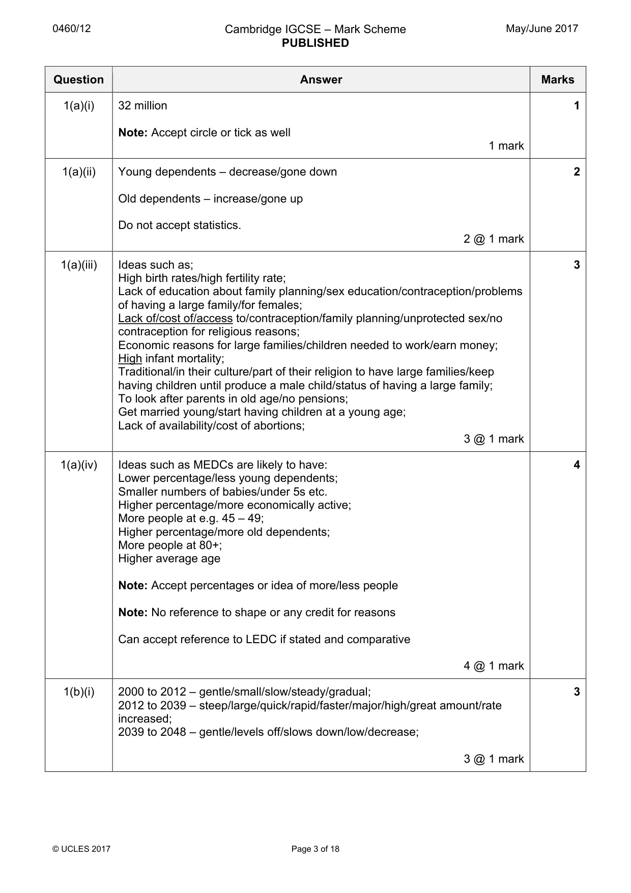
0460/12 Cambridge IGCSE – Mark Scheme PUBLISHED May/June 2017 © UCLES 2017 Page 3 of 18 Question Answer Marks 1(a)(i) 32 million Note: Accept circle or tick as well 1 mark 1 1(a)(ii) Young dependents – decrease/gone down Old dependents – increase/gone up Do not accept statistics. 2 @ 1 mark 2 1(a)(iii) Ideas such as; High birth rates/high fertility rate; Lack of education about family planning/sex education/contraception/problems of having a large family/for females; Lack of/cost of/access to/contraception/family planning/unprotected sex/no contraception for religious reasons; Economic reasons for large families/children needed to work/earn money; High infant mortality; Traditional/in their culture/part of their religion to have large families/keep having children until produce a male child/status of having a large family; To look after parents in old age/no pensions; Get married young/start having children at a young age; Lack of availability/cost of abortions; 3 @ 1 mark 3 1(a)(iv) Ideas such as MEDCs are likely to have: Lower percentage/less young dependents; Smaller numbers of babies/under 5s etc. Higher percentage/more economically active; More people at e.g. 45 – 49; Higher percentage/more old dependents; More people at 80+; Higher average age Note: Accept percentages or idea of more/less people Note: No reference to shape or any credit for reasons Can accept reference to LEDC if stated and comparative 4 @ 1 mark 4 1(b)(i) 2000 to 2012 – gentle/small/slow/steady/gradual; 2012 to 2039 – steep/large/quick/rapid/faster/major/high/great amount/rate increased; 2039 to 2048 – gentle/levels off/slows down/low/decrease; 3 @ 1 mark 3
Mark scheme, page 4
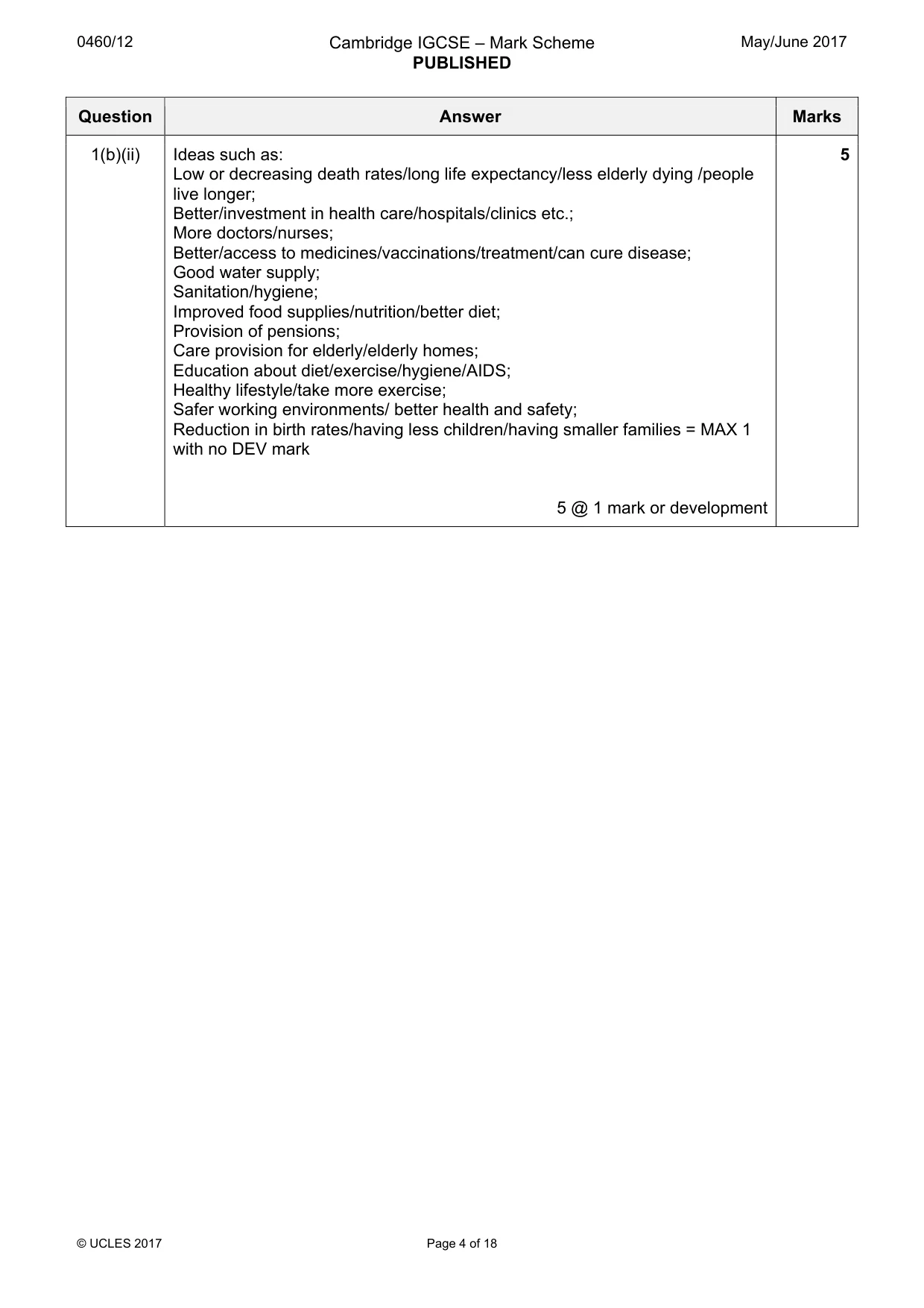
0460/12 Cambridge IGCSE – Mark Scheme PUBLISHED May/June 2017 © UCLES 2017 Page 4 of 18 Question Answer Marks 1(b)(ii) Ideas such as: Low or decreasing death rates/long life expectancy/less elderly dying /people live longer; Better/investment in health care/hospitals/clinics etc.; More doctors/nurses; Better/access to medicines/vaccinations/treatment/can cure disease; Good water supply; Sanitation/hygiene; Improved food supplies/nutrition/better diet; Provision of pensions; Care provision for elderly/elderly homes; Education about diet/exercise/hygiene/AIDS; Healthy lifestyle/take more exercise; Safer working environments/ better health and safety; Reduction in birth rates/having less children/having smaller families = MAX 1 with no DEV mark 5 @ 1 mark or development 5
Mark scheme, page 5
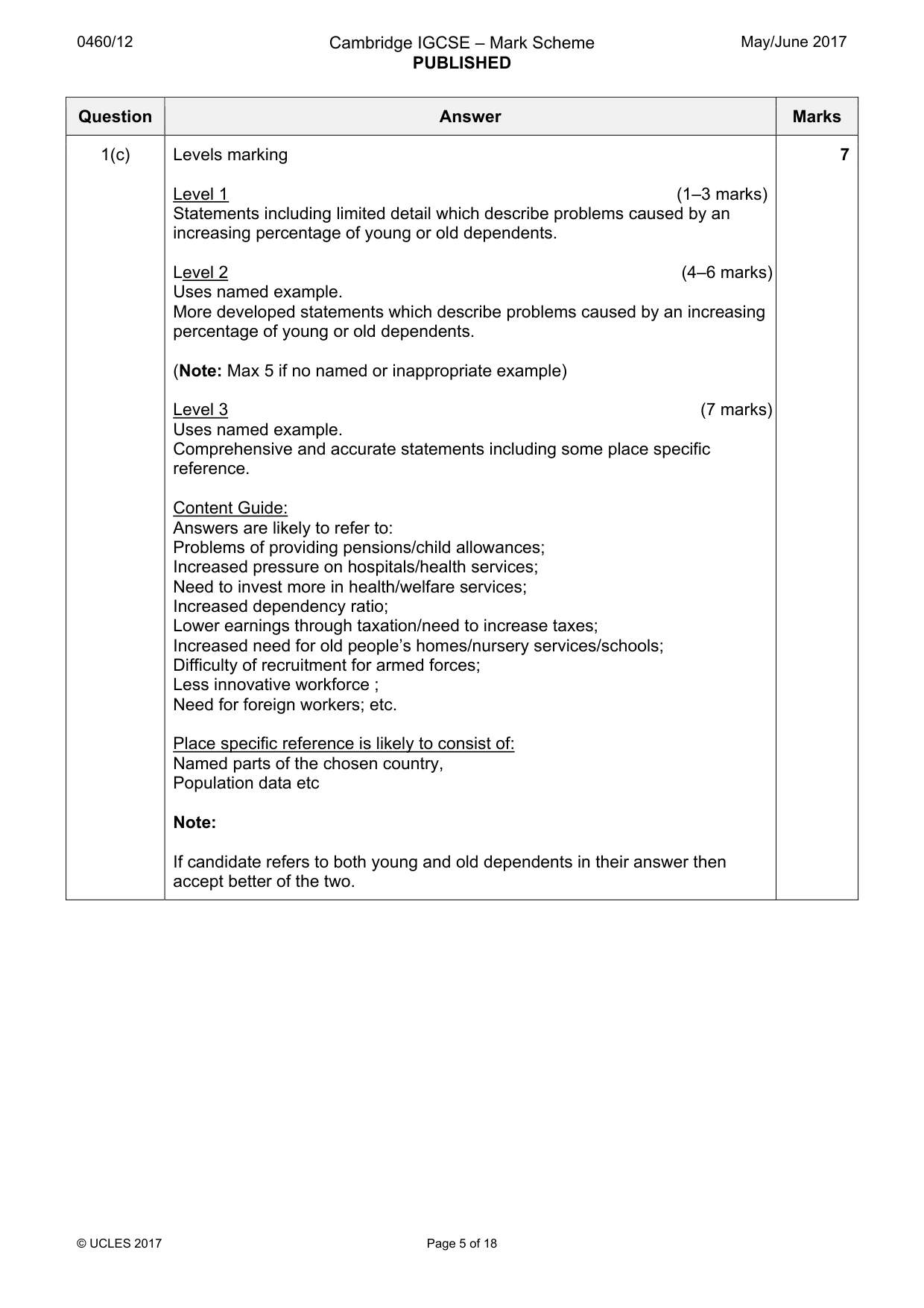
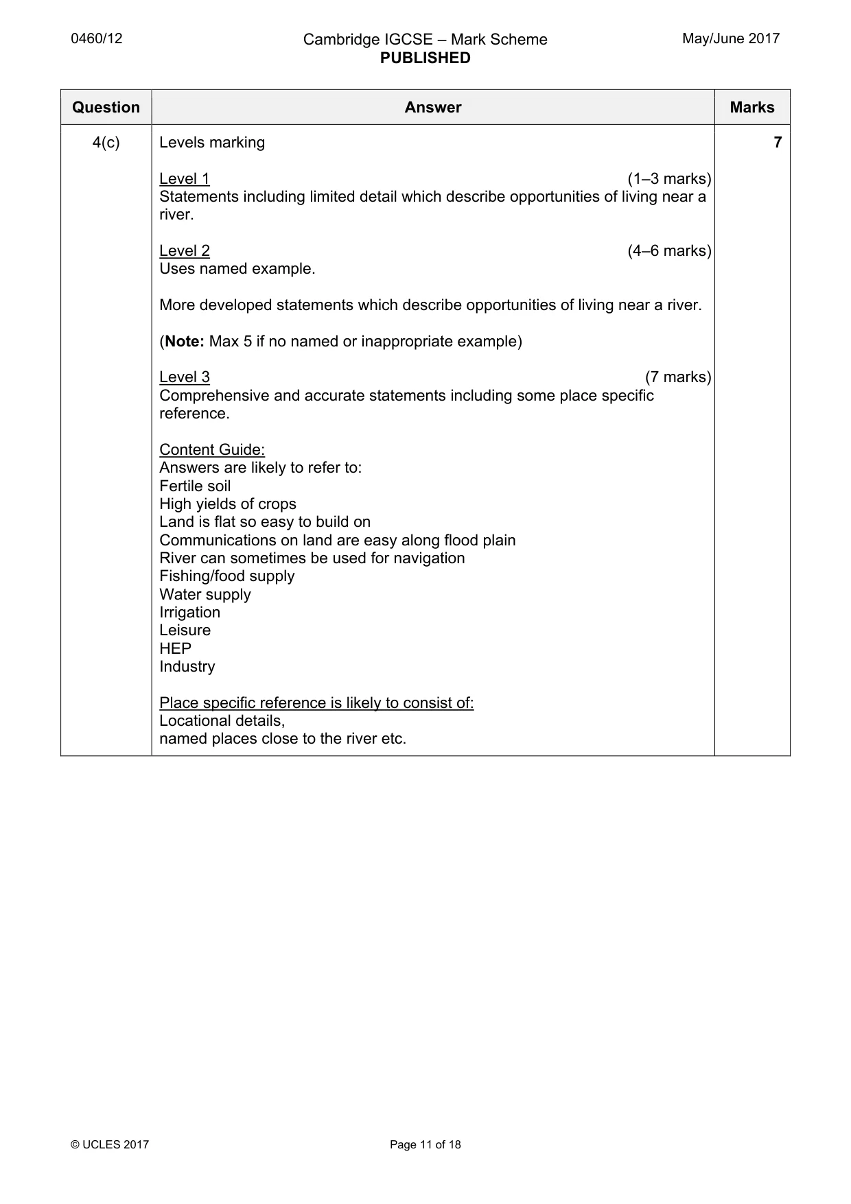
0460/12 Cambridge IGCSE – Mark Scheme PUBLISHED May/June 2017 © UCLES 2017 Page 5 of 18 Question Answer Marks 1(c) Levels marking Level 1 (1–3 marks) Statements including limited detail which describe problems caused by an increasing percentage of young or old dependents. Level 2 (4–6 marks) Uses named example. More developed statements which describe problems caused by an increasing percentage of young or old dependents. (Note: Max 5 if no named or inappropriate example) Level 3 (7 marks) Uses named example. Comprehensive and accurate statements including some place specific reference. Content Guide: Answers are likely to refer to: Problems of providing pensions/child allowances; Increased pressure on hospitals/health services; Need to invest more in health/welfare services; Increased dependency ratio; Lower earnings through taxation/need to increase taxes; Increased need for old people’s homes/nursery services/schools; Difficulty of recruitment for armed forces; Less innovative workforce ; Need for foreign workers; etc. Place specific reference is likely to consist of: Named parts of the chosen country, Population data etc Note: If candidate refers to both young and old dependents in their answer then accept better of the two. 7
Mark scheme, page 6
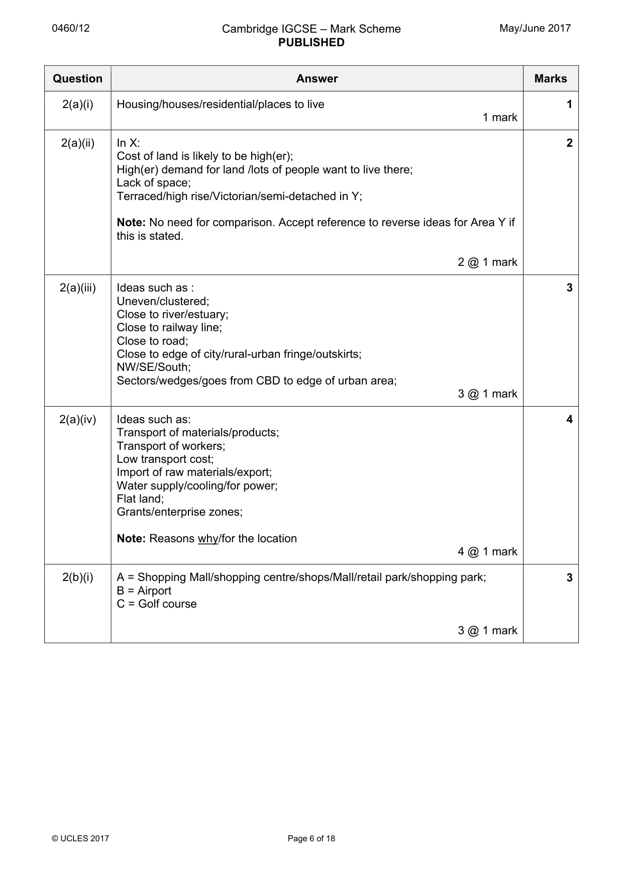
0460/12 Cambridge IGCSE – Mark Scheme PUBLISHED May/June 2017 © UCLES 2017 Page 6 of 18 Question Answer Marks 2(a)(i) Housing/houses/residential/places to live 1 mark 1 2(a)(ii) In X: Cost of land is likely to be high(er); High(er) demand for land /lots of people want to live there; Lack of space; Terraced/high rise/Victorian/semi-detached in Y; Note: No need for comparison. Accept reference to reverse ideas for Area Y if this is stated. 2 @ 1 mark 2 2(a)(iii) Ideas such as : Uneven/clustered; Close to river/estuary; Close to railway line; Close to road; Close to edge of city/rural-urban fringe/outskirts; NW/SE/South; Sectors/wedges/goes from CBD to edge of urban area; 3 @ 1 mark 3 2(a)(iv) Ideas such as: Transport of materials/products; Transport of workers; Low transport cost; Import of raw materials/export; Water supply/cooling/for power; Flat land; Grants/enterprise zones; Note: Reasons why/for the location 4 @ 1 mark 4 2(b)(i) A = Shopping Mall/shopping centre/shops/Mall/retail park/shopping park; B = Airport C = Golf course 3 @ 1 mark 3
Mark scheme, page 7
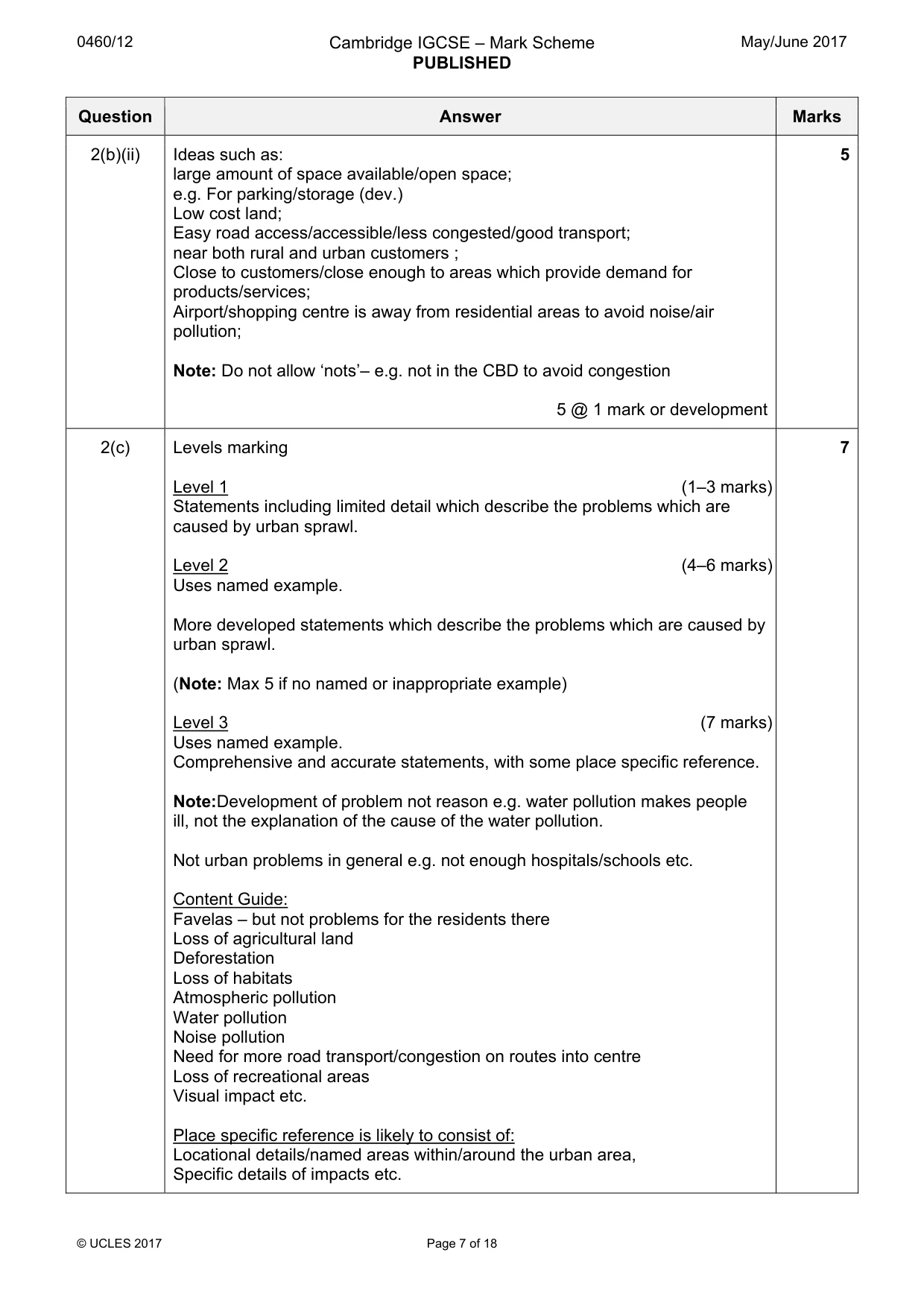
0460/12 Cambridge IGCSE – Mark Scheme PUBLISHED May/June 2017 © UCLES 2017 Page 7 of 18 Question Answer Marks 2(b)(ii) Ideas such as: large amount of space available/open space; e.g. For parking/storage (dev.) Low cost land; Easy road access/accessible/less congested/good transport; near both rural and urban customers ; Close to customers/close enough to areas which provide demand for products/services; Airport/shopping centre is away from residential areas to avoid noise/air pollution; Note: Do not allow ‘nots’– e.g. not in the CBD to avoid congestion 5 @ 1 mark or development 5 2(c) Levels marking Level 1 (1–3 marks) Statements including limited detail which describe the problems which are caused by urban sprawl. Level 2 (4–6 marks) Uses named example. More developed statements which describe the problems which are caused by urban sprawl. (Note: Max 5 if no named or inappropriate example) Level 3 (7 marks) Uses named example. Comprehensive and accurate statements, with some place specific reference. Note:Development of problem not reason e.g. water pollution makes people ill, not the explanation of the cause of the water pollution. Not urban problems in general e.g. not enough hospitals/schools etc. Content Guide: Favelas – but not problems for the residents there Loss of agricultural land Deforestation Loss of habitats Atmospheric pollution Water pollution Noise pollution Need for more road transport/congestion on routes into centre Loss of recreational areas Visual impact etc. Place specific reference is likely to consist of: Locational details/named areas within/around the urban area, Specific details of impacts etc. 7
Mark scheme, page 8
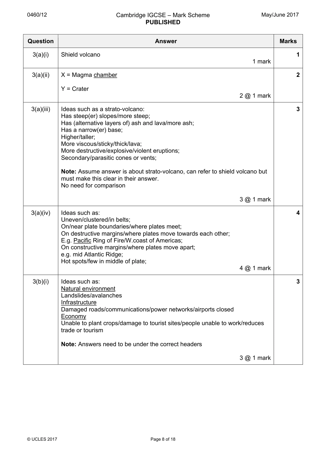
0460/12 Cambridge IGCSE – Mark Scheme PUBLISHED May/June 2017 © UCLES 2017 Page 8 of 18 Question Answer Marks 3(a)(i) Shield volcano 1 mark 1 3(a)(ii) X = Magma chamber Y = Crater 2 @ 1 mark 2 3(a)(iii) Ideas such as a strato-volcano: Has steep(er) slopes/more steep; Has (alternative layers of) ash and lava/more ash; Has a narrow(er) base; Higher/taller; More viscous/sticky/thick/lava; More destructive/explosive/violent eruptions; Secondary/parasitic cones or vents; Note: Assume answer is about strato-volcano, can refer to shield volcano but must make this clear in their answer. No need for comparison 3 @ 1 mark 3 3(a)(iv) Ideas such as: Uneven/clustered/in belts; On/near plate boundaries/where plates meet; On destructive margins/where plates move towards each other; E.g. Pacific Ring of Fire/W.coast of Americas; On constructive margins/where plates move apart; e.g. mid Atlantic Ridge; Hot spots/few in middle of plate; 4 @ 1 mark 4 3(b)(i) Ideas such as: Natural environment Landslides/avalanches Infrastructure Damaged roads/communications/power networks/airports closed Economy Unable to plant crops/damage to tourist sites/people unable to work/reduces trade or tourism Note: Answers need to be under the correct headers 3 @ 1 mark 3
Mark scheme, page 9
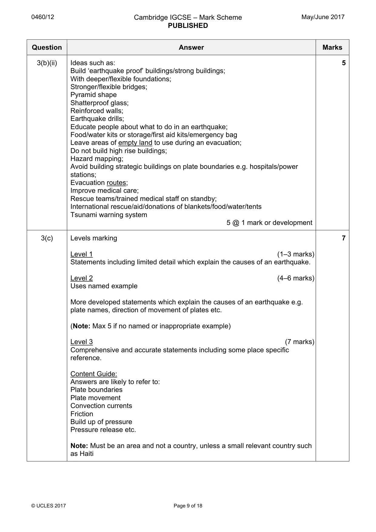
0460/12 Cambridge IGCSE – Mark Scheme PUBLISHED May/June 2017 © UCLES 2017 Page 9 of 18 Question Answer Marks 3(b)(ii) Ideas such as: Build ‘earthquake proof’ buildings/strong buildings; With deeper/flexible foundations; Stronger/flexible bridges; Pyramid shape Shatterproof glass; Reinforced walls; Earthquake drills; Educate people about what to do in an earthquake; Food/water kits or storage/first aid kits/emergency bag Leave areas of empty land to use during an evacuation; Do not build high rise buildings; Hazard mapping; Avoid building strategic buildings on plate boundaries e.g. hospitals/power stations; Evacuation routes; Improve medical care; Rescue teams/trained medical staff on standby; International rescue/aid/donations of blankets/food/water/tents Tsunami warning system 5 @ 1 mark or development 5 3(c) Levels marking Level 1 (1–3 marks) Statements including limited detail which explain the causes of an earthquake. Level 2 (4–6 marks) Uses named example More developed statements which explain the causes of an earthquake e.g. plate names, direction of movement of plates etc. (Note: Max 5 if no named or inappropriate example) Level 3 (7 marks) Comprehensive and accurate statements including some place specific reference. Content Guide: Answers are likely to refer to: Plate boundaries Plate movement Convection currents Friction Build up of pressure Pressure release etc. Note: Must be an area and not a country, unless a small relevant country such as Haiti 7
Mark scheme, page 10
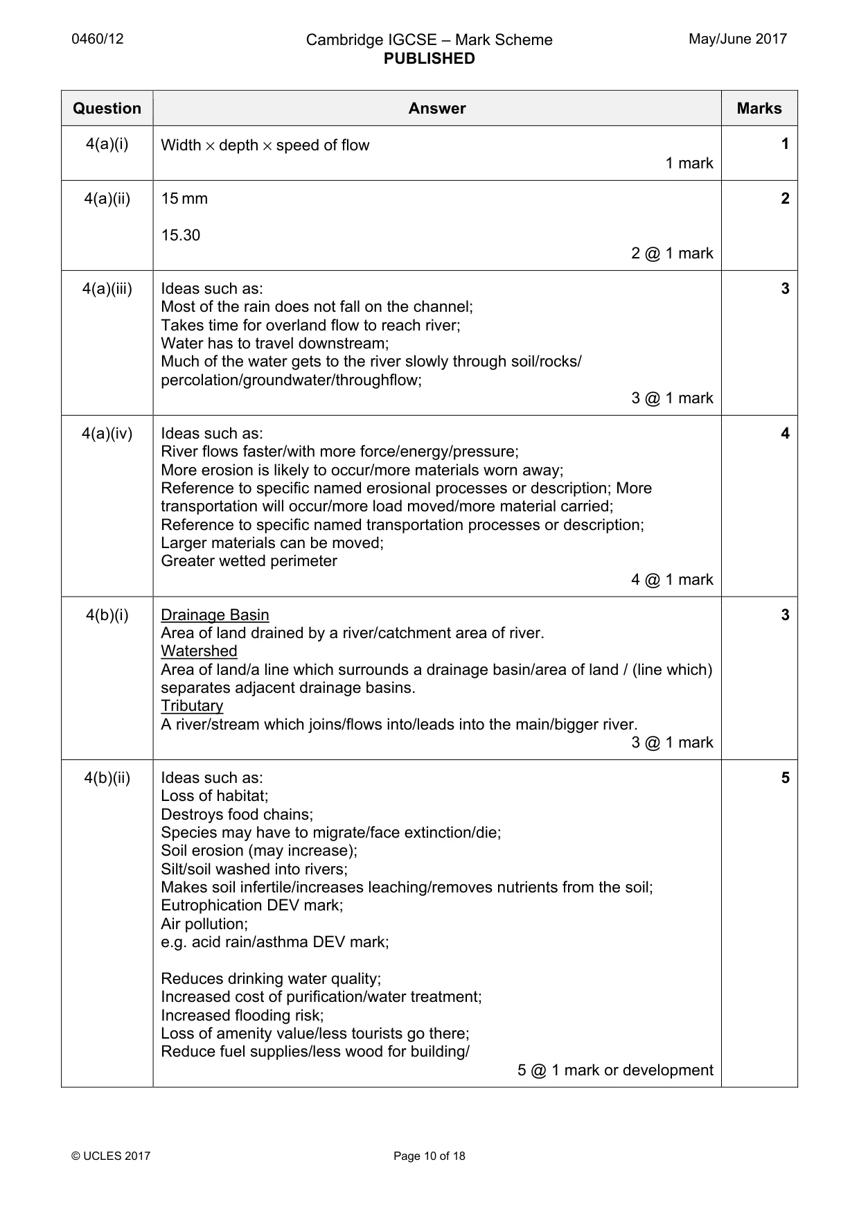
0460/12 Cambridge IGCSE – Mark Scheme PUBLISHED May/June 2017 © UCLES 2017 Page 10 of 18 Question Answer Marks 4(a)(i) Width × depth × speed of flow 1 mark 1 4(a)(ii) 15 mm 15.30 2 @ 1 mark 2 4(a)(iii) Ideas such as: Most of the rain does not fall on the channel; Takes time for overland flow to reach river; Water has to travel downstream; Much of the water gets to the river slowly through soil/rocks/ percolation/groundwater/throughflow; 3 @ 1 mark 3 4(a)(iv) Ideas such as: River flows faster/with more force/energy/pressure; More erosion is likely to occur/more materials worn away; Reference to specific named erosional processes or description; More transportation will occur/more load moved/more material carried; Reference to specific named transportation processes or description; Larger materials can be moved; Greater wetted perimeter 4 @ 1 mark 4 4(b)(i) Drainage Basin Area of land drained by a river/catchment area of river. Watershed Area of land/a line which surrounds a drainage basin/area of land / (line which) separates adjacent drainage basins. Tributary A river/stream which joins/flows into/leads into the main/bigger river. 3 @ 1 mark 3 4(b)(ii) Ideas such as: Loss of habitat; Destroys food chains; Species may have to migrate/face extinction/die; Soil erosion (may increase); Silt/soil washed into rivers; Makes soil infertile/increases leaching/removes nutrients from the soil; Eutrophication DEV mark; Air pollution; e.g. acid rain/asthma DEV mark; Reduces drinking water quality; Increased cost of purification/water treatment; Increased flooding risk; Loss of amenity value/less tourists go there; Reduce fuel supplies/less wood for building/ 5 @ 1 mark or development 5
Mark scheme, page 11
0460/12 Cambridge IGCSE – Mark Scheme PUBLISHED May/June 2017 © UCLES 2017 Page 11 of 18 Question Answer Marks 4(c) Levels marking Level 1 (1–3 marks) Statements including limited detail which describe opportunities of living near a river. Level 2 (4–6 marks) Uses named example. More developed statements which describe opportunities of living near a river. (Note: Max 5 if no named or inappropriate example) Level 3 (7 marks) Comprehensive and accurate statements including some place specific reference. Content Guide: Answers are likely to refer to: Fertile soil High yields of crops Land is flat so easy to build on Communications on land are easy along flood plain River can sometimes be used for navigation Fishing/food supply Water supply Irrigation Leisure HEP Industry Place specific reference is likely to consist of: Locational details, named places close to the river etc. 7
Mark scheme, page 12
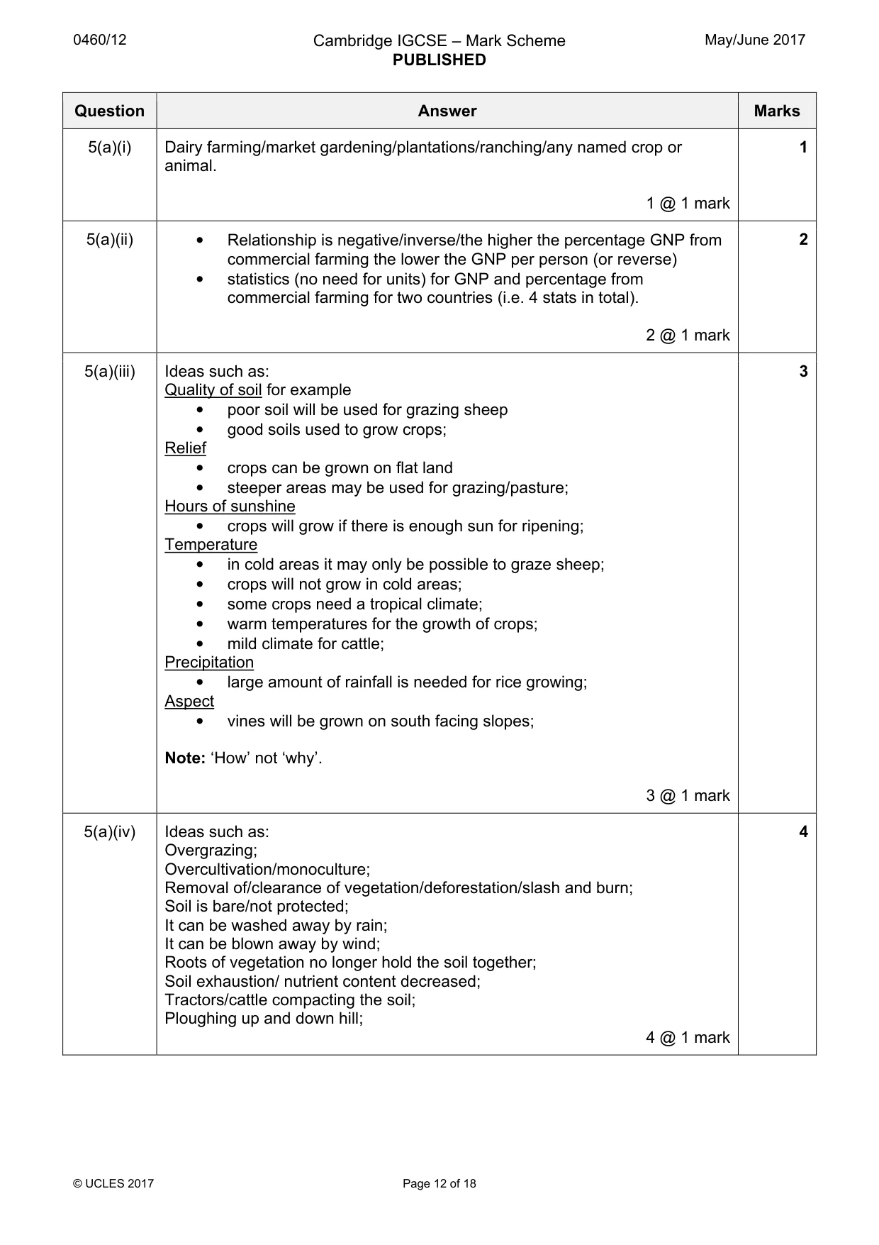
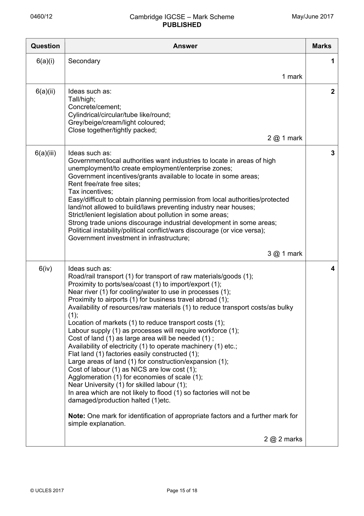
0460/12 Cambridge IGCSE – Mark Scheme PUBLISHED May/June 2017 © UCLES 2017 Page 12 of 18 Question Answer Marks 5(a)(i) Dairy farming/market gardening/plantations/ranching/any named crop or animal. 1 @ 1 mark 1 5(a)(ii) • Relationship is negative/inverse/the higher the percentage GNP from commercial farming the lower the GNP per person (or reverse) • statistics (no need for units) for GNP and percentage from commercial farming for two countries (i.e. 4 stats in total). 2 @ 1 mark 2 5(a)(iii) Ideas such as: Quality of soil for example • poor soil will be used for grazing sheep • good soils used to grow crops; Relief • crops can be grown on flat land • steeper areas may be used for grazing/pasture; Hours of sunshine • crops will grow if there is enough sun for ripening; Temperature • in cold areas it may only be possible to graze sheep; • crops will not grow in cold areas; • some crops need a tropical climate; • warm temperatures for the growth of crops; • mild climate for cattle; Precipitation • large amount of rainfall is needed for rice growing; Aspect • vines will be grown on south facing slopes; Note: ‘How’ not ‘why’. 3 @ 1 mark 3 5(a)(iv) Ideas such as: Overgrazing; Overcultivation/monoculture; Removal of/clearance of vegetation/deforestation/slash and burn; Soil is bare/not protected; It can be washed away by rain; It can be blown away by wind; Roots of vegetation no longer hold the soil together; Soil exhaustion/ nutrient content decreased; Tractors/cattle compacting the soil; Ploughing up and down hill; 4 @ 1 mark 4
Mark scheme, page 13
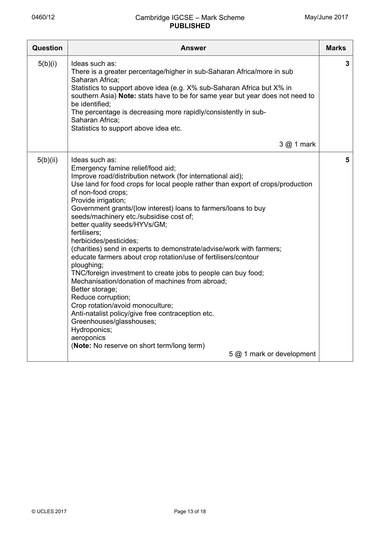
0460/12 Cambridge IGCSE – Mark Scheme PUBLISHED May/June 2017 © UCLES 2017 Page 13 of 18 Question Answer Marks 5(b)(i) Ideas such as: There is a greater percentage/higher in sub-Saharan Africa/more in sub Saharan Africa; Statistics to support above idea (e.g. X% sub-Saharan Africa but X% in southern Asia) Note: stats have to be for same year but year does not need to be identified; The percentage is decreasing more rapidly/consistently in sub- Saharan Africa; Statistics to support above idea etc. 3 @ 1 mark 3 5(b)(ii) Ideas such as: Emergency famine relief/food aid; Improve road/distribution network (for international aid); Use land for food crops for local people rather than export of crops/production of non-food crops; Provide irrigation; Government grants/(low interest) loans to farmers/loans to buy seeds/machinery etc./subsidise cost of; better quality seeds/HYVs/GM; fertilisers; herbicides/pesticides; (charities) send in experts to demonstrate/advise/work with farmers; educate farmers about crop rotation/use of fertilisers/contour ploughing; TNC/foreign investment to create jobs to people can buy food; Mechanisation/donation of machines from abroad; Better storage; Reduce corruption; Crop rotation/avoid monoculture; Anti-natalist policy/give free contraception etc. Greenhouses/glasshouses; Hydroponics; aeroponics (Note: No reserve on short term/long term) 5 @ 1 mark or development 5
Mark scheme, page 14
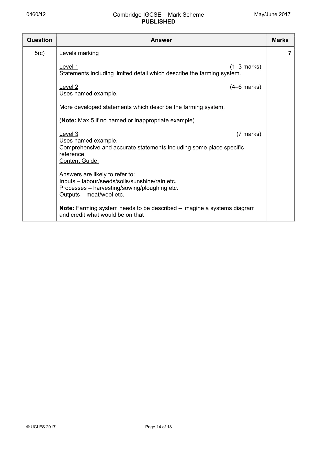
0460/12 Cambridge IGCSE – Mark Scheme PUBLISHED May/June 2017 © UCLES 2017 Page 14 of 18 Question Answer Marks 5(c) Levels marking Level 1 (1–3 marks) Statements including limited detail which describe the farming system. Level 2 (4–6 marks) Uses named example. More developed statements which describe the farming system. (Note: Max 5 if no named or inappropriate example) Level 3 (7 marks) Uses named example. Comprehensive and accurate statements including some place specific reference. Content Guide: Answers are likely to refer to: Inputs – labour/seeds/soils/sunshine/rain etc. Processes – harvesting/sowing/ploughing etc. Outputs – meat/wool etc. Note: Farming system needs to be described – imagine a systems diagram and credit what would be on that 7
Mark scheme, page 15
0460/12 Cambridge IGCSE – Mark Scheme PUBLISHED May/June 2017 © UCLES 2017 Page 15 of 18 Question Answer Marks 6(a)(i) Secondary 1 mark 1 6(a)(ii) Ideas such as: Tall/high; Concrete/cement; Cylindrical/circular/tube like/round; Grey/beige/cream/light coloured; Close together/tightly packed; 2 @ 1 mark 2 6(a)(iii) Ideas such as: Government/local authorities want industries to locate in areas of high unemployment/to create employment/enterprise zones; Government incentives/grants available to locate in some areas; Rent free/rate free sites; Tax incentives; Easy/difficult to obtain planning permission from local authorities/protected land/not allowed to build/laws preventing industry near houses; Strict/lenient legislation about pollution in some areas; Strong trade unions discourage industrial development in some areas; Political instability/political conflict/wars discourage (or vice versa); Government investment in infrastructure; 3 @ 1 mark 3 6(iv) Ideas such as: Road/rail transport (1) for transport of raw materials/goods (1); Proximity to ports/sea/coast (1) to import/export (1); Near river (1) for cooling/water to use in processes (1); Proximity to airports (1) for business travel abroad (1); Availability of resources/raw materials (1) to reduce transport costs/as bulky (1); Location of markets (1) to reduce transport costs (1); Labour supply (1) as processes will require workforce (1); Cost of land (1) as large area will be needed (1) ; Availability of electricity (1) to operate machinery (1) etc.; Flat land (1) factories easily constructed (1); Large areas of land (1) for construction/expansion (1); Cost of labour (1) as NICS are low cost (1); Agglomeration (1) for economies of scale (1); Near University (1) for skilled labour (1); In area which are not likely to flood (1) so factories will not be damaged/production halted (1)etc. Note: One mark for identification of appropriate factors and a further mark for simple explanation. 2 @ 2 marks 4
Mark scheme, page 16
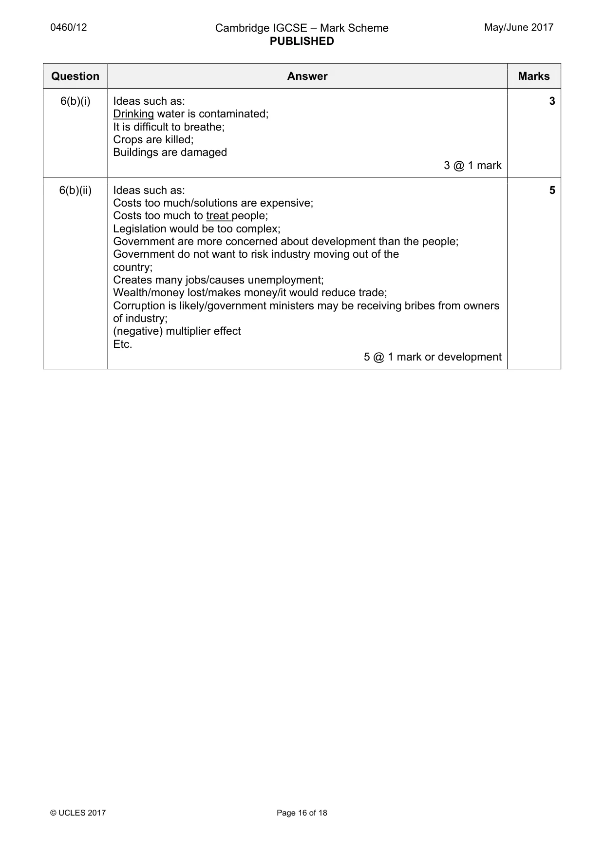
0460/12 Cambridge IGCSE – Mark Scheme PUBLISHED May/June 2017 © UCLES 2017 Page 16 of 18 Question Answer Marks 6(b)(i) Ideas such as: Drinking water is contaminated; It is difficult to breathe; Crops are killed; Buildings are damaged 3 @ 1 mark 3 6(b)(ii) Ideas such as: Costs too much/solutions are expensive; Costs too much to treat people; Legislation would be too complex; Government are more concerned about development than the people; Government do not want to risk industry moving out of the country; Creates many jobs/causes unemployment; Wealth/money lost/makes money/it would reduce trade; Corruption is likely/government ministers may be receiving bribes from owners of industry; (negative) multiplier effect Etc. 5 @ 1 mark or development 5
Mark scheme, page 17
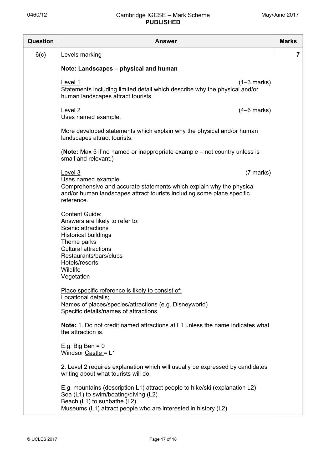
0460/12 Cambridge IGCSE – Mark Scheme PUBLISHED May/June 2017 © UCLES 2017 Page 17 of 18 Question Answer Marks 6(c) Levels marking Note: Landscapes – physical and human Level 1 (1–3 marks) Statements including limited detail which describe why the physical and/or human landscapes attract tourists. Level 2 (4–6 marks) Uses named example. More developed statements which explain why the physical and/or human landscapes attract tourists. (Note: Max 5 if no named or inappropriate example – not country unless is small and relevant.) Level 3 (7 marks) Uses named example. Comprehensive and accurate statements which explain why the physical and/or human landscapes attract tourists including some place specific reference. Content Guide: Answers are likely to refer to: Scenic attractions Historical buildings Theme parks Cultural attractions Restaurants/bars/clubs Hotels/resorts Wildlife Vegetation Place specific reference is likely to consist of: Locational details; Names of places/species/attractions (e.g. Disneyworld) Specific details/names of attractions Note: 1. Do not credit named attractions at L1 unless the name indicates what the attraction is. E.g. Big Ben = 0 Windsor Castle = L1 2. Level 2 requires explanation which will usually be expressed by candidates writing about what tourists will do. E.g. mountains (description L1) attract people to hike/ski (explanation L2) Sea (L1) to swim/boating/diving (L2) Beach (L1) to sunbathe (L2) Museums (L1) attract people who are interested in history (L2) 7
Mark scheme, page 18
0460/12 Cambridge IGCSE – Mark Scheme PUBLISHED May/June 2017 © UCLES 2017 Page 18 of 18 Question Answer Marks However do not credit explanation at L2 which simply states the obvious E.g. beaches for relaxation, restaurants to eat/drink, clubs to play in, art galleries to visit, forest to look at, explore the desert etc. These could be elaborated for L2 credit Eg art galleries to look at famous paintings (L2). Restaurants to eat a variety of local seafood.(L2)
What you needed in this session
Cambridge’s own grade thresholds for 2017 May/June, Paper 1 · Variant 2. A higher threshold means an easier paper — the bar moves with how the cohort did.