Cambridge IGCSE Geography 0460 — 2014 May/June Paper 1 · Variant 2
0460/12/M/J/14 · 75 marks · ≈84 min
The question paper and its mark scheme, free to read here and free to download. This is Cambridge’s own paper, exactly as it was sat.
Question paper32 pages


Mark scheme15 pages
Answers below. Sit the paper first if you are practising.
Paper as text
Question paper, page 1
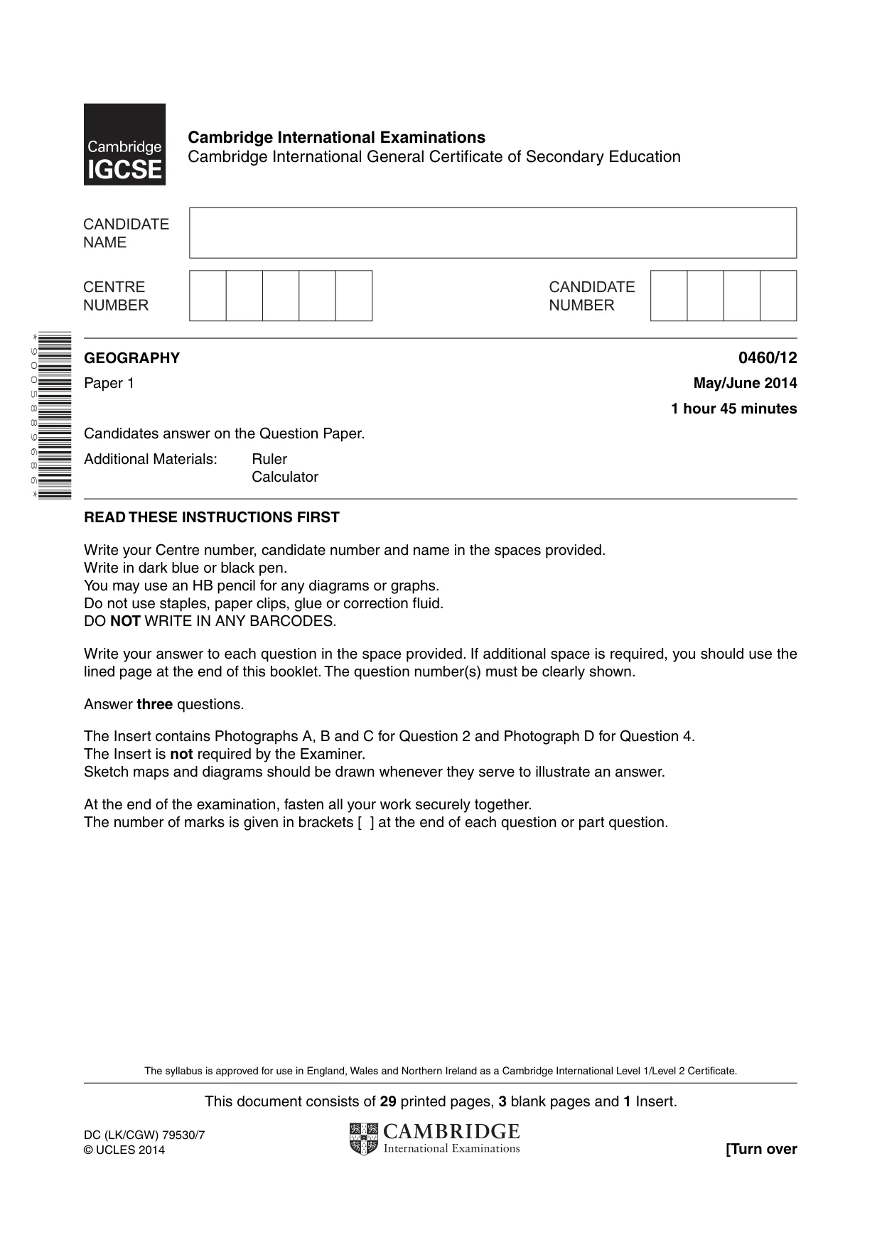
This document consists of 29 printed pages, 3 blank pages and 1 Insert. DC (LK/CGW) 79530/7 © UCLES 2014 [Turn over * 9 0 0 5 8 8 9 6 8 6 * GEOGRAPHY 0460/12 Paper 1 May/June 2014 1 hour 45 minutes Candidates answer on the Question Paper. Additional Materials: Ruler Calculator READ THESE INSTRUCTIONS FIRST Write your Centre number, candidate number and name in the spaces provided. Write in dark blue or black pen. You may use an HB pencil for any diagrams or graphs. Do not use staples, paper clips, glue or correction fluid. DO NOT WRITE IN ANY BARCODES. Write your answer to each question in the space provided. If additional space is required, you should use the lined page at the end of this booklet. The question number(s) must be clearly shown. Answer three questions. The Insert contains Photographs A, B and C for Question 2 and Photograph D for Question 4. The Insert is not required by the Examiner. Sketch maps and diagrams should be drawn whenever they serve to illustrate an answer. At the end of the examination, fasten all your work securely together. The number of marks is given in brackets [ ] at the end of each question or part question. Cambridge International Examinations Cambridge International General Certificate of Secondary Education The syllabus is approved for use in England, Wales and Northern Ireland as a Cambridge International Level 1/Level 2 Certificate.
Question paper, page 2
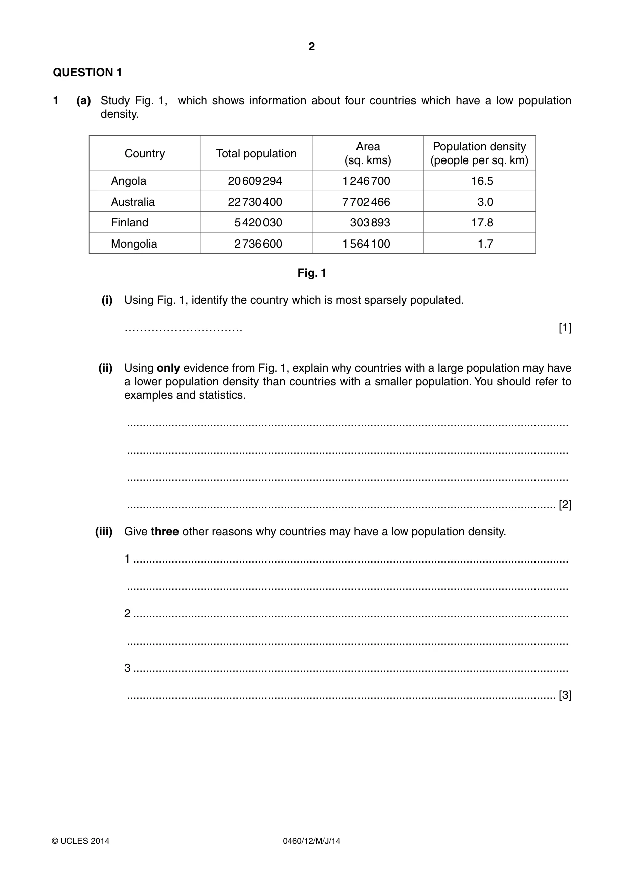
2 0460/12/M/J/14 © UCLES 2014 QUESTION 1 1 (a) Study Fig. 1, which shows information about four countries which have a low population density. Country Total population Area (sq. kms) Population density (people per sq. km) Angola 20 609 294 1 246 700 16.5 Australia 22 730 400 7 702 466 3.0 Finland 5 420 030 303 893 17.8 Mongolia 2 736 600 1 564 100 1.7 Fig. 1 (i) Using Fig. 1, identify the country which is most sparsely populated. …………………………. [1] (ii) Using only evidence from Fig. 1, explain why countries with a large population may have a lower population density than countries with a smaller population. You should refer to examples and statistics. … … … … [2] (iii) Give three other reasons why countries may have a low population density. 1 … … 2 … … 3 … … [3]
Question paper, page 3
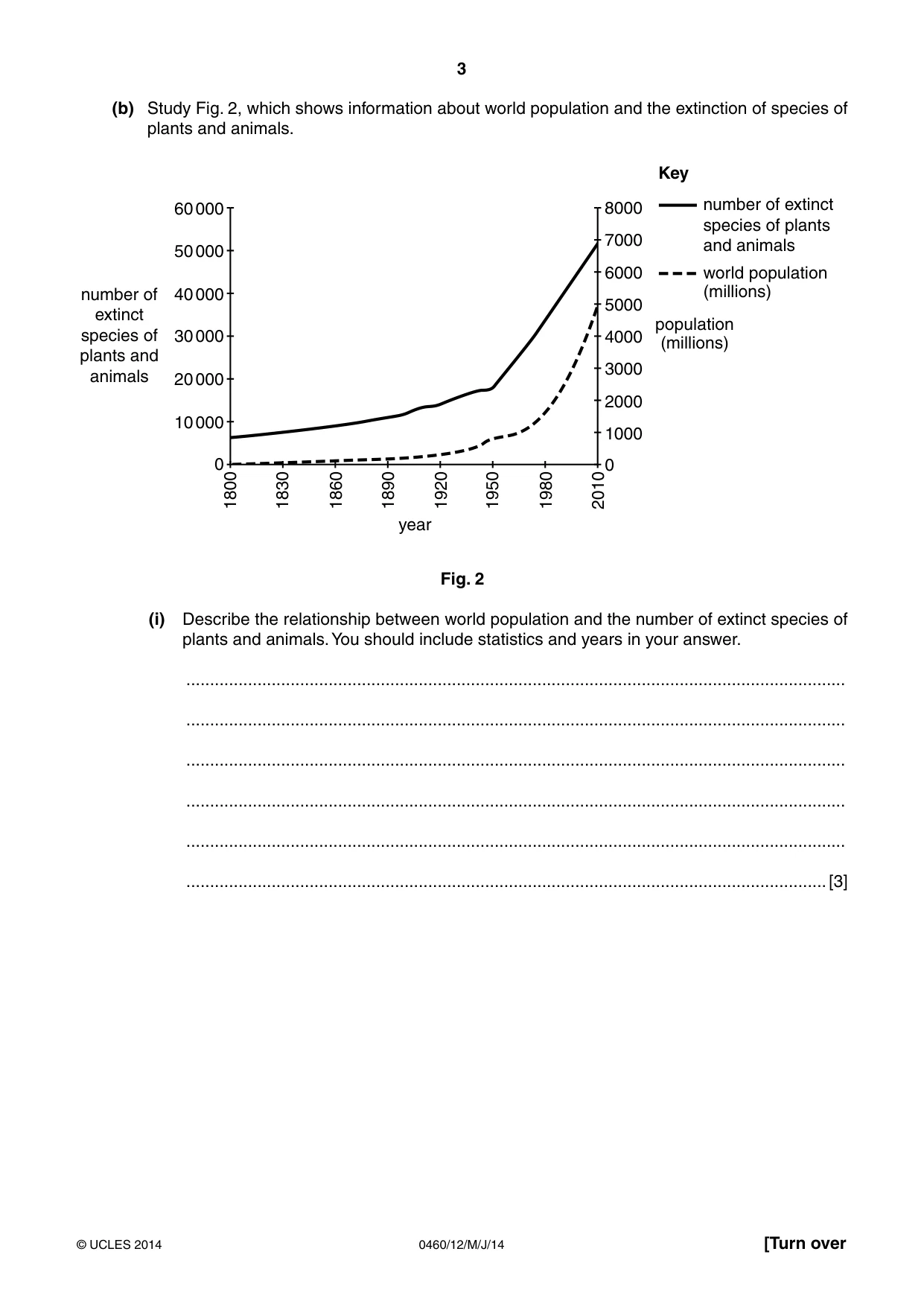
3 0460/12/M/J/14 © UCLES 2014 [Turn over (b) Study Fig. 2, which shows information about world population and the extinction of species of plants and animals. 1830 1860 1890 1920 year 4000 3000 2000 1000 0 60 000 50 000 40 000 30 000 number of extinct species of plants and animals 20 000 10 000 0 1950 1980 2010 8000 number of extinct species of plants and animals Key world population (millions) population (millions) 7000 6000 5000 1800 Fig. 2 (i) Describe the relationship between world population and the number of extinct species of plants and animals. You should include statistics and years in your answer. … … … … … …[3]
Question paper, page 4
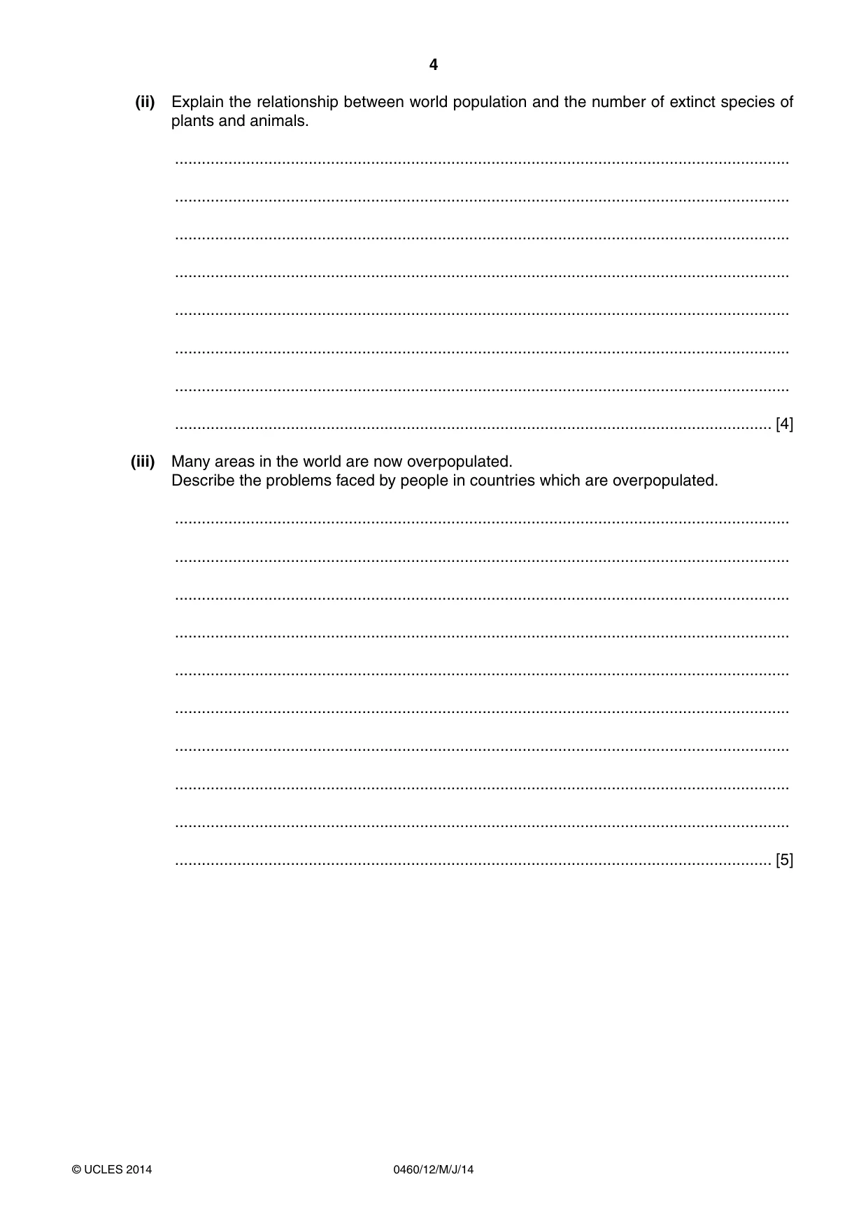
4 0460/12/M/J/14 © UCLES 2014 (ii) Explain the relationship between world population and the number of extinct species of plants and animals. … … … … … … … … [4] (iii) Many areas in the world are now overpopulated. Describe the problems faced by people in countries which are overpopulated. … … … … … … … … … … [5]
Question paper, page 5
5 0460/12/M/J/14 © UCLES 2014 [Turn over (c) For a named country you have studied, explain why the distribution of its population is uneven. Name of country… … … … … … … … … … … … … … … …[7] [Total: 25 marks] END OF QUESTION 1
Question paper, page 6
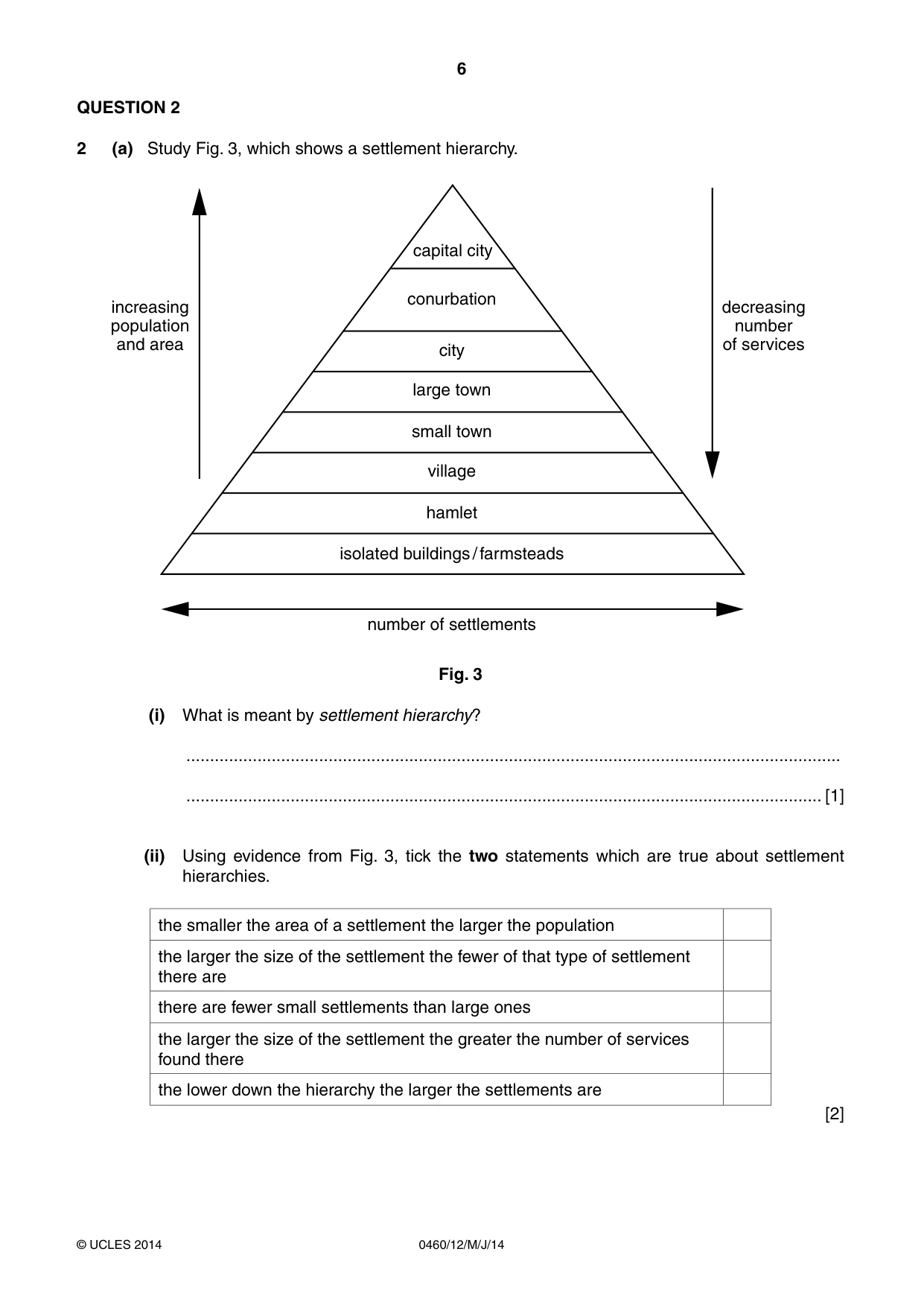
6 0460/12/M/J/14 © UCLES 2014 QUESTION 2 2 (a) Study Fig. 3, which shows a settlement hierarchy. number of settlements increasing population and area decreasing number of services isolated buildings / farmsteads hamlet village small town large town city conurbation capital city Fig. 3 (i) What is meant by settlement hierarchy? … … [1] (ii) Using evidence from Fig. 3, tick the two statements which are true about settlement hierarchies. the smaller the area of a settlement the larger the population the larger the size of the settlement the fewer of that type of settlement there are there are fewer small settlements than large ones the larger the size of the settlement the greater the number of services found there the lower down the hierarchy the larger the settlements are [2]
Question paper, page 7
7 0460/12/M/J/14 © UCLES 2014 [Turn over (iii) Describe three ways in which the type of services in a large town are likely to differ from those in a village. 1 … … 2 … … 3 … … [3] (b) Study Photographs A, B and C (Insert), which show three different types of shops in the Central Business District (CBD) of Madrid, the capital city of Spain (MEDC). (i) For each photograph state whether it shows a specialist shop, a convenience store or a comparison shop. Photograph A … Photograph B… Photograph C… [3] (ii) Explain why shops and services in the CBD of a capital city may have a large sphere of influence. … … … … … … … … [4]
Question paper, page 8
8 0460/12/M/J/14 © UCLES 2014 (iii) In many CBDs there are pedestrian zones. Explain the benefits and problems of pedestrian zones. … … … … … … … … … … [5]
Question paper, page 9
9 0460/12/M/J/14 © UCLES 2014 [Turn over (c) For a named example you have studied, explain the growth of an out-of-town shopping area. Name of town or city… Name of out-of-town shopping area… … … … … … … … … … … … … … … … [7] [Total: 25 marks] END OF QUESTION 2
Question paper, page 10
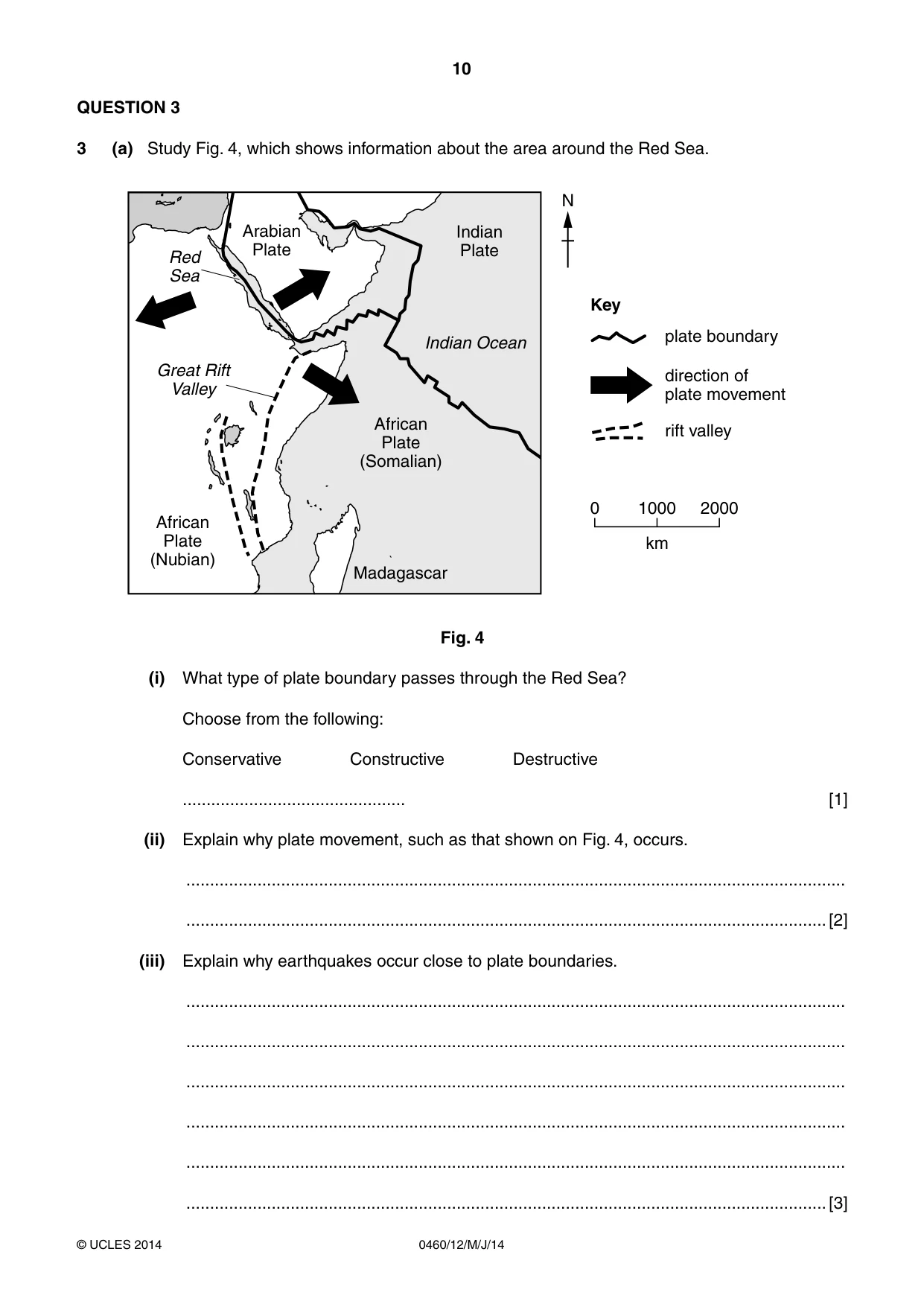
10 0460/12/M/J/14 © UCLES 2014 QUESTION 3 3 (a) Study Fig. 4, which shows information about the area around the Red Sea. Indian Plate Indian Ocean N Key African Plate (Somalian) Great Rift Valley African Plate (Nubian) Madagascar 0 1000 direction of plate movement plate boundary rift valley km 2000 Red Sea Arabian Plate Fig. 4 (i) What type of plate boundary passes through the Red Sea? Choose from the following: Conservative Constructive Destructive … [1] (ii) Explain why plate movement, such as that shown on Fig. 4, occurs. … …[2] (iii) Explain why earthquakes occur close to plate boundaries. … … … … … …[3]
Question paper, page 11
11 0460/12/M/J/14 © UCLES 2014 [Turn over (iv) Explain why people live in areas where earthquakes occur. … … … … … … … …[4]
Question paper, page 12
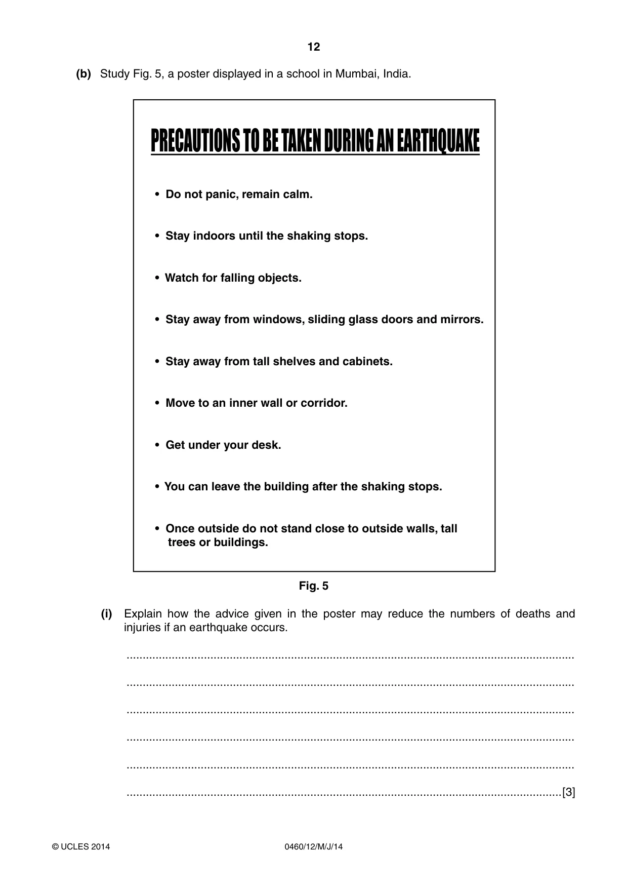
12 0460/12/M/J/14 © UCLES 2014 (b) Study Fig. 5, a poster displayed in a school in Mumbai, India. PRECAUTIONS TO BE TAKEN DURING AN EARTHQUAKE s$ONOTPANICREMAINCALM s3TAYINDOORSUNTILTHESHAKINGSTOPS s7ATCHFORFALLINGOBJECTS s3TAYAWAYFROMWINDOWSSLIDINGGLASSDOORSANDMIRRORS s3TAYAWAYFROMTALLSHELVESANDCABINETS s-OVETOANINNERWALLORCORRIDOR s'ETUNDERYOURDESK s9OUCANLEAVETHEBUILDINGAFTERTHESHAKINGSTOPS s/NCEOUTSIDEDONOTSTANDCLOSETOOUTSIDEWALLSTALL TREESORBUILDINGS Fig. 5 (i) Explain how the advice given in the poster may reduce the numbers of deaths and injuries if an earthquake occurs. … … … … … …[3]
Question paper, page 13
13 0460/12/M/J/14 © UCLES 2014 [Turn over (ii) Explain why earthquakes of the same magnitude (strength) are likely to cause more deaths and injuries in an LEDC than an MEDC. … … … … … … … … … … [5]
Question paper, page 14
14 0460/12/M/J/14 © UCLES 2014 (c) For a named example of a volcanic eruption you have studied, describe its effects on people and the natural environment. Name of volcano … … … … … … … … … … … … … … … …[7] [Total: 25 marks] END OF QUESTION 3
Question paper, page 15
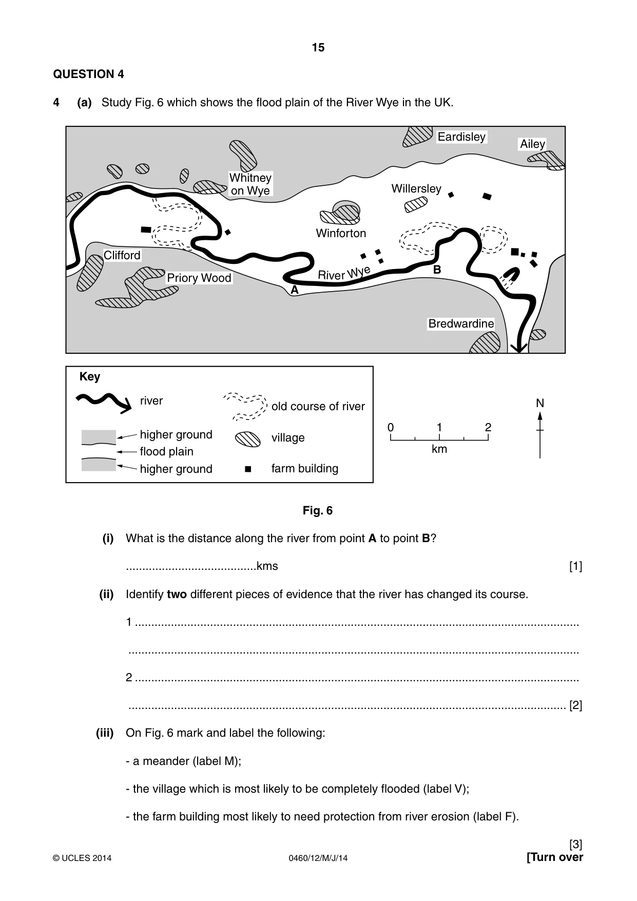
15 0460/12/M/J/14 © UCLES 2014 [Turn over QUESTION 4 4 (a) Study Fig. 6 which shows the flood plain of the River Wye in the UK. Whitney on Wye Priory Wood river old course of river village farm building higher ground flood plain higher ground Eardisley Willersley A B Winforton N 0 1 km Key 2 Bredwardine Ailey Clifford Riv e r Wye Fig. 6 (i) What is the distance along the river from point A to point B? …kms [1] (ii) Identify two different pieces of evidence that the river has changed its course. 1 … … 2 … … [2] (iii) On Fig. 6 mark and label the following: - a meander (label M); - the village which is most likely to be completely flooded (label V); - the farm building most likely to need protection from river erosion (label F). [3]
Question paper, page 16
16 0460/12/M/J/14 © UCLES 2014 (iv) Describe the advantages for people of living on a flood plain. … … … … … … … … [4]
Question paper, page 17
17 0460/12/M/J/14 © UCLES 2014 [Turn over (b) Study Photograph D (Insert), which shows a river and its valley. (i) Describe three different features of the river and its valley. 1 … … 2 … … 3 … …[3] (ii) Explain how the river may erode its banks and bed. … … … … … … … … … …[5]
Question paper, page 18
18 0460/12/M/J/14 © UCLES 2014 (c) For a named area you have studied, explain the causes of flooding. Name of area… … … … … … … … … … … … … …[7] [Total: 25 marks] END OF QUESTION 4
Question paper, page 19
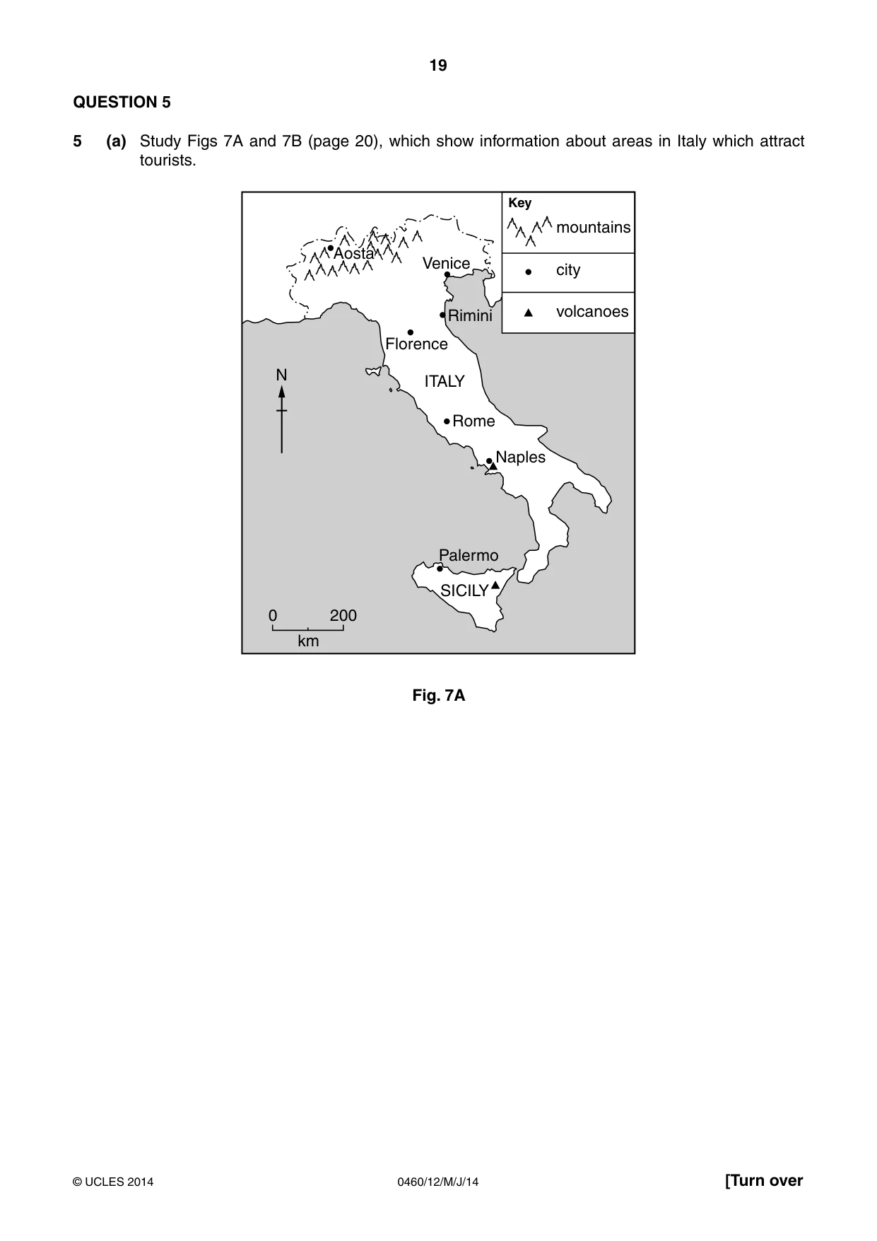
19 0460/12/M/J/14 © UCLES 2014 [Turn over QUESTION 5 5 (a) Study Figs 7A and 7B (page 20), which show information about areas in Italy which attract tourists. N 0 200 km SICILY Palermo Naples Rome ITALY Florence Rimini Venice mountains city volcanoes Key Aosta Aosta Fig. 7A
Question paper, page 20
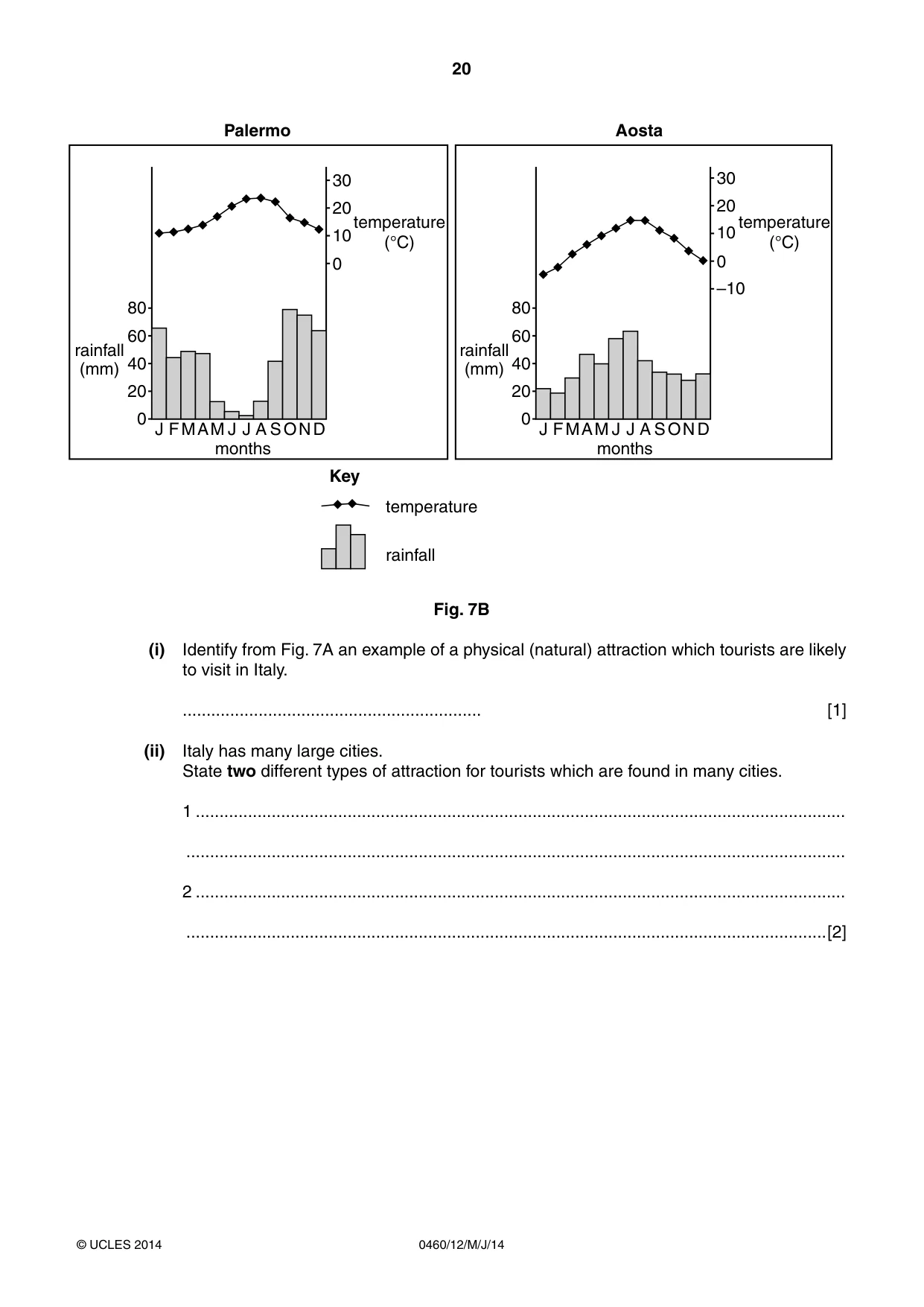
20 0460/12/M/J/14 © UCLES 2014 80 0 10 –10 20 30 40 20 J FMAM J Aosta J A SOND 0 80 0 10temperature (°C) temperature (°C) 20 30 60 40 rainfall (mm) 60 rainfall (mm) Key temperature months months rainfall 20 J FMAM J Palermo J A SOND 0 Fig. 7B (i) Identify from Fig. 7A an example of a physical (natural) attraction which tourists are likely to visit in Italy. … [1] (ii) Italy has many large cities. State two different types of attraction for tourists which are found in many cities. 1 … … 2 … …[2]
Question paper, page 21
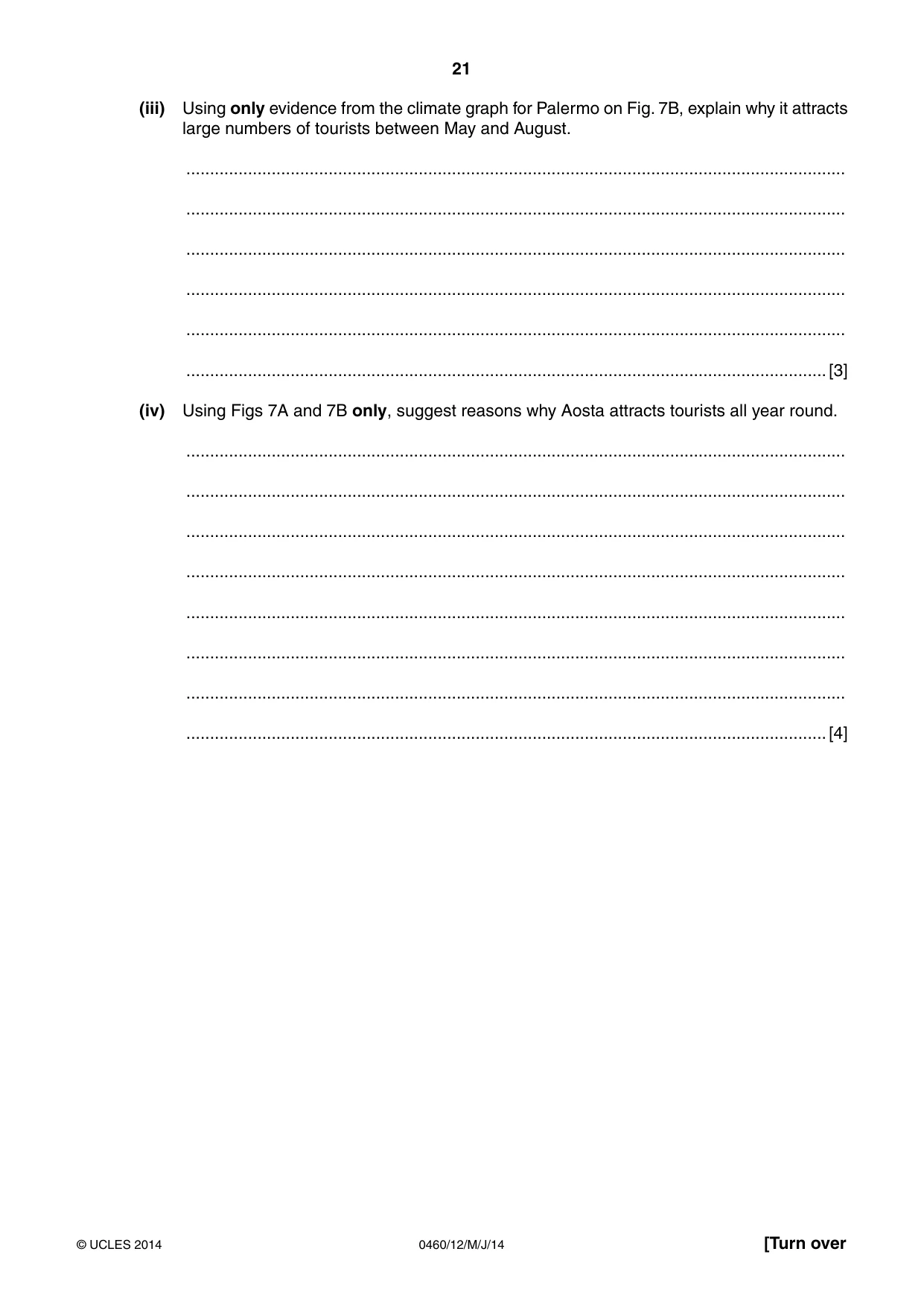
21 0460/12/M/J/14 © UCLES 2014 [Turn over (iii) Using only evidence from the climate graph for Palermo on Fig. 7B, explain why it attracts large numbers of tourists between May and August. … … … … … …[3] (iv) Using Figs 7A and 7B only, suggest reasons why Aosta attracts tourists all year round. … … … … … … … …[4]
Question paper, page 22
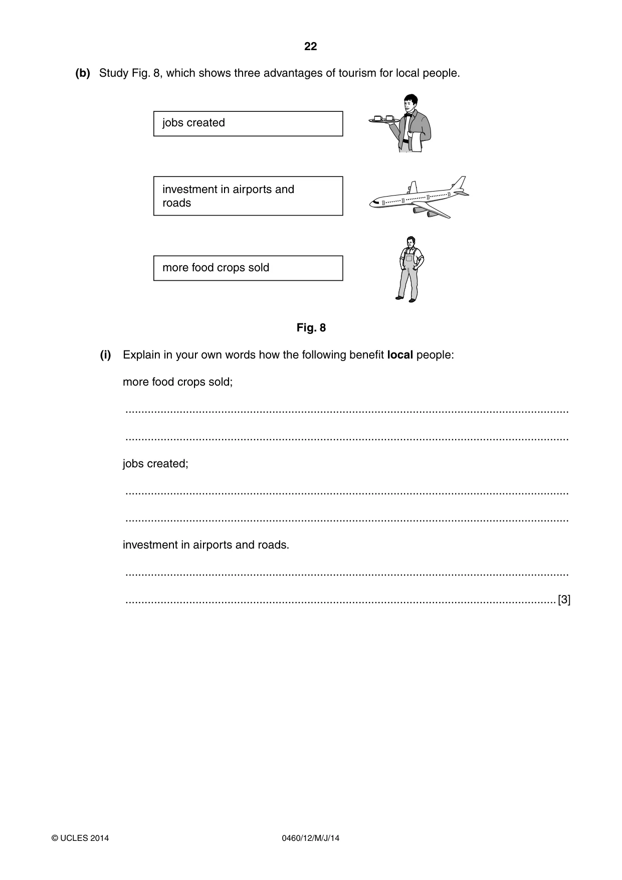
22 0460/12/M/J/14 © UCLES 2014 (b) Study Fig. 8, which shows three advantages of tourism for local people. jobs created investment in airports and roads more food crops sold Fig. 8 (i) Explain in your own words how the following benefit local people: more food crops sold; … … jobs created; … … investment in airports and roads. … …[3]
Question paper, page 23
23 0460/12/M/J/14 © UCLES 2014 [Turn over (ii) Explain the problems tourism may cause for local people. … … … … … … … … … … [5] (c) For a named area you have studied, explain how tourism is damaging the natural environment. Name of area… … … … … … … … … … … … … … … … [7] [Total: 25 marks] END OF QUESTION 5
Question paper, page 24
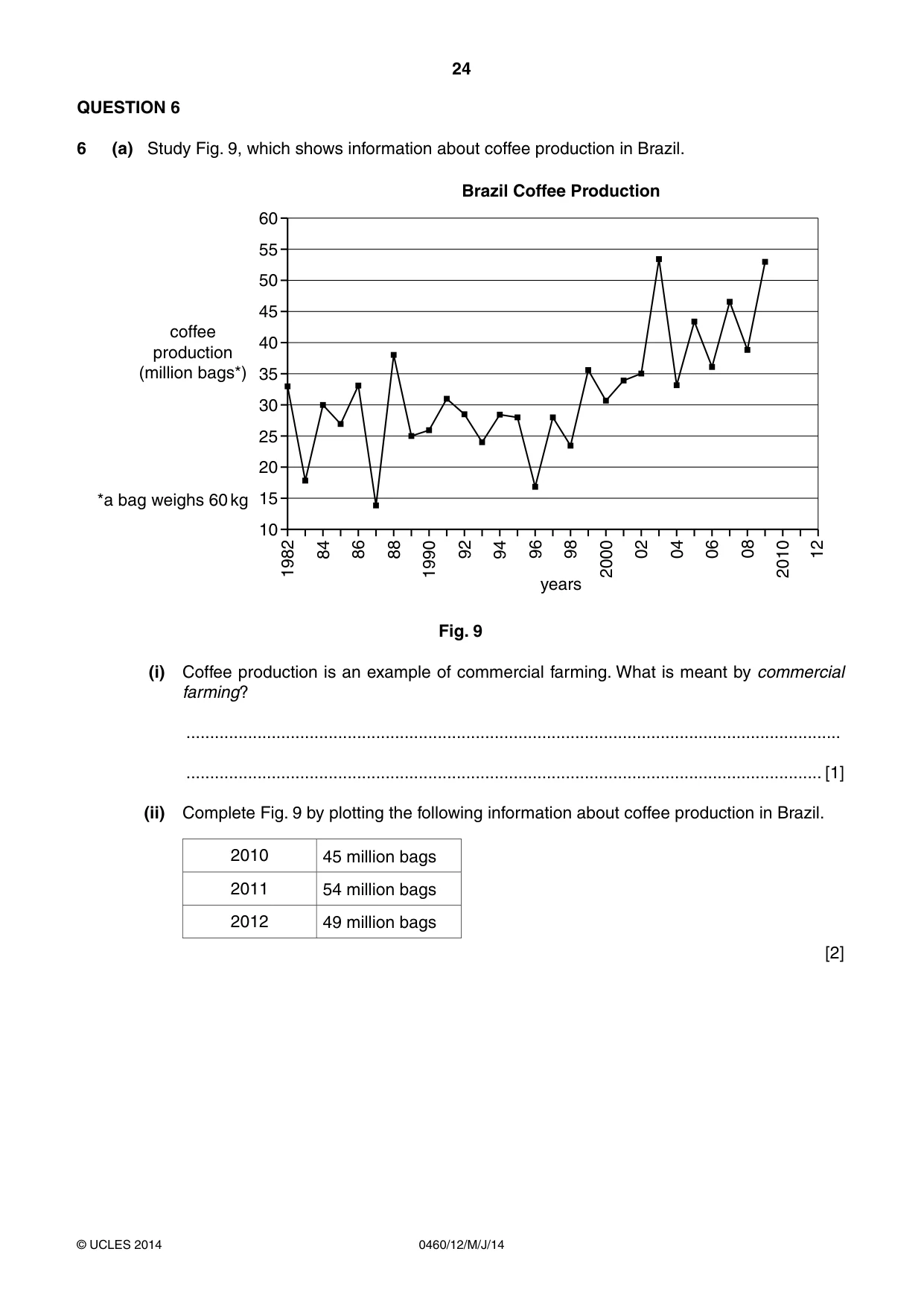
24 0460/12/M/J/14 © UCLES 2014 QUESTION 6 6 (a) Study Fig. 9, which shows information about coffee production in Brazil. 60 55 50 45 40 35 30 25 20 15 10 1982 84 86 88 1990 92 94 96 98 years Brazil Coffee Production coffee production (million bags*) *a bag weighs 60 kg 2000 02 04 06 08 2010 12 Fig. 9 (i) Coffee production is an example of commercial farming. What is meant by commercial farming? … … [1] (ii) Complete Fig. 9 by plotting the following information about coffee production in Brazil. 2010 45 million bags 2011 54 million bags 2012 49 million bags [2]
Question paper, page 25
25 0460/12/M/J/14 © UCLES 2014 [Turn over (iii) Suggest reasons why coffee production varies from year to year. … … … … … …[3] (iv) Describe different methods of soil conservation which can be used by commercial farmers. … … … … … … … …[4]
Question paper, page 26
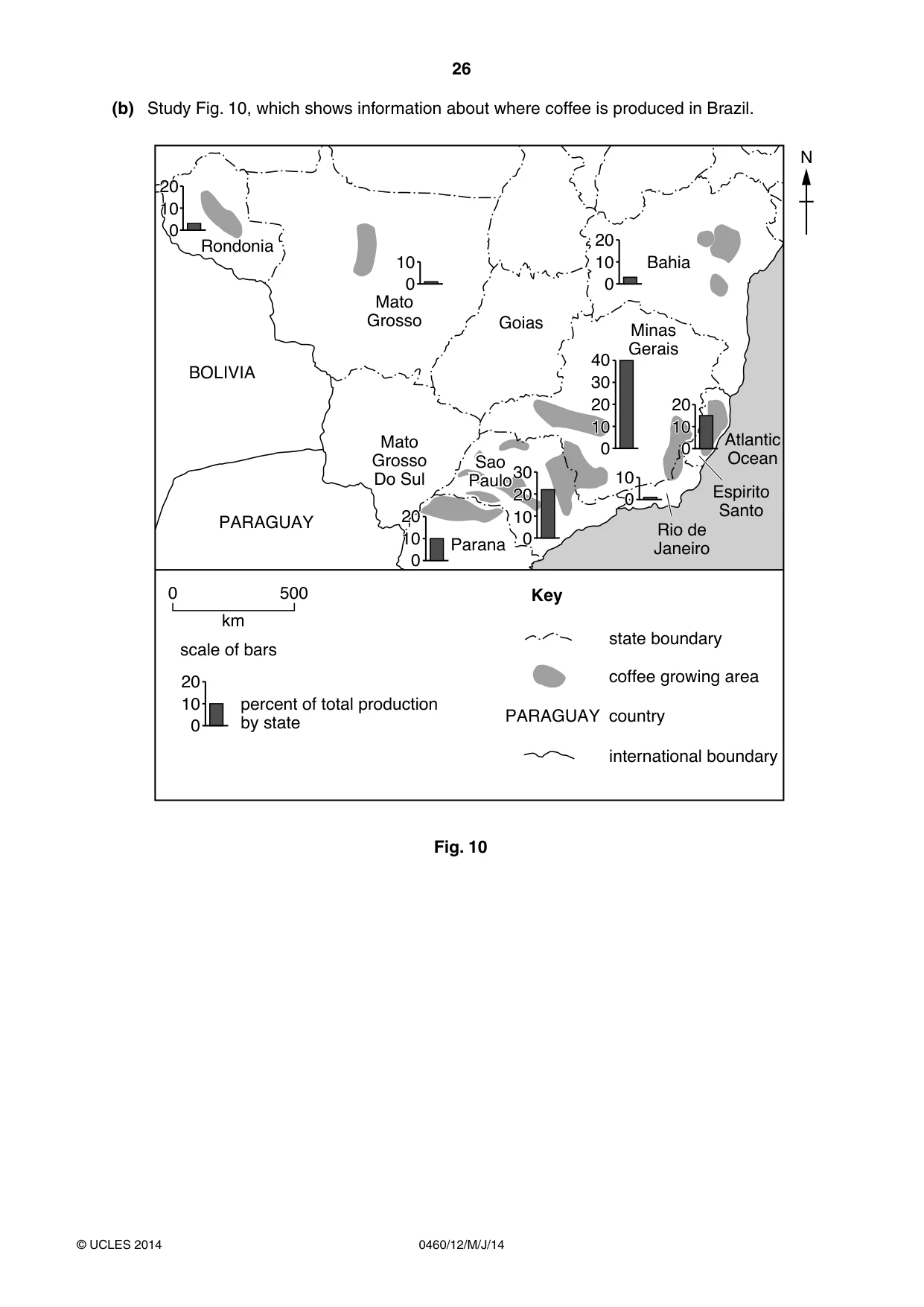
26 0460/12/M/J/14 © UCLES 2014 (b) Study Fig. 10, which shows information about where coffee is produced in Brazil. 0DWR *URVVR 0DWR *URVVR 'R6XO *RLDV 3$5$*8$< %2/,9,$ 0LQDV *HUDLV 6DR 3DXOR 3DUDQD VWDWHERXQGDU\ FRIIHHJURZLQJDUHD NP VFDOHRIEDUV .H\ 5LRGH -DQHLUR (VSLULWR 6DQWR $WODQWLF 2FHDQ %DKLD 1 5RQGRQLD 6DR 3DXOR FRXQWU\ 3$5$*8$< LQWHUQDWLRQDOERXQGDU\ SHUFHQWRIWRWDOSURGXFWLRQ E\VWDWH Fig. 10
Question paper, page 27
27 0460/12/M/J/14 © UCLES 2014 [Turn over (i) Describe the distribution of coffee production in Brazil. You should use statistics from Fig. 10 in your answer. … … … … … …[3] (ii) Explain why agricultural land use varies from place to place. … … … … … … … … … … …[5]
Question paper, page 28
28 0460/12/M/J/14 © UCLES 2014 (c) For a named country or area you have studied, describe the impacts of water shortages on the people and economic development. Name of country or area… … … … … … … … … … … … … … …[7] [Total: 25 marks] END OF QUESTION 6
Question paper, page 29
29 0460/12/M/J/14 © UCLES 2014 Additional Page If you use the following lined page to complete the answer(s) to any question(s), the question number(s) must be clearly shown. … … … … … … … … … … … … … … … … … … … … … … … … … …
Question paper, page 30
30 0460/12/M/J/14 © UCLES 2014 BLANK PAGE
Question paper, page 31
31 0460/12/M/J/14 © UCLES 2014 BLANK PAGE
Question paper, page 32
32 0460/12/M/J/14 © UCLES 2014 Copyright Acknowledgements: Photographs A-D S Sibley © UCLES. Question 1 Fig. 2 © http://www.biologicaldiversity.org/campaigns/overpopulation/extinction_and_population_graph.html Question 2 Fig. 3 © http://www.geographylwc.org.uk/GCSE/igcse/Settlement/sethierarchy.html Question 3 Fig. 4 Adapted from: © The Times; 20 July 2006. Question 6 Fig. 9 © http://www.commodityandderivativeadv.com/andyftp/Coffee_20110331_rjo.pdf Question 6 Fig. 10 © http://www.spectrumcommodities.com/education/commodity/kc.html Permission to reproduce items where third-party owned material protected by copyright is included has been sought and cleared where possible. Every reasonable effort has been made by the publisher (UCLES) to trace copyright holders, but if any items requiring clearance have unwittingly been included, the publisher will be pleased to make amends at the earliest possible opportunity. Cambridge International Examinations is part of the Cambridge Assessment Group. Cambridge Assessment is the brand name of University of Cambridge Local Examinations Syndicate (UCLES), which is itself a department of the University of Cambridge. BLANK PAGE
Mark scheme, page 1
CAMBRIDGE INTERNATIONAL EXAMINATIONS International General Certificate of Secondary Education MARK SCHEME for the May/June 2014 series 0460 GEOGRAPHY 0460/12 Paper 1, maximum raw mark 75 This mark scheme is published as an aid to teachers and candidates, to indicate the requirements of the examination. It shows the basis on which Examiners were instructed to award marks. It does not indicate the details of the discussions that took place at an Examiners’ meeting before marking began, which would have considered the acceptability of alternative answers. Mark schemes should be read in conjunction with the question paper and the Principal Examiner Report for Teachers. Cambridge will not enter into discussions about these mark schemes. Cambridge is publishing the mark schemes for the May/June 2014 series for most IGCSE, GCE Advanced Level and Advanced Subsidiary Level components and some Ordinary Level components.
Mark scheme, page 2
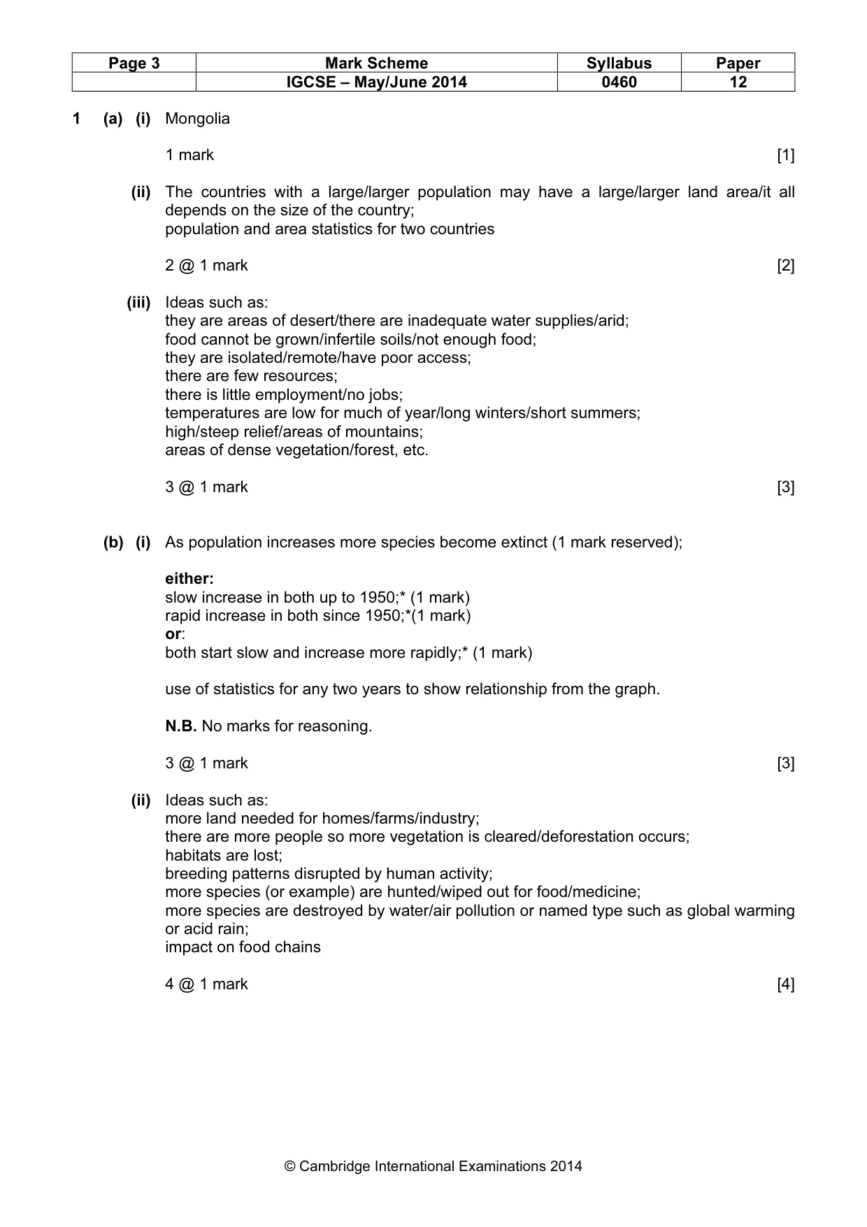
Page 2 Mark Scheme Syllabus Paper IGCSE – May/June 2014 0460 12 © Cambridge International Examinations 2014 The features of the marking scheme Each question carries 25 marks. Candidates cannot earn above the maximum marks available within each sub section. The marking scheme attempts to give guidance about the requirements of each answer and lists a number of responses, which will earn marks along with the general principles to be applied when marking each question. It should be noted that candidates can earn marks if their answers are phrased differently provided they convey the same meaning as those in the mark scheme. THE CANDIDATES DO NOT NEED TO USE THE SAME WORDING TO EARN MARKS. The notation ‘etc.’ at the end of an answer in the mark scheme signifies that there may well be other correct responses or examples that can be given credit. Providing the statement is true, relevant to the question asked and not repetition of a previous point made, credit should be given. A point made within one sub-section which is an answer to the question set in a different sub-section should not be given credit as each sub-section asks different questions which require independent answers. The mark scheme uses semi colons (;) to separate marks and diagonals to separate alternative answers. Levels of response marking is used for section (c) of each question. Thus it is the quality of the response that determines which level an answer is achieved rather than the quantity of statements contained within it. However, once assigned to a level the mark achieved within that level is determined by the number of points made. Levels 1 and 2 are distinguished by whether statements are simple (level 1) or developed/elaborated (level 2). A candidate can immediately enter L2 by making developed points without making any L1 statements. In order to achieve L3 a candidate must have already reached the top end of L2 – in addition his/her answer should have a clear example and if the answer is place specific as well (7 marks). Where statements are assigned levels by the examiner this should be indicated by the use of L1, L2 and L3 next to the statements. A summary of the overall level and mark awarded should be written at the end of the answer. Ticks should not be used on answers that are marked using levels of response marking. Summary: Level 1 (1 to 3 marks): 1 simple statement (1 mark) 2 simple statements (2 marks) 3 simple statements (3 marks) Level 2 (4 to 6 marks): 1 developed statement (4 marks) 2 developed statements (5 marks) 3 or more developed statements with example (6 marks) Level 3 (7 marks) 3 or more developed statements + named example with at least one piece of place specific detail.
Mark scheme, page 3
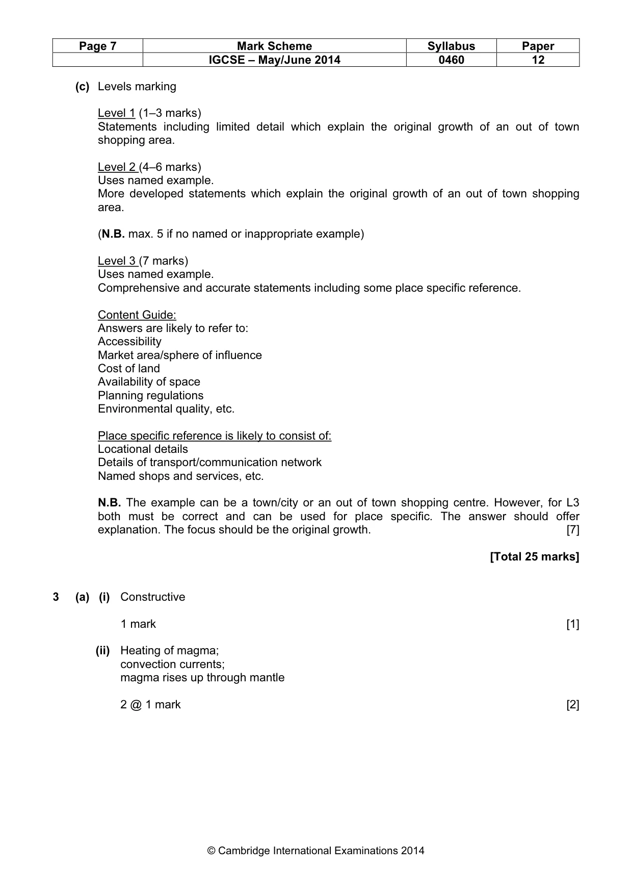
Page 3 Mark Scheme Syllabus Paper IGCSE – May/June 2014 0460 12 © Cambridge International Examinations 2014 1 (a) (i) Mongolia 1 mark [1] (ii) The countries with a large/larger population may have a large/larger land area/it all depends on the size of the country; population and area statistics for two countries 2 @ 1 mark [2] (iii) Ideas such as: they are areas of desert/there are inadequate water supplies/arid; food cannot be grown/infertile soils/not enough food; they are isolated/remote/have poor access; there are few resources; there is little employment/no jobs; temperatures are low for much of year/long winters/short summers; high/steep relief/areas of mountains; areas of dense vegetation/forest, etc. 3 @ 1 mark [3] (b) (i) As population increases more species become extinct (1 mark reserved); either: slow increase in both up to 1950;* (1 mark) rapid increase in both since 1950;*(1 mark) or: both start slow and increase more rapidly;* (1 mark) use of statistics for any two years to show relationship from the graph. N.B. No marks for reasoning. 3 @ 1 mark [3] (ii) Ideas such as: more land needed for homes/farms/industry; there are more people so more vegetation is cleared/deforestation occurs; habitats are lost; breeding patterns disrupted by human activity; more species (or example) are hunted/wiped out for food/medicine; more species are destroyed by water/air pollution or named type such as global warming or acid rain; impact on food chains 4 @ 1 mark [4]
Mark scheme, page 4
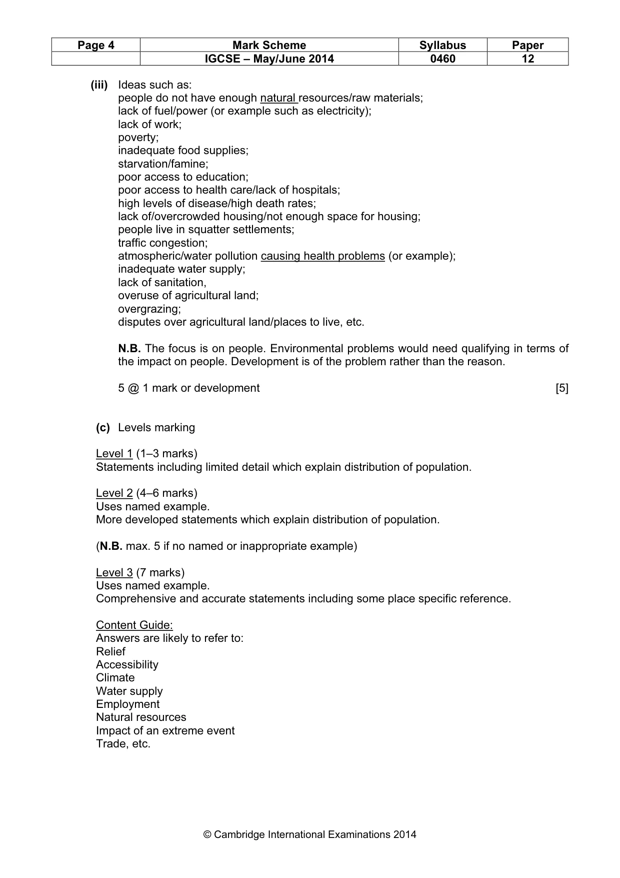
Page 4 Mark Scheme Syllabus Paper IGCSE – May/June 2014 0460 12 © Cambridge International Examinations 2014 (iii) Ideas such as: people do not have enough natural resources/raw materials; lack of fuel/power (or example such as electricity); lack of work; poverty; inadequate food supplies; starvation/famine; poor access to education; poor access to health care/lack of hospitals; high levels of disease/high death rates; lack of/overcrowded housing/not enough space for housing; people live in squatter settlements; traffic congestion; atmospheric/water pollution causing health problems (or example); inadequate water supply; lack of sanitation, overuse of agricultural land; overgrazing; disputes over agricultural land/places to live, etc. N.B. The focus is on people. Environmental problems would need qualifying in terms of the impact on people. Development is of the problem rather than the reason. 5 @ 1 mark or development [5] (c) Levels marking Level 1 (1–3 marks) Statements including limited detail which explain distribution of population. Level 2 (4–6 marks) Uses named example. More developed statements which explain distribution of population. (N.B. max. 5 if no named or inappropriate example) Level 3 (7 marks) Uses named example. Comprehensive and accurate statements including some place specific reference. Content Guide: Answers are likely to refer to: Relief Accessibility Climate Water supply Employment Natural resources Impact of an extreme event Trade, etc.
Mark scheme, page 5
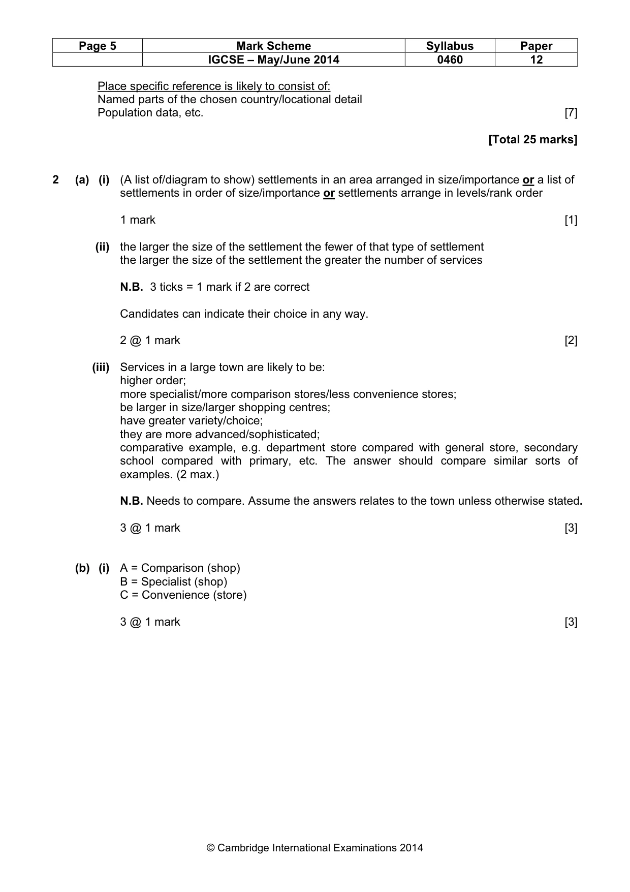
Page 5 Mark Scheme Syllabus Paper IGCSE – May/June 2014 0460 12 © Cambridge International Examinations 2014 Place specific reference is likely to consist of: Named parts of the chosen country/locational detail Population data, etc. [7] [Total 25 marks] 2 (a) (i) (A list of/diagram to show) settlements in an area arranged in size/importance or a list of settlements in order of size/importance or settlements arrange in levels/rank order 1 mark [1] (ii) the larger the size of the settlement the fewer of that type of settlement the larger the size of the settlement the greater the number of services N.B. 3 ticks = 1 mark if 2 are correct Candidates can indicate their choice in any way. 2 @ 1 mark [2] (iii) Services in a large town are likely to be: higher order; more specialist/more comparison stores/less convenience stores; be larger in size/larger shopping centres; have greater variety/choice; they are more advanced/sophisticated; comparative example, e.g. department store compared with general store, secondary school compared with primary, etc. The answer should compare similar sorts of examples. (2 max.) N.B. Needs to compare. Assume the answers relates to the town unless otherwise stated. 3 @ 1 mark [3] (b) (i) A = Comparison (shop) B = Specialist (shop) C = Convenience (store) 3 @ 1 mark [3]
Mark scheme, page 6
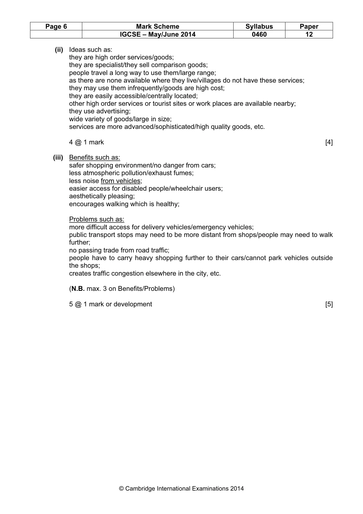
Page 6 Mark Scheme Syllabus Paper IGCSE – May/June 2014 0460 12 © Cambridge International Examinations 2014 (ii) Ideas such as: they are high order services/goods; they are specialist/they sell comparison goods; people travel a long way to use them/large range; as there are none available where they live/villages do not have these services; they may use them infrequently/goods are high cost; they are easily accessible/centrally located; other high order services or tourist sites or work places are available nearby; they use advertising; wide variety of goods/large in size; services are more advanced/sophisticated/high quality goods, etc. 4 @ 1 mark [4] (iii) Benefits such as: safer shopping environment/no danger from cars; less atmospheric pollution/exhaust fumes; less noise from vehicles; easier access for disabled people/wheelchair users; aesthetically pleasing; encourages walking which is healthy; Problems such as: more difficult access for delivery vehicles/emergency vehicles; public transport stops may need to be more distant from shops/people may need to walk further; no passing trade from road traffic; people have to carry heavy shopping further to their cars/cannot park vehicles outside the shops; creates traffic congestion elsewhere in the city, etc. (N.B. max. 3 on Benefits/Problems) 5 @ 1 mark or development [5]
Mark scheme, page 7
Page 7 Mark Scheme Syllabus Paper IGCSE – May/June 2014 0460 12 © Cambridge International Examinations 2014 (c) Levels marking Level 1 (1–3 marks) Statements including limited detail which explain the original growth of an out of town shopping area. Level 2 (4–6 marks) Uses named example. More developed statements which explain the original growth of an out of town shopping area. (N.B. max. 5 if no named or inappropriate example) Level 3 (7 marks) Uses named example. Comprehensive and accurate statements including some place specific reference. Content Guide: Answers are likely to refer to: Accessibility Market area/sphere of influence Cost of land Availability of space Planning regulations Environmental quality, etc. Place specific reference is likely to consist of: Locational details Details of transport/communication network Named shops and services, etc. N.B. The example can be a town/city or an out of town shopping centre. However, for L3 both must be correct and can be used for place specific. The answer should offer explanation. The focus should be the original growth. [7] [Total 25 marks] 3 (a) (i) Constructive 1 mark [1] (ii) Heating of magma; convection currents; magma rises up through mantle 2 @ 1 mark [2]
Mark scheme, page 8
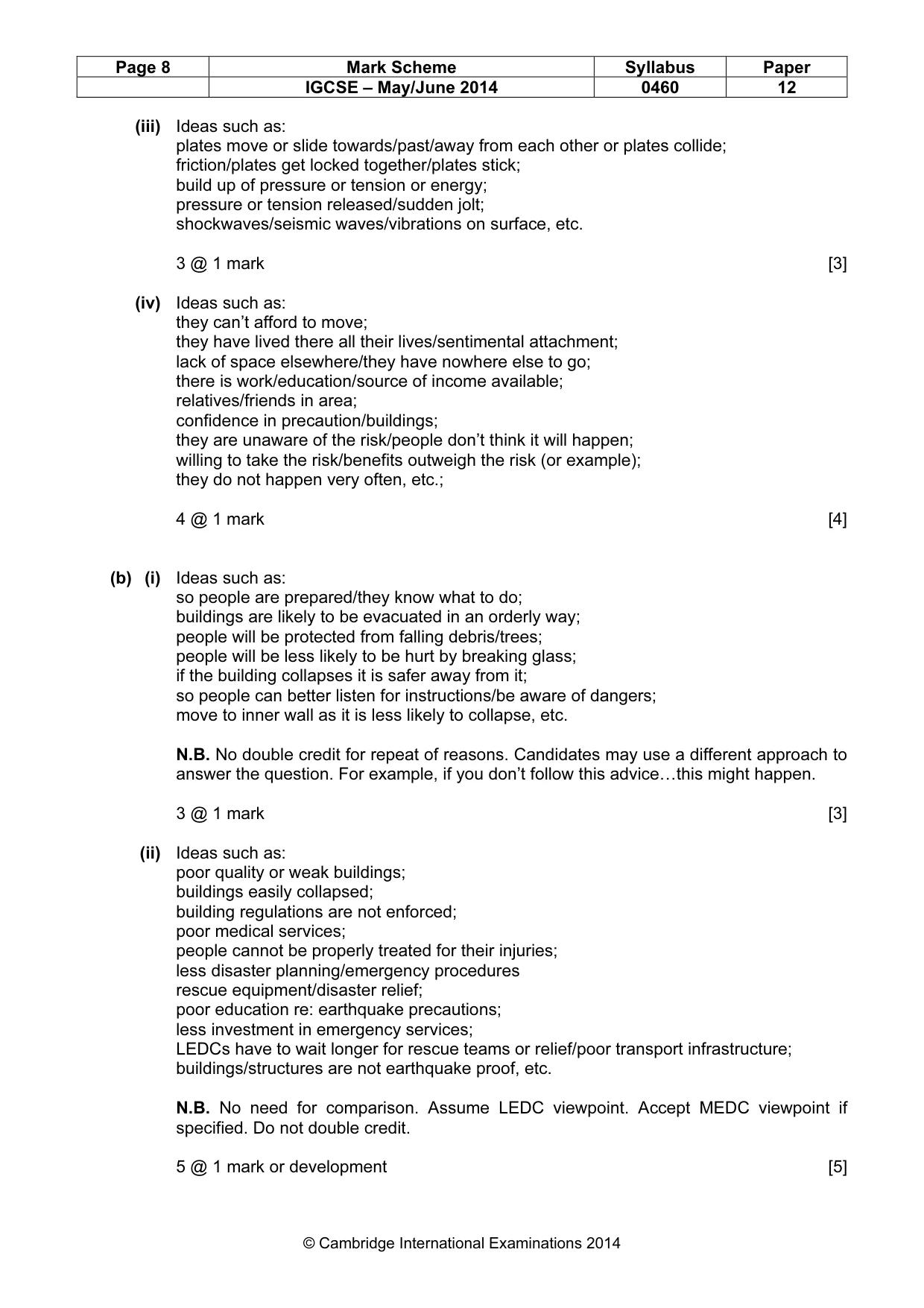
Page 8 Mark Scheme Syllabus Paper IGCSE – May/June 2014 0460 12 © Cambridge International Examinations 2014 (iii) Ideas such as: plates move or slide towards/past/away from each other or plates collide; friction/plates get locked together/plates stick; build up of pressure or tension or energy; pressure or tension released/sudden jolt; shockwaves/seismic waves/vibrations on surface, etc. 3 @ 1 mark [3] (iv) Ideas such as: they can’t afford to move; they have lived there all their lives/sentimental attachment; lack of space elsewhere/they have nowhere else to go; there is work/education/source of income available; relatives/friends in area; confidence in precaution/buildings; they are unaware of the risk/people don’t think it will happen; willing to take the risk/benefits outweigh the risk (or example); they do not happen very often, etc.; 4 @ 1 mark [4] (b) (i) Ideas such as: so people are prepared/they know what to do; buildings are likely to be evacuated in an orderly way; people will be protected from falling debris/trees; people will be less likely to be hurt by breaking glass; if the building collapses it is safer away from it; so people can better listen for instructions/be aware of dangers; move to inner wall as it is less likely to collapse, etc. N.B. No double credit for repeat of reasons. Candidates may use a different approach to answer the question. For example, if you don’t follow this advice…this might happen. 3 @ 1 mark [3] (ii) Ideas such as: poor quality or weak buildings; buildings easily collapsed; building regulations are not enforced; poor medical services; people cannot be properly treated for their injuries; less disaster planning/emergency procedures rescue equipment/disaster relief; poor education re: earthquake precautions; less investment in emergency services; LEDCs have to wait longer for rescue teams or relief/poor transport infrastructure; buildings/structures are not earthquake proof, etc. N.B. No need for comparison. Assume LEDC viewpoint. Accept MEDC viewpoint if specified. Do not double credit. 5 @ 1 mark or development [5]
Mark scheme, page 9
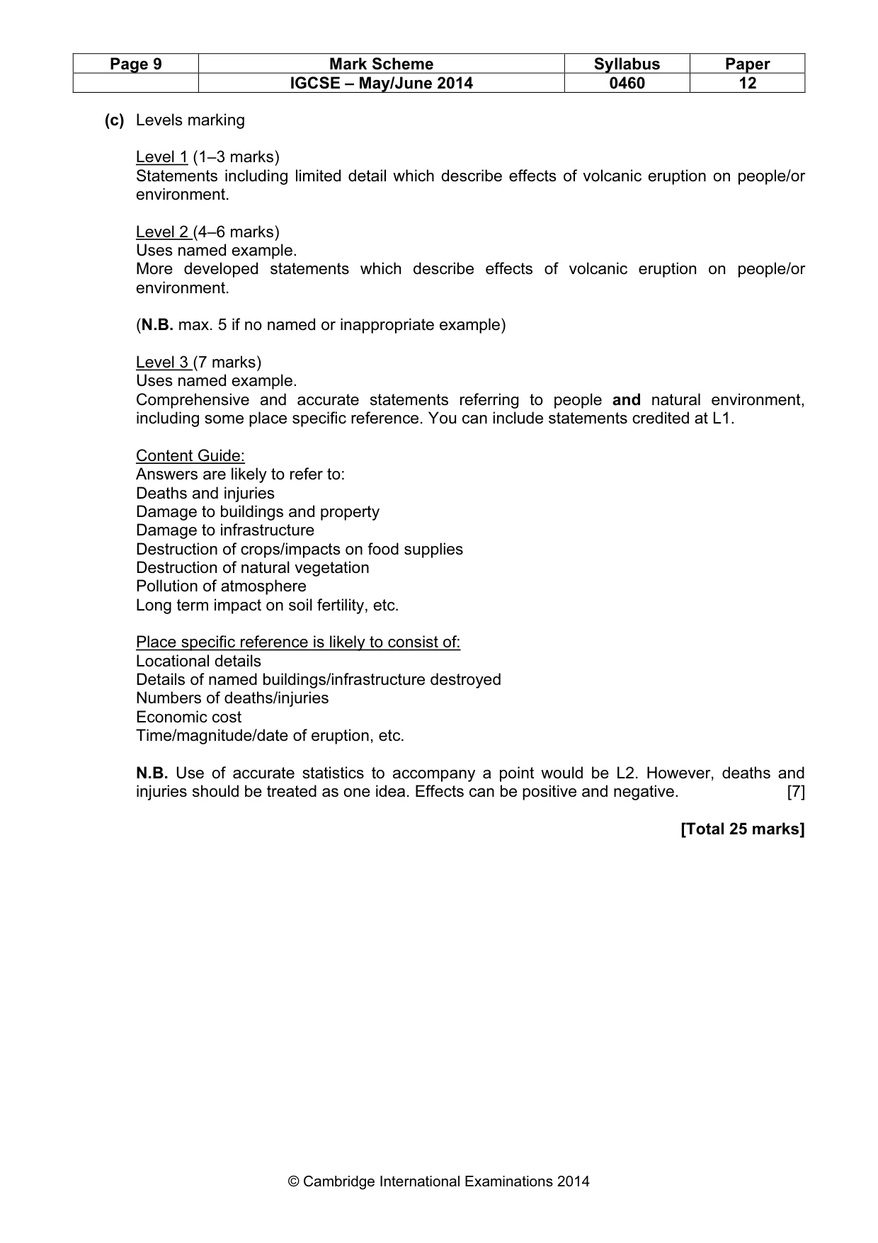
Page 9 Mark Scheme Syllabus Paper IGCSE – May/June 2014 0460 12 © Cambridge International Examinations 2014 (c) Levels marking Level 1 (1–3 marks) Statements including limited detail which describe effects of volcanic eruption on people/or environment. Level 2 (4–6 marks) Uses named example. More developed statements which describe effects of volcanic eruption on people/or environment. (N.B. max. 5 if no named or inappropriate example) Level 3 (7 marks) Uses named example. Comprehensive and accurate statements referring to people and natural environment, including some place specific reference. You can include statements credited at L1. Content Guide: Answers are likely to refer to: Deaths and injuries Damage to buildings and property Damage to infrastructure Destruction of crops/impacts on food supplies Destruction of natural vegetation Pollution of atmosphere Long term impact on soil fertility, etc. Place specific reference is likely to consist of: Locational details Details of named buildings/infrastructure destroyed Numbers of deaths/injuries Economic cost Time/magnitude/date of eruption, etc. N.B. Use of accurate statistics to accompany a point would be L2. However, deaths and injuries should be treated as one idea. Effects can be positive and negative. [7] [Total 25 marks]
Mark scheme, page 10
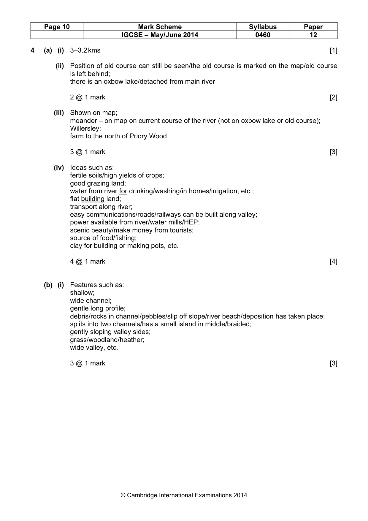
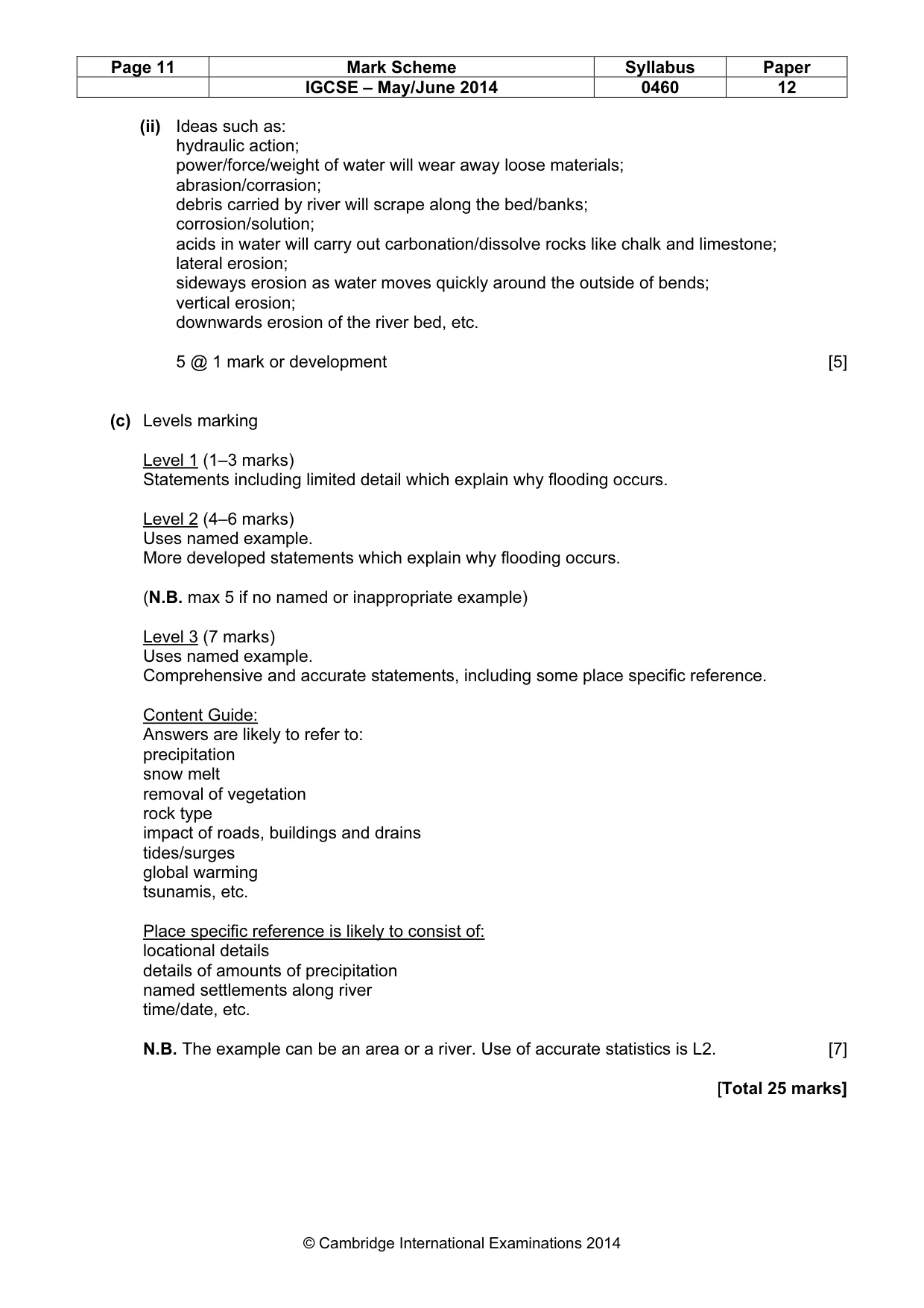
Page 10 Mark Scheme Syllabus Paper IGCSE – May/June 2014 0460 12 © Cambridge International Examinations 2014 4 (a) (i) 3–3.2 kms [1] (ii) Position of old course can still be seen/the old course is marked on the map/old course is left behind; there is an oxbow lake/detached from main river 2 @ 1 mark [2] (iii) Shown on map; meander – on map on current course of the river (not on oxbow lake or old course); Willersley; farm to the north of Priory Wood 3 @ 1 mark [3] (iv) Ideas such as: fertile soils/high yields of crops; good grazing land; water from river for drinking/washing/in homes/irrigation, etc.; flat building land; transport along river; easy communications/roads/railways can be built along valley; power available from river/water mills/HEP; scenic beauty/make money from tourists; source of food/fishing; clay for building or making pots, etc. 4 @ 1 mark [4] (b) (i) Features such as: shallow; wide channel; gentle long profile; debris/rocks in channel/pebbles/slip off slope/river beach/deposition has taken place; splits into two channels/has a small island in middle/braided; gently sloping valley sides; grass/woodland/heather; wide valley, etc. 3 @ 1 mark [3]
Mark scheme, page 11
Page 11 Mark Scheme Syllabus Paper IGCSE – May/June 2014 0460 12 © Cambridge International Examinations 2014 (ii) Ideas such as: hydraulic action; power/force/weight of water will wear away loose materials; abrasion/corrasion; debris carried by river will scrape along the bed/banks; corrosion/solution; acids in water will carry out carbonation/dissolve rocks like chalk and limestone; lateral erosion; sideways erosion as water moves quickly around the outside of bends; vertical erosion; downwards erosion of the river bed, etc. 5 @ 1 mark or development [5] (c) Levels marking Level 1 (1–3 marks) Statements including limited detail which explain why flooding occurs. Level 2 (4–6 marks) Uses named example. More developed statements which explain why flooding occurs. (N.B. max 5 if no named or inappropriate example) Level 3 (7 marks) Uses named example. Comprehensive and accurate statements, including some place specific reference. Content Guide: Answers are likely to refer to: precipitation snow melt removal of vegetation rock type impact of roads, buildings and drains tides/surges global warming tsunamis, etc. Place specific reference is likely to consist of: locational details details of amounts of precipitation named settlements along river time/date, etc. N.B. The example can be an area or a river. Use of accurate statistics is L2. [7] [Total 25 marks]
Mark scheme, page 12
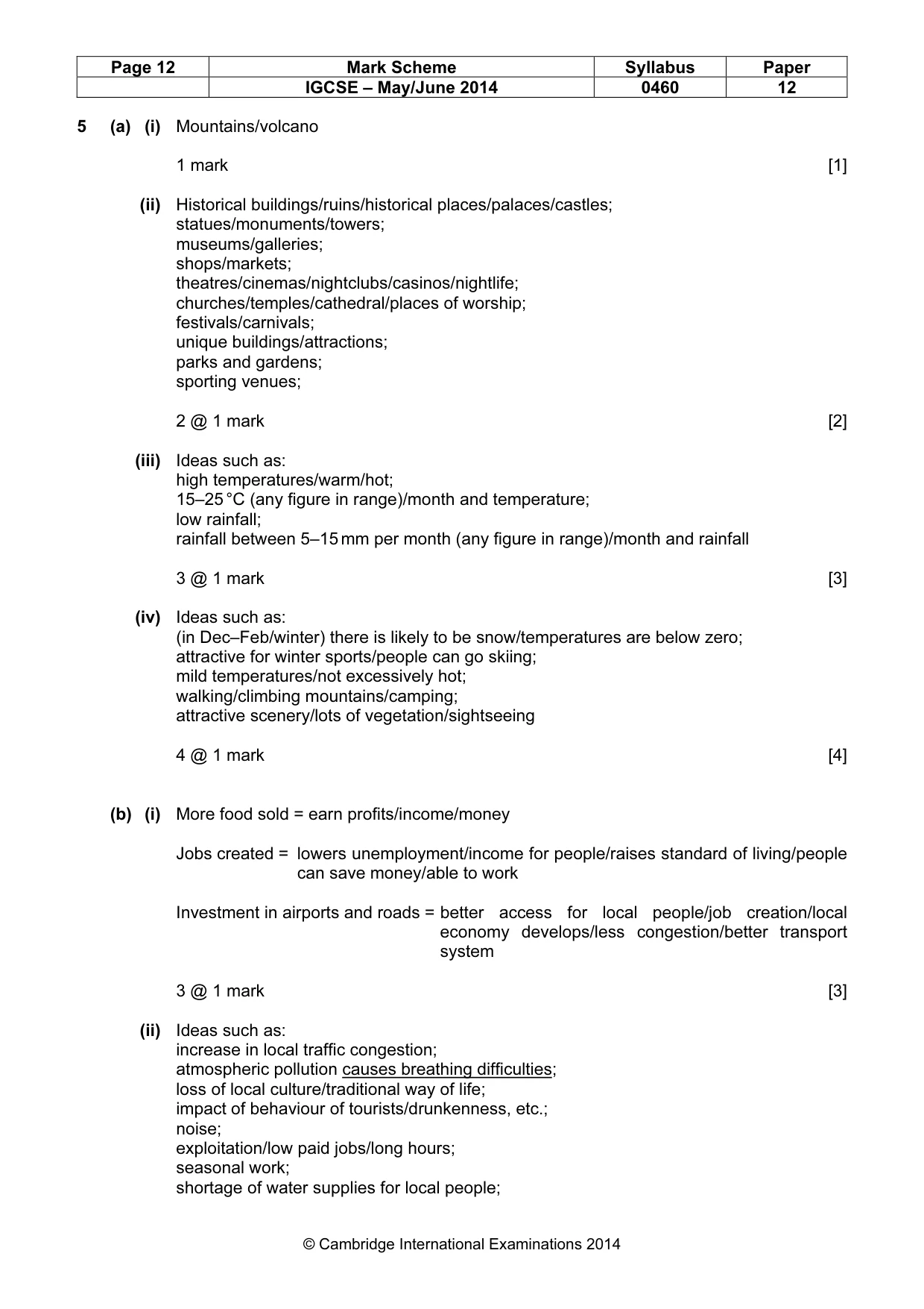
Page 12 Mark Scheme Syllabus Paper IGCSE – May/June 2014 0460 12 © Cambridge International Examinations 2014 5 (a) (i) Mountains/volcano 1 mark [1] (ii) Historical buildings/ruins/historical places/palaces/castles; statues/monuments/towers; museums/galleries; shops/markets; theatres/cinemas/nightclubs/casinos/nightlife; churches/temples/cathedral/places of worship; festivals/carnivals; unique buildings/attractions; parks and gardens; sporting venues; 2 @ 1 mark [2] (iii) Ideas such as: high temperatures/warm/hot; 15–25 °C (any figure in range)/month and temperature; low rainfall; rainfall between 5–15 mm per month (any figure in range)/month and rainfall 3 @ 1 mark [3] (iv) Ideas such as: (in Dec–Feb/winter) there is likely to be snow/temperatures are below zero; attractive for winter sports/people can go skiing; mild temperatures/not excessively hot; walking/climbing mountains/camping; attractive scenery/lots of vegetation/sightseeing 4 @ 1 mark [4] (b) (i) More food sold = earn profits/income/money Jobs created = lowers unemployment/income for people/raises standard of living/people can save money/able to work Investment in airports and roads = better access for local people/job creation/local economy develops/less congestion/better transport system 3 @ 1 mark [3] (ii) Ideas such as: increase in local traffic congestion; atmospheric pollution causes breathing difficulties; loss of local culture/traditional way of life; impact of behaviour of tourists/drunkenness, etc.; noise; exploitation/low paid jobs/long hours; seasonal work; shortage of water supplies for local people;
Mark scheme, page 13
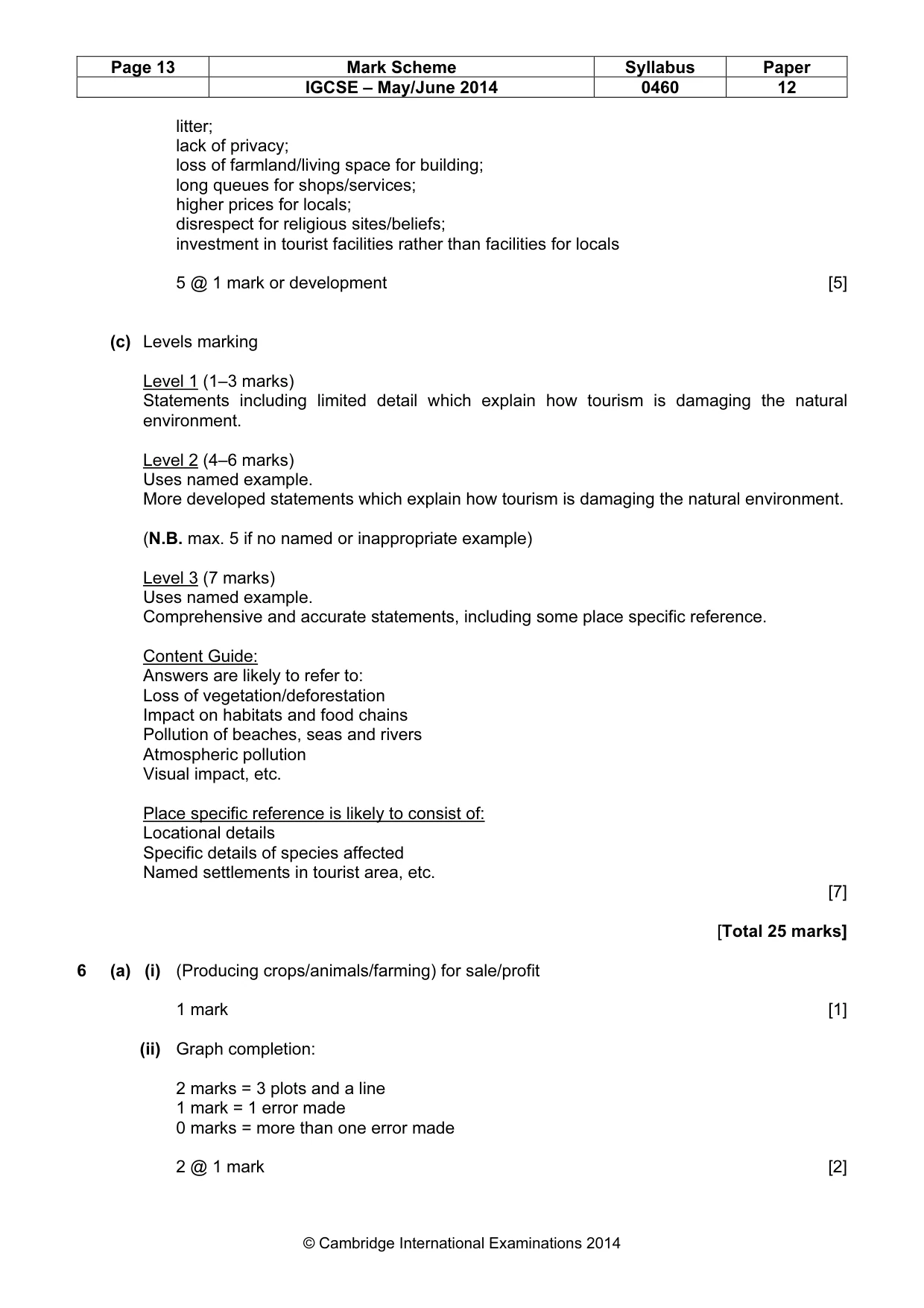
Page 13 Mark Scheme Syllabus Paper IGCSE – May/June 2014 0460 12 © Cambridge International Examinations 2014 litter; lack of privacy; loss of farmland/living space for building; long queues for shops/services; higher prices for locals; disrespect for religious sites/beliefs; investment in tourist facilities rather than facilities for locals 5 @ 1 mark or development [5] (c) Levels marking Level 1 (1–3 marks) Statements including limited detail which explain how tourism is damaging the natural environment. Level 2 (4–6 marks) Uses named example. More developed statements which explain how tourism is damaging the natural environment. (N.B. max. 5 if no named or inappropriate example) Level 3 (7 marks) Uses named example. Comprehensive and accurate statements, including some place specific reference. Content Guide: Answers are likely to refer to: Loss of vegetation/deforestation Impact on habitats and food chains Pollution of beaches, seas and rivers Atmospheric pollution Visual impact, etc. Place specific reference is likely to consist of: Locational details Specific details of species affected Named settlements in tourist area, etc. [7] [Total 25 marks] 6 (a) (i) (Producing crops/animals/farming) for sale/profit 1 mark [1] (ii) Graph completion: 2 marks = 3 plots and a line 1 mark = 1 error made 0 marks = more than one error made 2 @ 1 mark [2]
Mark scheme, page 14
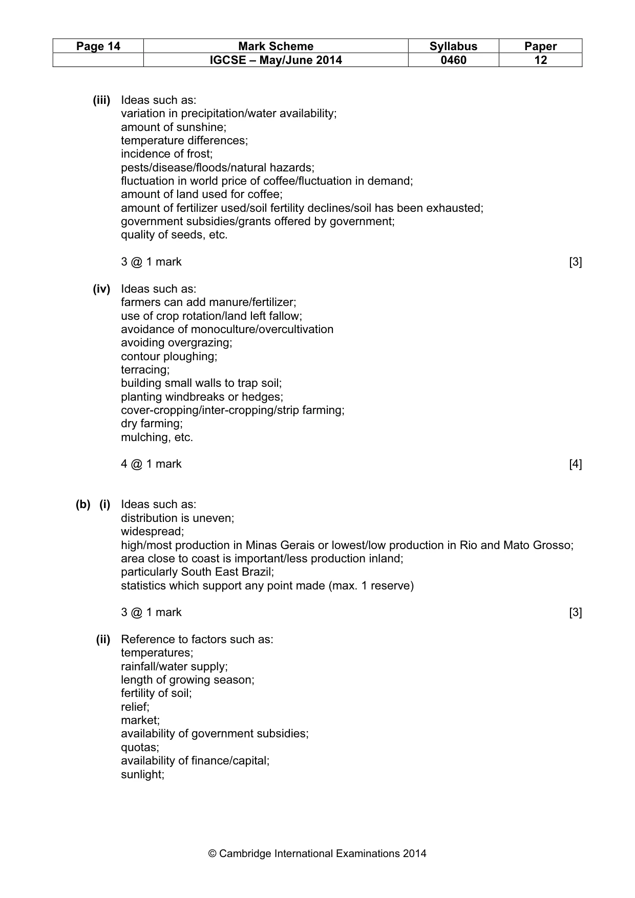
Page 14 Mark Scheme Syllabus Paper IGCSE – May/June 2014 0460 12 © Cambridge International Examinations 2014 (iii) Ideas such as: variation in precipitation/water availability; amount of sunshine; temperature differences; incidence of frost; pests/disease/floods/natural hazards; fluctuation in world price of coffee/fluctuation in demand; amount of land used for coffee; amount of fertilizer used/soil fertility declines/soil has been exhausted; government subsidies/grants offered by government; quality of seeds, etc. 3 @ 1 mark [3] (iv) Ideas such as: farmers can add manure/fertilizer; use of crop rotation/land left fallow; avoidance of monoculture/overcultivation avoiding overgrazing; contour ploughing; terracing; building small walls to trap soil; planting windbreaks or hedges; cover-cropping/inter-cropping/strip farming; dry farming; mulching, etc. 4 @ 1 mark [4] (b) (i) Ideas such as: distribution is uneven; widespread; high/most production in Minas Gerais or lowest/low production in Rio and Mato Grosso; area close to coast is important/less production inland; particularly South East Brazil; statistics which support any point made (max. 1 reserve) 3 @ 1 mark [3] (ii) Reference to factors such as: temperatures; rainfall/water supply; length of growing season; fertility of soil; relief; market; availability of government subsidies; quotas; availability of finance/capital; sunlight;
Mark scheme, page 15
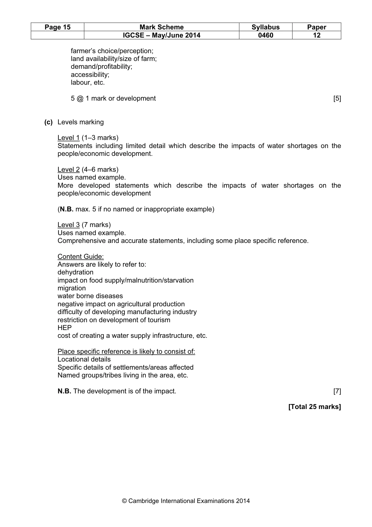
Page 15 Mark Scheme Syllabus Paper IGCSE – May/June 2014 0460 12 © Cambridge International Examinations 2014 farmer’s choice/perception; land availability/size of farm; demand/profitability; accessibility; labour, etc. 5 @ 1 mark or development [5] (c) Levels marking Level 1 (1–3 marks) Statements including limited detail which describe the impacts of water shortages on the people/economic development. Level 2 (4–6 marks) Uses named example. More developed statements which describe the impacts of water shortages on the people/economic development (N.B. max. 5 if no named or inappropriate example) Level 3 (7 marks) Uses named example. Comprehensive and accurate statements, including some place specific reference. Content Guide: Answers are likely to refer to: dehydration impact on food supply/malnutrition/starvation migration water borne diseases negative impact on agricultural production difficulty of developing manufacturing industry restriction on development of tourism HEP cost of creating a water supply infrastructure, etc. Place specific reference is likely to consist of: Locational details Specific details of settlements/areas affected Named groups/tribes living in the area, etc. N.B. The development is of the impact. [7] [Total 25 marks]
What you needed in this session
Cambridge’s own grade thresholds for 2014 May/June, Paper 1 · Variant 2. A higher threshold means an easier paper — the bar moves with how the cohort did.