Cambridge IGCSE Geography 0460 — 2011 Oct/Nov Paper 1 · Variant 2
0460/12/O/N/11 · 75 marks · ≈84 min
The question paper and its mark scheme, free to read here and free to download. This is Cambridge’s own paper, exactly as it was sat.
Question paper24 pages

Mark scheme17 pages
Answers below. Sit the paper first if you are practising.
Paper as text
Question paper, page 1
This document consists of 23 printed pages, 1 blank page and 1 Insert. DC (SM/DJ) 33057/8 © UCLES 2011 [Turn over UNIVERSITY OF CAMBRIDGE INTERNATIONAL EXAMINATIONS International General Certificate of Secondary Education * 6 1 1 5 7 5 6 0 4 3 * GEOGRAPHY 0460/12 Paper 1 October/November 2011 1 hour 45 minutes Candidates answer on the Question Paper. Additional Materials: Ruler READ THESE INSTRUCTIONS FIRST Write your Centre number, candidate number and name in the spaces provided. Write in dark blue or black pen. You may use a soft pencil for any diagrams, graphs or rough working. Do not use staples, paper clips, highlighters, glue or correction fluid. DO NOT WRITE IN ANY BARCODES. Write your answer to each question in the space provided. If additional space is required, you should use the lined page at the end of this booklet. The question number(s) must be clearly shown. Answer three questions. The Insert contains Photograph A for Question 2, Photographs B, C and D for Question 3 and Photograph E for Question 4. Sketch maps and diagrams should be drawn whenever they serve to illustrate an answer. The Insert is not required by the Examiner. The number of marks is given in brackets [ ] at the end of each question or part question. www.theallpapers.com
Question paper, page 2
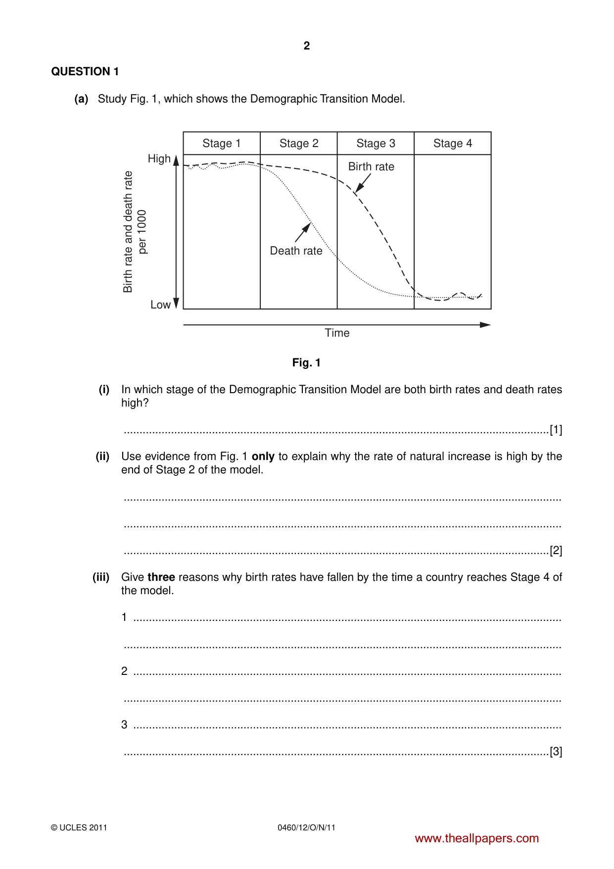
2 0460/12/O/N/11 © UCLES 2011 QUESTION 1 (a) Study Fig. 1, which shows the Demographic Transition Model. Stage 1 Stage 2 Stage 3 Stage 4 Time Low High Birth rate and death rate per 1000 Death rate Birth rate Fig. 1 (i) In which stage of the Demographic Transition Model are both birth rates and death rates high? …[1] (ii) Use evidence from Fig. 1 only to explain why the rate of natural increase is high by the end of Stage 2 of the model. … … …[2] (iii) Give three reasons why birth rates have fallen by the time a country reaches Stage 4 of the model. 1 … … 2 … … 3 … …[3] www.theallpapers.com
Question paper, page 3
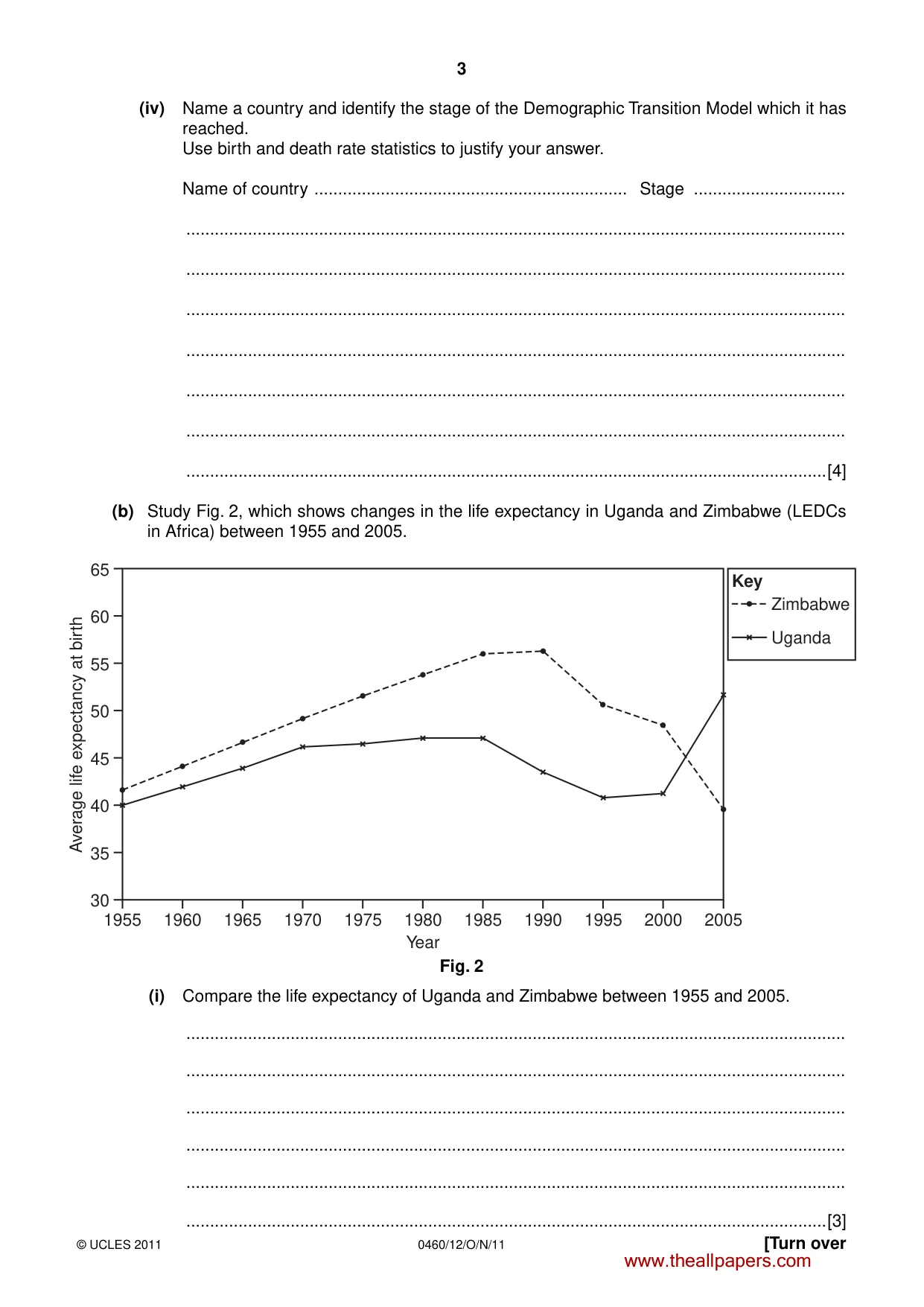
3 0460/12/O/N/11 © UCLES 2011 [Turn over (iv) Name a country and identify the stage of the Demographic Transition Model which it has reached. Use birth and death rate statistics to justify your answer. Name of country … Stage … … … … … … … …[4] (b) Study Fig. 2, which shows changes in the life expectancy in Uganda and Zimbabwe (LEDCs in Africa) between 1955 and 2005. 65 60 55 50 Average life expectancy at birth 45 40 35 1955 1960 1965 1970 1975 1980 Year 1985 1990 1995 2000 2005 30 Zimbabwe Key Uganda Fig. 2 (i) Compare the life expectancy of Uganda and Zimbabwe between 1955 and 2005. … … … … … …[3] www.theallpapers.com
Question paper, page 4
4 0460/12/O/N/11 © UCLES 2011 (ii) Suggest possible reasons for the changes in life expectancy in either Uganda or Zimbabwe between 1955 and 2005. Country chosen … … … … … … … … …[5] (c) For a named example of a country which you have studied, describe the policies used by the government to reduce natural population growth rates. Name of country … … … … … … … … … … … … … … …[7] [Total: 25 marks] END OF QUESTION 1 www.theallpapers.com
Question paper, page 5
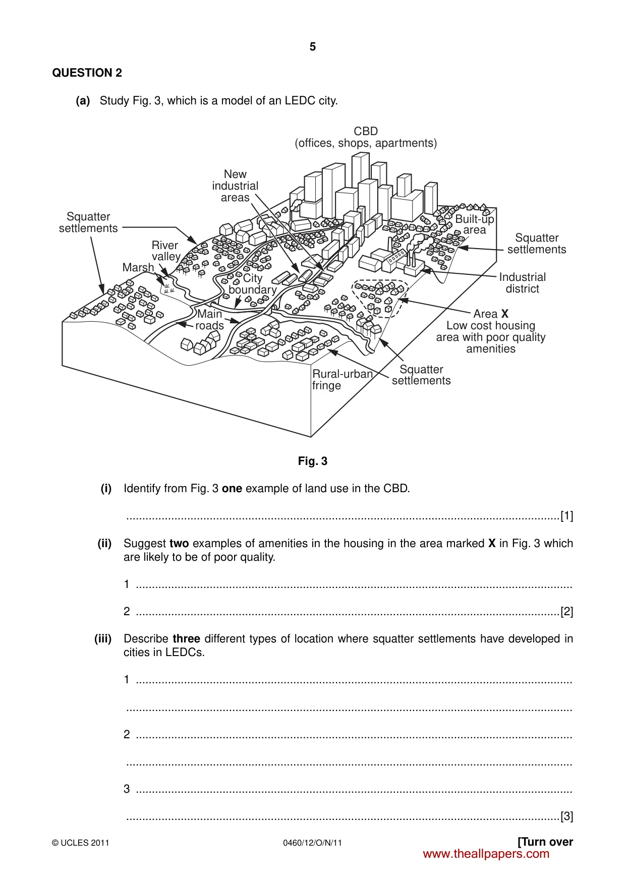
5 0460/12/O/N/11 © UCLES 2011 [Turn over QUESTION 2 (a) Study Fig. 3, which is a model of an LEDC city. Built-up area Squatter settlements Squatter settlements Area X Low cost housing area with poor quality amenities Rural-urban fringe Squatter settlements River valley Main roads City boundary New industrial areas Industrial district CBD (offices, shops, apartments) Marsh Fig. 3 (i) Identify from Fig. 3 one example of land use in the CBD. …[1] (ii) Suggest two examples of amenities in the housing in the area marked X in Fig. 3 which are likely to be of poor quality. 1 … 2 …[2] (iii) Describe three different types of location where squatter settlements have developed in cities in LEDCs. 1 … … 2 … … 3 … …[3] www.theallpapers.com
Question paper, page 6
6 0460/12/O/N/11 © UCLES 2011 (iv) Explain why large numbers of people live in squatter settlements in cities in LEDCs. … … … … … … … …[4] (b) Study Photograph A (Insert), which shows part of an urban area. (i) Suggest three likely problems of living in the urban area shown in Photograph A. 1 … … 2 … … 3 … …[3] (ii) Describe the methods which can be used by city planners to solve one of the problems which you have suggested in (b)(i). Problem chosen … … … … … … … … …[5] www.theallpapers.com
Question paper, page 7
7 0460/12/O/N/11 © UCLES 2011 [Turn over (c) In many towns and cities there have been changes in shopping facilities in recent years. Describe one recent change in shopping facilities in a named town or city which you have studied. Describe the advantages and disadvantages of this change for the people who live in the town or city. Town or city studied … … … … … … … … … … … … … … … …[7] [Total: 25 marks] END OF QUESTION 2 www.theallpapers.com
Question paper, page 8
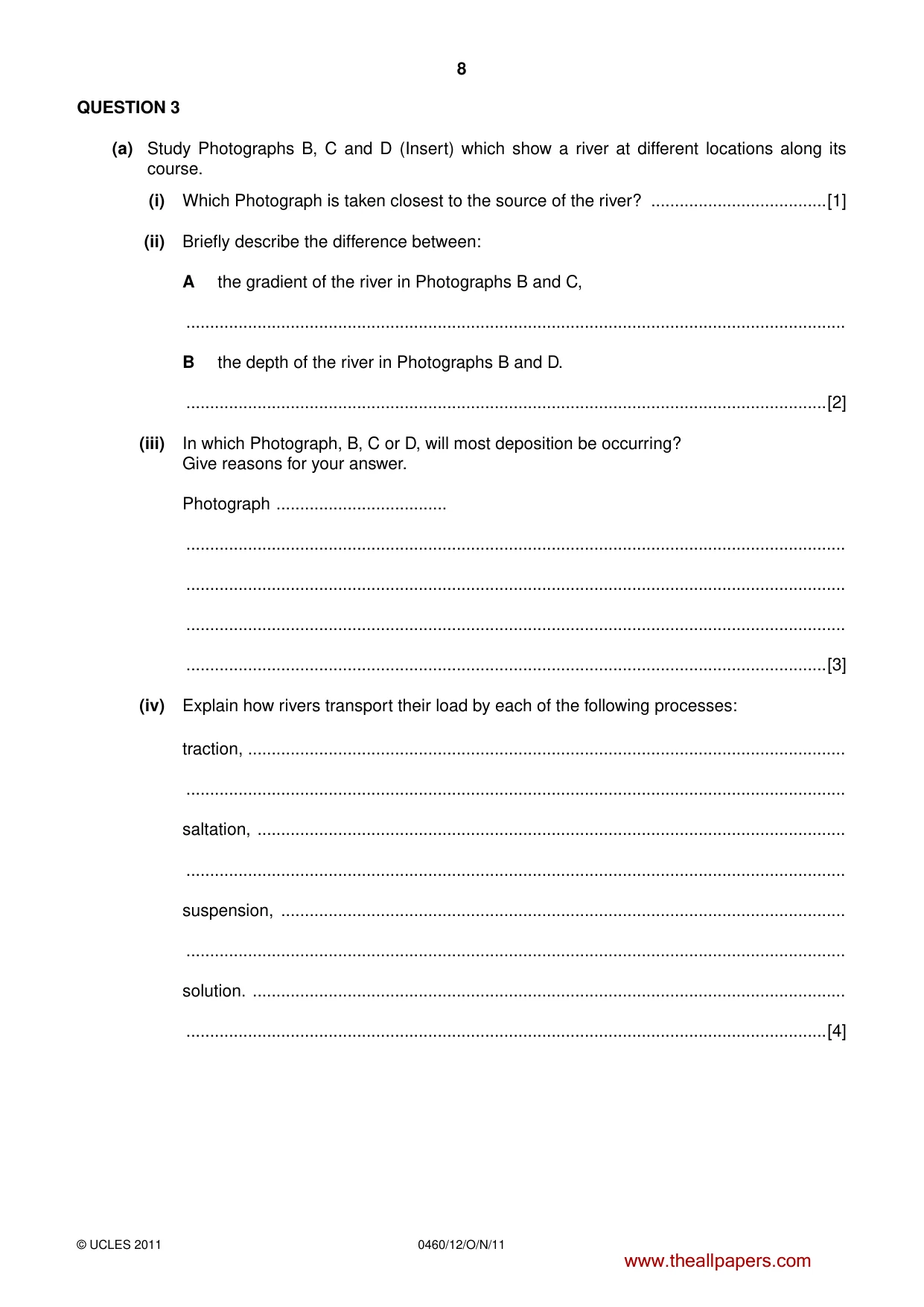
8 0460/12/O/N/11 © UCLES 2011 QUESTION 3 (a) Study Photographs B, C and D (Insert) which show a river at different locations along its course. (i) Which Photograph is taken closest to the source of the river? …[1] (ii) Briefly describe the difference between: A the gradient of the river in Photographs B and C, … B the depth of the river in Photographs B and D. …[2] (iii) In which Photograph, B, C or D, will most deposition be occurring? Give reasons for your answer. Photograph … … … … …[3] (iv) Explain how rivers transport their load by each of the following processes: traction, … … saltation, … … suspension, … … solution. … …[4] www.theallpapers.com
Question paper, page 9
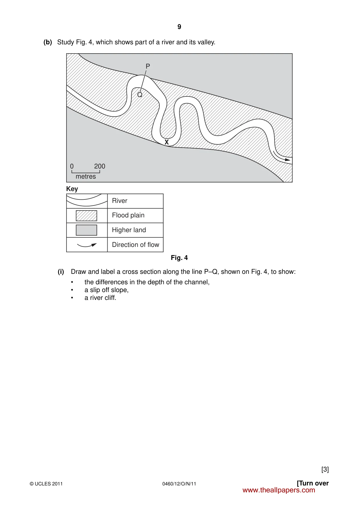
9 0460/12/O/N/11 © UCLES 2011 [Turn over (b) Study Fig. 4, which shows part of a river and its valley. X Q P 0 200 metres Key River Flood plain Higher land Direction of flow Fig. 4 (i) Draw and label a cross section along the line P–Q, shown on Fig. 4, to show: • the differences in the depth of the channel, • a slip off slope, • a river cliff. [3] www.theallpapers.com
Question paper, page 10
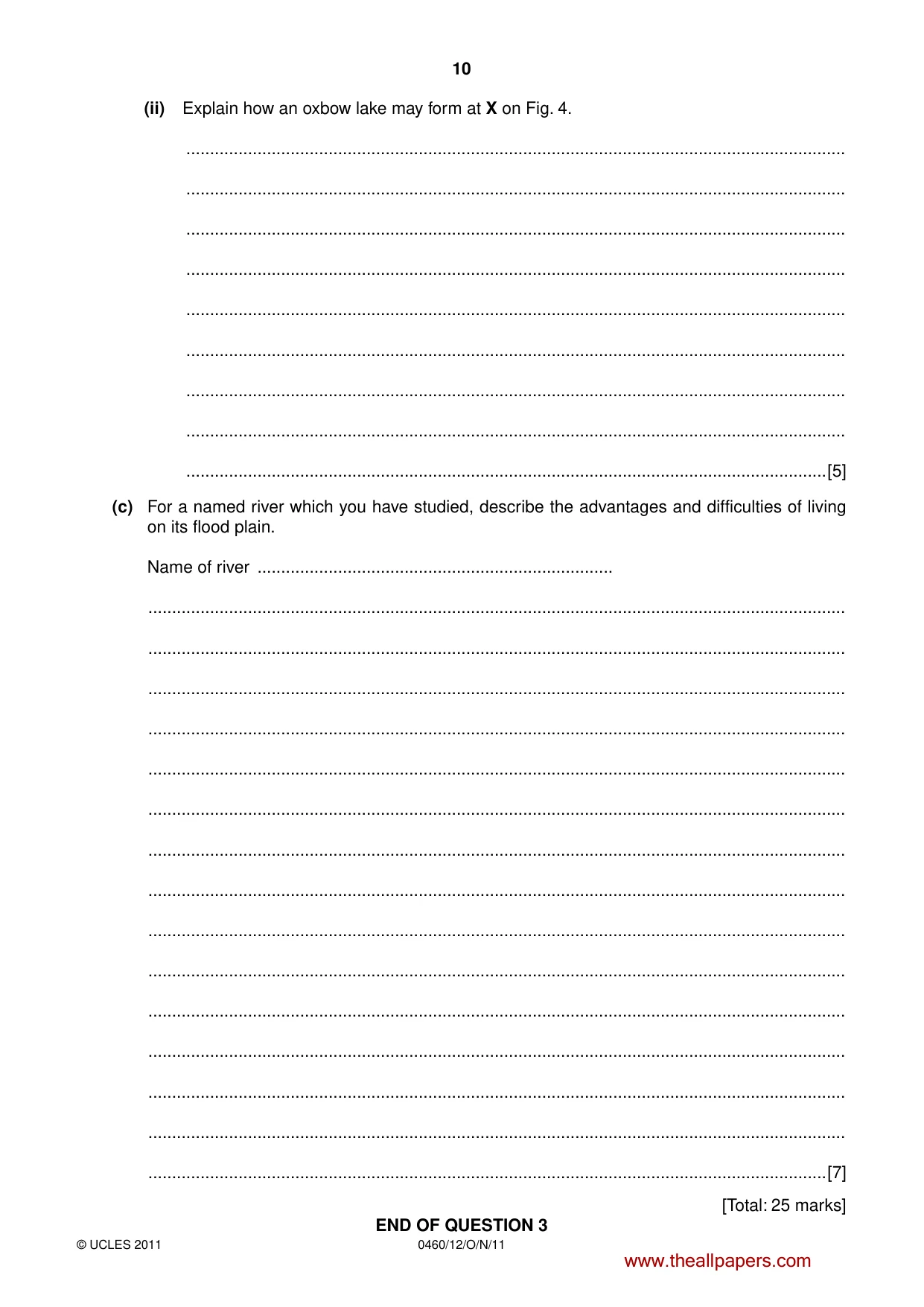
10 0460/12/O/N/11 © UCLES 2011 (ii) Explain how an oxbow lake may form at X on Fig. 4. … … … … … … … … …[5] (c) For a named river which you have studied, describe the advantages and difficulties of living on its flood plain. Name of river … … … … … … … … … … … … … … … …[7] [Total: 25 marks] END OF QUESTION 3 www.theallpapers.com
Question paper, page 11
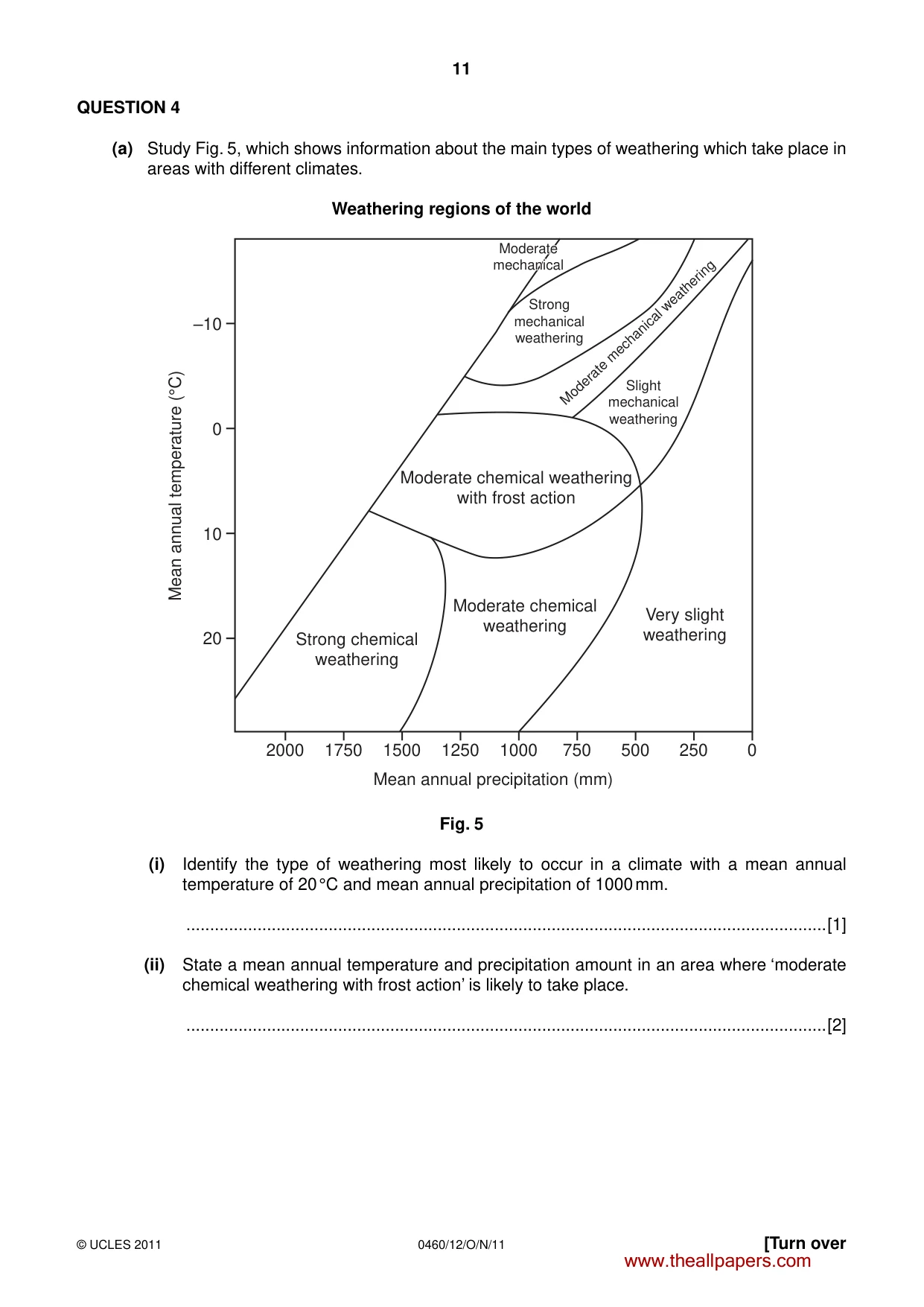
11 0460/12/O/N/11 © UCLES 2011 [Turn over QUESTION 4 (a) Study Fig. 5, which shows information about the main types of weathering which take place in areas with different climates. Weathering regions of the world Moderate chemical weathering with frost action Moderate chemical weathering Strong chemical weathering 2000 20 10 0 –10 1750 1500 1250 1000 Mean annual precipitation (mm) Mean annual temperature (°C) 750 500 250 0 Slight mechanical weathering Strong mechanical weathering Moderate Moderate mechanical mechanical Moderate mechanical Moderate mechanical weathering Very slight weathering Fig. 5 (i) Identify the type of weathering most likely to occur in a climate with a mean annual temperature of 20 °C and mean annual precipitation of 1000 mm. …[1] (ii) State a mean annual temperature and precipitation amount in an area where ‘moderate chemical weathering with frost action’ is likely to take place. …[2] www.theallpapers.com
Question paper, page 12
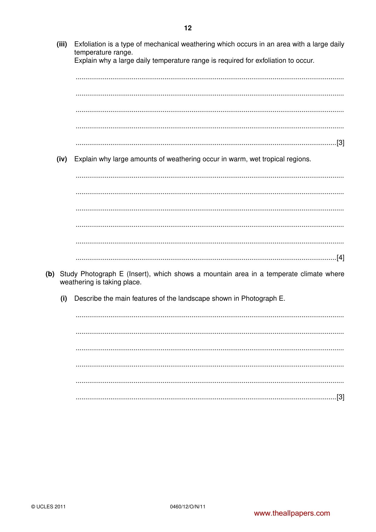
12 0460/12/O/N/11 © UCLES 2011 (iii) Exfoliation is a type of mechanical weathering which occurs in an area with a large daily temperature range. Explain why a large daily temperature range is required for exfoliation to occur. … … … … …[3] (iv) Explain why large amounts of weathering occur in warm, wet tropical regions. … … … … … …[4] (b) Study Photograph E (Insert), which shows a mountain area in a temperate climate where weathering is taking place. (i) Describe the main features of the landscape shown in Photograph E. … … … … … …[3] www.theallpapers.com
Question paper, page 13
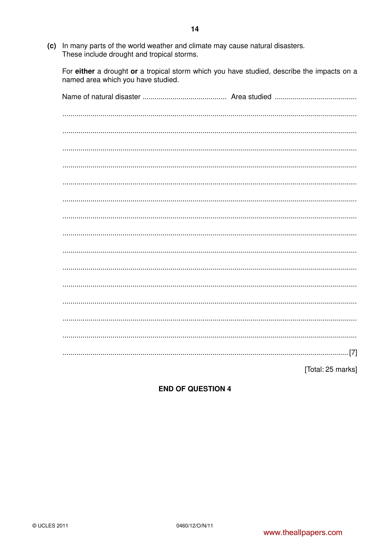
13 0460/12/O/N/11 © UCLES 2011 [Turn over (ii) Explain how mechanical weathering is operating in the area shown in Photograph E. You may use a labelled diagram in your answer. … … … … … … … …[5] www.theallpapers.com
Question paper, page 14
14 0460/12/O/N/11 © UCLES 2011 (c) In many parts of the world weather and climate may cause natural disasters. These include drought and tropical storms. For either a drought or a tropical storm which you have studied, describe the impacts on a named area which you have studied. Name of natural disaster … Area studied … … … … … … … … … … … … … … … …[7] [Total: 25 marks] END OF QUESTION 4 www.theallpapers.com
Question paper, page 15
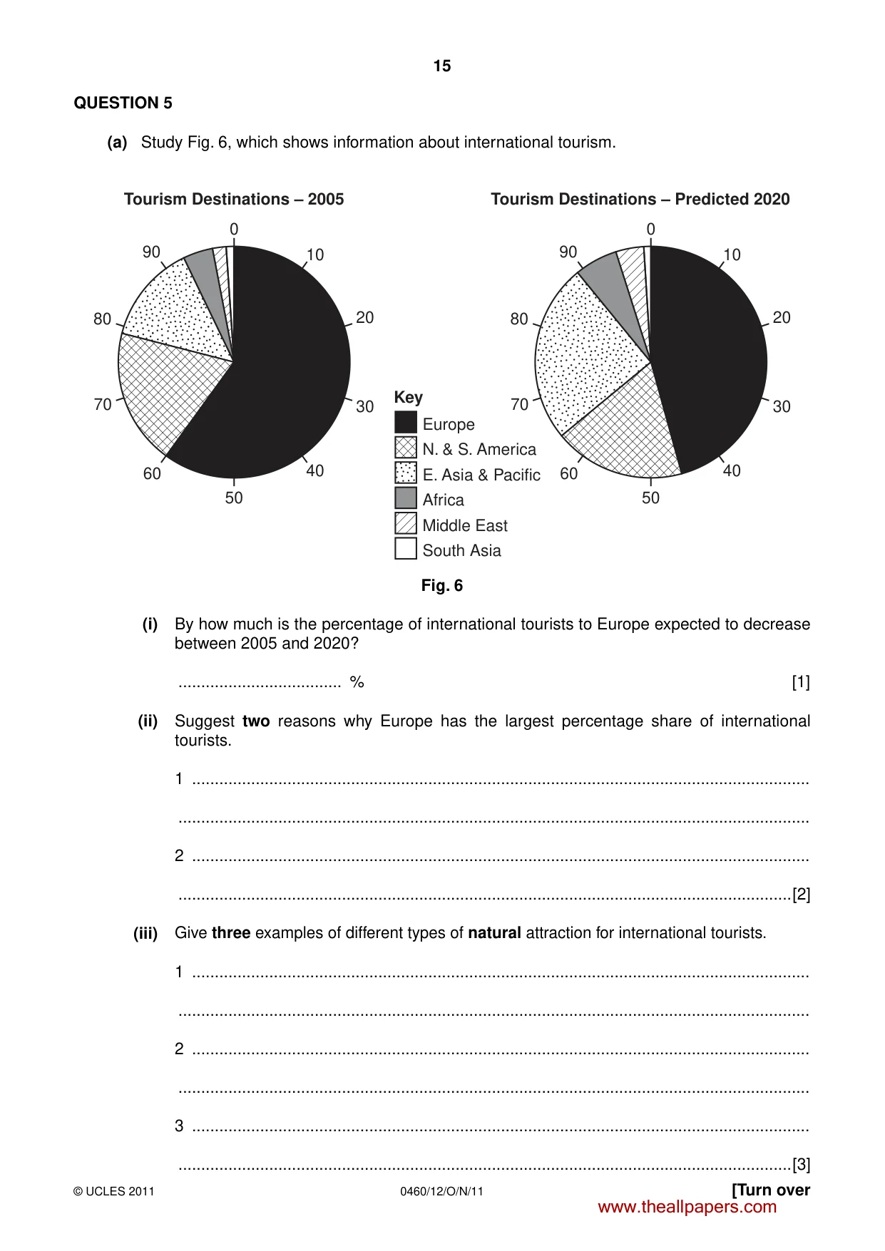
15 0460/12/O/N/11 © UCLES 2011 [Turn over QUESTION 5 (a) Study Fig. 6, which shows information about international tourism. 0 Tourism Destinations – 2005 10 20 30 40 50 60 70 80 90 0 Tourism Destinations – Predicted 2020 10 20 30 40 50 60 70 Europe N. & S. America E. Asia & Pacific Africa Middle East South Asia Key 80 90 Fig. 6 (i) By how much is the percentage of international tourists to Europe expected to decrease between 2005 and 2020? … % [1] (ii) Suggest two reasons why Europe has the largest percentage share of international tourists. 1 … … 2 … …[2] (iii) Give three examples of different types of natural attraction for international tourists. 1 … … 2 … … 3 … …[3] www.theallpapers.com
Question paper, page 16
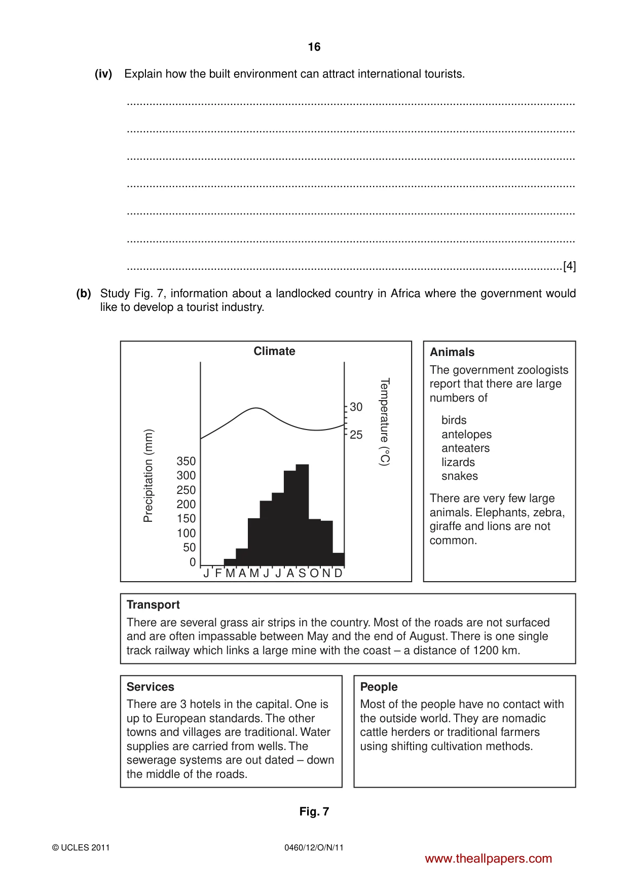
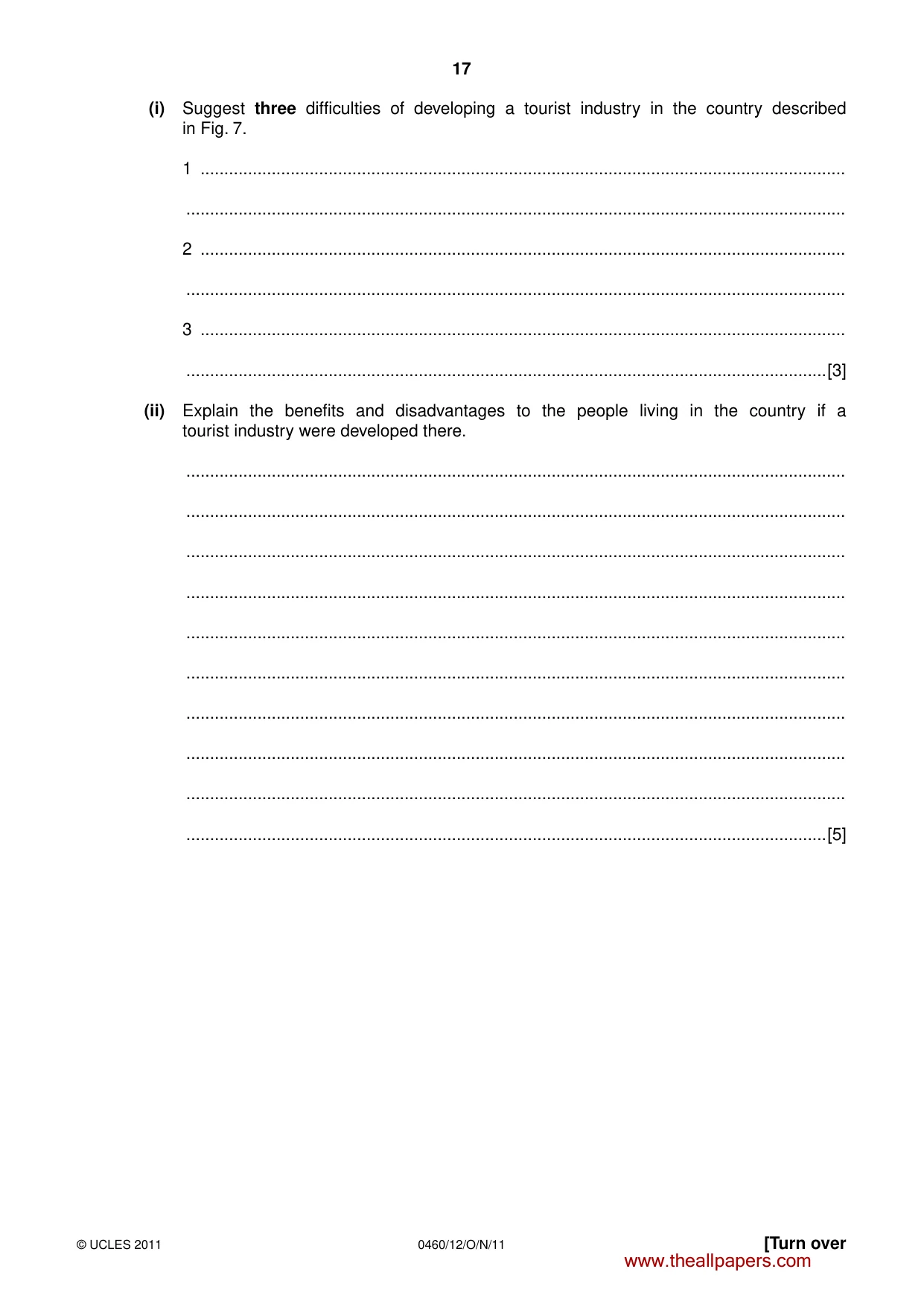
16 0460/12/O/N/11 © UCLES 2011 (iv) Explain how the built environment can attract international tourists. … … … … … … …[4] (b) Study Fig. 7, information about a landlocked country in Africa where the government would like to develop a tourist industry. J 0 50 100 150 200 250 300 350 Precipitation (mm) Temperature (°C) F M A M J J A S O N D Climate Animals The government zoologists report that there are large numbers of birds antelopes anteaters lizards snakes There are very few large animals. Elephants, zebra, giraffe and lions are not common. Transport There are several grass air strips in the country. Most of the roads are not surfaced and are often impassable between May and the end of August. There is one single track railway which links a large mine with the coast – a distance of 1200 km. Services There are 3 hotels in the capital. One is up to European standards. The other towns and villages are traditional. Water supplies are carried from wells. The sewerage systems are out dated – down the middle of the roads. People Most of the people have no contact with the outside world. They are nomadic cattle herders or traditional farmers using shifting cultivation methods. 30 25 Fig. 7 www.theallpapers.com
Question paper, page 17
17 0460/12/O/N/11 © UCLES 2011 [Turn over (i) Suggest three difficulties of developing a tourist industry in the country described in Fig. 7. 1 … … 2 … … 3 … …[3] (ii) Explain the benefits and disadvantages to the people living in the country if a tourist industry were developed there. … … … … … … … … … …[5] www.theallpapers.com
Question paper, page 18
18 0460/12/O/N/11 © UCLES 2011 (c) Name an area which you have studied where the environment is at risk from tourism. Explain how tourism is damaging the natural environment of your chosen area. Name of area … … … … … … … … … … … … … … … …[7] [Total: 25 marks] END OF QUESTION 5 www.theallpapers.com
Question paper, page 19
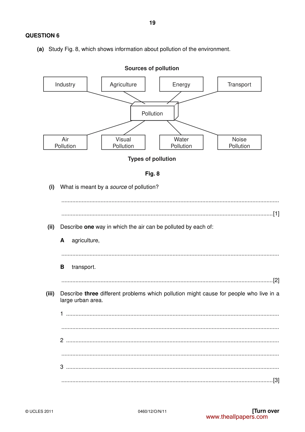
19 0460/12/O/N/11 © UCLES 2011 [Turn over QUESTION 6 (a) Study Fig. 8, which shows information about pollution of the environment. Pollution Agriculture Sources of pollution Types of pollution Energy Transport Industry Visual Pollution Water Pollution Noise Pollution Air Pollution Fig. 8 (i) What is meant by a source of pollution? … …[1] (ii) Describe one way in which the air can be polluted by each of: A agriculture, … B transport. …[2] (iii) Describe three different problems which pollution might cause for people who live in a large urban area. 1 … … 2 … … 3 … …[3] www.theallpapers.com
Question paper, page 20
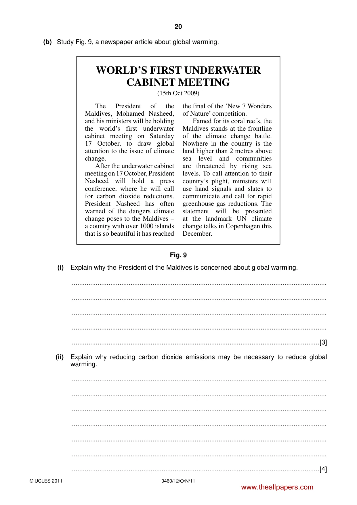
20 0460/12/O/N/11 © UCLES 2011 (b) Study Fig. 9, a newspaper article about global warming. WORLD’S FIRST UNDERWATER CABINET MEETING (15th Oct 2009) The President of the Maldives, Mohamed Nasheed, and his ministers will be holding the world’s first underwater cabinet meeting on Saturday 17 October, to draw global attention to the issue of climate change. After the underwater cabinet meeting on 17 October, President Nasheed will hold a press conference, where he will call for carbon dioxide reductions. President Nasheed has often warned of the dangers climate change poses to the Maldives – a country with over 1000 islands that is so beautiful it has reached the final of the ‘New 7 Wonders of Nature’ competition. Famed for its coral reefs, the Maldives stands at the frontline of the climate change battle. Nowhere in the country is the land higher than 2 metres above sea level and communities are threatened by rising sea levels. To call attention to their country’s plight, ministers will use hand signals and slates to communicate and call for rapid greenhouse gas reductions. The statement will be presented at the landmark UN climate change talks in Copenhagen this December. Fig. 9 (i) Explain why the President of the Maldives is concerned about global warming. … … … … …[3] (ii) Explain why reducing carbon dioxide emissions may be necessary to reduce global warming. … … … … … … …[4] www.theallpapers.com
Question paper, page 21
21 0460/12/O/N/11 © UCLES 2011 [Turn over (iii) Describe the strategies which can be used to reduce carbon dioxide levels in the atmosphere. … … … … … … … … … …[5] www.theallpapers.com
Question paper, page 22
22 0460/12/O/N/11 © UCLES 2011 (c) For a named country or area which you have studied, describe the causes and effects of water pollution. Name of country or area … … … … … … … … … … … … … … … …[7] [Total: 25 marks] END OF QUESTION 6 www.theallpapers.com
Question paper, page 23
23 0460/12/O/N/11 © UCLES 2011 Additional Page If you use the following lined page to complete the answer(s) to any question(s), the question number(s) must be clearly shown. … … … … … … … … … … … … … … … … … … … … … … … … … … www.theallpapers.com
Question paper, page 24
24 0460/12/O/N/11 © UCLES 2011 BLANK PAGE Copyright Acknowledgements: Question 6 Fig. 9 © http://www.miadhu.com/2009/10/local-news/world%E2%80%99s-first-underwater-cabinet-meeting-on-saturday; 28 July 2010. Photographs A–E Steve Sibley © UCLES. Permission to reproduce items where third-party owned material protected by copyright is included has been sought and cleared where possible. Every reasonable effort has been made by the publisher (UCLES) to trace copyright holders, but if any items requiring clearance have unwittingly been included, the publisher will be pleased to make amends at the earliest possible opportunity. University of Cambridge International Examinations is part of the Cambridge Assessment Group. Cambridge Assessment is the brand name of University of Cambridge Local Examinations Syndicate (UCLES), which is itself a department of the University of Cambridge. www.theallpapers.com
Mark scheme, page 1
UNIVERSITY OF CAMBRIDGE INTERNATIONAL EXAMINATIONS International General Certificate of Secondary Education MARK SCHEME for the October/November 2011 question paper for the guidance of teachers 0460 GEOGRAPHY 0460/12 Paper 1, maximum raw mark 75 This mark scheme is published as an aid to teachers and candidates, to indicate the requirements of the examination. It shows the basis on which Examiners were instructed to award marks. It does not indicate the details of the discussions that took place at an Examiners’ meeting before marking began, which would have considered the acceptability of alternative answers. Mark schemes must be read in conjunction with the question papers and the report on the examination. • Cambridge will not enter into discussions or correspondence in connection with these mark schemes. Cambridge is publishing the mark schemes for the October/November 2011 question papers for most IGCSE, GCE Advanced Level and Advanced Subsidiary Level syllabuses and some Ordinary Level syllabuses. www.theallpapers.com
Mark scheme, page 2
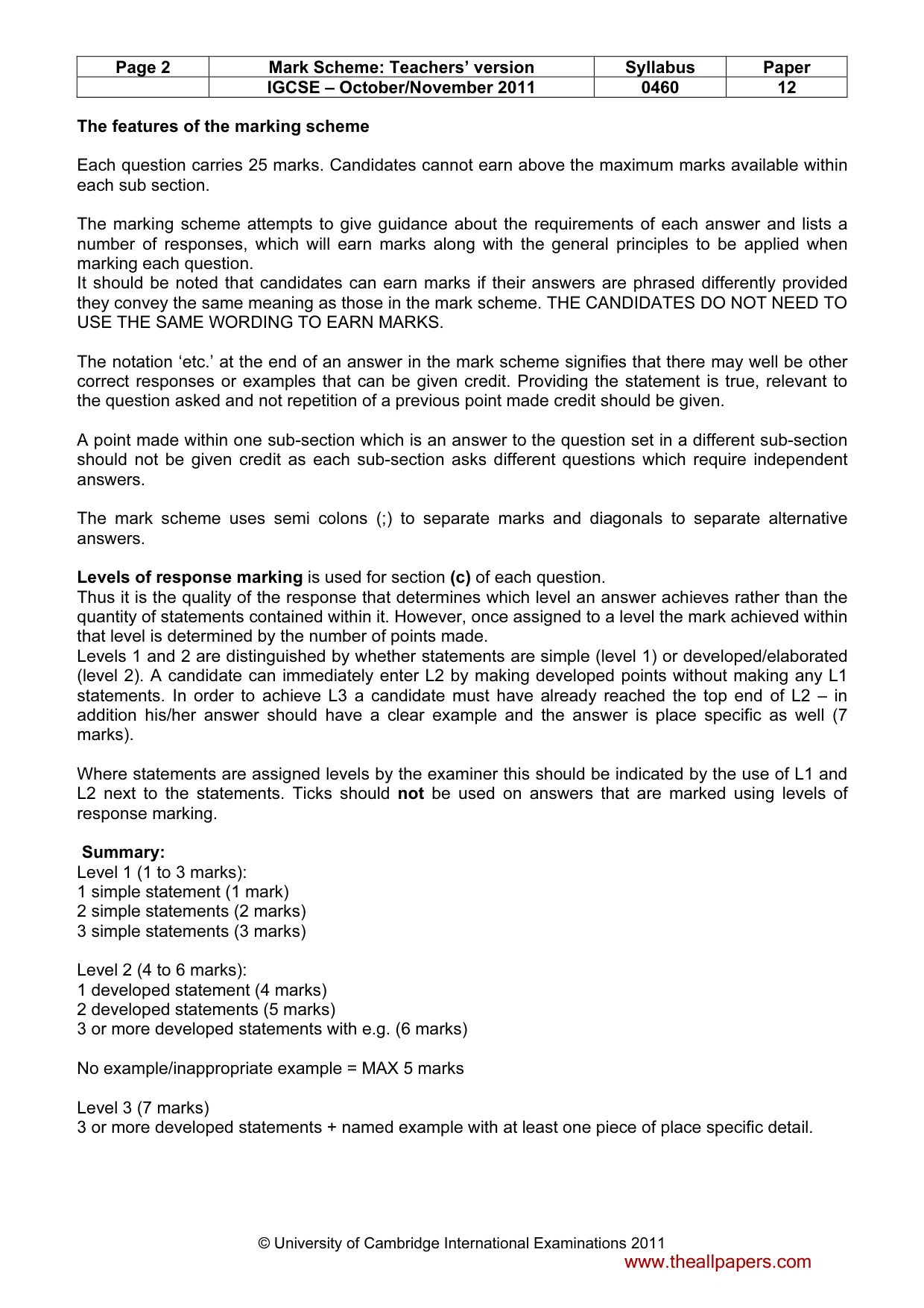
Page 2 Mark Scheme: Teachers’ version Syllabus Paper IGCSE – October/November 2011 0460 12 © University of Cambridge International Examinations 2011 The features of the marking scheme Each question carries 25 marks. Candidates cannot earn above the maximum marks available within each sub section. The marking scheme attempts to give guidance about the requirements of each answer and lists a number of responses, which will earn marks along with the general principles to be applied when marking each question. It should be noted that candidates can earn marks if their answers are phrased differently provided they convey the same meaning as those in the mark scheme. THE CANDIDATES DO NOT NEED TO USE THE SAME WORDING TO EARN MARKS. The notation ‘etc.’ at the end of an answer in the mark scheme signifies that there may well be other correct responses or examples that can be given credit. Providing the statement is true, relevant to the question asked and not repetition of a previous point made credit should be given. A point made within one sub-section which is an answer to the question set in a different sub-section should not be given credit as each sub-section asks different questions which require independent answers. The mark scheme uses semi colons (;) to separate marks and diagonals to separate alternative answers. Levels of response marking is used for section (c) of each question. Thus it is the quality of the response that determines which level an answer achieves rather than the quantity of statements contained within it. However, once assigned to a level the mark achieved within that level is determined by the number of points made. Levels 1 and 2 are distinguished by whether statements are simple (level 1) or developed/elaborated (level 2). A candidate can immediately enter L2 by making developed points without making any L1 statements. In order to achieve L3 a candidate must have already reached the top end of L2 – in addition his/her answer should have a clear example and the answer is place specific as well (7 marks). Where statements are assigned levels by the examiner this should be indicated by the use of L1 and L2 next to the statements. Ticks should not be used on answers that are marked using levels of response marking. Summary: Level 1 (1 to 3 marks): 1 simple statement (1 mark) 2 simple statements (2 marks) 3 simple statements (3 marks) Level 2 (4 to 6 marks): 1 developed statement (4 marks) 2 developed statements (5 marks) 3 or more developed statements with e.g. (6 marks) No example/inappropriate example = MAX 5 marks Level 3 (7 marks) 3 or more developed statements + named example with at least one piece of place specific detail. www.theallpapers.com
Mark scheme, page 3
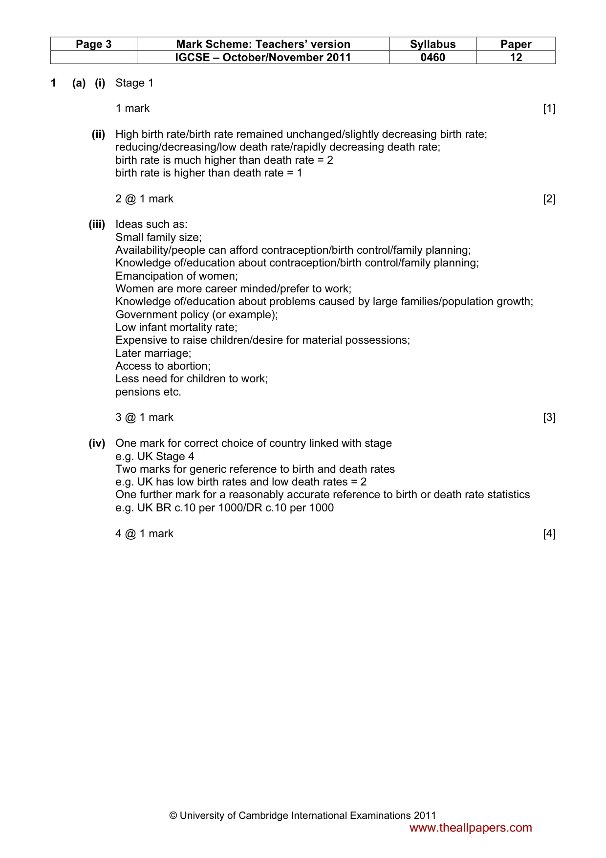
Page 3 Mark Scheme: Teachers’ version Syllabus Paper IGCSE – October/November 2011 0460 12 © University of Cambridge International Examinations 2011 1 (a) (i) Stage 1 1 mark [1] (ii) High birth rate/birth rate remained unchanged/slightly decreasing birth rate; reducing/decreasing/low death rate/rapidly decreasing death rate; birth rate is much higher than death rate = 2 birth rate is higher than death rate = 1 2 @ 1 mark [2] (iii) Ideas such as: Small family size; Availability/people can afford contraception/birth control/family planning; Knowledge of/education about contraception/birth control/family planning; Emancipation of women; Women are more career minded/prefer to work; Knowledge of/education about problems caused by large families/population growth; Government policy (or example); Low infant mortality rate; Expensive to raise children/desire for material possessions; Later marriage; Access to abortion; Less need for children to work; pensions etc. 3 @ 1 mark [3] (iv) One mark for correct choice of country linked with stage e.g. UK Stage 4 Two marks for generic reference to birth and death rates e.g. UK has low birth rates and low death rates = 2 One further mark for a reasonably accurate reference to birth or death rate statistics e.g. UK BR c.10 per 1000/DR c.10 per 1000 4 @ 1 mark [4] www.theallpapers.com
Mark scheme, page 4
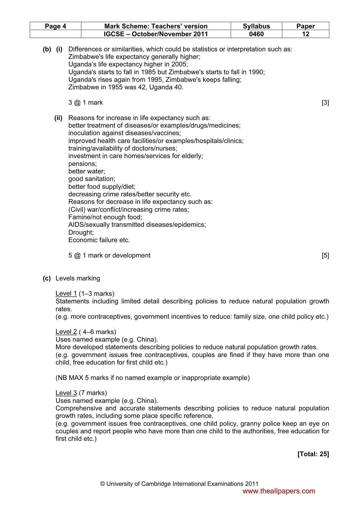
Page 4 Mark Scheme: Teachers’ version Syllabus Paper IGCSE – October/November 2011 0460 12 © University of Cambridge International Examinations 2011 (b) (i) Differences or similarities, which could be statistics or interpretation such as: Zimbabwe's life expectancy generally higher; Uganda’s life expectancy higher in 2005; Uganda's starts to fall in 1985 but Zimbabwe's starts to fall in 1990; Uganda's rises again from 1995, Zimbabwe's keeps falling; Zimbabwe in 1955 was 42, Uganda 40. 3 @ 1 mark [3] (ii) Reasons for increase in life expectancy such as: better treatment of diseases/or examples/drugs/medicines; inoculation against diseases/vaccines; improved health care facilities/or examples/hospitals/clinics; training/availability of doctors/nurses; investment in care homes/services for elderly; pensions; better water; good sanitation; better food supply/diet; decreasing crime rates/better security etc. Reasons for decrease in life expectancy such as: (Civil) war/conflict/increasing crime rates; Famine/not enough food; AIDS/sexually transmitted diseases/epidemics; Drought; Economic failure etc. 5 @ 1 mark or development [5] (c) Levels marking Level 1 (1–3 marks) Statements including limited detail describing policies to reduce natural population growth rates. (e.g. more contraceptives, government incentives to reduce: family size, one child policy etc.) Level 2 ( 4–6 marks) Uses named example (e.g. China). More developed statements describing policies to reduce natural population growth rates. (e.g. government issues free contraceptives, couples are fined if they have more than one child, free education for first child etc.) (NB MAX 5 marks if no named example or inappropriate example) Level 3 (7 marks) Uses named example (e.g. China). Comprehensive and accurate statements describing policies to reduce natural population growth rates, including some place specific reference. (e.g. government issues free contraceptives, one child policy, granny police keep an eye on couples and report people who have more than one child to the authorities, free education for first child etc.) [Total: 25] www.theallpapers.com
Mark scheme, page 5
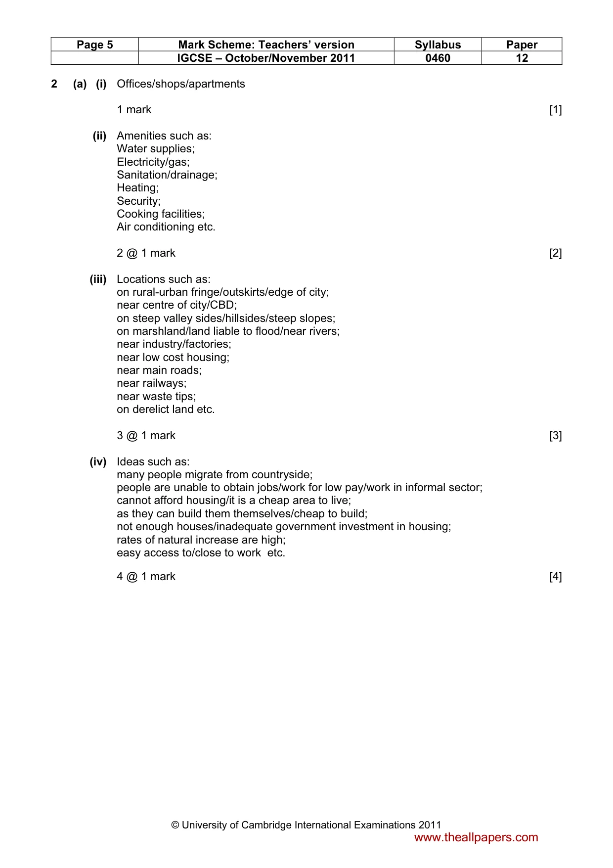
Page 5 Mark Scheme: Teachers’ version Syllabus Paper IGCSE – October/November 2011 0460 12 © University of Cambridge International Examinations 2011 2 (a) (i) Offices/shops/apartments 1 mark [1] (ii) Amenities such as: Water supplies; Electricity/gas; Sanitation/drainage; Heating; Security; Cooking facilities; Air conditioning etc. 2 @ 1 mark [2] (iii) Locations such as: on rural-urban fringe/outskirts/edge of city; near centre of city/CBD; on steep valley sides/hillsides/steep slopes; on marshland/land liable to flood/near rivers; near industry/factories; near low cost housing; near main roads; near railways; near waste tips; on derelict land etc. 3 @ 1 mark [3] (iv) Ideas such as: many people migrate from countryside; people are unable to obtain jobs/work for low pay/work in informal sector; cannot afford housing/it is a cheap area to live; as they can build them themselves/cheap to build; not enough houses/inadequate government investment in housing; rates of natural increase are high; easy access to/close to work etc. 4 @ 1 mark [4] www.theallpapers.com
Mark scheme, page 6
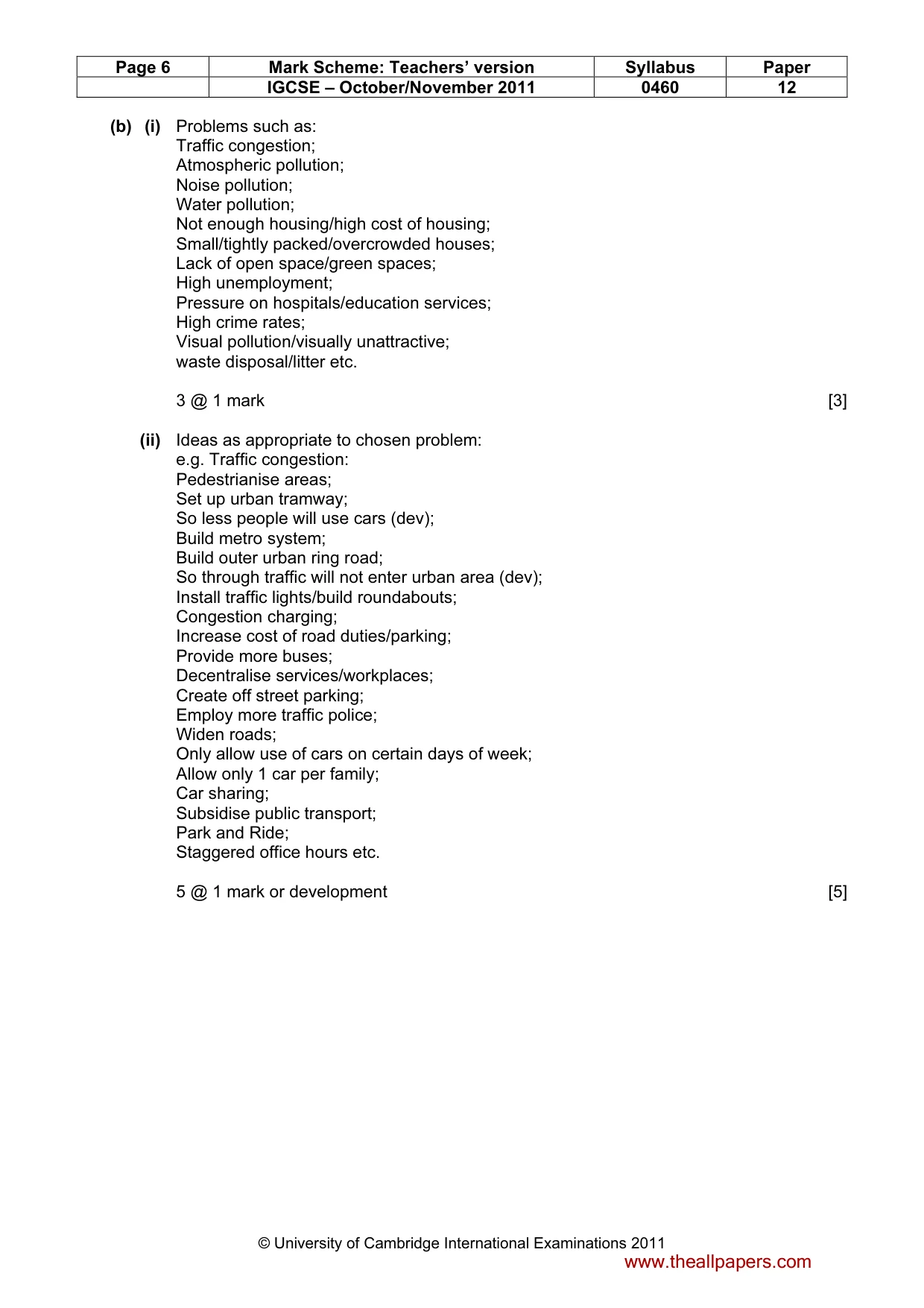
Page 6 Mark Scheme: Teachers’ version Syllabus Paper IGCSE – October/November 2011 0460 12 © University of Cambridge International Examinations 2011 (b) (i) Problems such as: Traffic congestion; Atmospheric pollution; Noise pollution; Water pollution; Not enough housing/high cost of housing; Small/tightly packed/overcrowded houses; Lack of open space/green spaces; High unemployment; Pressure on hospitals/education services; High crime rates; Visual pollution/visually unattractive; waste disposal/litter etc. 3 @ 1 mark [3] (ii) Ideas as appropriate to chosen problem: e.g. Traffic congestion: Pedestrianise areas; Set up urban tramway; So less people will use cars (dev); Build metro system; Build outer urban ring road; So through traffic will not enter urban area (dev); Install traffic lights/build roundabouts; Congestion charging; Increase cost of road duties/parking; Provide more buses; Decentralise services/workplaces; Create off street parking; Employ more traffic police; Widen roads; Only allow use of cars on certain days of week; Allow only 1 car per family; Car sharing; Subsidise public transport; Park and Ride; Staggered office hours etc. 5 @ 1 mark or development [5] www.theallpapers.com
Mark scheme, page 7
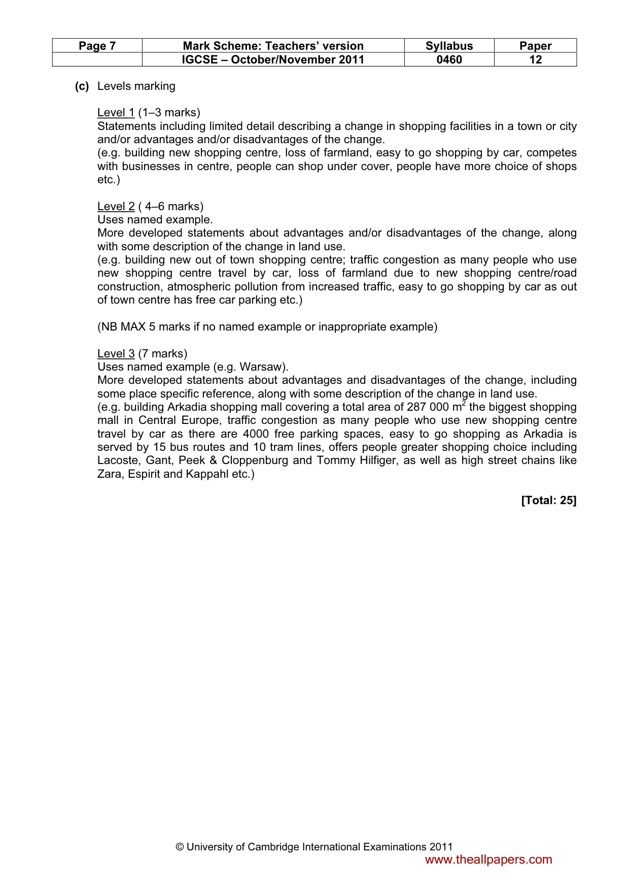
Page 7 Mark Scheme: Teachers’ version Syllabus Paper IGCSE – October/November 2011 0460 12 © University of Cambridge International Examinations 2011 (c) Levels marking Level 1 (1–3 marks) Statements including limited detail describing a change in shopping facilities in a town or city and/or advantages and/or disadvantages of the change. (e.g. building new shopping centre, loss of farmland, easy to go shopping by car, competes with businesses in centre, people can shop under cover, people have more choice of shops etc.) Level 2 ( 4–6 marks) Uses named example. More developed statements about advantages and/or disadvantages of the change, along with some description of the change in land use. (e.g. building new out of town shopping centre; traffic congestion as many people who use new shopping centre travel by car, loss of farmland due to new shopping centre/road construction, atmospheric pollution from increased traffic, easy to go shopping by car as out of town centre has free car parking etc.) (NB MAX 5 marks if no named example or inappropriate example) Level 3 (7 marks) Uses named example (e.g. Warsaw). More developed statements about advantages and disadvantages of the change, including some place specific reference, along with some description of the change in land use. (e.g. building Arkadia shopping mall covering a total area of 287 000 m2 the biggest shopping mall in Central Europe, traffic congestion as many people who use new shopping centre travel by car as there are 4000 free parking spaces, easy to go shopping as Arkadia is served by 15 bus routes and 10 tram lines, offers people greater shopping choice including Lacoste, Gant, Peek & Cloppenburg and Tommy Hilfiger, as well as high street chains like Zara, Espirit and Kappahl etc.) [Total: 25] www.theallpapers.com
Mark scheme, page 8
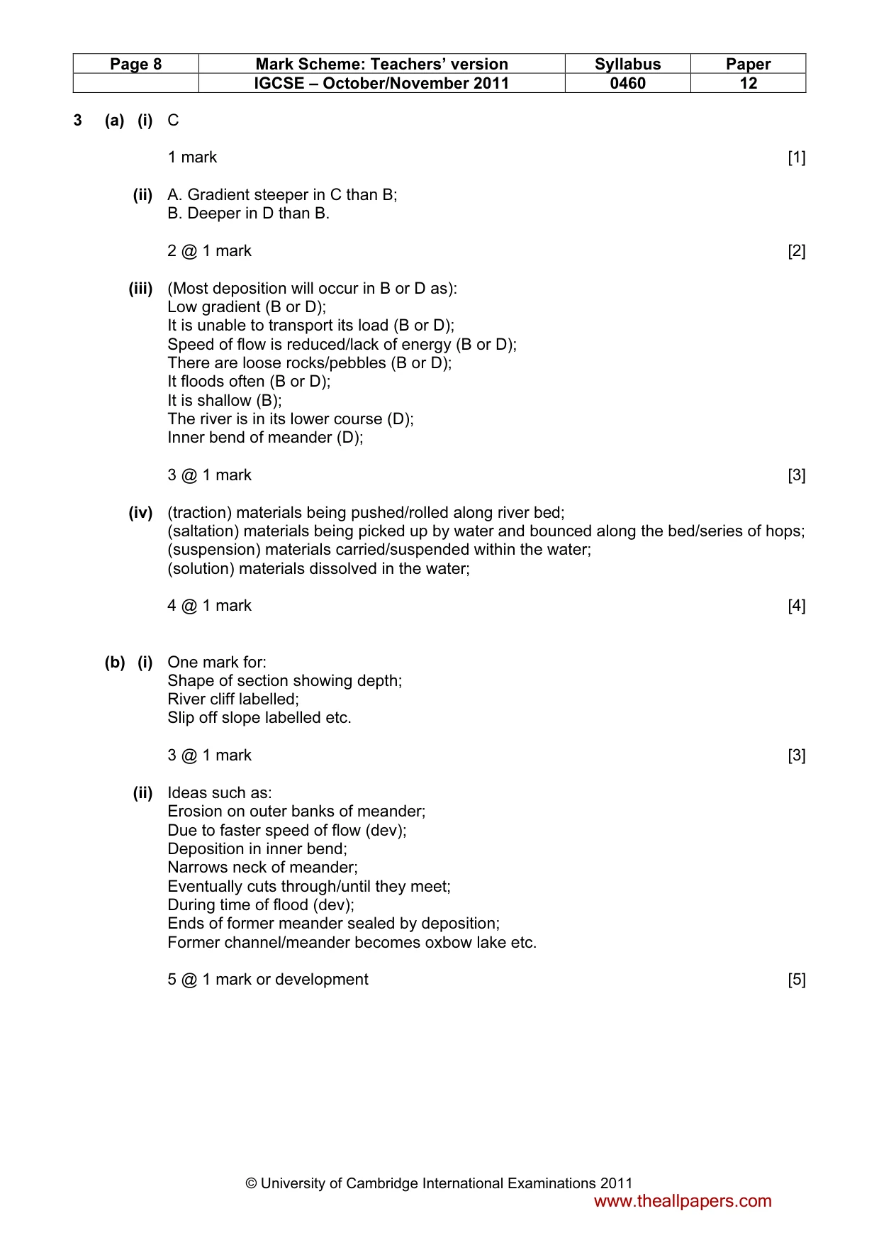
Page 8 Mark Scheme: Teachers’ version Syllabus Paper IGCSE – October/November 2011 0460 12 © University of Cambridge International Examinations 2011 3 (a) (i) C 1 mark [1] (ii) A. Gradient steeper in C than B; B. Deeper in D than B. 2 @ 1 mark [2] (iii) (Most deposition will occur in B or D as): Low gradient (B or D); It is unable to transport its load (B or D); Speed of flow is reduced/lack of energy (B or D); There are loose rocks/pebbles (B or D); It floods often (B or D); It is shallow (B); The river is in its lower course (D); Inner bend of meander (D); 3 @ 1 mark [3] (iv) (traction) materials being pushed/rolled along river bed; (saltation) materials being picked up by water and bounced along the bed/series of hops; (suspension) materials carried/suspended within the water; (solution) materials dissolved in the water; 4 @ 1 mark [4] (b) (i) One mark for: Shape of section showing depth; River cliff labelled; Slip off slope labelled etc. 3 @ 1 mark [3] (ii) Ideas such as: Erosion on outer banks of meander; Due to faster speed of flow (dev); Deposition in inner bend; Narrows neck of meander; Eventually cuts through/until they meet; During time of flood (dev); Ends of former meander sealed by deposition; Former channel/meander becomes oxbow lake etc. 5 @ 1 mark or development [5] www.theallpapers.com
Mark scheme, page 9
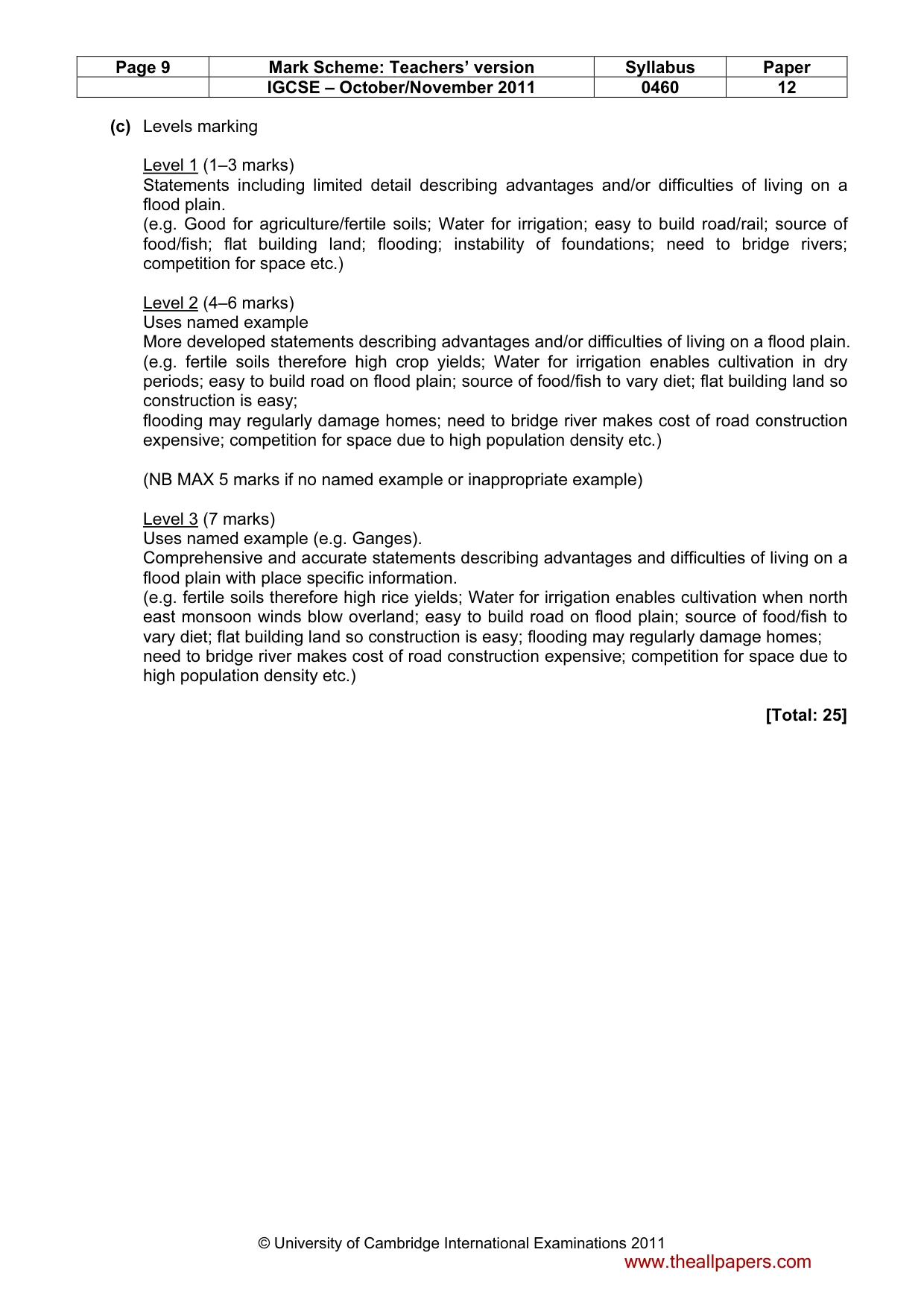
Page 9 Mark Scheme: Teachers’ version Syllabus Paper IGCSE – October/November 2011 0460 12 © University of Cambridge International Examinations 2011 (c) Levels marking Level 1 (1–3 marks) Statements including limited detail describing advantages and/or difficulties of living on a flood plain. (e.g. Good for agriculture/fertile soils; Water for irrigation; easy to build road/rail; source of food/fish; flat building land; flooding; instability of foundations; need to bridge rivers; competition for space etc.) Level 2 (4–6 marks) Uses named example More developed statements describing advantages and/or difficulties of living on a flood plain. (e.g. fertile soils therefore high crop yields; Water for irrigation enables cultivation in dry periods; easy to build road on flood plain; source of food/fish to vary diet; flat building land so construction is easy; flooding may regularly damage homes; need to bridge river makes cost of road construction expensive; competition for space due to high population density etc.) (NB MAX 5 marks if no named example or inappropriate example) Level 3 (7 marks) Uses named example (e.g. Ganges). Comprehensive and accurate statements describing advantages and difficulties of living on a flood plain with place specific information. (e.g. fertile soils therefore high rice yields; Water for irrigation enables cultivation when north east monsoon winds blow overland; easy to build road on flood plain; source of food/fish to vary diet; flat building land so construction is easy; flooding may regularly damage homes; need to bridge river makes cost of road construction expensive; competition for space due to high population density etc.) [Total: 25] www.theallpapers.com
Mark scheme, page 10
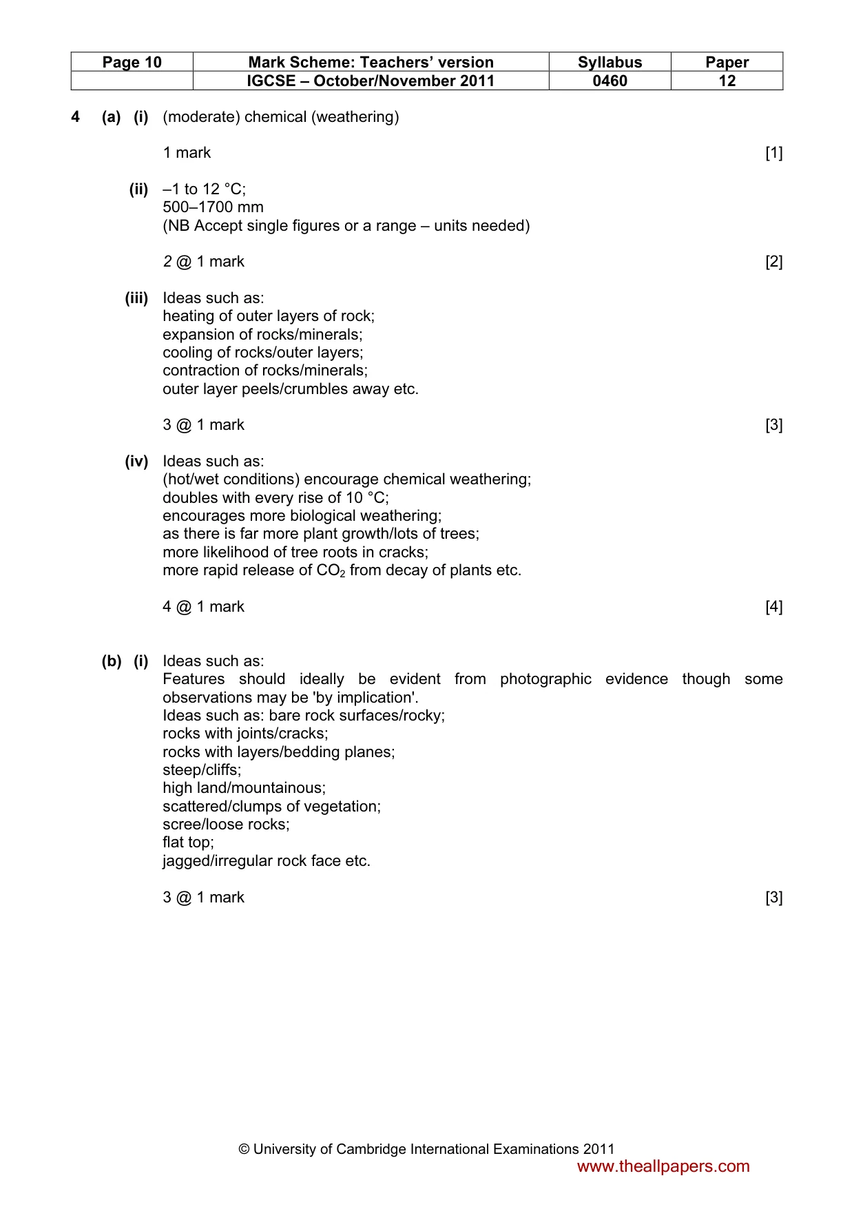
Page 10 Mark Scheme: Teachers’ version Syllabus Paper IGCSE – October/November 2011 0460 12 © University of Cambridge International Examinations 2011 4 (a) (i) (moderate) chemical (weathering) 1 mark [1] (ii) –1 to 12 °C; 500–1700 mm (NB Accept single figures or a range – units needed) 2 @ 1 mark [2] (iii) Ideas such as: heating of outer layers of rock; expansion of rocks/minerals; cooling of rocks/outer layers; contraction of rocks/minerals; outer layer peels/crumbles away etc. 3 @ 1 mark [3] (iv) Ideas such as: (hot/wet conditions) encourage chemical weathering; doubles with every rise of 10 °C; encourages more biological weathering; as there is far more plant growth/lots of trees; more likelihood of tree roots in cracks; more rapid release of CO2 from decay of plants etc. 4 @ 1 mark [4] (b) (i) Ideas such as: Features should ideally be evident from photographic evidence though some observations may be 'by implication'. Ideas such as: bare rock surfaces/rocky; rocks with joints/cracks; rocks with layers/bedding planes; steep/cliffs; high land/mountainous; scattered/clumps of vegetation; scree/loose rocks; flat top; jagged/irregular rock face etc. 3 @ 1 mark [3] www.theallpapers.com
Mark scheme, page 11
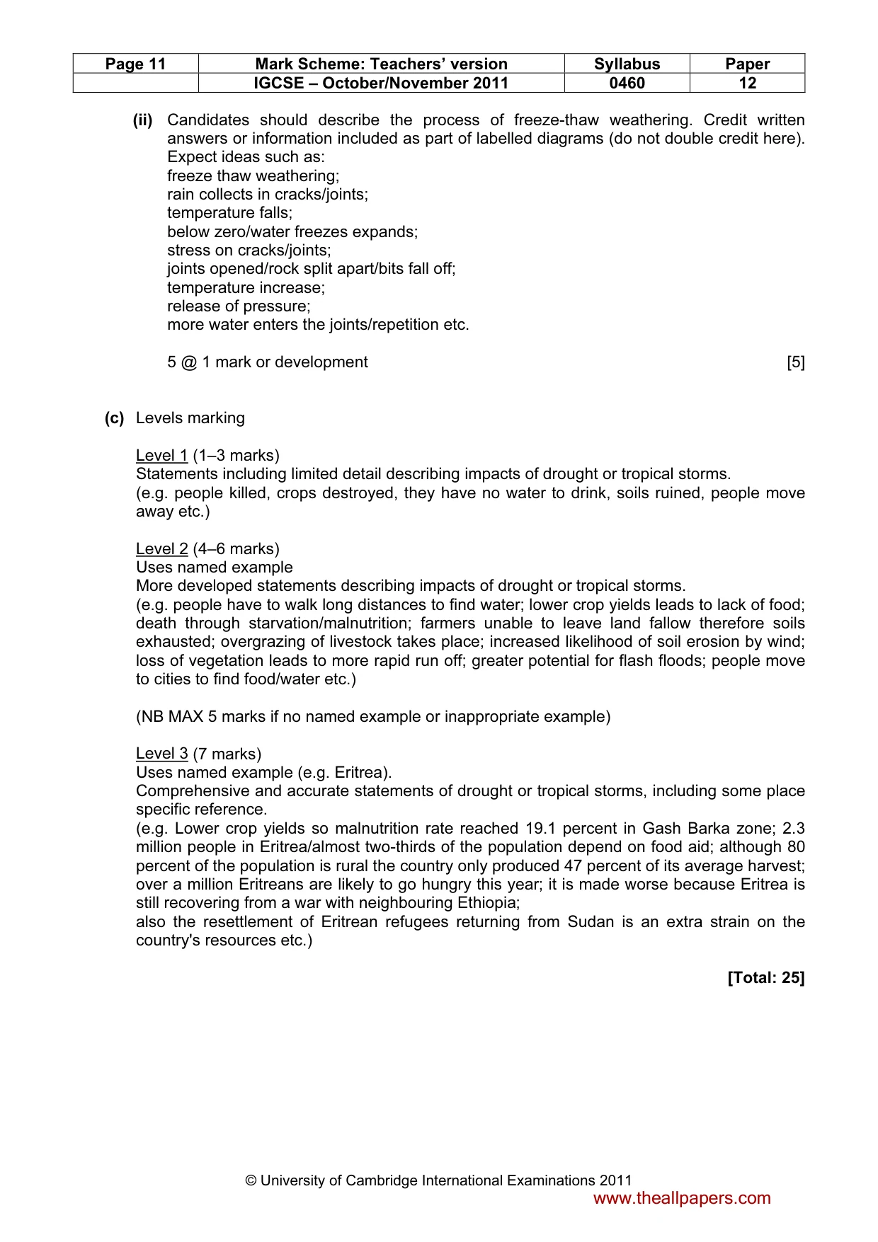
Page 11 Mark Scheme: Teachers’ version Syllabus Paper IGCSE – October/November 2011 0460 12 © University of Cambridge International Examinations 2011 (ii) Candidates should describe the process of freeze-thaw weathering. Credit written answers or information included as part of labelled diagrams (do not double credit here). Expect ideas such as: freeze thaw weathering; rain collects in cracks/joints; temperature falls; below zero/water freezes expands; stress on cracks/joints; joints opened/rock split apart/bits fall off; temperature increase; release of pressure; more water enters the joints/repetition etc. 5 @ 1 mark or development [5] (c) Levels marking Level 1 (1–3 marks) Statements including limited detail describing impacts of drought or tropical storms. (e.g. people killed, crops destroyed, they have no water to drink, soils ruined, people move away etc.) Level 2 (4–6 marks) Uses named example More developed statements describing impacts of drought or tropical storms. (e.g. people have to walk long distances to find water; lower crop yields leads to lack of food; death through starvation/malnutrition; farmers unable to leave land fallow therefore soils exhausted; overgrazing of livestock takes place; increased likelihood of soil erosion by wind; loss of vegetation leads to more rapid run off; greater potential for flash floods; people move to cities to find food/water etc.) (NB MAX 5 marks if no named example or inappropriate example) Level 3 (7 marks) Uses named example (e.g. Eritrea). Comprehensive and accurate statements of drought or tropical storms, including some place specific reference. (e.g. Lower crop yields so malnutrition rate reached 19.1 percent in Gash Barka zone; 2.3 million people in Eritrea/almost two-thirds of the population depend on food aid; although 80 percent of the population is rural the country only produced 47 percent of its average harvest; over a million Eritreans are likely to go hungry this year; it is made worse because Eritrea is still recovering from a war with neighbouring Ethiopia; also the resettlement of Eritrean refugees returning from Sudan is an extra strain on the country's resources etc.) [Total: 25] www.theallpapers.com
Mark scheme, page 12
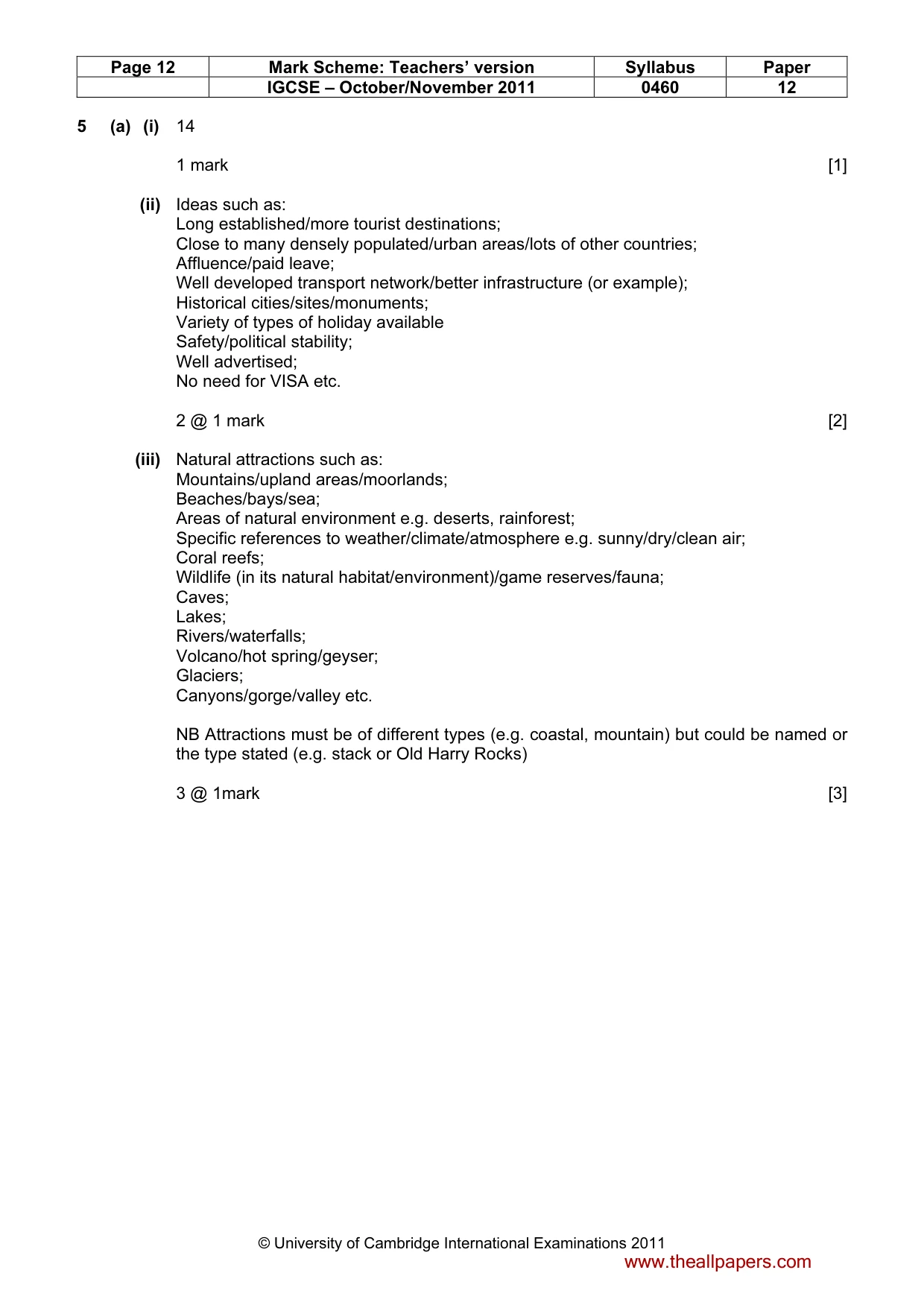
Page 12 Mark Scheme: Teachers’ version Syllabus Paper IGCSE – October/November 2011 0460 12 © University of Cambridge International Examinations 2011 5 (a) (i) 14 1 mark [1] (ii) Ideas such as: Long established/more tourist destinations; Close to many densely populated/urban areas/lots of other countries; Affluence/paid leave; Well developed transport network/better infrastructure (or example); Historical cities/sites/monuments; Variety of types of holiday available Safety/political stability; Well advertised; No need for VISA etc. 2 @ 1 mark [2] (iii) Natural attractions such as: Mountains/upland areas/moorlands; Beaches/bays/sea; Areas of natural environment e.g. deserts, rainforest; Specific references to weather/climate/atmosphere e.g. sunny/dry/clean air; Coral reefs; Wildlife (in its natural habitat/environment)/game reserves/fauna; Caves; Lakes; Rivers/waterfalls; Volcano/hot spring/geyser; Glaciers; Canyons/gorge/valley etc. NB Attractions must be of different types (e.g. coastal, mountain) but could be named or the type stated (e.g. stack or Old Harry Rocks) 3 @ 1mark [3] www.theallpapers.com
Mark scheme, page 13
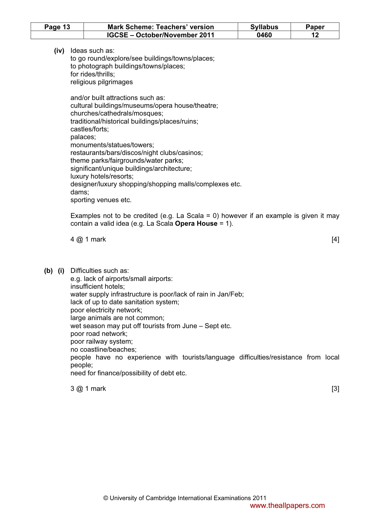
Page 13 Mark Scheme: Teachers’ version Syllabus Paper IGCSE – October/November 2011 0460 12 © University of Cambridge International Examinations 2011 (iv) Ideas such as: to go round/explore/see buildings/towns/places; to photograph buildings/towns/places; for rides/thrills; religious pilgrimages and/or built attractions such as: cultural buildings/museums/opera house/theatre; churches/cathedrals/mosques; traditional/historical buildings/places/ruins; castles/forts; palaces; monuments/statues/towers; restaurants/bars/discos/night clubs/casinos; theme parks/fairgrounds/water parks; significant/unique buildings/architecture; luxury hotels/resorts; designer/luxury shopping/shopping malls/complexes etc. dams; sporting venues etc. Examples not to be credited (e.g. La Scala = 0) however if an example is given it may contain a valid idea (e.g. La Scala Opera House = 1). 4 @ 1 mark [4] (b) (i) Difficulties such as: e.g. lack of airports/small airports: insufficient hotels; water supply infrastructure is poor/lack of rain in Jan/Feb; lack of up to date sanitation system; poor electricity network; large animals are not common; wet season may put off tourists from June – Sept etc. poor road network; poor railway system; no coastline/beaches; people have no experience with tourists/language difficulties/resistance from local people; need for finance/possibility of debt etc. 3 @ 1 mark [3] www.theallpapers.com
Mark scheme, page 14
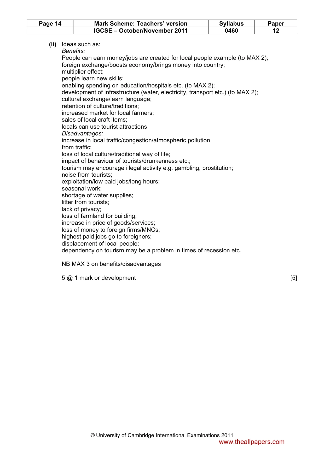
Page 14 Mark Scheme: Teachers’ version Syllabus Paper IGCSE – October/November 2011 0460 12 © University of Cambridge International Examinations 2011 (ii) Ideas such as: Benefits: People can earn money/jobs are created for local people example (to MAX 2); foreign exchange/boosts economy/brings money into country; multiplier effect; people learn new skills; enabling spending on education/hospitals etc. (to MAX 2); development of infrastructure (water, electricity, transport etc.) (to MAX 2); cultural exchange/learn language; retention of culture/traditions; increased market for local farmers; sales of local craft items; locals can use tourist attractions Disadvantages: increase in local traffic/congestion/atmospheric pollution from traffic; loss of local culture/traditional way of life; impact of behaviour of tourists/drunkenness etc.; tourism may encourage illegal activity e.g. gambling, prostitution; noise from tourists; exploitation/low paid jobs/long hours; seasonal work; shortage of water supplies; litter from tourists; lack of privacy; loss of farmland for building; increase in price of goods/services; loss of money to foreign firms/MNCs; highest paid jobs go to foreigners; displacement of local people; dependency on tourism may be a problem in times of recession etc. NB MAX 3 on benefits/disadvantages 5 @ 1 mark or development [5] www.theallpapers.com
Mark scheme, page 15
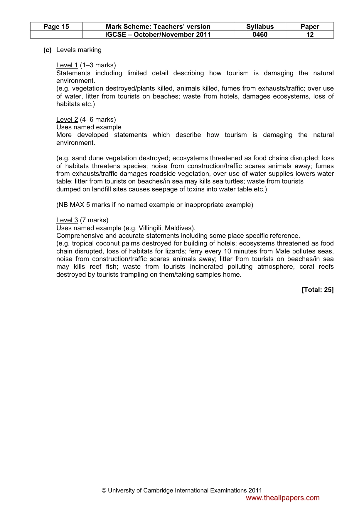
Page 15 Mark Scheme: Teachers’ version Syllabus Paper IGCSE – October/November 2011 0460 12 © University of Cambridge International Examinations 2011 (c) Levels marking Level 1 (1–3 marks) Statements including limited detail describing how tourism is damaging the natural environment. (e.g. vegetation destroyed/plants killed, animals killed, fumes from exhausts/traffic; over use of water, litter from tourists on beaches; waste from hotels, damages ecosystems, loss of habitats etc.) Level 2 (4–6 marks) Uses named example More developed statements which describe how tourism is damaging the natural environment. (e.g. sand dune vegetation destroyed; ecosystems threatened as food chains disrupted; loss of habitats threatens species; noise from construction/traffic scares animals away; fumes from exhausts/traffic damages roadside vegetation, over use of water supplies lowers water table; litter from tourists on beaches/in sea may kills sea turtles; waste from tourists dumped on landfill sites causes seepage of toxins into water table etc.) (NB MAX 5 marks if no named example or inappropriate example) Level 3 (7 marks) Uses named example (e.g. Villingili, Maldives). Comprehensive and accurate statements including some place specific reference. (e.g. tropical coconut palms destroyed for building of hotels; ecosystems threatened as food chain disrupted, loss of habitats for lizards; ferry every 10 minutes from Male pollutes seas, noise from construction/traffic scares animals away; litter from tourists on beaches/in sea may kills reef fish; waste from tourists incinerated polluting atmosphere, coral reefs destroyed by tourists trampling on them/taking samples home. [Total: 25] www.theallpapers.com
Mark scheme, page 16
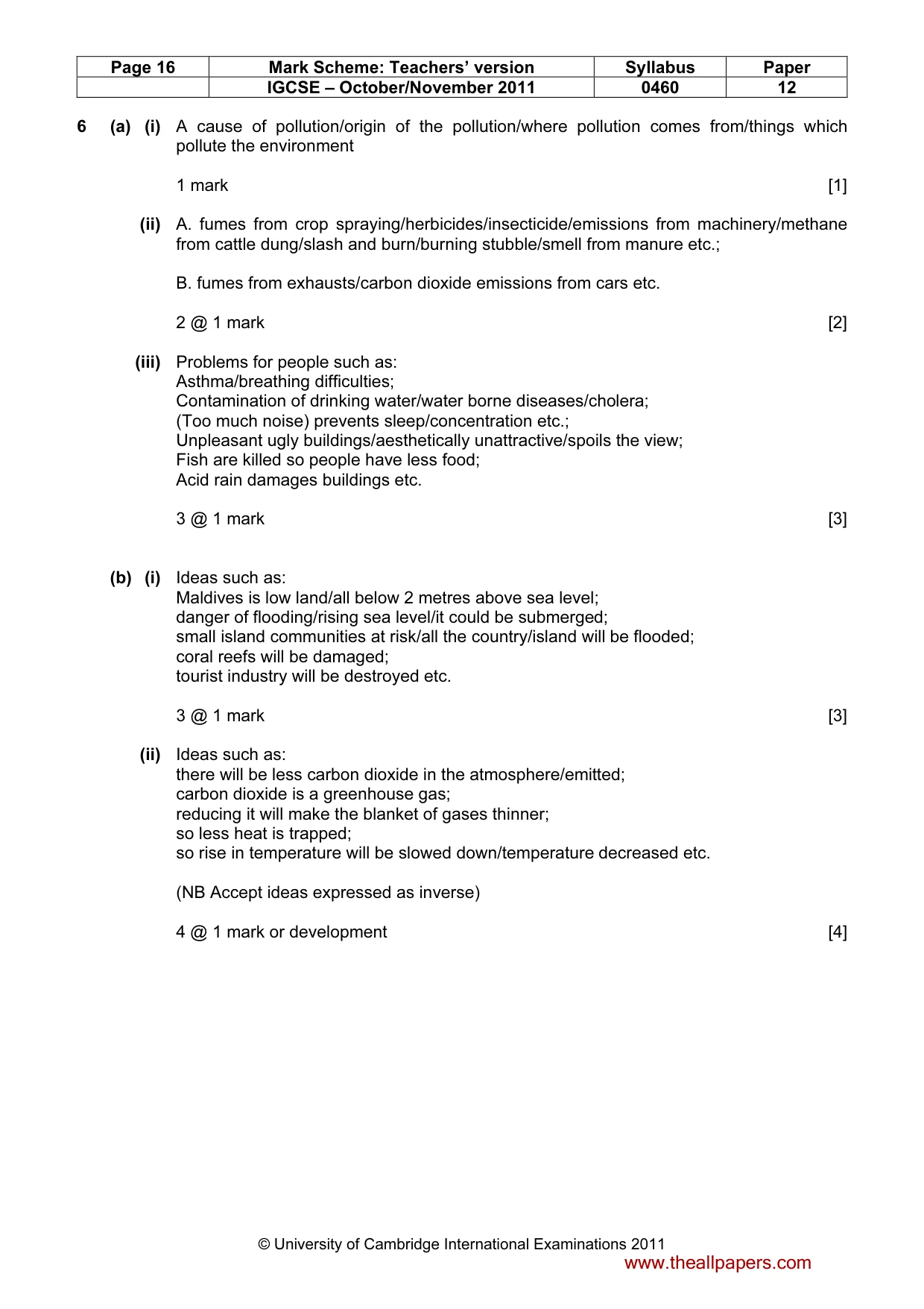
Page 16 Mark Scheme: Teachers’ version Syllabus Paper IGCSE – October/November 2011 0460 12 © University of Cambridge International Examinations 2011 6 (a) (i) A cause of pollution/origin of the pollution/where pollution comes from/things which pollute the environment 1 mark [1] (ii) A. fumes from crop spraying/herbicides/insecticide/emissions from machinery/methane from cattle dung/slash and burn/burning stubble/smell from manure etc.; B. fumes from exhausts/carbon dioxide emissions from cars etc. 2 @ 1 mark [2] (iii) Problems for people such as: Asthma/breathing difficulties; Contamination of drinking water/water borne diseases/cholera; (Too much noise) prevents sleep/concentration etc.; Unpleasant ugly buildings/aesthetically unattractive/spoils the view; Fish are killed so people have less food; Acid rain damages buildings etc. 3 @ 1 mark [3] (b) (i) Ideas such as: Maldives is low land/all below 2 metres above sea level; danger of flooding/rising sea level/it could be submerged; small island communities at risk/all the country/island will be flooded; coral reefs will be damaged; tourist industry will be destroyed etc. 3 @ 1 mark [3] (ii) Ideas such as: there will be less carbon dioxide in the atmosphere/emitted; carbon dioxide is a greenhouse gas; reducing it will make the blanket of gases thinner; so less heat is trapped; so rise in temperature will be slowed down/temperature decreased etc. (NB Accept ideas expressed as inverse) 4 @ 1 mark or development [4] www.theallpapers.com
Mark scheme, page 17
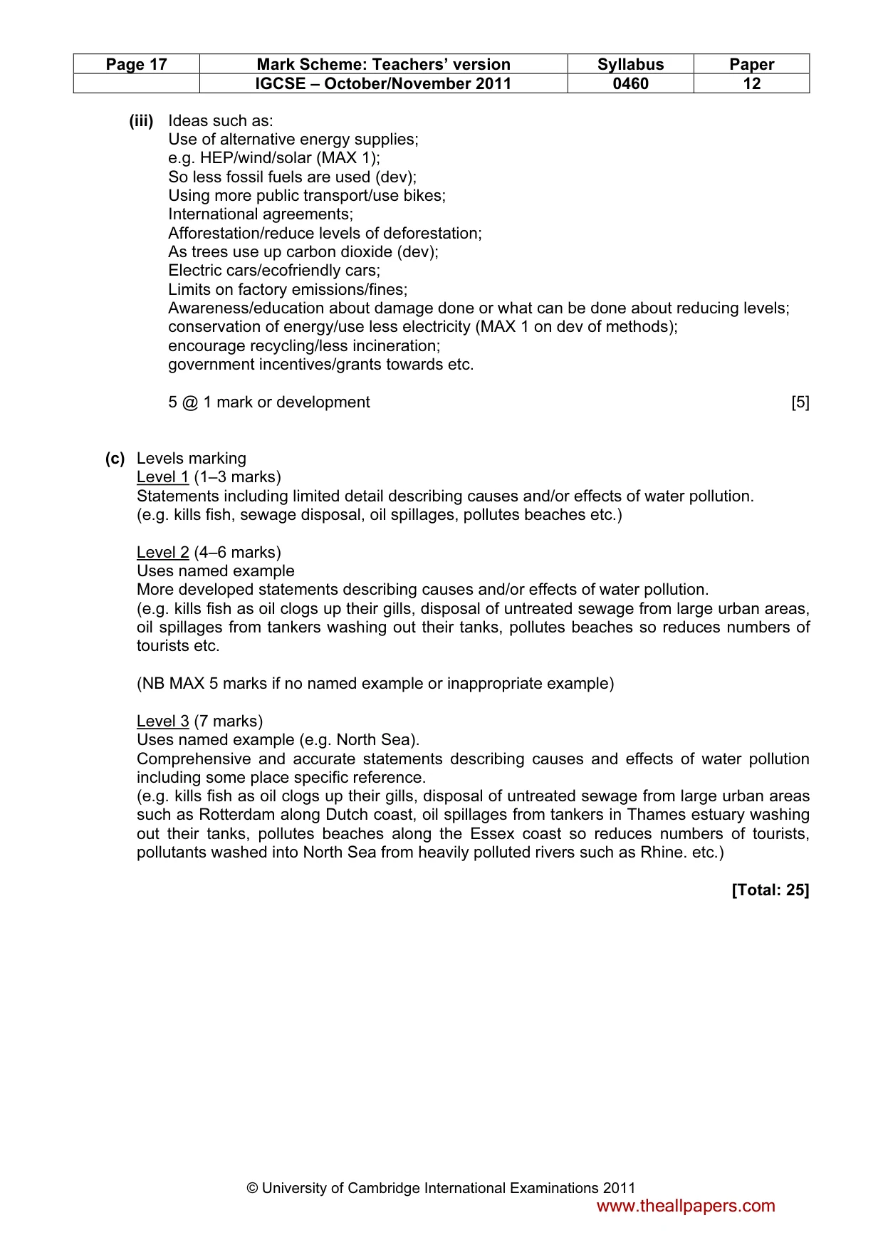
Page 17 Mark Scheme: Teachers’ version Syllabus Paper IGCSE – October/November 2011 0460 12 © University of Cambridge International Examinations 2011 (iii) Ideas such as: Use of alternative energy supplies; e.g. HEP/wind/solar (MAX 1); So less fossil fuels are used (dev); Using more public transport/use bikes; International agreements; Afforestation/reduce levels of deforestation; As trees use up carbon dioxide (dev); Electric cars/ecofriendly cars; Limits on factory emissions/fines; Awareness/education about damage done or what can be done about reducing levels; conservation of energy/use less electricity (MAX 1 on dev of methods); encourage recycling/less incineration; government incentives/grants towards etc. 5 @ 1 mark or development [5] (c) Levels marking Level 1 (1–3 marks) Statements including limited detail describing causes and/or effects of water pollution. (e.g. kills fish, sewage disposal, oil spillages, pollutes beaches etc.) Level 2 (4–6 marks) Uses named example More developed statements describing causes and/or effects of water pollution. (e.g. kills fish as oil clogs up their gills, disposal of untreated sewage from large urban areas, oil spillages from tankers washing out their tanks, pollutes beaches so reduces numbers of tourists etc. (NB MAX 5 marks if no named example or inappropriate example) Level 3 (7 marks) Uses named example (e.g. North Sea). Comprehensive and accurate statements describing causes and effects of water pollution including some place specific reference. (e.g. kills fish as oil clogs up their gills, disposal of untreated sewage from large urban areas such as Rotterdam along Dutch coast, oil spillages from tankers in Thames estuary washing out their tanks, pollutes beaches along the Essex coast so reduces numbers of tourists, pollutants washed into North Sea from heavily polluted rivers such as Rhine. etc.) [Total: 25] www.theallpapers.com
What you needed in this session
Cambridge’s own grade thresholds for 2011 Oct/Nov, Paper 1 · Variant 2. A higher threshold means an easier paper — the bar moves with how the cohort did.