Cambridge IGCSE Geography 0460 — 2011 May/June Paper 1 · Variant 2
0460/12/M/J/11 · 75 marks · ≈84 min
The question paper and its mark scheme, free to read here and free to download. This is Cambridge’s own paper, exactly as it was sat.
Question paper24 pages
Mark scheme15 pages
Answers below. Sit the paper first if you are practising.
Paper as text
Question paper, page 1
This document consists of 24 printed pages and 1 Insert. DC (RCL/KM/CGW) 31985/11 © UCLES 2011 [Turn over UNIVERSITY OF CAMBRIDGE INTERNATIONAL EXAMINATIONS International General Certificate of Secondary Education GEOGRAPHY 0460/12 Paper 1 May/June 2011 1 hour 45 minutes Candidates answer on the Question Paper. No Additional Materials are required. READ THESE INSTRUCTIONS FIRST Write your Centre number, candidate number and name in the spaces provided. Write in dark blue or black pen. You may use a soft pencil for any diagrams, graphs or rough working. Do not use staples, paper clips, highlighters, glue or correction fluid. DO NOT WRITE IN ANY BARCODES. Write your answer to each question in the space provided. If additional space is required, you should use the lined page at the end of this booklet. The question number(s) must be clearly shown. Answer three questions. Sketch maps and diagrams should be drawn whenever they serve to illustrate an answer. The Insert contains Photographs A and B for Question 3 and Photograph C for Question 4. The Insert is not required by the Examiner. At the end of the examination, fasten all your work securely together. The number of marks is given in brackets [ ] at the end of each question or part question. * 0 8 1 6 2 6 3 8 0 9 * www.theallpapers.com
Question paper, page 2
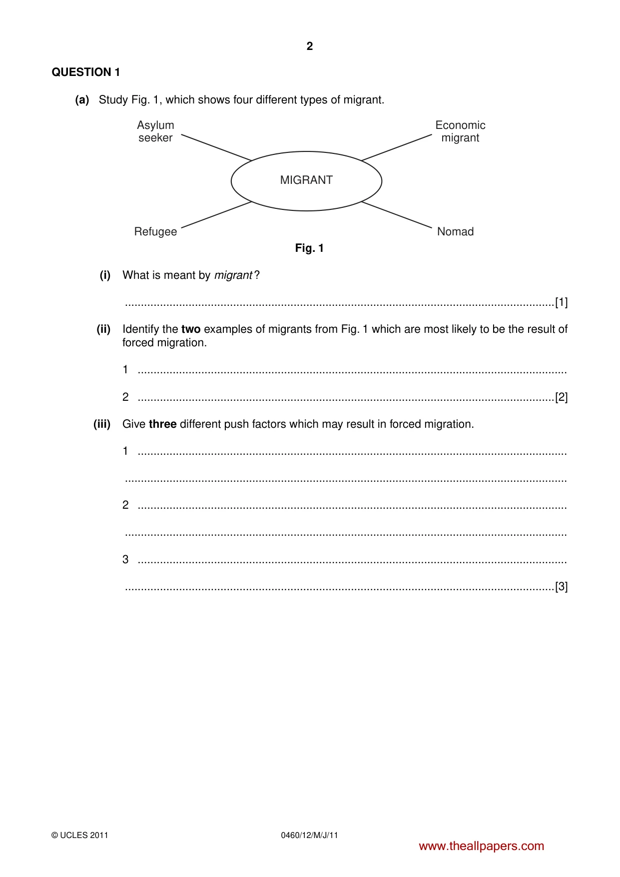
2 0460/12/M/J/11 © UCLES 2011 QUESTION 1 (a) Study Fig. 1, which shows four different types of migrant. MIGRANT Asylum seeker Refugee Economic migrant Nomad Fig. 1 (i) What is meant by migrant ? …[1] (ii) Identify the two examples of migrants from Fig. 1 which are most likely to be the result of forced migration. 1 … 2 …[2] (iii) Give three different push factors which may result in forced migration. 1 … … 2 … … 3 … …[3] www.theallpapers.com
Question paper, page 3
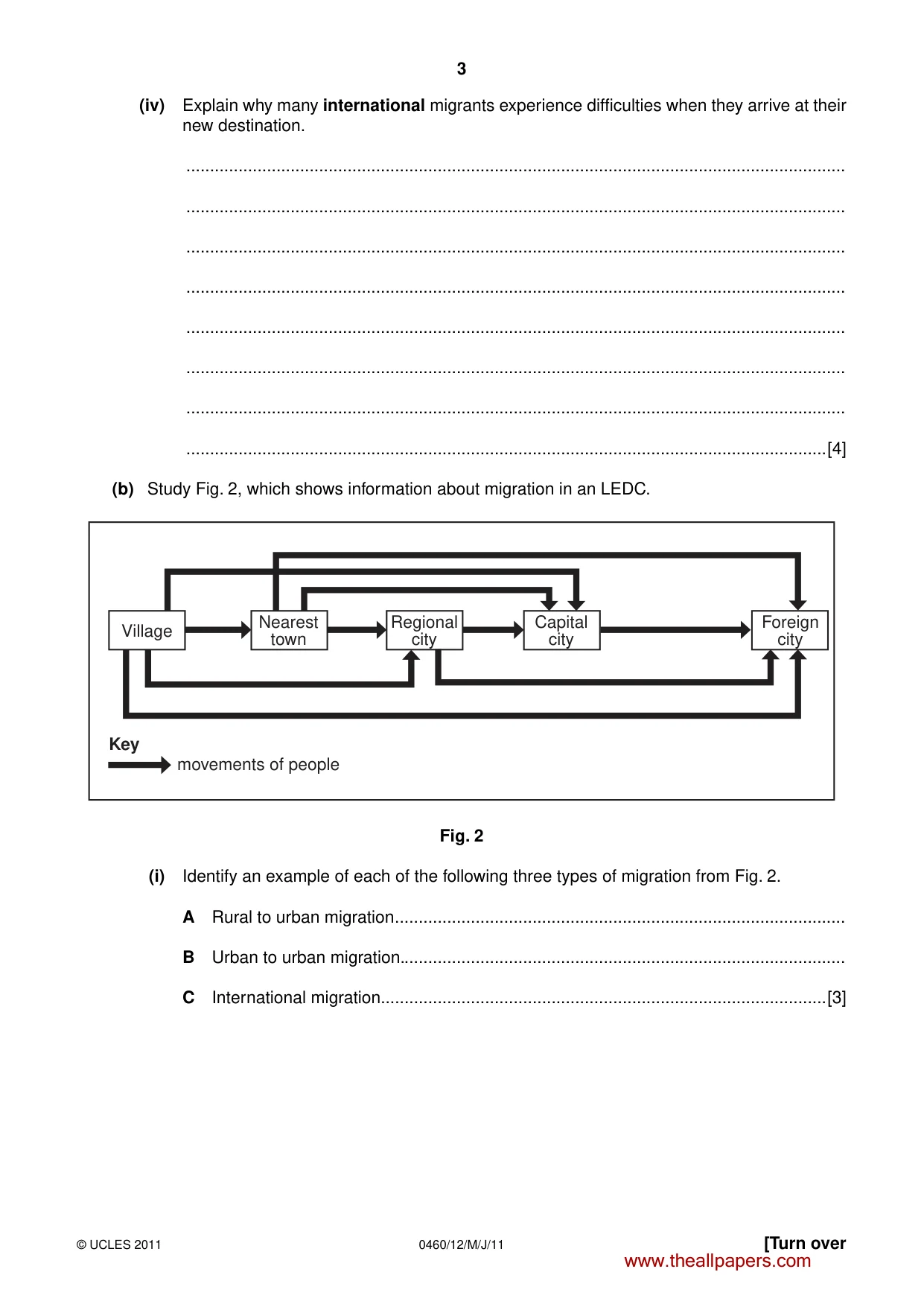
3 0460/12/M/J/11 © UCLES 2011 [Turn over (iv) Explain why many international migrants experience difficulties when they arrive at their new destination. … … … … … … … …[4] (b) Study Fig. 2, which shows information about migration in an LEDC. Village Nearest town Key movements of people Regional city Capital city Foreign city Fig. 2 (i) Identify an example of each of the following three types of migration from Fig. 2. A Rural to urban migration … B Urban to urban migration. … C International migration. …[3] www.theallpapers.com
Question paper, page 4
4 0460/12/M/J/11 © UCLES 2011 (ii) Choose one example of a migration shown on Fig. 2. Explain why people migrate between the types of place you have chosen. Example of migration … … … … … … … …[5] (c) For a named country which you have studied, describe the problems caused by overpopulation. Name of country … … … … … … … … … … … … … … … …[7] [Total: 25 marks] END OF QUESTION 1 www.theallpapers.com
Question paper, page 5
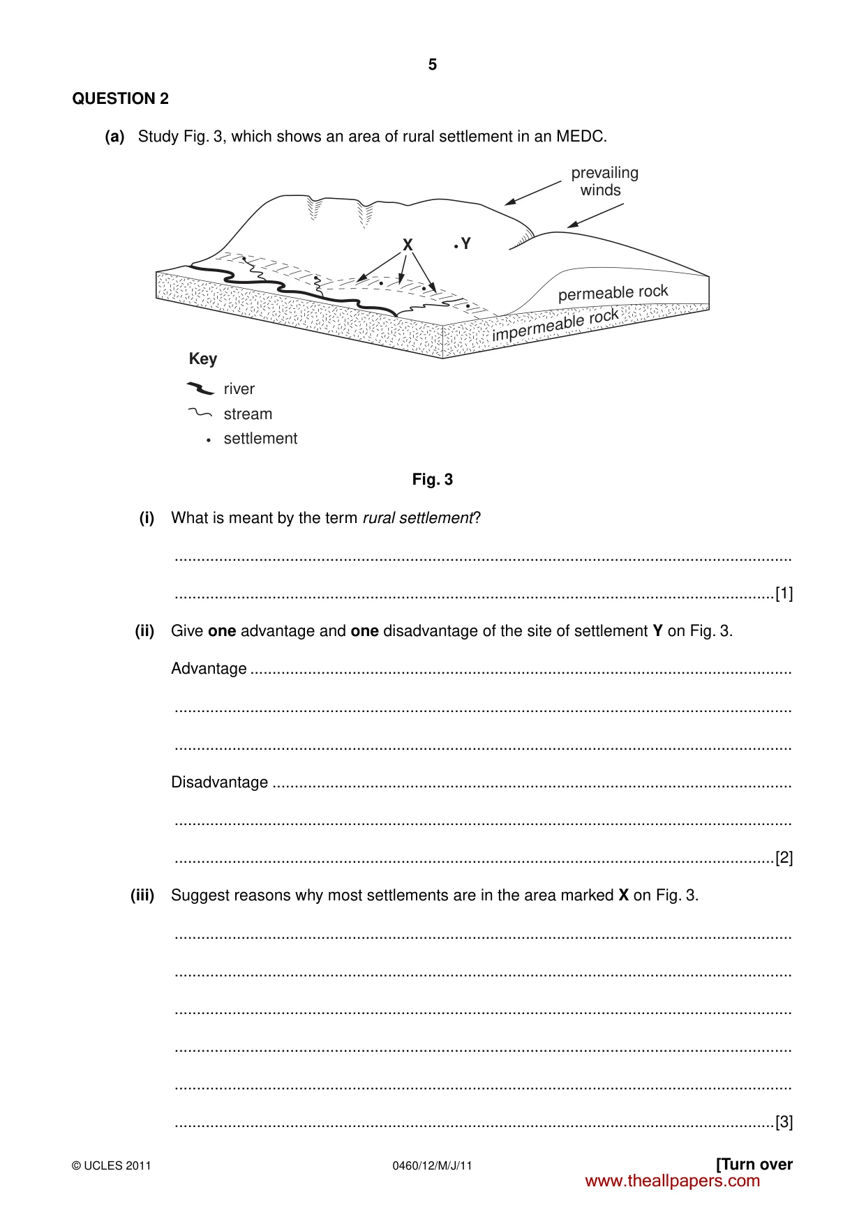
5 0460/12/M/J/11 © UCLES 2011 [Turn over QUESTION 2 (a) Study Fig. 3, which shows an area of rural settlement in an MEDC. permeable rock impermeable rock prevailing winds Y X river Key stream settlement Fig. 3 (i) What is meant by the term rural settlement? … …[1] (ii) Give one advantage and one disadvantage of the site of settlement Y on Fig. 3. Advantage … … … Disadvantage … … …[2] (iii) Suggest reasons why most settlements are in the area marked X on Fig. 3. … … … … … …[3] www.theallpapers.com
Question paper, page 6
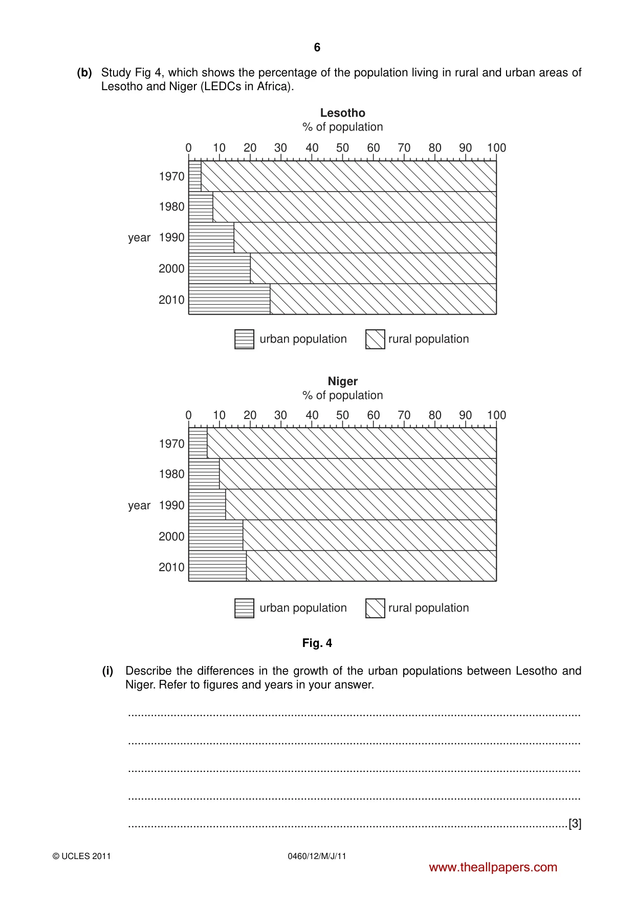
6 0460/12/M/J/11 © UCLES 2011 (b) Study Fig 4, which shows the percentage of the population living in rural and urban areas of Lesotho and Niger (LEDCs in Africa). 0 10 20 30 40 50 60 80 90 100 70 0 1970 1980 1990 year 2010 2000 1970 urban population rural population urban population rural population Niger % of population Lesotho % of population 1980 1990 year 2010 2000 10 20 30 40 50 60 80 90 100 70 Fig. 4 (i) Describe the differences in the growth of the urban populations between Lesotho and Niger. Refer to figures and years in your answer. … … … … …[3] www.theallpapers.com
Question paper, page 7
7 0460/12/M/J/11 © UCLES 2011 [Turn over (ii) Suggest how urban growth may have created problems for people in Maseru, the capital city of Lesotho. … … … … … … … … …[4] (iii) Describe the effects of rapid urban growth on the natural environment. … … … … … … … … … …[5] www.theallpapers.com
Question paper, page 8
8 0460/12/M/J/11 © UCLES 2011 (c) Name a city in an LEDC and describe what has been done to improve the quality of life of the people who live there. Name of city … … … … … … … … … … … … … … … …[7] [Total: 25 marks] END OF QUESTION 2 www.theallpapers.com
Question paper, page 9
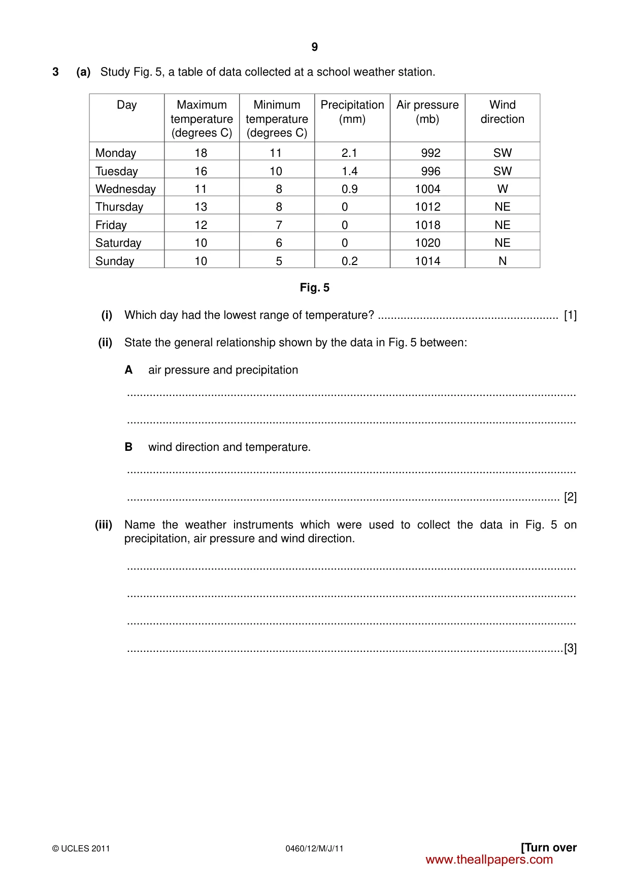
9 0460/12/M/J/11 © UCLES 2011 [Turn over 3 (a) Study Fig. 5, a table of data collected at a school weather station. Day Maximum temperature (degrees C) Minimum temperature (degrees C) Precipitation (mm) Air pressure (mb) Wind direction Monday 18 11 2.1 992 SW Tuesday 16 10 1.4 996 SW Wednesday 11 8 0.9 1004 W Thursday 13 8 0 1012 NE Friday 12 7 0 1018 NE Saturday 10 6 0 1020 NE Sunday 10 5 0.2 1014 N Fig. 5 (i) Which day had the lowest range of temperature? … [1] (ii) State the general relationship shown by the data in Fig. 5 between: A air pressure and precipitation … … B wind direction and temperature. … … [2] (iii) Name the weather instruments which were used to collect the data in Fig. 5 on precipitation, air pressure and wind direction. … … … …[3] www.theallpapers.com
Question paper, page 10
10 0460/12/M/J/11 © UCLES 2011 (iv) Draw a labelled diagram to show the main features of a maximum–minimum thermometer. [4] (b) Study Photographs A and B (Insert), which show different types of clouds. (i) Describe three differences between the clouds shown in Photographs A and B. 1 … … … 2 … … … 3 … … …[3] www.theallpapers.com
Question paper, page 11
11 0460/12/M/J/11 © UCLES 2011 [Turn over (ii) Explain why very few clouds form in tropical deserts. … … … … … … … … …[5] (c) For a named area of tropical rainforest which you have studied, describe and explain the characteristics of its climate. Area of rainforest … … … … … … … … … … … … … … …[7] [Total: 25 marks] END OF QUESTION 3 www.theallpapers.com
Question paper, page 12
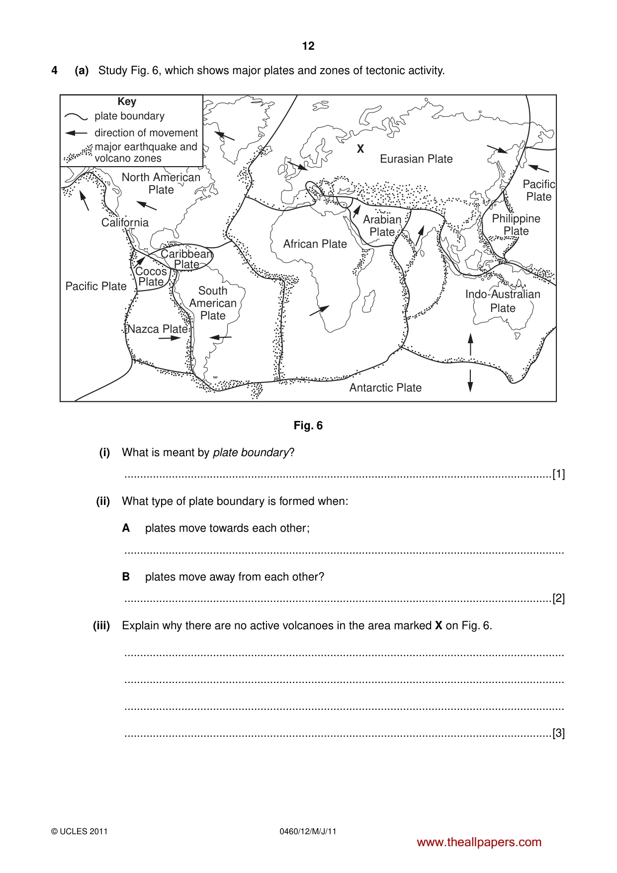
12 0460/12/M/J/11 © UCLES 2011 4 (a) Study Fig. 6, which shows major plates and zones of tectonic activity. X plate boundary North American Plate South American Plate African Plate Arabian Plate Eurasian Plate Pacific Plate Pacific Plate Antarctic Plate Nazca Plate Caribbean Plate Cocos Plate Key direction of movement major earthquake and volcano zones California Philippine Plate Indo-Australian Plate Fig. 6 (i) What is meant by plate boundary? …[1] (ii) What type of plate boundary is formed when: A plates move towards each other; … B plates move away from each other? …[2] (iii) Explain why there are no active volcanoes in the area marked X on Fig. 6. … … … …[3] www.theallpapers.com
Question paper, page 13
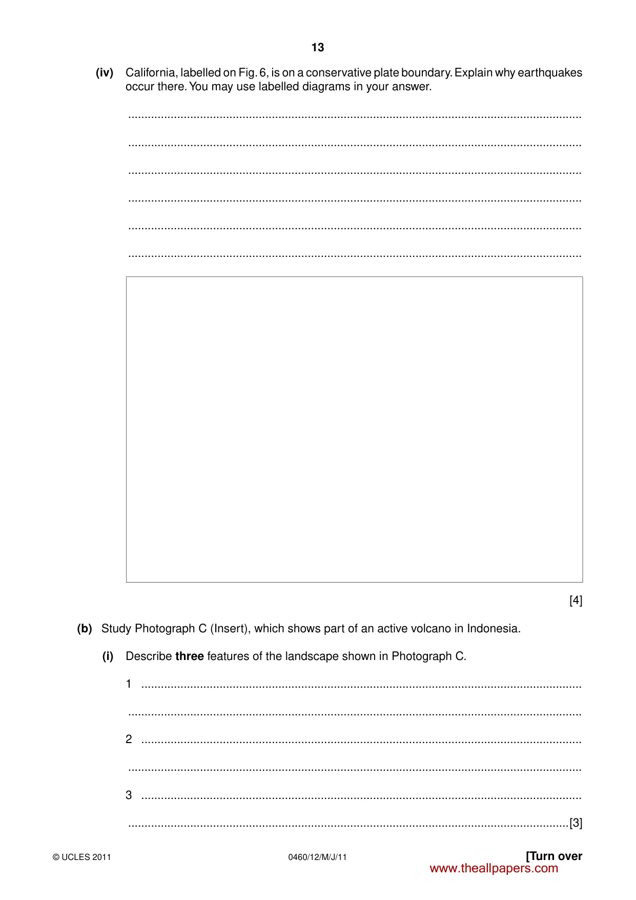
13 0460/12/M/J/11 © UCLES 2011 [Turn over (iv) California, labelled on Fig. 6, is on a conservative plate boundary. Explain why earthquakes occur there. You may use labelled diagrams in your answer. … … … … … … [4] (b) Study Photograph C (Insert), which shows part of an active volcano in Indonesia. (i) Describe three features of the landscape shown in Photograph C. 1 … … 2 … … 3 … …[3] www.theallpapers.com
Question paper, page 14
14 0460/12/M/J/11 © UCLES 2011 (ii) Explain why people live in areas where there are active volcanoes. … … … … … … … … …[5] (c) Name an area which you have studied where there has been an earthquake. Describe the impacts of this earthquake. Name of area … … … … … … … … … … … … … … …[7] [Total: 25 marks] END OF QUESTION 4 www.theallpapers.com
Question paper, page 15
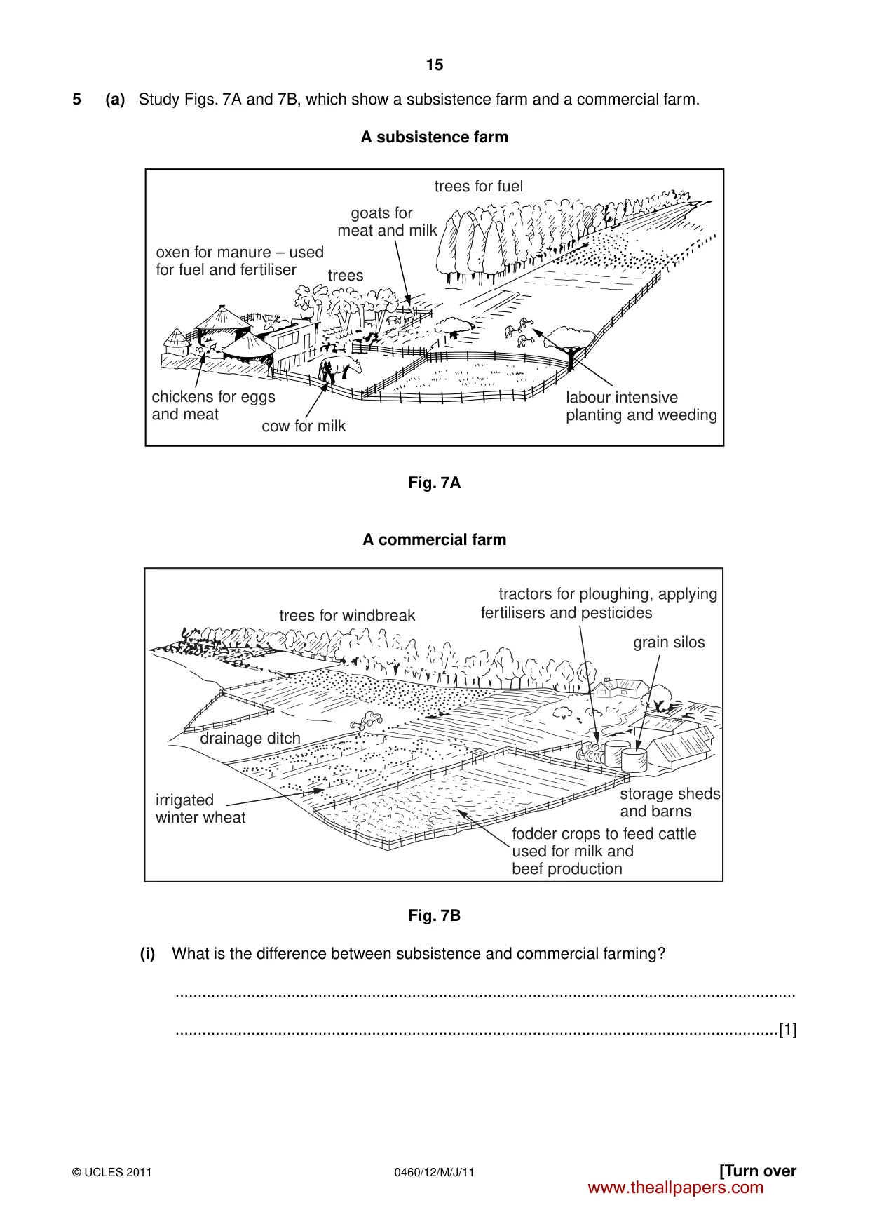
15 0460/12/M/J/11 © UCLES 2011 [Turn over 5 (a) Study Figs. 7A and 7B, which show a subsistence farm and a commercial farm. A subsistence farm trees for fuel labour intensive planting and weeding cow for milk trees goats for meat and milk oxen for manure – used for fuel and fertiliser chickens for eggs and meat Fig. 7A A commercial farm trees for windbreak grain silos drainage ditch irrigated winter wheat storage sheds and barns fodder crops to feed cattle used for milk and beef production tractors for ploughing, applying fertilisers and pesticides Fig. 7B (i) What is the difference between subsistence and commercial farming? … …[1] www.theallpapers.com
Question paper, page 16
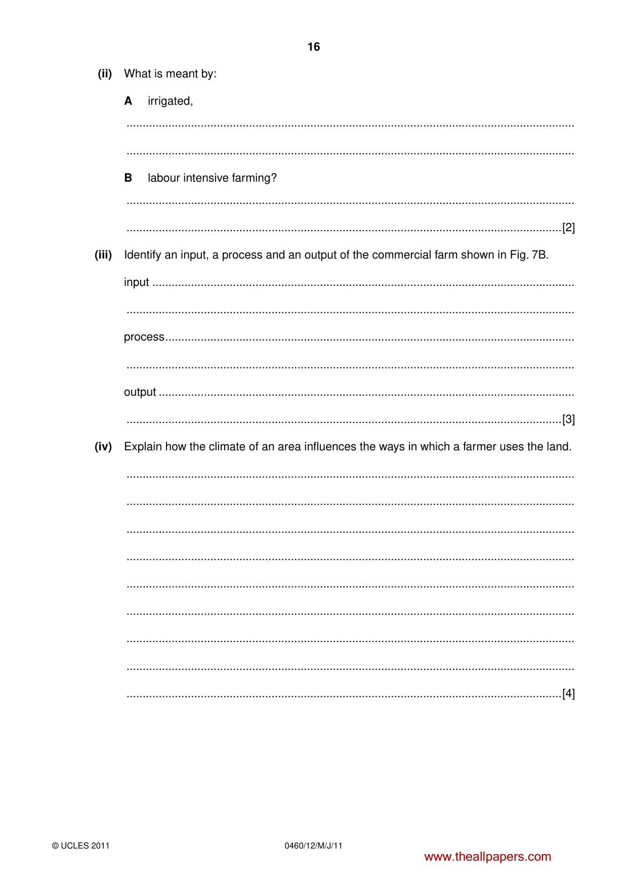
16 0460/12/M/J/11 © UCLES 2011 (ii) What is meant by: A irrigated, … … B labour intensive farming? … …[2] (iii) Identify an input, a process and an output of the commercial farm shown in Fig. 7B. input … … process … … output … …[3] (iv) Explain how the climate of an area influences the ways in which a farmer uses the land. … … … … … … … … …[4] www.theallpapers.com
Question paper, page 17
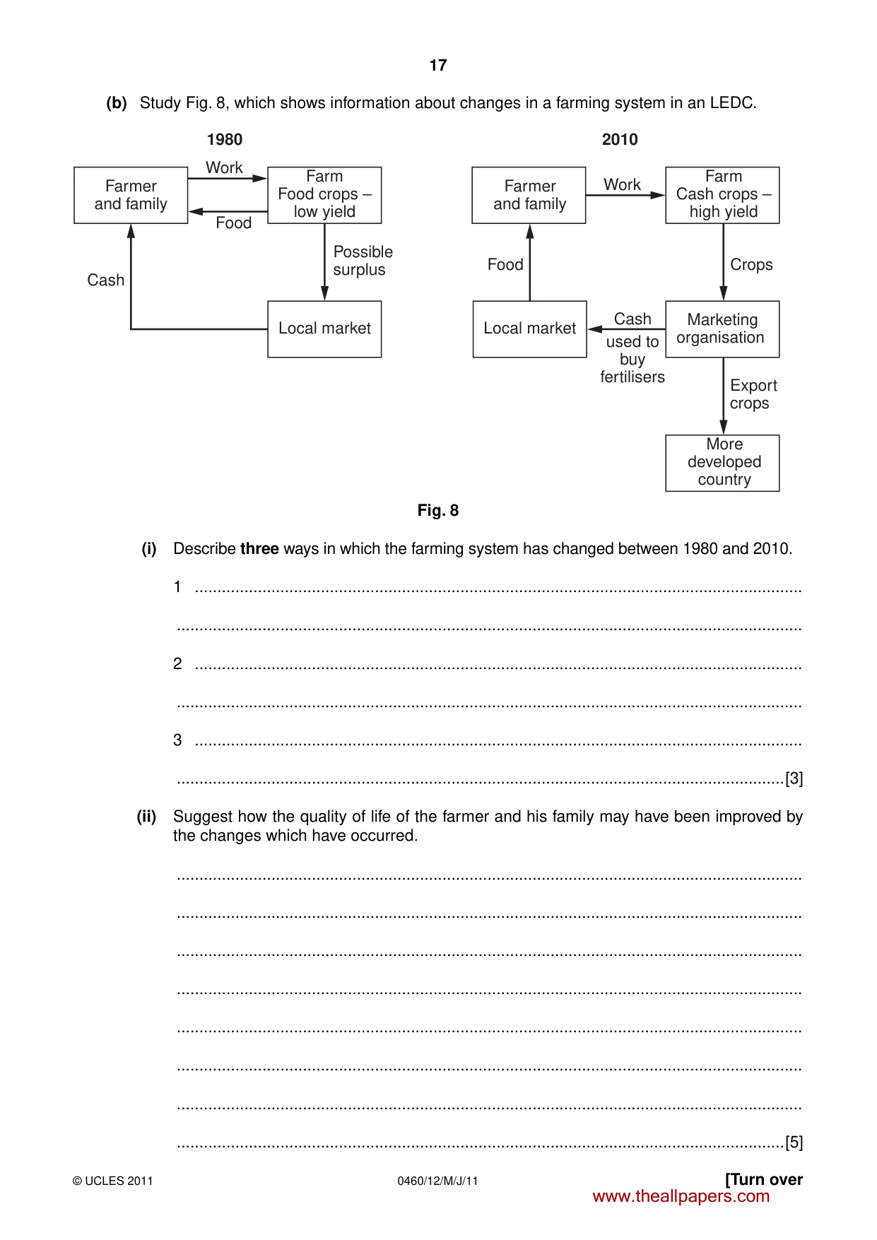
17 0460/12/M/J/11 © UCLES 2011 [Turn over (b) Study Fig. 8, which shows information about changes in a farming system in an LEDC. Farmer and family Farm Food crops – low yield Farmer and family Marketing organisation More developed country Farm Cash crops – high yield Local market Local market Cash Cash used to buy fertilisers Food Food Crops Export crops Possible surplus Work Work 2010 1980 Fig. 8 (i) Describe three ways in which the farming system has changed between 1980 and 2010. 1 … … 2 … … 3 … …[3] (ii) Suggest how the quality of life of the farmer and his family may have been improved by the changes which have occurred. … … … … … … … …[5] www.theallpapers.com
Question paper, page 18
18 0460/12/M/J/11 © UCLES 2011 (c) For a named area or country which you have studied which suffers from famine, explain why there is a shortage of food. Name of area or country … … … … … … … … … … … … … … … …[7] [Total: 25 marks] END OF QUESTION 5 www.theallpapers.com
Question paper, page 19
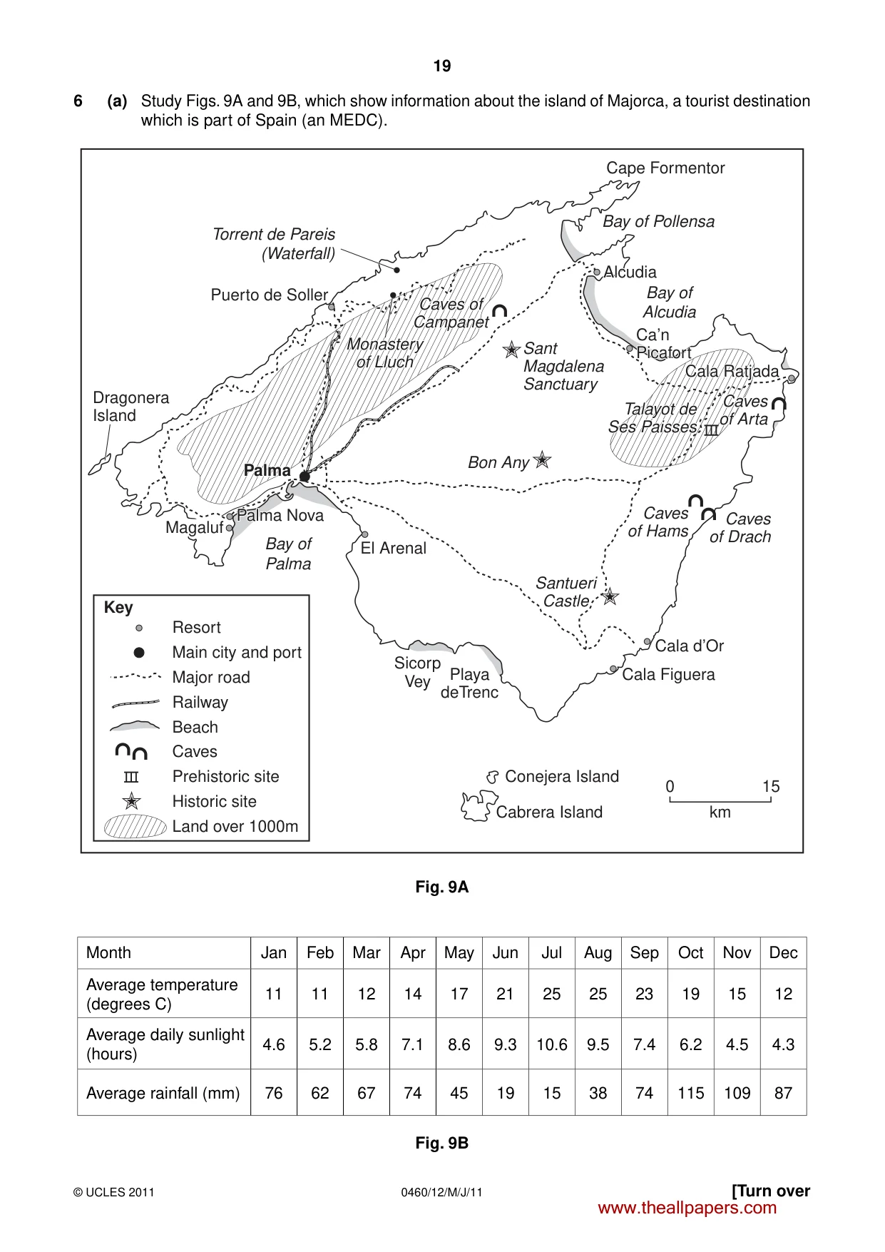
19 0460/12/M/J/11 © UCLES 2011 [Turn over 6 (a) Study Figs. 9A and 9B, which show information about the island of Majorca, a tourist destination which is part of Spain (an MEDC). Cape Formentor Ca’n Ca’n Picafort Picafort Bay of Pollensa Torrent de Pareis (Waterfall) Bay of Alcudia Alcudia Alcudia Bay of Palma Bon Any Caves of Caves of Campanet Campanet Sant Magdalena Sanctuary Santueri Castle Caves of Hams Caves of Drach Caves Caves of Arta of Arta Playa deTrenc El Arenal Land over 1000m Historic site Prehistoric site Caves Beach Railway Major road Main city and port Resort Key Sicorp Vey Cala d’Or Cala Figuera Conejera Island Cabrera Island 0 15 km Caves of Arta Talayot de Talayot de Ses Paisses Ses Paisses Ca’n Picafort Cala Ratjada Cala Ratjada Cala Ratjada Talayot de Ses Paisses Alcudia Puerto de Soller Dragonera Island Caves of Campanet Monastery Monastery of Lluch of Lluch Monastery of Lluch Magaluf Palma Nova Palma Nova Palma Nova Palma Palma Palma Fig. 9A Month Jan Feb Mar Apr May Jun Jul Aug Sep Oct Nov Dec Average temperature (degrees C) 11 11 12 14 17 21 25 25 23 19 15 12 Average daily sunlight (hours) 4.6 5.2 5.8 7.1 8.6 9.3 10.6 9.5 7.4 6.2 4.5 4.3 Average rainfall (mm) 76 62 67 74 45 19 15 38 74 115 109 87 Fig. 9B www.theallpapers.com
Question paper, page 20
20 0460/12/M/J/11 © UCLES 2011 (i) Using Fig. 9A only, name a tourist resort in Majorca. …[1] (ii) Use evidence from Fig. 9A to name: A a natural attraction in Majorca, … B a human attraction in Majorca. …[2] (iii) Use evidence from Fig. 9B to explain why most tourists are attracted to Majorca between June and August. … … … … … … …[3] www.theallpapers.com
Question paper, page 21
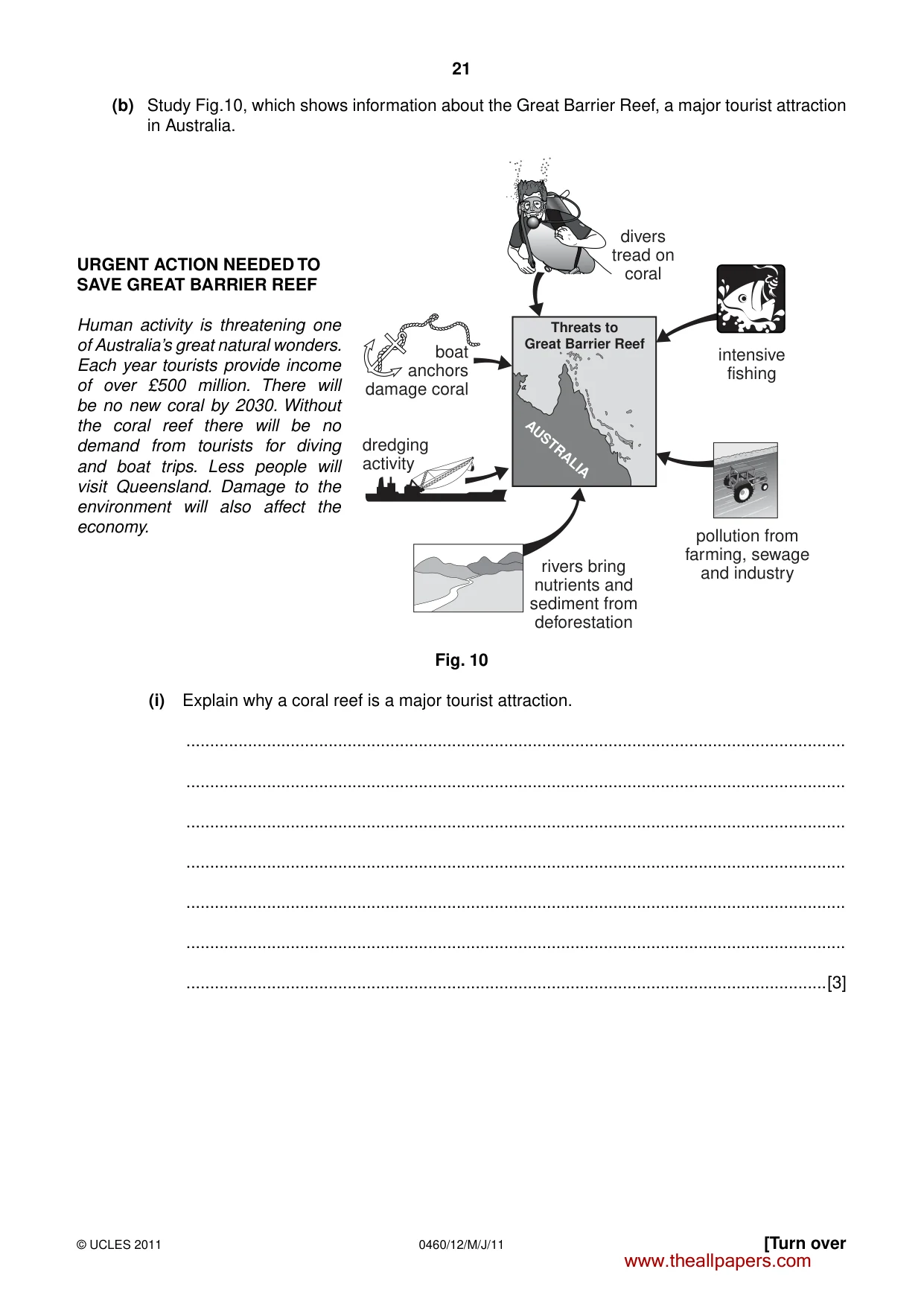
21 0460/12/M/J/11 © UCLES 2011 [Turn over (b) Study Fig.10, which shows information about the Great Barrier Reef, a major tourist attraction in Australia. URGENT ACTION NEEDED TO SAVE GREAT BARRIER REEF Human activity is threatening one of Australia’s great natural wonders. Each year tourists provide income of over £500 million. There will be no new coral by 2030. Without the coral reef there will be no demand from tourists for diving and boat trips. Less people will visit Queensland. Damage to the environment will also affect the economy. AUSTRALIA Threats to Great Barrier Reef dredging activity rivers bring nutrients and sediment from deforestation pollution from farming, sewage and industry intensive fishing divers tread on coral boat anchors damage coral Fig. 10 (i) Explain why a coral reef is a major tourist attraction. … … … … … … …[3] www.theallpapers.com
Question paper, page 22
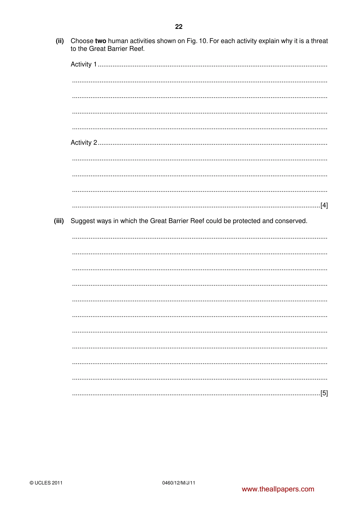
22 0460/12/M/J/11 © UCLES 2011 (ii) Choose two human activities shown on Fig. 10. For each activity explain why it is a threat to the Great Barrier Reef. Activity 1 … … … … … Activity 2 … … … … …[4] (iii) Suggest ways in which the Great Barrier Reef could be protected and conserved. … … … … … … … … … … …[5] www.theallpapers.com
Question paper, page 23
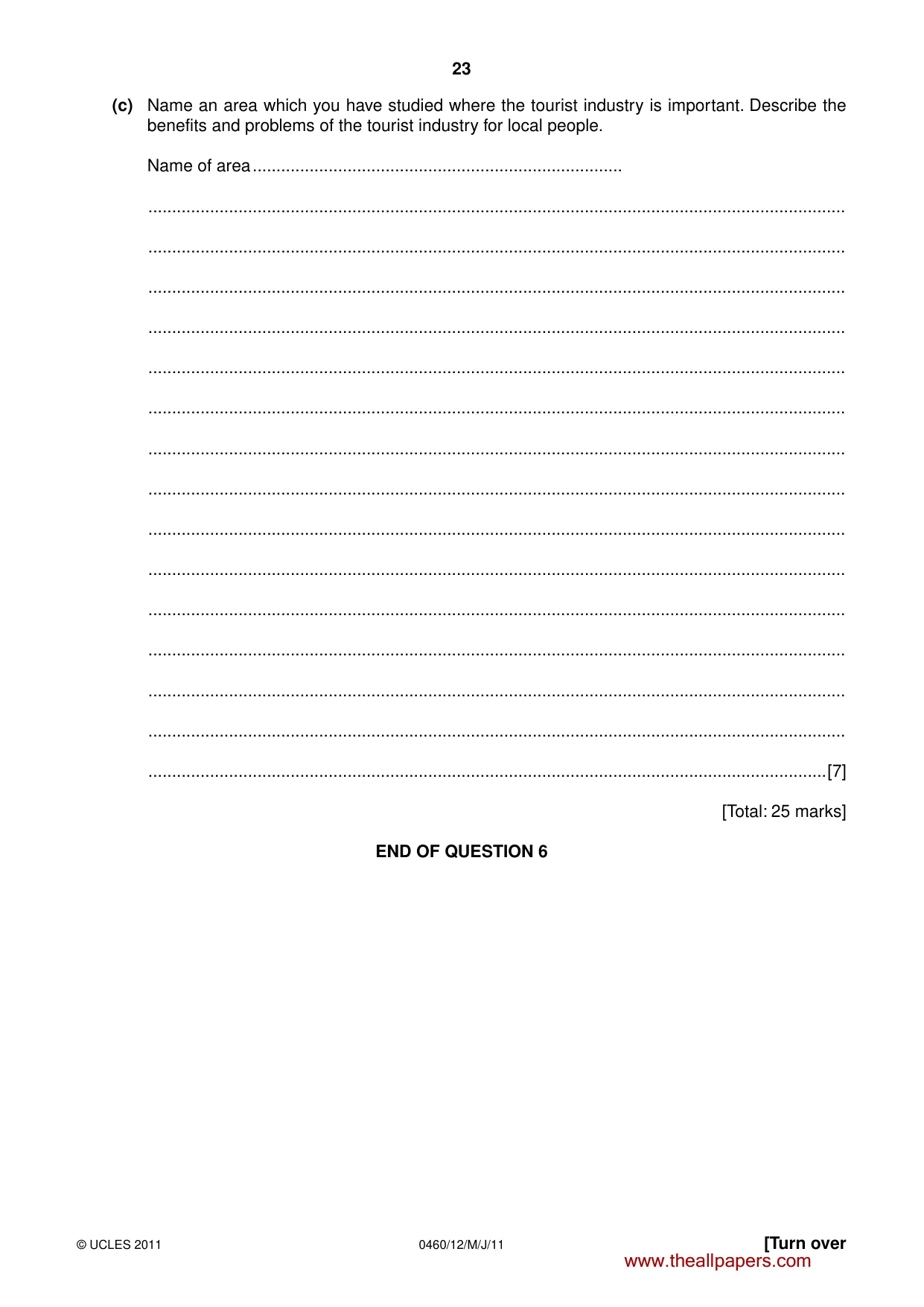
23 0460/12/M/J/11 © UCLES 2011 [Turn over (c) Name an area which you have studied where the tourist industry is important. Describe the benefits and problems of the tourist industry for local people. Name of area … … … … … … … … … … … … … … … …[7] [Total: 25 marks] END OF QUESTION 6 www.theallpapers.com
Question paper, page 24
24 0460/12/M/J/11 © UCLES 2011 Additional Page If you used the following lines to complete the answer(s) to any question(s), the question number(s) must be clearly shown. … … … … … … … … … … … … … … … … … … … … … … Copyright Acknowledgements: Question 5 Figs. 7A & 7B © Philip Weiss; The Human Geography of Southern Africa (amended); College Press. Photographs A, B & C S Sibley; © UCLES. Permission to reproduce items where third-party owned material protected by copyright is included has been sought and cleared where possible. Every reasonable effort has been made by the publisher (UCLES) to trace copyright holders, but if any items requiring clearance have unwittingly been included, the publisher will be pleased to make amends at the earliest possible opportunity. University of Cambridge International Examinations is part of the Cambridge Assessment Group. Cambridge Assessment is the brand name of University of Cambridge Local Examinations Syndicate (UCLES), which is itself a department of the University of Cambridge. www.theallpapers.com
Mark scheme, page 1
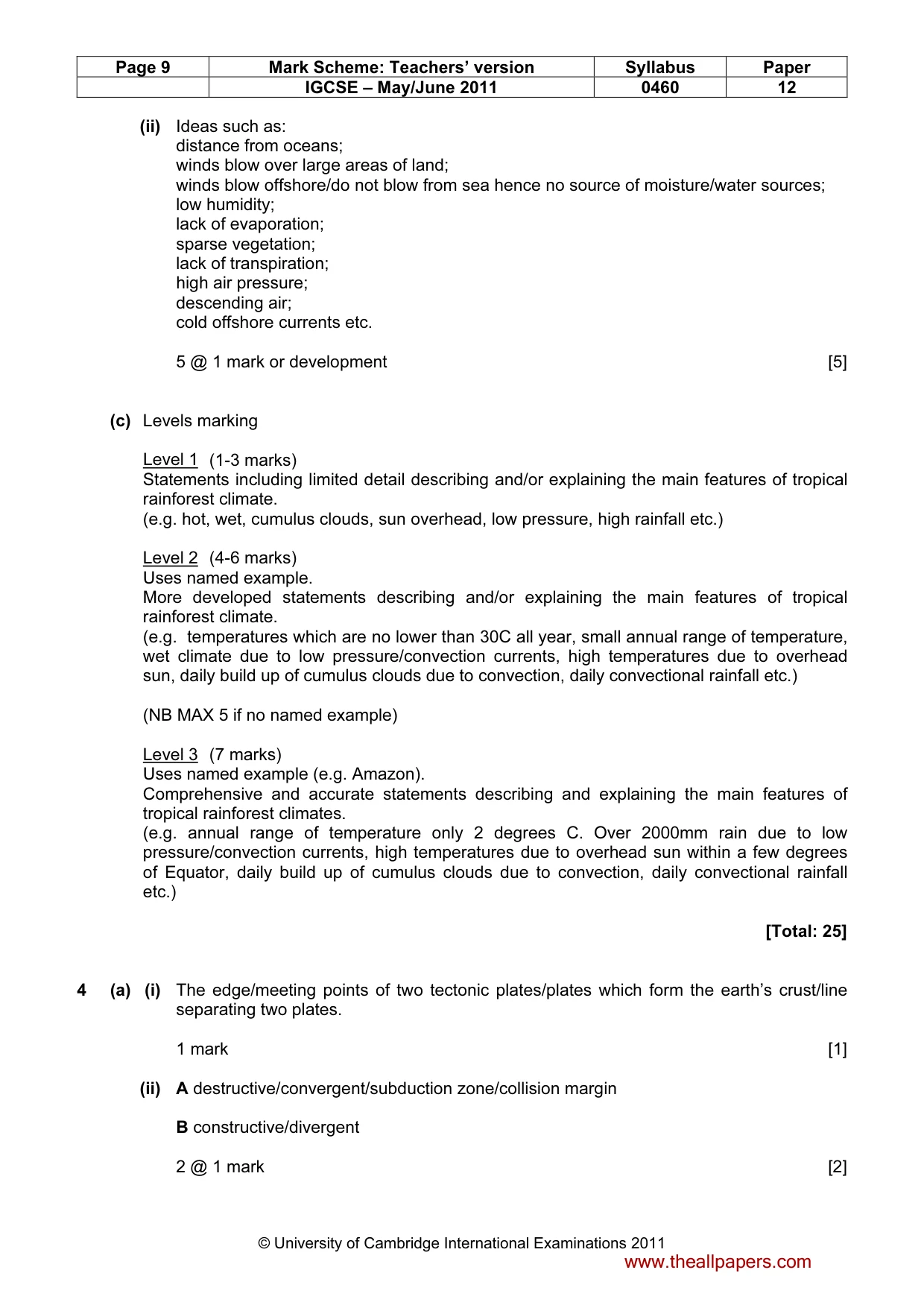
UNIVERSITY OF CAMBRIDGE INTERNATIONAL EXAMINATIONS International General Certificate of Secondary Education MARK SCHEME for the May/June 2011 question paper for the guidance of teachers 0460 GEOGRAPHY 0460/12 Paper 1, maximum raw mark 75 This mark scheme is published as an aid to teachers and candidates, to indicate the requirements of the examination. It shows the basis on which Examiners were instructed to award marks. It does not indicate the details of the discussions that took place at an Examiners’ meeting before marking began, which would have considered the acceptability of alternative answers. Mark schemes must be read in conjunction with the question papers and the report on the examination. • Cambridge will not enter into discussions or correspondence in connection with these mark schemes. Cambridge is publishing the mark schemes for the May/June 2011 question papers for most IGCSE, GCE Advanced Level and Advanced Subsidiary Level syllabuses and some Ordinary Level syllabuses. www.theallpapers.com
Mark scheme, page 2
Page 2 Mark Scheme: Teachers’ version Syllabus Paper IGCSE – May/June 2011 0460 12 © University of Cambridge International Examinations 2011 The features of the marking scheme Each question carries 25 marks. Candidates cannot earn above the maximum marks available within each sub section. The marking scheme attempts to give guidance about the requirements of each answer and lists a number of responses, which will earn marks along with the general principles to be applied when marking each question. It should be noted that candidates can earn marks if their answers are phrased differently provided they convey the same meaning as those in the mark scheme. THE CANDIDATES DO NOT NEED TO USE THE SAME WORDING TO EARN MARKS. The notation `etc.` at the end of an answer in the mark scheme signifies that there may well be other correct responses or examples that can be given credit. Providing the statement is true, relevant to the question asked and not repetition of a previous point made credit should be given. A point made within one sub-section which is an answer to the question set in a different sub-section should not be given credit as each sub-section asks different questions which require independent answers. The mark scheme uses semi colons (;) to separate marks and diagonals to separate alternative answers. Levels of response marking is used for section (c) of each question. Thus it is the quality of the response that determines which level an answer is achieved rather than the quantity of statements contained within it. However, once assigned to a level the mark achieved within that level is determined by the number of points made. Levels 1 and 2 are distinguished by whether statements are simple (level 1) or developed/elaborated (level 2). A candidate can immediately enter L2 by making developed points without making any L1 statements. In order to achieve L3 a candidate must have already reached the top end of L2 – in addition his/her answer should have a clear example and if the answer is place specific as well (7 marks). Summary: Level 1 (1 to 3 marks): 1 simple statement (1 mark) 2 simple statements (2 marks) 3 simple statements (3 marks) Level 2 (4 to 6 marks): 1 developed statement (4 marks) 2 developed statements (5 marks) 3 or more developed statements with e.g. (6 marks) No example/inappropriate example = MAX 5 marks Level 3 (7 marks) 3 or more developed statements + named example with at least one piece of place specific detail. www.theallpapers.com
Mark scheme, page 3
Page 3 Mark Scheme: Teachers’ version Syllabus Paper IGCSE – May/June 2011 0460 12 © University of Cambridge International Examinations 2011 1 (a) (i) A person who goes to live in another place/moves away from an area/leaves his country etc. 1 mark [1] (ii) Refugee; Asylum seeker 2 @ 1 mark [2] (iii) Push factors such as: war/conflict/civil war; famine/food shortage/starvation; floods/volcano/earthquake/tsunami/tropical storm (MAX 2); drought; (religious/political) persecution etc. 3 @ 1 mark [3] (iv) Ideas such as: lack of qualifications/skills/education/no experience/they have to do unskilled jobs/work informally; many are doing low paid jobs; poor working conditions/dirty jobs/long hours/exploitation by employers; many cannot speak the language; some are unable to obtain employment/not enough jobs; can’t afford education/health care/food/housing etc.; live in poor conditions/overcrowding/lacks sanitation; some may have to live away from their families; discrimination may occur/racism; some may lack documentation/have to hide from authorities; trouble adapting to culture/religion etc. 4 @ 1 mark [4] www.theallpapers.com
Mark scheme, page 4
Page 4 Mark Scheme: Teachers’ version Syllabus Paper IGCSE – May/June 2011 0460 12 © University of Cambridge International Examinations 2011 (b) (i) Ideas such as: rural to urban = village to nearest town/regional city/capital city; urban to urban = nearest town to regional/capital city etc. International migration = e.g. to any foreign city 3 @ 1 mark [3] (ii) Candidates can choose any example from Fig. 2 – accept generic example (e.g. village to nearby town) or named example. Reasoning will depend on example chosen such as: for work opportunities/lots of/more jobs; better paid jobs; to improve quality of life/better lifestyle/standard of living; better provision of doctors/hospitals etc.; better chance of education for children; to escape (religious/political) persecution; bright lights/leisure facilities/wider choice of shops; war/civil war; drought; famine/food shortages; lack of water supply/sanitation; floods/volcano/earthquake/tsunami/tropical storm etc. 5 @ 1 mark or development [5] (c) Levels marking Level 1 (1-3 marks) Statements including limited detail describing problems caused by overpopulation. (e.g. traffic congestion, overuse of agricultural land/overgrazing, deforestation/loss of natural vegetation etc.) Level 2 (4-6 marks) Uses named example. More developed statements describing problems caused by overpopulation. (e.g. traffic congestion as there are too many vehicles on the roads, overuse of agricultural land/overgrazing leads to loss of soil fertility, deforestation/loss of natural vegetation to use for firewood etc.) (NB MAX 5 marks if no named example or if example of city given rather than country) Level 3 (7 marks) Uses named example (e.g. Bangladesh). Comprehensive and accurate statements including some place specific reference. (e.g. traffic congestion as there are far too many vehicles on the roads especially in cities such as Dhaka, overuse of agricultural land on floods plains of Brahmaputra/Ganges leads to loss of soil fertility/lower yields, widespread deforestation for firewood on slopes of Himalayas etc.) [Total: 25] www.theallpapers.com
Mark scheme, page 5
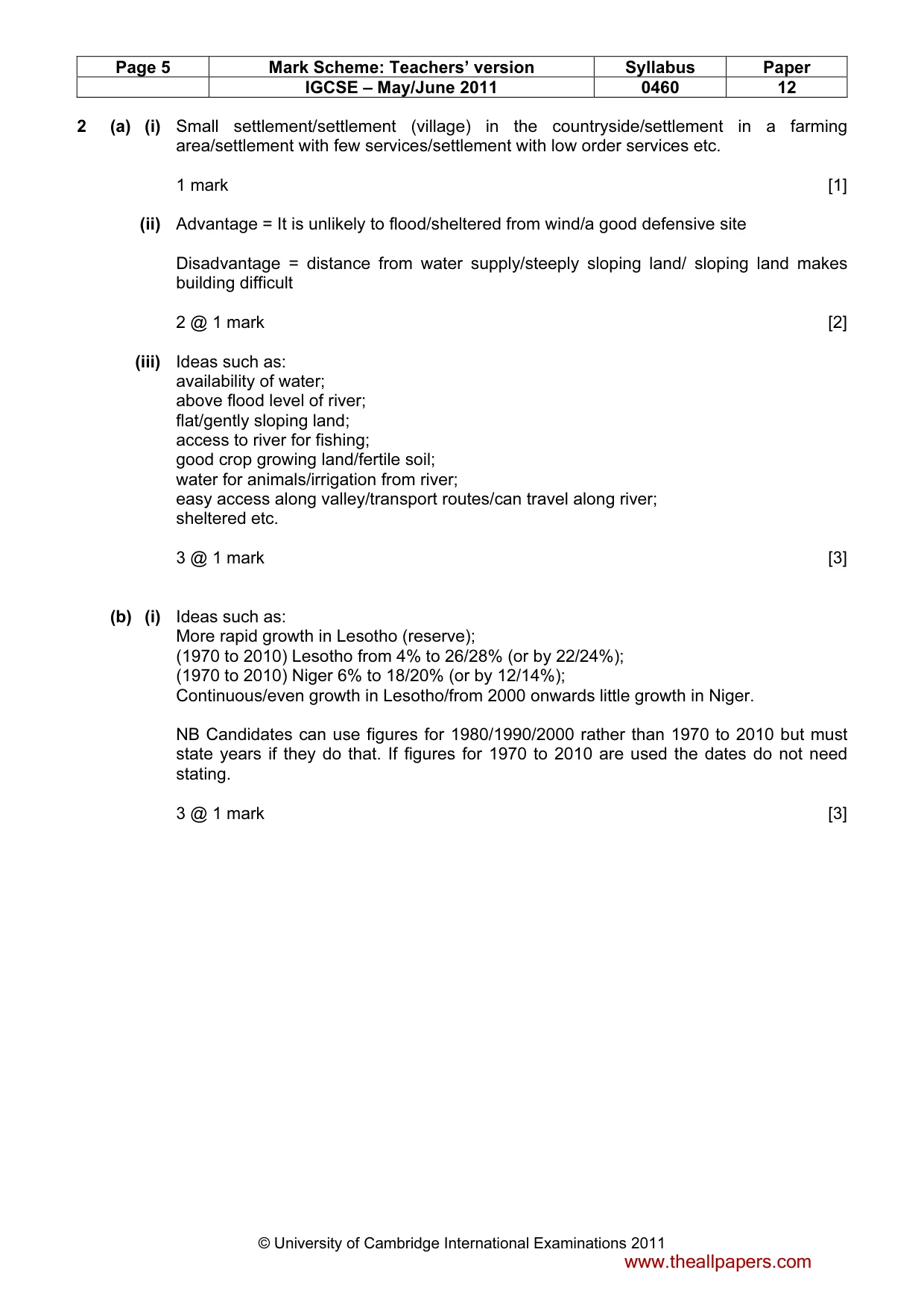
Page 5 Mark Scheme: Teachers’ version Syllabus Paper IGCSE – May/June 2011 0460 12 © University of Cambridge International Examinations 2011 2 (a) (i) Small settlement/settlement (village) in the countryside/settlement in a farming area/settlement with few services/settlement with low order services etc. 1 mark [1] (ii) Advantage = It is unlikely to flood/sheltered from wind/a good defensive site Disadvantage = distance from water supply/steeply sloping land/ sloping land makes building difficult 2 @ 1 mark [2] (iii) Ideas such as: availability of water; above flood level of river; flat/gently sloping land; access to river for fishing; good crop growing land/fertile soil; water for animals/irrigation from river; easy access along valley/transport routes/can travel along river; sheltered etc. 3 @ 1 mark [3] (b) (i) Ideas such as: More rapid growth in Lesotho (reserve); (1970 to 2010) Lesotho from 4% to 26/28% (or by 22/24%); (1970 to 2010) Niger 6% to 18/20% (or by 12/14%); Continuous/even growth in Lesotho/from 2000 onwards little growth in Niger. NB Candidates can use figures for 1980/1990/2000 rather than 1970 to 2010 but must state years if they do that. If figures for 1970 to 2010 are used the dates do not need stating. 3 @ 1 mark [3] www.theallpapers.com
Mark scheme, page 6
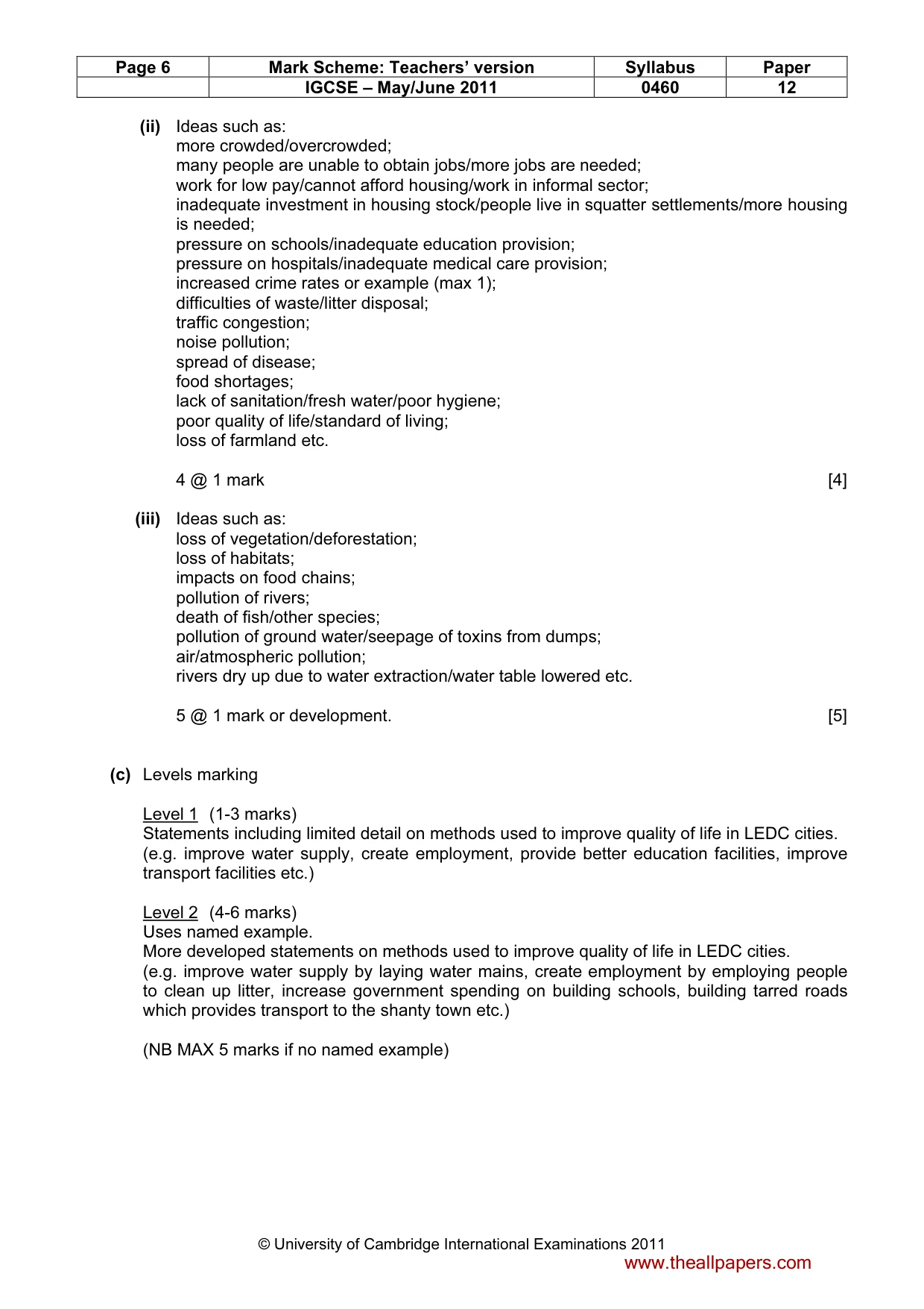
Page 6 Mark Scheme: Teachers’ version Syllabus Paper IGCSE – May/June 2011 0460 12 © University of Cambridge International Examinations 2011 (ii) Ideas such as: more crowded/overcrowded; many people are unable to obtain jobs/more jobs are needed; work for low pay/cannot afford housing/work in informal sector; inadequate investment in housing stock/people live in squatter settlements/more housing is needed; pressure on schools/inadequate education provision; pressure on hospitals/inadequate medical care provision; increased crime rates or example (max 1); difficulties of waste/litter disposal; traffic congestion; noise pollution; spread of disease; food shortages; lack of sanitation/fresh water/poor hygiene; poor quality of life/standard of living; loss of farmland etc. 4 @ 1 mark [4] (iii) Ideas such as: loss of vegetation/deforestation; loss of habitats; impacts on food chains; pollution of rivers; death of fish/other species; pollution of ground water/seepage of toxins from dumps; air/atmospheric pollution; rivers dry up due to water extraction/water table lowered etc. 5 @ 1 mark or development. [5] (c) Levels marking Level 1 (1-3 marks) Statements including limited detail on methods used to improve quality of life in LEDC cities. (e.g. improve water supply, create employment, provide better education facilities, improve transport facilities etc.) Level 2 (4-6 marks) Uses named example. More developed statements on methods used to improve quality of life in LEDC cities. (e.g. improve water supply by laying water mains, create employment by employing people to clean up litter, increase government spending on building schools, building tarred roads which provides transport to the shanty town etc.) (NB MAX 5 marks if no named example) www.theallpapers.com
Mark scheme, page 7
Page 7 Mark Scheme: Teachers’ version Syllabus Paper IGCSE – May/June 2011 0460 12 © University of Cambridge International Examinations 2011 Level 3 (7 marks) Uses named example (e.g. Rio de Janeiro). Comprehensive and accurate statements on methods used to improve quality of life in LEDC cities, including some place specific reference. (e.g. improve water supply by laying water mains to the favelas, create employment by employing people to clean up litter in areas such as Rocinha, increase government spending on building schools; build tarred roads to shanty towns on mountain slopes on edge of city.) [Total: 25] 3 (a) (i) Wednesday 1 mark [1] (ii) A lower air pressure the higher the precipitation/inverse relationship/negative correlation B winds from south (west) / southerly direction bring higher temperatures (than winds from north) 2 @ 1 mark [2] (iii) precipitation = rain gauge; air pressure = barometer; wind direction = wind/weather vane. NB Assume same order and credit if precipitation/air pressure and wind direction not stated. 3 @ 1 mark [3] www.theallpapers.com
Mark scheme, page 8
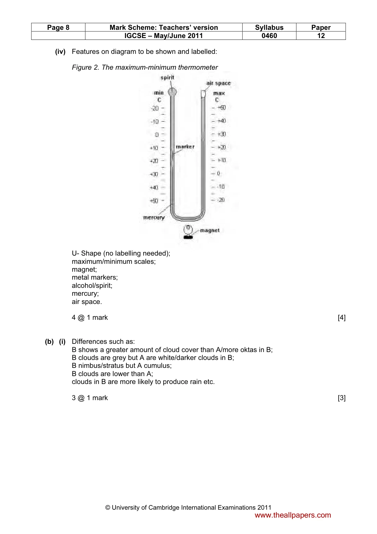
Page 8 Mark Scheme: Teachers’ version Syllabus Paper IGCSE – May/June 2011 0460 12 © University of Cambridge International Examinations 2011 (iv) Features on diagram to be shown and labelled: Figure 2. The maximum-minimum thermometer U- Shape (no labelling needed); maximum/minimum scales; magnet; metal markers; alcohol/spirit; mercury; air space. 4 @ 1 mark [4] (b) (i) Differences such as: B shows a greater amount of cloud cover than A/more oktas in B; B clouds are grey but A are white/darker clouds in B; B nimbus/stratus but A cumulus; B clouds are lower than A; clouds in B are more likely to produce rain etc. 3 @ 1 mark [3] www.theallpapers.com
Mark scheme, page 9
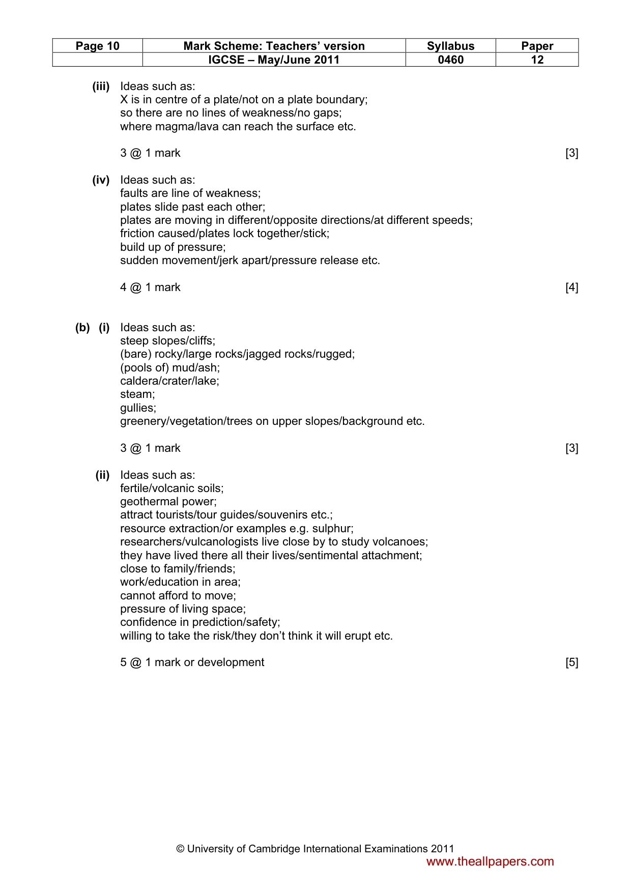
Page 9 Mark Scheme: Teachers’ version Syllabus Paper IGCSE – May/June 2011 0460 12 © University of Cambridge International Examinations 2011 (ii) Ideas such as: distance from oceans; winds blow over large areas of land; winds blow offshore/do not blow from sea hence no source of moisture/water sources; low humidity; lack of evaporation; sparse vegetation; lack of transpiration; high air pressure; descending air; cold offshore currents etc. 5 @ 1 mark or development [5] (c) Levels marking Level 1 (1-3 marks) Statements including limited detail describing and/or explaining the main features of tropical rainforest climate. (e.g. hot, wet, cumulus clouds, sun overhead, low pressure, high rainfall etc.) Level 2 (4-6 marks) Uses named example. More developed statements describing and/or explaining the main features of tropical rainforest climate. (e.g. temperatures which are no lower than 30C all year, small annual range of temperature, wet climate due to low pressure/convection currents, high temperatures due to overhead sun, daily build up of cumulus clouds due to convection, daily convectional rainfall etc.) (NB MAX 5 if no named example) Level 3 (7 marks) Uses named example (e.g. Amazon). Comprehensive and accurate statements describing and explaining the main features of tropical rainforest climates. (e.g. annual range of temperature only 2 degrees C. Over 2000mm rain due to low pressure/convection currents, high temperatures due to overhead sun within a few degrees of Equator, daily build up of cumulus clouds due to convection, daily convectional rainfall etc.) [Total: 25] 4 (a) (i) The edge/meeting points of two tectonic plates/plates which form the earth’s crust/line separating two plates. 1 mark [1] (ii) A destructive/convergent/subduction zone/collision margin B constructive/divergent 2 @ 1 mark [2] www.theallpapers.com
Mark scheme, page 10
Page 10 Mark Scheme: Teachers’ version Syllabus Paper IGCSE – May/June 2011 0460 12 © University of Cambridge International Examinations 2011 (iii) Ideas such as: X is in centre of a plate/not on a plate boundary; so there are no lines of weakness/no gaps; where magma/lava can reach the surface etc. 3 @ 1 mark [3] (iv) Ideas such as: faults are line of weakness; plates slide past each other; plates are moving in different/opposite directions/at different speeds; friction caused/plates lock together/stick; build up of pressure; sudden movement/jerk apart/pressure release etc. 4 @ 1 mark [4] (b) (i) Ideas such as: steep slopes/cliffs; (bare) rocky/large rocks/jagged rocks/rugged; (pools of) mud/ash; caldera/crater/lake; steam; gullies; greenery/vegetation/trees on upper slopes/background etc. 3 @ 1 mark [3] (ii) Ideas such as: fertile/volcanic soils; geothermal power; attract tourists/tour guides/souvenirs etc.; resource extraction/or examples e.g. sulphur; researchers/vulcanologists live close by to study volcanoes; they have lived there all their lives/sentimental attachment; close to family/friends; work/education in area; cannot afford to move; pressure of living space; confidence in prediction/safety; willing to take the risk/they don’t think it will erupt etc. 5 @ 1 mark or development [5] www.theallpapers.com
Mark scheme, page 11
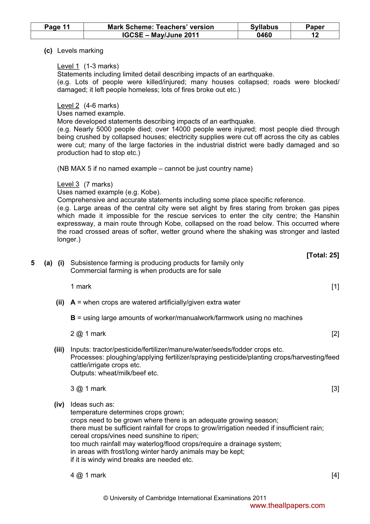
Page 11 Mark Scheme: Teachers’ version Syllabus Paper IGCSE – May/June 2011 0460 12 © University of Cambridge International Examinations 2011 (c) Levels marking Level 1 (1-3 marks) Statements including limited detail describing impacts of an earthquake. (e.g. Lots of people were killed/injured; many houses collapsed; roads were blocked/ damaged; it left people homeless; lots of fires broke out etc.) Level 2 (4-6 marks) Uses named example. More developed statements describing impacts of an earthquake. (e.g. Nearly 5000 people died; over 14000 people were injured; most people died through being crushed by collapsed houses; electricity supplies were cut off across the city as cables were cut; many of the large factories in the industrial district were badly damaged and so production had to stop etc.) (NB MAX 5 if no named example – cannot be just country name) Level 3 (7 marks) Uses named example (e.g. Kobe). Comprehensive and accurate statements including some place specific reference. (e.g. Large areas of the central city were set alight by fires staring from broken gas pipes which made it impossible for the rescue services to enter the city centre; the Hanshin expressway, a main route through Kobe, collapsed on the road below. This occurred where the road crossed areas of softer, wetter ground where the shaking was stronger and lasted longer.) [Total: 25] 5 (a) (i) Subsistence farming is producing products for family only Commercial farming is when products are for sale 1 mark [1] (ii) A = when crops are watered artificially/given extra water B = using large amounts of worker/manualwork/farmwork using no machines 2 @ 1 mark [2] (iii) Inputs: tractor/pesticide/fertilizer/manure/water/seeds/fodder crops etc. Processes: ploughing/applying fertilizer/spraying pesticide/planting crops/harvesting/feed cattle/irrigate crops etc. Outputs: wheat/milk/beef etc. 3 @ 1 mark [3] (iv) Ideas such as: temperature determines crops grown; crops need to be grown where there is an adequate growing season; there must be sufficient rainfall for crops to grow/irrigation needed if insufficient rain; cereal crops/vines need sunshine to ripen; too much rainfall may waterlog/flood crops/require a drainage system; in areas with frost/long winter hardy animals may be kept; if it is windy wind breaks are needed etc. 4 @ 1 mark [4] www.theallpapers.com
Mark scheme, page 12
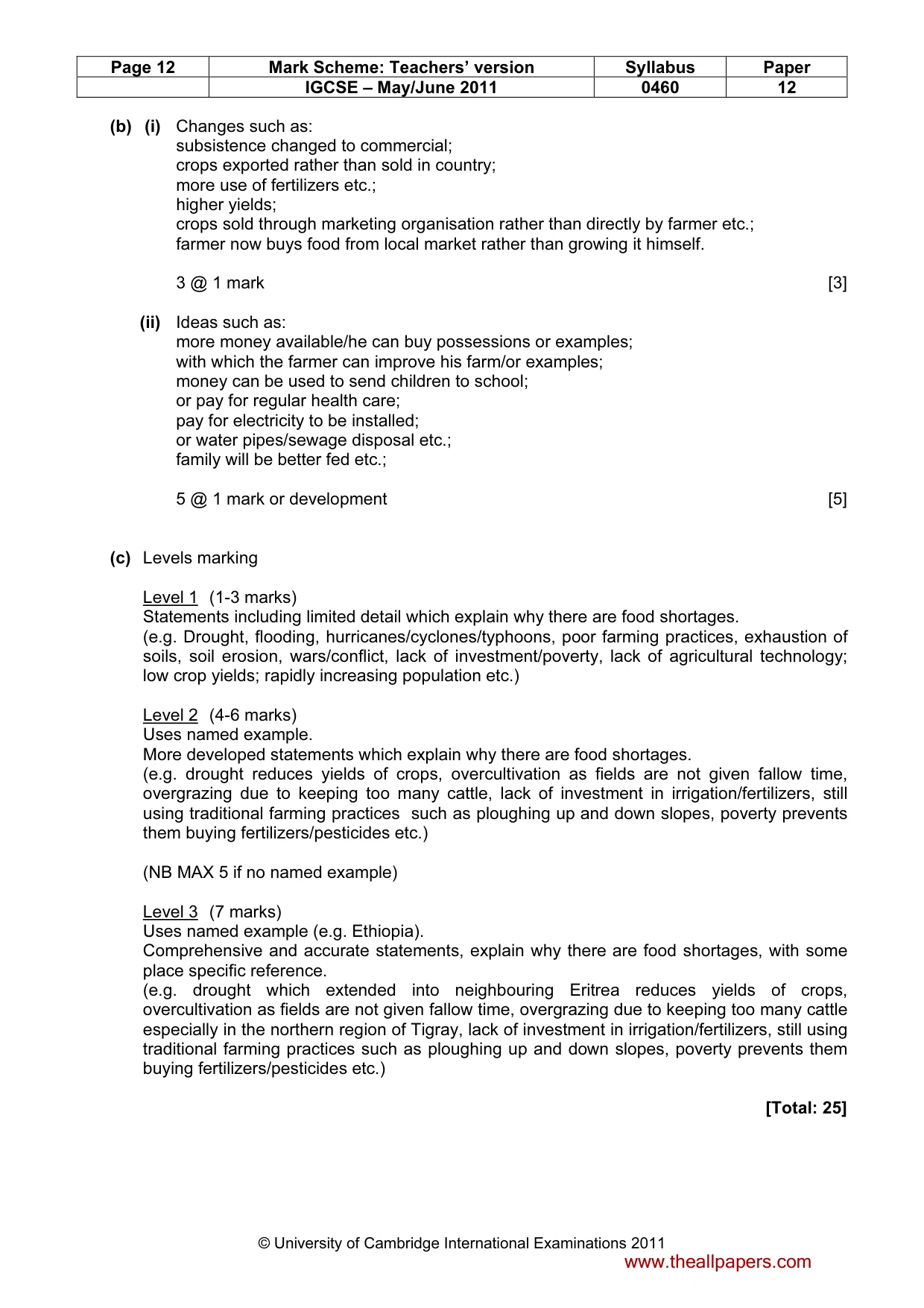
Page 12 Mark Scheme: Teachers’ version Syllabus Paper IGCSE – May/June 2011 0460 12 © University of Cambridge International Examinations 2011 (b) (i) Changes such as: subsistence changed to commercial; crops exported rather than sold in country; more use of fertilizers etc.; higher yields; crops sold through marketing organisation rather than directly by farmer etc.; farmer now buys food from local market rather than growing it himself. 3 @ 1 mark [3] (ii) Ideas such as: more money available/he can buy possessions or examples; with which the farmer can improve his farm/or examples; money can be used to send children to school; or pay for regular health care; pay for electricity to be installed; or water pipes/sewage disposal etc.; family will be better fed etc.; 5 @ 1 mark or development [5] (c) Levels marking Level 1 (1-3 marks) Statements including limited detail which explain why there are food shortages. (e.g. Drought, flooding, hurricanes/cyclones/typhoons, poor farming practices, exhaustion of soils, soil erosion, wars/conflict, lack of investment/poverty, lack of agricultural technology; low crop yields; rapidly increasing population etc.) Level 2 (4-6 marks) Uses named example. More developed statements which explain why there are food shortages. (e.g. drought reduces yields of crops, overcultivation as fields are not given fallow time, overgrazing due to keeping too many cattle, lack of investment in irrigation/fertilizers, still using traditional farming practices such as ploughing up and down slopes, poverty prevents them buying fertilizers/pesticides etc.) (NB MAX 5 if no named example) Level 3 (7 marks) Uses named example (e.g. Ethiopia). Comprehensive and accurate statements, explain why there are food shortages, with some place specific reference. (e.g. drought which extended into neighbouring Eritrea reduces yields of crops, overcultivation as fields are not given fallow time, overgrazing due to keeping too many cattle especially in the northern region of Tigray, lack of investment in irrigation/fertilizers, still using traditional farming practices such as ploughing up and down slopes, poverty prevents them buying fertilizers/pesticides etc.) [Total: 25] www.theallpapers.com
Mark scheme, page 13
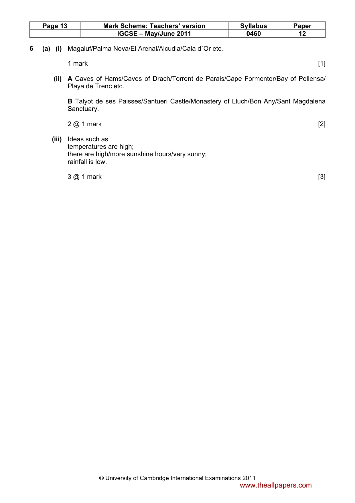
Page 13 Mark Scheme: Teachers’ version Syllabus Paper IGCSE – May/June 2011 0460 12 © University of Cambridge International Examinations 2011 6 (a) (i) Magaluf/Palma Nova/El Arenal/Alcudia/Cala d`Or etc. 1 mark [1] (ii) A Caves of Hams/Caves of Drach/Torrent de Parais/Cape Formentor/Bay of Pollensa/ Playa de Trenc etc. B Talyot de ses Paisses/Santueri Castle/Monastery of Lluch/Bon Any/Sant Magdalena Sanctuary. 2 @ 1 mark [2] (iii) Ideas such as: temperatures are high; there are high/more sunshine hours/very sunny; rainfall is low. 3 @ 1 mark [3] www.theallpapers.com
Mark scheme, page 14
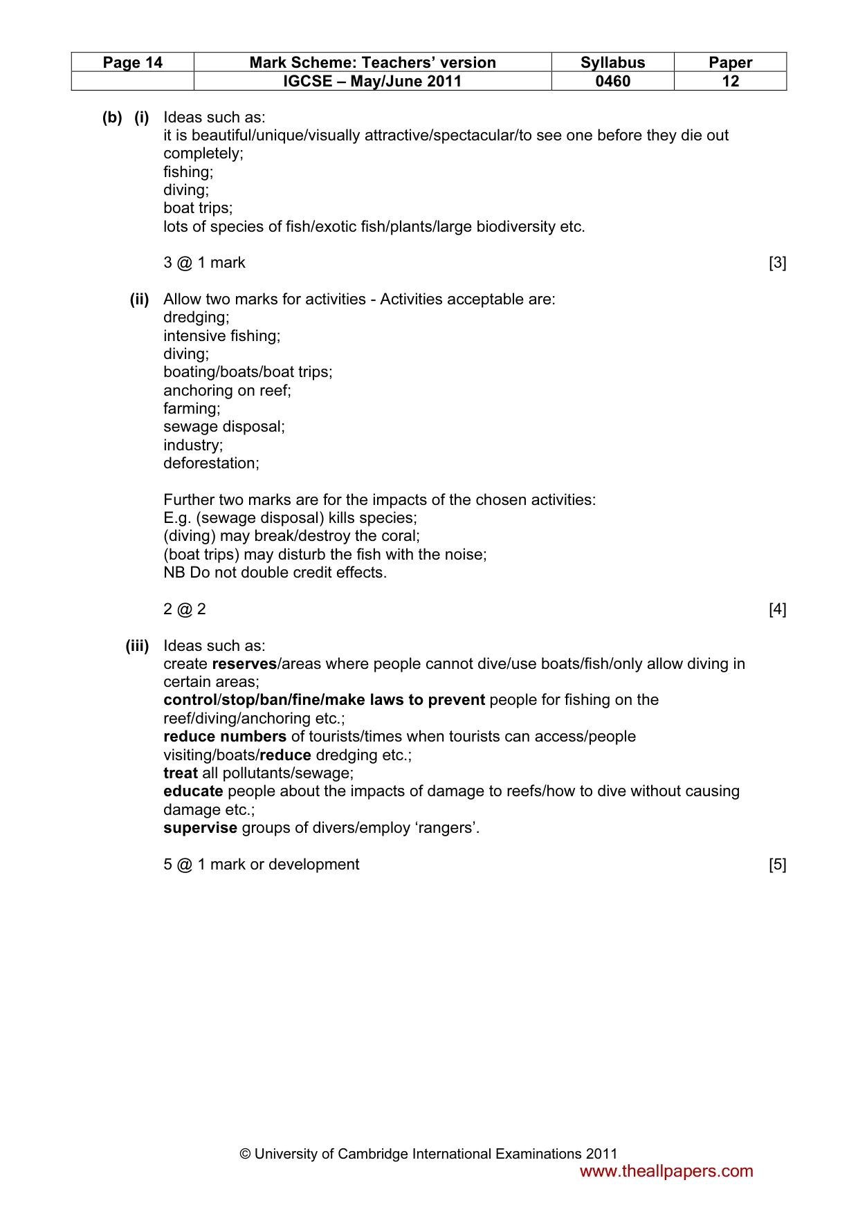
Page 14 Mark Scheme: Teachers’ version Syllabus Paper IGCSE – May/June 2011 0460 12 © University of Cambridge International Examinations 2011 (b) (i) Ideas such as: it is beautiful/unique/visually attractive/spectacular/to see one before they die out completely; fishing; diving; boat trips; lots of species of fish/exotic fish/plants/large biodiversity etc. 3 @ 1 mark [3] (ii) Allow two marks for activities - Activities acceptable are: dredging; intensive fishing; diving; boating/boats/boat trips; anchoring on reef; farming; sewage disposal; industry; deforestation; Further two marks are for the impacts of the chosen activities: E.g. (sewage disposal) kills species; (diving) may break/destroy the coral; (boat trips) may disturb the fish with the noise; NB Do not double credit effects. 2 @ 2 [4] (iii) Ideas such as: create reserves/areas where people cannot dive/use boats/fish/only allow diving in certain areas; control/stop/ban/fine/make laws to prevent people for fishing on the reef/diving/anchoring etc.; reduce numbers of tourists/times when tourists can access/people visiting/boats/reduce dredging etc.; treat all pollutants/sewage; educate people about the impacts of damage to reefs/how to dive without causing damage etc.; supervise groups of divers/employ ‘rangers’. 5 @ 1 mark or development [5] www.theallpapers.com
Mark scheme, page 15
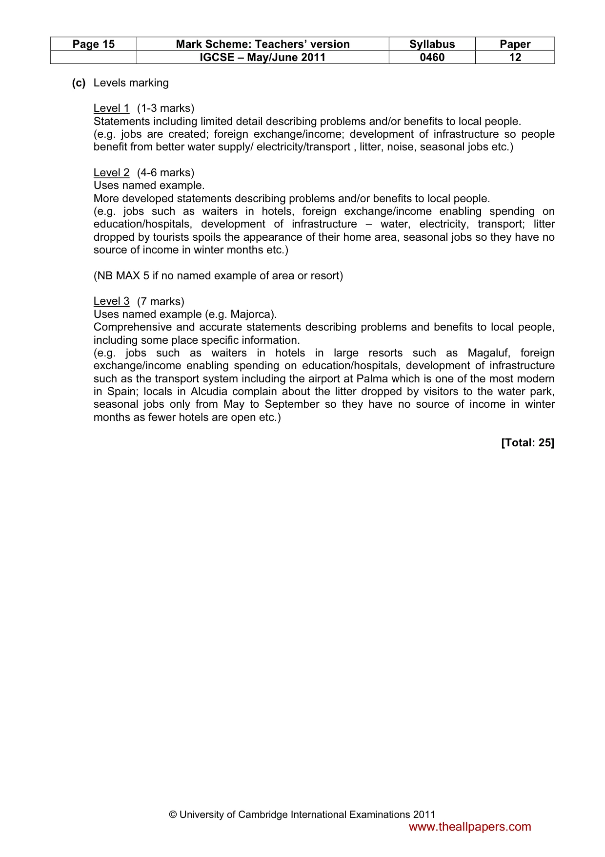
Page 15 Mark Scheme: Teachers’ version Syllabus Paper IGCSE – May/June 2011 0460 12 © University of Cambridge International Examinations 2011 (c) Levels marking Level 1 (1-3 marks) Statements including limited detail describing problems and/or benefits to local people. (e.g. jobs are created; foreign exchange/income; development of infrastructure so people benefit from better water supply/ electricity/transport , litter, noise, seasonal jobs etc.) Level 2 (4-6 marks) Uses named example. More developed statements describing problems and/or benefits to local people. (e.g. jobs such as waiters in hotels, foreign exchange/income enabling spending on education/hospitals, development of infrastructure – water, electricity, transport; litter dropped by tourists spoils the appearance of their home area, seasonal jobs so they have no source of income in winter months etc.) (NB MAX 5 if no named example of area or resort) Level 3 (7 marks) Uses named example (e.g. Majorca). Comprehensive and accurate statements describing problems and benefits to local people, including some place specific information. (e.g. jobs such as waiters in hotels in large resorts such as Magaluf, foreign exchange/income enabling spending on education/hospitals, development of infrastructure such as the transport system including the airport at Palma which is one of the most modern in Spain; locals in Alcudia complain about the litter dropped by visitors to the water park, seasonal jobs only from May to September so they have no source of income in winter months as fewer hotels are open etc.) [Total: 25] www.theallpapers.com
What you needed in this session
Cambridge’s own grade thresholds for 2011 May/June, Paper 1 · Variant 2. A higher threshold means an easier paper — the bar moves with how the cohort did.